Spider Peak
March 15, 2021
1597m
Caroline Mine / Coquihalla Highway, BC
I’ve done a few spider-themed peaks in SW BC such as the remote and obscured Spidery Peak by Meager Creek of Pemberton Valley, or Snowspider Mountain which is sort of a “classic” in the skiers’ world in the Duffey zone. This particular Spider Peak is even more obscured and in fact, the whole group of peaks sandwiched between the lower Coquihalla Highway and Fraser Canyon are obscured and rarely ascended even by the die-hard peak-baggers. Spider Peak locates to the north of Squeah Mountain and to the west of “Ladner Mountain”. I’m 100% sure that among these already-obscured peaks Spider Peak is the least sought-after for simple reason that it’s the lowest in this group. It does boast over 300 m of topographical prominence but it does not stand out of the surroundings. There was virtually zero information about the routes of this peak online but it’s not difficult to see a logical attack by gazing at the topo maps and satellite images. The most obvious approach is by plodding up Caroline Mine road and the road system reaches high on the SE flanks of a sub-summit. The upper mountain involves unavoidable bushwhacking so doing it with a thick snowpack (ie. spring time) sounds like a smarter idea.
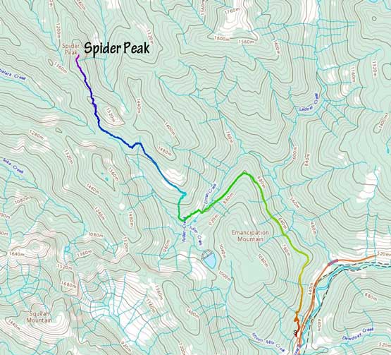
Spider Peak via Caroline Mine Road. GPX DL
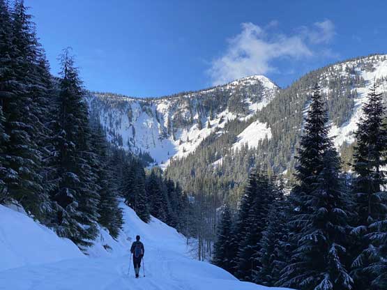
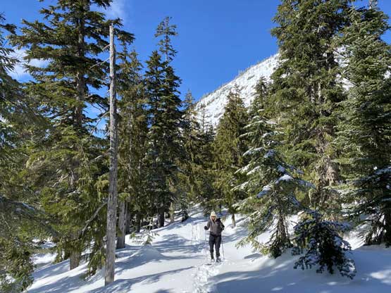
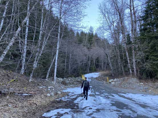
I threw out a few ideas to Vlad and he picked this one, which actually surprised me as I thought nobody would be interested in joining me on Spider Peak. That being said none of my other ideas for this past Monday was particularly exciting so it’s a pick-your-poison kind of game for Vlad. I anticipated some freeze-thaw conditions and the temperature for the whole day would stay cool so we didn’t have to start too early. We left Which Rock at 6 am and started the plod two hours later. The weather was moody with flurries but the forecast called for a clearing trend. The gate at the start of Caroline Mine Road was open but snow started even before the gate, so we parked at the bottom. We were happy to see truck and snowmobile traffics on the road as that meant we would have zero trail-breaking for the first 6-7 km contouring around Emancipation Mountain. Vlad kept his snowshoes in his pack for the whole period while I opted to use snowshoes after a few km. I’m a rare hiker who plods faster on snowshoes than on foot.
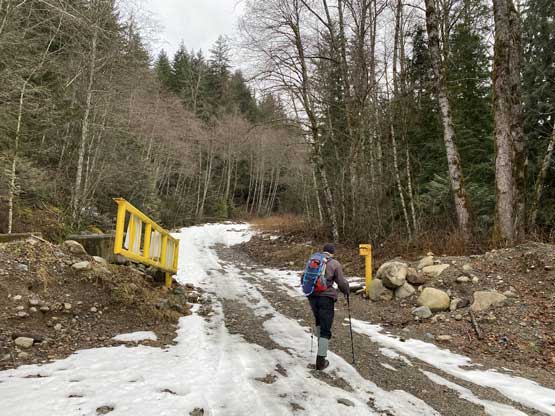
Vlad hiking through the gate at the start
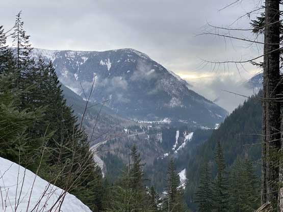
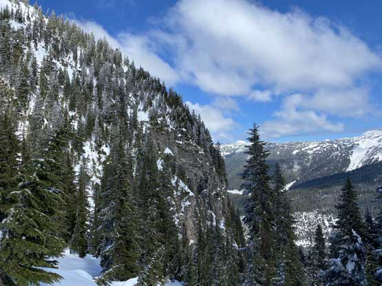
Moody view looking down towards Coquihalla Highway

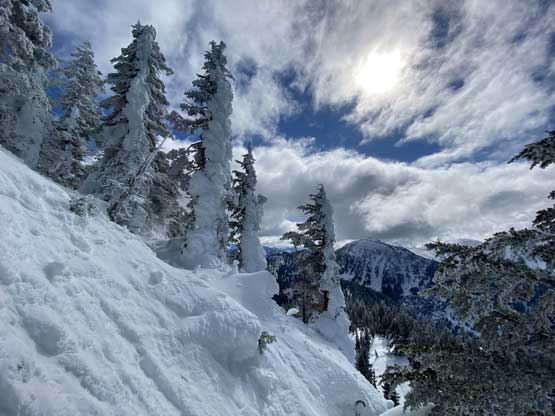
After an hour or so we finally saw some blue skies

The morning sun beams shone through the thinning clouds
Around the northern corner of Emancipation Mountain
A slight descending traverse towards Caroline Mine
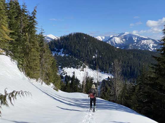
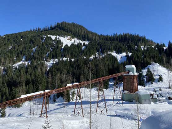
The Caroline Mine site was sort of impressive. The sled tracks unfortunately turned a direction that we were not hoping for, so beyond the mine we were on our own. Thankfully the trail-breaking was minimal given the freeze-thaw conditions. Vlad even led us through a fairly major short-cut to shave some distance off the road plodding. The short-cut involved some navigation through forest but bushwhacking was minimal. The short-cut led us onto the uppermost spur and we followed it due NW towards an obvious buttress of a sub-summit that we could see from distance. The road here didn’t really feel like a road anymore as we were constantly side-hilling on sloppy terrain. The obvious buttress of that sub-summit was clearly not doable so we aimed for a “south bypass” option, leaving the road and side-hilling towards the “key saddle” between Spider Peak and a sub-peak of Squeah Mountain. This stretch involved come constant GPS navigation in order to stay on the most efficient line as the terrain was undulating and confusing.

Arriving at the impressive mine site.

Plodding past the mine, we soon lost the snowmobile tracks

Vlad leading us taking a short-cut
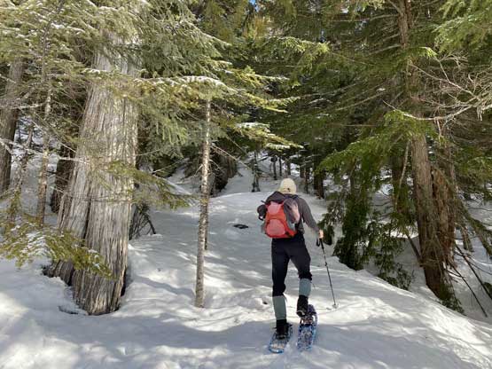
The shot-cut involved cross-country travel through forest

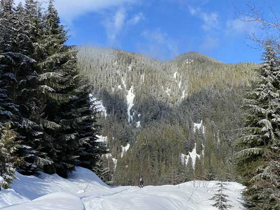
Reaching the uppermost spur road. Ahead just a sub-peak of Squeah Mtn.

Believe or not we were still on a road…
Vlad carefully making his way across this stretch of side-hilling
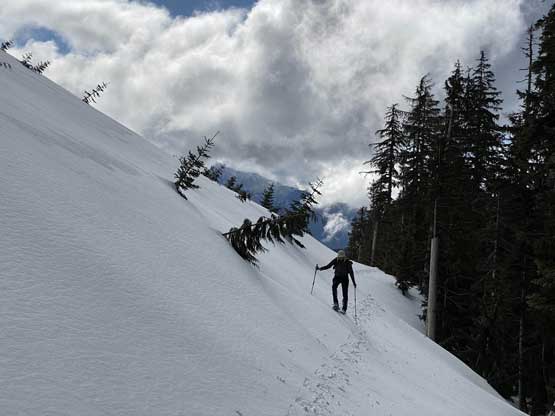
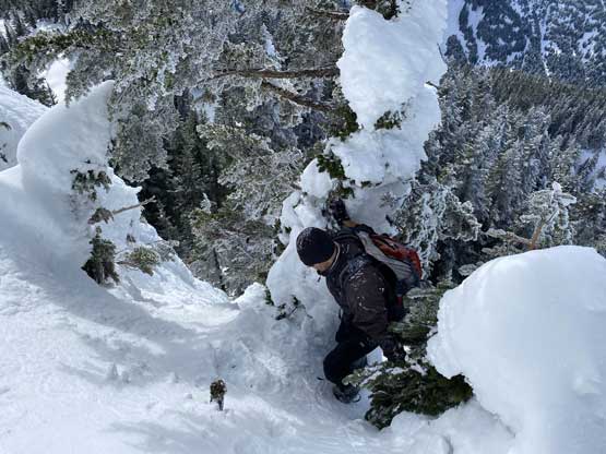
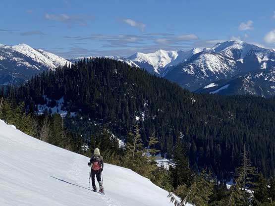
Vlad mentioned that the easiest way around that sub-summit was to bypass it on the south side. I looked at the maps and agreed, so led us through a rising traverse line aiming for the col between the sub-summit and Spider Peak itself. This rising traverse was sort of steep at places, but went reasonably well without difficulty. We did have to deal with a few short stretches of elevation losses but none was worth noting. The plod up on Spider Peak’s south ridge was also undulating at places.

A steep side-hill traversing across the sub-summit
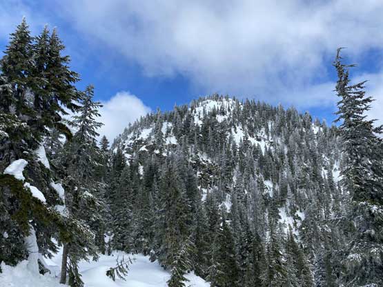
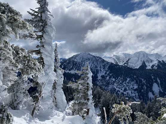
Partway up the south ridge of Spider Peak looking at the summit block
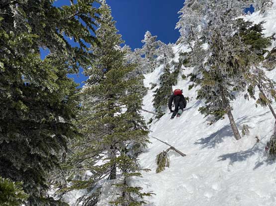
None of us came here expecting a summit block challenge but as soon as we saw it we knew we were in some adventures. I even checked my own photos taken from Squeah Mountain and didn’t notice any potential difficulty. There was no obvious attack but the lowest-angled terrain appeared on the SW (climber’s left) side so we aimed for that direction. The ascent didn’t look too bad with possibly a few 3rd or 4th class bushy steps on steep snow. However, none of us brought an ice axe and we only brought aluminum crampons. This meant we had to be sure that we could kick into the slope for every step. Thankfully the terrain was not exposed and the snow was not as icy as it appeared that with some caution we were able to haul ourselves up this stretch. The rest of the ascent onto the summit was pretty easy but involved post-holing as we left snowshoes lower down. The views from this peak were also much more expansive than anticipated making it a totally worthwhile summit.

Vlad hauling himself up the icy vege-belay step. Tricky without an ice axe
A sideways view from just above the crux
Vlad finishing the crux sequence
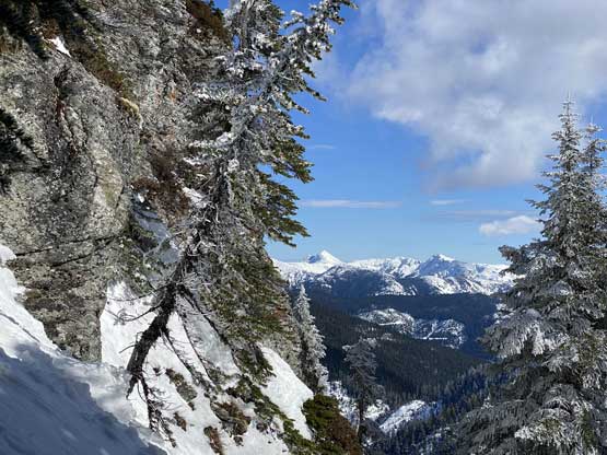
Another view looking across the icy trees towards sub-peaks of Squeah Mtn.

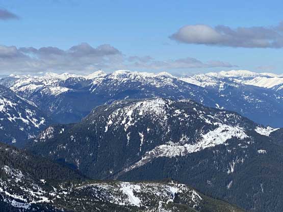
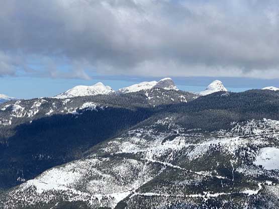
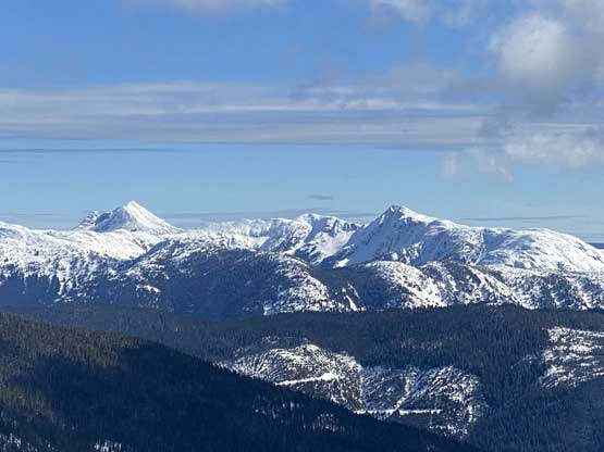
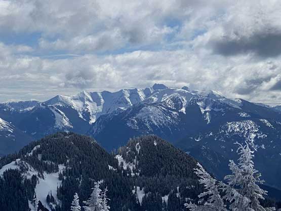
Summit Panorama from Spider Peak. Click to view large size.

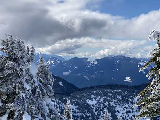
A northern view looking down into Fraser Canyon

Mt. Fagervik across Fraser Canyon

A very zoomed-in view of The Old Settler
Dog Mountain and “American Mountain” near Hope
“Saddle Peak” in foreground – a P600 objective in lower Fraser Canyon
Ibex Peak et al. in Anderson River Group
Coquihalla Mountain (L) and “Carry Peak” (R)
Tulemeen Mountain rises behind Mt. Snider

A closer look at the true summit of Squeah Mountain

Me on the summit of Spider Peak

Another photo of me on the summit of Spider Peak
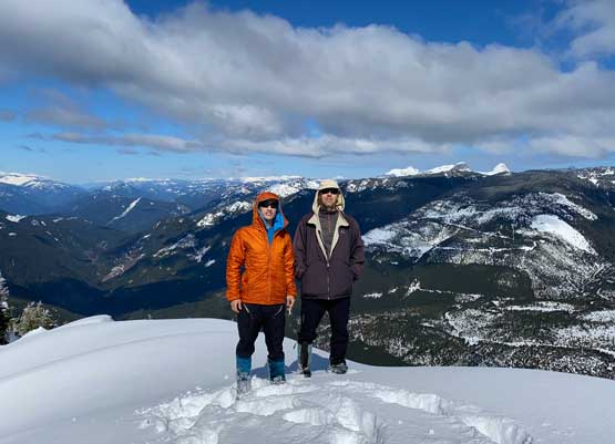
Vlad and I on the summit of Spider Peak
The down-climb required caution but felt reasonably easy. Once the snowshoes were strapped back on all we needed was to put one foot in front of another. Reversing the sections around that sub-summit was honestly not too bad we still had some variety in the terrain. The descent back into Caroline Mine was also not too bad thank to the views. The worst was the final 6 km plodding around Emancipation Mountain as that was a pure slog fest with hardly anything worth noting other than perseverance.
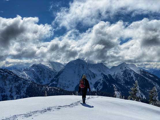
Vlad descending from the summit with sub-peaks of Squeah Mtn. ahead

Walking down increasingly steep slopes towards the crux
This sideways shot shows the slope angle around the crux
Vlad down-climbing steep snow just after the crux vege-belay step
Another photo to show that there was no easy way up the summit block

Somewhere on that long side-hill traverse around the sub-summit
This picture sums up the long stretch of contouring

Back onto the road but we were not done the side-hilling yet…

This frozen lake in foreground is apparently man-made

Descending with a sub-summit of Squeah Mountain behind
Another photo to show Vlad plodding down the never-ending roads
The treed bump of Emancipation Mountain (official name) ahead
Caroline Mine with Emancipation Mountain behind

Me posing for a photo to show the scale of this mine site

Mt. Jarvis from the final 6 km plod
We finished the plod pretty much just as we ran out of snow
Our round trip distance clocked at over 25 km and the time was just over 9 hours, a tad faster than expected thank to the cruise-saling snow conditions. I came here expecting Spider Peak to be a pure peak-bagger’s mission objective but this peak turned out much better than I thought and I would actually recommend it to adventurous hikers, just make sure to bring an ice axe and crampons for the summit block challenge.
