Mount Bryce
May 17-19, 2015
3507m
Bush River / Columbia Icefield Area, BC
The mighty Mt. Bryce is another giant in the Rockies. It might not be the highest in its vicinity (higher peaks including Mt. Columbia and The Twins immediately to its north on the Columbia Icefield), but the relief of 2000-2500 vertical meters of rock/snow/ice faces above Bush River, Rice Brook and Bryce Creek on the west, south and north sides is something the Icefield’s peaks cannot compete with. Mt. Robson is probably the only one that can match, or even surpass this majesty in this mountain range. From the mountaineering point of view, it boasts two of the grand classic alpine lines (the N. Face and the NE Ridge) – both are out of my league (at least for now). The easiest route, the S. Couloir transition to SE Face is by no doubt where I’d be going up. But even this line involves 1000 vertical meters of snow/ice climbing at a sustained 40-50 degrees, making Mt. Bryce among one of the harder snow/ice 11,000ers in the Canadian Rockies. Adding a complicated driving approach (~100 km one-way on logging roads), as well as a major river crossing to successfully reach the summit of Mt. Bryce is by no mean easy, and is for sure a grand prize.
The standard time to climb Bryce is obviously not May, as one can see from many ski guidebooks including Chic Scott’s Summits and Icefields that Mt. Bryce is not included in. However, the nature of this route being almost entirely a snow/ice climb does make climbers, including myself at least giving a passing thought to attempt in spring time. The advantage is very obvious especially for folks who have done a lot of snow climbs but do not have technical ice climbing experience (ie. myself)… It wasn’t until last weekend though that I really started to plan this trip. My inspiration came from the successful ascent by two of the local ski/snowboard legends (Trevor Sexsmith & Trevor Dingman) who made the top at the same time I did the Twins, and managed to ski/snowboard right from the summit. With only roughly 1 week apart, no new snowfall and a reasonable weather forecast (not a high pressure system, but good enough for a try in my “weather sense”) I managed to convince Ben that it’s eventually the time.

Mt. Bryce ascent route via S. Couloir and SE Face. GPX DL
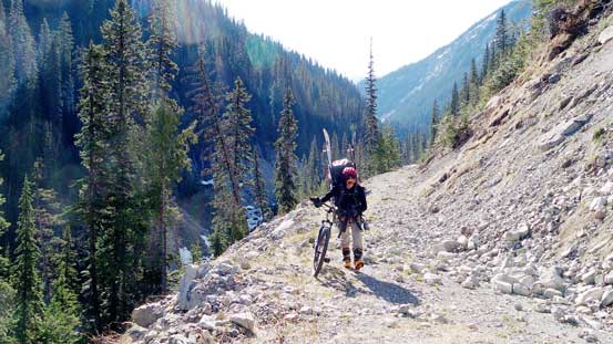
Having some fresh beta from Trevor’s trip we new roughly what to expect and came prepared with a saw (not a proper chainsaw, but good enough to cut a small tree) and mountain bikes. We left Edmonton by 4:30 pm on Saturday, drove all the way to Golden and then up the Bush River FSR. At roughly kilometer 80 we came to the first obstacle – a rockfall area with some boulders on the road. We moved them away and continued on. At kilometer 89 we came across those two big tree trunks that stopped Trevors from driving any further. We got extremely lucky that someone else just saw’d them for us so we continued on, across a critical bridge and onto the narrower side branch – the Rice Brook Road. We weren’t expect to drive all the way to its end but we were hoping to drive to where the Rice Brook canyon started. After cutting a fallen tree (medium sized) and then negotiating around a snow patch we had no choice but to call it a quit since there’s a huge tree trunk that we’d have no way to cut without a chainsaw. That’s still okay though as we just had to bike the rest 3 km or so. It was already 2:30 am and we decided to sleep in.
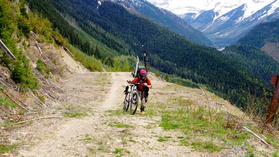
Sunday was overcast just as expected – which was perfect as we actually did not want the sun on this approach day. Biking uphill was quite a tough work and certainly not as fun as what others had advertised, partially because I’d never mountain biked before and I hadn’t been biking in town for almost 7 years already. All I still remember was how to bike, but my muscles had become super weak so that I pretty much couldn’t do any uphill even on the lowest gear, so I pushed my bike up. Ben also had to push for the most part. Around the corner and into the Rice Brook canyon we started to see snow and some huge boulders blocking the road. We pushed for another kilometer or so before ditching the bikes (which itself was quite a highlight for me on this particular day).. Continuing up on foot we soon passed the turn-off for Alexandra’s approach, and shortly after we arrived at the supposed crossing point for Rice Brook.

Ben biking along the Rice Brook Road
Soon we had to start pushing the bikes. Note the skis and ski boots…
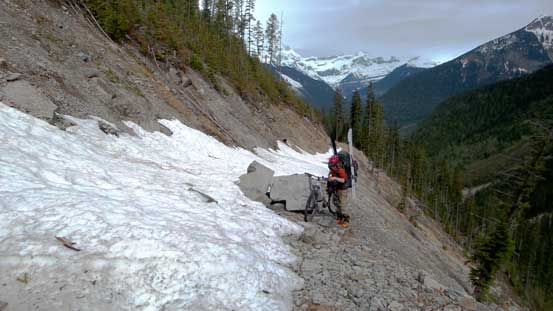
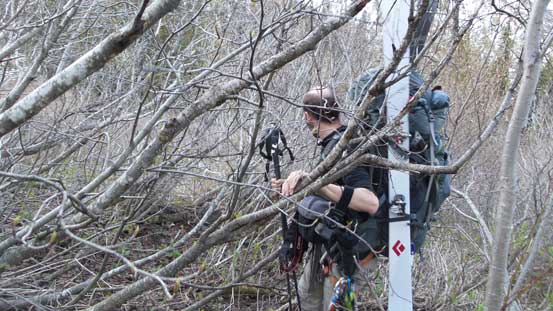
Negotiating this boulder was tricky

At the old bridge site, now preparing for the river fording
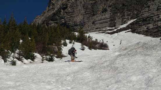
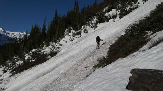
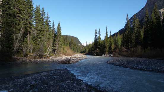
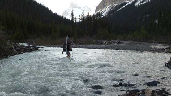
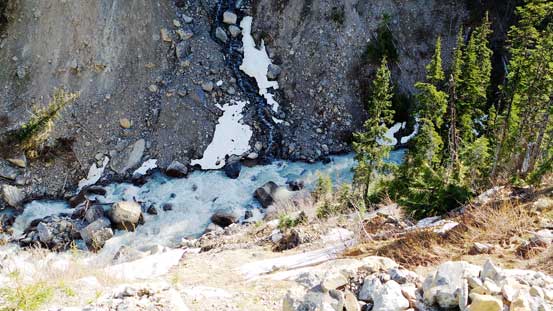
Rice Brook was quite a river in this particular day. The river was flowing fast but thankfully not very deep. We continued upstream for about 100 m before spotting a reasonable place to cross where the channels were more braided. It never exceeded knee deep but it’s quite a cold cross. Soon we were back on the abandoned logging road. About half an hour later we arrived at the giant avalanche path that we were supposed to ascend. There was a lot less snow than what I expected, but nonetheless after some brief bushwhacking we were able to strap the snowshoes and skis on (which was another highlight on this day).. That’s quite a bulk of the weight to drop… The path had already slid and travelling was reasonably straightforward. About 2/3 of the way up we ventured into the bush briefly and then kicked the rest of the way up on foot.
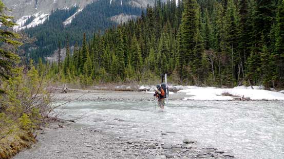
Easily crossed Rice Brook. It was cold though…
Then, continued along the old logging road for another half an hour

Now, ascending the obvious avalanche slide path. Ben was still trying to skin up
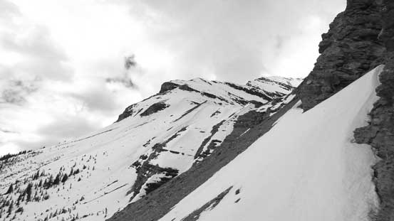
Looking upwards. It’s very foreshortening
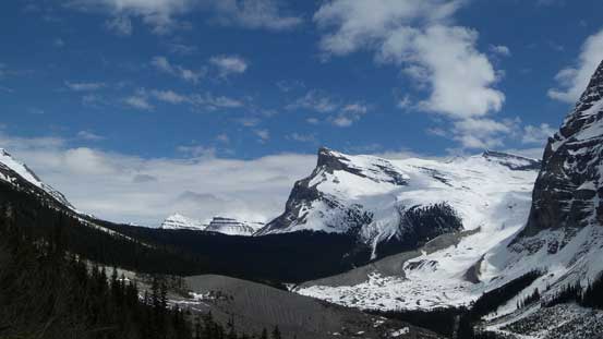
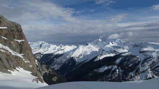
Watchman Peak looks like a solid ski ascent

We ventured into the bush briefly. Bit of a mistake as the bush was terrible…
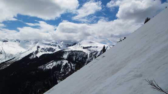
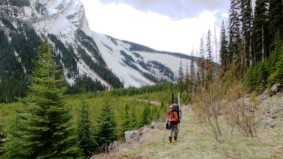
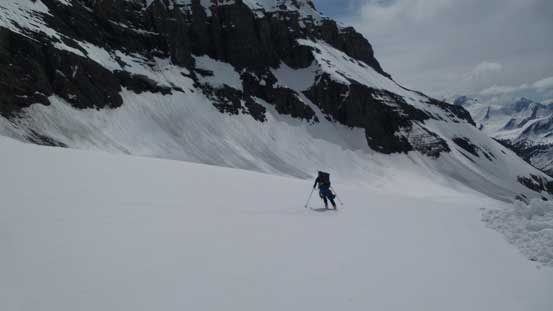
Now at treeline, time to traverse horizontally
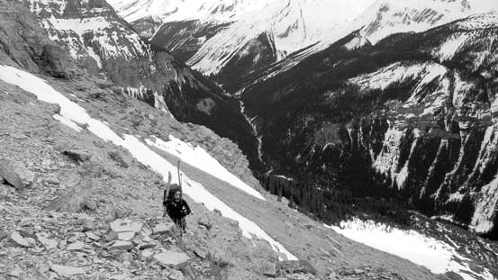
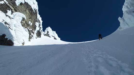
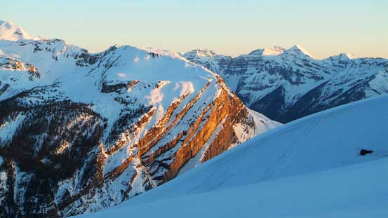
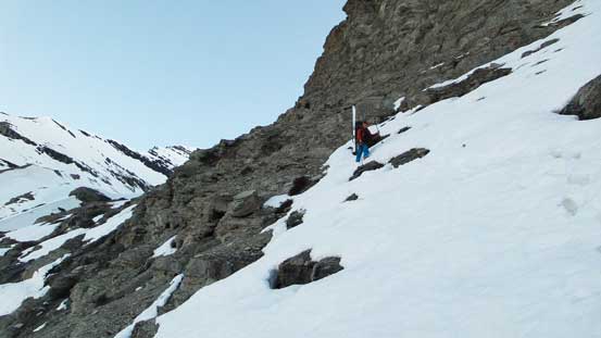
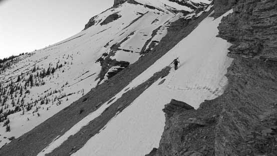
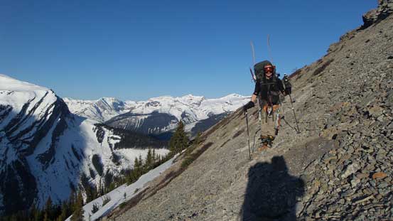
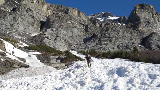
The next section was an ugly side-hill bashing back towards the proper ascending drainage. Considering what we’d done on Alexandra’s approach just across the valley, this was nothing by comparison. But still, carrying ski/snowshoe and winter overnight mountaineering loads made it quite a quality suffering. We managed to maintain a gentle uphill diagonal traversing line. Around a corner (with a cairn) we crossed a steep snow slope, and the next section would be some moderate scrambling on loose rocks. This part was as expected, pretty shitty but with good perseverance we made it through. All the snow we encountered here involved deep post-holing on isothermal crap which added to the “fun” factor. The upside was that sketchy waterfall crossing was trouble-free for us as we just had to walk across a snow slope. And shortly after that we arrived at the cirque below Bryce’s S. Couloir. We decided to camp at the exact same place as Trevor did. The bonus was to use their site as a well-built kitchen!!
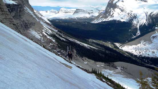
Ben starting the traverse part.

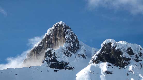
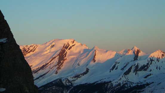
The N. Face of Mt. Spring-Rice is very impressive. I also notice a couloir in it…
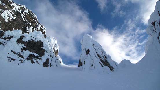
Around a corner (with a cairn) here’s what we saw
Immediately after the corner we had to cross a steep slope
And then, onto the scree…
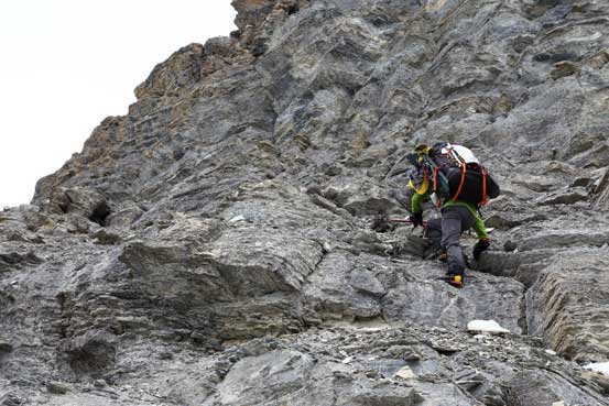
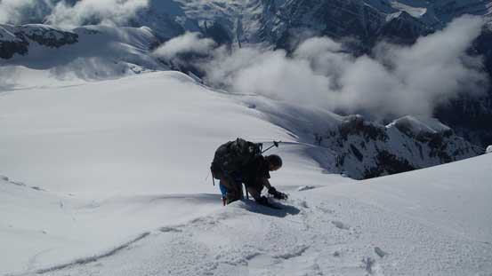
Some moderate scrambling. Painful with the pack. Photo by Ben

Another slope traverse that we used to cross that waterfall

Almost at the campsite
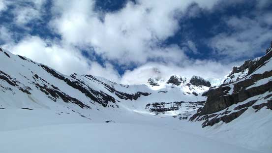
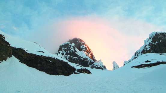
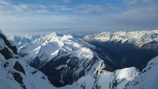
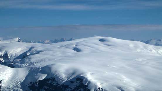
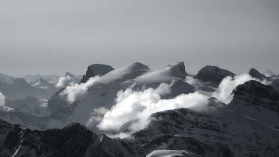
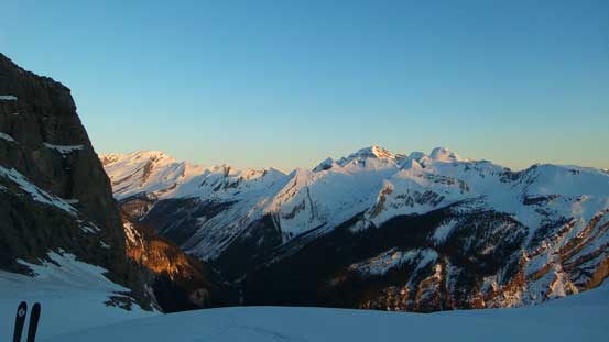
A view of the upper mountain from our bivy site
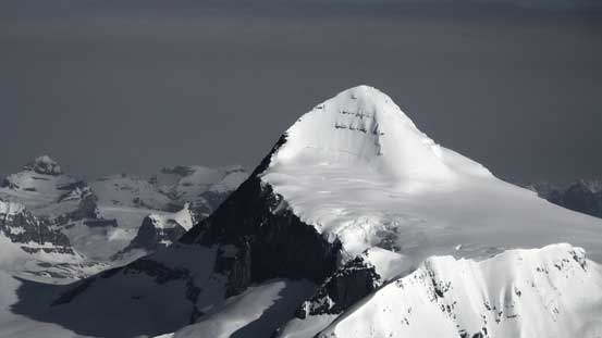
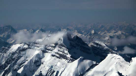
Our objective the majesty. Clouds only made it bigger
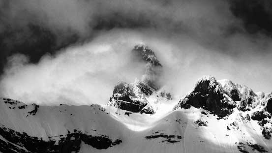
Later in the day clouds lifted up
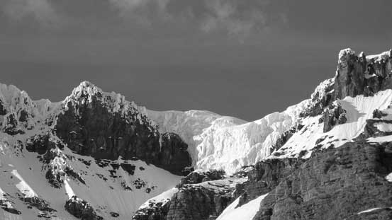
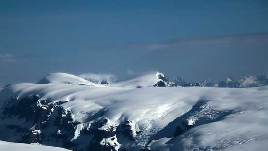
Impressive seracs on the upper glacial plateau
This is a bivy with some gorgeous views, just like other 11,000ers
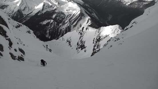
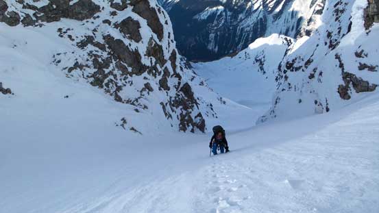
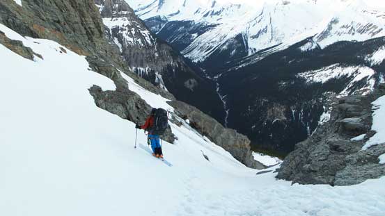
Unfortunately the forecast for the night did not come correct and when we woke up at 2:45 am we immediately had to realize our objective was soaked in clouds and there’s no freeze at all. Oh well, we decided to go anyway hoping the conditions would improve higher up. For the least we’d make some tracks for Tuesday as a second shot if things got worse. From my summer pictures taken from Alexandra we knew there were quite a lot of crevasses on this glacier, but they were all well-bridged in May. We followed the faint tracks left by Trevor S & Trevor D and got to the base of that gigantic S. Couloir with no incidence. Apparently there had been some massive avalanches in the past few days as Trevor’s tracks were completely buried by microwave-to-car sized debris at sections. The snow got harder as expected once we started the couloir so we ditched skis/snowshoes soon. The weather also started to improve with a clearing trend coming in from Alberta side so our mood suddenly got boosted up. Upwards and onwards the condition changed from post-holing to step-kicking and eventually to front-pointing. Ice tool out and we got to enjoy some fun snow climbing. After grinding 600 vertical meters up we went climber’s left of the obvious gendarme.

Starting in the pitch dark. Photo by Ben
Gorgeous morning light shone on the upper mountain

Ben starting the long couloir
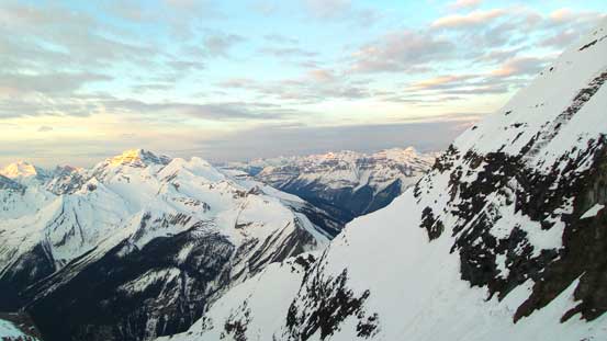
More morning colours on the horizon

Ben in the couloir.
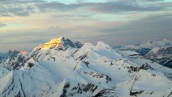
Cockscomb Mountain on alpenglow
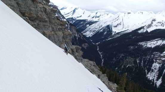
Terrain got steeper soon. Deja Vu Lefroy…
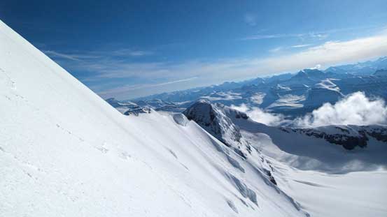
Looking upwards. It’s very very foreshortening
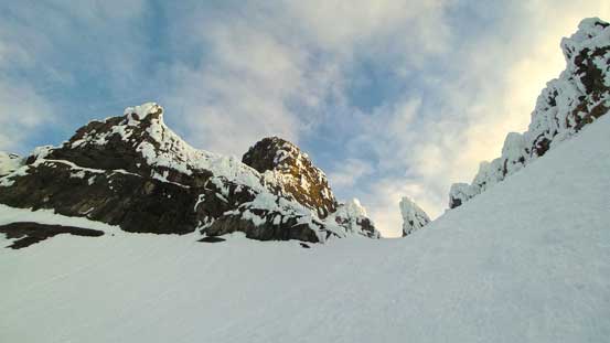
We’d aim at this obvious funnel on climber’s left of the gendarme
Ben grinding his way up
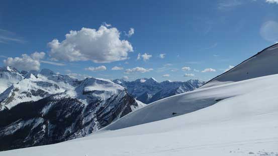
Already great views
Ben ascending through the funnel onto the upper face
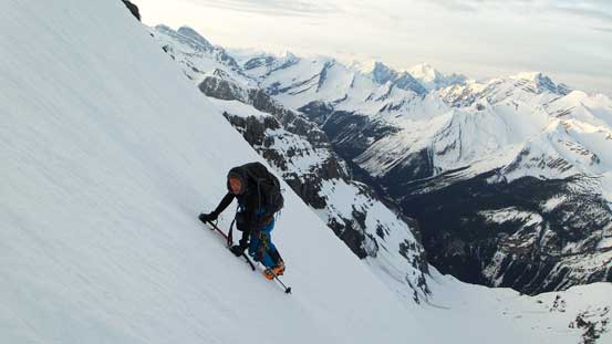
At this point I was hoping for a “snow platform” as a natural break between the couloir and the face, but I was wrong. By staying way on the climber’s left side there was no break. The SE Face followed immediately after the exit of the S. Couloir, so the snow climbing continued on. Unfortunately the sun really came out at this point beating down the rime covered rocks around us, and as a result the rime started to fall off. Ben was the unlucky one and got a cut on his hand and lost his sunglasses. Fortunately the snow was perfect here for step-kicking so we could make progress fairly efficiently. Higher up on the face the slope angled increased to the steepest. By lifting my legs upwards my knees were touching the surface so that’s how I knew it’s probably steeper than 45 degrees for a short while. Further up the angle eased a bit and we trended climber’s left, broke through the final cornice, and soon stood on the top. The views were fabulous towards each direction, but we knew the descent would be just as challenging if not more.
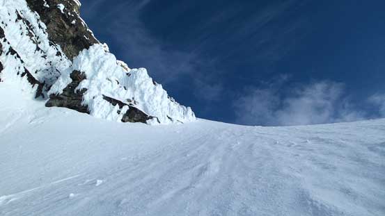
There’s no break between the couloir and the face

Due to a sudden rime ice fall Ben lost his sunglasses and got a cut on his hand
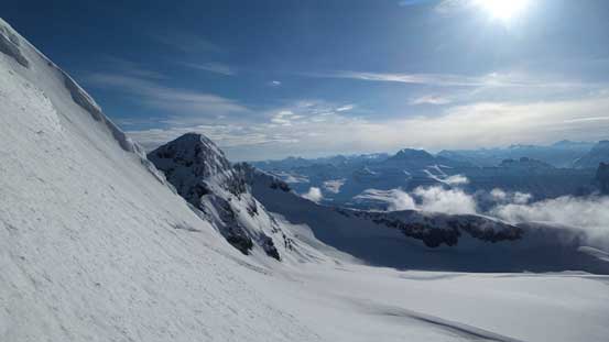
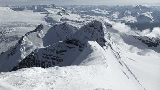
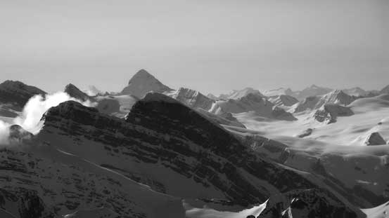
Soon we’d get higher than the Center Peak. It looks fairly far away

Typical on the upper face. Just go straight up…
Got higher than the Center Peak.
Ben ascending through the final summit cornice
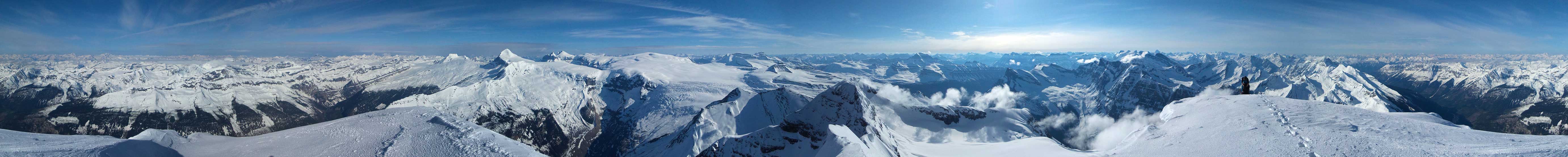
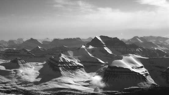
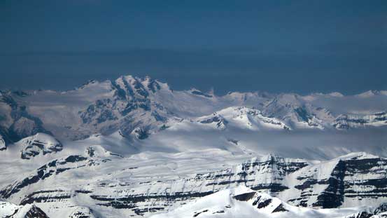
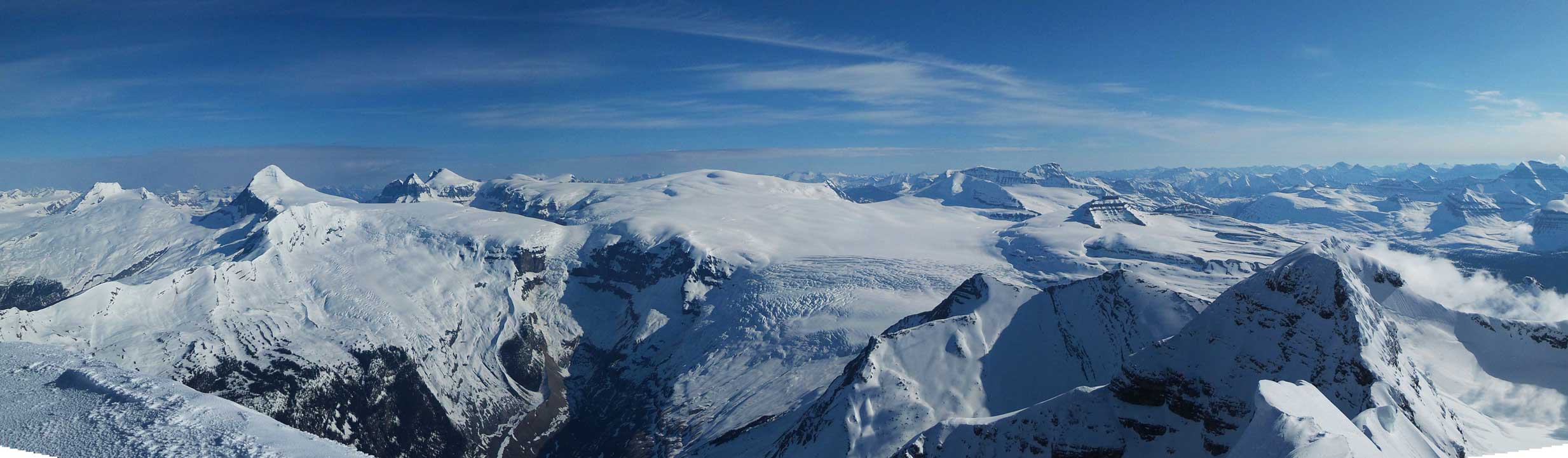
Summit Panorama from Mt. Bryce. Click to view large size.
The heavily corniced ridge connecting from Bryce/Bryce Center col

Mt. King Edward and the western side of Columbia Icefield
This picture clearly shows there’re lots of huge crevasses on Snow Dome
Andromeda and Athabasca

A heavily crevassed section on the Columbia Icefield
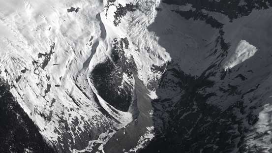
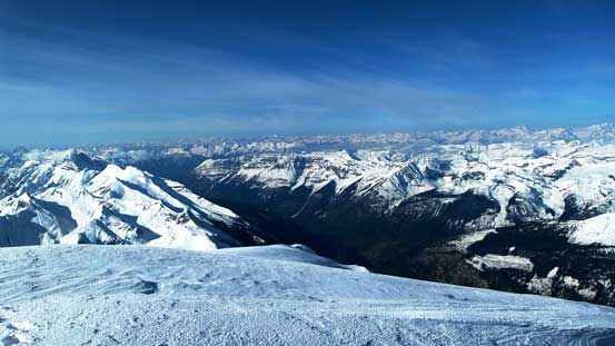
The deep drainage of Bryce Creek
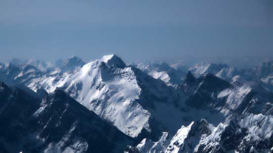
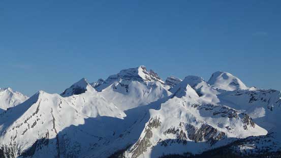
Tsar Mountain is always the eye-catching giant

So is Mt. Clemenceau
Mt. Columbia which we bagged 1 month ago
The 4 Twins which we bagged in one long day, last weekend
Bush River Valley is now 2500 vertical meters down low
The Stutfields which we also bagged last weekend
The 5 peaks on Mt. Lyell is very high on our to-do list
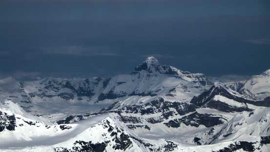
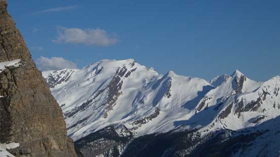
The mighty Mt. Forbes rises behind Mt. Alexandra
Behind the steep N. Face of Kemmel is Arras Mountain and its banana-shaped couloirs
Bush Mountain (Rostrum, Bush and Icefall Peaks) isn’t a sexy name…

Robinson Peaks and other rugged mountains in BC Rockies
Cockscomb Mountain now looks small

Mt. Dawson massive and the classic Mt. Sir Donald in the distance

Iconoclast Mountain is a giant in the Northern Selkirks

Pawn Peak in the Chess Group
Mt. Saskatchewan – a near 11,000er
Mt. Sir Sandford is the highest in the Selkirks
The Adament Group has arguably the hardest summits in its range
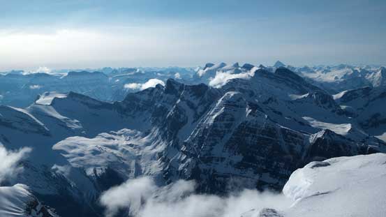
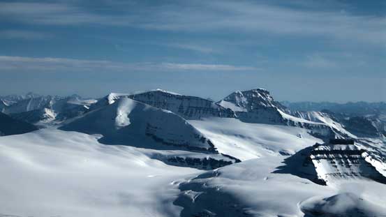
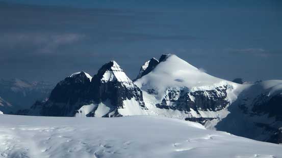
The summit of Bryce provides a birdeye view of the nearby peaks including Spring-Rice
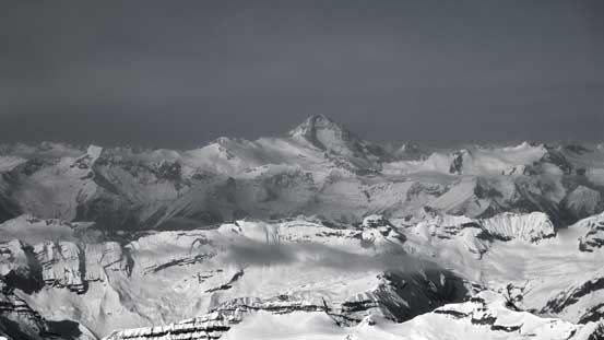
Panorama of Columbia Icefield. Click to view large size.
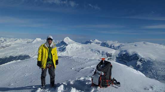
Me on the summit of Mt. Bryce, my 27th 11,000er!!
Down-climbing the face was relatively easy but the challenge came from snow balling underneath our crampons. Nothing major comparing with what’s coming next but it did slow down our progress a bit. Once entering the fall line of the rime/ice we got to practice dodge ball game for the next 1-2 hours… Baseball sized ice chucks came down a couple times per minute and we had to pay close attention to what’s coming from above as well as the steep and icy slope underneath.. We both got hit by a couple chunks but thankfully nothing worse happened and we all got down this shooting gallery safely, albeit exhausted. Ben got to enjoy about 5 minutes of skiing while I leisurely walked back to camp, and now we had to make a decision.

Starting the long down-climb. Firstly we had to drop down that summit cornice

And then, down-climbing the upper face. Step by step

It’s a long way down…
Dropping into the couloir, also the shooting gallery…

More down-climb…

Seracs on Bryce’s upper plateau
Ben got to enjoy about 5 minutes of skiing.

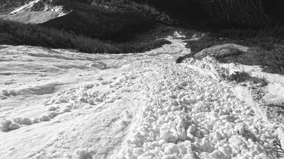
There’s a shit ton load of avalanche debris, all over the place.
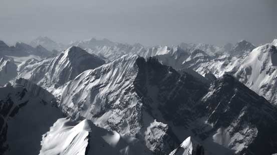
Great views as usual

Back to camp, looking back at this gigantic couloir
It’s only 11:30 am and we had about 10 hours of daylight time to kill. Theoretically that’s perfect for finishing the depproach on the same day, but given the poor overnight freeze and the fact the sun was beating down on full force we all had a second thought. There were a couple aggressive slopes including a giant avalanche path to descent. The reason for rushing the descent was that we had another aggressive plan beside the ascent of Bryce, but to get that one started we had to finish Bryce on Monday due to time constraint. However, my right foot was feeling tight and a bit pain throughout this trip. Adding to the concern with the conditions we decided against it. Alright, we had to kill 10 hours of daylight time (probably my first time ever to spend time enjoying a winter camping trip, rather than racing to bag peaks), and then hope there’s a reasonable freeze overnight to finish the return on Tuesday morning.

Avalanches coming down all over the place. Every 3 minutes there’s a BOOM…
Cockscomb Mountain in the afternoon light
Whiterose Mountain which we could have bagged together with Alexandra, but we ran out of time
What a front-door view from my tent.

Evening glow on Cockscomb Mountain

Evening colours on the horizon and the Chess Group
Unnamed peaks in the foreground
Whiterose Mountain on glow
The sky was clear overnight so we did get a bit of a freeze, but only for the upper few cm’s anyway. We woke up at 4:30 am and started about 1 hour after. Ben somehow convinced himself to ski (actually, side-slip) the steep and icy slope immediately below our camp and then across the waterfall. I just boot-packed down with occasional post-holes. Then came some top quality-suffering negotiating the ugly side-hill scrambling bash, while carrying heavy loads including skis and snowshoes… And then came the lower avalanche path. Apparently there was a huge slide on the previous day adding a whole lot of new debris. Ben tried to ski down the first section and we all boot-packed down the second half. Walking on the ice boulders was kind of fun though. Lower down we stayed too far skier’s right and had to bash through a brief, but very dense alder zone…
Ben convinced himself to ski this steep slope
Now, time to really boot-pack

Descending steep scree. Photo by Ben
Ben crossing another steep slope
And, more scree side-hill bashing. Top end quality suffering

Another slope

Yet, another slope to traverse…
Dropping into the avalanche path
Ben tried to ski for a while before switching to boot-packing
Fresh avalanche debris everywhere.
Boot-packing down the debris…
Done the path, looking back
We went a bit off route. Type 3 fun here in the alders…
Now all the hard parts were over except for the river crossing. I was suspecting it to rise a bit higher given the heat in this couple days, but once we arrived there we had to realize it got a whole foot or so higher. Thankfully it was still manageable (a bit higher than knee deep with good route-finding). Half an hour later we arrived at the bikes and got to enjoy a fast return back to the car. It was a bit interesting to bike steeply downhill with the huge pack though. Back at the car we saw a huge porcupine wondering around, but thankfully no damage to the car which was a huge relief.
We crossed Rice Brook at a braided section about 100 m upstream from the old bridge site
Ben crossing the river

And, onto the road slog
Getting ready for a fast return
This road is a bit exposed
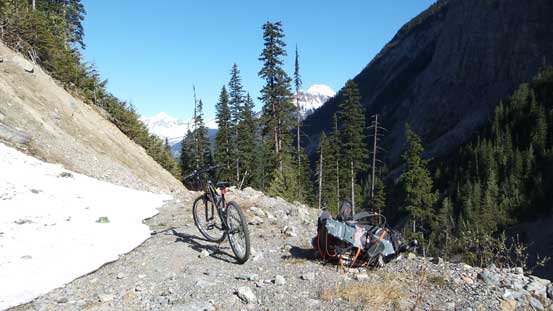
Ben and his bike
Great views from this road
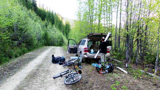
Back to the car
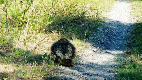
Only to find this fat bastard… Thankfully no damage to the car
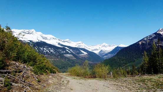
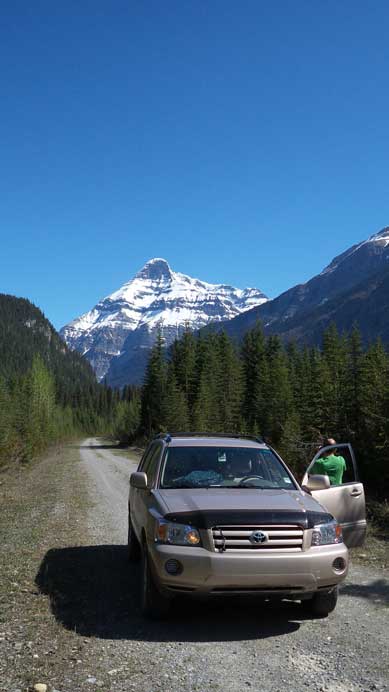
As for other BC trips we were not home free yet. There’s still 100 kilometers of logging road to drive, and then another 6 hours drive from Golden back to Edmonton. It’s an exhausting game (both mentally and physically) but at least the Bush Road was scenic with a lot of cool peaks nearby. We regularly stopped for pictures for future reference.
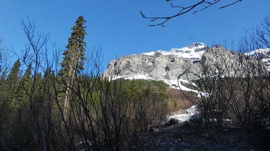
Looking back towards our objective from the drive-out
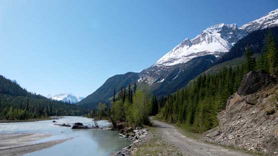
Bush River, Bush Road and the scenic views
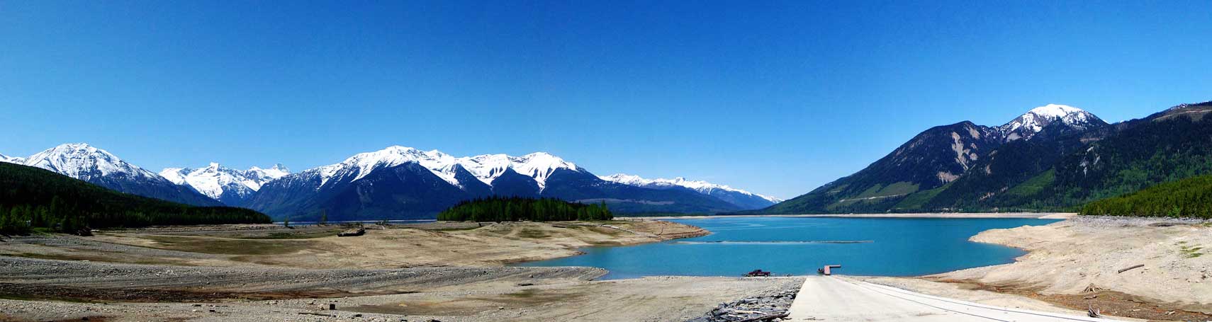
Panorama of Kinbasket Lake from the campground. The water level was low.
Overall I felt a great sense of success to have Mt. Bryce climbed on my first try, even though the trip did not go exactly as the “best case scenario”. This peak is probably one of my major objectives in this summer and I’m very happy to have it knocked off already before the summer officially starts. Speaking this objective, not sure how much I’d recommend due to the extreme rock/ice fall hazard in the couloir. But it’s a Rockies giant and I’m sure it’s on every climber’s dream-list as long as they’ve seen it from other peaks nearby. I’d probably recommend a bivy on the upper glacier/plateau (especially if you also plan to ascent the center peak of Bryce), but that way you’d have to haul all the loads up the 600-meter 40-degree couloir that could be icy later in the season.
A few years later Ben and I went all the way up there again and climbed Bryce Center.

Could have picked any one of your adventures to comment on so Bryce is as good as any. Your route information and candid comments make your site in my opinion one of the Rockies climbing world best blogs. I’ve been climbing for some 42 years (and still manage a 10k or 11K annually. . . in fact off Monday with my 23 year old daughter (to do Castleguard). I come from a heritage of original first route climbers, Swiss seat and Willans harness (and bowline around the waist !) to old school pro . . . I tell you this so that you know your adventures resonate with us “seasoned” mountaineers and to tell you continued safe adventures . . . keep the treks alive (Patagonia is definitely in your stars) . . . cheers
great job on the mountain and writing the TR. I climbed the NE ridge in 2002 (TR on Bivouac.com) so can appreciate your effort. great to see the other side of the mountain from the comfort of home. Wotan
link http://bivouac.com/TripPg.asp?TripId=1188
Cool. Thanks for your trip report about the NE Ridge. Mount Bryce is definitely one of the most beautiful peaks in the Rockies from any side.
great and not easy hike.respect!!!!!
This is totally intense. Huge and complex hike for an approach, a very tall alpine snow climb, plus having to contend with weather and potential avalanches. Hats off to you.
Mt. Bryce is on my lifetime list but I am not ready to take on such an epic, yet. Everything I have ever climbed seem like ‘training peaks’ (having been up Temple, Mt. Athabasca, Mt. Edith Cavell, and preparing for Mt. Victoria, next month).
Yep it’s a tough one. Took some huge risks on the climb and will never forget that moment when you have to take the backpack off to shield from the fallen rime ice debris. Front-pointing down while actually looking UP so keep an eye for the fallen ice. No helmet neither. Later in the day every single slope surrounding us went slide. In the end it makes Mt. Bryce one of the most rewarding I’ve done. All-time top 5 together with Bugaboo, Sir Donald, Atwell, Twins Tower..