Nivalis Mountain
July 3, 2017
2659m
Lillooet River / Garibaldi Provincial Park, BC
Nivalis Mountain is a remote, iconic and at the same time, elusive summit in the far eastern reach of McBride Range. It’s within Garibaldi Provincial Park and not too far from the town of Whistler, but rarely sees visitors thank to the access difficulties. The most logistic way of tagging this summit is by a week-long ski traverse, aka. the classic McBride Traverse. For those lacking skiing ability or simply aren’t interested in skiing with a ultra-heavy backpack then the logging roads system from Lillooet River offers an alternative summer route. This route is very much less explored and other than it “goes” I had little knowledge about the details. In fact when Alex tossed around Nivalis Mountain it took me a good day or two to figure out the route possibilities, using whatever I could find – maps, satellite images, my own photos and some brief account by other parties. And there there came the 3rd day of this trip.

Ascent routes for peaks around Nivalis Mountain
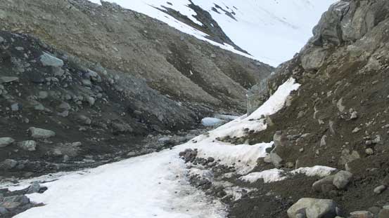
After two long days of work bagging Gauguin, Flood, Talon, Adieu and then Orphans the other guys decided to sleep in and save Nivalis Mountain for a ski trip which left me having to venture up the two biggest objectives on my own. The alarm was set at 4 am and within 20 minutes I was on my way up the Nivalis Glacier towards Talon/Nivalis col. This section pretty much follows our Talon Peak scramble route although within a mere day I had lost the tracks. I could spot intermittent tracks here and there but for the most parts I had to pick my own route. A few cracks started to show up but nothing major. The sunrise was beautiful and then I made to the first col of this day.

Morning colour on Nivalis Mountain as I ascended the glacier towards Talon col

Talon Peak from near the col

Another view looking back down the glacier from this col
Without doing much of lingering I dropped down the south side of this col. The plan was to descend for only 100 m or so and then cut across the broad south bowl resisting losing too much of elevation. Soon enough the terrain became steep and I had to don crampons and then the long side-hill traverse began. Even without doing much elevation change in the macroscopic view I still had to deal with the constant micro up-and-downs, and then there came a strip of moraine gulch blocking my further progress. I ascended to the top and spent a good 20 minutes to down-climb into the gulch but eventually came to a conclusion there’s no way without risking a long slip. The alternative was to descend a full 200 m down into the bottom and then regain all of the hard won elevation on either boulders or shitty snow, but at this point I just had to suck it up. Too much effort put in already and there’s no chickening out.

A typical terrain that I traversed a long ways across
This strip of moraine gulch required an additional 150-200 m elevation loss
There’s water running underneath the middle of the moraine gulch forcing me to ascend more shitty terrain on the sides (mostly climber’s left side). Once out of the gulch the rest of the traversing ascent was uneventful. Of course towards the “high col” things were getting steep but still, it wasn’t steep enough to require ice axe yet. Lots of step-kicking had to be made and the work was tiring to say the least, and then the clouds were coming on and off.
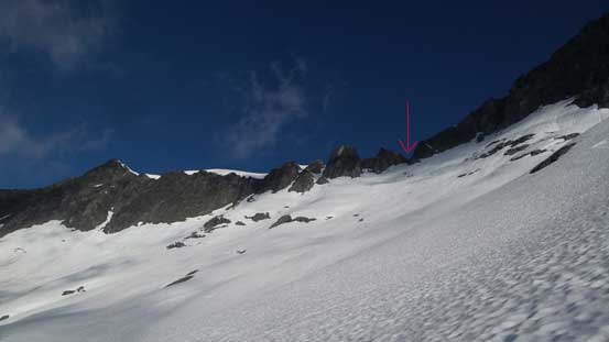
Now back to the traversing level. Aiming at the distant “high col”
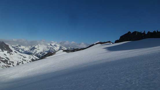
Looking south into some remote country
Adieu Mountain which we ascended the day prior
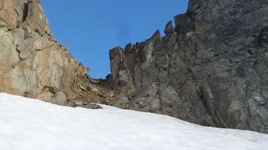
This is the “high col” in close-up shot. Easy peasy
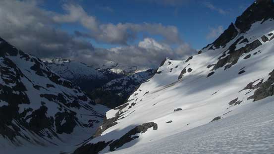
The top of this “high col” had me worried before but actually tamely easy. Just a couple meters of crampons-on-gravel and that’s about it. Later in the season the moat might open but as of early July it’s not a big deal. Crossing over to the other side I arrived at the edge of an immense icefield with Mt. Sir Richard straight in front and Nivalis Mountain just to my right. Again without doing much of lingering I turned right, side-hilling around on firm snow without losing too much of elevation. This worked out pretty well and then I trended right, ascending some easy snow to the broad south ridge of Nivalis Mountain. There’s one steeper (snow) step at the start of this ridge.
Crossing over to the other side of this high col, Mt. Sir Richard in front
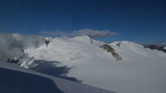
Plodding up this tame glacier

Looking back at one of the pinnacles I bypassed
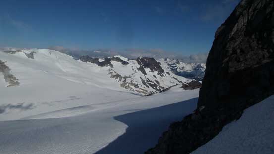
Just another glacier view

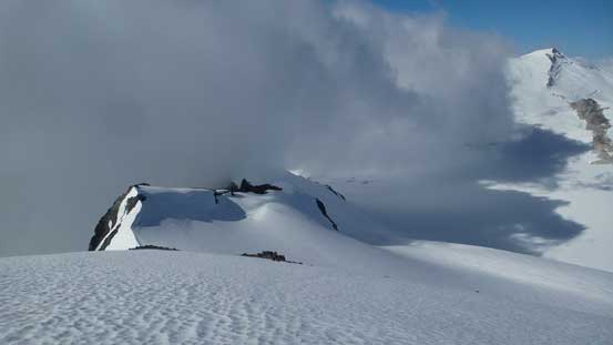
Clouds came in and out obscuring my views
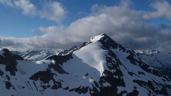
Onwards easy going albeit felt like a plod. The clouds were closing in for a while but then lifted when I reached the top. The coolest thing was discovering a John Clarke first ascent register placed nearly 50 years ago. That’s something unexpected although I did think given the remoteness of this peak I might come across one.

Looking down the south ridge from partway up. My favourate from this peak

Summit view looking at Outlier Peak

This is looking down the north face towards The Orphans from the top

First ascent note by John Clarke in 1968

Second ascent note, also by John Clarke

Another view from the summit
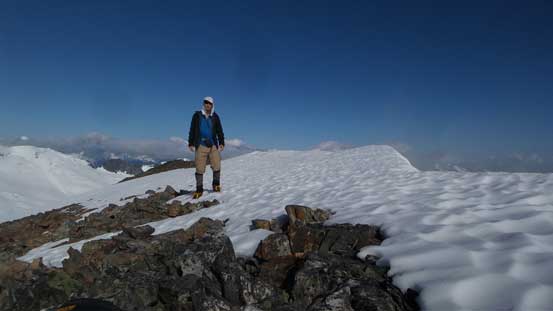
Me on the summit of Nivalis Mountain
Time to go down and move on to my next objective
After taking a much-needed rest break it’s time to focus on my last objective – Mt. Sir Richard.
