Mount Cole
December 29, 2020
1704m
Pavilion / Marble Canyon, BC
Mt. Cole is the northernmost summit of Clear Range that locates just to the west of Marble Canyon and Pavilion Lake and to the east of Fraser Canyon. This area is about half an hour’s drive north of Lillooet. I had noticed this summit on the topographic maps a few years ago and had noted it as an easy ascent in winter. There was of course minimal information on the internet but several logging roads apparently run pretty close to the summit. I had no idea how far these roads could be driven but in winter time I fully expected having to walk from the bottom anyway.
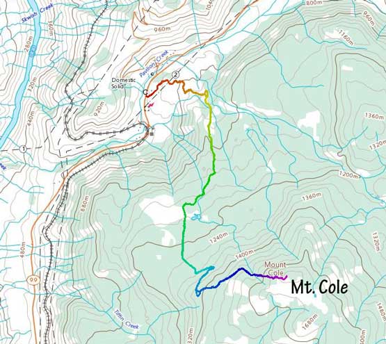
Mt. Cole walk-up route. GPX DL
Earlier in this trip I had made a snowshoe ascent of Blowdown Peak on Duffey Lake Road with a group of friends. The weather for the following day looked slightly more promising towards the interior so I drove out to Lillooet. I had several ideas in mind and in the end, opted for Mt. Cole as it was the most no-brainer option. I killed a few hours in the A&W until they closed the store and then drove out to a random spot to sleep in my truck.
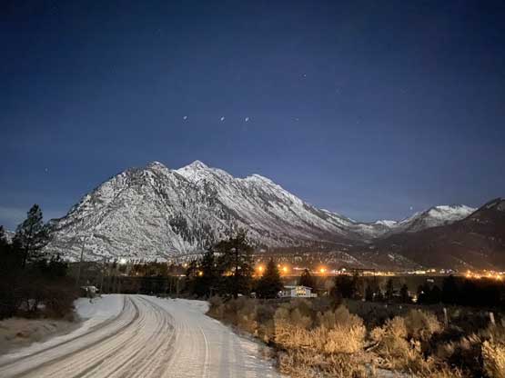
Mt. McLean and the town of Lillooet from where I slept in the truck
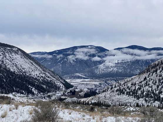
The weather was not as great as forecasted as I woke up under some overcast sky. I made my way back to the A&W for breakfast and browsed some weather maps. The forecast indeed downgraded but I decided to resume the plan as I was already in Lillooet anyway. About half an hour’s drive later I made to the bottom of Mt. Cole. The logging road that I noticed on the maps located slightly to the south of the small town of Pavilion. I had no idea what to expect about the status of this road. The start of this road was fairly obvious but I was disappointed to see signs of “private properties” and “no trespassing”. There was no gate nor any physical barrier to actually block the access so I decided to just risk it. There were tire tracks going into the land but I was not very confident nor experienced in 4-wheel driving in winter conditions. The roads were narrow and slippery but I wanted to make sure I parked out of the sights from the main highway. After about 50 m of elevation gain I noticed a wider spot to turn around and parked.
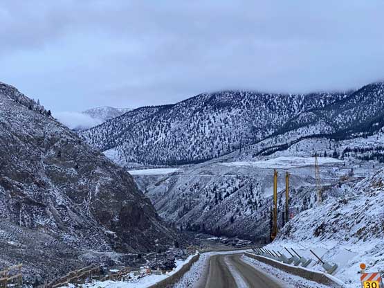
The winter scenery in Fraser Canyon north of Lillooet
I really had little idea of what to expect about these tire tracks or the conditions of trail-breaking higher up. I packed the snowshoes and soon started the plod. The road was not fully marked on the Gaia map but I had downloaded the satellite images of this area. There were at least half a dozen intersections and to my surprise the tire tracks kept picking the directions that I wanted them to go. After a while the truck tracks transitioned to some ATV tracks. Eventually after about 5 km or so the tracks stopped and I strapped the snowshoes on. The ascent from there onward towards the summit involved some heavy duty trail-breaking from boot-top to almost knee-deep. Near the top I abandoned the road and went for a more direct attack through some cut-blocks. The snow condition was absolutely garbage in the cut-block. The snow was not very deep, but bottomless that reminded me the conditions that I would have expected in the Rockies at this time of a year. Thankfully the views were not too bad.

The start of the hike.
The views were actually pretty good from the start of this hike

Passing a cattle gate that was surprisingly kinda tricky to walk across
Believe or not this mighty forested hill was Mt. Cole

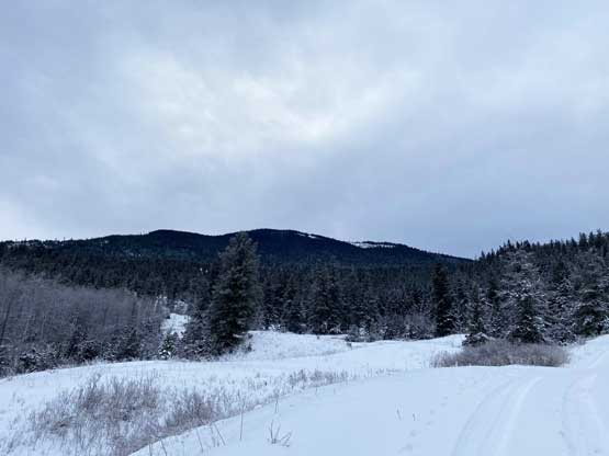
For the next few kilometers this was the typical scenery…

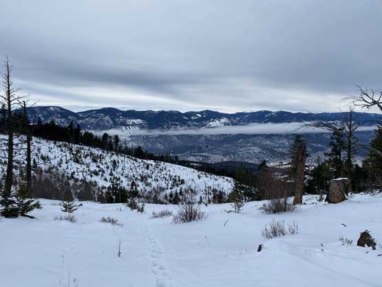
The views opened up again. Marble Range to the north
This is looking west towards hills on Camelsfoot Range
Mission Peak on Mission Ridge showed up

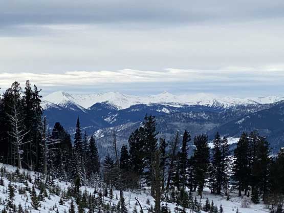
A zoomed-in view of the northern stretch of Fraser Canyon

The mighty Mt. Brew that rises 2500 vertical meters above Lillooet

Mt. Martley and other forested summits on Clear Range

The forested bump in foreground is “Camelshoof Peak”

Mt. McLean is the highest summit on Mission Ridge

Me on the summit of Mt. Cole
The summit was windy and cold so I didn’t linger very long. The descent was pretty easy but fairly boring. I listened to music for the entire hike as this entire ascent/descent was monotonous and mind-numbing plod on logging roads. The round trip distance was about 16 km and the elevation gain was just under 1000 m.
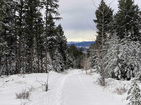
As boring as the descent went…

The small community of Pavilion in foreground
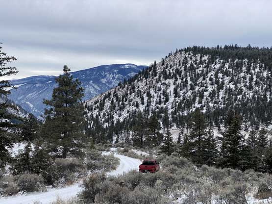
Taco parked. Almost done…
Once finished the hike I leisurely drove south back to Lillooet for some cell reception. I cooked a late lunch then resumed the long ass drive down the Fraser Canyon. I made all the way back to Yale before having to take a rest break but as soon as I stepped out of the truck I stepped onto someone’s fresh shit. Thankfully there were puddles of water and snow nearby to rub my shoes on… I lost all appetite of taking a nap so pushed the rest of the drive back home in a single shot. The weather had collapsed and at least a week of wet weather had returned marking this as my last hike of year 2020. This year might be shitty in many ways but not in peak-bagging. 144 new summits bagged in a single year was my second most productive since I started this game 9 years ago. I also managed to finish the Canadian Rockies 11,000ers list, hit my 1000th unique summit, did my first major traverse in the Coast Mountains, and reached my elevation record at just under 6900 m. I also managed to bag my lowest summit to date – Mt. Shannon at 110 m…
