Raspberry Ridge
May 21, 2014
2360m
Kananaskis Country (South), AB
Weather forecast for this past May long weekend was horrible from Grande Cache all the way to Waterton… Not wishing to get soaked thoroughly, I stayed home for the entire weekend, killing time by watching all kinds of stuffs on the internet. However, the actual weather wasn’t as bad as forecasted. Folks that insisted to go out succeeded on their objectives. Oh well… With good weather returning in the middle of the following week, I was keen on doing something. However, for the most part of the Rockies I had no idea about the current condition. I knew another group just did Mount Crandell but driving all the way down to Waterton by myself for only 1 day would be luxury.. This was a crazy year with record-breaking snow level in the front country, so to make things secure I set my objectives on Sentinel Peak and Hailstone Butte.
Mom wasn’t busy with her work in recent days so she decided to join me. Having two people would be safer speaking the bear hazard. She managed to maintain a good fitness level by walking to work everyday so I figured she’d be okay with this trip. We slept in car in Okotoks on Tuesday night and woke up early the next morning. The drive down Highway 541 and then Highway 940 went well until Cataract Creek. The winter closure gate was still closed (it was supposed to open on April 30th). I guess the road’s still suffering from last year’s flooding damage… Oh well. We decided to do the nearby Raspberry Ridge instead.
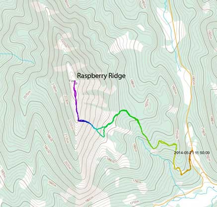
Raspberry Ridge hiking route. GPX DL
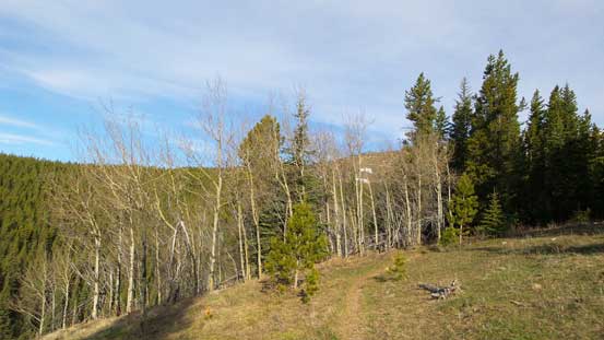
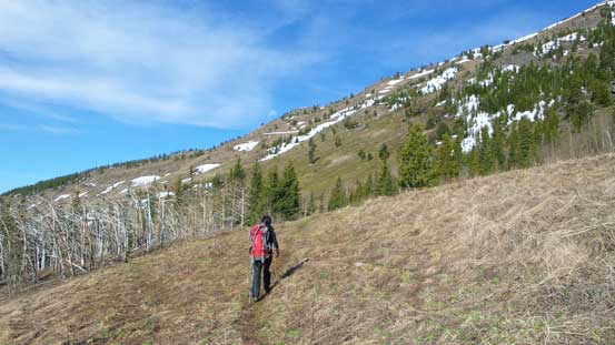
Since this was such a last minute objective, I didn’t do any homework apart from knowing it’s doable from this side. But thankfully I brought my GPS for this trip so I knew where to go. The parking lot was at a logging road gate. There’re two branches and we took the bigger one, left branch. This was a mistake right at the start, but soon I realized it. My GPS also confirmed the other branch being the correct route. There were a few indistinct sections but for the most part the road was very easy to follow. Post holing wasn’t as bad as I thought and for the most part we could avoid snow (thus, avoid wallowing in horrible isothermal stuffs). After a while the road led us to the base of a grassy slope. Directly above was the summit but to avoid steep snow and cornices we kept following the road for a while until spotting a snow-free line to gain the ridge crest.
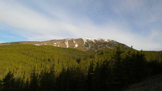
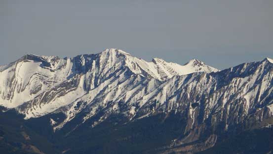
Morning view of our objective
Morning light creates some nice colours
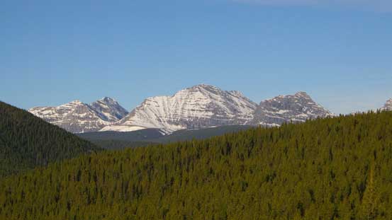
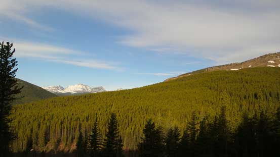
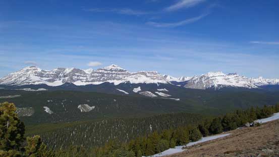
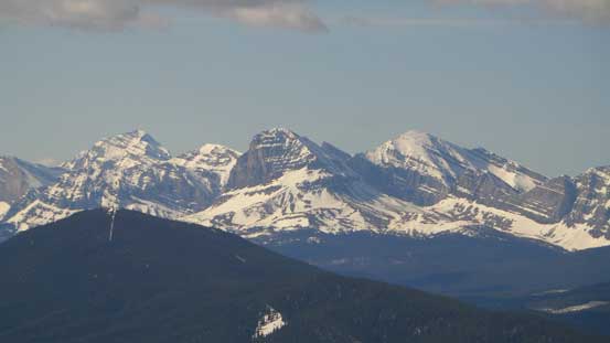
A view towards High Rock Range on the Continental Divide
Following a good trail
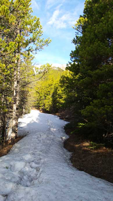
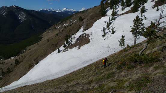
Still some (isothermal) snow on the road
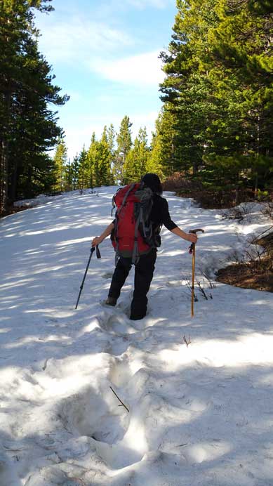
Brief post-holing
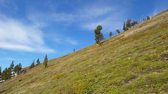
We aimed straight ahead here

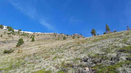
Directly going up wasn’t an option due to a massive cornice on the ridge
Finally seen some green colour after an everlasting winter.
At this point we were finally 100% sure snowshoes weren’t required so ditched them. But the slope was very foreshortened. It was quite a grind. The ridge was also longer than expected with a couple false summits. The actual summit was actually on a fire lookout. This is one of the best viewpoints of the peak on High Rock Range on the Continental Divide. The summit of Raspberry Ridge is much closer to them, so even though lower in elevation, it has better view than the nearby Mount Burke. We took a lengthy break on the summit before heading down.
Ascending steep grass slope
Looking up
Cresting the ridge, what a view.

A short snow slope to ascent just before the ridge crest
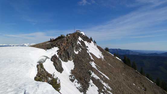
The summit ahead

Beautiful cornice
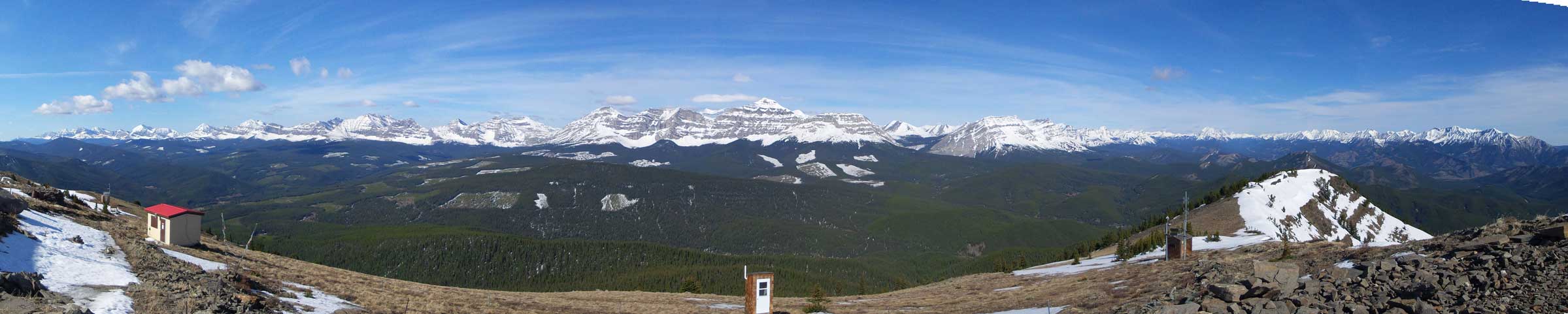
Summit Panorama looking west. Click to view large size.
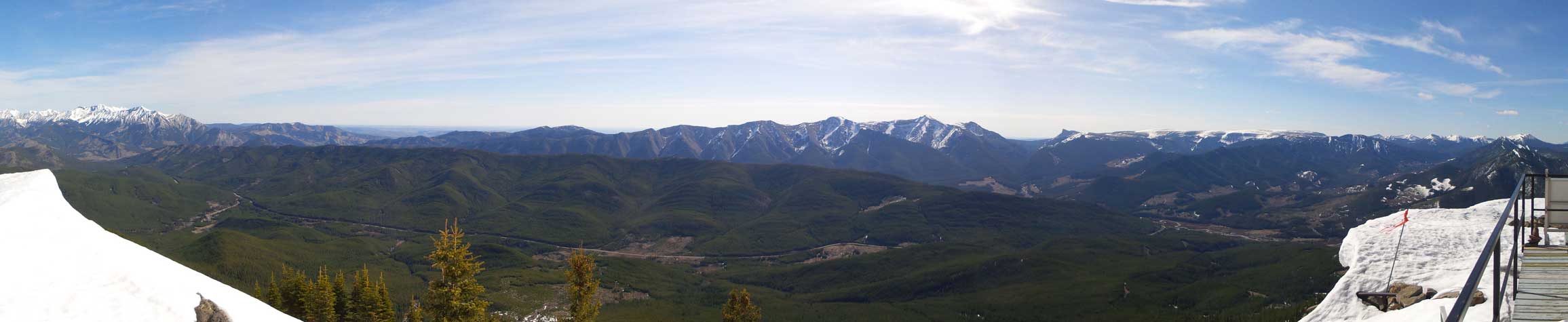
Summit Panorama looking east. Click to view large size.

Mist Mountain is a “Kane scramble” in Highwood area
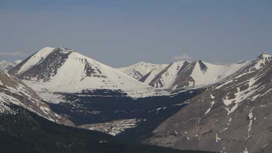
Tornado Mountain and Beehive Mountain

Mount Lyall. (Not to be confused with the Lyells on Lyell Icefield)…
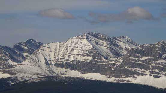
Mount Farquhar
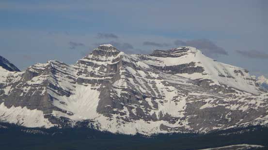
Mount Scrimger
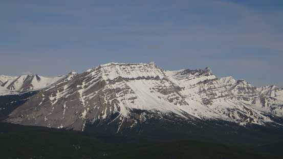
The impressive Baril Peak
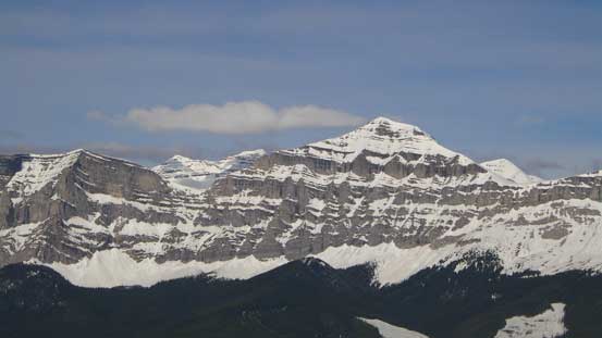
Mount Etherington
Mount Bolton looks easy
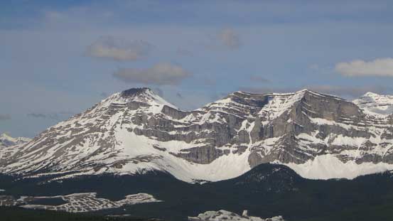
Mount Armstrong is one of the few “Nugara scrambles” in this area
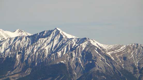
Mount Bishop is another scramble
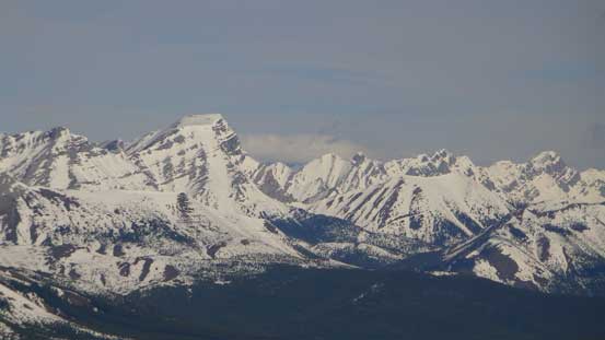
Holy Cross Mountain is probably the most popular scramble here
Mount Head is also scramble-able

Bull Creek Hills is a snowshoe objective.

A view from the summit lookout
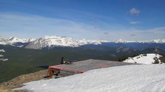
The helicopter pad
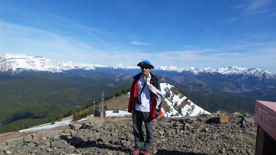
Me on the summit of Raspberry Ridge
Going down was much faster, but still, the logging road seemed to drag on forever. It was lunch time only when we finished the trip, so to make full use of this sunny day we had to do another objective, even though we knew it’s not gonna be very fun in this hot afternoon…
