Cerro Atacazo
December 13, 2022
4457m
Quito, Ecuador
Co. Atacazo is an old volcano in the broader vicinity of Quito. The elevation makes it a great acclimatization hike, but this peak isn’t often done as the neighbourhood is rumoured to be “bad” and in addition to that, the summit is riddled with communication structures making it more of a peakbagger’s summit than a mountaineer’s. The access is also rough and a reliable 4WD vehicle would be required for all but the most determined drivers. Adam and I did not have a lot of “beta” about this peak so we naively opted to hire a taxi driver. Adam had been hiring Jorge during his first two days of arrival so we naturally hired him again for the hike on Atacazo (through WhatsApp), but as mentioned above, Jorge’s vehicle is 2WD and the tires were as bald as one could imagine.
Jorge came to pick us up at around 7 am and we made quick work southwards out of the city as we were still earlier than the rush hour. There wasn’t an accurate description about the road access and the higher roads weren’t even shown on the Google Maps. Even if they were shown in Google we shouldn’t completely trust them as we learnt later in this trip. Instead, the roads were well labelled on my Gaia map so I directed us as soon as we exited the main roads. The cobble stone pavements came to an end and the road instantly became rough, and I believe that’s the spot where our reference GPX track (from peakbagger.com) started. Dustin W. who made the track likely had to walk from there making a 20 km round trip distance. Adam and I definitely did not want to do that, so we convinced Jorge to push further and further. At one point I thought we definitely had to start walking but he somehow made it through. The neighbourhood was indeed sketchy with weird-looking people and barking dogs. After getting bitten the day before we definitely didn’t want to mess around with the dogs neither.

At around 3500 m elevation the road made a sharp right turn and started to circumnavigate around the mountain in a horizontal fashion. The conditions actually improved from this point onward except for another short stretch of steep and rough section. We eventually turned onto the final spur due south and I anticipated a “driveable end” at any time, but Jorge managed to drive us all the way to the road’s end near an observatory or communication structure. We opted to park a tiny bit under the road’s end in front of the “trail-head” and that’s at 4100 m elevation. Since there’d be virtually no way to find an Uber to get us back into the city from this remote and weird spot, we opted to let Jorge wait at the trail-head. The clock would be ticking meaning that the faster we hiked, the cheaper the ride would be.


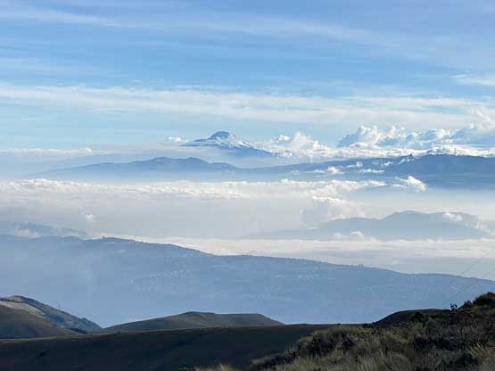
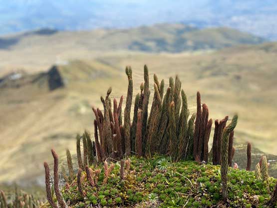
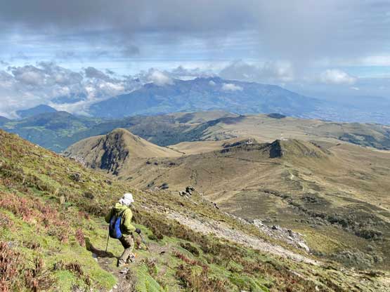
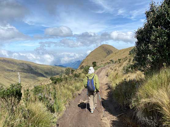
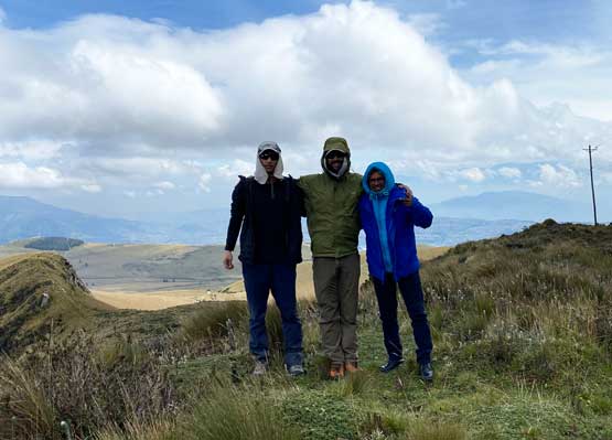
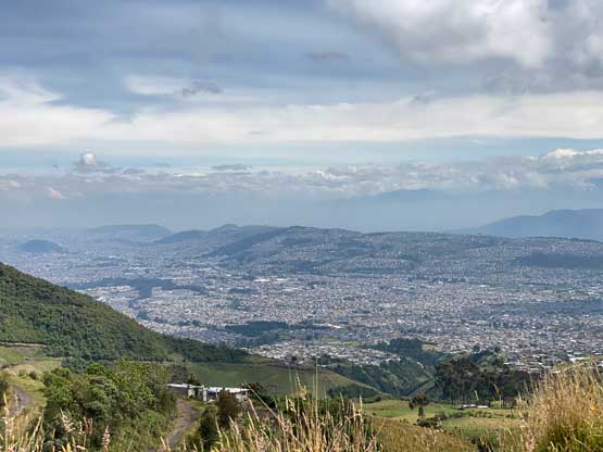
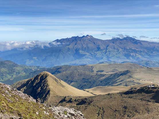
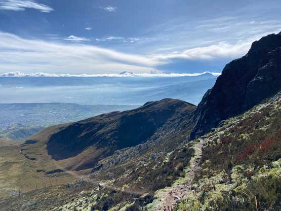
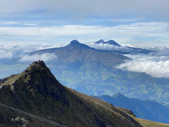
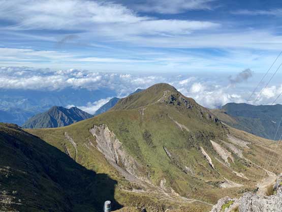
On the other hand, we did not want to hike too fast as the purpose of this ascent was to properly acclimatize for the bigger peaks coming up, so we went at a modest pace. The previous hike we did was as high as 3500 m and now we were ascending to 4450 m so we couldn’t hike too fast anyway. The ascent was short and no-brainer as we just needed to follow the old road and the trail to the very summit with hardly anything worth noting. The trail did become very steep on the final 200 m elevation gain and we were constantly high-stepping on grass fields. The final summit ridge also required a bit of scrambling and the summit was indeed quite obstructed. Thank to the man-made structures we couldn’t get that 360-degree view despite the weather being cooperative. We did also find out that the contours on Gaia map were incredibly wrong and we found that on many peaks in this country.


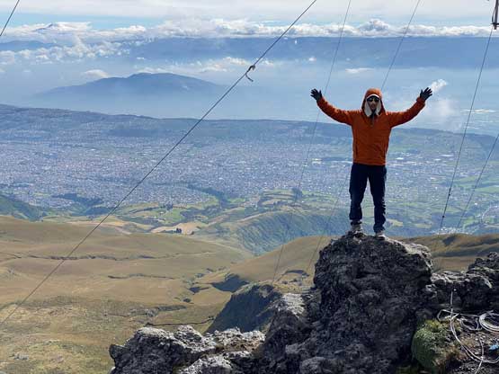
After about 20 minutes on the summit to breathe in some thin air we had to descend and we went down fairly quickly. Our round trip time was just over 2 hours covering about 3.5 km distance and 250 m elevation gain. I had concern about getting a flat tire on these rough roads but the worrisome proved to be unnecessary. Jorge successfully drove us down the sketchy roads and back into the city of Quito and we spent the rest of the day eating and resting.