Mount Hallowell
June 7, 2020
1231m
Sechelt / Sunshine Coast, BC
Mt. Hallowell is a forested, dome-shaped summit on the northern end, also the second highest of Caren Range on Sechelt Peninsula. It boasts an old lookout tower and some open views towards north and west into some remote fjords of Sunshine Coast. This is apparently a fairly popular hike among the locals as a maintained trail runs up its western flanks all the way to the summit, while adventurous folks can link it up with the slightly-higher Spipiyus Peak to the south by walking the logging roads on the high plateau of Caren Range. My original plan for Mt. Hallowell had always been the standard route thank to Al and Simon’s trip a few years ago, but recently I knew I also had to do the taller Spipiyus Peak so a link-up made more sense.
Earlier in the day Vlad and I boarded the first ferry from Horseshoe Bay to Langdale and drove up the increasingly rough access road south of Spipiyus Peak to within 1 km from the park’s boundary, leaving only slightly over half an hour’s hike to our first objective. We then hiked to the summit of Spipiyus Peak in a white-out and continued walking the logging roads northwards for an hour and half. It had been a boring hike so far but the weather seemed improving.

Spipiyus Peak and Mt. Hallowell loop. GPX DL
From the junction we easily picked up Mt. Hallowell’s trail. The trail descended a little bit to a very muddy area at a forested saddle before climbing steeply up the southern slopes of the summit pyramid. The ascent involved more than 200 m elevation gain and dragged on for quite a while. The views opened up near the summit and we wondered around for quite a while exploring every single possible viewpoint on the summit area. The weather was indeed improving so we lingered for over an hour on the summit.
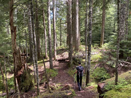
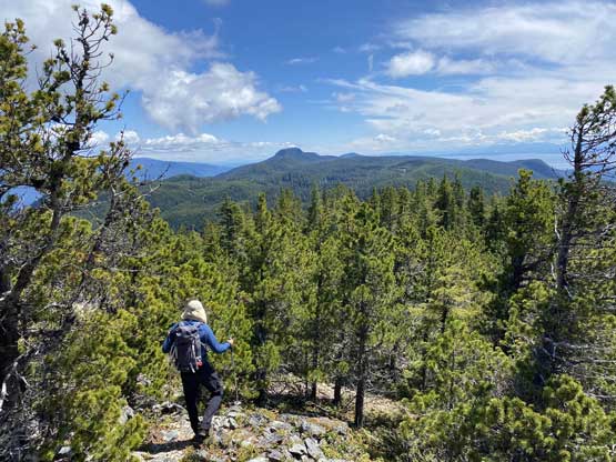
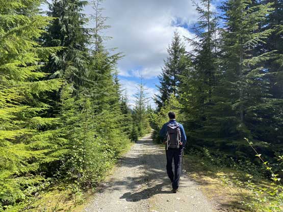
Vlad hiking on the Mt. Hallowell Trail

More about the trail
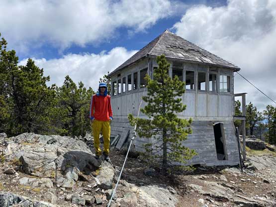
Me on the fire lookout near the summit of Mt. Hallowell
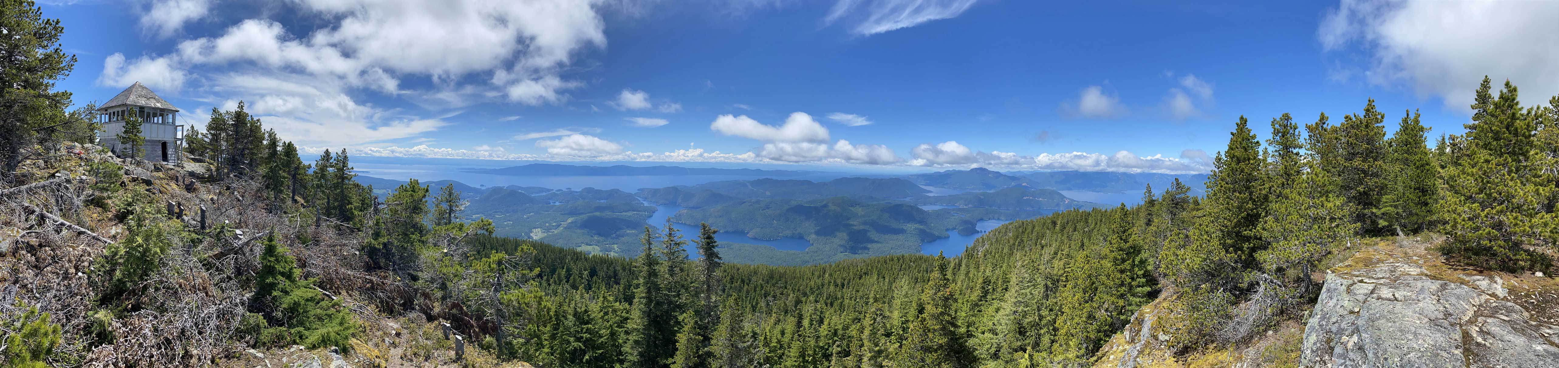
Partial Summit Panorama from Mt. Hallowell. Click to view large size.
Partial Summit Panorama from Mt. Hallowell. Click to view large size.
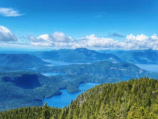
Looking across Ruby Lake, Nelson Island towards Mt. Troubridge

The summit lookout structure
Sechelt Inlet to the east

Me on the fire lookout tower on Mt. Hallowell

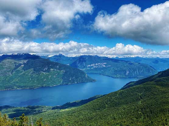
This is looking across Manaspina Straight towards Texada Island

The southern Manaspina Straight and Texada Island

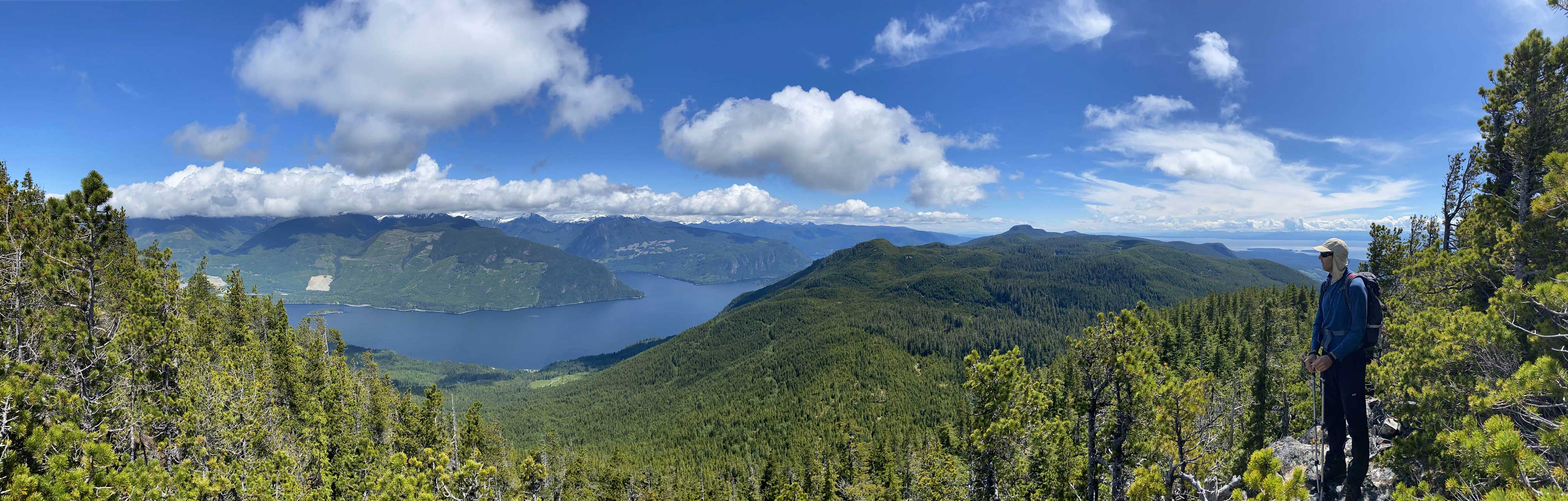
Looking south towards Spipiyus Peak, our previous objective

Rainy Mtn. and Tetrahedron Peak finally showed up

Vlad and I on the summit of Mt. Hallowell
We then leisurely plodded back down the trail and decided to make this hike a loop by walking back along the roads on the west side of the plateau. This road was in a slightly better shape than the east side road but equally boring with virtually no view whatsoever, for about 8 km long. Once back to the main junction we then easily walked down to our truck concluding the 25-km round trip mostly walking on flat logging roads with minimal views.
Time to head down. Spipiyus Peak ahead

Vlad descending the upper Mt. Hallowell Trail
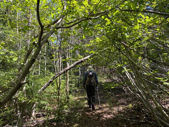
More about Mt. Hallowell Trail. We were still on the standard route here
About 8 km of plod on logging roads like this…
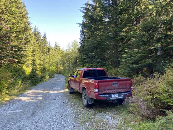
It’s Taco time…
Not doing much lingering we spent the next while driving down the rough access road. Thankfully the grader had moved away but I also needed to pull over and take a nap as I was exhausted from the lack of sleep. We thought about bagging a few more bumps near the coastline but it seemed like we weren’t doing too good on time, so opted to drive back while killing a bit of time on the coast. Vlad noticed the last ferry was 83% full already so we made a hasty retreat back to the ferry terminal and were able to squeeze into the line-up. It seemed like there’s a bigger line-up behind the gate meaning those folks might have to wait for the following morning to go home. It was such a mess.
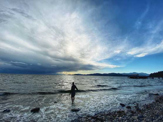
Have to touch the sea if visiting Sunshine Coast…
The ferry ride back home was pretty scenic as we were there right at sunset time. The rest of the driving back home was tiring but uneventful and I eventually got back after 10 pm. As usual to day-trip Sunshine Coast or Vancouver Island one would need to expect a very full day despite the shortness of these hikes.
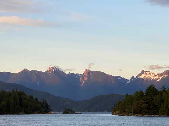
Brunswick, Harvey and West Lion on evening glow

Mt. Elpinstone and the evening colours
