Mount Boucherie
March 20, 2019
758m
Kelowna, BC
Mt. Boucherie is one of the several hills within the city limit of Kelowna that does not boast much scrambling and mountaineering interest. I’m sure it’s a popular hike among the locals but for us tourists coming from Vancouver the whole area is more famous for the picturesque Okanagan Lake. On the second day of this spring break peak-bagging trip in Okanagan I found myself having the whole afternoon to kill, after finishing a hike up Blue Grouse Mountain in the morning. I could have just rested on the lake shore soaking in the sun but such was not my way of peak-bagging. I grabbed some food in a nearby A&W, waited for an hour or two and made a spontaneous decision to hike up Mt. Boucherie in the late-afternoon hours. There are several starting points with a maze of trails and I randomly picked one to start near a secondary school on the north side. This isn’t the shortest but whatever.

Mt. Boucherie hiking route. GPX DL
The trail-head felt very local and it’s clear to me that few tourists had gone this way: no trail-head sign but rather a Dow Chemical plant, a secondary school and what seemed like a mine site. The trail was however marked clearly on my Gaia GPS app. The decision was to link up several trails making a full loop on Mt. Boucherie, in a clockwise direction. The crux was actually the first stretch where the trail was narrow, down-sloping, exposed and super icy and muddy. Wearing trail-runners seemed like a foolish idea but I somehow managed to get through without a slip. I had to step off the icy trail many times in search for softer, but still slippery (wet) grasses. Once over to the east side the trail suddenly became wider and soon I entered the backyard of the local area of Eain Lamont Park.

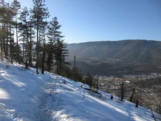
As you can see, the north side of the mountain was still cold
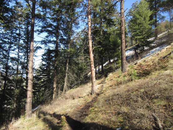
This is the trail that traverses the north side.
The houses in Eain Lamont Park.
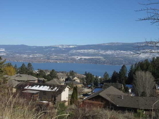
There were houses, children and dogs all around and all the sudden I was back in civilization. The trail widened up considerably. I followed a wide path of “highway” around to the south side where a new road was under development, and picked up a nicely maintained trail heading for the summit. This was a steep grunt under the hot afternoon sun, but the view was very inspiring. The best view was actually from a minor viewpoint below the highest point. On the summit I met a solo hiker coming up the steeper NE side and he showed me a brief introduction of the peaks of Kelowna area. I tried to memorize for as much as I could for later use.
I ascended the peak from the south side. This is the typical terrain
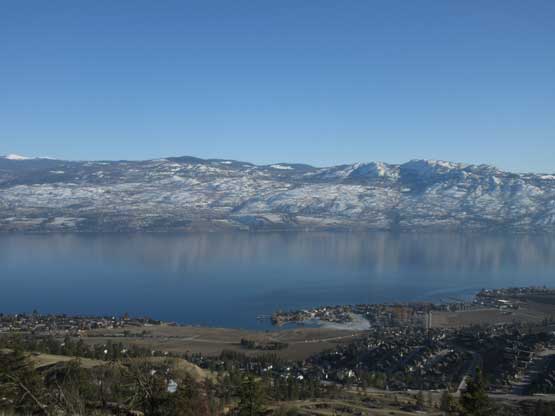
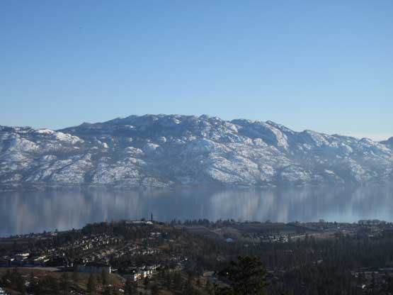
Already great view of Okanagan Lake

This is looking down into the city of West Kelowna

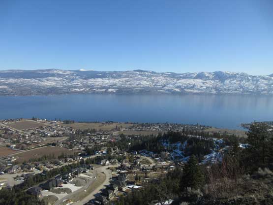
Summit Panorama from Mt. Boucherie. Click to view large size.

Zooming-in towards the portion of Okanagan Lake north of Kelowna

City of Kelowna, Okanagan Lake and the bridge across the lake.

A zoomed-in view of Mt. Hayman
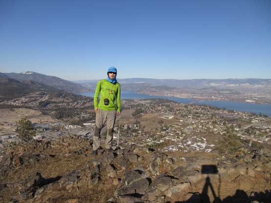
Me on the summit of Mt. Boucherie
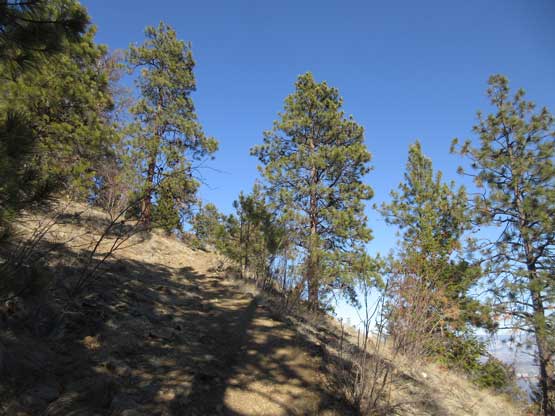
The high traverse across the several bumps along the summit ridge was decent but not as scenic as I was expecting. There’s a lookout platform on the western sub-summit so I did a short detour to check it out. The descent via “Boucherie Rush” trail was fast and fun and was actually quite scenic. I stopped many times for photos.

Traversing across the summit ridge
Okanagan Lake from the western sub-summit

Okanagan Mountain and part of Okanagan Lake

Time to head down. The trail still had a lot of snow and ice on it.
Picking up the “Boucherie Rush” trail

The icy trail… Needs caution
Finally ran out of snow and ice. Descending the SW flanks now.

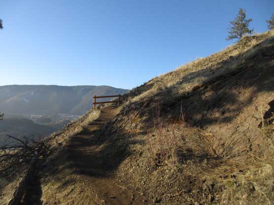
The trail was very well constructed with too many switchbacks

More about the descent
One last look at Okanagan Mountain that I ascended the day prior
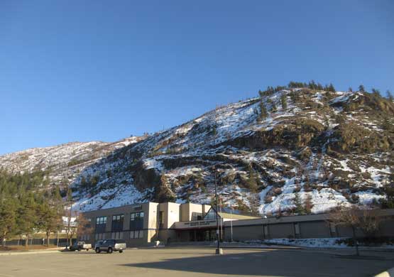
Back to the high school. Mt. Boucherie behind
It turned out that a loop hike over Mt. Boucherie was much more than I had originally thought. This is one of the finest viewpoints of Okanagan Lake and the city of Kelowna and the hike has enough variation (not just a plod up a tower road). Earlier in the day I had made a plan to snowshoe up Apex Mountain near Penticton, so once back to my vehicle I immediately started driving south. The road trip down towards Penticton was uber scenic.

Okanagan Mountain and its reflection in Okanagan Lake

Mt. Eneas makes a backdrop when looking south from Peachland.
The town of Penticton is much quieter than Kelowna and I did my usual evening routine there: Subway, Safeway, McDonalds, etc. The ascent of Apex Mountain would involve utilizing the ski resort so in order not getting caught by a ski patrol I had to climb most of the way in dark. To do that I drove up the access road and slept in my vehicle in the upper parking lot. And then there went the next day – Beaconsfield to Apex to Riordan.
