Mount Aylmer
July 7, 2012
3163m
Banff / Ghost River Wilderness, AB
Mt. Aylmer is one of the highest peaks in Banff’s front country. Though not even close to match the magic number of 11,000 foot, it’s higher than most nearby summits. Getting there requires a long slog up a well defined trail followed by scree bashing. It’s not a difficult objective but does require a long day. I did it as a solo ascent on the second day of my 6-day peak-bagging adventure based in Canmore and Banff. I messaged several friends at the last minute but they all had other plans. I didn’t quite want to do this solo because of the lengthy approach in active grizzly country, but considering the group size restriction starting at July 10th, I couldn’t wait for another week.

Mt. Aylmer scramble route. GPX DL
Despite the fact it’s described as a “very long day” by Alan Kane in his famous Scrambles in the Canadian Rockies even for biking parties, I figured 12 hours would be sufficient enough. Therefore I slept in a bit and started at 8:30 AM. The first 8 km approach along Lake Minnewanka shoreline trail wasn’t as smooth as I thought. I didn’t know there were so many up-and-downs including a big hill with about 150 m elevation gain/loss. Bringing a bike can reduce the pain but the trail is narrow, rocky, rooty and rough. I don’t know if I can bike comfortably on this terrain as mountain-biking is something I’ve never tried yet. But nonetheless, 1 hour and 40 minute later I arrived at camp ground Lm8, where the trail to Aylmer Pass branches off.
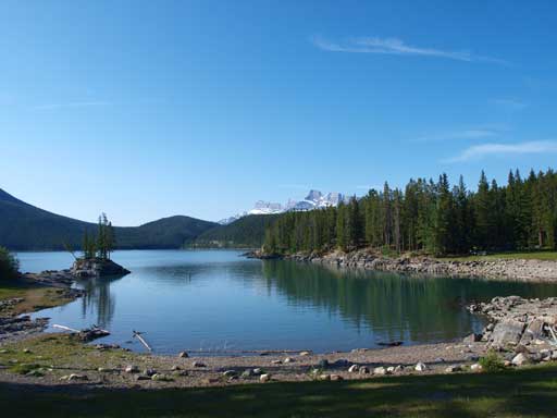
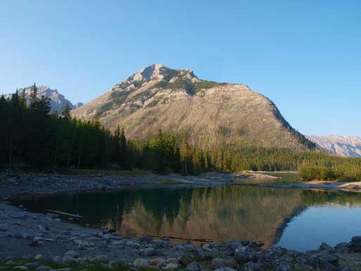
Morning view of Lake Minnewanka

Crossing the bridge. This goes towards Stewart Canyon
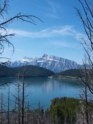
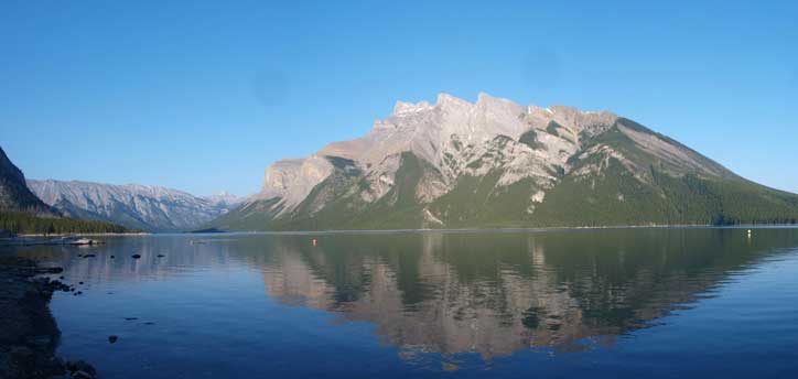
Mount Rundle rises behind the Lake

Beautiful paint brushes
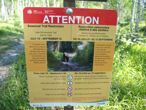
There’ll be a group size restriction very soon.
I was yelling during the past 1.5 hours on Lake Minnewanka Trail, and now, I have to yell at a much more frequent pace. Compared with Lake Minnewanka Trail, Aylmer Pass Trail is much more less traveled. Seeing those signs just made me more nervous. Normally if you don’t surprise a bear it won’t attack you (unless it has been fed on human food), so making lots of noise is the best weapon. I yelled about once in every 10-15 seconds. Upon reaching the Aylmer Lookout Junction, I decided to take the faster way up, which is via Aylmer Pass. Yes it’s a faster way, but I soon realized that this trail leads you to a more active grizzly country. Oh well, at least I knew I would be out of the trees in about 40 min, so not too bad.
I was more-or-less right about the timing so half an hour later I reached a huge avalanche gully and following Kane’s direction I left the trail and ascended this gully. There was supportive snow in it. I didn’t yell that often but I still had to yell, because of the huge grassy slope ahead. Life became a game of slog from here. It was mainly a steep slog up endless foreshortening slopes to the summit. I suggest you to divide the game into several pieces. At the end of game 1, you gotta be treated with the first full view to Lake Minnewanka. During game 3, you can see most of the unnamed peaks towards NW (part of Palliser Range). The downclimb in game 4 requires difficult move on down-sloping and overhanging ledges, friction move, definitely not a moderate by any means. The final slog in game 5 requires 40min so be mentally prepared.
1. slog up avalanche gully followed by grassy slope on climber’s right to ridge crest
2. slog up brown scree to the saddle (where different color rocks meet)
3. slog up talus and boulder fields to the difficult down-climb
4. down-climb rock bands (difficult scramble for one of them)
5. slog up the final 300+ meters to the summit

Going up the avalanche gully. Snow offered some easy travelling

Flowers
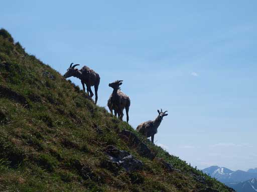
A group of sheep
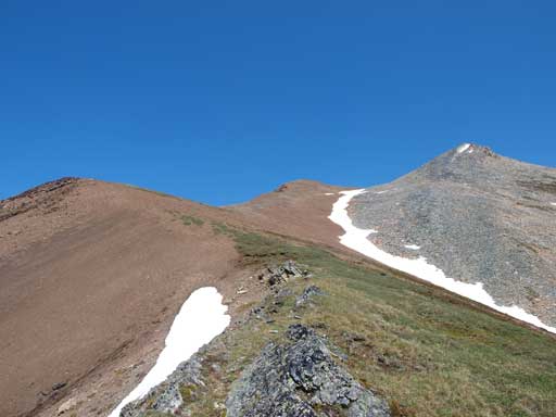
Above the gully and the big grassy slope. Now I’m aiming for the saddle between two brown bumps
Mount Aylmer’s upper slope

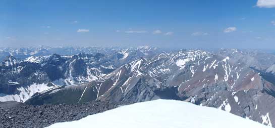
The Palliser Range looks better from this height than from the summit.
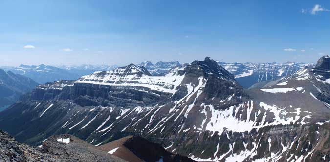
More Palliser Range. Very few of these peaks are named.
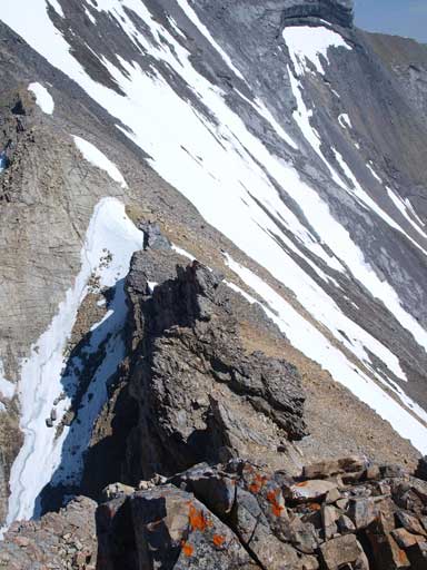
The crux down-climb. It’s avoidable if you’re taking my descent route.
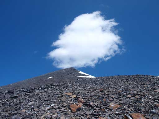
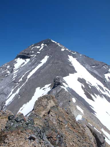
The summit is ahead. This part is a true slog.
Finally, after 6 hours trudging, I stood on the summit of Mount Aylmer, a peak more than 3100m elvation. The views are awesome as I could look down at most stuff, but mostly unnamed peaks though. The most imposing feature towards east was Devil’s Head in Ghost River area. Towards south I could see Lake Minnewanka with the dual-summit Girouard/Inglismaldie rising behind. The view was a bit smoky. I don’t think that’s because of forest fire, but rather the high humidity of the air. The register was placed in 2005, and there are not so many ascents since then, but I could recognize lots of familiar names.

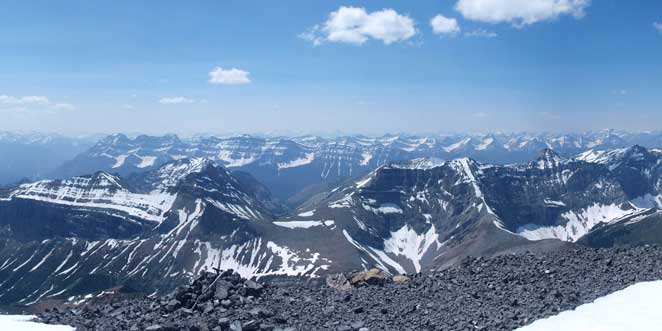
This valley is Ghost River Valley. Most of these peaks are unnamed.
Looking North to more Palliser Range peaks
Cascade Mountain (a long ridge) pokes behind Palliser Range
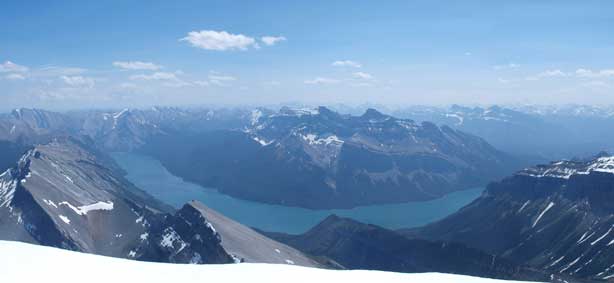
Lake Minnewanka, with Giouard and Inglismaldie behind

Unnamed peaks in Ghost Area

Revenant Mountain at center.
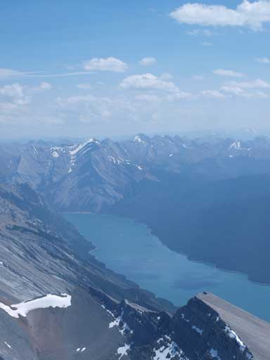
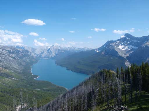
Lake Minnewanka is s-shaped and is very long. This is the middle part.
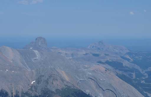
Devil’s Head and Black Rock Mountain in the Ghost area

Devil’s Gap

Me on the summit

Summit Register
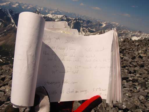
My entry
I stayed more than half an hour on the summit soaking in the views before descending. Coming down the summit block was fast. I skirted around the difficult section on the way back, side-sloping on the scree and boulders (only easy scramble). I chose the Aylmer Lookout trail on the way back. The ridge went on forever, and the trail on the ridge was in a very bad shape. Lots of dead falls to negotiate. Despite that, this route is much more scenic than the direct route. Once at the lookout, a good trail led me back to the major Aylmer Pass trail, where I was joined by two other hikers. We hiked down together to the campground Lm8. It was a sunny Saturday night so there were lots of bikers and campers around, so I was not worrying about bears by this time. I didn’t speed on the last 8km back, but rather took time taking photos of Lake Minnewanka and Mt. Inglismaldie. The afternoon and evening sun provided much better lighting for photographing.

Looking back to Mount Aylmer. Note I took a different route on the way down. This bypasses the crux

I would follow this ridgeline ahead towards Aylmer Lookout
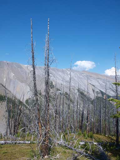
A view from the ridge. There were lots of burned trees
Lake Minnewanka
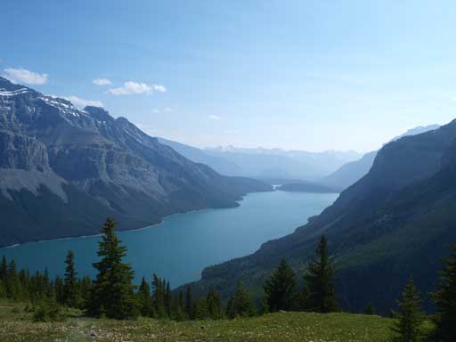
This is where I came from. I need to make to this end of the lake.
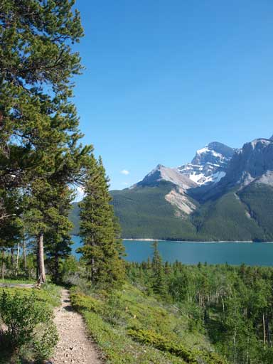
Almost back to Lake Minnewanka Trail.
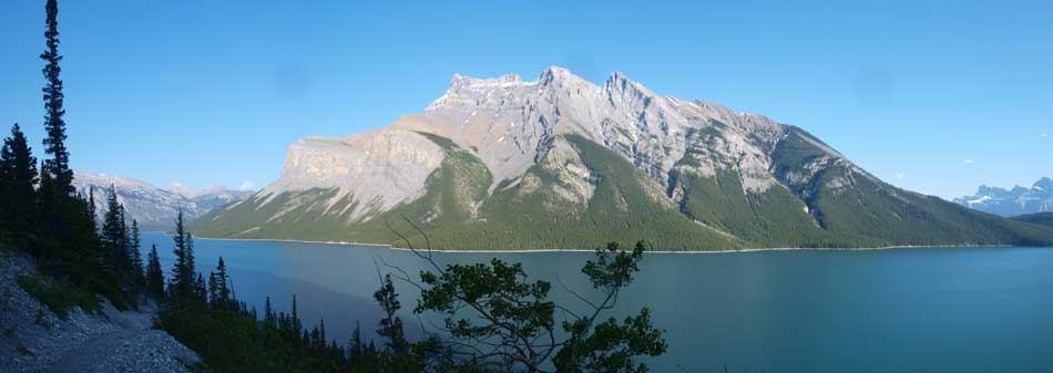
A panorama view of the Lake and Mt. Inglismaldie from a hill on the Trail.

Back to the tourists’ paradise. The sun was getting lower too.
An unnamed peak
Another photo of Mount Inglismaldie and Lake Minniwanka

Back to parking lot. There were like 100 tourists hanging around.
This week is my first trip to Banff area in this year, so not surprisingly I was amazed by how many people around the lake shore and the parking lot. My round trip time was 11.5 hours including all of the stops.
