Mount Columbia
April 18-20, 2015
3747m
Columbia Icefield, AB/BC
The mighty Mt. Columbia is the second highest peak, also the grand prize of ski mountaineering in the Canadian Rockies. A successful ascent of the ‘mighty C’ should be on every climber’s dream list and just like other 11,000ers timing is ‘everything’, with this particular peak emphasizing even more on this factor. In the right conditions Mt. Columbia is not a difficult ascent (though still a long one) but to get the right conditions lining up perfectly with weather as well as everyone’s work/school/family schedule is certainly not an easy task.. That’s why most people, even the most experienced ones ended up having to wait for years and perhaps several attempts before eventually standing on her apex. With a high pressure system forming up slowly towards this past weekend Ben, Vern and I started to get excited with the opportunity ahead.
Over the past few years I always had a dream to climb Mt. Columbia as a day-trip from car, and I knew form facts (ascents by Dave Stephen’s as well as Paul Zizka’s groups) this is certainly doable with a full moon or a pre-established skin tracks, or better both. I don’t know what’s the exact reasoning for ‘rushing’ it but I guess it’s just cool to climb such a well-known objective a bit differently. However, realistically I knew if I had a chance I’d like to have 3 days – not just for a relaxing pace, but also to give multiple chances to attempt in case weather does not work out in one particular time frame. And if weather does work out in the first ‘window’ then we’d have plenty of time bagging other peaks nearby such as Snow Dome, and this turned out exactly to be the case for us.

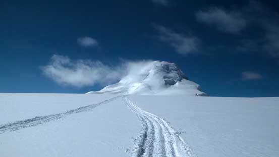
Mt. Columbia ski ascent route via The Trench. GPX DL
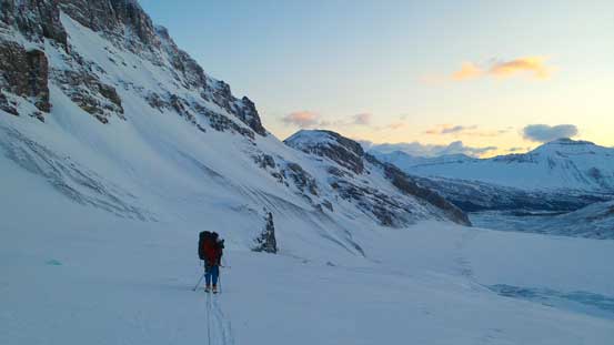
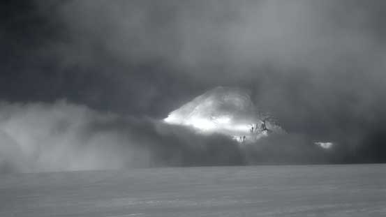
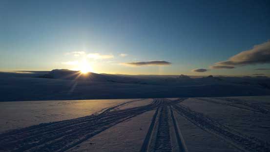
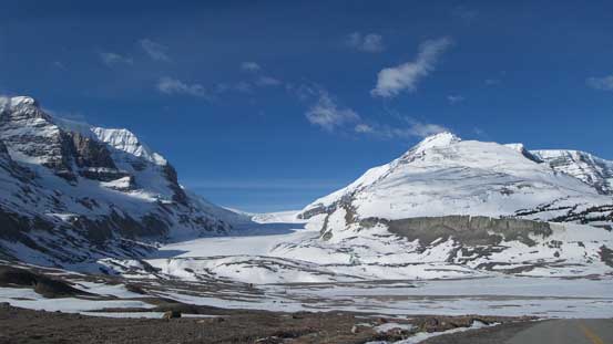
The weather forecast for the first day (Saturday) was not the most perfect but we figured it’d be at least good enough for an approach. In fact, despite the strong high pressure ridge dominating over BC neither of the three days’ forecasts for Canadian Rockies were absolutely guaranteed. That was surely a bit strange so in order to give us one more ‘window’ we decided to start the trek by 4:30 am in pitch dark, aiming to make the summit bid on the evening of Day 1 in the best case scenario. Obviously right at the start we had to realize there’d be no tracks nor moon guiding us.. The initial descent from the tourists’ parking lot to the toe of Athabasca Glacier was not pleasant, but at least by following closely to our GPS tracks (from Andromeda’s ascent in the previous year) we didn’t make any major navigation error. In short time we were skinning gently up climber’s right side of the glacier towards the first icefall.

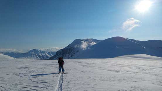
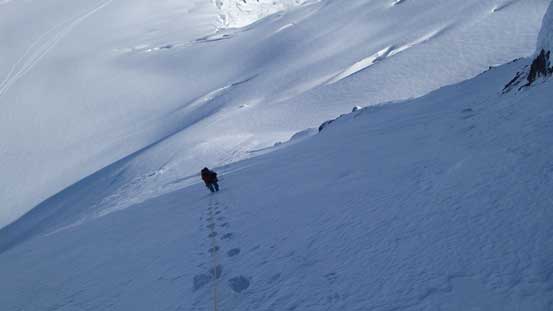
Me skinning towards the first icefall at dawn. Photo by Ben
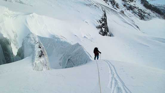
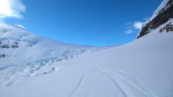
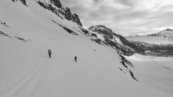
Ascending the first icefall went by uneventful but the second icefall looked to be a bit more broken than in the previous year. We took a short break beneath an obvious rock outcrop, roped up and decided to ascend a narrow snow arete between some ice chucks and crevasses straight ahead since the slope on far climber’s right looked to be narrow, steep and a bit too icy to skin up. Neither of us was in the mood of taking skis off at this time of the day yet.. The snow arete was a bit interesting but worked out perfectly and shortly after we were skinning across the ‘drop zone’ underneath Snow Dome’s house-sized seracs, trying to maintain a fast pace. The third icefall (the ramp) looked to be in a much better shape than in last year. It was a perfect ‘ramp’ this time with no open crevasse visible and I led the way basically straight up the middle of it.
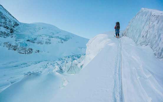
Ascending between some ice chucks on a slight variation of climber’s right side of 2nd ice fall. Photo by Vern
Looking back at Ben beside the ice
Traversing climber’s right side above the second ice fall

Yes, we were underneath Snow Dome’s seracs
Ascending the ramp onto the Neve
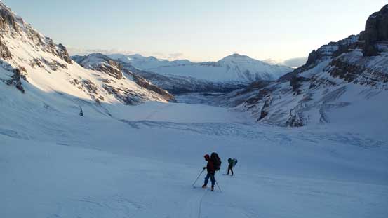
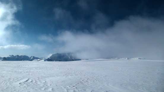
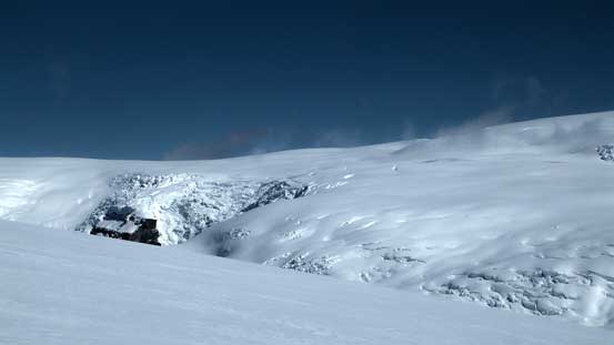
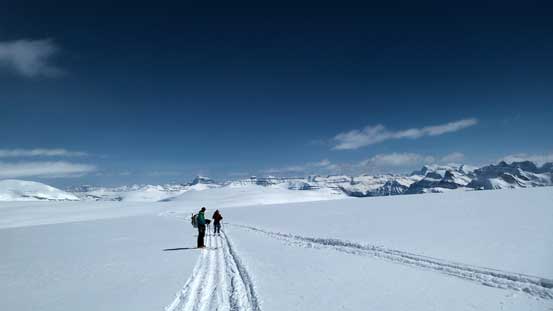
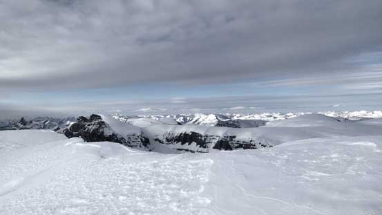
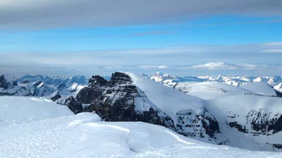
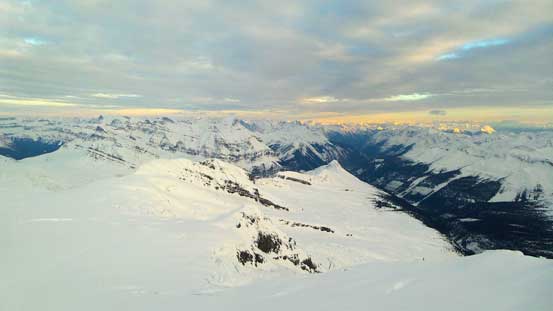
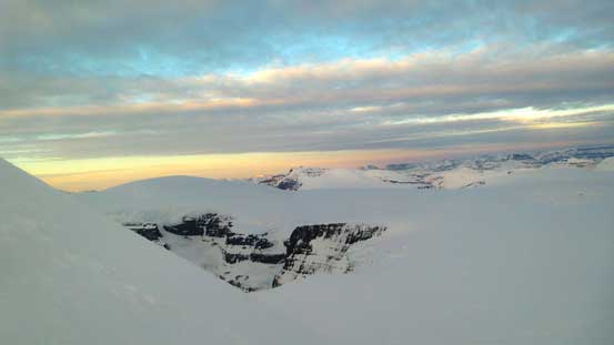
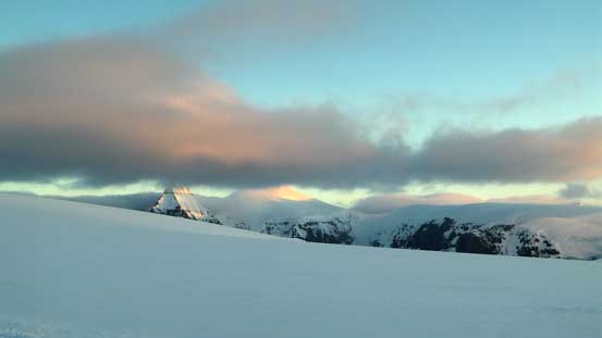
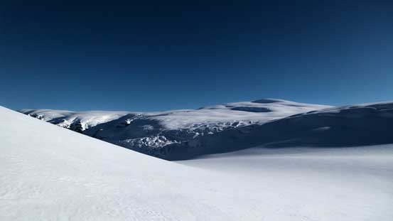
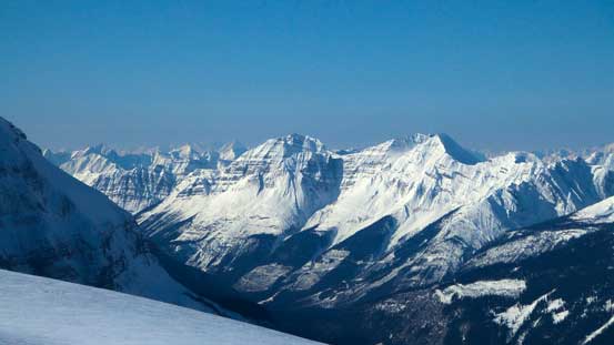
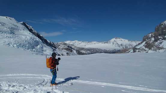
Once above the Ramp I was surprised there’s still a gentle but very foreshortened rise before topping out on the main Icefield, and once there we were greeted by some chilly wind. There were some clouds forming up and passing by (just like expected) but overall weather was fairly stable. One theme for the Columbia is that everything is much farther than they appear, and this includes the trench. Due to the intermittent clouds I ended up leading the group way too close to the SW flanks of Snow Dome before Vern realizing our navigation mistake. Ben checked his GPS and informed us that we’d already 1 km too far to the right (north) of the line. Oh well… The trench was deeper and more impressive than I’d imagine, with numerous enormous crevasses on both sides. We carefully picked our way down, and it was now that weather really started to get better again. We were all amazed by the size of the terrain around us, with the Twins and Mt. Bryce stealing the show looking northward and southward, respectively.

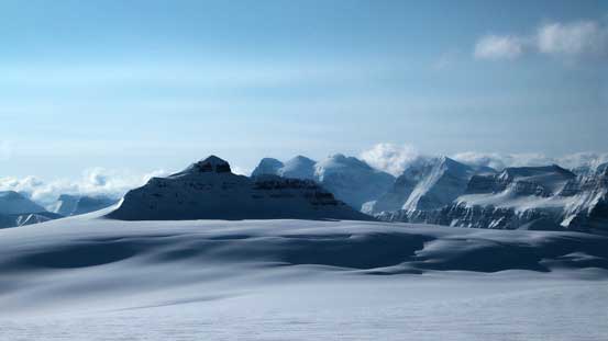
Start to see the rounded summit “hump” of Snow Dome
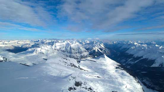
Ascending onto the Icefield, with Andromeda behind
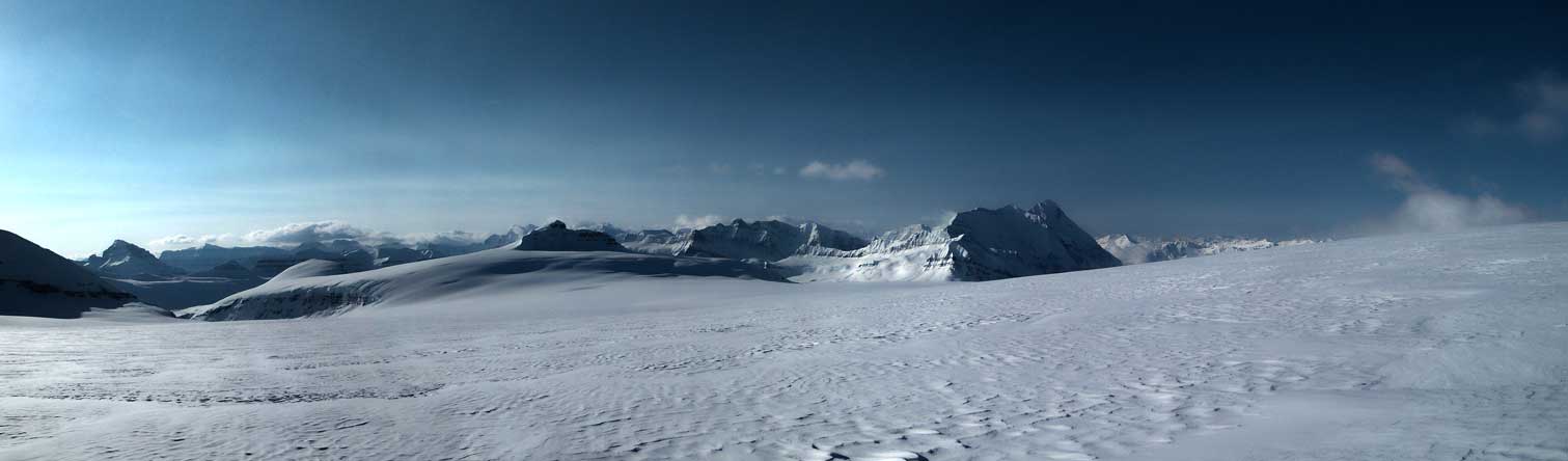
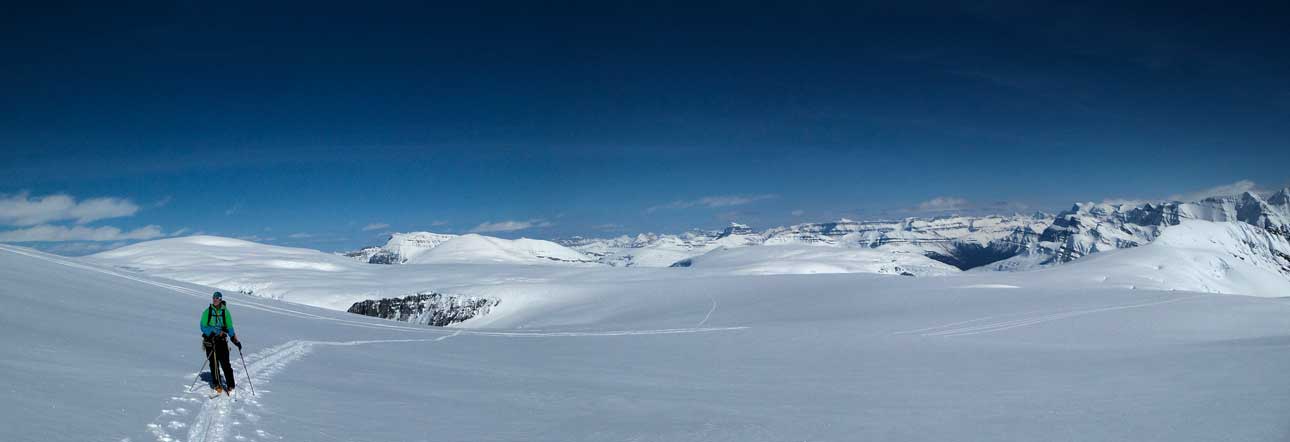
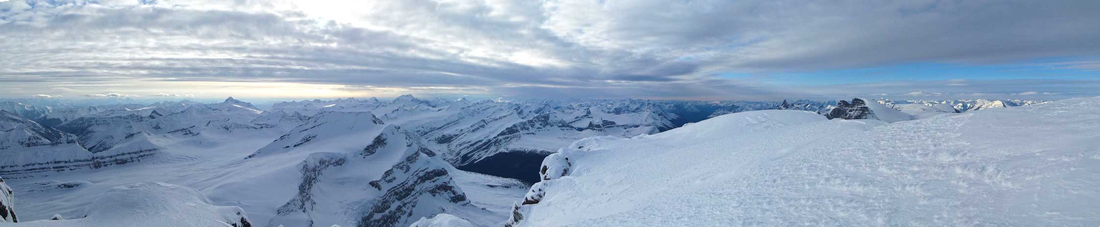
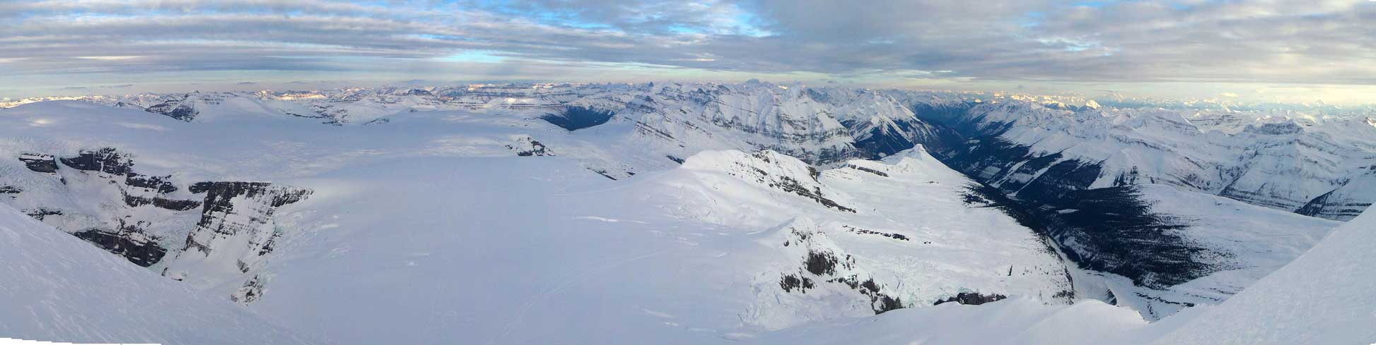
Panorama from the immense Columbia Icefield. Click to view large size.

Some clouds were forming up and passing by
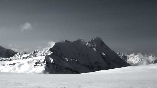
The mighty North Face of Mt. Bryce
We were getting higher than Castleguard Mountain – my first summit on the Columbia
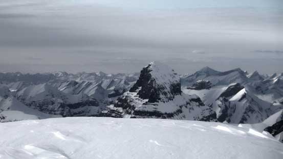
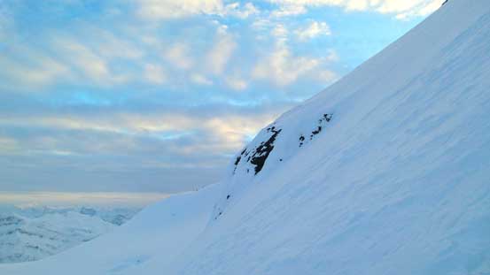
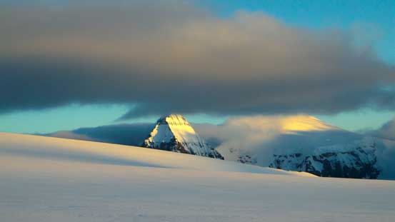
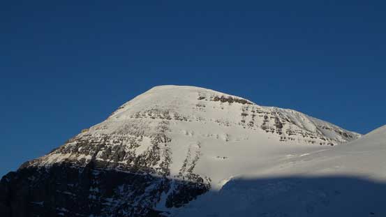
The face of Mt. Columbia trying to sneak out in the intermittent clouds
The clouds surely added some mood to the long slog

See? Now we were in a near white-out…

Some giants started to show up and we soon realized they are the Twins…

Now we are at the Trench
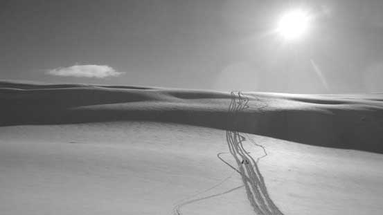
Vern skiing into the Trench
Vern enjoying a fast descent into the Trench. Photo by Ben
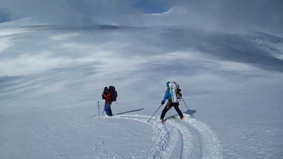
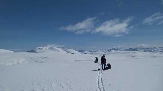
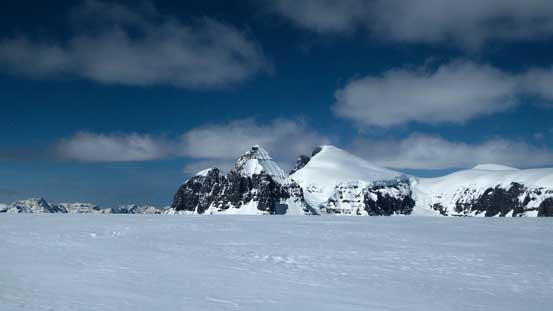
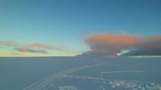
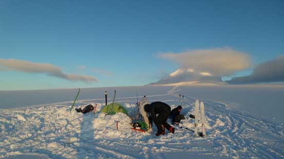
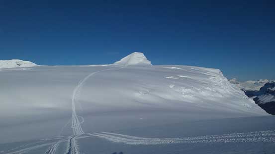
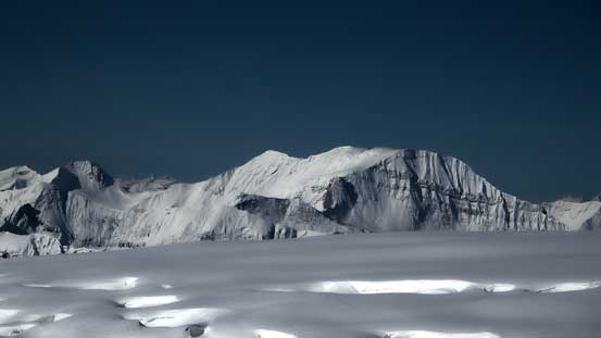
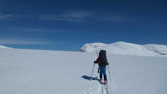
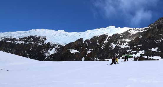
After a steep grind out of the trench our objective was soon back in view. And this time it’s finally getting bigger and bigger, though slowly.. Checking Ben’s GPS we still had more than 4 km horizontal distance but at just above a steeper roll we figured it’s already ‘good enough’ to drop our heavy packs and set up camp. The weather looked to be stable enough to allow a summit bid in the afternoon/evening so there’d be no need in carrying any farther. In addition to the sunshine, there was literally no wind which was certainly a bonus, making the camp set-up nice and pleasant. This was my first time camping on an icefield and also (surprisingly) my first time winter camping with ski gears… There were quite a lot of stuffs to learn from Ben and Vern and they both had camp’d on the Columbia multiple times and in bad weather. What actually shocked us was a sudden appearance of 4 snowmobiles over the horizon to the south… Before this trip I’d heard rumers that people sled all the way to the top of Snow Dome from Golden (via Bush Arm) and didn’t quite believe in that. But as of now I’d seen it personally so that has to be true. It took them less than 1 hour to sled to Snow Dome and back, but before going home they’d break a straight-line trail all the way to the base of East Face.

Reascending out of the Trench
Snow Dome has impressive seracs/crevasses on all of it sides
What a beautiful day. Deciding where exactly to camp
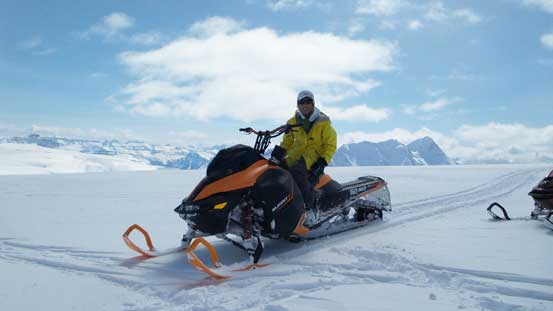
Oh here we go. At camp I took a few minutes break and pose on one of the snowmobiles. Don’t blame me though as I did not even know how to ride a machine like this…
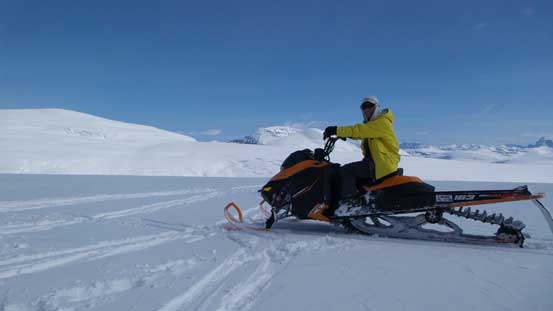
Another picture of me posing on the snowmobile. Snow Dome behind
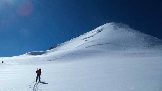
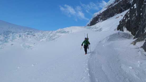
It took us 2 hours to set up camp and I have to say these 2 hours were not nearly “resting”, as none-stop shovelling was in some sense more tiring than trail-breaking for me. All I was glad I could finally drop that heavy loads.. By 3 pm we were off towards our objective and in another 1-1.5 hours or so we arrived at the base (again, a bit longer than we thought). Ben led a nice line crossing a few gaps and I switched to lead at just below the bergschrund. It was very filled in and we managed to skin diagonally up across, and then ditched skis shortly after.
Leaving our camp behind towards our objective
Vern and Ben skinning up the snowmobile tracks
The Twins are now free of clouds!!
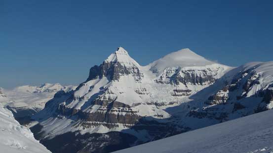
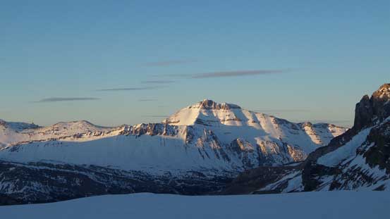
The face is finally getting bigger. It’s a giant face.
Panorama of the Columbia again. Click to view large size.
Getting higher. We were now above the bergschrund.
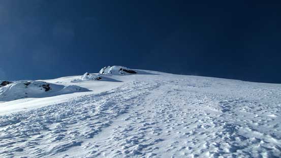
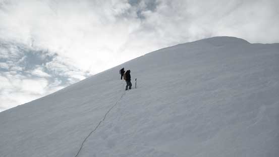
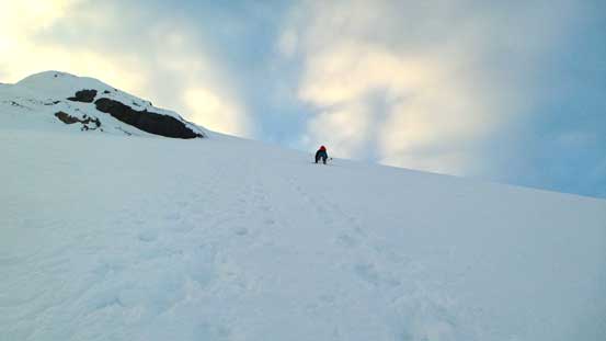
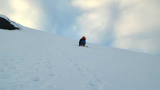
The East face did not look nearly as steep as from afar, but still, it’s a steep snow climb. It’s also a long one (500 vertical meters) with literally no break. At this time of a day with over 20 km distance of skiing (and carrying winter overnight mountaineering loads) we were all very fatigued and tired. Thankfully once the snow climb started my energy kicked-in as usual so we didn’t really slow down by much. Despite the lateness of the day, the snow condition was just perfect with only occasional post-holing and mostly step-kicking. The slope angle did get steep near a rock feature (about halfway up) to 40-45 degrees. After that section the slope angle eased a little bit but it was still no-fall zone. At about 100 vertical meters below the summit I discovered a crevasse and stepped over it somehow. Ben wasn’t nearly as lucky and fell through, but thankfully both Vern and I kept the rope very tight so he wasn’t going anywhere. He managed to free himself out and we continued upwards and onwards. I then led a line diagonally up climber’s left breaking through the summit roof on some deep loose snow, and soon enough, the summit was right in front of us. Yes we made it.. Unfortunately the summit was cold and windy like hell, plus the fact it was already past 7:30 pm so we didn’t linger any longer than necessary before starting the descent.
Looking up the 500-meter face.
Ascending the Face

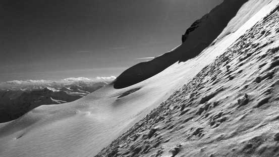
The sideway angle shows the steepness in a better perspective

The steepest part is near this rock outcrop. My estimate is 40-45 degrees.
Looking back at Ben and Vern following me up

After stepping through a crevasse here’s Ben and Vern ascending onto the summit ridge
It’s not often you can look down at the mighty Bryce blended with the background. Gorgeous views.
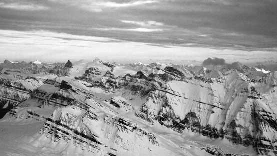
Panorama from the summit of Mt. Columbia. Click to view large size.
The long stretch of Columbia Icefield’s northern branch to the Twins

A zoomed-in view towards Tusk Peak and Mt. Clemenceau. Photo by Ben
Even the Twins were below us!!
Looking down at the hardest 11,000er – Mt. Alberta

We had great memories from Catacombs Mountain (right of center). Mt. Quincy on the bottom left
Tsar Mountain is a giant on the BC Rockies.

If you looks closely you can see familiar peaks by Rogers Pass in the distance
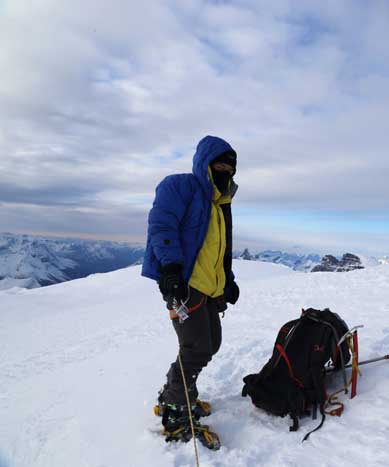
Me on the summit of Mt. Columbia, my 19th 11,000er!!
Ben had blew up one of his aluminum crampons on the ascent so he only had one crampon to descend the steep face. This worried us a little bit but thankfully the snow wasn’t that hard to absolutely require crampons. For the worse case we could have lowered him down the face so we’d see. I made the steps bigger by plunging harder every step forward, and near the steepest part I switched to down-climbing mode facing inwards and the snow was just as easy to kick-in as an hour or two earlier. Ben had no problem descending so in short time we were all back to where we ditched skis. Skiing down in flat light conditions required some extra caution to not deviate any farther away from the uptracks than necessary (especially the part crossing that bergschrund). Back across the icefield went by fast and uneventful in the fading daylight time. Skiing cross-country terrain without skins was certainly one of my weaknesses so I fell far behind the others, but still I managed to beat the head-lamp time to get back to camp.
Leaving the summit behind.
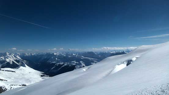
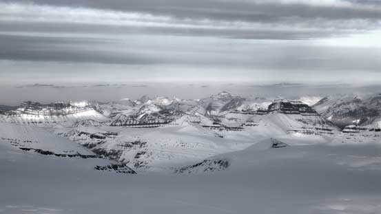
One of my favourite panoramas from this trip – looking down at the immense Columbia Icefield. Click to view large size.

The Bush River Valley was more than 2500 vertical meters below us. It also brought back some good memories from the lengthy drive/approach to the basecamp of Mt. Alexandra.
Everything is below us including giants like Mt. Saskatchewan
The Lyells and Mt. Alexandra
The classic evening colours over the horizon
Ben and I down-climbing the Face. Photo by Vern
Ben carefully descending the steep face with only 1 crampon
Looking back at Ben down-climbing the Face
Almost done the Face
Evening colours over the Eastern horizon above Snow Dome
Oh the exhausting slog back to camp after dusk..
It was an exhausting day out to say the least and we spent 17 hours in total (including the camp set-up). The 2-hour period at camp was just as tiring as we simply did not have much time to ‘rest’. Shovelling used entirely different muscle groups and doing it for more than 1 hour was quite a work-out for me. Ben and Vern ended up doing more of the jobs but that also saved me enough energy for breaking trail up the entire Columbia’s East face. I managed to catch up about 6 hours or so’s sleep overnight. It was surprisingly quite tough to fall asleep even after such a tiring day out, partially because sleeping with boot liners, all electronics and down gears made the sleeping bag a tight and non-comfortable place. On Sunday morning we woke up at alpenglow time. Seeing Mt. Columbia hidden in clouds actually made us happier to have it already climbed but half an hour later all the clouds dissipated and apparently it’s going to be a perfect bluebird day ahead.
We woke up at alpenglow time. Well timed for the views!!
Some clouds hanging around The Twins
Gorgeous sunrise over Mt. Andromeda. Note the snowmobile tracks…

Familiar 11,000ers on alpenglow
Time to break camp and move to a closer place to home…
South Twin and North Twin on alpenglow

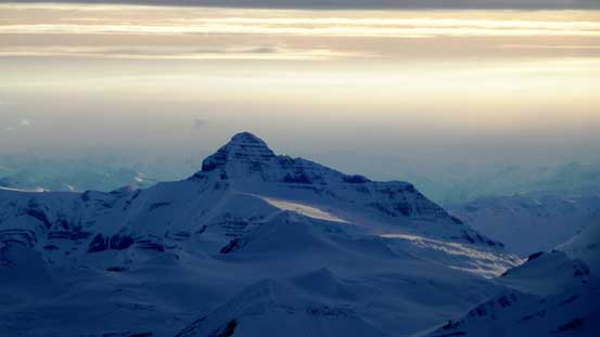
Mt. Columbia with a piece of cloud

Now what! It’s completely free of clouds!!
The plan for Day 2 was for Ben and I bagging both Snow Dome and Kitchener, while at the same time Vern continuing down to the top of the Ramp and setting up camp. Once Ben and I get back to the new camp we’d accompany Vern to Andromeda/Androlumbia col and then Vern would climb Andromeda solo before skiing back to camp. After re-evaluating time, energy and motivation level it’s apparent this plan was overly ambitious… Vern did a great job warning us how far back Snow Dome and Kitchener were and managed to convince us to save Kitchener for the Twins. The skiing from our camp to the Trench was fast and fun. The slogging back up the East side of the Trench was not so much though, but given the perfect weather none of us was in a rush. It didn’t seem to take very long to arrive back to the south flanks of Snow Dome but we knew it was a long way back.
Snow Dome would be our next objective. We had plenty of time to bag it.
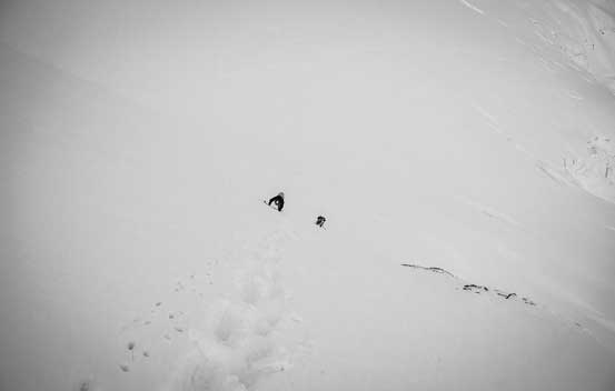
Looking down at Vern and Ben (tiny dots) in the Trench
Reascending the trench, looking back towards Columbia
Oh the million-dollar view of the Twins. Psyched!!
Some giant peaks in the BC Rockies
I think it’s “Pawn Peak” in the Chess Group

Leaving the Trench behind

Ben, The Trench and Mt. Columbia
Our decision at this point was for Ben and I tagging Snow Dome only and Vern continuing down to the top of the ramp to set up camp, and hopefully to have a shot of Andromeda in the afternoon/evening. I guess even for Snow Dome we underestimated the effort required. Due to the presence of a “highway” of snowmobile tracks all the way to the top Ben and I decided to drop every single piece of gear possible, leaving only our jackets and a bit of water/food. Since Snow Dome is a separate peak (even an 11,000er), the ascent is written in a separate trip report. Once back down we realized there’d be no way in making to the new camp before 2 pm. We ended up getting there by 3 pm and this would not grant enough time for a realistic shot on Andromeda. Remember Ben and I had already climbed it last year so Vern would have to do upper mountain’s trail-breaking solo. Vern did an excellent job digging out tent pads, kitchen, washroom, etc by himself. Thanks Vern! He even had enough time to take a nap before Ben and I came down. After some discussion we redirected our objective to the nearby 3330-meter unnamed summit. Raff referred it as “Androlumbia” and I’ll use this name. This one turned out much better than our expectation and is also written in a separate trip report.
It’s a long freaking slog back across the Columbia

Seracs on Snow Dome
Ben at our new camp location, just before leaving for Androlumbia
Mt. Andromeda in evening hours

Looking back at our tracks on Androlumbia
Nigel Peak on evening glow
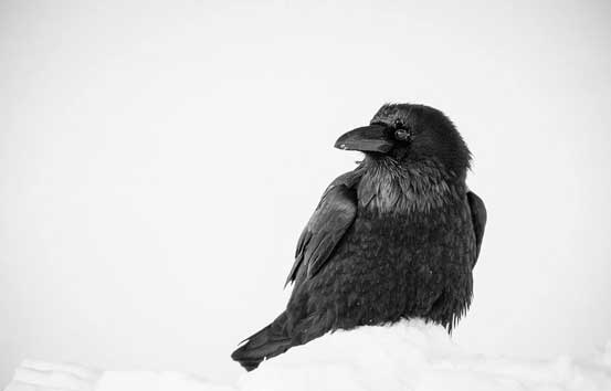
Vern got an excellent picture of this crow who ate my food… Photo by Vern
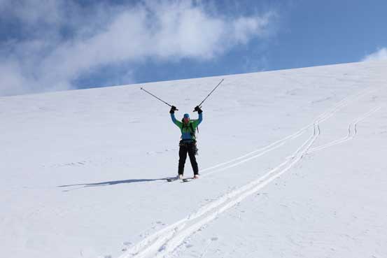
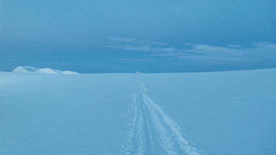
At this point all left was a fast ski down the Athabasca Glacier. Given the daylight time left we might actually have enough time to finish the return on Day 2 but since we all took Monday off there’d be no reason to rush. Arriving back to camp I realized a crow had already eaten most of my 3rd day’s food. That’s bad but also good. Good in the sense that I wouldn’t need much for Day 3 at all so this way I no longer had to haul those extra weight. On Monday morning we again, woke up at sunrise time, quickly cooked some breakfast and broke camp. The uptracks were no longer very visible but the route was obvious. We actually got to enjoy some turns down the Ramp. Descending back underneath the serac zone was also faster than what I remembered from last year’s trip, but descending the 2nd icefall was a bit too icy in the morning and we ended up having to boot-pack down.

Me skiing down the Ramp. Lots of hazards here but we were glad to have good snow for a fun descent.
Looking back from just past the Snow Dome drop zones
This slope is very steep and icy. We ended up having to take skis off
Vern and I down-climbing the steep snow. Photo by Ben
We continued bootpacking down for a while
The rest of the skiing down the 1st icefall and then the main Athabasca Glacier was crusty but still, very fast. I didn’t time ourselves but it did seem like it didn’t take us much time at all in descending. Reascending from the toe back to the parking lot was no fun by comparison as we had to carry skis and slog up either on moraine or on road…
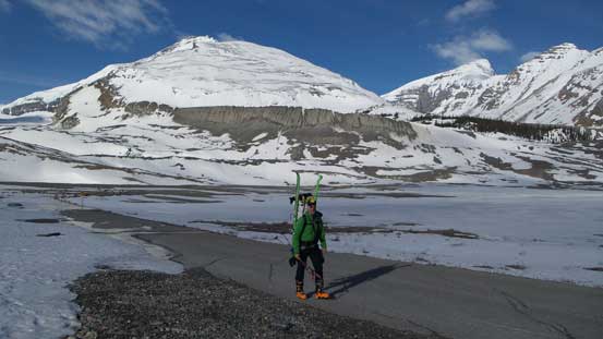
Uh the tiring road slog (~2 km) back to the parking lot
Done! But I’ll be back up there sooner than later, hopefully..
Overall I felt a great sense of ‘achievement’ to have Alberta’s highest peak, also Canadian Rockies’ second highest peak successfully climbed on my first try. We excellently timed the weather and condition and the mountain did not show her teeth on us. When comparing with the peaks on Wapta Icefield which I’ve nearly finished, other than the geological significance, what actually makes this peak standing out is the overall commitment on glaciated terrain and the winter wilderness. Technically it’s an easier peak than Collie, Ayesha or Trapper but it’s a bigger and more serious trip overall. By now I’ve also climbed a good amount of peaks on the Columbia Icefield. Can’t wait for the next high pressure system to attempt the Twins on the far northern branch!

Hey Steve! Almost every time I google a wild adventure your articles come up! haha… and this is actually the second time I’m reaching out to you. I’m trying to find info on being able to do this in hiking season (if this mountain ever experiences it). Do you have or know of any resources you could point me to?
Was there a lot of planning for your route? What did you reference for your trip planning?
Thanks in advance,
Bill
Amazing report !