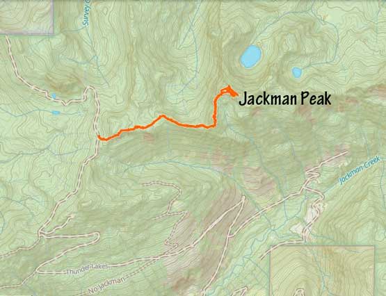
Jackman Peak
October 21, 2022
1586m
North Cascades Highway, WA
“Jackman Peak” does not have any of the usual elements to become a popular destination. The name is unofficial meaning one (myself in particular) would not have noticed it by playing with USGS Topo maps. The peak is invisible from the highway and does not “stand out” from the surrounding terrain to be iconic. This peak does however boast over 400 m prominence so it does get included in at least one peakbagging list – the “Washington state peaks with over 1000 feet prominence”. Needless to say when Matt J., Chris G. and myself went south this wasn’t the primary objective. The primary objective was “Big Gee” south of the highway but we encountered road closure.
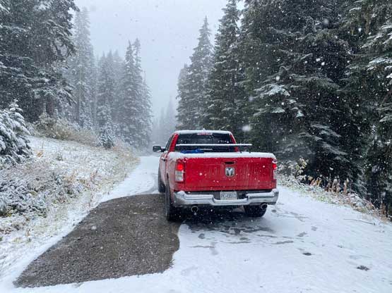
I only had half a day available since I absolutely needed to be back to White Rock by 3 pm for work, so the objectives were limited. Matt needed something more prominent so while driving Chris and I played with the maps and came up with a few “P300m” objectives nearby. Among those I picked Jackman Peak as this seemed to be the most straightforward. I proposed an idea to ascend straight up the south-eastern forested slopes to mostly bypass any unforeseen difficulty on the summit block, but one trip report mentioned a “path” on the west ridge. That trip ended up in a failure due to “slick terrain under the summit” which was my main worry given the rain and snow in the forecast. The west ridge route does start from a higher logging spur so could potentially shave off a couple hours, so we agreed to give it a try. Matt as usual, did the driving job so we cruised up Jackman Creek FSR in no time. The road condition stayed excellent until the final kilometer on the uppermost spur where we encountered a few fallen obstacles. That section still seemed to have user-maintenance so we did drive to the start of the west ridge. The entire road system was correctly labelled in the Gaia app which is basically the standard tool in this modern era so I wouldn’t be bothering to give out driving directions, which would be too complicated to write about anyway.
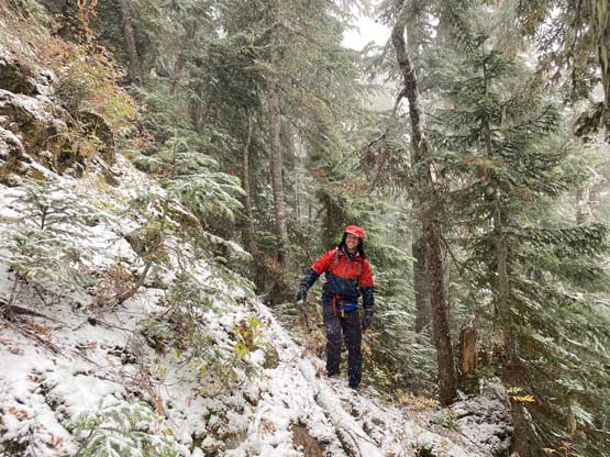
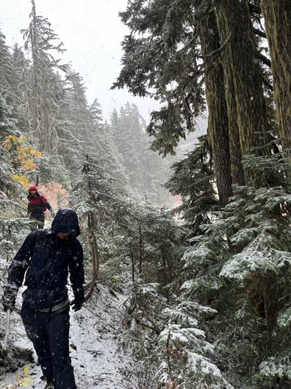
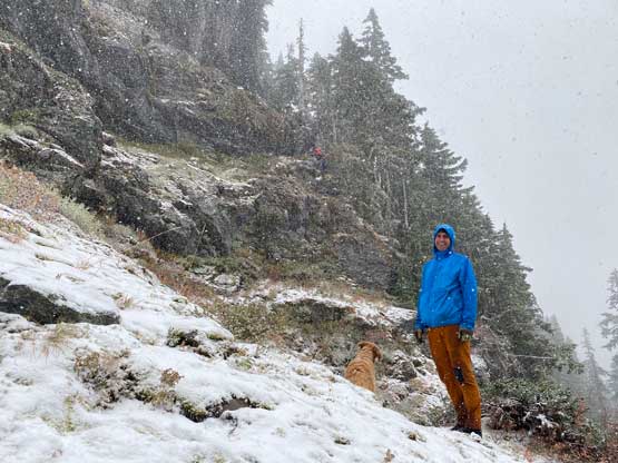
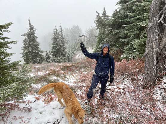
The forecasted rain came a few hours earlier such that we were already hammered by the weather system when we geared up at the trail-head. At this elevation of 1300+ meters the precipitation actually fell in the solid form making the ground as slick as one could imagine. I decided at the last minute to bring ice axe and crampons that I had previously stored in the duffle bag. While planning “Big Gee” I thought there’s a small chance I might want them and I was very glad to have brought them. I always bring a shit ton load of redundant gears in my blue duffle bag on even the smallest possible trips, as who knows. A few times my partner(s) ended up forgetting crucial stuffs (sunglasses, gloves, hiking pants, t-shirt etc.) and it’s important to have some contingency to lend out these stuffs at the trail-head.

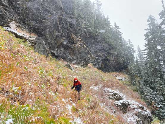
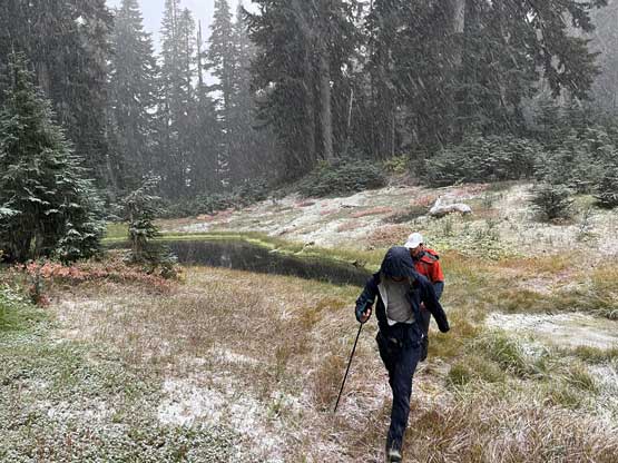
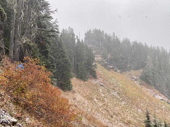
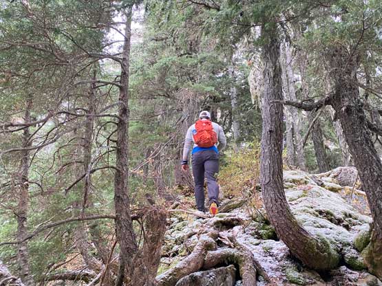
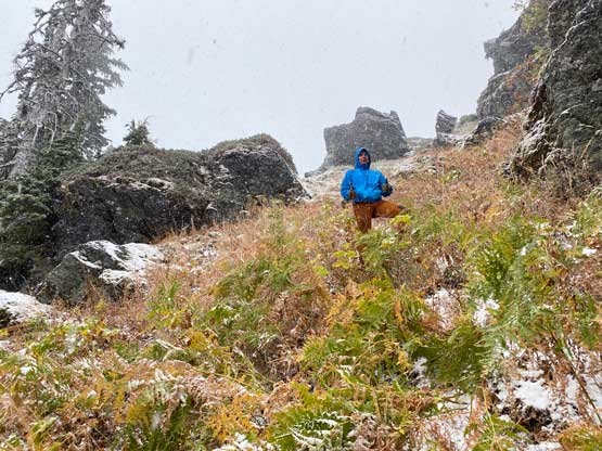
We anticipated a game trail or an animal path but we actually found a well-maintained hiking trail that lasted for the majority of the west ridge. The trail actually started from being an abandoned ATV track but soon turned into a singletrack. We bypassed the top of the first forested bump on the south side and then made a gradual descent into a meadow area. The snow blizzard was really hammering as this point that the ground was already covered by a layer of the white. The trail brought us trending east and then north all the way to the base of the summit block. Due to the weather we really couldn’t tell much about the direction so I checked GPS multiple times to make sure our bearing was correct. The trail was too good to be true.


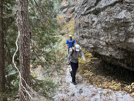

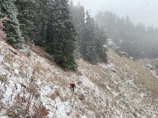
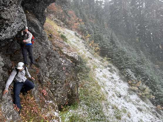
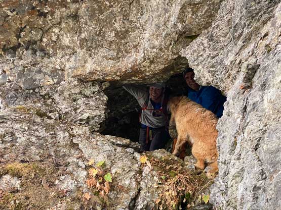
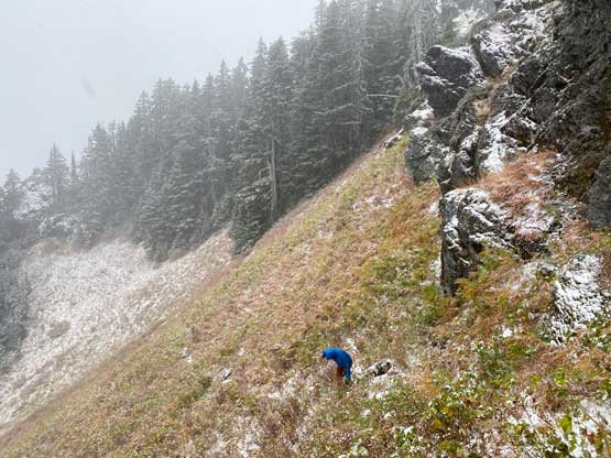
The trail came to an abrupt end upon hitting gendarmes on the west ridge of the summit block. None of us had enough “beta” so we had to explore it out, as the only reference ended his trip here, even without the snow nor the blizzard conditions. Chris G. contemplated soloing a pitch of 5th class rock and meanwhile Twig went down and around to the north side. Both choices were proven to be wrong in the end. We opted to follow Twig down and around, traversing some extremely slippery grassy terrain with moderate exposure. Matt went much farther down but couldn’t find a way around. Chris and I tried to scramble a slick gully but quickly gave up. I took out my ice tool and swung a few times into the frozen dirt and grass. It didn’t take us long to come up with the conclusion that the correct route must be on the south side, so we reluctantly backtracked. Chris and Matt then led ahead but I opted to spend 5 minutes donning crampons and taking out the gloves. I eventually caught up to Matt on a gigantic field of steep grass, while Chris went ahead to solo some exposed ledges on a possible direct route. Matt and I decided to traverse/descend this grass slopes and eventually found a hiker’s route on the east side of the summit block to join Chris on the summit. I got to practice some ice climbing techniques on this grass slopes but Matt, Chris and Twig all did this climb without the added traction.


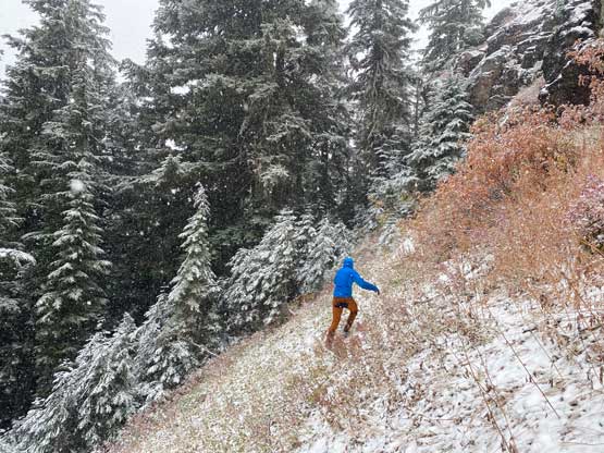
The only view we could see from the summit was ourselves, some trees and the snow blizzard so we quickly retreated, taking the route Matt and I used. We somehow overshot the entrance point into the steep forest so had to backtrack again. While traversing that grass slopes we decided to continue traversing without gaining elevation to rejoin the trail. Again I appreciated having crampons and an ice axe but the others did it without and were just fun. After joining the trail we began to jog and the objective now was to set a time record so that I could get home early enough for work. Unfortunately I hit my head massively on a fallen log since I was running while looking at my feet. I was fine sans some bruises but I had to take the rest of the hike-out more cautiously. There’s already a few cm of snow accumulation on the ground around the truck so the drive-out was also a little bit slippery. We earned ourselves enough time to have a proper lunch in the Mod’s Pizza and I eventually got home with about an hour of spare time before work.