Mount McGuire
September 18, 2018
2008m
Tamihi Creek / Chilliwack Lake Road, BC
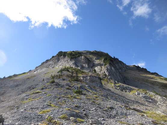
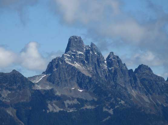
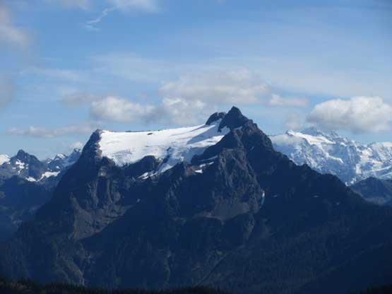
Mt. McGuire is not a “big mountain” by any measure, but the formation of this mountain is unique for the North Cascades thank to the abundance of limestone. As we all know limestone is the fundamental building blocks of Rockies but not for the coastal ranges. The rock formation makes this peak appearing white from many vantage points. The main issue for Mt. McGuire is the access. Despite the inclusion in Matt Gunn’s Scrambles in SW British Columbia the route described in that book has long gone. For many years the status of this peak remained mysterious but things have improved in the last two years. A new logging road extending from the Tamihi FSR system was fixed to very high up on the NE flanks of Mt. McGuire and since then a new trail was built from the end of that road.
A couple friends had since used the new access to ascend Mt. McGuire but for some reasons I never got a chance to attempt. Now came the fall of 2018 and my main inspiration came from a few recent posts on “Chilliwack Outdoor Club” Facebook group. I inquired them about the road status and the reply was that a Tacoma should have no problem making to the upper trail-head. I thought it make perfect sense to bag it right now given the access was still there. Upon seeing a brief weather window formed towards this past Tuesday I immediately got a group going. Adam (Gimplator) and John Stolk would come from Seattle to join Lily and myself coming from Vancouver. This international team has at least three thousand unique summits combined. The stoke level was very high. This would also be my first time meeting John Stolk who has been leading the “BC/Alberta Ultras” on peakbagger.com for many years.
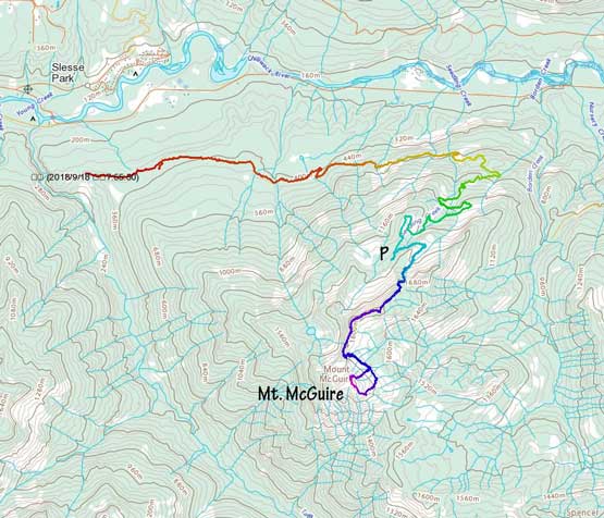
Mt. McGuire via Tamihi Creek FSR. GPX DL
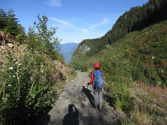
On the morning of Tuesday my alarm failed but thankfully Lily managed to wake me up by knocking my door. This was the 3rd time I was too tired to even hear the alarm, but I soon dragged myself out of the house. In less than an hour we picked up Adam and John from Abbotsford and then resumed eastwards onto Chilliwack Lake Road. Despite the recent updates the crux of this trip was still the drive. The eastern branch of Tamihi Creek FSR soon became narrow, rough and overgrown and with a lot of junctions. For the few confusing branches the correct turn was always the left branch but we did take a wrong turn at one point. A large ditch forced us to reverse about 100 m to get back on track. The trickiest part of this road was actually two short sections with big boulders on road. The long box Tacoma Sport barely made across with only 5 cm of space on each side. After what seemed like a long haul we finally started the steep switchbacks up the NE flanks. There was no more cruxy spot but averagely speaking the road was very rough, steep and overgrown. Upwards and onward I even drove into and then above the clouds ceiling and eventually parked at the switchback above elevation of 1300 m. Taco did it, no problem… I’m very impressed…
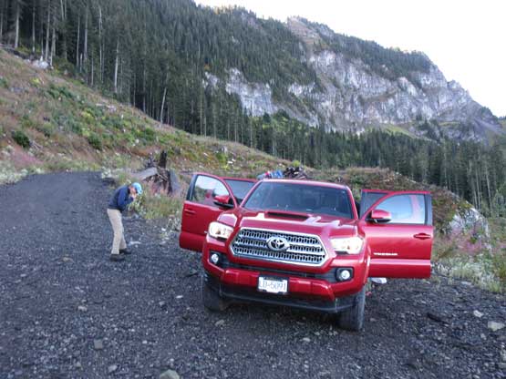
Taco made to the upper parking lot. Good job…
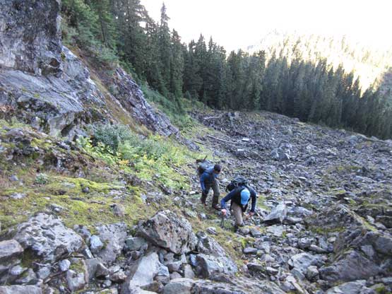
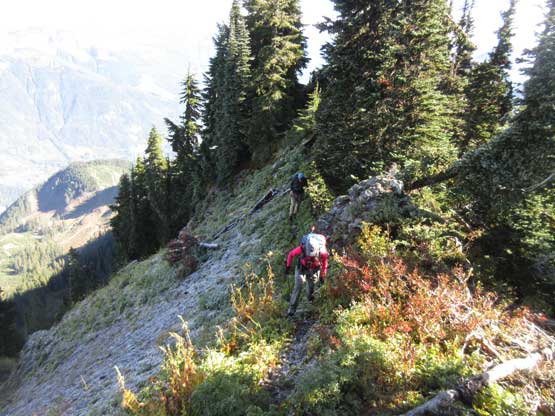
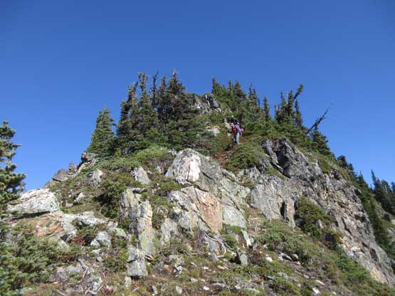
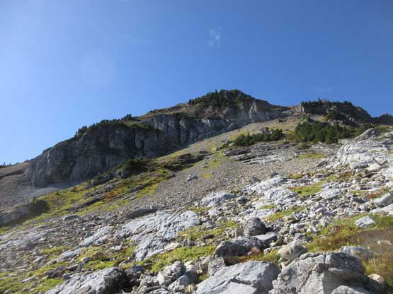
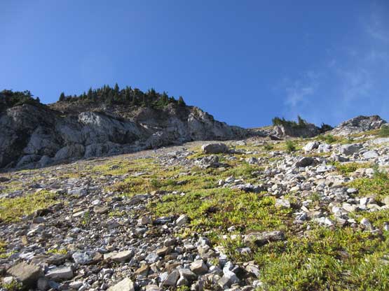
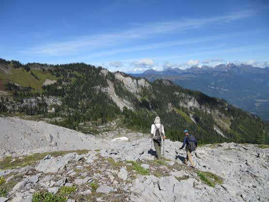
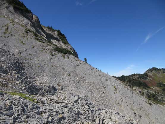
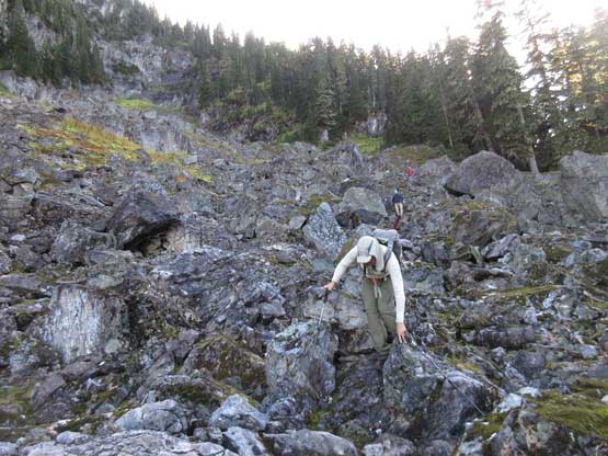
The highest spur of the logging road still required a short bit of walking. In about 15 minutes we were at the “trail-head” except we couldn’t see an obvious trail leading anywhere. I knew we had to gain the ridge somehow but doing so required ascending this steep headwall. After checking various sources we decided to explore farther into the valley and sure enough we picked up a faint trail heading upwards into a boulder field. There were flagging and cairns marking the route, but the boulders were very slippery with the recent precipitation as well as the morning dew and frost. I did not enjoy this boulder field but at least our progress wasn’t that slow. We managed to cross the field over to the west side and picked up another path heading farther up the valley. This time we stayed entirely on the climber’s right (west) side of the boulders and once above the slick zone we officially got on the “scrambler’s trail”. This not-so-obvious trail ascends diagonally out climber’s right, and although steep at places, was very easy to follow. There’s even a fixed rope on the upper stretch, and the next thing, we topped out on the NE Ridge enjoying some sunshine.

The last switchback still needed walking
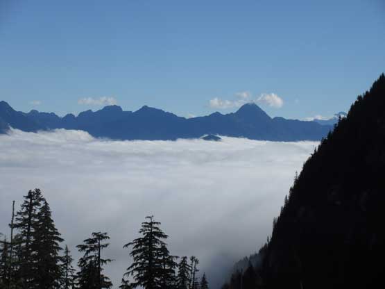
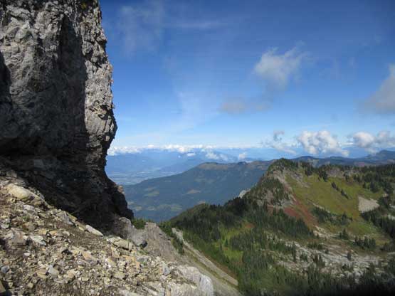
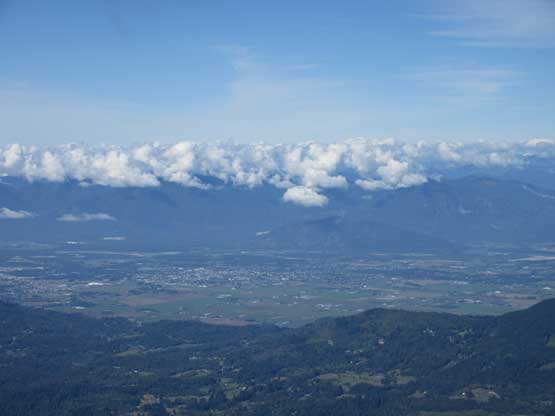
Mt. Northgraves and Williams Peak above the valley fog

Working our way up the slick boulder field
John and Adam having fun on the boulders

Above the boulder field we had to thrash up a steep trail

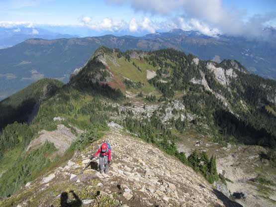
Lily arriving at the broad NE Ridge plateau.
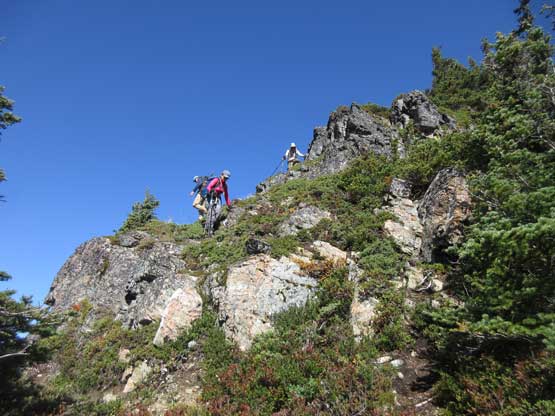
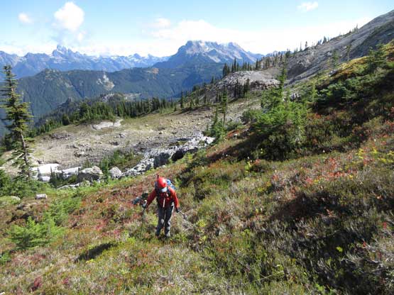
The next stage was an easy plod up and over several bumps along the broad NE Ridge. The challenge came from the frozen conditions that some northern aspects of the trail felt quite slippery and exposed. There’s not much worth nothing though as we just had to be a little bit more careful about the footings. The trail ascends up and over a subsidiary summits before dropping steeply down into the saddle right in front of Mt. McGuire’s north ridge. This part of the descent was longer and more complicated than I thought and involved a bit of scrambling moves.

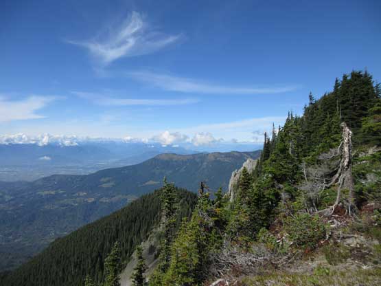
Already got some neat views towards the northern horizon

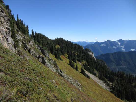
Working our way up the series of rises along NE Ridge

The truck was fairly visible from this ridge crest
Lily on a slick section of the trail.
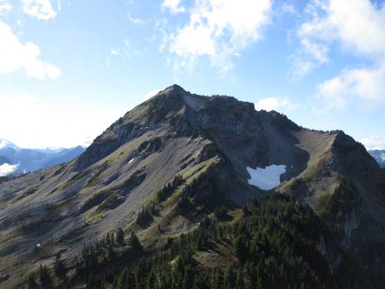
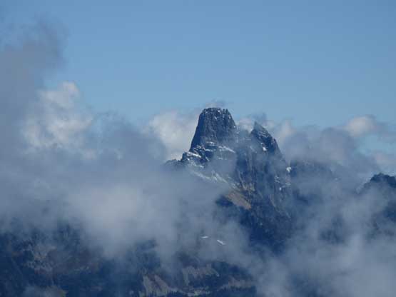
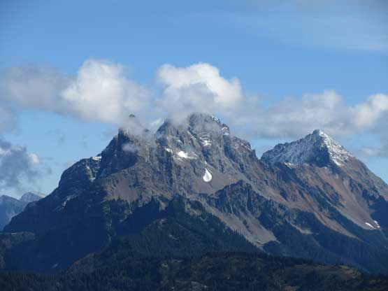
Our first view of the objective – Mt. McGuire and its north ridge

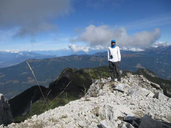
Me on the subsidiary summit with Fraser Valley behind. Photo by Lily Q.
Descending the south ridge of this subsidiary summit
Looking sideways across the south side slopes.
The descent was quite steep and complicated at places

Lily and the subsidiary summit behind

Another view looking down into Fraser Valley area

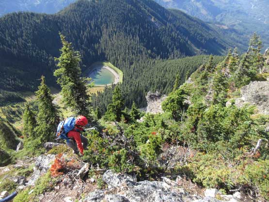
A closer look at this unnamed tarn which some refers as “Lizard Lake”
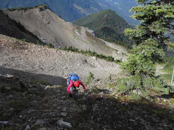
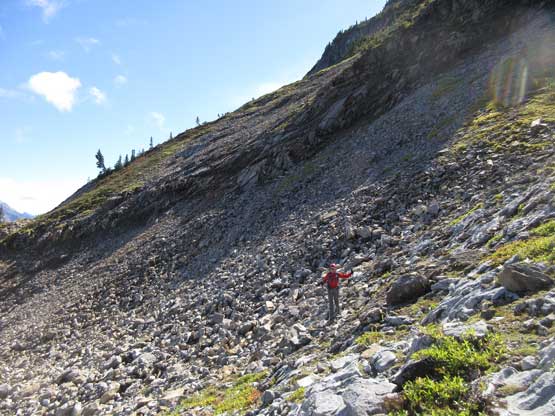
At the base of North Ridge we had several options. The most enjoyable but also the hardest route is by following the 3rd class North Ridge direct. That’s the route I wanted to try but didn’t generate too much stoke among four of us. The second option was to ascend the scree bowl far out to the north-east but the upper portion wasn’t very clear. We had no beta whether or not that side would work. The decision was to traverse a long stretch of scree on the east side of the peak, all the way over to the SE Ridge joining the old days’ standard route. The traverse started out nicely on some grassy benches but soon got tedious. There’s a lot of limestone choss that resembles the Canadian Rockies slog fest. This was not very pleasant even though it’s 10 times more solid here than the typical Rockies fest. After about halfway across Lily and I got tired of the side-hilling and went for a variation to join the upper north ridge. John and Adam opted to continue along the line and we would meet each other on the summit.

To contour around the East side of Mt. McGuire we had to lose some elevation

Traversing scree slopes wasn’t very pleasant
This is roughly where Lily and I started up towards the north ridge.
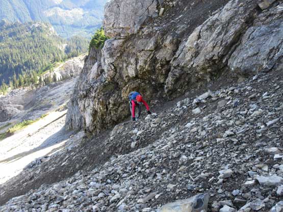
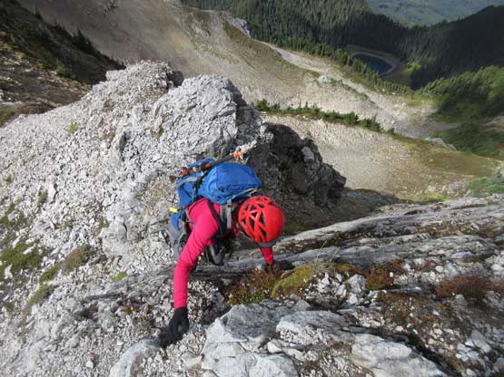
The call to short-cut onto the uppermost North Ridge was a creative, but not-so-smart idea. After plodding up a very foreshortened slope of rubble and scree Lily and I arrived at the base of a short cliff band. The break of this band is out on climber’s right but traversing there involved fair amount of kicking and edging into those hardpacked-dirt type of choss. Meanwhile there’s a bit of exposure so our progress was quite slow. Once joining the upper North Ridge the rest was much more pleasant, although the “3rd class scrambling” only exists on the last 10 m to the true summit. I was expecting a lot of hands-on scrambling but not really. Most of the ridge was still a slog.

Lily posing on the talus field.

Lily working her way the increasingly steep terrain
Upwards and onward…
Unfortunately we had to deal with some choss…

Lily scrambling on choss with a bit of exposure behind
We found a break through this cliff band. This is a critical spot

Lily slowly gaining the North Ridge crest
Lily hiking up the upper North Ridge
More scrambling and more choss…

This is the final gully to get onto the true summit
A bit of 3rd class scrambling at the end but easy peasy…

Summit Panorama from Mt. McGuire. Click to view large size.

Looking east towards Mt. MacFarlane and the Chilliwack Cascades

The north face of Mt. Shuksan
Fraser Valley looking north

Cheam Peak with the tiny Mt. Archibald on its left shoulder
The spire of Slesse Mountain just about to show up.
Canadian Border Peak was still shy to show up…

This is looking down the south face. It’s a steep route for sure..
Me on the summit of Mt. McGuire
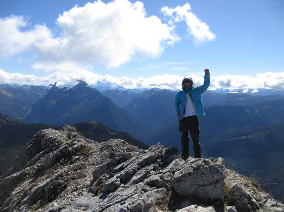
Another photo of me on the summit of Mt. McGuire
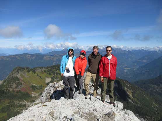
Our group shot on the summit of Mt. McGuire
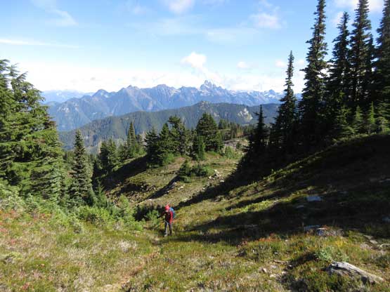
John and Adam arrived there about five minutes earlier than us and we spent at least another half an hour soaking in the views. The register had a lot more entries than I was expecting but I barely could recognize any name out of it. This was shockingly surprising and it shows how disconnected the mountaineering community is in SW British Columbia. All four of us opted to descend the standard SE Ridge as it seemed more pleasant. John and Adam led the way and I just followed from behind not doing any mental work. The long traverse back to the base of North Ridge did involved a lot of side-hilling but felt more pleasant than anticipated. The views were gradually improving with some giants starting to show up, and the abundance of huckleberries also helped our mood…

Lily starting down the SE Ridge

Down the narrow part of SE Ridge, looking back

Adam descending the standard route

Adam just about to traverse the first of many scree slopes
John and Adam leading the way
Lots of scree slopes here. We had to play smart to avoid the choss
This is looking back towards the summit
Back onto the grassy bench now
But there’s still some scree traversing to do…
Lily re-ascending towards the saddle under Mt. McGuire’s north ridge
The fang of Slesse Mountain now fully showed up
After taking another lengthy break I volunteered to lead in front for the rest of this hike-out. First of all we had to gain ~90 m up and over that subsidiary summit and then descend the undulating NE Ridge. The ground was no longer frozen but had become muddy and slippery. Descending the steep zone under the NE Ridge still required lots of care. None of us took a tumble on that slick zone and then we were all down into the boulder field. The boulders were unfortunately just as slippery as in the morning so the hopping game became a hands-down scrambling theme. It wasn’t fun at all but again we all made across with no mishap. Another 15 minutes of walking we were done.
Time to head home now. The view’s very good this afternoon
The Border Peaks and Mt. Larabee now almost showed up

Re-ascending the south ridge of that unnamed bump
Lily with that tarn behind
Tomyhoi Peak

Lily hiking back along the scrambler’s trail on NE Ridge

Now we had descended into the shady part

This is the typical terrain on that boulder field.
Adam playing very carefully with the slick rocks
Back to the uppermost spur of the logging road

Taco for the win…
The game wasn’t entirely over yet as I still had to drive the Tacoma down this rough road. Driving down is always much easier than going up for quite a few reasons and this time was no exception. The crux was still negotiating that two zones of boulders but John did an excellent job spotting. The narrow and rough stretches of this road were overall quite long – longer than most of the BC backroads I’ve driven onto. Mt. McGuire is down and I’m glad I never need to come back to touch this road again. I would hate life if I ended up having to walk it, neither would I want to risk driving my truck up there for a second time. The conclusion – the access is currently “in” so grab it while you still can…
