Mount Lefroy
July 9-10, 2014
3423m
Lake O’Hara/Louise, AB/BC
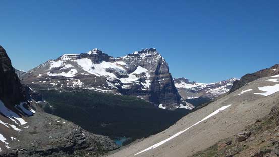
Together with Mount Victoria, the glaciated Mount Lefroy dominates the skyline when viewing from Lake Louise. About 5 years ago I had my eyes on this beautiful mountain for the first time on my first road trip to the Canadian Rockies, and ever since I’ve got a ton of photos of it from many nearby scrambles. Needless to say I’d wish to climb it at some point ever since I started mountaineering. Fortunately I didn’t have to wait for too many years, and in this past week, everything lined up nicely and Ben and I bagged it on our first try. It was done as the second objective of our ambitious 3-day mountaineering trip. Speaking the objective itself, it’s quite a sustained snow/ice route at 40-45 degrees for about 400 meters, with short sections approaching 50 degrees. Depends on the condition it can range from avalanche prone slushy snow to hard ice. It’s the scene of the first fatal tragedy in Canadian alpine climbing history, and over the past few years there’s been numerous rescues from climbers slipping on snow and tumbling hundreds of meters down the face. It’s certainly not a “beginner” objective and I’d suggest only attempting if you’ve done some shorter snow routes like the south face of Mt. Rogers.
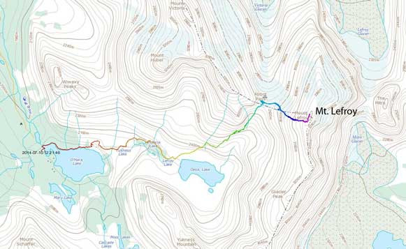
Ascent route for Mt. Lefroy via West Face. GPX DL
After successfully bagged North Victoria we had the entire afternoon ahead of schedule because we’d booked the Lake O’Hara’s bus at 5:30 pm. That was very good as Ben had to obtain a new pair of crampons. We went to Lake Louise first but they didn’t sell crampons (renting only). Then we drove to Canmore and got the job done (at the meantime had a nice meal and bought more food) before driving back to Lake O’Hara parking lot. There was another group of 3 approaching Abbot Hut together with us (one from Calgary, the other two from Victoria, BC).
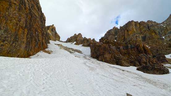
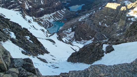
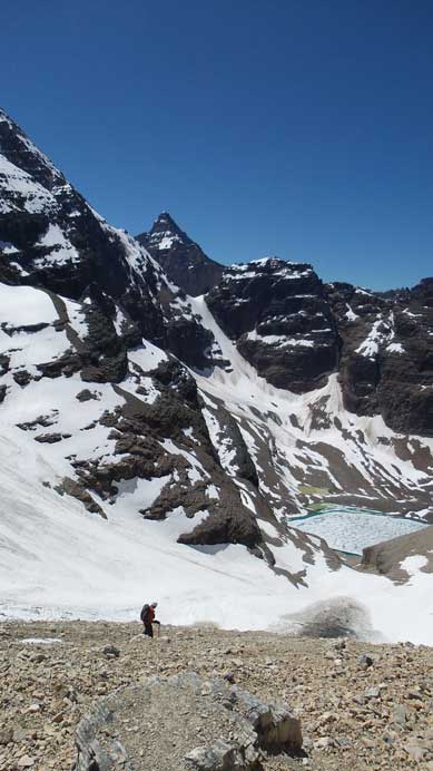
The approach to Abbot Pass via Lake O’Hara and Lake Oesa was as scenic as expected, especially in the evening hours. We passed 4-5 turquoise lakes on the way with each having slightly different colour and Lake Oesa being partially frozen, along with 1 waterfall. The slog to Abbot Pass wasn’t as fun though. Ben had previously done this approach two years ago in early July so he guided us up climber’s left. I didn’t do any homework for this past as I thought the route’s gonna be obvious. I thought the route would start from the bottom of the big scree/snow gully but apparently not. There’s a good trail leading high up climber’s left through some cliff bands to access the gully way up high. Once in the gully it was either a scree slog or a snow slog. We stuck to scree initially as we were lazy to change gears but the scree was horrible moraine styled. Then we took out ice axe and ascended the snow which was proven to be a much better option. The slog to Abbot Pass was very foreshortened. My suggestion would be looking back at Yukness Mountain (you have to get roughly 100 vertical meters higher than Yukness before arriving at Abbot Pass). We made there in about 3 hours. Other than the group of 3 climbers we’ had the hut to ourselves. Their original objective was Mt. Lefroy too but they decided against it so we’d have the entire mountain to ourselves.

Panorama of Lake O’Hara from the start of this trip
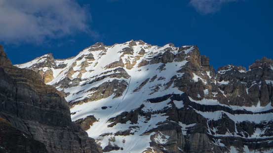
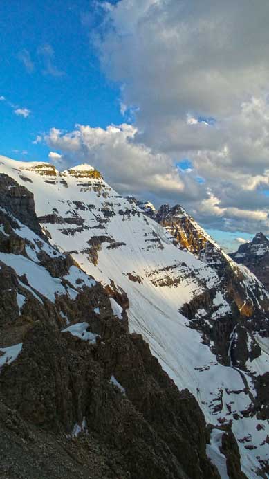
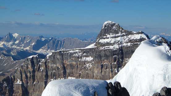
Zoom-in view of our objective, Mt. Lefroy
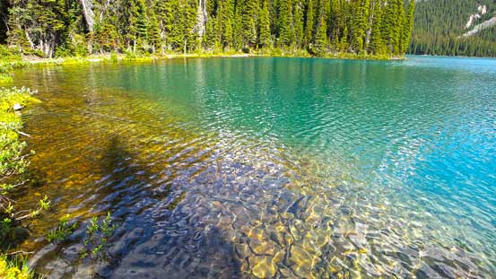
Crystal clear water in Lake O’Hara
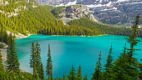
Lake O’Hara
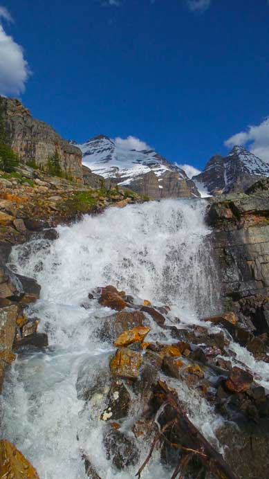
We passed by this mini waterfall
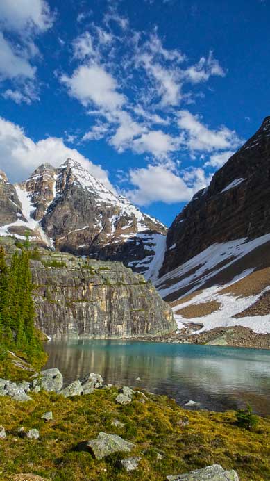
This pond is either Victoria Lake and Lefroy Lake (pretty obvious how it got the name)
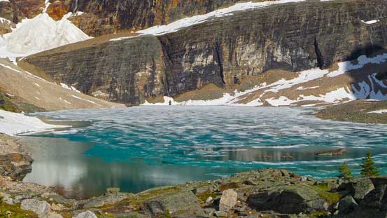
Lake Oesa is probably my favourite lake in this area
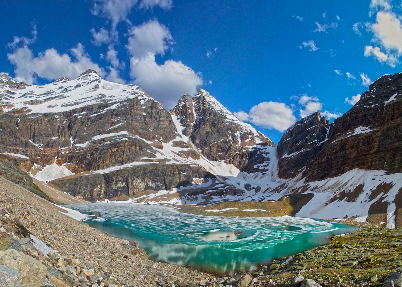
A panorama view of Lake Oesa. Click to view large size.

We went a bit too high climber’s left
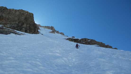
Ben ascending snow towards Abbot Pass
This slope is very foreshortened
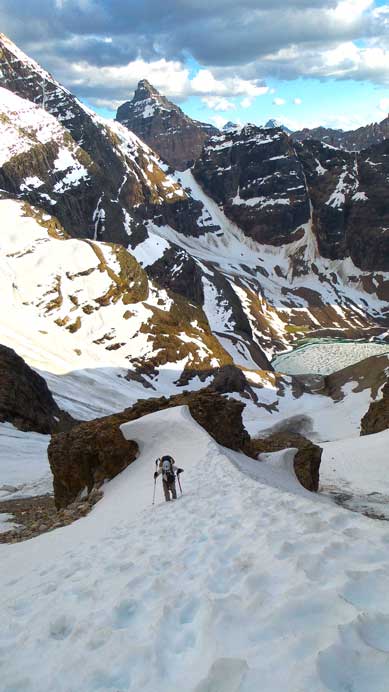
More of the slog to Abbot Pass

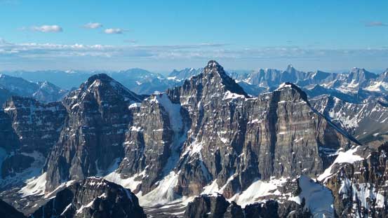
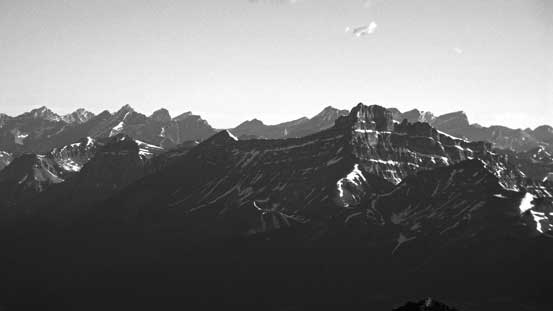
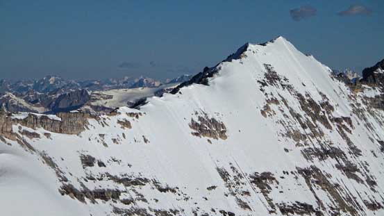
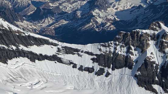
Mt. Lefroy seen from Abbot Pass
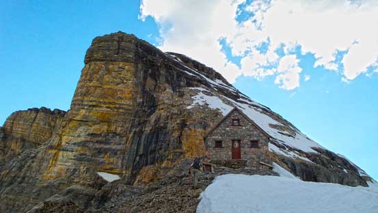
This hut is made full of stone
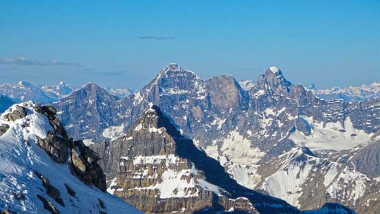
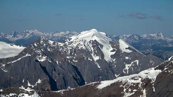
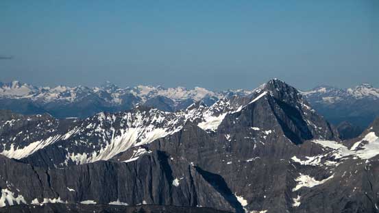
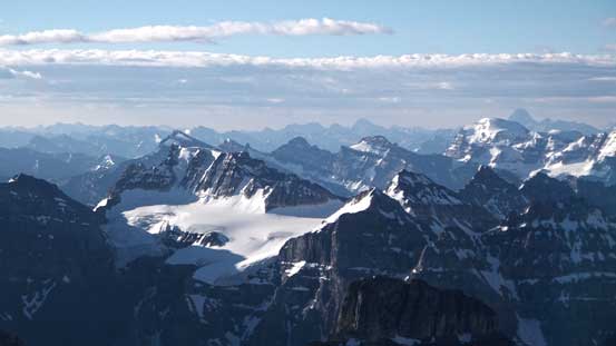
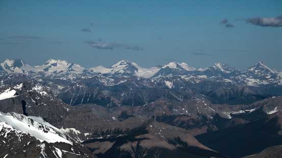
Glacier Peak looks beautiful

So does Collier Peak and Popes Peak

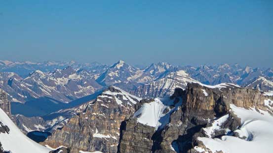
We were at roughly the same height as Whyte and Niblock.

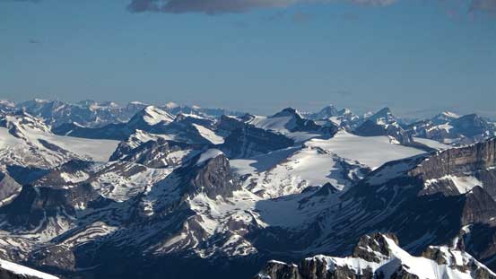
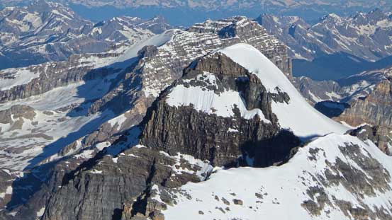
Zooming-in view of Victoria/Collier col. You could easily see where the thin spots are
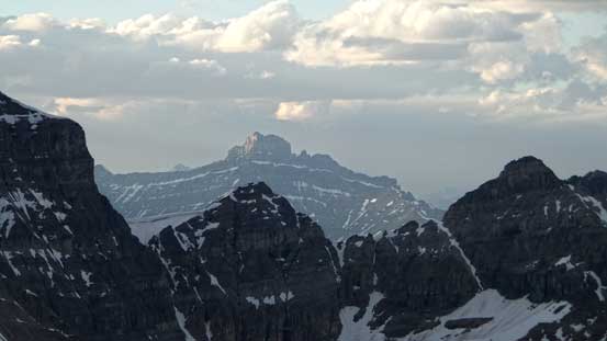
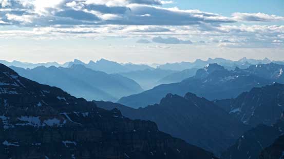
Smoky view towards Mt. Hector, thank to the forest fire in David Thompson Country

Now comes the sunset view. Mt. Goodsir in the distance
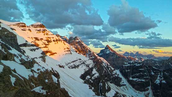
Evening glow on Glacier Peak
One last view of our objective before sleep.
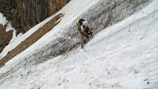
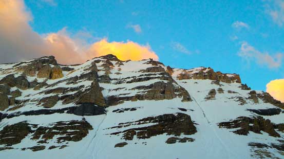
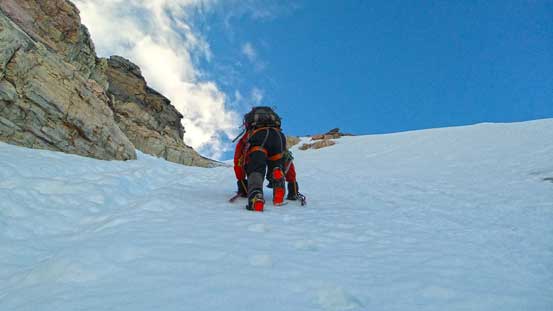
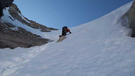
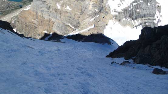
The night was super windy so when we woke up at 3:30 am in the morning it was very tough to get up (not to mention our tired body after a long day’s hard work). We eventually dragged ourselves out of the comfortable hut when it’s just bright enough and started the day. The wind got less crazy once getting up the initial bump and the overnight freeze seemed decent even though we were not expecting that. We took a short break before continuing on. It was a sustained, tough, exhilarating and exhausting work to front-point up roughly 70% of the slope with the increasing exposure for each step forward. An ice tool was mandatory on this face and without them we’d have to turn around within 100 m up the main slope… On a couple sections our mountaineering axes couldn’t even spike in and our “hand holds” were purely relying on the ice tools. Our footholds were obviously, just the front points of the crampons… There’s a ice runnel/gully in the middle of the ascending slope and we climbed up to the left of it which was somehow a mistake. I say “somehow” because on this side there was less front pointing but higher up we had to find a way to cross this gully. This was certainly the crux for our trip and we had to cut a few steps in order to cross the steep water ice gully… And after that it was again, front pointing on very hard snow until the gully narrowed down. At this point we were finally able to kick in some steps but at the mean time the gully reached its steepest. Near the top we had to deal with another thin/icy section with only a small patch of snow covering the ice. I’m sure this step will soon become totally icy within one week given the current heat. The transition from snow/ice to rock near the summit ridge was steep and very loose. We easily dislodged some rocks down into the gully with one particular piece being microwave sized. We were really glad nobody was following up (and we were not below anybody neither).

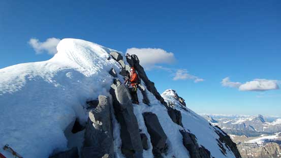
Ben ready to tackle the crux – crossing this ice gully…. This photo looks insane. I don’t know how we gathered the courage to do that…

Looking upwards. I had to focus on the climb so only took 2-3 photos on the up/down
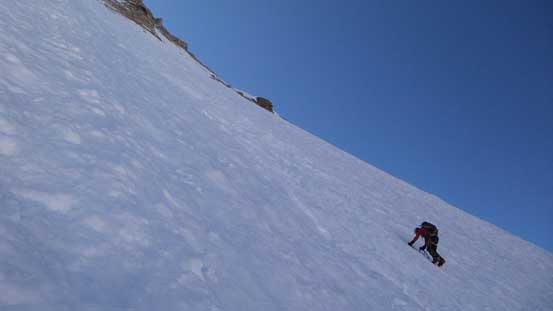
Higher up we could finally kick in some steps…
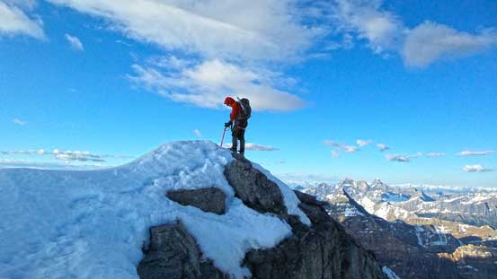
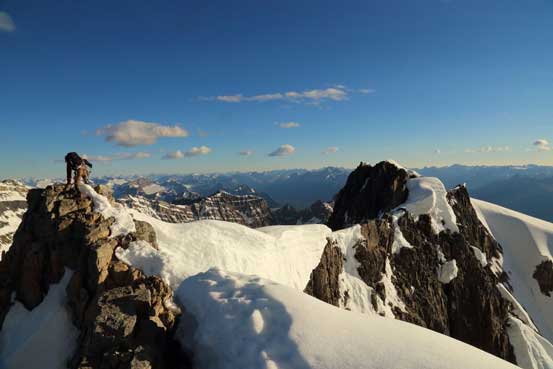
The summit ridge decided to give us more “fun” as we worked our way onto the suspecting boundary of some gigantic cornices, or down and around, kicking hardly in with the exposure of the entire west face drop-off… After climbing over 2 subsidiary bumps we came to the last bit which was all dry. I removed my snow gears and proceeded on foot while Ben kept his crampons on for more practice. The summit view from my 13th 11,000er was mind blowing but just like the previous day, we had little time/mood to soak them in, and after some obligatory photos we immediately focused on getting down alive and unhurt…
Ben on the false summit
Me traversing towards the true summit. Photo by Ben N
Looking down on our way up…
Ben on the ridge
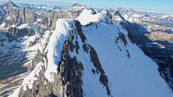
Ben crossing an exposed section with the ridge behind

A zoomed-in view of the previous photo
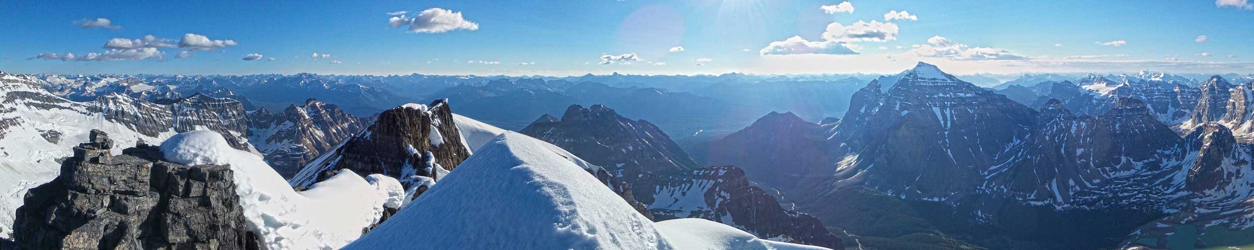
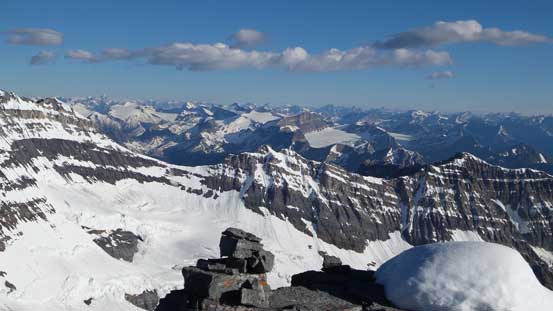
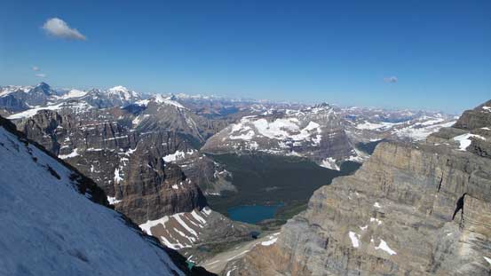
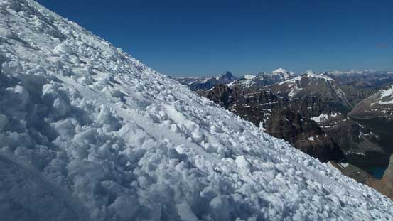
Partial summit panorama. Click to view large size.
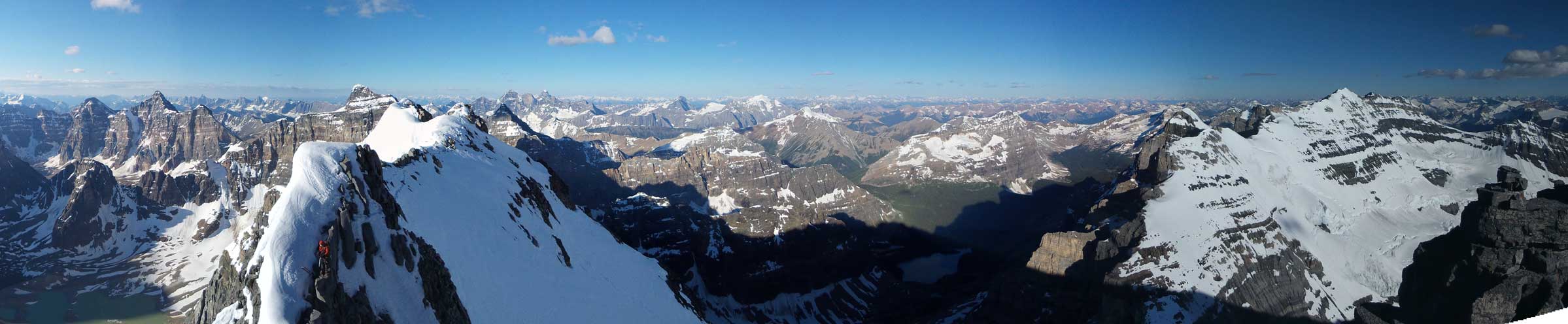
Partial summit panorama. Click to view large size.
The three peaks of Mt. Goodsir
Deltaform Mountain
Hungabee Mountain
Mt. Vaux
Chancellor Peak
Mt. Sir Donald in the distance
Mt. Rogers dominates the skyline
Bow Valley
Mt. Fay and Neil Colgan Hut area

Mt. Victoria is high on my to-do list
Looking down at the king-of-the-wapta: Mt. Balfour, one of my favourites
Mt. Forbes pokes behind Mt. Collie
In the distance we could see Mt. Sir Sandford and Adament Mountain
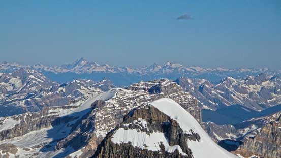
Mt. Hector in black-and-white
Mt. Laussedat always looks impressive from any peak in Yoho
Looking down at Mt. Huber
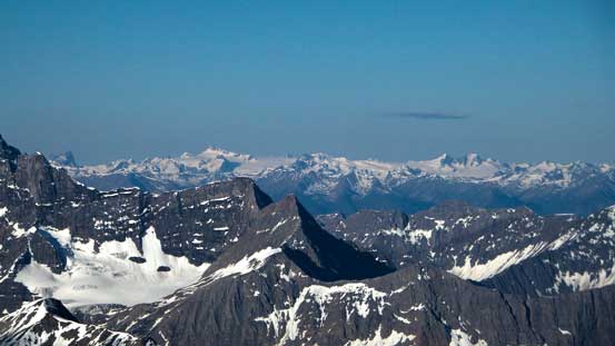
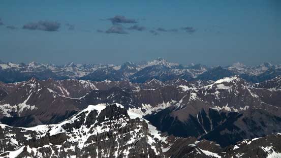
Glaciated peaks in the northern Purcells. One of them should be Mt. Conrad
Glaciated peaks in the southern Selkirks
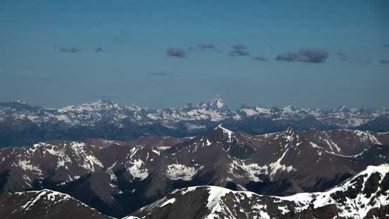
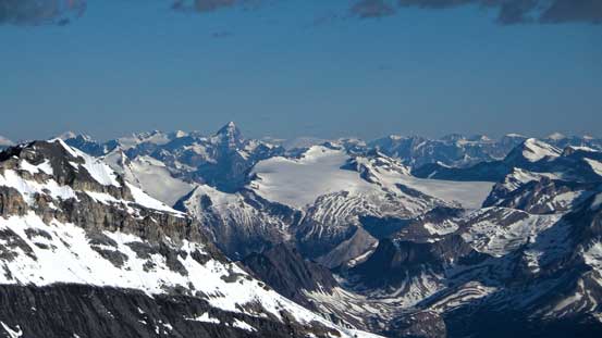
On the horizon there’re giants like Murchison and Cline
A closer look at the SE ridge of Mt. Victoria
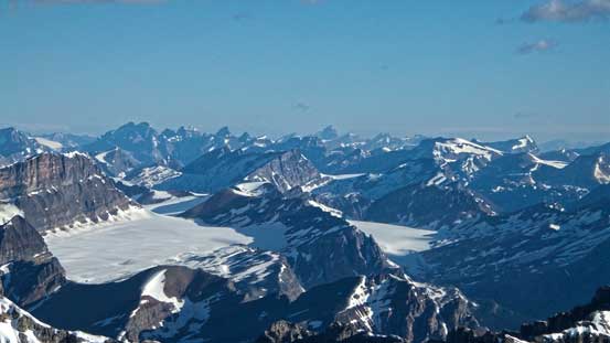
The entire Wapta Icefield is below us!
Victoria/Collier col…

Me on the summit of Mt. Lefroy, my 13th 11,000er
The descent was mostly just reversing our upward motion. For the upper part we managed to use the steps made on our way up, but once the gully became wider we were back to front-pointing, pretty much for the rest of the descent.. Lots of strength (physical) and concentration (mental) required as we just simply couldn’t afford even one minor slip… Lower down instead of cutting back across the ice we decided to continue down skier’s left. It certainly helped us avoid the hardest moves but on the other hand, the snow on this side was much harder and for a long section we couldn’t even find a single step to kick in for a break. Oh well, eventually we still had to cross the ice part (much lower down this time) to reach somewhat softer terrain. And not far after that we were able to walk down facing outwards, and it was now that we could finally take a deep breathe…
Ben down-climbing the upper gully. Just below him was a thin/icy spot

This pretty much summarizes the lower 2/3 of the climb…
Front-pointing

More front-pointing
Took a short break and took in some views
Still a long way to go, back to front pointing
Typical, typical
A ton of avalanche debris on the face

Finally able to walk facing outwards
Back into Abbot Hut we decided to take a long break and aim for catching up the 4:30 pm bus. It took me quite a while to calm down after such a tough climb. On the descent from Abbot Pass the snow had softened considerably and we managed to walk down snow for as much as we could. The snow certainly saved our knees a lot and also speeded up our descent. The rest of the hike back to Lake O’Hara was easy and scenic. The waiting at Lake O’Hara wasn’t as great though since the mosquitoes were out on full force. I was forced to wear my jacket for more than 1 hour even though the afternoon was super hot…
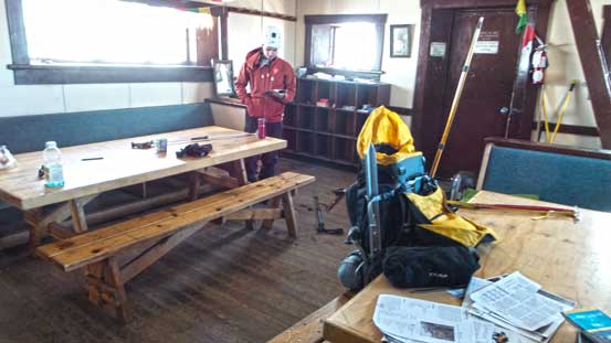
Ready to leave Abbot Hut. We’ll be back here for Mt. Victoria

Descending from Abbot Pass
We tried to merge to snow for as much as possible

Looking back towards Abbot Pass
Odaray Mountain is another climb in this area

Back to Lake O’Hara. Another 11,000er down the “list”!
Mount Lefroy turned out to be a lot tougher than expected mainly because of the “late season” condition. It was exhausting work to front-point up (and down) such a long section for folks without technical ice climbing experience like us, and we both felt a great sense of accomplishment to have it successfully and safely climbed. It’s certainly the most difficult and the most dangerous 11,000er I’ve climbed to date, and yet, one of my major “highlights” in my climbing career to date as well. I think for a hot year like 2014 the easiest climbing condition on Lefroy does not exist for more than 2 weeks. I remember on July long weekend it was still “winter” with avalanche coming off all over the places and now it’s getting “too icy”. Anyway, it was a great climb and I felt good about it.
Having successfully climbed Victoria North and Lefroy I was not home free yet. Objective for the next day, Goat Mountain Traverse, was rated at 5.3 and lots of no-mistake zones were still waiting for us!

I came here because I made a copy of Harris’ Mt Lefroy painting as a boy…(I won a contest, for the best copy using those little hockey pucks of water coloured paint they used to give you…)
I came to the realization, that I actually knew nothing about this place..that it was some kind of Canadian myth…I didn’t even know what province it was in…yet I had this history with it…but no, it is indeed a real place…Congrats on your climb…that hut looks very well maintained.
I love your photos and tale of your journey. Mt Lefroy is close to my heart as it was named for an ancestor of mine. Thank you for sharing!!