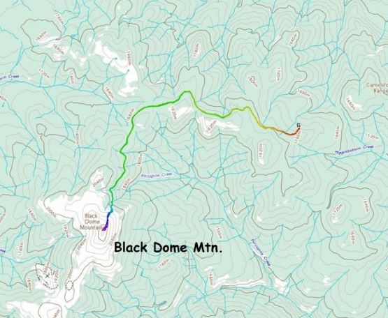
Black Dome Mountain
December 3, 2023
2257m
Gang Ranch, BC
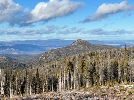
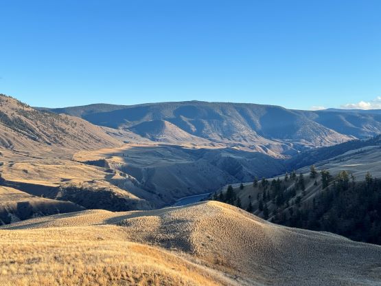
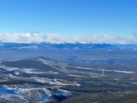
Black Dome Mountain sits on the northernmost section of Camelsfoot Range that extends from Lillooet all the way north to Gang Ranch along the west side of Fraser Canyon. Like stated on bivouac.com this peak offers absolutely no mountaineering interest whatsoever as an old gold mine road goes all the way to the very summit, but it offers unobstructed views into some remote countries in the Chilcotins. The mining road is private but not gated at the bottom, and can be driven in a standard SUV. There is however a gate at 26 km repelling those “mechanized ascensionists”, so one does need to walk at least a few kilometers to earn this obscured summit. I noticed this objective as it boasts over 600 m prominence and Matt J. had actually made an attempt in the previous winter but turned around due to the sketchy “winter driving” combined with the lack of time. This winter has been unusually warm and dry such that the rainshadow zone hadn’t even got a single major dump of precipitation. About two weeks ago I was on a 2300-m summit in Clear Range not too far away, and the condition was dry enough that I ended up carrying snowshoes for training weight. There wasn’t any major precipitation event since then, so the conditions should roughly be the same. When Matt suggested a redemption on Black Dome Mtn. I was instantly game.
At the time I knew nothing about this objective other than it’s accessed from Gang Ranch, one of the only few spots that has a bridge crossing Fraser River. I thought we would have to drive southwards from Williams Lake but Matt was keen to repeat the way that he used in the previous attempt, by taking Meadow Lake Road for almost 80 km NW from Clinton to the bridge crossing Fraser River. We would then drive 15 km down Empire Valley Road on the west side of the canyon before driving another 20 km up the Black Dome’s mining road, concluding the 115-km one way travel on gravel roads. I had never been this far north in the Coast Mountains so part of my excitement was to just see the area. As per Matt’s fashion we would forgo the “car camping” routine and make the attempt in a single push home-to-home. I estimated the driving time to be at least 7 hours each way so to make sure we wouldn’t run out of time the meet-up was set at 3:15 am in Abbotsford. This meant I would have to wake up at 2 am with only a mere hour and half’s sleep.
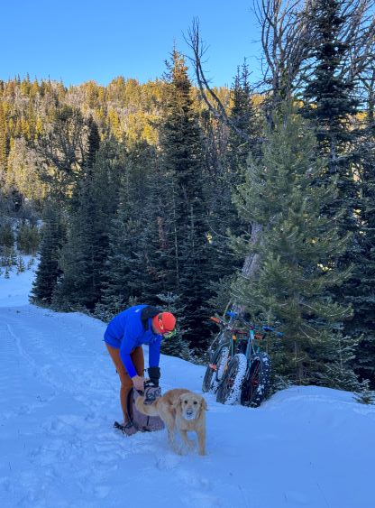
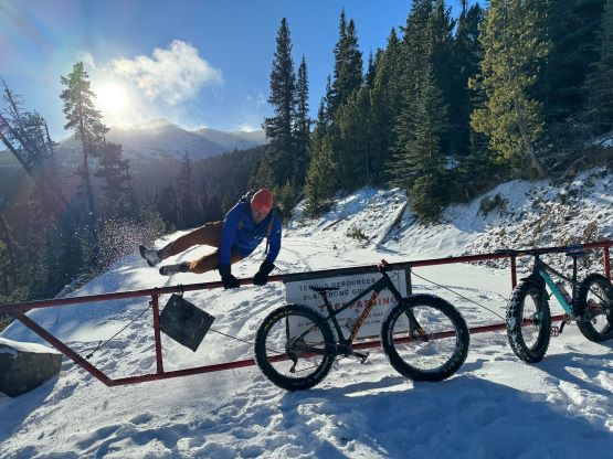
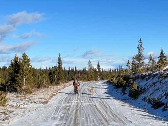
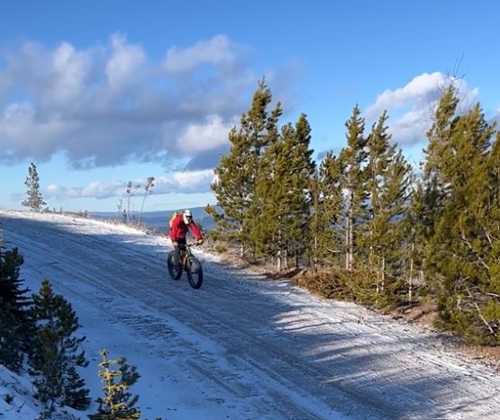
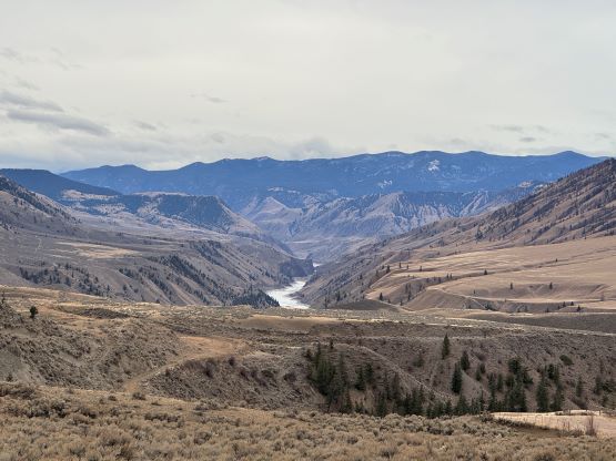
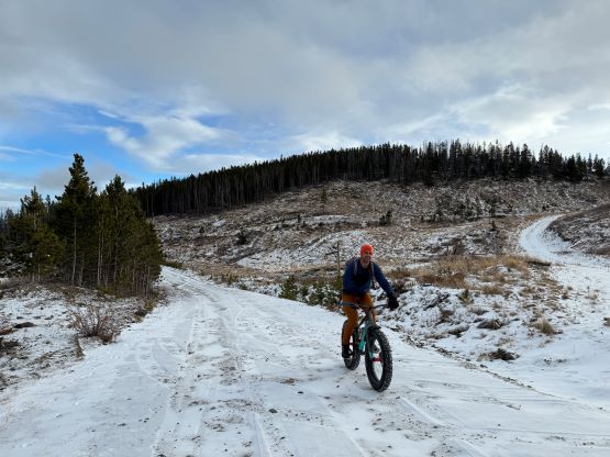
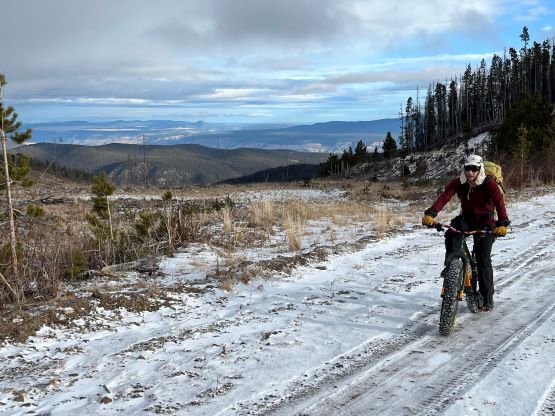
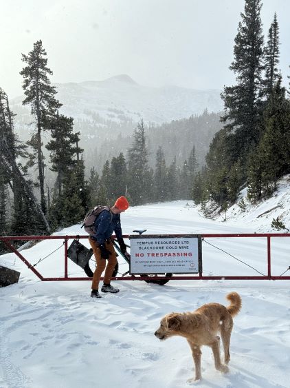
The drive up through the lower Fraser Canyon was sketchy at night due to some thick fog such that Matt had to call for a break/nap near Spences Bridge, which was unusual but understandable. We then cruised up past Cache Creek to Clinton in daybreak and then onto the gravel roads. Matt didn’t even need to consult with the GPS maps. The Meadow Lake Road offered views of Marble Range and later, down into the Fraser Canyon so we stopped a few times for photos. The travel along both sides of Fraser River was also scenic and interesting. I suggested that we should stop somewhere to don hiking cloths. The forecast was calling for some strong winds so I wasn’t keen to change cloths higher up. The only uncertainty was the bottom of the summit access road as Matt recalled seeing some “no trespassing” signs. It’s been a year since Matt’s trip and they totally could have installed a gate to block stealth baggers like us. Thankfully they did not and we were able to drive in as if we did not see their signs. Our success was also dependent on the mine being not operational and that’s actually the main reason why we picked a Sunday in winter (off season). We did encounter abundant tire tracks but those were clearly not made by mining trucks. There was at most 15 cm of fresh snow even on the uppermost elevation and the road was as smooth as one could ever have expected, that we could have driven all the way to the closed 26-km gate. We opted to park at the exact spot where Matt parked in that previous trip (1700 m) because we still wanted to have some exercise after all. I had suggested to bring the fatbikes so we might as well use them. We did not really look at the maps but from this starting point we had about 18 km round trip.


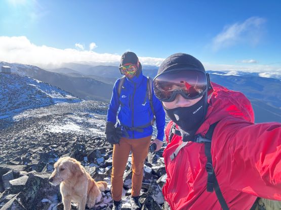
A few items were ditched at the starting point including gaitors, head-lamps, snowshoes and my 135-cm uncontractible poles. Matt brought his two contractible poles and promised to give one to me for the hike/scramble, but I’m only used to having two poles. I turned out regretting about ditching the poles and the gaitors but the snowshoes were definitely not needed on this particular day. The ride to the closed gate involved a lot of undulating terrain. There wasn’t any major climb nor descent but I somehow found it to be exhausting, probably because we were riding on tire tracks. I’m still not very used to riding on snow after all. I also needed to make an additional stop to don balaclava and ski goggles as the winds were picked up as a storm brew in. This was correctly predicted in the weather forecasts. Thankfully the snow squall stopped quickly and it was a “mostly sunny” day after all. The tire tracks stopped at that closed gate but we rode and pushed the bikes for another 200 m beyond. We quickly concluded that biking would no longer make sense.
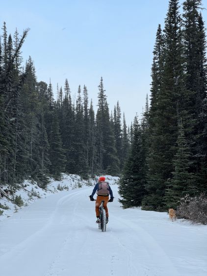


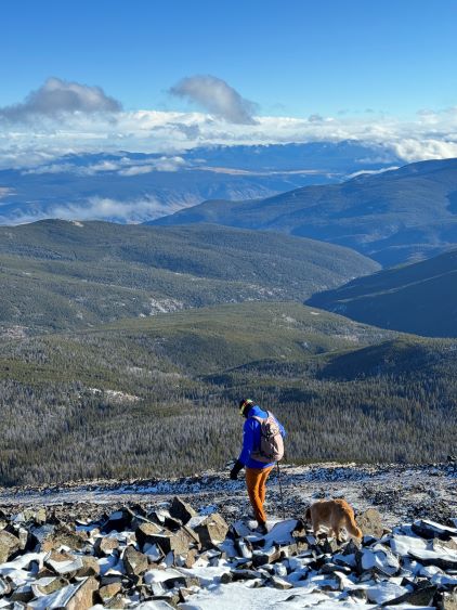
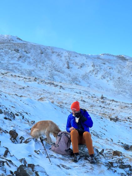
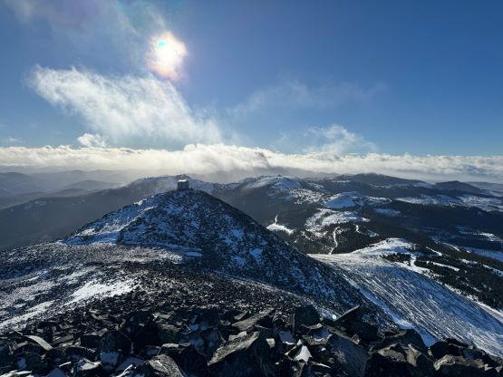
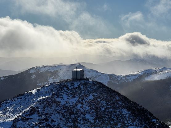
The original plan was to follow this road for longer but the 15-20 cm fresh snow was enough to create annoying post-holing. Instead, we dashed into the forest and made a straight beeline through the treeline zone into the alpine. There was some light bushwhacking and extremely slick terrain but nothing worth noting. We found the alpine slopes to be entirely scoured so the worst post-holing was just the few deeper drifts near the uppermost clusters of trees. I unfortunately got my boots wet for not bringing gaitors. The scramble to the summit was loose and tedious. I could not understand the reason, but I later learnt at home that this is actually an ancient volcano. The winds were fortunately not as fierce as predicted in the forecasts, but we still did not linger any longer than a few minutes as per Matt’s fashion. The ski goggles and balaclavas were not entirely needed but definitely made the outing more enjoyable.


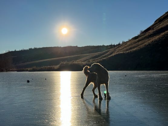
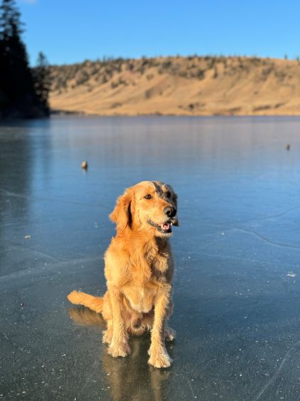
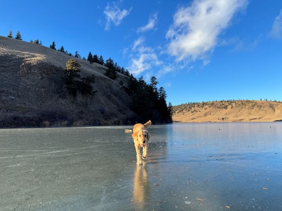
On the descent we took some slight variations to avoid some steep, loose and slippery sections but mostly just took the same way back to that mining road. We then easily plodded back to the bikes and rode back to the truck, finishing in just over 3 hours of round trip. Matt spotted a Christmas tree and decided to drive us back to that tree to bring it home. This was not something I would ever consider so it’s cool to watch. We then stopped at the frozen lake near the start of the mining road before starting the 7-hour journey homewards. There were only two additional stops made – one in Boston Bar for gas, and the other in Hope for food. My home-to-home time was 19.5 hours.