Mount Fryatt
August 20-22, 2018
3361m
Jasper / Icefield Parkway North, AB
Mt. Fryatt is a fabled 11,000er visible from the townsite of Jasper and very recognizable from a tourist’s point of view while driving down the northernmost portions of Icefield Parkway. Back in the summer of 2008 I had my sight on this towering massif for the first time with my parents, and needless to say nobody would believe that I eventually did end up standing on its summit, almost exactly ten years later. This was towards the rear end of my quest to complete all of the 54-58 11,000ers of Canadian Rockies – a project that has lasted for over 5 years since it’s kicked off in the spring of 2013 by a snowshoe ascent of Mt. Hector. By mid-August of 2018 I was already at 51/58 with the “deadliest triangle”, namely Alberta, Robson and Goodsirs already down behind. I had only seven to go and none of them is exceptionally difficult from either the technical or objective hazards point of view. Among them Mt. Fryatt might actually be the trickiest mostly because the ascent via SW Face standard route has a very short timing window.
A mere day after returning home from a very success trip bagging Tsar and Goodsirs I saw another high pressure system kicking in… My feeling was a mixed bag for a simple reason that I really needed a break from the choss-fest mental game but if the mother nature gave me another chance I had to take it. If I wanted to be one of the fastest/youngest to finish this list then there’s no question on that. I had to push harder. Meanwhile I got a message from Mike Mitchell looking for a partner to climb Mt. Fryatt with. It took me literally only a fraction of a second to pull the trigger. We had the perfect weather, perfect conditions and fresh beta from two separate groups a week ago, that there’s literally no reason to fail this mission other than screwing it up ourselves. On top of that Mike had attempted Mt. Fryatt in the fall of 2017 making to within 200m from the summit so we had everything lining up including Mike’s own GPS track.
With less than two days of resting at home I was on the road again, driving for once again up Coquihalla Highway into the city of Kamloops. This time I turned north up the North Thompson Corridor and despite the lateness I pushed all the way to Valemount. To get some better sleep I turned onto a smaller road heading towards Kinbasket Lake and slept in my car at a top-quality, but secret pull-out. The next morning I had a breakfast in the town of Valemount before driving eastwards into Jasper. Mike wouldn’t show up until well past 2 pm in the afternoon so I killed some time in the town and then paid a visit to Athabasca Falls observing tourists’ excitement. Mike showed up at around 2:30 pm and we piled everything into his Subaru Forester for the steep and rough Geraldine Lakes road.

Mt. Fryatt via Geraldine Lakes and SW Face
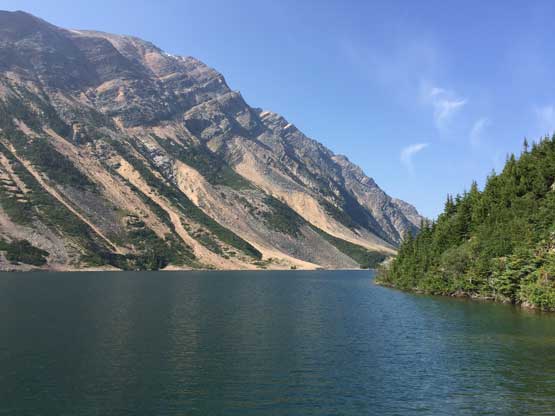
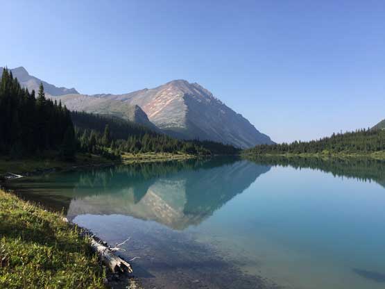
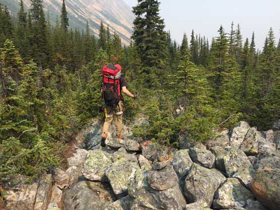
The approach via Geraldine Lakes is well known for its beautiful scenery. We did not even have the clearest skies due to the wildfire smoke but even that I had to agree with everyone else. We passed four large lakes with each of them prettier than the previous one and towards the two upper lakes we had the sight of this majestic Mt. Fryatt dominating in front. It’s hard to believe that’s what we would climb on the following day. The bad aspect about this approach is the endless boulder fields, muddy trail and some degree of “on-trail bushwhacking”. The boulders are all quartzite so it’s crucial to do this approach in dry conditions. I actually found the boulders quite fun probably because of the three years experience mountaineering in the coastal ranges’ blocky granite terrain. The mud and bush along this trail was annoying at times but it’s nothing if you come from the “wild west” – the British Columbia’s Coast Mountains.
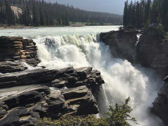
The trip started with a visit to Athabasca Falls
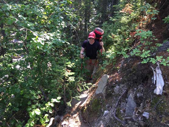
Past the first lake already. Mike hiking on the trail

This picture sets the theme for the next couple hours

There’s a small, but beautiful tarn between the 1st and 2nd Geraldine Lakes

This steep headwall underneath the second lake felt like a drag..

Arriving at the 2nd Geraldine Lake. More boulders to come
The second Geraldine Lake.

Past the second lake we entered more boulder fields. Thankfully they are dry
Believe or not we were on the trail at this point… Don’t expect a good trail…
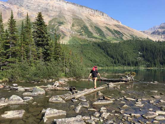
Mike fording the outflow of 3rd lake on a log bridge

This is still at the outflow of 3rd Geraldine Lake
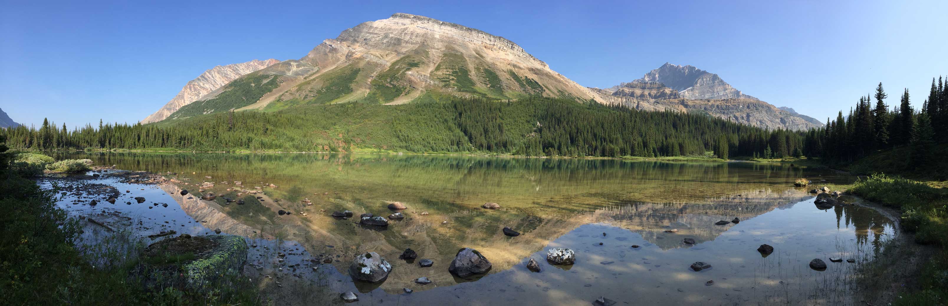
Panorama of the 3rd Geraldine Lake. Click to view large size.
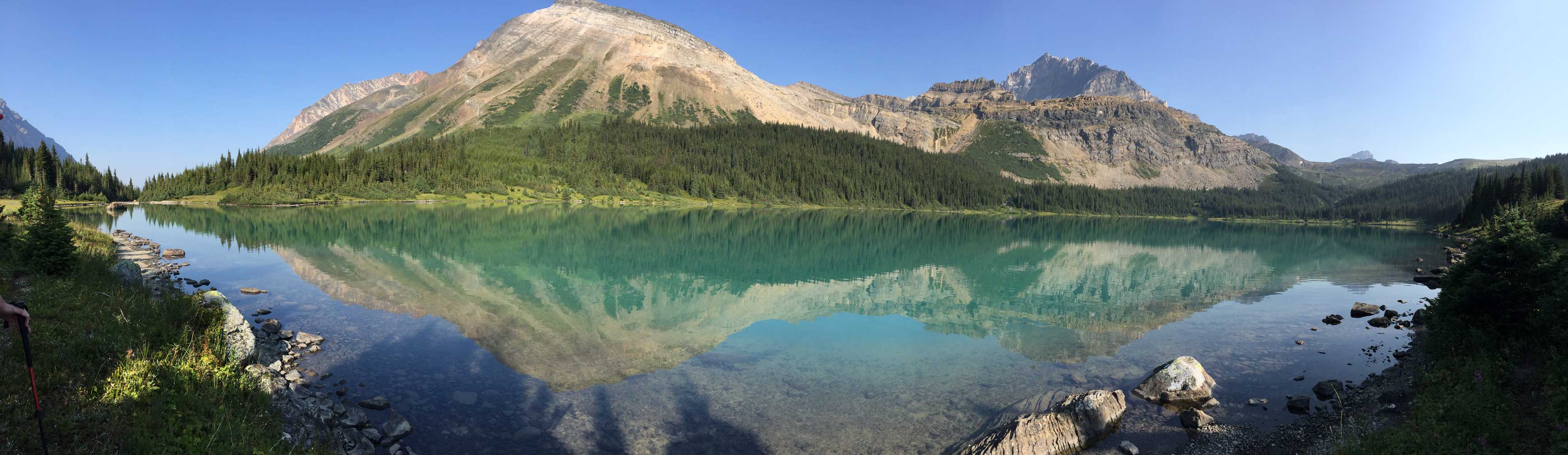
Panorama of the 4th Geraldine Lake. Click to view large size.

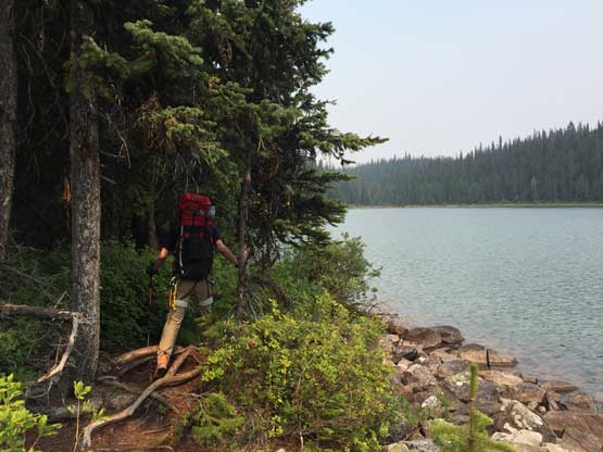
Mike contouring the shore of the 4th, also the last Geraldine Lake
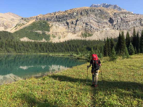
Mike and the 4th Geraldine Lake
That pile of talus behind is unofficially named “Geraldine Peak”
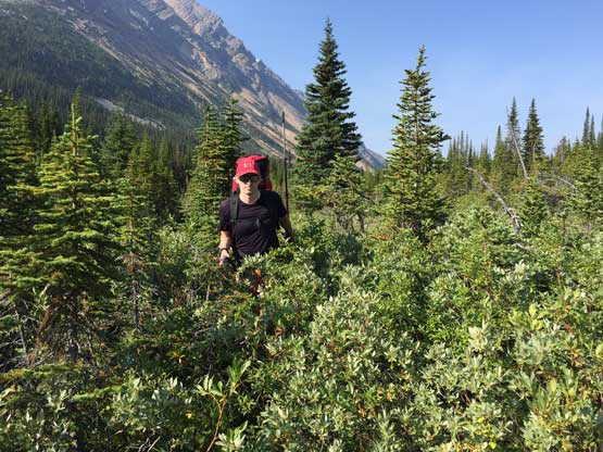
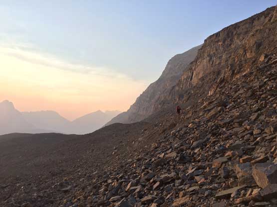
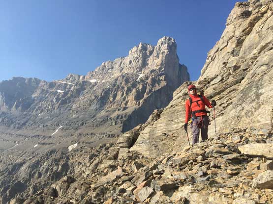
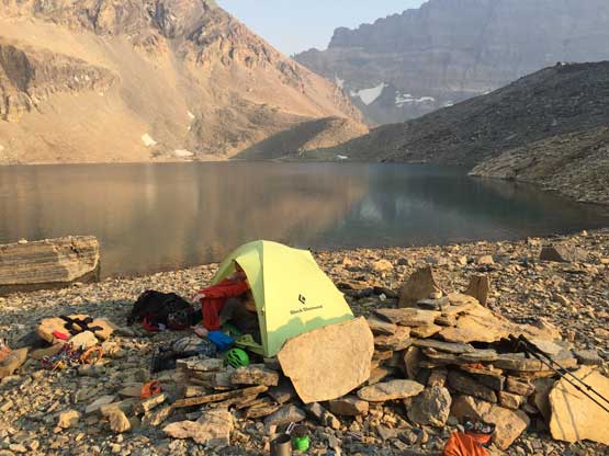
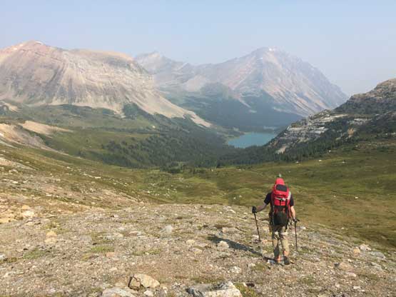
The next stage was a very foreshortened off-trail slog to that broad, grassy skyline ridge in front. It looked close but actually terribly far away with some significant elevation gain, that once we crested the ridge we all needed a lengthy break. At this point we still had about 2 hours of daylight time so the decision was pushing to the SW Face’s bivy at “Iceberg Lake”. Mike has his first-hand knowledge of this stretch and he warned me it’s shittier than I might think. Mike was right. I did not enjoy any fraction of this part of the plod. The first stretch was a long ass side-hill bashing on steep grass and hard-packed scree with some exposure. Technically speaking it’s easy, but every step required concentration. A slip on this grass bench isn’t an option. After the side-hilling we had to deal with a long plod on unstable rubble. We had to “overshoot” the outflow of Iceberg Lake by roughly a kilometer before finding a weakness in the cliffs immediately to our left. The ascent through this weakness followed by another side-hilling traverse was entirely on unpleasant terrain. Arriving at a well-built tent pad on the shore of Iceberg Lake was quite a relief. I was beat and seriously needed a break. Mike volunteered to find some running water at the lake’s outflow while I managed to get the tent erected. It took Mike a good while to fill up the water bottles because that lake’s outflow was quite far away. The rest of this night was spent doing the evening routine and then sleeping… I was to spent to play around this lovely site.

There’s a bit of bushwhacking to ascend above the last lake
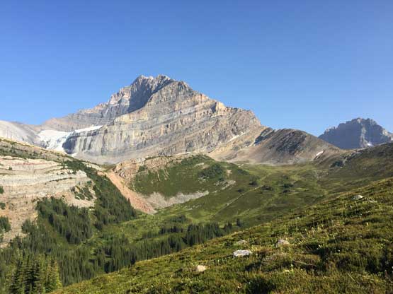
Breaking out of the forest, the majestic Mt. Fryatt displaced in front

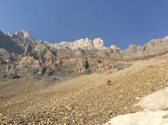
The plod up onto the skyline divide was very foreshortened.

The North Face of Mt. Fryatt with the classic West Ridge forming the right skyline

Plodding across the broad, grassy plateau

Mike and the lower west ridge of Mt. Fryatt
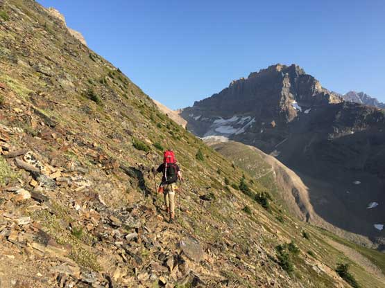
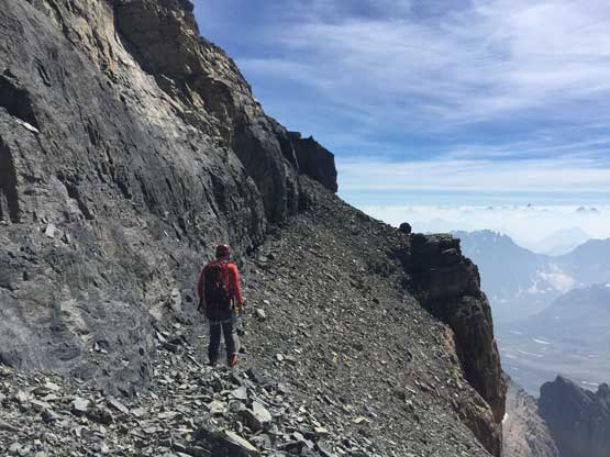
Mike just about to start that very long and ugly side-hilling bash…

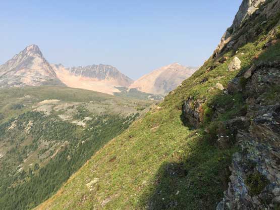
At least the view down into Divergence Creek valley was superb

Mike on one of the choss stretches. The ground was hardpacked moraine type
The side-hilling continues on forever…
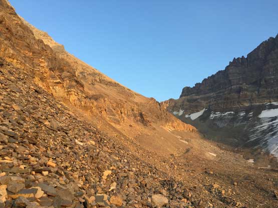
This part of the approach was shit. But at least the view’s getting better
Mike picking a line ascending the headwall underneath Iceberg Lake

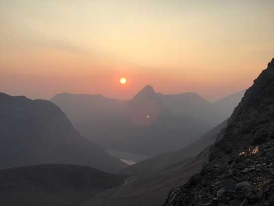
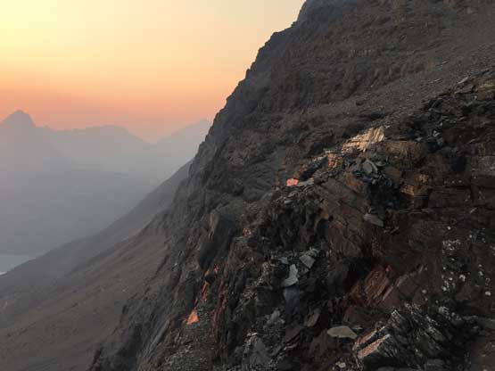
It’s almost time for sunset. The evening was gorgeous
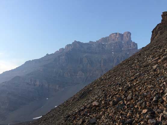
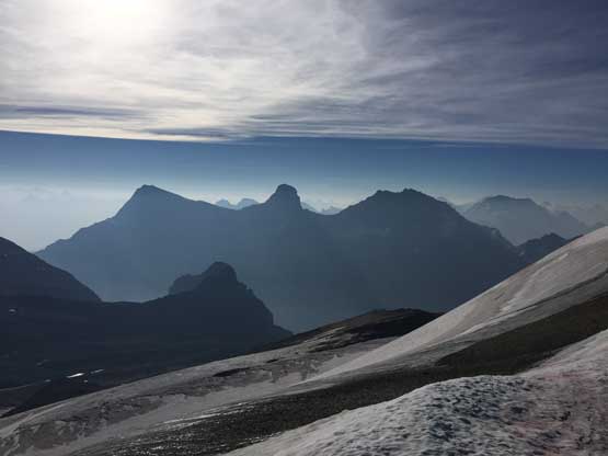
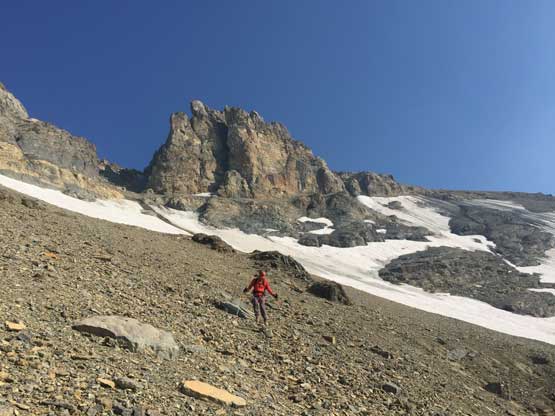
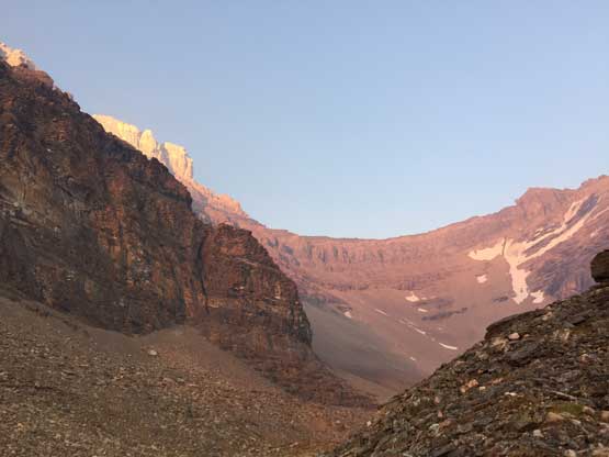
Finally the objective – SW Face of Mt. Fryatt came in sight

Traversing back due NW towards the bivy by Iceberg Lake
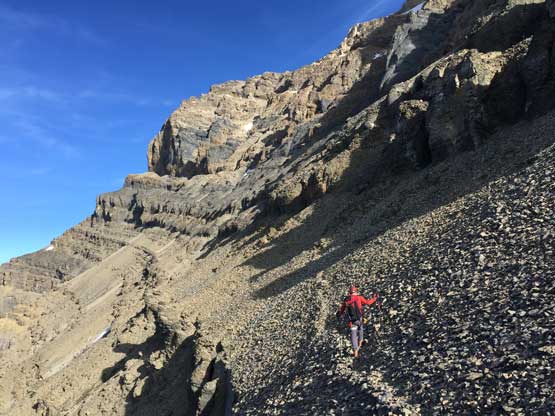
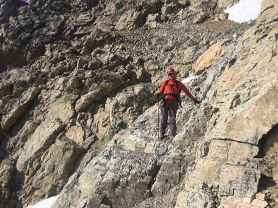
Because the fact we planned this trip in a 3-day period there’s absolutely no reason to rush on our summit day. The entire ascent should be done without having to touch snow so I didn’t see a point of making an “alpine start”. Mike and I agreed to wake up at whenever we wanted and that ended up being a 9 am wake up time… Our morning routine was fairly efficient and we eventually did manage to get going before 10 am. This was alright as I was still tired from this month’s pushing through… The 450-m scree slog to a high col on the south shoulder of Mt. Fryatt looked terribly tedious but actually not that bad. The scree wasn’t entirely treadmill plus we managed to pick up some game trails here and there. The final 100 m involved a bit of “moderate scrambling”. The route wasn’t that obvious but I believe there are more than one line that goes. The shoulder is a very scenic site to linger and soak in the views.

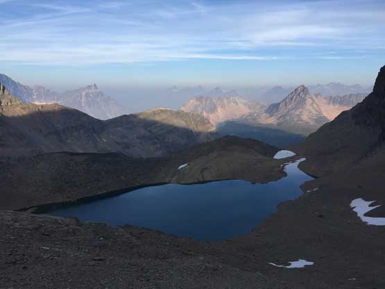
Morning view of Iceberg Lake with an unnamed peak behind

We just traversed to the NE side of Iceberg Lake
Partway up the scree grunt, looking back down at Iceberg Lake

Mike scrambling up a 3rd class step on the final section to gain the high col

Arriving at the high col/shoulder on Mt. Fryatt’s south ridge.
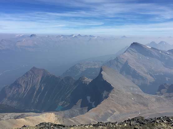
Looking south we could see the trio of Mt. Christie, Brussels Peak and Mt. Lowell

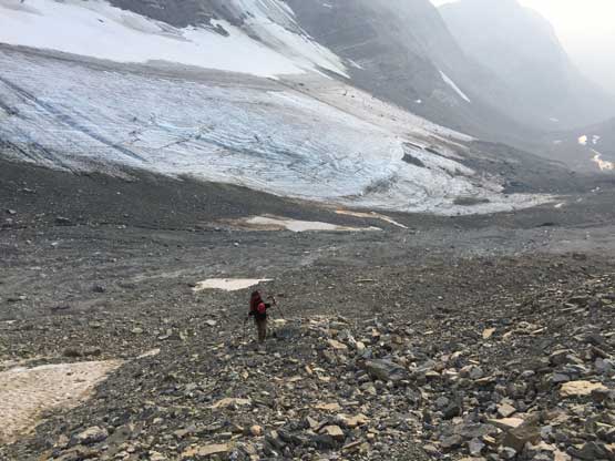
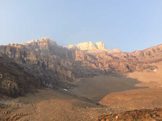
This glacier on the south side of Mt. Fryatt probably sees very few visitor
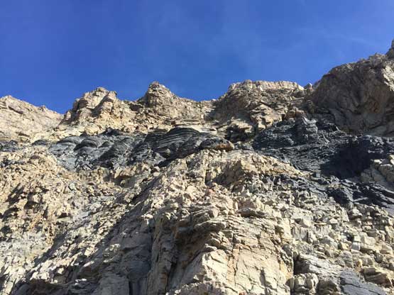
The ascent of SW Face consists of two stages in my opinion. The first stage is a rising traverse aiming for the high end of West Ridge and the second stage involves two short pitches of 5th class climbing and then the summit block. The first stage is the most confusing as we had little idea where exactly to go along this “rising traverse”. I did not do much of research other than reading Vern’s trip report because Mike had a GPS track. Our plan was to follow that GPS track along with Mike’s memories from this past attempt. After traversing along the wide brown bench (with a game trail) we found a shallow gully ascending onto a shitty black bench. The traverse across this black bench sucked balls. We did not start gaining elevation until we’d crossed several large gullies all the way over to the far climber’s left side of the face. At one point Mike instructed us to finally start going uphill and as expected, the face started out easily with nothing harder than 3rd class with occasional 4th class steps. The exposure was moderate and the rocks were reasonable by Rockies standard. Upwards and onward the terrain stayed in this form for a long while.
Mike leading the way, traversing the wide brown bench with a “path”

The north face of Mt. Belanger with the remote Mt. Clemenceau behind
After traversing a long ways across the black band we started upwards again

Mike scrambling up the typical chossy terrain on the lower SW Face
Upwards and onward we just had to pick our own way up.

Typical, typical. You have to cruise on terrain like this otherwise don’t bother…
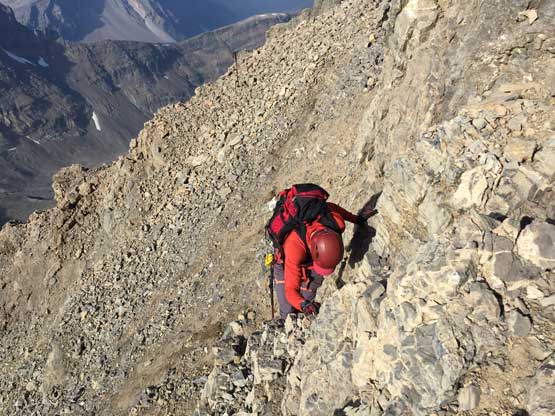
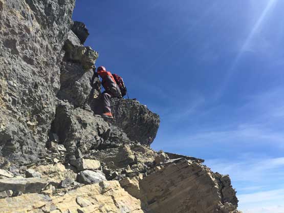
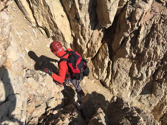
Aiming towards one of the several notches on the higher west ridge we could sense the terrain’s getting harder and harder. It seemed apparent that we’d run into 5th class terrain on the yellow ish rocks but I did not recall the same position from Vern’s trip report. I thought for sure Vern’s group was one gully climber’s right of us but to cross this gully we had to step onto dirty ice. We strapped the crampons on anyway and made a half hearted attempt. I did not like it. The Petzl Irvis Hybrids felt undertooled plus we had fresh beta that we should not encounter snow/ice at all. After some discussion Mike and I agreed to explore the climber’s left side of this gully even though we knew this was likely off-route. After fighting our ways up a long section of sustained and very loose 4th class choss I made the call to pull the ropes out. There wasn’t much indication of past human traffic and the pitch ahead looked nothing “scrambling”. I had to build a trad anchor (one size 0 cam and a micro nut), switched to rock shoes and led a short, but solid pitch of 5.6 on good-ish rocks. There’s a big boulder above the steep pitch that I used to belay Mike up. Mike had no problem to second this pitch but the two pieces of pro that I used to build the belaying station were forever donated…

We put crampons on. This patch was crossed but the next gully was sketchy

Traversing and climbing the climber’s left of ice gully was harder than expected

I led a short pitch of 5.5-5.6 ish on solid rock. Off route pitch #1
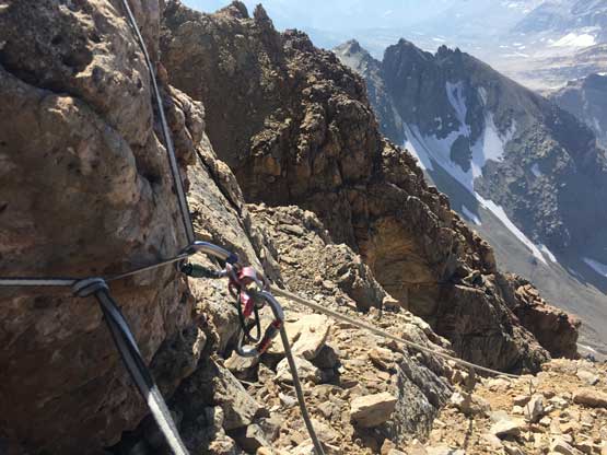
Because of the off-route nature I had to set up all stations.
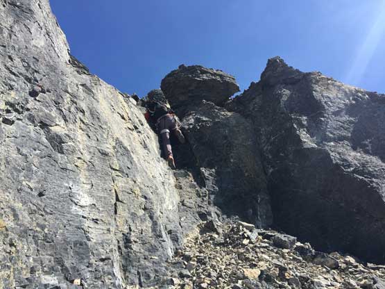
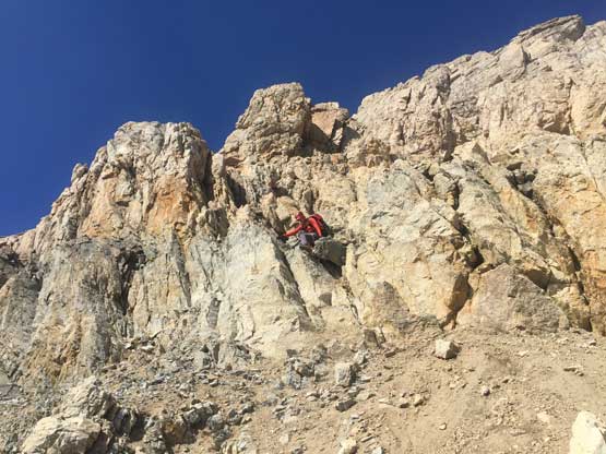
The terrain then forced us traversing farther climber’s left onto a flat shoulder of the upper west ridge. Much of this stage was 3rd-4th class but very exposed so instead of pitching out I decided to short-rope Mike up. We then briefly ascended the crest of west ridge before traversing an obvious ledge back onto the SW Face. At least two rappelling anchors indicated we were back on route, but unfortunately we screwed up the next pitch again. I could not figure out how exactly Vern’s group managed to keep the terrain within “5.2” and lost my patience to farther look around. I called for a belay and then went for whatever that felt reasonable following my own route-finding. This led to a awkward corner with two or three strenuous moves probably at 5.7 grade. I barely made it up on my rock shoes and then ran a full rope length to another big boulder. A top anchor was soon built but as expected, Mike had big issues climbing that corner step in his mountaineering boots. After attempting a few times Mike decided it’s over despite the top-rope belay. Not good… There’s nothing I could do other than pulling the ropes up but I told Mike to give it one last try by exploring far out onto the north side. This decision changed the game. The immediate north side of west ridge was a mostly 4th class, albeit exposed pitch. I think we found a better bypass than Vern’s 5.2 face route on the second pitch.
Traversing left on some ledges to gain the west ridge, for a brief moment

At this ledge we went back onto the SW Face.

At the upper pitch. Where should I go??

Looking back at Mike trying to fight his way up my off-route pitch #2..
Eventually Mike opted to explore the ridge crest which turned out much easier
From the second time we gained the west ridge, looking down the north face

This is a northern view. Note the tip of Mt. Edith Cavell sticking out of the smoke
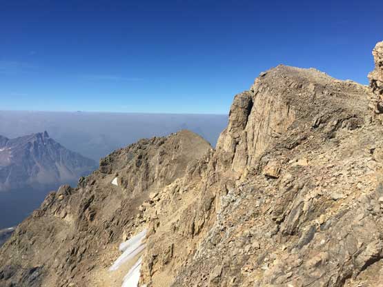
With the technical pitches officially over we stared at the summit block knowing the route shouldn’t go any harder than 4th class anymore. Mt. Fryatt is almost in the bag. Mike went ahead to attack the next step along the crest of west ridge. It looked harder than it actually was – mostly just 3rd class and only moderately exposed. Then at an obvious black bench we traversed all the way over to the south side of summit block and found a shallow 3rd class charcoal gully. Ascending this feature got us dumped right on the summit ridge and the summit was only two minute’s walk from there. The view was magnificent but even better, 52/58 down for me and only 6 to go!

Mike ascending the brown rock onto easier ground now. 3rd class now.
Then, we had to traverse across this black bench all the way to the south side

Mike ascending a short, 3rd class choss step along the traverse

Mike arriving at the summit of Mt. Fryatt

Summit Panorama from Mt. Fryatt. Click to view large size.
A southern view into the Athabasca River valley

Looking over Mt. Belanger and Mt. Lapensee towards Clemenceau Icefield giants

Mt. Christie, Brussels Peak and Mt. Lowell now look smaller
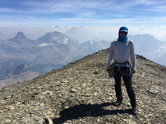
Mike on the summit of Mt. Fryatt
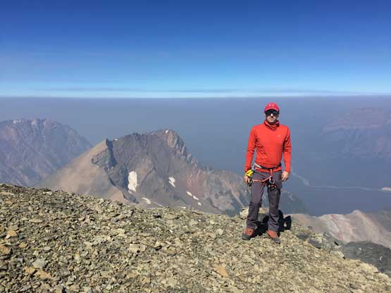
Me on the summit of Mt. Fryatt
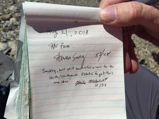
The page of our register entry. There aren’t a lot of names in this booklet
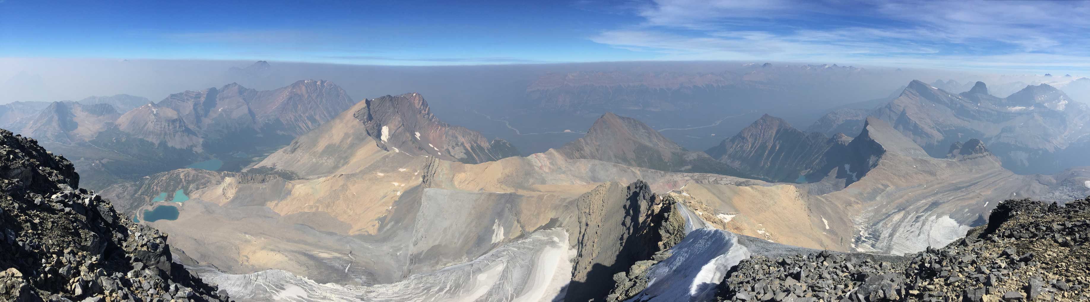
Another panorama from the summit of Mt. Fryatt. Click to view large size.
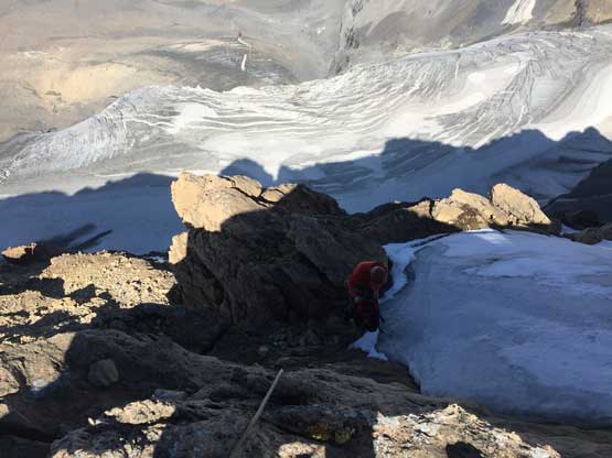
Despite the delays in route-finding we were still doing good on time. We stayed for almost an hour soaking in the views before starting the descent. After easily reversed our ascent line off the summit block we arrived at the first rappelling station. From there we did two full 30-m pitches of rappelling off the technical terrain. There’s another anchor at the bottom that we skipped. Mike found a scramble route and we managed to get off the yellow band by a bit of 4th class down-climbing. This got us dumped down-climber’s left of the major ice gully that we were too scared to cross on ascent. I was 100% sure we were now on the correct route so insisted to not cross that gully. This would involve descending the lower SW Face on “unfamiliar terrain” that we hadn’t gone up but let’s face it. I think we did fairly well finding the easiest route and managed to stay within “3rd class terrain” for much of the lower face. Traversing back across that black choss bend still sucked balls but at least short-lived. In no time we were back to that high saddle taking another lengthy, but much-deserved break. The descent was a lot easier than anticipated.
Down-climbing that short 3rd class step on the summit block

Descending the south side of the summit block. Chossy as typical…

Dropping onto this black bench and traverse back onto the west ridge
A bit of 3rd class down-climb on charcoal… This step was not fun..

And then, we had to carefully down-climb the yellow nose. This part is exposed…

Almost back to the technical terrain. Time to find a good anchor

Mike on Rappel #1.

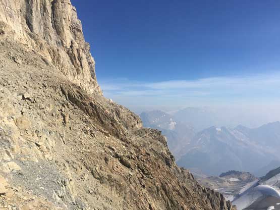
Looking south across the middle SW Face

Mike on Rappel #2
We skipped the 3rd rappel by some chossy 4th class down-climbing
Down-climbing, down-climbing and down-climbing…
Exiting the harder terrain, but more choss to come
Mike seemed to have some fun here…

Typical descending on the lower SW Face.

Nothing harder than 3rd class nor exposed now, but very chossy

Almost back to the shoulder. Note the smoke’s blown in

Back onto the shoulder, looking back at our objective
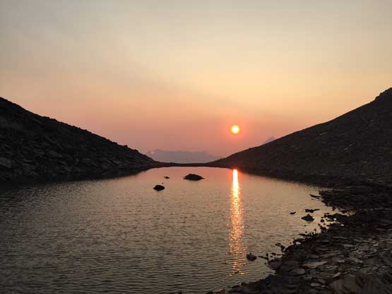
From the saddle what’s left was a 450-m plod down to our basecamp at Iceberg Lake. Other than the initial 100 vertical meters (“moderate scrambling”) the rest was mostly scree skiing. The scree wasn’t the nicest but anyhow it’s hard to complain about it. Back to camp we earned ourselves a bit over 2 hours of daylight time so after cooking dinners I went to search for some sunset views. The lake’s outflow had some neat colours and I stayed there for about half an hour taking pictures. The night was peaceful and relaxing and the next morning we did not set up an alarm neither. We would sleep till whenever we wanted. The reason was simple – why not…
Mike starting down the next stage
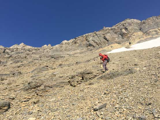
The scrambling’s over now. Onto the scree run part
It wasn’t too bad at this point
The scree was not as easy as it looked here, but again it’s not too bad
Finally back to our lovely campsite.
Looking back at the SW Face of Mt. Fryatt.
I went to explore around at sunset time
Watching sunset from the lake’s outflow
Another look back at the face. The col/saddle is up on the skyline
One last picture of this beautiful evening
On the morning of Day 3 we eventually got going by around 10 am, as much of a non-alpine start as anticipated. I was still tired from whatever reasons. Descending the headwall underneath Iceberg Lake sucked and then there came that long ass side-hill traverse across hardpacked choss and steep grass, with some degree of exposure. Much of this side-hilling bash was no-mistake zone and we were just glad to have weather on our side. The grass was dry and grippy. I had no idea how some of the parties managed to cross this stretch in wet conditions… We took another long break at West Ridge’s base and then Mike took over the lead. I was mentally tired… While descending towards the uppermost Geraldine Lake we took a line following more-or-less the drainage. There’s some bushwhacking but nothing worth noting. The rest of the hike-out was uneventful except for the endless boulder-hopping. I found the boulders quite fun for reasons that I don’t even know myself. Another long slog down and glad I never have to come back.

Iceberg Lake on the morning of our exit day

Mike struggling on an awkward step down the headwall

We had a bit of brief easier travelling

But soon enough we had to face this shitty traverse

Again, the view down at Divergence Lake was great
This steep grassy traverse was quite exposed actually.
Glad the traverse’s over. Mike leading the way down towards the lakes

Exploring and checking out a cave feature

Down to the 4th Geraldine Lake now

Crossing the outflow of the 3rd Geraldine Lake
Boulder hopping is the theme

Traversing back across the side of 2nd Geraldine Lake
Back onto the trail contouring around the 1st Geraldine Lake
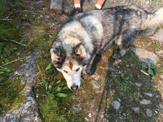
Beasty sightting on the trail…
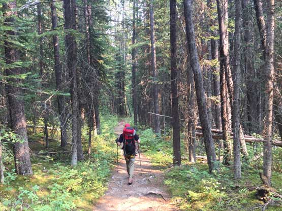
This is the forested part of the trail. Almost done…
Mike did an excellent job driving us down the rough Geraldine Lakes road and then we departed our own way. It’s too late to push all the way back to Vancouver but I did manage to get most of the drive out of the way that night. I slept at a secret and quiet pull-out on Coquihalla Highway before resuming the rest of the drive back home on the morning of Day 5 of this trip. Overall I do agree that the setting around Mt. Fryatt is one of the most beautiful in Canadian Rockies but much of this trip was “type 2 fun” that I’m definitely not looking forward to repeat. In terms of climbing the technical pitches were reasonably solid and in terms of exploring the Geraldine Lakes valley and bivy by Iceberg lake are top-notch. However, to put down Mt. Fryatt one needs to cover a ton of unpleasant terrain. It’s not terribly remote and far from “difficult” by the 11,000ers standard, but I can see why it doesn’t get climbed that often.
