Howse Peak
May 2-3, 2015
3295m
Icefield Parkway (South), AB/BC
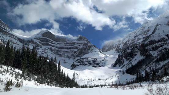
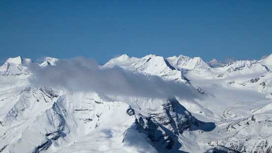
For the tourists visiting the Canadian Rockies, Howse Peak is a giant dominating the skyline (together with its neighbours, Mt. Chephren and White Pyramid) when driving along the famous Icefield Parkway near Waterfowl Lakes. In the mountaineering community, it’s known as the highest summit in Waputik Range (that also means higher than everything on the Wapta Icefield). There’s some confusion regarding which of the two is higher – Howse or Chephren. The official status indicates Howse being slightly higher so I’ll go with this. The steep East face of Howse Peak offers some of the most challenging alpine routes in the Rockies, while its “backside” is described as a straightforward glacier ascent. For obvious reasons the “backside” is where I’d be going up.
The challenge of Howse Peak via its “backside” (or West Face) is not about the technical aspect of the ascent, but rather the approach. A number of years ago Rick Collier’s group climbed Howse Peak and its adjacent summits by driving up the Blaeberry River FSR from Golden. That was a very reasonable approach option but with the recent year’s flooding as well as decommissioning I believe one can no longer drive as far up that road as it used to be. Another option – probably the most obvious one, is via Howse River from Saskatchewan Crossing. This route may look great on the map, but apparently quite a “sufferfest” given the distance and the number of river crossings after talking to folks who had gone up that way. My solution was to propose an experimental ski/snowshoe route up and over Epaulette/White Pyramid col. The close-up pictures I took from various nearby peaks gave me enough confidence that this route would go with a stable snowpack. Apparently Ben was sold on this idea so with 3 days of weather window, we decided to give it a try. I somehow managed to convince Ben using snowshoes this time…
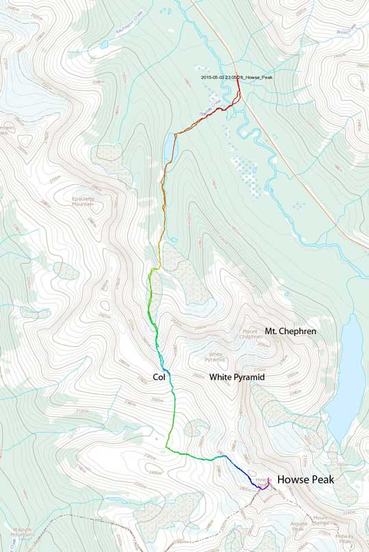
Howse Peak snowshoe/ski ascent route. GPX DL
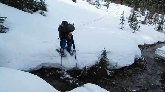
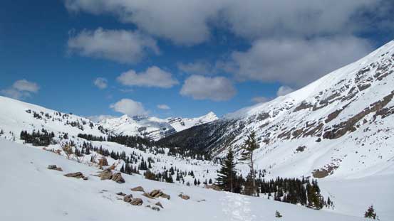
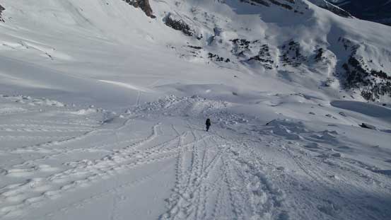
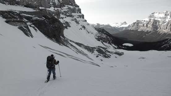
The first bulk part of elevation gain would be following exactly the same route as White Pyramid’s ski route to the high col. I ascended White Pyramid 2 years ago so pretty much knew exactly where to go, except for this time we had a lot less snow at lower elevation. We both had a dinner/party commitment on Friday evening so didn’t manage to leave Edmonton until 9:30 am on Saturday morning, so didn’t start our trek until 2 pm in the afternoon. Our task for the 1st day was at least making to the upper valley of Epaulette Creek and depends on snow conditions we’d decide whether to finish the approach (up and over the high col) on this day or not. There was as expected, no snow at the low elevation and the ford of Mistaya River was surprisingly high for early May (thigh deep).. Ascending climber’s left side of the creek, we didn’t don our snowshoes until almost at Epaulette Lake. Thankfully the lake was still frozen enough to walk across. Upwards and onwards alongside Epaulette Creek, the snow condition was again as expected, weak and partially isothermal. There were a lot of all-the-sudden knee-deep post-holing involved.
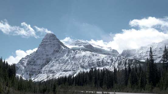
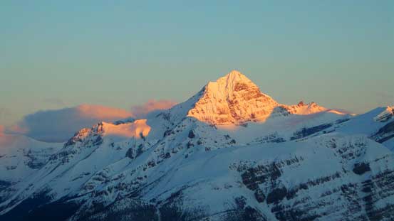
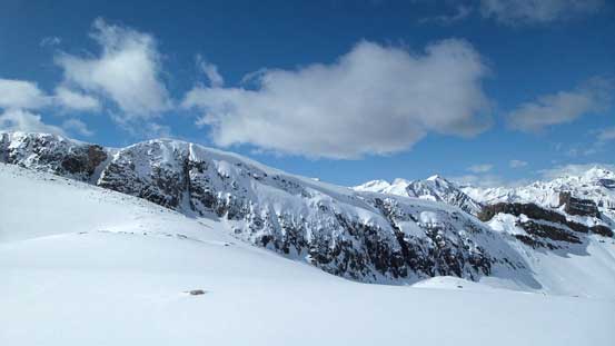
A view of Chephren and White Pyramid from the “parking lot”

Ben fording Mistaya River – a bit more than knee deep..

It’s still very dry by the side of Epaulette Creek
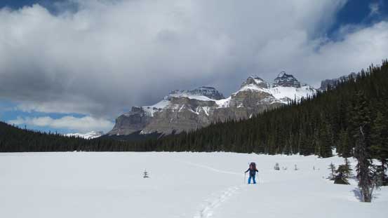
Snowshoeing across Epaulette Lake with Mt. Murchison behind
The creek was very open at places making some interesting snowshoeing
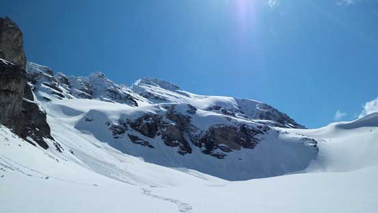
Looking ahead to the steep grind up White Pyramid. Deja Vu 2 years ago!!

The uppermost Epaulette Creek was still completely snow covered.
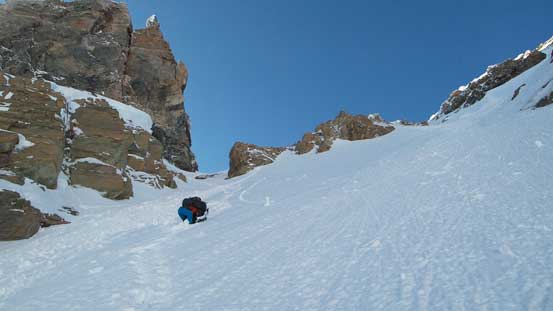
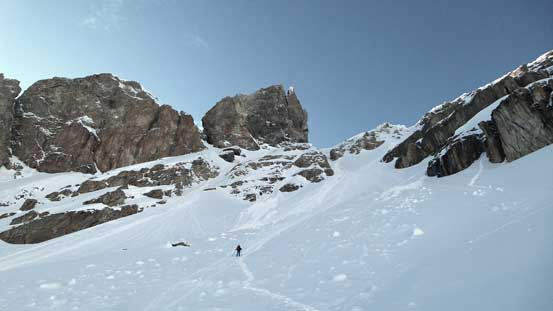
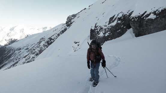
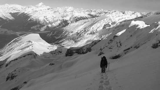
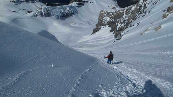
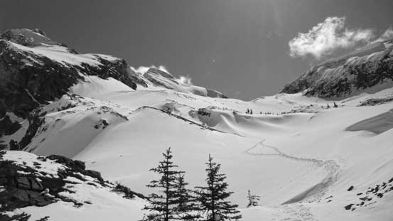
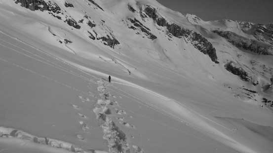
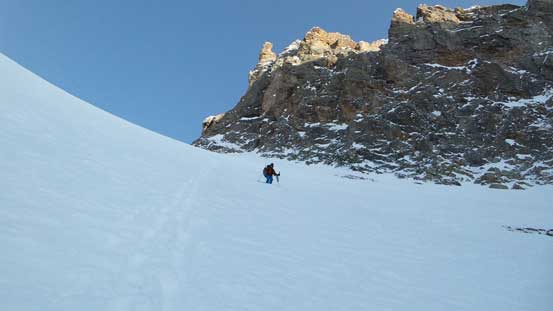
Thankfully the snowpack had gained its strength significantly once hitting those thick and open areas, and with the sun slowly setting behind and the partially cloudy sky we figured it’s worth to carry on. So up we went. The first bit up that giant slope/gully towards the high col was just as remembered, steep.. I led the way up climber’s right side on a moraine-like feature before veering right again and then back left to gain the flatter bench. The middle section of the gully was not very steep, but foreshortened enough to take us a long time. Except for getting hit by a brief snow squall (quite heavy actually) this section was uneventful. The last 50 m or so to the high col was the steepest (40+ degrees) and we ended up having to remove our snowshoes. I have to say dragging the heavy winter overnight mountaineering gears all the way up here involved a lot of work, but we were doing pretty good on time.

Looking back from partway up the first section of this slope
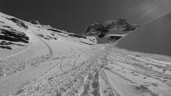
Looking ahead towards the middle section
Ben nearing the upper section. It’s much steeper than appears in this photo
Looking back from high up on White Pyramid
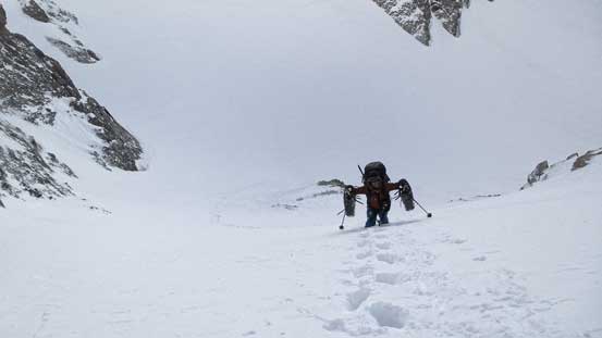
Steep snow climb towards the col. Snowshoes are already off
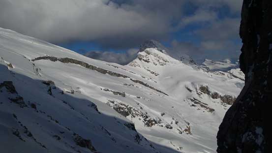
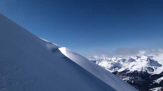
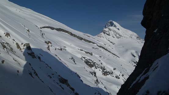
From the col, we got the first sight of our objective
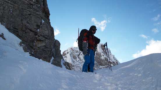
Ben on Epaulette/White Pyramid col, ready to drop down the unknown side
Me on the col checking things out. Photo by Ben
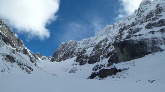
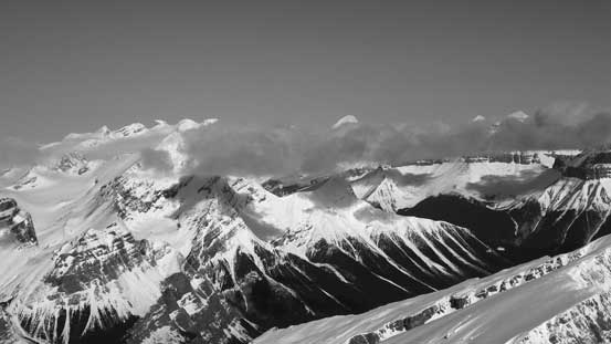
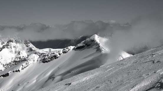
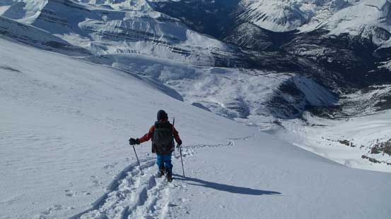
Due to the cold wind we didn’t bother to linger any longer than necessary at the high col but immediately dropped down the steep south side. This part was the most experimental but worked out very nicely. There was indeed, a continuous snow line down from the col. It wasn’t nearly as steep as what I would expect neither (the steepest part never exceeded 45 degrees), and with the snow not being rock-hard we both managed to descend facing outwards. In short time we strapped snowshoes back on and from here on it was simply putting one foot in front of another. Of course with the crust forming up it was a bit hard on our knees descending 600 vertical meters from the high col to the bivy site. There was surprisingly a mini stream of running water, some isolated groups of trees making some natural wind sheltered areas and a lot of neat-looking slopes around. In other words, the bowl between White Pyramid and Howse Peak is an excellent spot for backcountry wondering.

It’s a long way down (600 vertical meters in total)
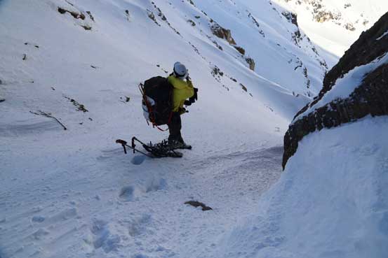
Ben strapping his snowshoes on again.

The weather was clearing up towards West
Looking back towards the steep descent from Epaulette/White Pyramid col. Still a long day to descend
Started to see some evening colours over the Freshfields

Ben continuing down the slope
The last bit of sunbeam
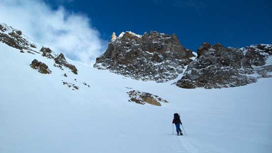
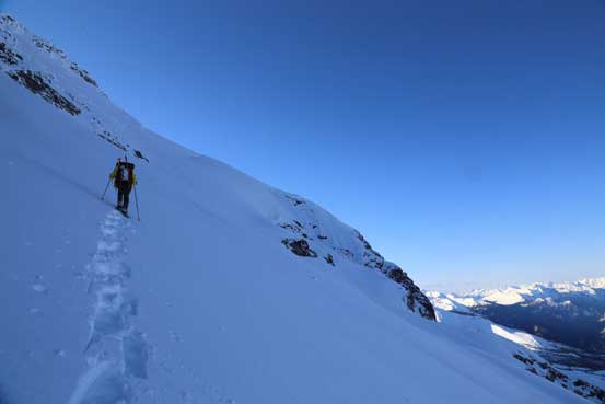
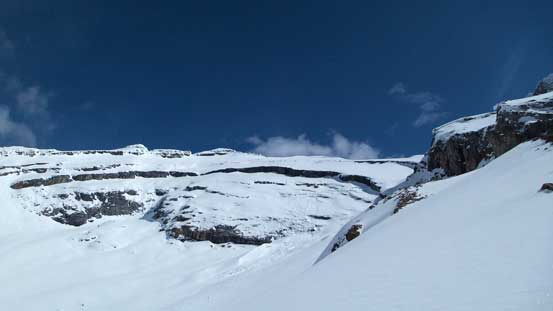
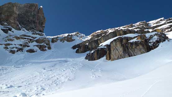
The night was nice and peaceful (no wind) and we woke up at 5 am under clear sky. We agreed to just have some “cold breakfast” (ie. no cooking) in the morning so didn’t waste too much time before starting the ascent. There was nothing tricky for the initial section of the ascent as we slowly worked our way upwards, until we were facing directly at a foreshortened and steep terrain trap/gully to access the upper hanging glacier. There’s probably another (gentler) line further to the climber’s right but looked like that’d involve some height loss and we couldn’t tell exactly from our vantage point, so opted to ascend that gigantic gully. It took us about a good hour to grind up with the snowshoe crampons biting firmly on the surface. Near the top of this gully we turned climber’s right to access the glacier.

Some clouds making for good colours, looking towards White Pyramid

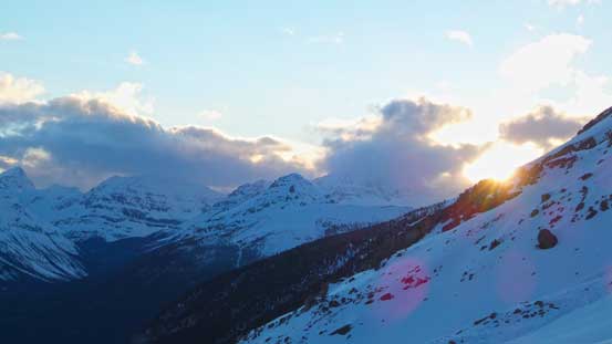
Alpenglow on Forbes and Outram over the horizon
Our objective – still a loooong way to go despite the appearance in this picture
Alpenglow on the mighty Mt. Forbes
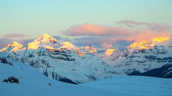
And, glow on Mt. Conway and Coronation Mountain
The next section would be this very foreshortened grind
We finally made to the glacier.
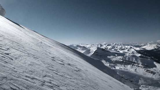
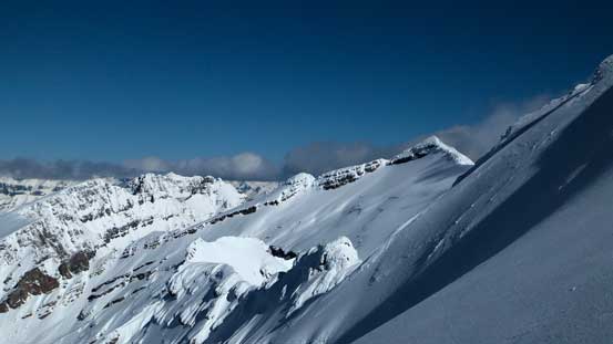
There wasn’t anything technical on this glacier neither except for huge avalanche terrain all over the places. It appeared to us we’d have a long section of diagonal traverse on increasingly steep terrain aiming towards the climber’s left side of a gigantic open crevasse in the distance. There’s a long section of 40-degree ish zone with very bad run-out and big slopes above that we’d have no choice but cutting a line through. On snowshoes I usually had a lot of energy so led the way up pretty much the entire mountain, but due to the amount of post-holing on loose snow our pace was not fast. This mountain was huge and the terrain just seemed to never end. We eventually managed to get high above that house-eating crevasse, around a rib, only to figure we’d still have about 200 vertical meters to go on steep terrain (30-35 degrees). Again, there’s a lot of post-holing involved but with some patience we managed to snowshoe right to the summit. The last meter or so was on an enormous cornice that we didn’t risk to ascend.
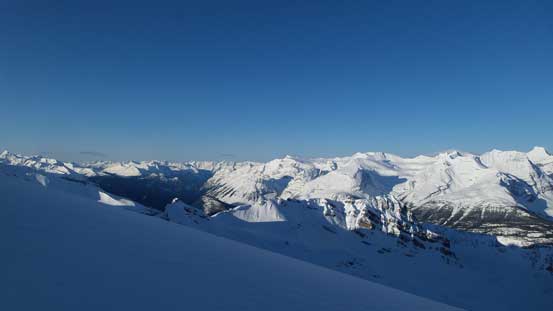
Already great morning view towards West
Oh the Freshfields
Me leading the way up this glacial bench. Photo by Ben

We had to avoid this man-eating crevasse!!
Ben following up

Higher up on the face

It was still very steep
Almost on the summit ridge now!

The last push to the top

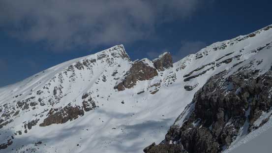
This summit on the climber’s right side is a false one, slightly lower

Ben arriving at the summit
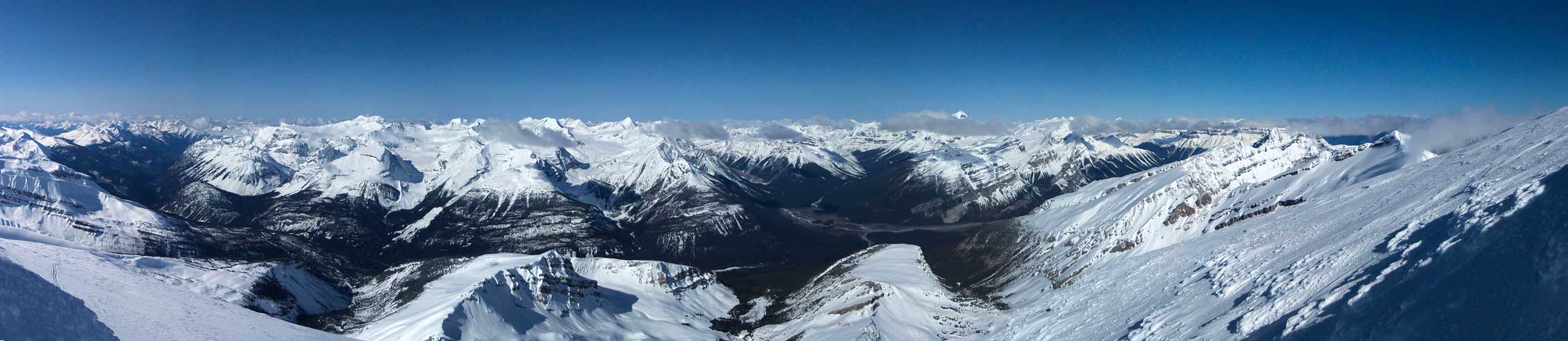
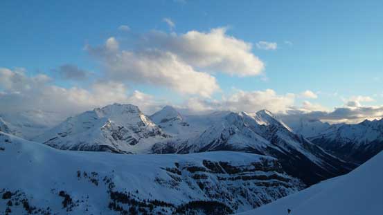
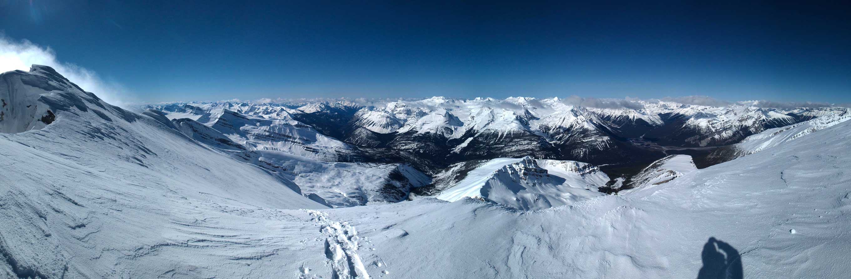
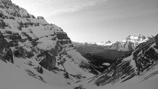
Summit Panorama. Click to view large size.

Gorgeous view of White Pyramid and Epaulette Mountain

This is Blaeberry River Valley. A logging road goes up this way but unsure how far

Familiar peaks on the Wapta – Baker, Collie, etc.
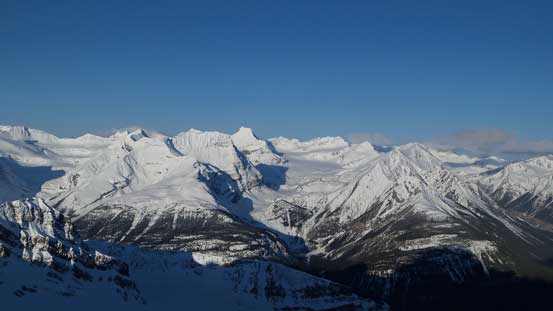
Peaks by Blaeberry River in the BC Rockies

The mighty Mt. Mummery
More peaks on the Freshfield Icefield. Nanga Parbat on the far left

Mt. Forbes pokes through a layer of clouds
The Lyells, Columbia and the Twins also poking through
A closer look at White Pyramid from a not-so-often-seen angle
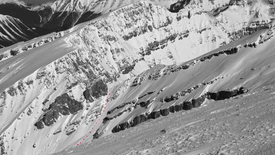
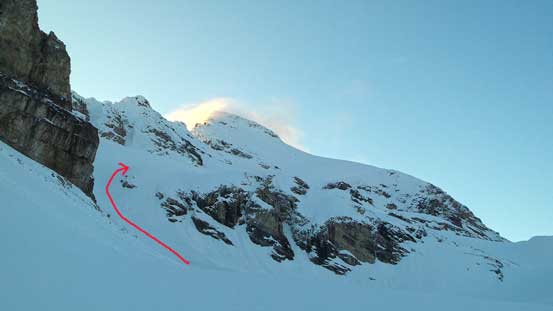
And, here’s our short-cut col. Red dots show the route
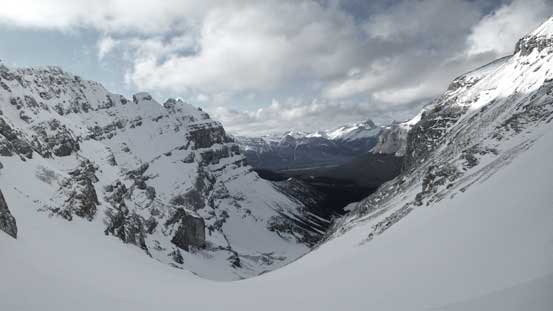
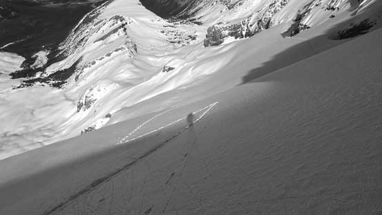
Due to the concern with the solar effect we didn’t linger long on the summit. Retracing our steps down on snowshoes was fast and effortless, but that long diagonal traverse was a bit painful on my ankles. I always forget the rigid mountaineering boots do not fit well with the snowshoes (too mush twisting on sidehilling terrain), but oh well, at least they brought us down that slope safely. Lower down the snowpack was still strong which was good for avalanche condition, but bad for our knees… We managed to finish the trip before noon, so it’s the time to make a decision. Given the long exposure to the strong solar radiation it’s probably not the greatest idea to just pack up and climb back up and over White Pyramid’s col right away, but none of us was keen on sitting around camp for 9 hours and waiting till the next day neither. We figured the air temperature was cool (~0 degree) so it’s probably okay to finish the return in the evening time (once the sun beams moved away from that upper slope).

Time to leave the lovely summit behind
Me near the summit. Photo by Ben
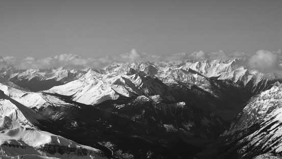
A panorama from near the summit. Click to view large size.
Descending the upper face

More about the upper face. We managed to plunge straight down it

Transitioning to the glacial bench
White Pyramid is view again
Now, this crevasse gets some sun beam on it
It’s very steep around here
Ben retracing our steps down, very carefully not taking a fall…
Here’s that long diagonal traverse

Ben on the diagonal traverse

A lot of rime covered features around

I wonder if that col will give a better view towards the Parkway…

Looking back at our tracks

Almost done the glacier walk
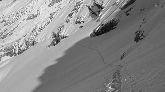
And then, dropping down into this huge terrain trap

Continuing down
Looking back. We didn’t linger longer than necessary here
A lot of neat terrain around

Ben finishing the terrain trap
Cool rock formation

Looking back at this long grind

Now, it’s a leisurely walk back to camp

Only if we had skis on…
More beautiful surroundings. This area might worth to come back for..
Looking back at our ascent route up Howse
And, here’s the steep col we had to go up and over on the return… Looks very intense..

We took our time here
Looking up towards White Pyramid
And, looking back towards our objective
Almost back to camp. This drainage could potentially be a neat short-cut to the Freshfields
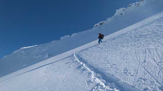
So we took a nap and then leisurely broke camp, aiming to set off by 6 pm. With a more bomber snowpack than the day before at the same time (we sank much less than our down-tracks) we made progress fairly quickly. The lower few hundred meters felt very hot but once getting into the shade we were back in winter.. Thank to the steps we made on the day before we managed to re-ascend all the way back to the col without the aid of ice axe nor crampons. Without the tracks we for sure had to take them out. Down the other side it was again a steep descent on loose snow. I opted to face inwards and down-climb since the hardness of the snowpack was a bit inhomogeneous but Ben managed to descend entirely facing outwards. Once the terrain became gentler we strapped the ‘shoes on again and had a quick descent down White Pyramid’s ski route. The lower slope was ugly though thank to the breakable crust..

The mighty Forbes free of clouds again in the late afternoon

Started re-ascending

Ben following me behind
Ben looks tiny compared to this slope!!
Ahead is the steeper part
We kept snowshoes on for as long as we could

Then, time to boot-pack using our tracks made in the previous day

Looking ahead to the col

Ben climbing up steep snow

This part is the steepest (~40-45 degrees)
Looking back from the col. Our objective in sunshine!
Descending steep and loose snow down the “familiar” side of White Pyramid

This slope is also very steep and long
A view looking over the shoulder of Epaulette
Ben snowshoeing down

Looking back at the seracs on White Pyramid
White Pyramid in evening
The rest of the return went by fast and uneventful except for we took a slightly different route coming down Epaulette Creek. We stayed on snow for much longer by staying more in the forest than near the creek. The river crossing gave us a bit of refreshment and shortly after we were back to the highway. Despite the lateness of the day we managed to beat head-lamp time so arrived back to the parking lot at pretty much 10 pm.
Back down to the flats. Looking back. Will this slope see me again? Mm..

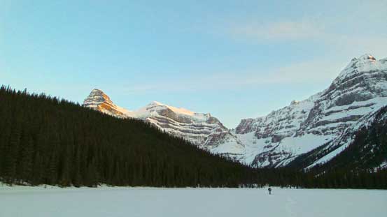
Snowshoeing down Epaulette Creek

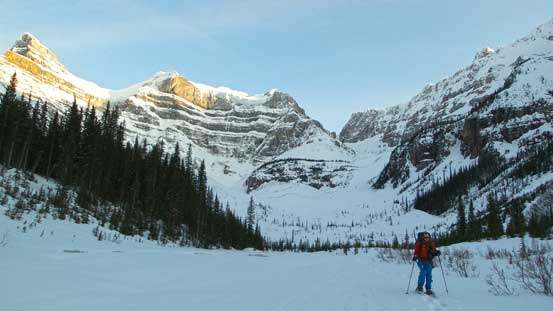
Now, we were back to the Lake. Mt. Murchison looming behind
Looking back from Epaulette Lake. Chephren and White Pyramid on evening glow

Fording Mistaya River at almost dark
Overall it was a very successful ascent, as usual. This one felt a bit special since the route was pretty much our experimental design and worked out just as expected. (At least we did not have any reference saying people using this col to approach Howse Peak). There were a couple interesting facts.
- We each brought 2 axes and steel crampons but did not use any of them.
- We managed to snowshoe right to the summit.
- We planed 3 days but managed to finish in 2 days (or 1.5 days precisely).
- The shear amount of post-holing on loose snow we did throughout the trip. At sections it felt more like February than May…

I am extremely interested in hiking to this peak with my brother, as it has our last name. We would be coming from Florida and Utah, and flying in, so would it be better for us to do this in the summer to have better weather? Or does the snow make the ascent possible? Thanks for all the information here! Any additional information you can point me to if making this hike in the summertime would also be great! andyhowse11@gmail.com