Black Rock Mountain
July 20, 2014
2462m
Ghost River Wilderness, AB
The second day (Sunday) of this past weekend didn’t turn out as expected neither. With unsettled weather pattern in the forecast Ben and I agreed to meet in Canmore to discuss. With a few options in our mind we figured it’s better to do our first trip in the Ghost area. Based on Saturday’s weather we should go as eastwards as we could in order to hopefully escape from the rain. So we set the objective to Orient Point, a difficult scramble with a long approach… As usual for our trips, we would drive to the trail-head and car camp there in the evening. Ben’s SUV did an excellent job negotiating the very rough road especially the last 400 m or so down the “big hill”. Beyond that the road was largely destructed by last year’s flood and we could no longer see where the road went. It basically disappeared into a pile of gravel on the river bed, so we decided to car camp at the bottom of the “big hill”, and do the rest of the drive the following morning when it’s bright enough.
Unfortunately we woke up under some dark low clouds and soon enough, it started raining. There’s no way we’d start a day in weather like this, so we slept in till 9:30 am. By this time the clouds had lifted but we no longer trusted the weather (we didn’t have enough time for a long ascent neither). I knew there’s an easy objective with a trail leading all the way up, namely Black Rock Mountain, so that’s what we would do. Obviously neither of us did any homework about this ascent, and we weren’t even sure which of the nearby peaks was Black Rock Mountain (I had to use my GPS to confirm that).
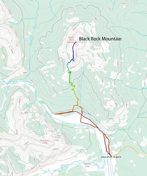
Black Rock Mountain scramble route. GPX DL
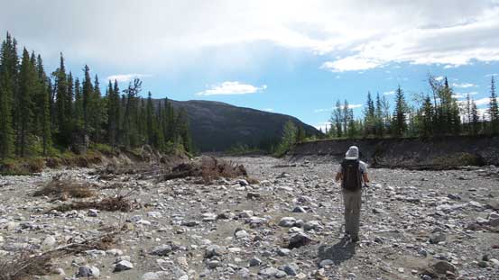
The day started with hiking up gravel flats on the right hand side of Ghost River, but soon we came to a dead-end and were forced to ford the river to the other side. Then came a section of mundane walk on the river flats until we saw an ambitious jeep driving from behind. The jeep gave us some idea about where the road went and we soon found it. There were many wash-outs on this road so the jeep couldn’t drive on it and had to maneuver around on the gravel flats. It seemed like we were even faster on foot and we felt very good about it. Soon we had to ford the river again, but after that we missed the trail to Black Rock Mountain. We followed the river flats blindly up and after what seemed like a long section we caught up a group of 14 backpackers. They just did Black Rock Mountain the day before and warned us we’d already past the trail. So we started back-tracking, but after a while we got frustrated and started heading up into the bush. We aimed climber’s right in the bush and after crossing a small gully we eventually joined the trail (actually, an old ATV road).
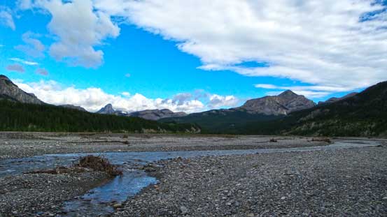
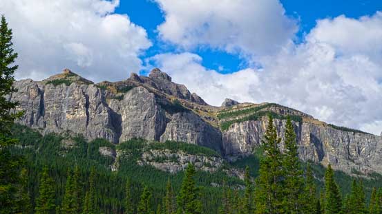
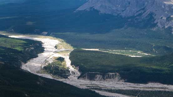
A view of Ghost River from the bottom of “big hill”. Our objective is on the right
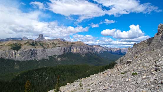
Orient Point, our original objective

Ben hoping to walk around on the right side of this river

It didn’t work out so he had to ford it
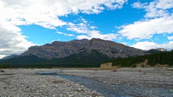
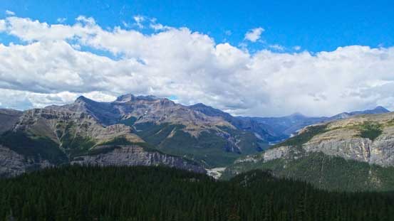
Looking ahead up the Ghost River valley

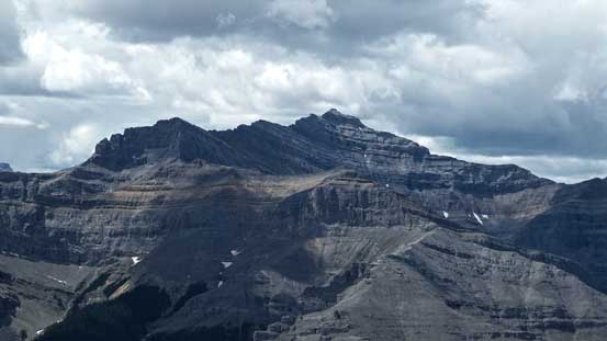
A zoomed-in view of Black Rock Mountain. Route goes up the left side
To our left was the impressive Phantom Crag
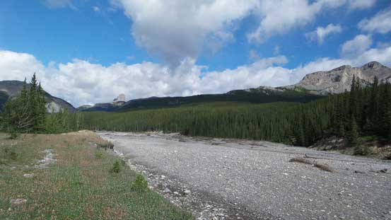
We walked too far in and had to backtrack…
By this point what we needed to do was just following this trail, which would eventually lead us to the summit. There’s little to say about it apart from the trail being in excellent condition. Near the treeline there’s one short easy scrambling section that the trail/path led us through the middle of a rock gully, and after that we came to a grassy plateau, and ahead would be the final scree slog to the summit. There’s an old fire lookout on the top but it’s very broken and provided limited sheltering from the wind. From the summit we could see some nasty weather towards Calgary but since we had blue sky and sunshine we were not in a rush.
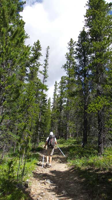
Hiking up the excellent trail – wish we’d found it earlier…
Near treeline
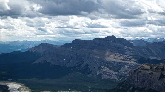
A view towards Mt. Costigan from near treeline
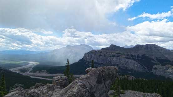
A storm just hit Devil’s Gap area
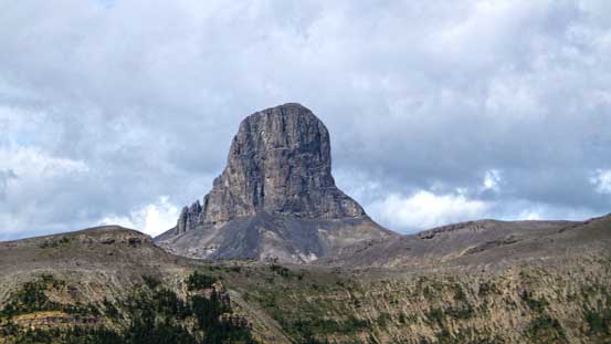
A zoomed-in view of Devil’s Head. It’s definitely on my to-do list
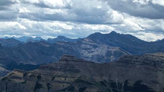
A wider view of this area. Devil’s Head on left
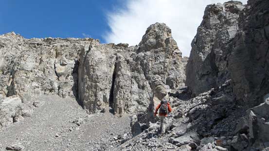
The trail led us through a gully
After the gully, we came to this view

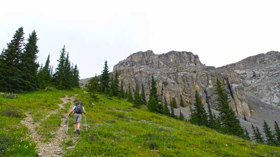
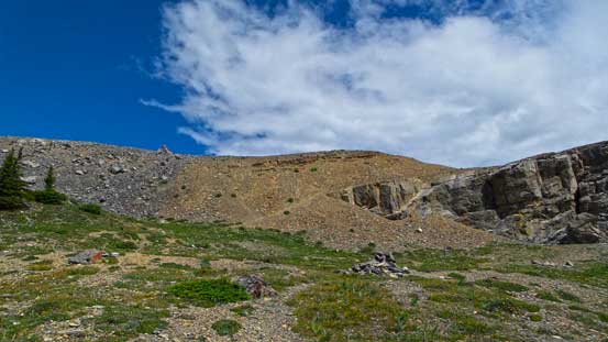
We gained the plateau, and the summit was finally in sight

Ben hiking up the grassy plateau. It was windy here
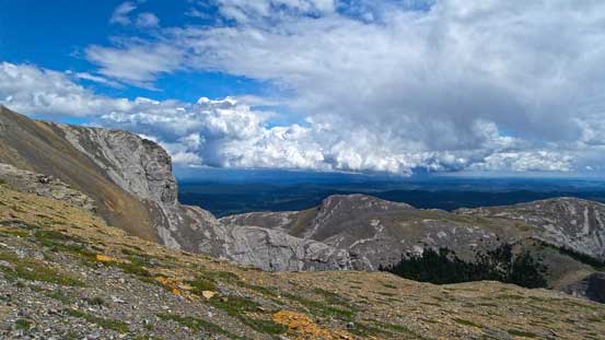
Towards Calgary looks pretty stormy

Summit Panorama looking towards the mountains. Click to view large size.
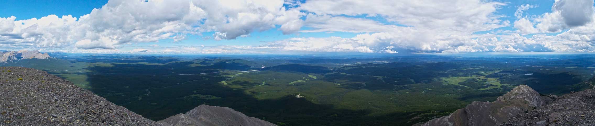
Summit Panorama looking towards the prairie. Click to view large size.
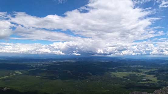
Thunderstorms towards Calgary
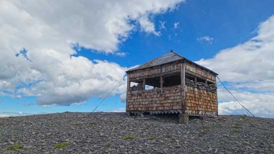
The summit fire lookout
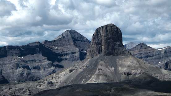
Devil’s Head
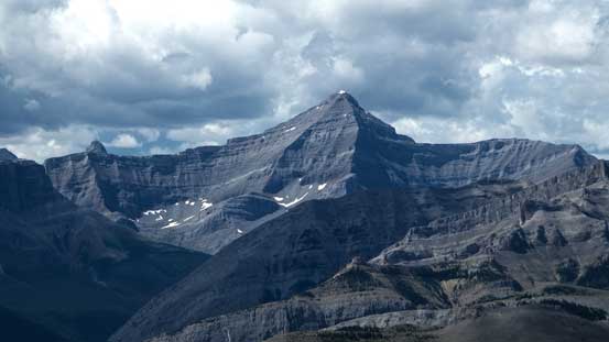
Mt. Aylmer
Mt. Costigan
Orient Point
Saddle Peak
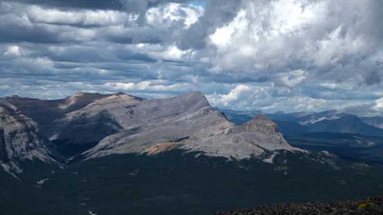
An unnamed peak looking north. Further north would be Panther River area
Looking down at the Ghost River
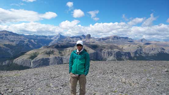
Me on the summit of Black Rock Mountain
The descent was easy and fast and we followed the old fire road all the way down to the river flats. Near the bottom the trail/road disappeared suddenly into a shear 5 m drop-off (thank to the flooding damage). We descended a narrower path down skier’s left to a (hidden) campground before exiting the bush. Looking back, it was nearly impossible to see the campground nor the trail/road so that’s why we totally missed it on the way in. A GPS track would be handy here but oh well, I no longer need to do this hike anymore so I won’t complain anything now. The two river crossings added a bit of refreshment given the heat for the final slog back to the parking lot.

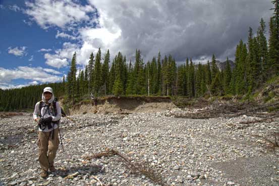
The campsite at the bottom of Black Rock Mountain trail
Behind me was where that trail started… Thank to the flood it’s no longer obvious

Ben fording Ghost River
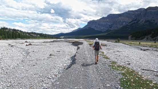
Then walking on the road. It’s heavily destroyed by the flood.
This trip, though a bit technically too easy for a July outing, does feel satisfying. I had done Association, Aylmer and Otuskwan which were all on the outer boundary of the Ghost but never been to the core area before and this was the first time (for both of us actually). We were also able to see some cool peaks like Devil’s Head. This area was also unaffected by the forest fire smoke which was also to our surprise.
