Johnson Peak [BC]
February 9, 2020
2024m
Hope / Sunshine Valley, BC
Johnson Peak is best known for the “Hope Slide” that runs from a sub-summit all the way to the valley floor where Highway 3 travels through. It locates right next to the much-bigger Mt. Outram and is significantly overshadowed, and unlike its taller neighbour where a trail leads all the way to the alpine, there is no trail on this peak. I’ve seen reports in which scramblers scrambled up the Hope Slide to reach its summit in summer time, while a few others opted for traverse from Mt. Manson. However, if the objective is only Johnson Peak the best approach might actually be the south ridge, in winter when the deep coastal snowpack covers the brushes.
This was the day immediately after my tiring flights back to Vancouver from South America and I was definitely not planning to head out into the mountains. However, my friend Alan Blair and Katie had just made a deep snowshoe trench on Saturday and reported their ascent on Facebook. I immediately checked the weather forecast and it’s still good on Sunday, and spontaneously decided to head out. It’s a very rare thing in SW BC that I ended up following a set of snowshoe track on especially, lesser-known summits. For most of the time I was the one breaking trail in deep snow, and other times I had to use skier’s skin tracks to access the alpine. The terrain on Johnson Peak’s south ridge wouldn’t be pleasant for skiers so I couldn’t turn down this oppourtunity. It took Al’s group 6 hours to reach the summit but with their trench I expected to half their time, especially considering I just returned from a month of high-altitude climbing and my cardio was at its peak level.

Johnson Peak via South Ridge. GPX DL
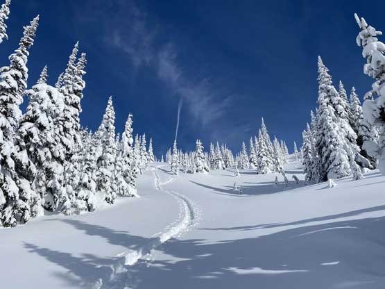
I didn’t bother to leave home until 6 am which meant I didn’t start the ascent until past 8 am. I parked at the gate about 100 m from the main highway on a side road directly north of Sunshine Valley. It seemed like the locals continued to drive further onto the logging roads but I didn’t have the access to the gate’s key. The road walk was only 1 km. I could see that Al and Katie had strapped their snowshoes even on the road but for me such wasn’t necessary as fresh tire tracks had packed down the snow. I easily located the point where they turned into the woods. The going soon became steep and was not easy even with the tracks. The snow was also icy and firm compared to the previous day and I was glad to have the teeth under my Lightning Ascents. There was some bushwhacking and one particular cruxy spot that forced me to take off snowshoes and bootpack. I almost had to don crampons but opted to traverse around on an exposed ledge to bypass the steepest step. Around this stage the track was doing a rising traverse eastwards to join the south ridge and the terrain was very steep and aggressive.

The morning sun from where I parked near Sunshine Valley

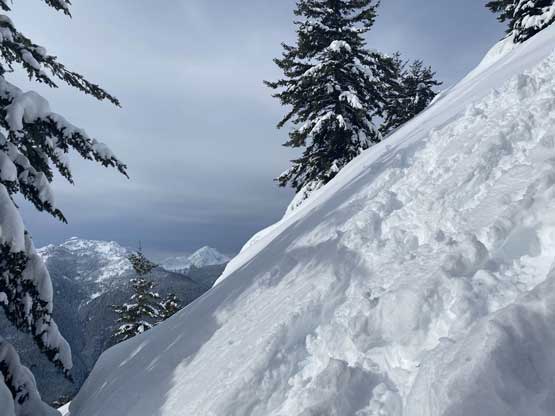
The messed-up steep shits in the forest. Not pleasant…
Once gaining the ridge proper the going became easier for a while but soon became steep again. The snow depth also increased drastically. One particular dead-fall field required some caution but with the tracks and the firmer snow the risk of falling through a weak spot was very low for me. Further up there had one stretch steep and open enough for avalanche concerns but again, given the firmer conditions there’s not much I needed to worry about. The grade was for sure over 35 degrees on a lot of places on this ridge and the grunt was relentless.
There were steep stretches on the ridge.

The clouds dissipated and I started to see blue skies
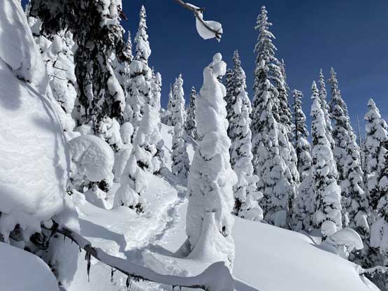
What a winter wonderland!
I also encountered some sections of tight timbers and judging by the tracks I could sense the confusion and frustration of Al’s party. For me however, there was no confusion nor frustration as I just needed to follow the path.. After a short energy break I reached the plateau at around 1800 m, then easily descended a bit to the start of the summit ridge. The wind had picked up, unfortunately and the tracks became partially covered. At last I finally got to break some trail, and a short while later I reached the summit. The plod across the summit ridge took longer than I thought though.
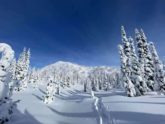
Reaching the 1800-m plateau looking towards the summit
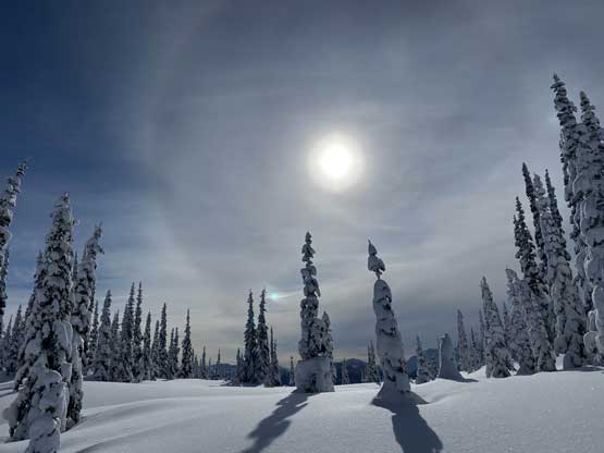
The sun provided a dramatic backdrop

A view from the 1800-m plateau. There’s some elevation drop here
Following the snowshoe tracks ascending onto the summit ridge

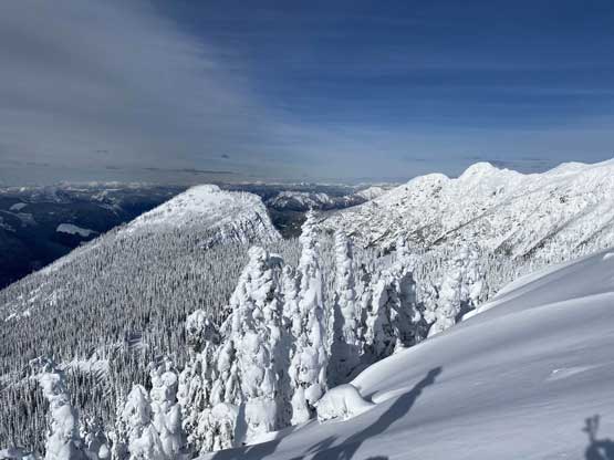
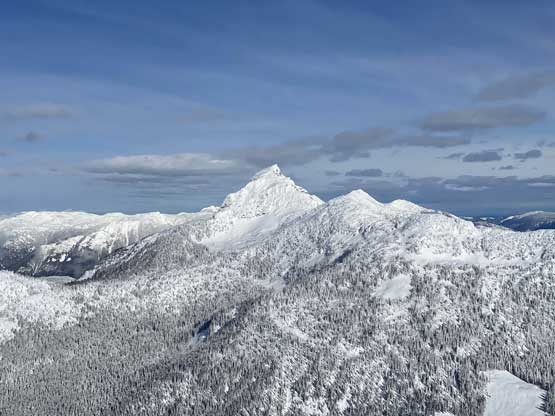
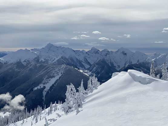
Mt. Outram in its full glory
This is a view towards the sub-summit where Hope Slide came down from
Mt. Outram and Mt. Manson
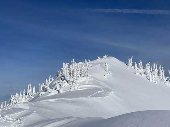
Not far from the summit now

The snowshoe tracks in contrast with the North Cascades behind
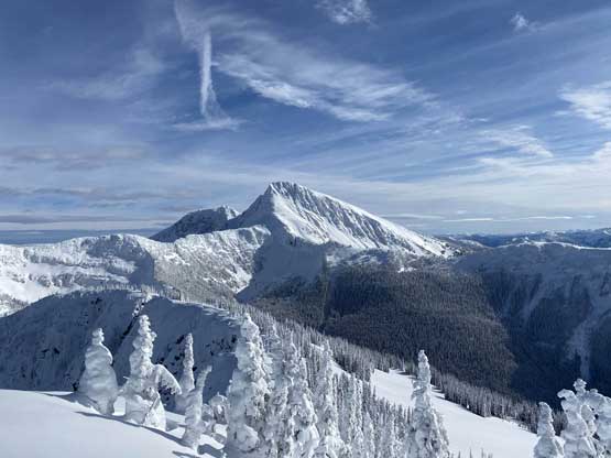
Another view of Mt. Outram

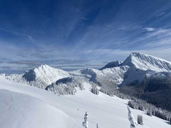
Partial Summit Panorama from Johnson Peak. Click to view large size.
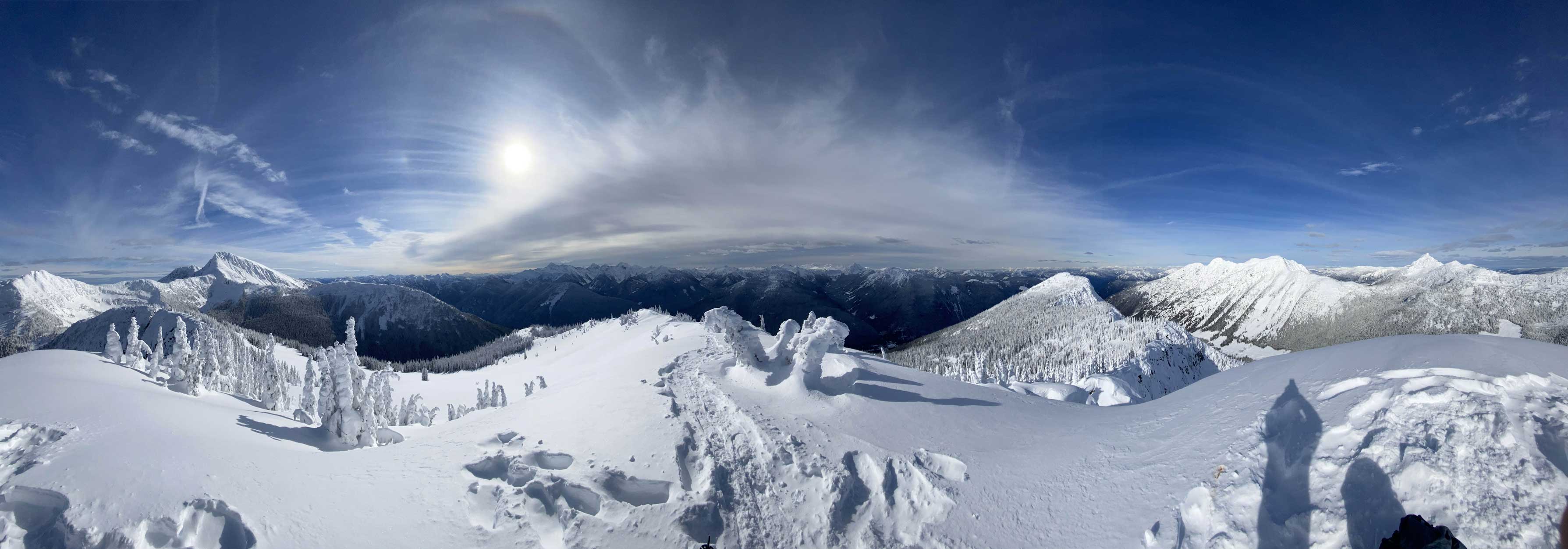
Partial Summit Panorama from Johnson Peak. Click to view large size.

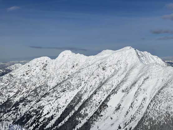
A closer look at Mt. Manson
Mt. Hatfield
McLeod Peak

On the horizon are Hozomeen Mtn. and Jack Mtn. in Washington

Mt. Grant in foreground

Hope Mountain in foreground with Mt. Judge Howay and Mt. Clarke behind
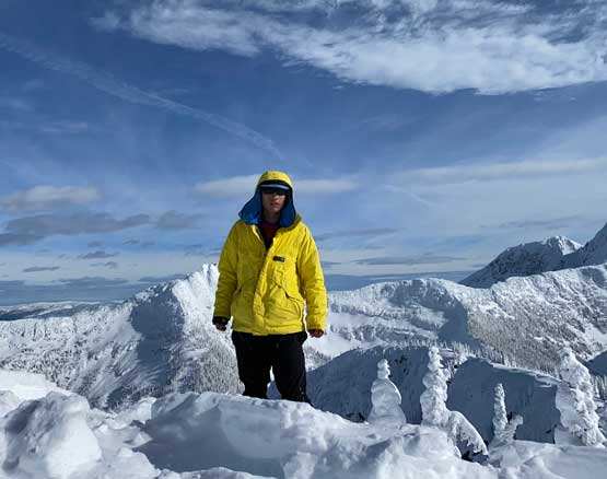
Me on the summit of Johnson Peak

My summit selfie on Johnson Peak, with Mt. Outram behind
I briefly considered traversing to Mt. Manson but the ridge looked complicated enough for the “considerable” avalanche rating, plus I also ran out of water as I wasn’t expecting a long day, so decided to leisurely head down. While snowshoeing down the powder on the upper mountain I had a ton of fun, but once the powder ran out the descent soon became a Type II fun sufferfest. I had to be careful about each step and the steep grade combined with the firm and uneven surface had made downhill snowshoeing an exhausting fair. To not further complicate things I removed the snowshoes at about 100 m lower than the aforementioned dead-fall fields and it’s also apparent that the other group did the same thing. The condition was firmer for my trip so I had much less post-holing than Al and Katie did.
Descending the ridge with Silvertip Mtn. looming in front
My round trip time was exactly 5 hours including the long-ish summit break so it’s indeed the short trip that I was looking for. I had to thank Al and Katie for breaking trail and publishing their report immediately on Facebook. Without the social media posts I definitely would have missed out this excellent day of snowshoeing and peak-bagging. To give back to the peak-bagging community I provide this trip report along with the GPS track download. Hope you enjoy!
