Thompson Peak
January 18, 2021
2202m
Chilliwack Lake / Paleface FSR, BC
Thompson Peak is the highest summit on the Canadian part of Custer Ridge on the east side of Chilliwack Lake. This is a fairly prominent peak (P2K) but doesn’t seem to get ascended very often. A new logging cut on the “Meroniuk Spur” that goes up the north fork of Paleface Creek had made the summer access relatively easy in recent years and parties had gone to the summit via the long and undulating NW Ridge. The winter/spring access is via the logging road system in the main (south) fork of Paleface Creek and the status of this road was largely unknown other than “overgrown” and “bushy”. For a while I thought my option to summit this peak was only from the north side in summer but that’s no longer the case until a party of four strong snowshoeers and one dog went up the winter route and reported it to be “in”. There were still substantial amount of alders based on their photos but the round-trip time of 7 hours meant the alders must have been manageable. Two days later four other peak-baggers, two on skis and two more on snowshoes had followed this same route to the summit and meanwhile I managed to get another team-of-four on the board, aiming for Monday which was the only bluebird day in the last week. There had been up to 15 cm of snow on Sunday but I figured the conditions wouldn’t have changed much.
The avalanche conditions had dropped to “Moderate” across all zones with lingering instability emphasizing on pockets of wind slabs so I jacked up the ambition to grab the nearby Mt. Daly as well. I messaged my team about this change of plan but none of them was very keen on making close to 2000 m elevation gain on snowshoes. To make sure I definitely could summit both peaks I decided to drive out separately. At around 5:30 am the team (Katie, Alana, Ilia, myself and Ilia’s dog) grouped in Chilliwack and we drove three separate vehicles up the Chilliwack Lake Road. The driving was not as bad as expected although the pot-holes were indeed as annoying as the previous parties reported. The drive up Paleface FSR to the “Meroniuk Fork” was a bit adventurous with numerous large water bars and about 1 km of snow up to a foot deep (with previous tire tracks). I was a bit impressed that all three vehicles made to the “trail-head” and it was just about to get bright at this point.
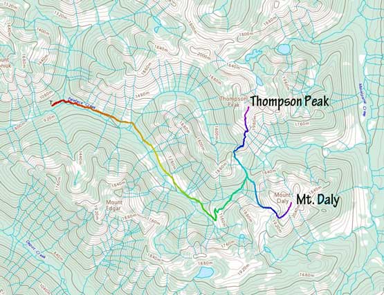
Thompson Peak and Mt. Daly via Paleface FSR. GPX DL
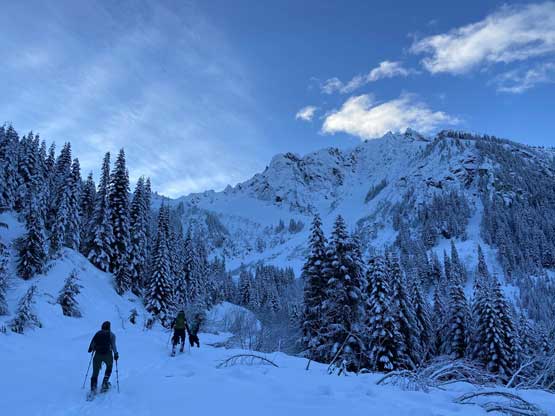
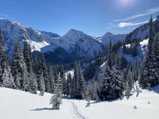
We were able to put snowshoes on right from the truck and we only needed head-lamps for 5 minutes. llia went ahead and set a blistering pace up the boring sections of this FSR and in no time I was sweating like a pig. Thankfully once the alders kicked in the pace had slowed down. The alders were easier to negotiate than they appeared and the previous parties’ tracks also eliminated the thought process for us. The road was chocked by alders for pretty much the entire way but there wasn’t even one stretch that I felt overly annoying. The most annoying was actually the few mandatory creek-crossings but we all did them without even having to take snowshoes off. Over an hour later we were slowly but steadily approaching the head of the valley with impressive peaks and faces all around. The alders had given way to thick snowpack at this point and we had a cruise sail up the few switchbacks to the end of the road.

My Tacoma parked at the “Meroniuk Spur” junction
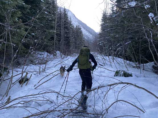
The old Paleface FSR had alders right off the bat
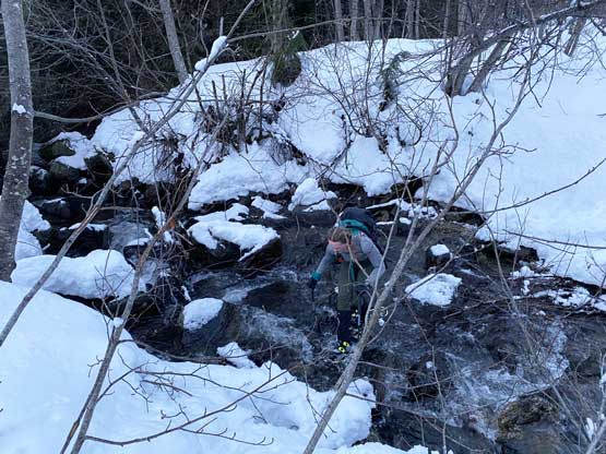
Alana crossing the main stream en route. I’ve heard this’s a nasty ford in summer
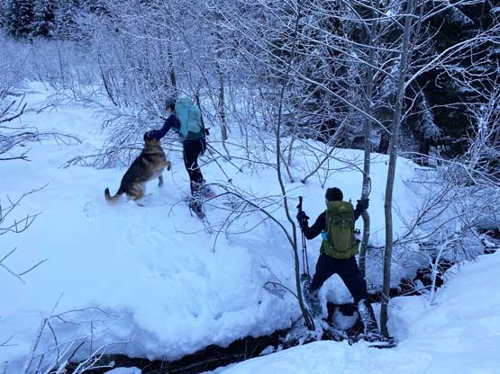
Katie and Ilia crossing another (minor) creek

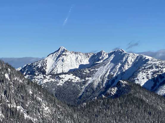
The NE Face of Mt. Edgar looms above

Alana kept charging up the alder-chocked road
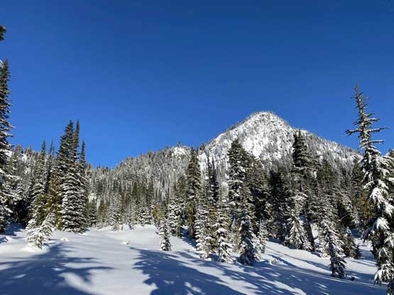
Finally the alders gave way to some openings. Peak ahead is unnamed
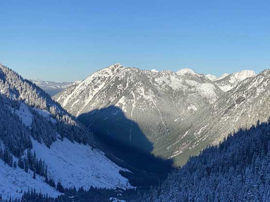
Looking back from the head of this valley

Katie breaking trail up the switchbacks at the end of the road’s plod
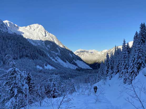
Looking down Paleface Creek valley towards Mt. Meroniuk

Plodding up with Mt. Edgar behind

A closer look at Mt. Edgar, another somewhat obscured peak
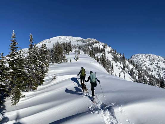
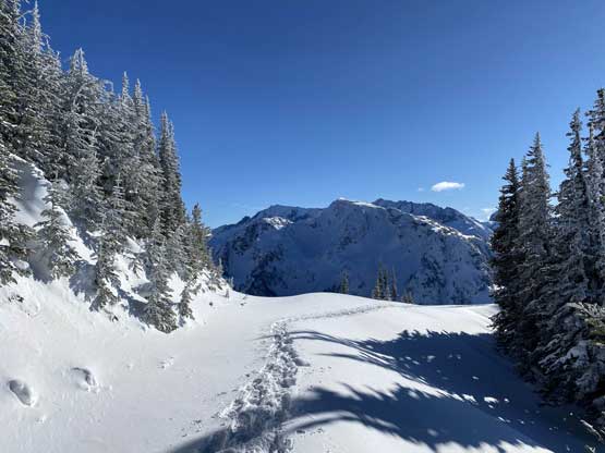
From there we followed the previous parties tracks (still visible despite the recent dump of snow) losing ~30 m elevation side-hilling into the bowl between Mt. Daly and Thompson Peak. Ascending to the forested Thompson/Daly col was easy following the tracks and then a short while later we emerged out of the trees into sunshine where we took the first break of the day. The tracks were completely covered at this point so we had to break trail onward. The trail-breaking was variable ranging from nothing to calf-deep. The next section was plodding to a higher col between Thompson Peak’s south ridge and a sub-summit south-west of Thompson Peak. The crux on Thompson Peak came on the next 100 m gain as we must ascend a very steep stretch of the ridge with a few rolls of 35-40 degrees. Despite the icy conditions we all managed to climb up this stretch without even taking the snowshoes off.
Finally made to sunshine. The lower S/SW Ridge of Thompson Peak ahead

Mt. Daly behind, my second objective in this day

Katie ready to charge the steepest roll on Thompson Peak

Katie leading the way.

Ilia following up with some typical North Cascades terrain behind
Ilia taking turns to break trail.
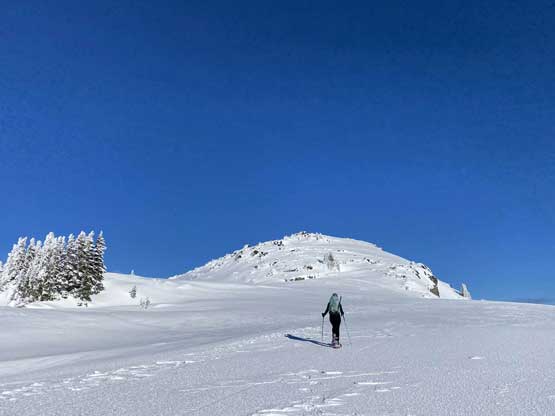
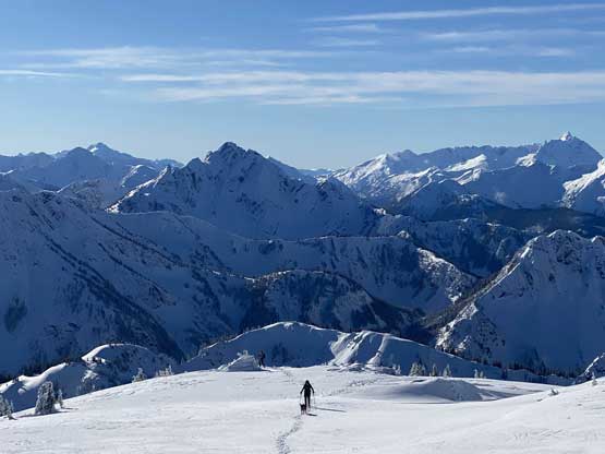
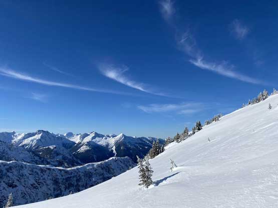
And finally there came the upper south slopes/ridge where all we needed was to put one foot in front of another. The drag was longer than I thought but the views were getting better and better. We all lingered on the summit for over half an hour soaking in the views.

Onto the semi-open slopes of Thompson Peak’s upper south ridge

As you can see, fresh snow and cooler temperature than a few days ago

Macdonald Peak and Mt. Webb from east

Alana plodding up

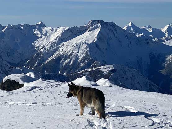
Ilia’s dog enjoying the sun and the snow
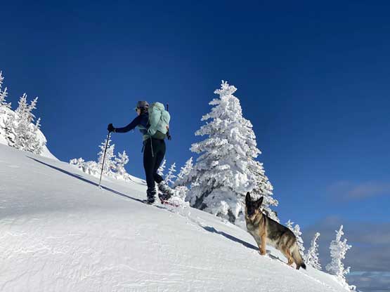
Katie and Ilia’s dog

Ilia taking a much needed rest break
Ilia and Alana plodding with Mt. Daly and Mt. Rahm/Mt. Custer behind
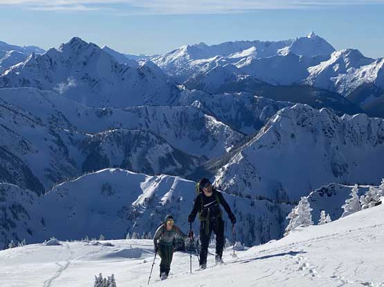
Katie approaching the summit of Thompson Peak
Ilia plodding up the last slope with Nodoubt Peak behind

Partial Summit Panorama from Thompson Peak. Click to view large size.
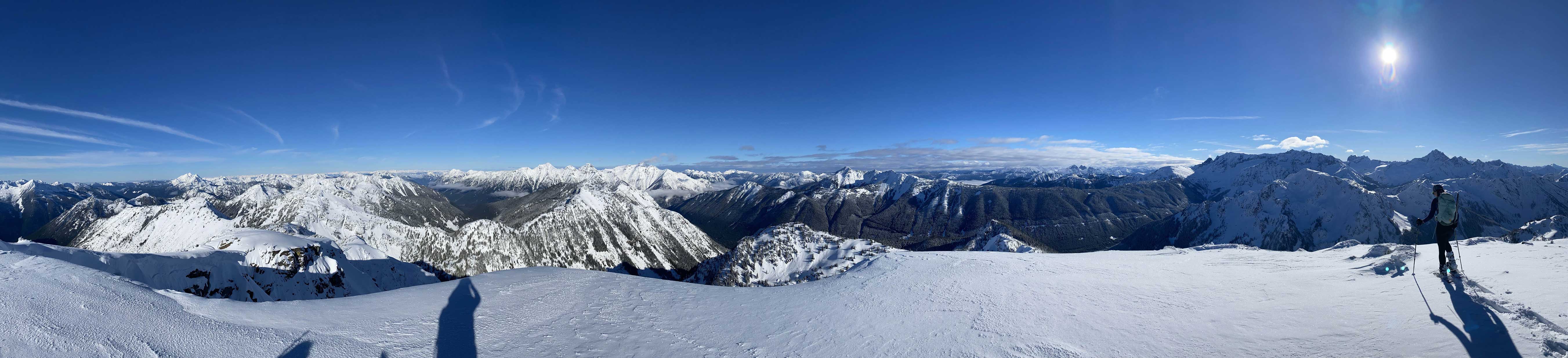
Partial Summit Panorama from Thompson Peak. Click to view large size.

Katie posing for a shot on the summit of Thompson Peak
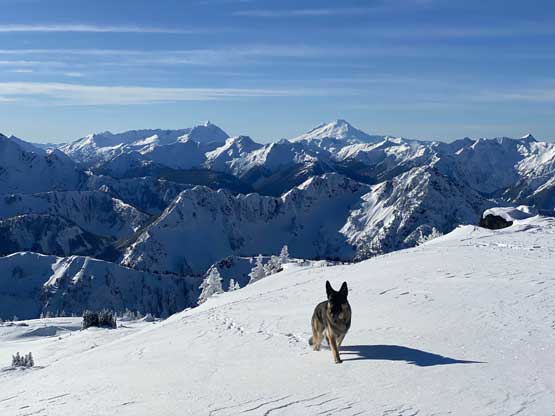
Ilia’s dog made the summit before Ilia himself!

American Border Peak and Slesse Mountain pokes behind Macdonald Peak
Ilia’s dog in front of Mt. Lindeman
Ilia and Alana with Nodoubt Peak and Mt. Shuksan behind

Whitworth Peak to the east
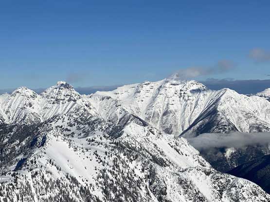
The south side of Silvertip Mountain with Mt. Rideout to the left
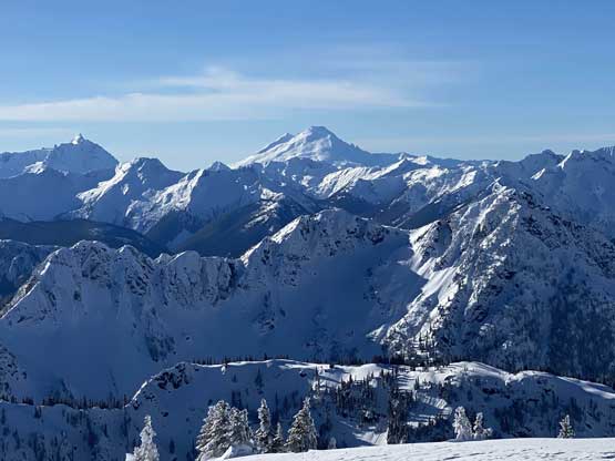
Welch Peak and Foley Peak stole the show

The double summits of Hozomeen Mountain

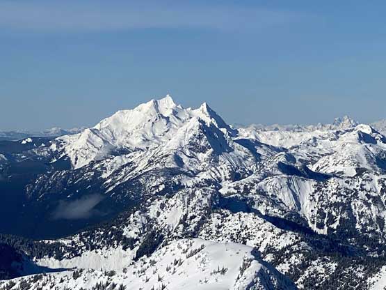
Hard Mox behind Easy Mox – two of the harder Bulgers in Washington
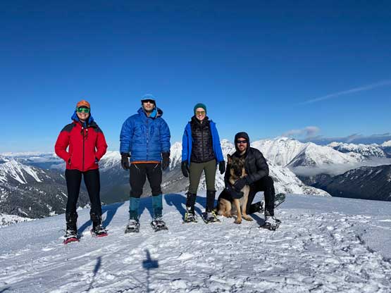
Our group shot on the summit of Thompson Peak
The other guys decided to opt out for Mt. Daly but I wanted to keep the two-peak plan (especially given the stable avalanche conditions), so I started the descent earlier than them. Following our tracks back down the ridge was pretty easy and once down to Thompson/Daly col I bailed off the track for Mt. Daly.
Mt. Baker dominates the skyline in front of Mt. Edgar
Descending the upper south ridge
Retracing our own snowshoe tracks
Another view of Whitworth Peak and Finlayson Peak
Descending towards Thompson/Daly col
