Portal Peak
July 13-14, 2013
2911m
Wapta Icefield, AB
I have to thank Marko and Paul Zizka for providing detailed trip reports finally indicating Portal Peak as being a scramble. It’s probably the least popular peak on the Wapta Icefield. The reason is simple. It’s not a ski ascent compared to the other classics, and, it’s overshadowed by the higher and bigger neighbour, Mount Thompson. However, after finishing this ascent, I have to say that it deserves more attention. Even just the approach via the scenic Iceberg Lake deserves a visit, not to say the endless hands-on scrambling this peak offers. The rock quality is bad, but experienced scramblers will find this ascent enjoyable.
With some last minute cancellations, our objective of this past weekend got downgraded by several degrees. It was a perfect weekend for mountaineering ascents, but I enjoyed this trip very much and that’s enough to make me satisfied. It was down to just Ben and I for a day trip on Sunday, and being weather wise, we were looking at a scramble around Lake Louise area. Our objective will be this rarely ascended peak on the edge of Wapta Icefield, and if weather allows we would get Mt. Jimmy Simpson as well. After some detailed planning I figured the best way to get them both is by a high level bivy on the ledge system below Portal Peak. We left Edmonton at 3:30 pm, and started our trek at Num-Ti-Jah Lodge parking lot by 9 pm on Saturday.
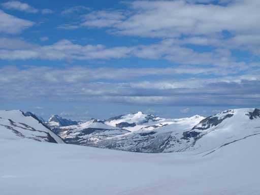
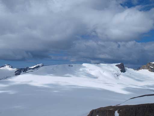
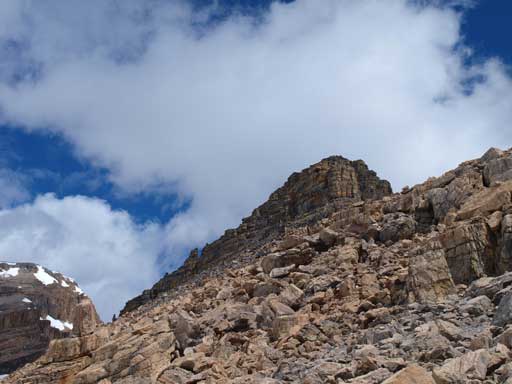
Portal Peak scramble route
The only trip I’d done in this area in summer is Cirque Peak, and this would be my first time on west side of Bow Lake when the lake isn’t frozen. The approach direction is pretty much the same as the winter approach, but we did see some slightly differences. Obviously we had to walk around the lake which adds extra distance. But still, it was faster than snowshoeing across the lake in winter. And once around to the other side, we followed a path through the moraines towards a distant staircases. The route goes up this staircase on climber’s right side of the 1st canyon. In winter, the ski route goes high on climber’s left side avoiding this canyon. Not far up we came to a trail junction and we would pick the right branch towards Bow Glacier Falls, and we would be following it down until out of the trees.
Interesting stick on the lakeshore

Ben hiking up the staircases
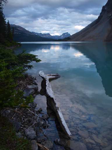
The last bit of sun on Vulture Glacier
Our plan was to gain the high level ledge by following Marko’s ascent route. From here it was obvious where he went up so we aimed for that general direction. We managed to stay mostly out of the bush, and slowly worked our way up the steep terrain. The darkness was about to fall in short time as we encountered difficult scrambling here and there. I also underestimated how high we had to go up before topping above. Apparently this route brought us high above the Iceberg Lake, and once we were finally out of the difficult terrain we thought it was better to just keep going up the ledge until dark. At about 11pm or so, we came to a relatively flat spot and bivy. I wouldn’t forget to bring sleeping pad next time as I didn’t really enjoy the rocky ground.

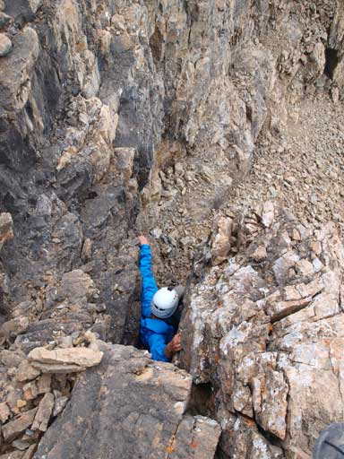
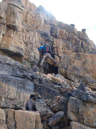
Ben scrambling up some difficult scrambling terrain. It’s not as dark as it looks from this photo.
At 4 am on Sunday morning, we woke up under cloudy skies. Oh no!! Our plan was to get up early, hike up Mt. Jimmy Simpson and watch sunrise at that amazing viewpoint, but with all of the clouds there’s no point, and we woke up at 6 eventually. We still wanted to get Mt. Jimmy Simpson so after quickly packing we were on the way up. At about half an hour we realized that it might not connect from our big ledge to the ascent gully, and we certainly didn’t want to make all the way up to false summit and get cliffed out there. I do believe we could find a way down but we would lose elevation and it would consume a lot of time. With the afternoon thunderstorm in forecast, we decided to bail Mt. Jimmy Simpson and focus on our primary objective, Portal Peak. It was a tough call since Mt. Jimmy Simpson was right there. In retrospect, the weather stayed on our side so had we continued we would get both. But I still think we made a good call because we didn’t want to take a chance and get caught on Portal’s difficult terrain in a nasty storm.

Probably the best morning photo I got..
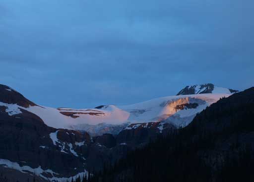
Alpenglow on Mount Thompson

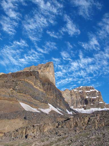
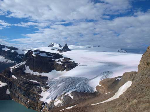
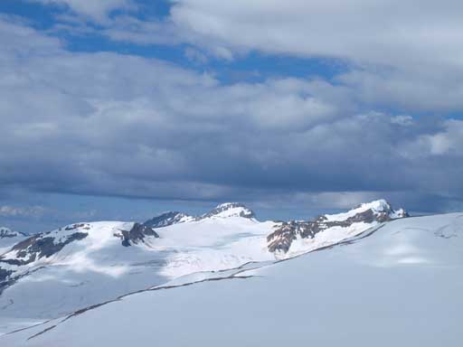
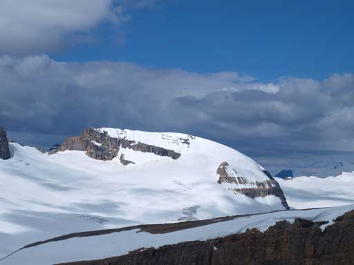
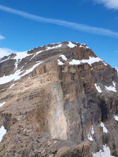
Our objective, Portal Peak
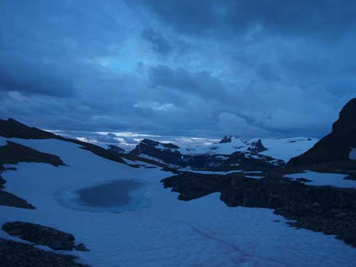
View from near our bivy site
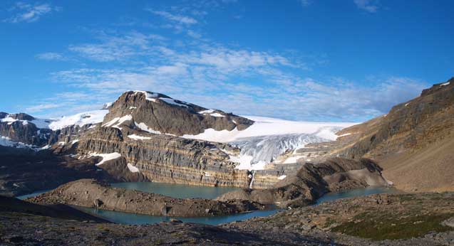
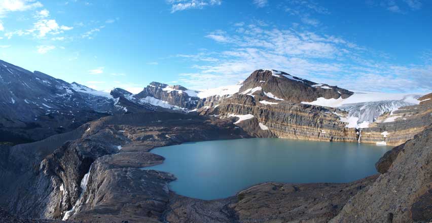
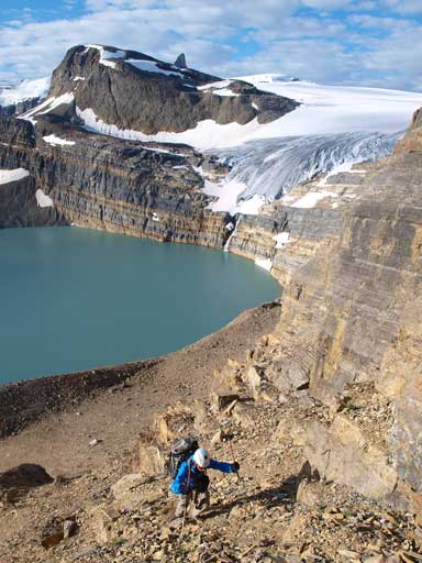
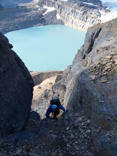
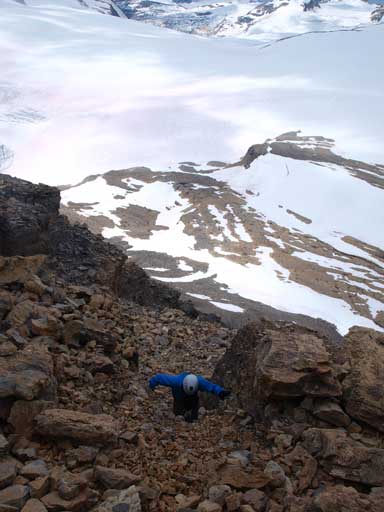
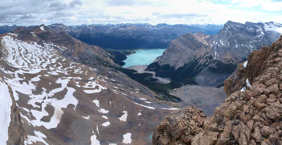
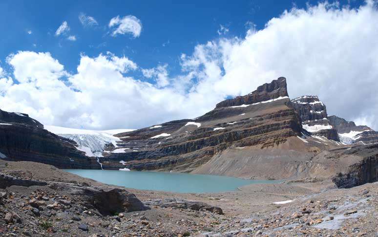
The elevation loss back to Iceberg Lake was massive and frustrating since we knew we’d gained all of them back. The terrain also got bouldery at places and our progress wasn’t fast. However, we did get some nice morning views of a couple alpine tarns. Once around the corner, we finally could see the gorgeous Iceberg Lake. It was my first time seeing it so closely, and oh man, I think this is a must-visit lake in the Rockies. It’s so unique that you won’t find a similar one easily. The morning light was also the greatest for photographing it. We only needed to lose elevation to the smaller lake, thankfully, and once walking around that smaller lake, we could finally focus on the fun scrambling ahead.

An alpine tarn on our way down towards Iceberg Lake

Looking down to Iceberg Lake and a smaller lake

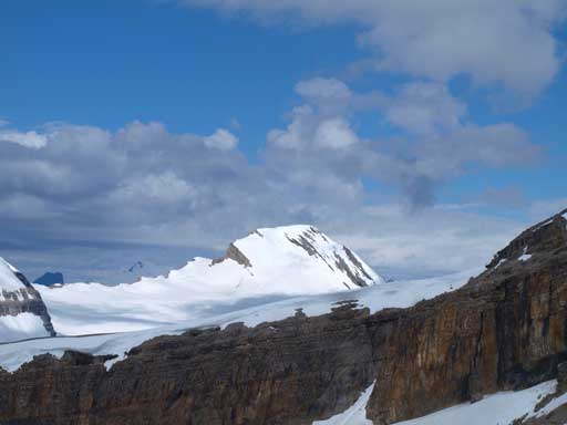
Sunlight shone on Portal Peak
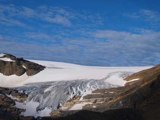
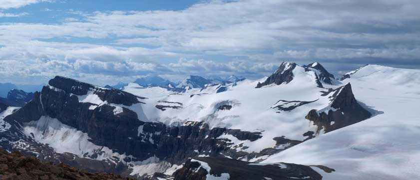
Bow Glacier
Portal and Thompson
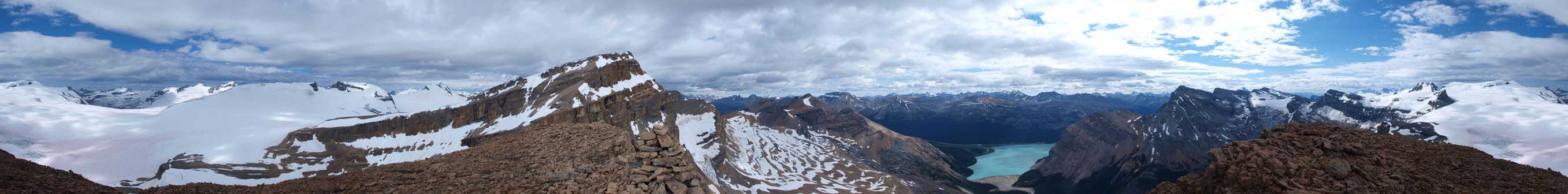
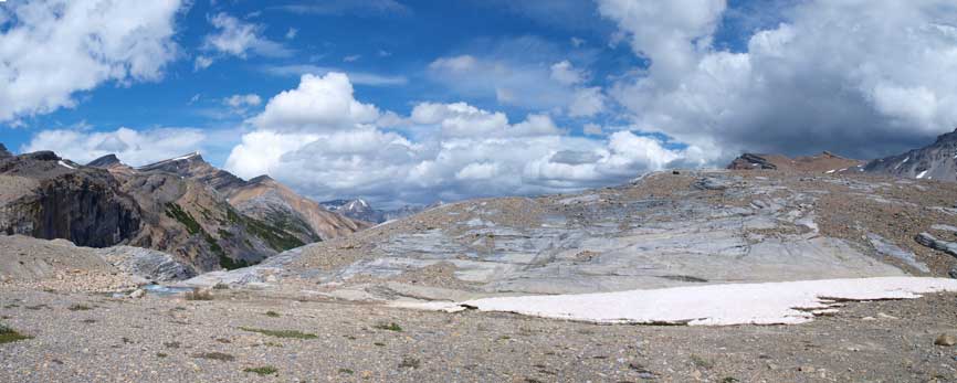
Panorama of this area
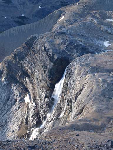
What a view of Bow Glacier Falls
Panorama of the Falls, Iceberg Lake, and Bow Glacier
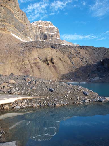
Thompson and its reflection in this smaller lake
The smaller lake

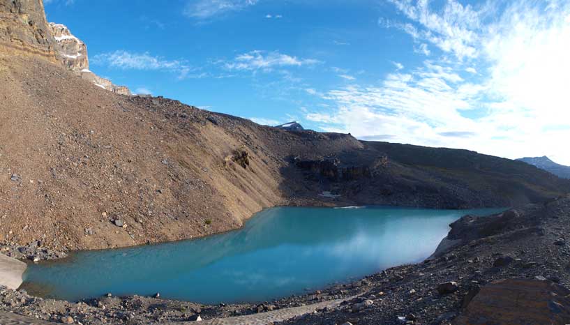
Iceberg Lake
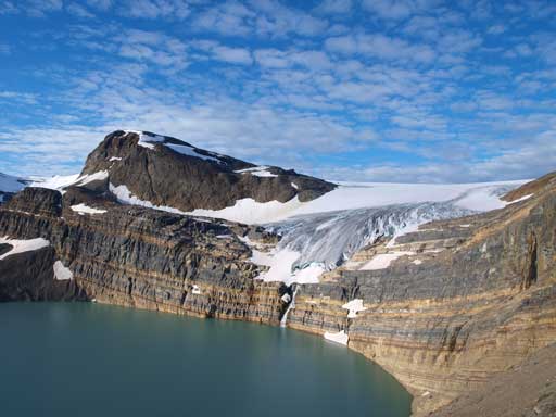
Bow Glacier and Iceberg Lake
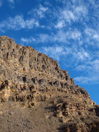
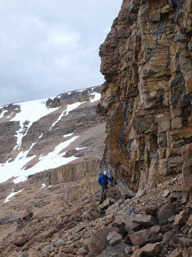
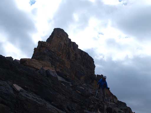
Looking ahead to interesting scrambling terrain. Whether you’re going for Portal or Thompson, you need to go up these bands.
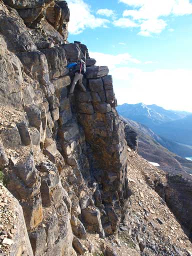
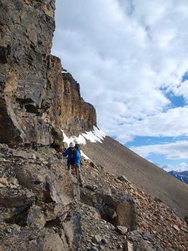
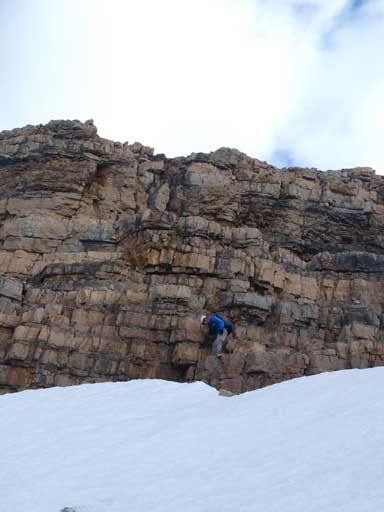
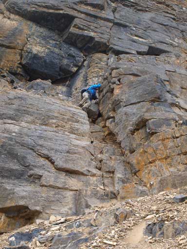
The scrambling route up through the first rock band was very clear based on Marko and Paul’s trip reports. We would slog up the loose scree and aim towards climber’s right side looking for weaknesses. Once at the base of these gullies we just followed our basic sense up. At lots of places it was difficult scrambling, and the terrain was loose. Most of the terrain is scree covered ledges, and some of the ledges aren’t that stable neither. Coming through this band is the crux for this ascent, and once through, we trended climber’s left aiming for less steep terrain through another cliff band, and after that we were looking at the long diagonal traverse section. The looseness of this mountain makes it an ideal ascent for a 2-man team. It would be very time consuming if you have more people going up.
The initial bit is slogging up scree, with big views behind though.

Hands-on scrambling starts now
Ben going up the typical terrain
Ben challenging a harder route
Up a gully

After a brief horizontal traverse, here is Ben coming up another step before the big diagonal traverse
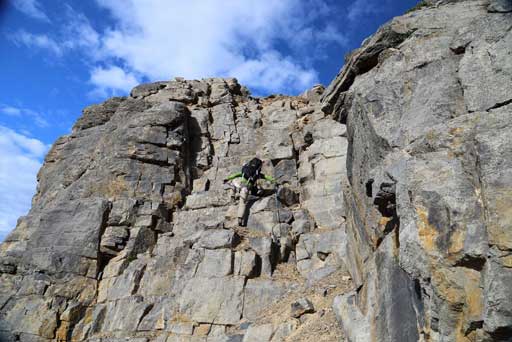
Me doing this same step. Photo by Ben N
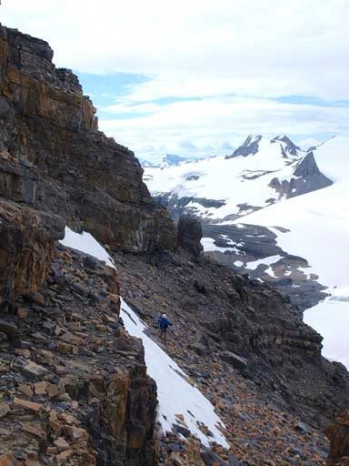
Traversing diagonally towards climber’s left aiming for a corner at the base of next imposing cliff took us longer than expected, and once around it, we got a full panorama of the Wapta Icefield stretching ahead. We couldn’t see the entire icefield from here though. I’d been up the Wapta Icefield for at least 4 times and I wasn’t too excited about seeing these familiar peaks, but it was good to finally see the icefield up-close in summer time. We would immediately traverse climber’s left looking for a break up the next band, and once through here, the terrain got easier and we could see the summit block ahead. Slogging up close, we encountered very loose terrain, but moderately scrambling only. The terrain here was so loose that it was easily to dislodge a microwave sized boulder to your partner(s), and we were extremely careful about moving one at a time.
Aiming towards this arrow. This is a critical point
Great views of the Wapta!
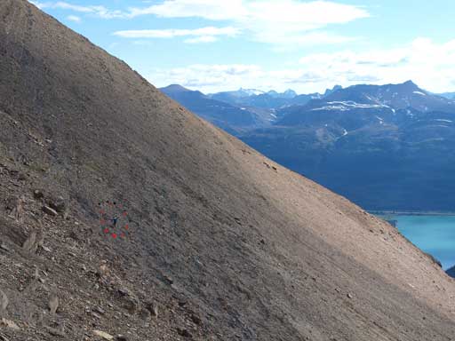
Can you spot Ben in the red circle? This bit is foreshortened.
Ben ready to traverse around this critical point.

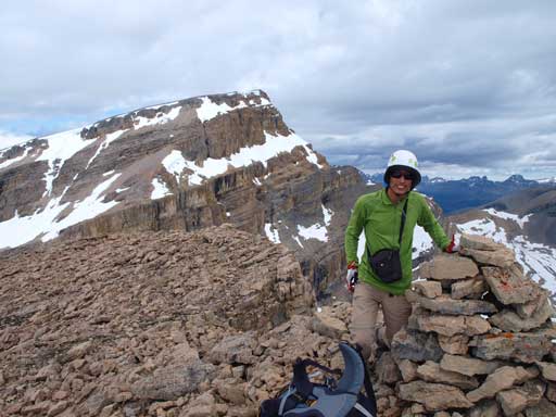
Looking ahead towards the summit block
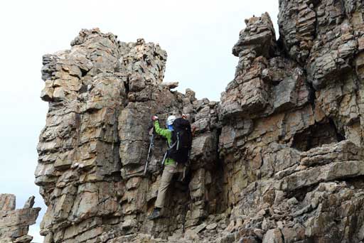
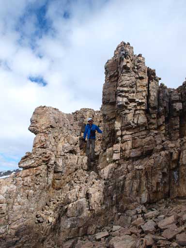
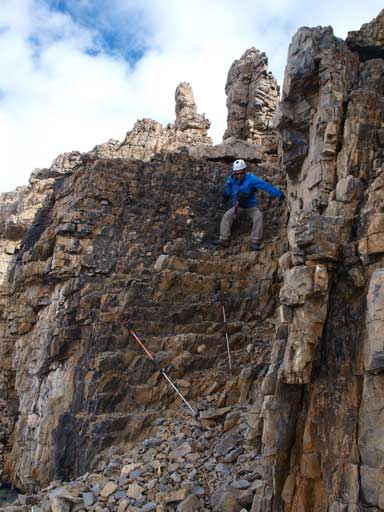
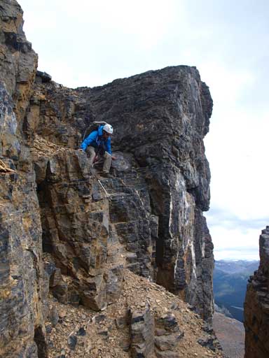
According to Paul’s trip report, the crux was supposed to be on the summit block, and also according to him, there exists an easier line from Portal/Thompson col, so at the base of imposing summit block band, we started the horizontal traverse towards climber’s left looking for weakness. We couldn’t find any until we were around to the Thompson side, where we managed to gain the next step, and then, we would soon traverse back towards climber’s right side looking for the next break. Eventually after traversing most of the way back, we found two chimneys being right next to each other, with the second one being easier. We picked the easier one. It was moderate to difficult scrambling up this chimney, and once through, we were looking at the last step, which looked to be quite difficult. At this point we were doomed there exists a 5th class crux on this mountain so we each picked a climbing line through the last cliff band. Mine being an overhanging step on good rock, and Ben’s is a vertical chimney. However, there exists a walk-up if we did look for it that we’d discovered on the way down… Minutes later we were standing on the summit.
At the summit block, we firstly traversed climber’s left to Thompson side
Mount McArthur steals the show
Up a step, and then traverse climber’s right most of the way back
Ben scrambling up the chimney on this part that probably can be rated as a difficult scramble. This is the only break up through this rock band.
I climbed up an overhanging step to gain the summit. The easier walk-up is just to the left of this photo, but I didn’t see it.
The final step, Ben took another hardcore route
Summit Panorama. Click to view large size.

Mount Jimmy Simpson doesn’t look too exciting from this angle
Vulture, Olive and St. Nick
Panorama looking East
Mount Des Poilus is now high on my list

Me on the summit
Me on the summit again.
Due to the concern with weather we started down very soon. Once back down the summit block, we decided to give the alternate descent a go, so we aimed towards Portal/Thompson col. Descending this way is indeed easier but only if you make all the way down to the col. We made a bad call of bailing down too early and ended up on some difficult and loose terrain, and once we made through we had a steep snow slope to deal with. I brought crampons up so I booted it down very quick. Ben had to squeeze through a moat since he didn’t bring cramps. I followed the snow line quickly down to the base. There’re lots of flat spots here that potentially offer great bivy spots if you plan to ascend Mount Thompson the next day. Even though we didn’t do it, I’m very confident that Thompson can be easily reached from here. Ben and I did it in winter and we had no interest in repeating that slog up the slope.
We found a walk-down route on the way back
Ben down-climbing that moderate/difficult chimney
Rhondda
Habel
Baker
Leaving the summit block behind now
Descending towards Portal/Thompson col
However, we made life harder than necessary

Panorama of Wapta Icefield
Ben ready to merge to snow. Oh wait, he didn’t bring crampons and he would be squeezing in the moat..

Panorama of Wapta Icefield again
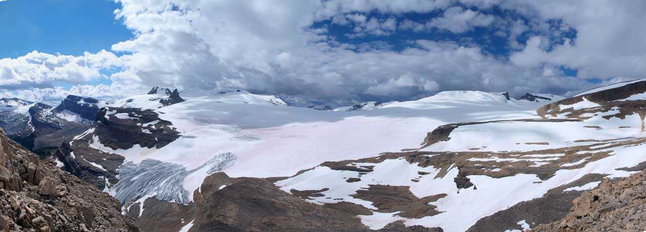
Another panorama
Looking back towards Portal’s summit block
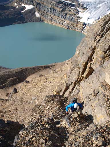
However, by doing so I needed to regain some elevation to find the critical spot to traverse back to the other face. It wouldn’t be troublesome but since I didn’t guess it correctly, I had to do some extra work gaining and losing elevation. Ben joined me shortly after. He retraced back to our ascent line and followed it down. Descending through the initial cliff bands gave me a bit more respect with this mountain. At many places it would exceed most of the Kane difficult scrambles, but assuming you have done something like Fisher Peak or Wapta Mountain, you’re very fine on this. We also failed to follow our exact ascent lines, but many lines would work. I led the way down following my basic sense and eventually we made down to a big scree/rubble slope and followed it back to the smaller lake, where we retrieved our bivy gears.

Looking down at Iceberg Lake

Me searching for a way down. Photo by Ben N
Descending through the first cliff band
Descending

And, descending
On the way back, we chose to cross the outflow of Iceberg for some change of scenery. We did make a good call as it was very beautiful around that lake. The fording was only knee deep and wasn’t as cold as expected. We would soon pick a trail on the other side, and followed it back to to the Bow Hut approach trail. And once through the first canyon, we were back to the familiar slog across Bow Lake. It went quickly and it was an enjoyable trip in the mountains.

It’s funny to looking down at tourists from Iceberg Lake, while most of them don’t even know the beauty up here.
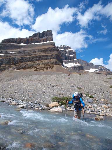
Ben fording the outflow

Gorgeous view of Iceberg Lake’s out flow stream

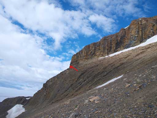
Portal Peak with our ascent route shown (roughly).
Panorama of this lovely area.
Iceberg Lake and Portal Peak

Jimmy Simpson in the background. We’d already left the lake now.

A faint trail goes down the crest of this moraine ridge.

Neat water in the first canyon
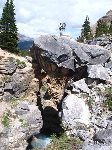
The traditional route to Bow Hut goes over this boulder.. What a place to cross the stream!
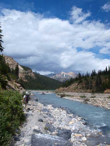
Back to the familiar slog. The Bow Lake…

A black bear on our drive home.

[…] it might be out of reach. In July 2013, Marko Stavrik posted an attempt which Ben and Steven used to make a successful summit bid in 2014. Their reports, along with a fairly detailed trip […]
[…] hikes in the area are The Onion, The Bow Hut, Iceberg lake or follow the Portal Peak route trail to the top although shows on the trails map but can’t find the actual west side […]