Scarped Peak
June 10, 2021
1802m
Lytton, BC
“Scarped Peak” is the unofficial name that refers to the highest point in Scarped Range which is rather just the southernmost sub-range of Clear Range. This peak looms directly above Thompson River and the town of Lytton for almost one vertical mile but the profile of the peak is rather dull and uninteresting. There are trees on the summit, and because of that it had been logged on all sides to pretty much the very top. This peak boasts over 600 m prominence but despite that, there had been zero “beta” online. Through browsing maps and satellite images it was not difficult to spot a route that comes up from the west from Botanie Lake, but who knows how far up I could drive on those roads. Nobody would go in there to make a road report and I convinced myself that the only way was to face the unknown myself. The satellite image does show the roads being reasonably clear so I hoped it’s been secretly maintained by the locals in Botanie Valley and Lytton.
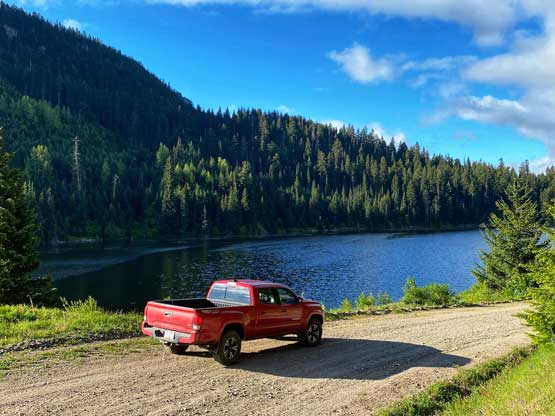
As for most peaks in this rainshadow region the only “window” that makes sense is when the weather is not so great in the coast. This happened to be the case on this Thursday. I made the spontaneous decision to drive out alone to check out the access despite that I definitely needed to be back home at 3 pm for work. I figured that if I were able to drive to within 2 hours of walking from the summit I could push it through the night, bag the summit and still get back in time. The best case scenario would be to drive to within half an hour’s walking distance from the summit, but I was not counting on that. I left White Rock at 10 pm after work on Wednesday night and made to Lytton 3 hours later. The drive into Botanie Valley (~20 km) was very smooth that I could cruise at 60 km/h.
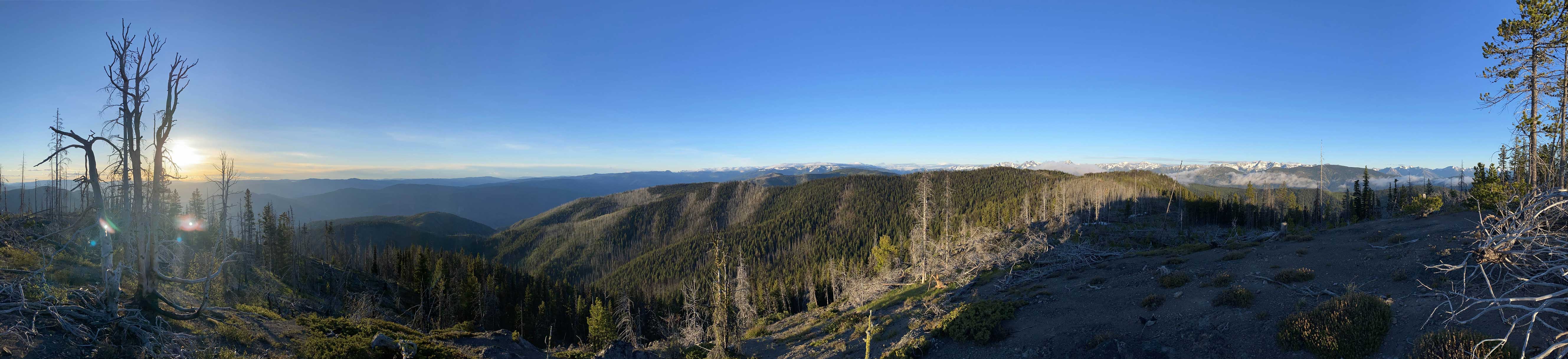
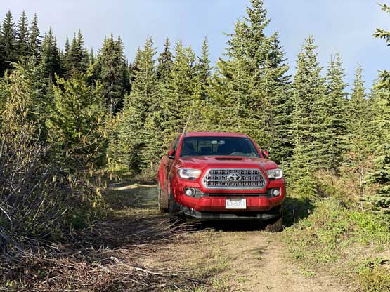
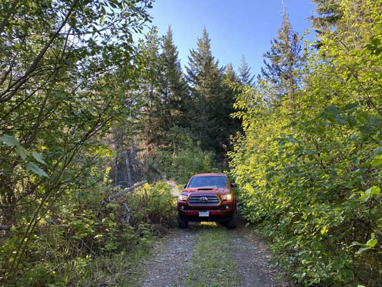
I correctly located the spur road that would shoot a long ways due east down along Skoonka Creek and I immediately knew I was in for some adventures. The road was much narrower than expected that within a kilometer I started to encounter bushy sections, but the road’s bed wasn’t bad and I could definitely see fresh signs of maintenance such as fallen logs being cut in half. I kept thinking that even turning around on this road could be sketchy if not impossible on some stretches but I believed in those signs of user-maintenance and kept pushing. A while later the road started to climb up again gaining elevation rapidly and at the next important fork I picked the right branch even though that’s the smaller road. The left fork would eventually lead onto the NE Ridge but I feared the pick-up-sticks situation would be horrendous on that ridge. The right fork would do a much longer corkscrew route to the south ridge but the road goes mostly to the summit from the south side. I kept thinking that my trip would soon come to an end but the road just kept delivering. I did have to get out to deal with a small fallen alder and also to inspect a particularly deep ditch. The alder was easily moved and and ditch did not impose much of an issue to the Taco. After the ditch the road started to gain elevation rapidly and the grade had become insanely steep in one particular spot. I pushed through that and onward. Eventually I crested the SW Ridge of Scarped Peak and made a descent to the east side but that’s as far as I could drive to without a chainsaw. It’s clear that ATVs had driven around a fallen tree but such was impossible for the long bed Taco, so I made a sketchy turn around and parked. I estimated I was about 4 km from the summit with hardly any elevation gain, so decided to take an hour nap to start hiking at daybreak.
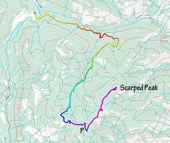
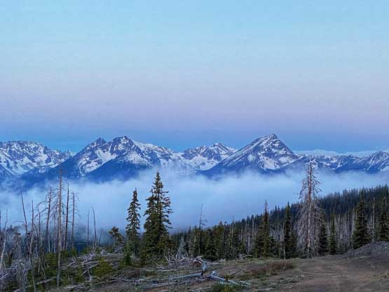
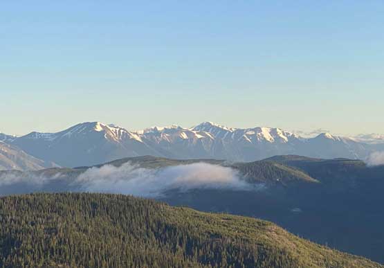
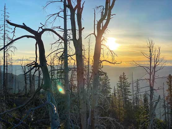
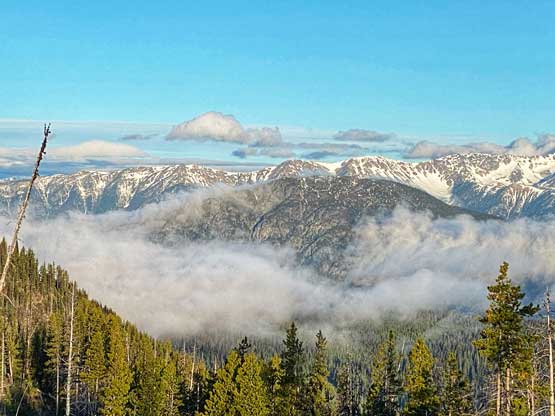
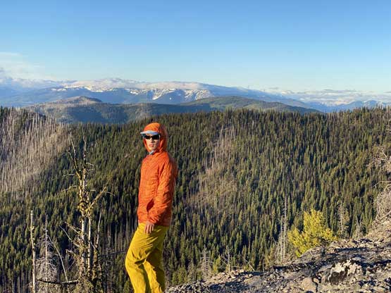
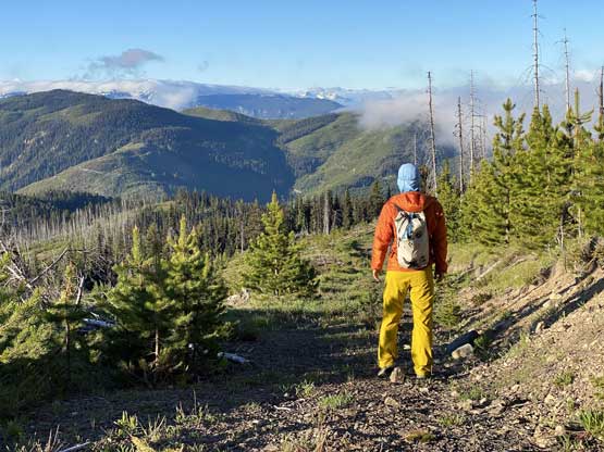
I started hiking at around 4:40 am and easily followed the road to the southern sub-summit at near sunrise. There were some up-and-downs on this road. I estimated the sunrise would be 15 minutes later so I left this precious viewpoint and walked towards the “south summit”. The contours on my map showed this “summit” having the exact same elevation as the north (true) summit and that was too close for my comfort, so I bushwhacked through dense pick-up-sticks to the very top of this “peak”, disappointed to realize this was a much worse viewpoint for sunrise. Nonetheless I took some photos as there’s no going-back in decision-making.


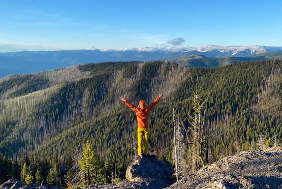
I then followed the road descending ~30 m and re-ascended it towards where the real summit was located. The road disappointedly came to a dead end a few hundred horizontal meters from the very top and what laid ahead appeared to be a tangled mess of pick-up-sticks. But once sticking my nose into the dead-fall field I realized it’s not nearly as bad as I thought. I managed to find a line without much of resistance on the far left side. The summit offered much better view than the forested “south summit”.


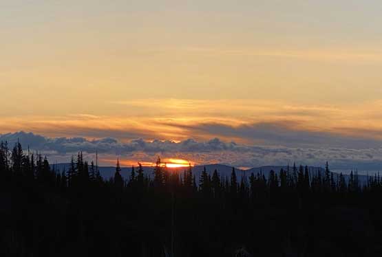
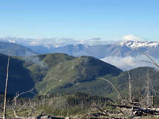
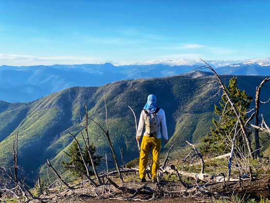
On the way back down I explored another line more on the southern edge of this dead-fall field and it worked out greatly as well. The rest of the plod back to my truck was rather uneventful and I have to say the views were pretty damn good from up on this ridge but that was because the expectation was low. I thought about to have a warm breakfast but decided that the top priority was to drive the hell out of this place. I worried that if some logs fell across the road then I would be fucked as I did not even have a chainsaw. Thankfully the drive-out wasn’t too bad. I also did not meet anybody near Botanie Lake as I did believe that they would not appreciate me being there. While driving down Botanie Valley Road I got chased by one aggressive dog. I also met one massive truck going up but that’s already near the very bottom of the road. We waved at each other and resumed driving our respective ways.


I was doing pretty good on time so took my time cooking a ramen breakfast somewhere between Lytton and Boston Bar. I did not encounter any COVID road-blocks that were rumoured to be north of Boston Bar. The rain started once I drove into the small town of Yale and that’s also where I became too tired to drive. I pulled over on the roadside and took an hour’s nap. I eventually made back to White Rock at 12:40 pm right in time for lunch, and even earned myself another short nap before the afternoon work.
