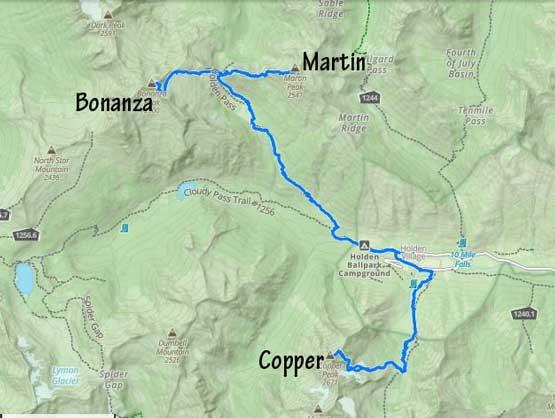
Copper Peak (Holden, WA)
August 7-8, 2022
2732m
Holden Village, WA
Copper Peak is connected towards the taller neighbour, Mt. Fernow and in fact I would say the two peaks along with Seven Fingered Jack form one massif with Mt. Fernow being the true summit. Copper Peak does boast over 100 m prominence above Copper/Fernow saddle hence it’s included in both Bulger and WA’s Top 100 lists. The connecting ridge between the two peaks is too rugged to be traversed. This peak does get regularly climbed from Mt. Fernow but the route is contrived with significant amount of elevation loss and regain on rough terrain. The standard route goes up from Copper Basin which is accessed from Holden Village, but doing Copper Peak from this side means it’s an entirely separate climb from Mt. Fernow’s standard route. From the village this peak requires over 1700 m elevation gain. Basically no matter which side one chooses to climb Copper Peak from there’s substantial amount of work involved, and considering this peak’s low prominence value it’s obvious why this peak doesn’t get done often. Those who intend to finish the Bulger list need this peak and that’s about it.
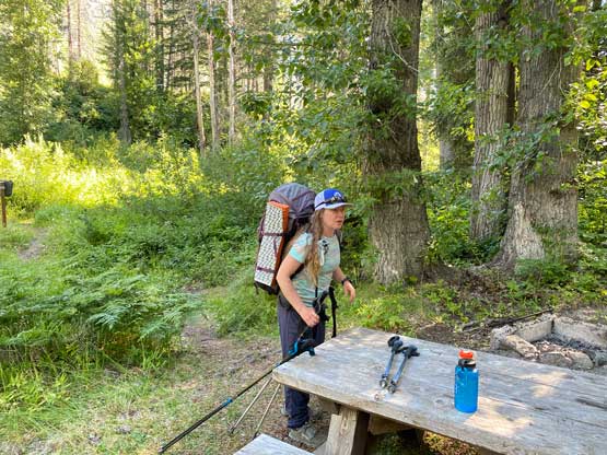
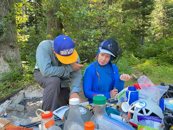
When I agreed to join Selena and Max on Bonanza Peak and Martin Peak over 4 days I wasn’t thinking about to add Copper Peak in, but we somehow jacked up the ambition to do all three, despite having one day less than the “standard” time required. I wasn’t super stoked but once the decision’s made we had to stick to the plan to make it happen. On the 3rd day we woke up early, dashed down Holden Pass trail and made back to Holden Ballpark campground at 9 am. We spent about an hour there to repack and eat. I decided to carry my mountaineering boots while wearing trail runners, and squeeze all the needed gears into my ridiculously small Black Diamond pack. I somehow managed to fit things in, but had to dangle the two boots outside. We did not bring a rope for Copper and did not regret this decision even though there were some quite exposed moves on the summit ridge.
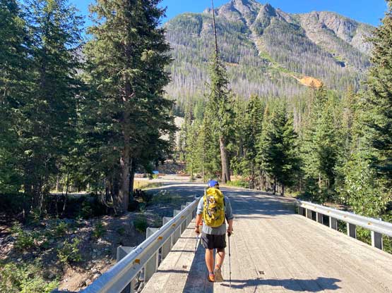
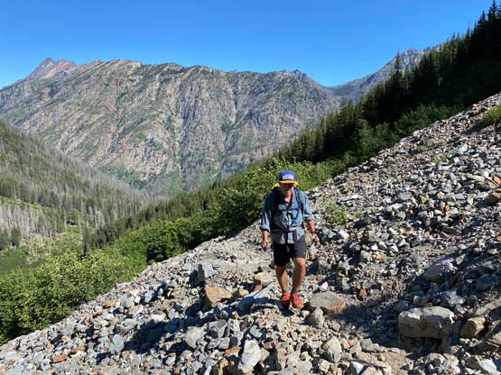
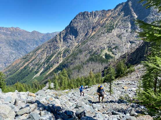
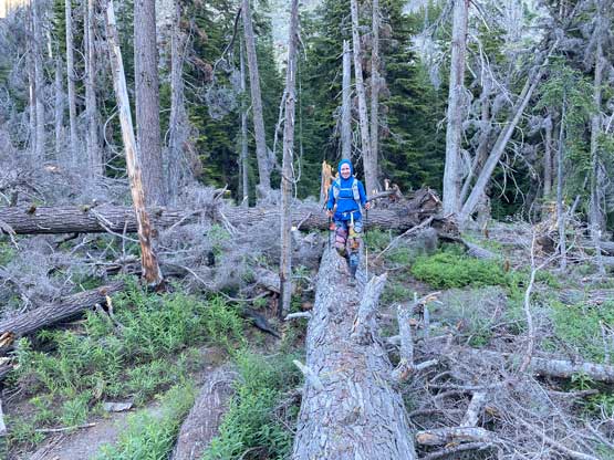
We then walked back towards Holden Village but didn’t have to go into the actual village. There’s a trucker’s bridge and a gravel road leading into the mine on the south side of the village. We walked past the mine and then onto the “tailing bypass trail”, but right at the start of the trail Selena and I got stung by bees. Max was leading in front and luckily escaped from the bees. We walked along this bypass trail traversing horizontally for another annoying kilometer before finally starting the elevation gain. The trail leading into Copper Basin was actually better than expected with minimal dead-falls nor overgrown stretches. The elevation gain was also quite steady and there was minimal elevation loss along the way. Near the end of this trail we opted to ascend all the way into the basin (finally some blowdowns) and waded across the creek. After fording the creek we finally decided to take a break ditching some gears including my trail runners. We still had over 1000 m elevation gain to the summit on mostly rough and slow-going terrain.

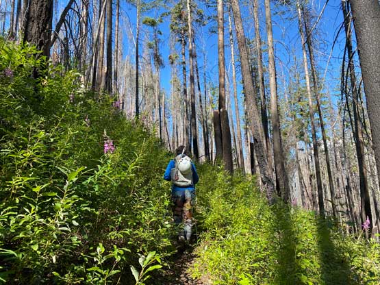
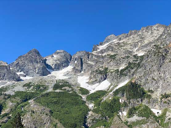


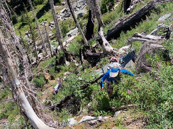
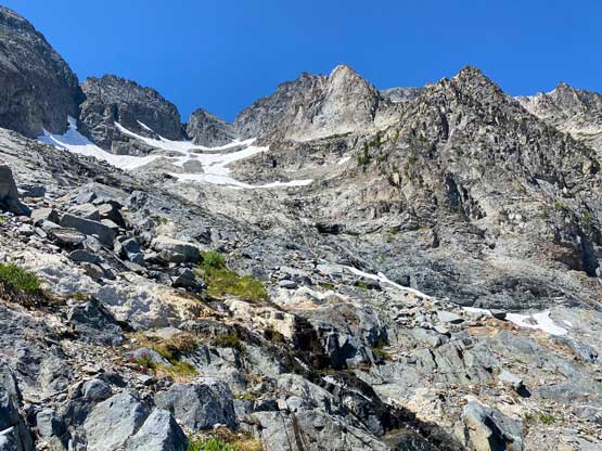
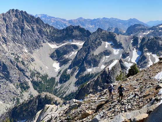
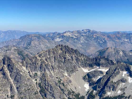
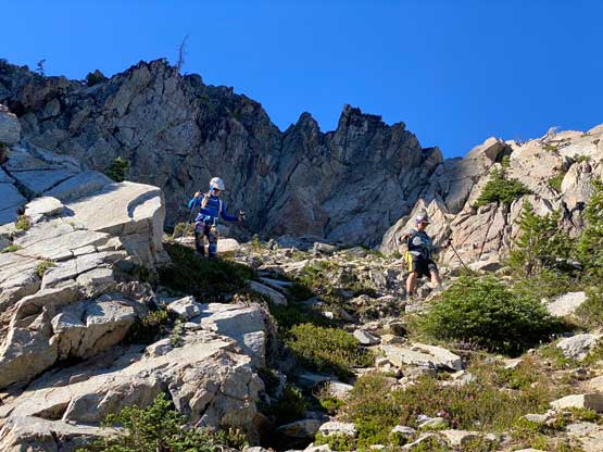
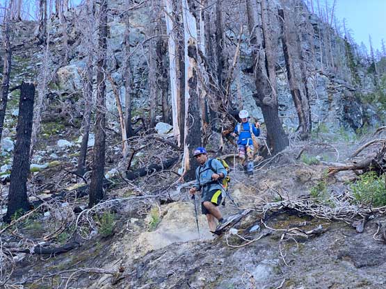
The first stretch was a horizontal traverse due NW while maintaining elevation. It was very difficult to maintain elevation so we were constantly doing up-and-downs on the micro scale. This was the only “bushwhacking” stretch but the brush was actually not too bad. After a while we entered a boulder field, crossed it and the started the straight-up ascent of a burnt forest. The burnt forest brought us to a wooded ridge. We then turned left and ascended this ridge to the base of a wall. Once there we traversed under the wall on either slabs or heather slopes into what I would call the “lower basin”. Ascending out of this lower basin on moraine and boulders was uneventful but very tedious.


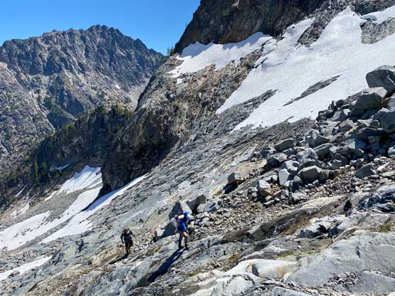
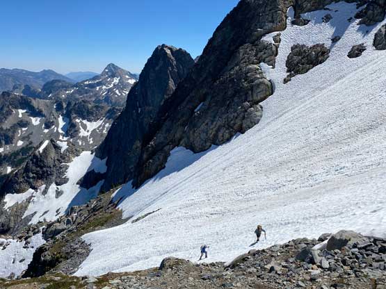
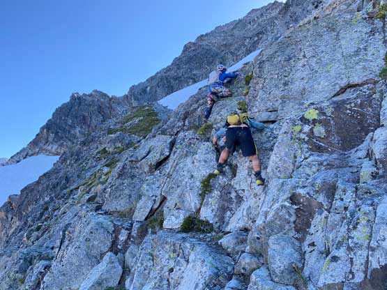
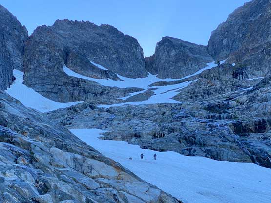
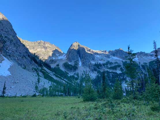
Above the lower basin we came to the first patches of snow and here we faced some route-finding decisions. I opted to lead us up the rock but later in the day we all descended the snow. The rock option wasn’t as great as I thought with lots of loose rocks and harder-than-expected slabs but still, we made efficient work on the ascent. Between the two stretches of rock slabs we still had to traverse across a (steeper) field of snow. After ascending the section (harder) stretch of rock slabs (class 3) we traversed another snow field rightwards and then ascended a uber-steep heather gully towards a notch feature on the right hand side skyline. Above the notch we scrambled up the ridge for a short period and then traversed farther rightwards towards the next ridge line which would be the final summit ridge. This uppermost traverse zone was complicated with more snow slopes steep enough to warrant the use of ice axes, and class 3+ scrambling on loose rocks. The route-finding wasn’t very obvious neither but with a preloaded GPS track and our experience I think we nailed the route pretty well. We also took some longer breaks as we were getting tired.


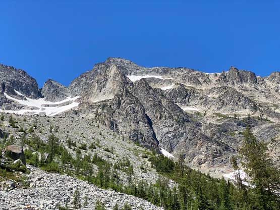
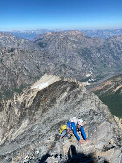
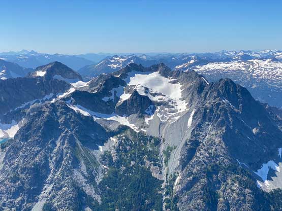
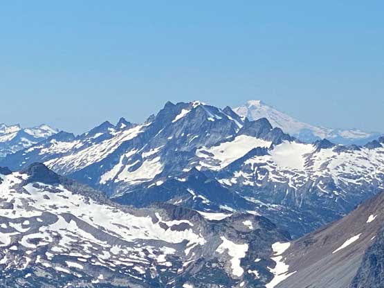
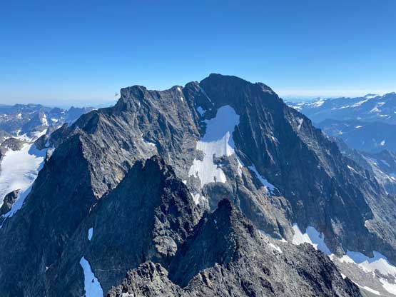
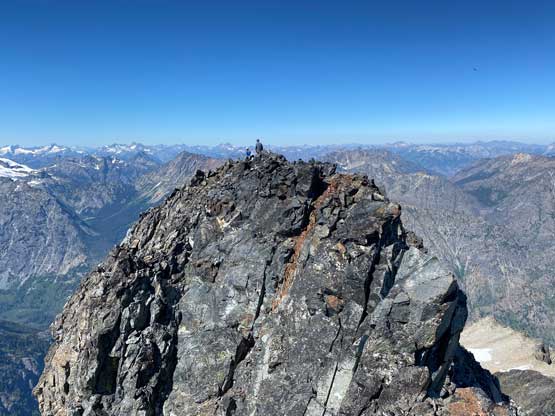
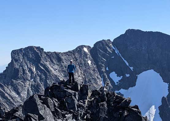
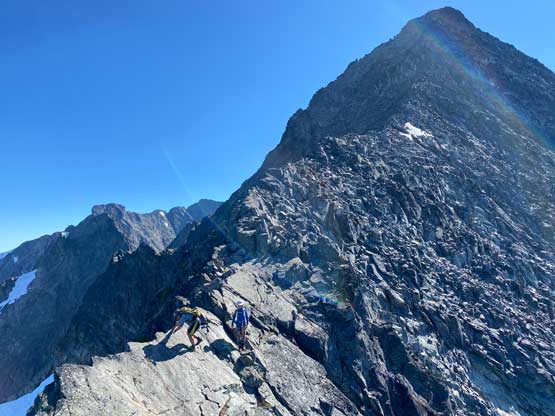
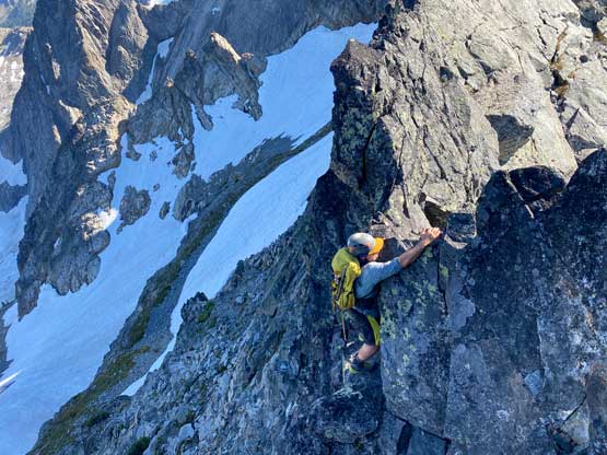
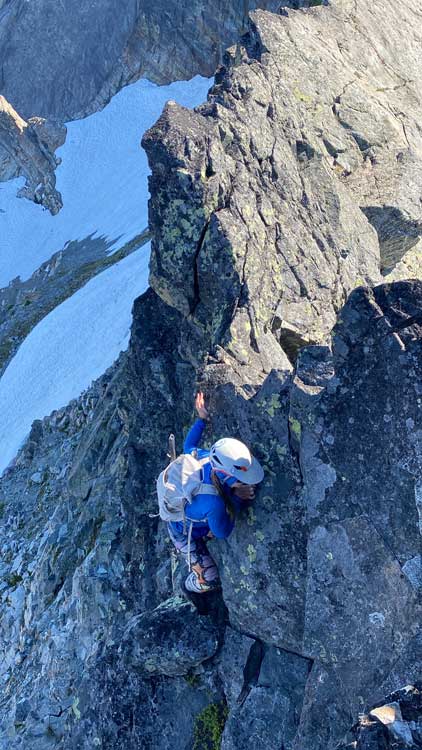
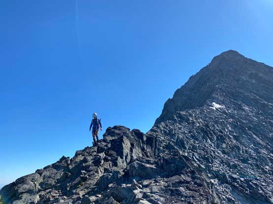
I did not come here with lots of research so I wasn’t aware the actual crux would be the summit ridge itself. I thought we would then have a nice and easy stroll to the top but the reality was the opposite. The crux came at an unexpected notch where we must down-climb an airy, class 3+ move on questionable holds. The lower parts of the summit ridge was actually quite easy, but the higher we ascended the steeper and more complicated the ridge became. The scrambling was sustained 3rd class with lots of steps of 4th class thrown in as we weren’t paying too much attention to stick to the easiest path. I think we detoured onto climber’s left (south) side of the ridge only once or twice but did a lot of scrambling on the climber’s right (north) side. The summit also had a surprise. Despite the register being located on the first high point we could see another contender further down the ridge. It’s difficult to determine which was the highest one by visual inspection. The scrambling looked involved but I was determined to check out that high point for completeness. The ridge turned out to be class 4. From this farther summit I got some much-better views towards Mt. Fernow and the jagged ridge connecting towards where I was standing on.


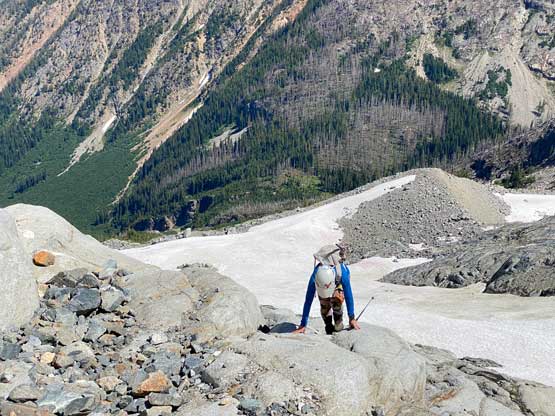
After about half an hour’s lingering we had to descend as time was getting on. We all gingerly down-climbed the ridge and it definitely took a long while. We then tried really hard to stick as close to the path we took as possible down the numerous traverses across numerous bowls. I then made a spontaneous decision to see if we could traverse onto the “grand central snowfield” higher, without having to down-climb the 3rd class slabs. The answer was yes but with a few tricky steps. After managing the rock-to-snow transition I took off boot-skiing that entire slope bypassing both stretches of slabs. We then tediously descended the moraine off the “lower basin” and the burnt forest. The bushwhacking traverse back to the creek crossing wasn’t too bad but completely avoiding brushes wasn’t possible. The rest of the descent was rather uneventful asides that Selena got a massive bruise from hopping across a log on the trail. We eventually got back to camp just about the need to use head-lamps and that concluded a massively exhausting but satisfying day.


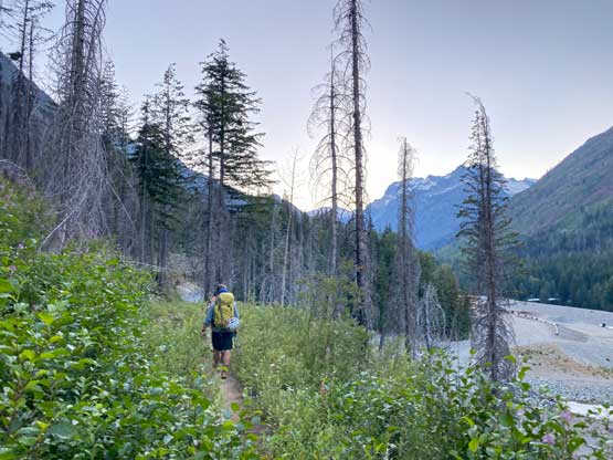


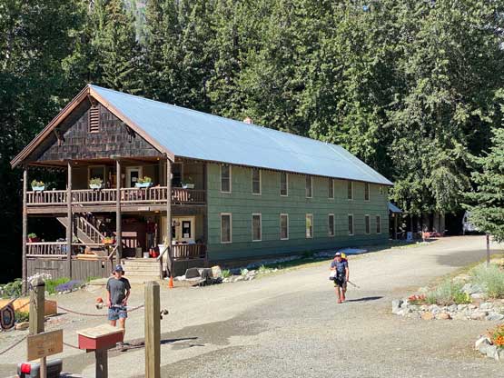
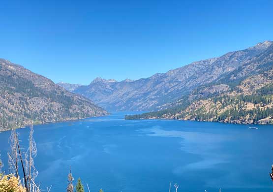
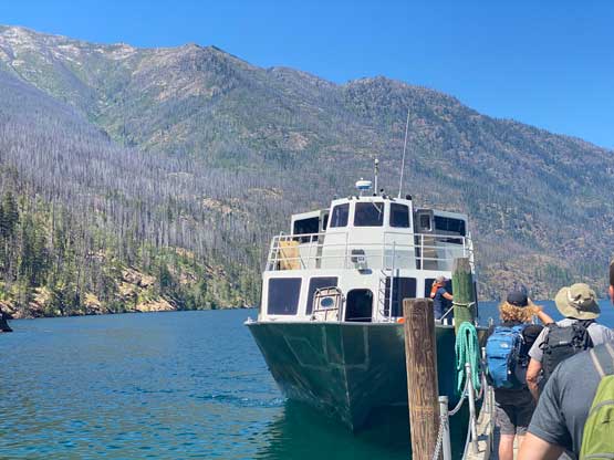
On the 4th day we all had a lazy wake-up and then easily walked the 1.5 km distance back into Holden Village. We surprisingly bumped into another group. One of them was Eve with trip reports that I had been following for a few years so it was great to finally meet each other in person. They had just completed Tupshin, Devore and Flora and we would share the same bus and boat rides back to Fields Point landing. The outwards journey involved less waiting at the transitions but still took a few hours. The best part of the 4th day was taking a dip into Lake Chelan and that was hands down the best swim I had ever had. The rest of the trip involved a shit ton loads of driving, firstly back to Selena’s home in Issaquah and then back to my home in White Rock, BC. I eventually got back at 10:30 pm. In conclusion we pulled off Bonanza, Martin and Copper in 4 days but the first and last days were rather travel days.