Mount Rohr
December 16, 2015
2423m
Pemberton / Duffey Lake Road, BC
Mt. Rohr is a popular early-season ski objective immediately north of Cayoosh Pass (the highest point on Duffey Lake Road between Pemberton and Lillooet). On a clear day this summit offers some unobstructed views of the north side of Mt. Matier and Joffre Peak just across the highway, so with a very brief high pressure ridge dominating over the SW BC on this past Wednesday I was keen to head there as I hadn’t done any peak nearby the Joffre Group yet.. The problem was, I had to be back in YVR picking up my dad by around 4 pm so that limited what I could do. However, after some research (and some helps from ClubTread) I figured with a 5 AM start I could still get back in time. But of course the long drive (3-4 hours) meant I’d have to get there the previous night and sleep in my car.

Mt. Rohr ski route. GPX DL
The road was a bit slippery as expected but didn’t impose too much of a problem to my small 2WD and I made to the parking lot by 10:30 pm. The sky was clearing up but apparently it’s gonna be a cold night (-15 degrees). After catching up a few hours of sleep I woke up with a some truck sounds and high beams from behind. My first reaction was some trail-head theft going to smash my windows but in another few minutes another truck came by and they started to work around the Ministry of Highways salt shed. It’s getting close to my supposed wake-up time anyway so I just quickly ate the (cold) breakfast, and started my day at just before 5 am.
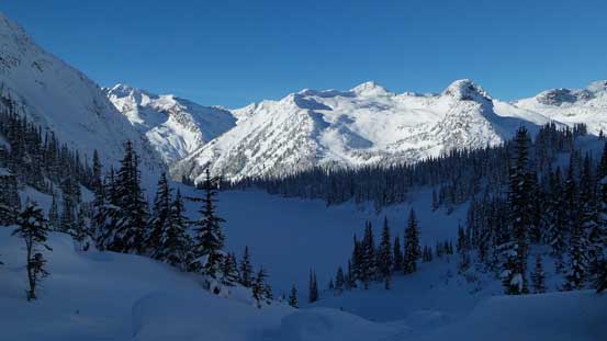
There were quite a few sets of skin tracks near the start and I immediately picked a wrong one. It led me into the bush and checking my GPS I quickly correctly myself. The correct route follows a logging road that starts 100-200 m west of the parking lot. Once onto the road it was mostly cruise sailing although a few open creek crossings were a little bit interesting on skis… I didn’t have to take my skis off though but doing so involved some risks of getting my skins iced up. About 2 km into the trip this road ended, but the trail was still easy to follow. There were at least 1 or 2 markers/flaggings for every 20 meters, so it’s nearly impossible to get completely lost. In short time I arrived that Rohr/Aspen junction sign (which I didn’t know what “Aspen” was referring), but I didn’t care as I’d follow the “Rohr” side. There were about 2-3 sets of skin tracks and I just picked the most obvious one (which actually deviated slightly from the GPX track I was using). But in the end they all led to the base of that famous boulder field so it didn’t really matter. The boulder field was fairly steep and open but the skin track was easy to follow and the next stop for me was Rohr Lake. I wasn’t 100% sure about the ice quality at this time of a year but the track descended onto the lake, so I just followed across (which looked to be much faster than skirting around). Towards the far end I lost the tracks probably due to the blowing wind and by this time it’s already getting a little bit brighter on the horizon.

Partway across Rohr Lake, looking back towards Cayoosh Mountain.
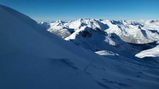
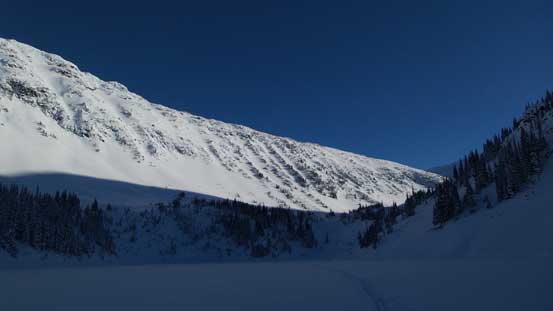
From here on the route-finding became easy as I just had to follow the broad valley upwards and onwards due south-east towards my objective. There’s one large bowl with a slight dip towards the end of that valley which I bypassed traversing on the left side without having to lose any elevation. I then went straight up the foreshortened slope on climber’s right side before cutting back left on a bench. The views were already amazing at this point and the only downside was that constant head wind plus the cold temperature. My camera failed and I had to warm it up inside my jacket which basically told it’s at least -20 degrees if not colder…
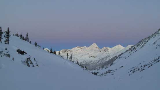
Starting to see some morning colours on the horizon

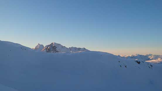
Looking ahead to the slopes I was going to ascend

Just before Alpenglow time
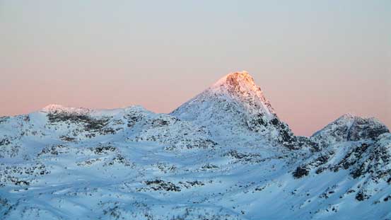
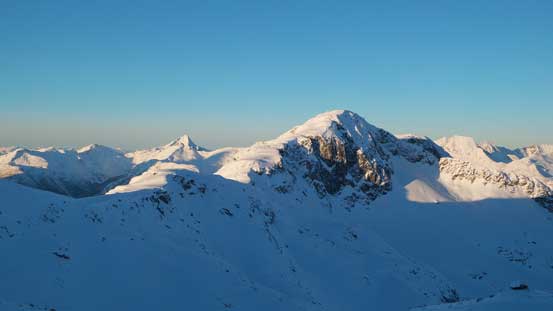
Mt. Marriott on alpenglow

Alpenglow full-on
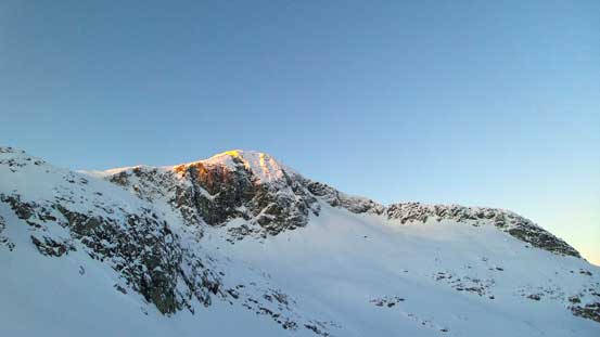
A bit of glow on Rohr W2 – the sub-peak west of Mt. Rohr
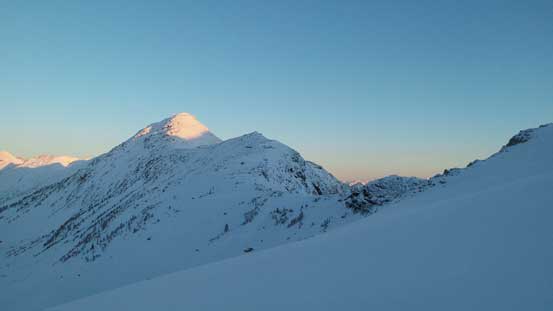
And, morning light on the summit of Rancherie Peak
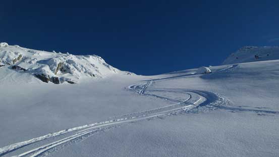
For the upper mountain I ignored the direct west ridge as the north slopes looked more skier friendly, although it’s steep at places. There’s enough snow to cover most of the boulders and I managed to skin right to the summit cairn. I went down the south side for a little bit in search for a sheltered spot. I didn’t eat nor drink anything on the ascent so I greatly appreciated the 1-hour summit stay to regather my strength in the sunshine.
Rohr W2
Finally started to see the Joffre Group poking behind the ridgeline
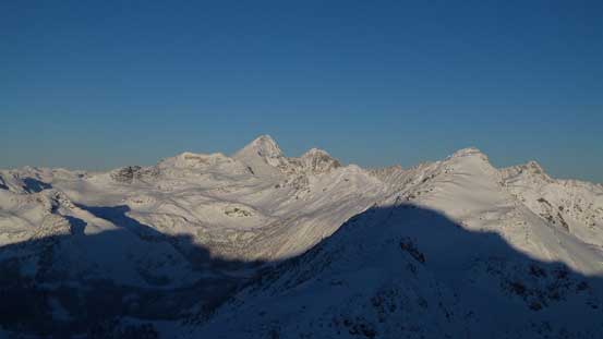
Looking back into the Marriott Basin and Mt. Marriott
Wedge – Weart – Hibachi – Currie on the skyline
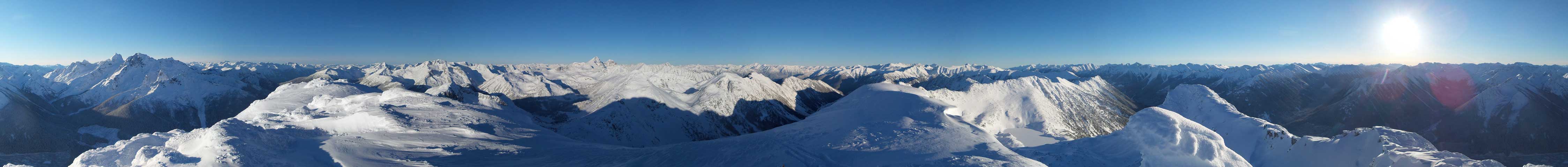
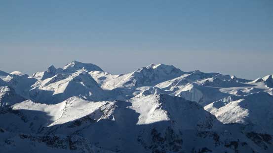
Summit Panorama from Mt. Rohr. Click to view large size.

Mt. Howard in the Joffre Group
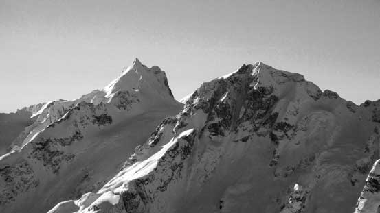
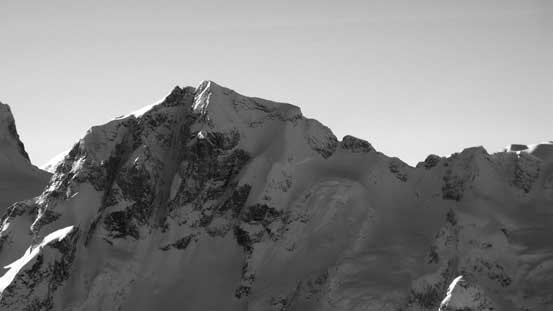
Mt. Matier (L) and Joffre Peak (R) – high on my list for the next year…
A closer look at Mt. Matier. The normal route goes up the right hand face
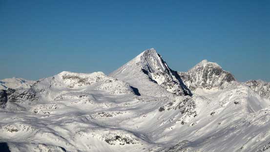
Mt. Marriott with Nequatque Mountain to its right
Wedge Mountain (L) is the 4th highest in SW BC; Mt. Weart which I bagged in October on right

Mt. Currie is the biggest peak one can see from Pemberton – also bagged earlier this year
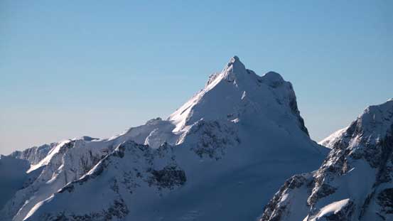
Joffre Peak with its central couloir visible. The normal route up the Aussie Couloir is on the backside

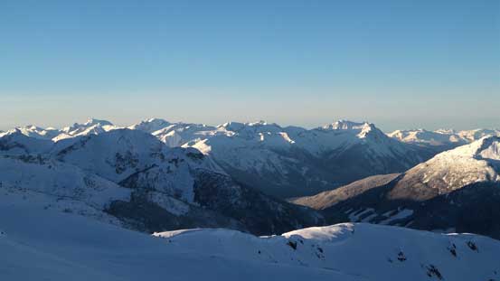
Peaks here do look like the Rockies in some way. Skihist Mountain left of center (highest in SW BC)

Tigger Peak looks interesting
The highest peak by this group is Melvin Peak – a prominent one by Downton Creek drainage

Mt. Brew is the biggest out there, left of center on the skyline

Not sure if it’s actually visible, but Mt. Seton is the highest peak looking that way

The massive Whitecap Mountain catches one’s eye from everywhere
Mt. Truax – the 6th highest in SW BC by Gold Bridge area

And, looking way to the NW towards Mt. Sampson – another huge one…

A zoomed-in view of Cayoosh Mountain – apparently a spring ski classic via this glacier

Behind Saxifrage Peak is the dome-shaped Ipsoot Mountain.

Can see familiar peaks by Sea-to-Sky Corridor, behind the shoulder of Cassiope Peak

Another look at Cayoosh Mountain

And, another look into Marriott Basin. Mt. Marriott is documented in Matt Gunn’s book

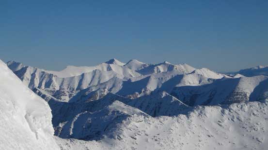
A wider picture of the Interior Zone of Coast Mountains

Wondering around the summit for more views

Looking down towards Cayoosh Pass
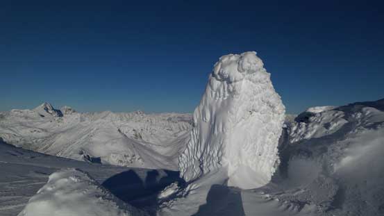
A rime-covered boulder

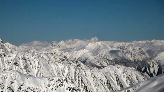
Joffre Group in one picture

Can’t get rid of the views…

Me on the summit of Mt. Rohr
Not sure if these lakes are named, to the NE
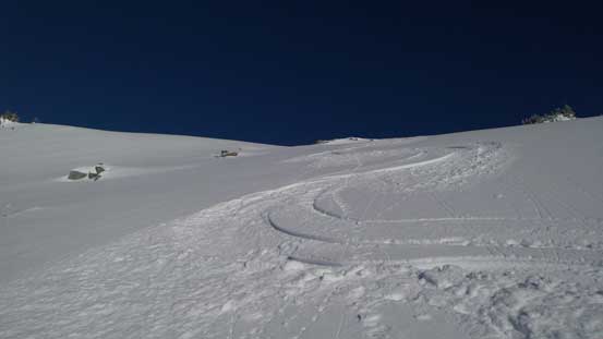
But eventually it’s time to get going. I hit one boulder on the upper mountain but overall the skiing quality was amazing. It’s even better than Iago Peak which I did a few days ago, although it’s not as steep as that run. In no time I was back into the bowls and looking at the time I decided to do another run. I figured given the perfect snow I just had to make the most use of it. The slopes just to my right on Rancherie Peak looked very inviting so that’s where I’d go next. Unfortunately I didn’t have enough time left otherwise I’d for sure go all the way up that peak as it’s looking fairly straightforward via the S. Ridge. But nonetheless, the skiing was super fun.

Time for some fun 🙂
Skiing down the upper north slopes
Trackless powder!!
Down, down..
Finally into some sunshine

Rohr W2 and some pristine alpine powder
Going up the shoulder of Rancherie Peak for more fun

That’s the slopes I was going to ski

A look back towards the north face of Mt. Rohr

A view from Rancherie Peak’s shoulder
My tracks down the slopes
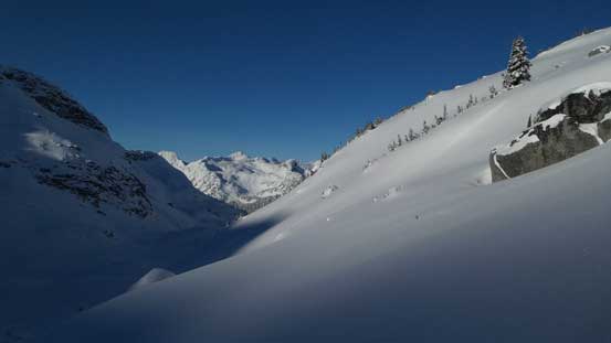
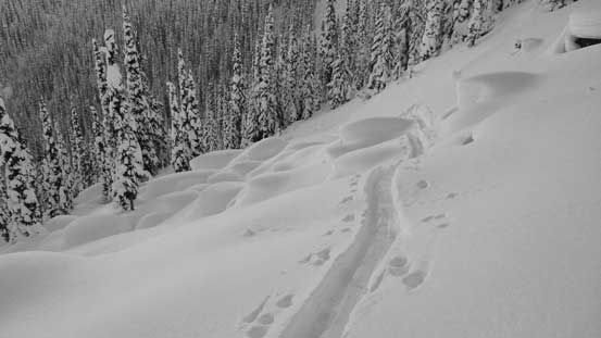
The next stage of the return through those bowls and Rohr Lake involved fair amount of flat terrain which kinda sucked, but then it came the boulder field descent which was just as fun as the alpine part. Into the trees the terrain was a little bit too icy, steep and tight for my like so I didn’t cruise down that fast. The road slog near the end wasn’t that fast neither thank to the many flat (and even uphill) sections. As a result I didn’t finish the trip until almost 1 pm which was a little bit later than I thought.
Dropping into Rohr Lake

Almost down to Rohr Lake

Partway across, looking ahead towards Cayoosh Mountain
Looking back from Rohr Lake

Rancherie Peak
Time to ski down this boulder field

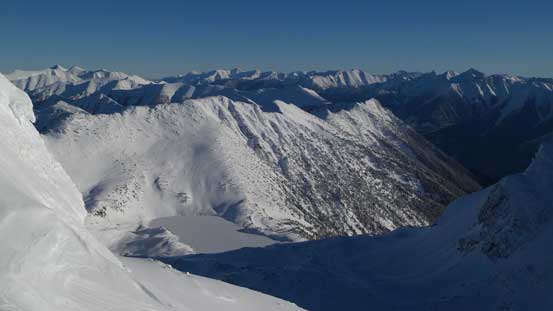
Marriott Basin
Fun time

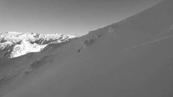
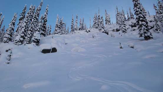
Tree skiing…

Back to the logging road

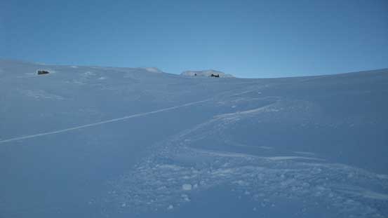
A bit of slog here as it wasn’t steep enough…
At the parking lot I was welcomed by a whole bunch of guys making some kind of movie or TV shows that explained the two trucks earlier in the morning.. The drive down Duffey Road and through the Sea-to-Sky Corridor was fast without the weekend traffic, but once into the Lower Mainland it’s a different story. There firstly came that 1-hour traffic delay by Lions Gate Bridge followed by the Downtown gong show. I ended up late by almost 1 hour to YVR but that’s still fine. But then from Richmond back to Surrey across that Alex Fraser Bridge I was caught in traffics again.. Quite a frustrating way to end an otherwise, perfect day spent in the mountains.
