Mount Winthrop
May 2, 2017
2393m
Manning Park / Okanogan National Forest, WA
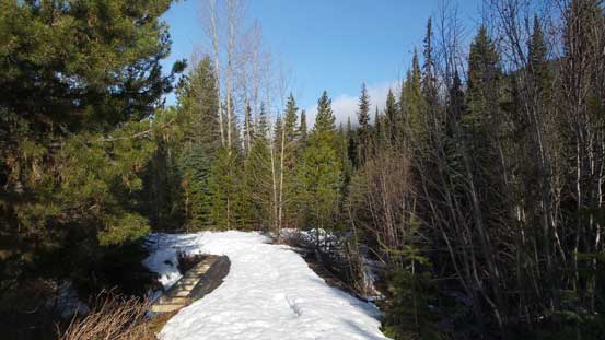
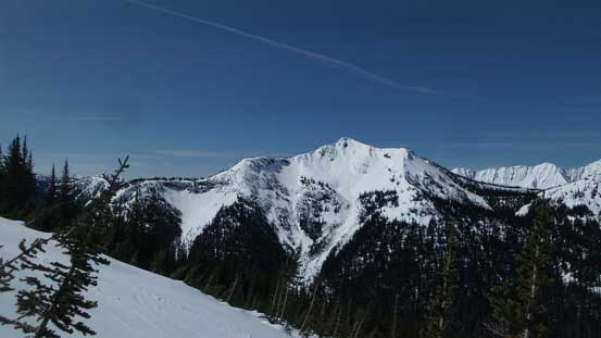
Mt. Winthrop just south of the Canadian border on the far north-western Okanogan County may not be the “biggest” as far as the North Cascades standard goes, but is surely a striking objective especially when viewing from various summits in Manning Park of British Columbia. This is also a peak that hasn’t seen many ascents mainly due to the access difficulties. Despite the fact it sits right beside the Pacific Crest Trail getting to the base of Mt. Winthrop is a very long haul no matter what route you take, from Ross Lake or from North Cascades Highway. The easiest option is from Manning Park via Monument 78 but I wouldn’t elaborate on this for some obvious reasons.
My inspiration of making an ascent of Mt. Winthrop mainly came from a recent BCMC trip that a group of 4 skiers apparently got it done in 15 hours and did not make back to the parking lot until midnight. This really intrigued me and I also remembered it looked pretty impressive from the nearby Windy Joe Mountain. A couple days after their trip a brief high pressure ridge came back on this Tuesday and weather was strongly in favour of the eastern slopes. Knowing their tracks would probably still be there the decision was easily made, but not wanting to deal with a crazy early start I opted to drive out on Monday evening. I got to the parking lot by around 10 pm, slept right away (tired from the work day), and did not manage to start the plod until 6 am in the following morning.
Mt. Winthrop ascent route.
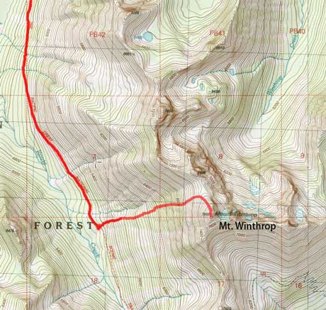
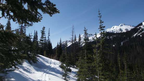
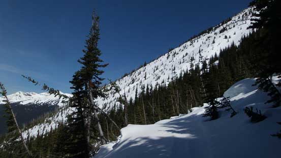
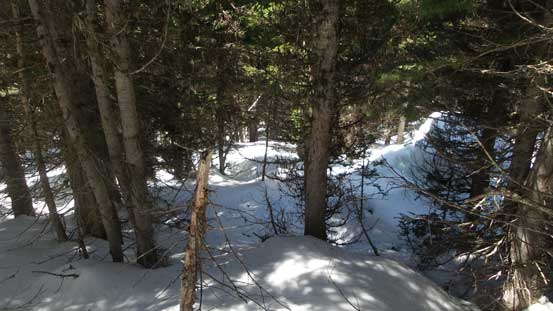
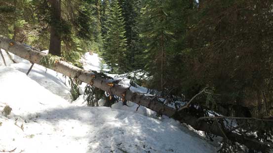
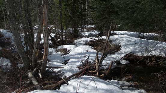
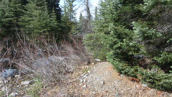
As usual since the start of the trail looked dry I would carry boots and snowshoes while wearing sneakers. It didn’t give me too much of an advantage though as in about 2 km I had to switch the footwear, and another kilometer or so later I had to don snowshoes. The snow was very intermittent but the patches couldn’t support my weight without the ‘shoes. There were fair amount of dead-falls along with lots of boggy sections mixed with some alder bashing. The swamps were actually easier to negotiate with the snowshoes on. There’s one pretty bad stretch right beside a river where the old road was washed out and the new, flagged trail travels beside the bank. After this bits the trail became much more defined although the built has lots of up-and-downs and the plod was very monotonous. It took me about 2 hours 40 minutes to complete the first section of this approach.
As much as the first section of this approach goes.
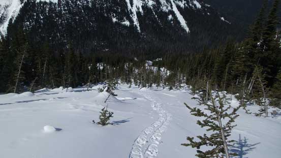
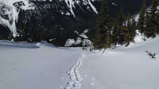
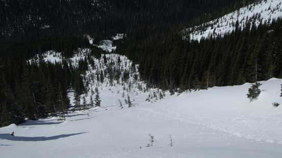
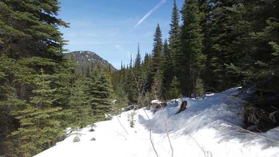
And then there came the second section of the approach and judging by the map I still had about 4 km to cover. Much of this stage was a long side-hill bash with some consistent, but gentle elevation gain. The trail did see some maintenance but definitely not in this year and there were at least 5 or 6 major dead-falls to negotiate. Not so much of a pain on snowshoes, but skiers would definitely not appreciate them especially on the way down. I had the BCMC party’s GPS track but loading it on the topographic map I had decided to follow neither their skin tracks nor their descent route. Instead, I’d go straight up in between their up and down tracks as snowshoes work far better for “going straight up” as opposed to traversing sideways. And once I made to the point where I was supposed to go uphill I took the first break of the day. By far I was doing really good on time.
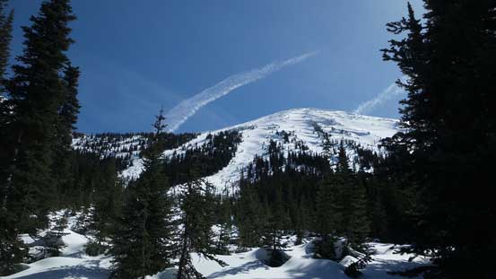
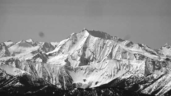
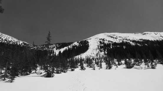
The south-east aspect of Frosty Mountain
Crossing one of the few avalanche paths.

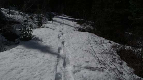
The typical condition on Pacific Crest Trail.

One of the many dead-falls.
Hiking into the sunshine.

Castle Peak, Stonghold Peak and Frosty Mountain

Another avalanche path that I just crossed.
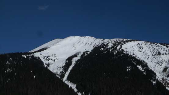
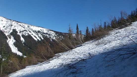
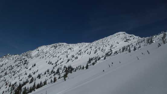
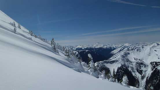
Like I mentioned earlier, the general bearing was to go straight up the forested slope. The timber was pretty tight and the slope was pretty steep but there’s no bushwhacking involved. About 200 vertical meters later I joined the previous party’s down tracks which led me into a big avalanche chute. The snow was locked very firmly so the decision was then to ascend this chute all the way up, but before that I spent a minute or two ditching some unnecessary gears. Higher up the grade steepened to about 35 degrees but that’s the perfect angle for my Lightning Ascents and the felt was like walking upstairs. My progress was very fast and the next thing, the angle tapered off and I was close to the col just to the “NNW” of the actual summit. The terrain was wide and open and I really enjoyed it.

The typical travel up the lower forested slope.
Finished the forested ascent, now looking ahead.
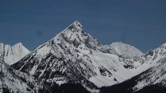
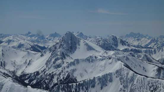
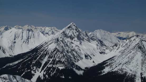
Castle Peak looks very impressive.
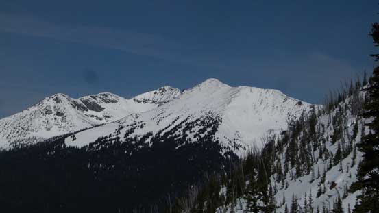
Frosty Mountain
This peak immediately west of Castle Pass does not have a name..
A sideways view shows the slope was pretty steep throughout.
The lower reach of this avalanche path ascent.
Gaining height very rapidly..

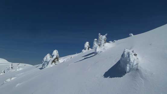
Very pristine alpine slopes.
This are the lower north sub-summits.

Another picture to show the pristine slopes around

Castle Peak with Freezeout Mountain to its left
Almost at the col now. Note the very winter-like snow formation.
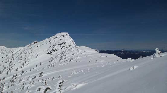
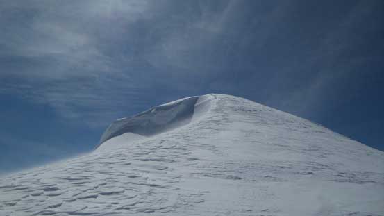
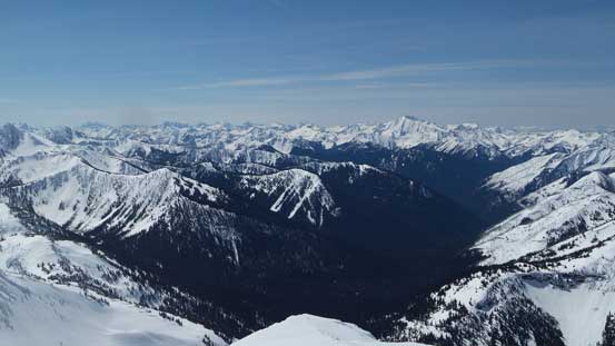
From the col I only had about 150 m of elevation gain to go and much of it was following the very wide north ridge/slopes. Much of it was indeed just a plod, but the wind picked up (unfortunately) and near the summit I had to be careful about some massive cornices hanging on the side. The summit was not as windy but the temperature was hovering around freezing so it was still cold. I spent about half an hour up there and surprisingly I could catch some phone signals. The views were very inspiring though with lots of North Cascades’ giants in sight.
Getting above the col now, looking at the north sub-summit

Plodding up the very broad north slopes.
The last push to the summit.

Looking back from just below the summit.

Summit Panorama from Mt. Winthrop. Click to view large size.
Another picture of Frosty Mountain

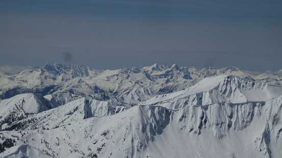
This is a south-western view into the North Cascades

A sea of peaks to the south.

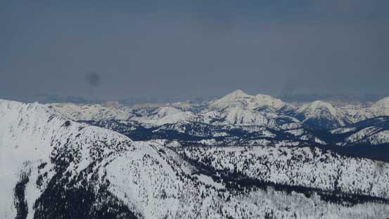
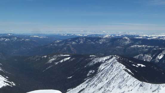
Looking over the eastern outlier towards the far eastern peaks in Okanogan.
Ptarmigan Peak

Lago, Carru, Osceola and Monument Peak from L to R.
Three Fools Peak with distant giants such as Golden Horn and Black Peak behind.
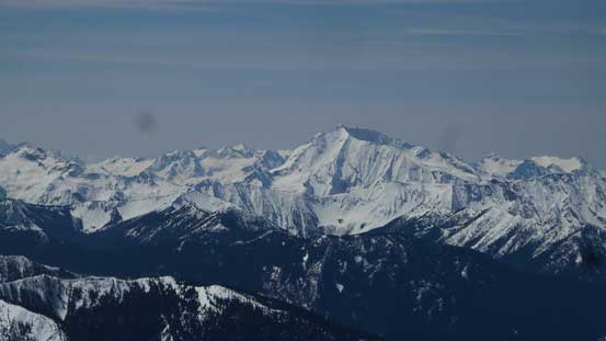
Jack Mountain is a bulky massif from any vantage point.
A full range of the infamous Picket Range.
Another look at Castle Peak
Mt. Outram on the skyline
Another look at Jack Mountain

Crater Mountain with Boston/Sahale and Forbidden Peak behind.

A full vista looking south
A view looking down Castle Fork valley

Another wider view of Freezeout Mountain and Castle Peak
The eastern Manning Park scenery including Chuwanten Mountain
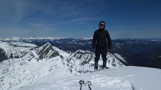
Me on the summit of Mt. Winthrop
I was not in a rush at all but it was getting cold so I decided to move on. Snowshoeing down the north slopes following my own tracks was very fun slipping and sliding on the soft powder, but once turning down the west slopes the grade picked up and I could no longer control the slip/slide. Not wanting to do an involuntary glissade down the entire path of the avalanche chute (I did not bring an ice axe for this trip) I opted to remove the snowshoes and boot-pack. The conditions were excellent for walking down. The heals got in firmly and at the same time, there’s no post-holing involved until much low down near where I ditched the gears. Then I strapped the ‘shoes on again, and easily descended back to the Pacific Crest Trail.

Time to go down..
A sideways view while descending the upper north slopes.

Looking at the northern outliers.
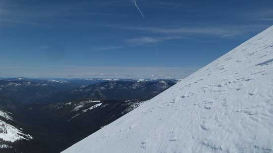
Bailing down the west slopes now.

My snowshoe tracks.
The avalanche path descent.
A review shot of the upper mountain.
Into the forest.
The snow had gone softer now so reversing the second part of this approach was easier than expected. I no longer had to suffer from side-hilling on firm snow anymore and the few dead-falls were pretty easy going on the way down too. And then into the first part of this approach, I snapped my snowshoe’s binding and still 11 km to go.. After some inspection I figured this wasn’t the end of the game but the binding then became loose (only one pivot). The snowshoes easily got caught on each other and I did at least 10-15 face plants which was not fun. On top of that, the snow had gone isothermal and I got to deal with about 8 km of heavy duty post-holing along with lots of up-and-downs. And then there came the bushy and swampy stretches, and finally the dry ground.

As far as the Pacific Crest Trail goes.
One of the many dead falls.
The typical scenery from the first section of the approach. Not very inspiring.
Isothermal snow post-holing. For about 8 km.
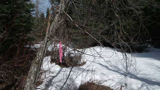
Following the ribbons.
Very confusing at places.
Running out of snow.

Many swampy sections like this.
Back to the truck my round trip time was just 10.5 hours which is a tad faster than the ski party’s pace. It makes sense as this approach trail would be a pain in the ass on skis and had I gone on skis I would hate life (skis on and off for at least 20 times if not more, plus I cannot ski that densely vegetated lower slopes neither)… The drive home was fluent and I got back right in time for dinner and that concluded another awesome day.
