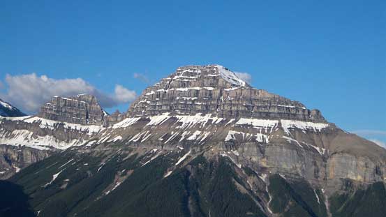
Mount Ishbel
July 4, 2014
2908m
Banff, AB
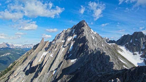
The weather forecast for this past Friday was a bit more reliable than the weekend’s so I decided to take advantage of that to bag a peak. Fortunately enough, I saw Brandon Boulier’s post on Facebook asking if anyone’s interested in Mt. Ishbel. Of course I’m interested in as I’d been wishing to ascend it pretty much since the summer of 2012. This is a impressively looking mountain particularly when driving from Lake Louise to Banff, and the route goes up the long and jagged south ridge with a couple detours to one side or the other. I believe the original rating for this route was a 5th class climb, but over the past few years it gets pretty clear that with some route-finding this ridge can be scrambled. (A big thank to Sonny, Vern and So for writing their trip reports). We used So and Vern’s trip reports as reference as they successfully bypassed the (supposed) crux.
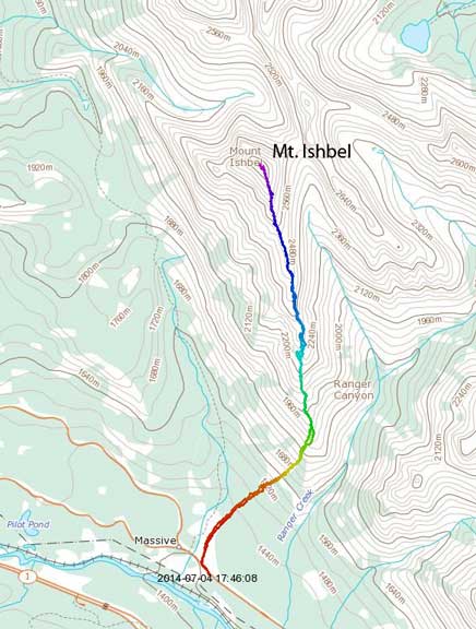
Mt. Ishbel standard scramble route. GPX DL
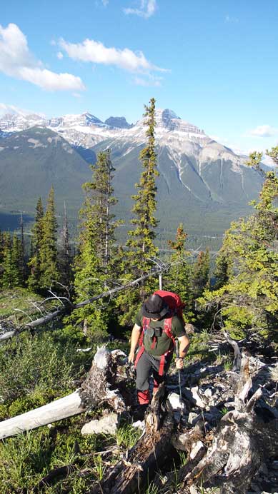
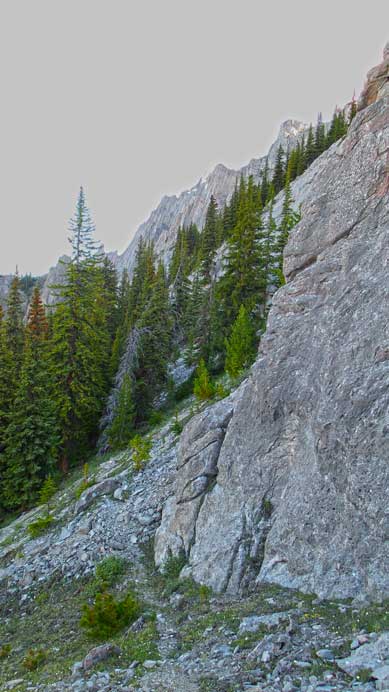
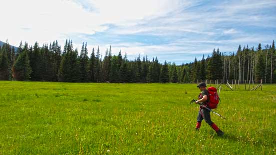
We both like early start so at 4 am Friday morning, I met Brandon and his buddy, Josh Lynn at Shoudice Arena in Calgary, squeezed all gears in Brandon’s truck and drove to the trail-head at Hillside Meadows on the Bow Valley Parkway. The first part of this trip was gaining the south ridge which itself was not an easy fair. We had to gain more than 600 meters of height on off-trail terrain with lots of dead falls to hop over or squeeze under. Vern did a good job to get us mentally prepared for the nasty bash through forecast by warning it’s comparable to Inglismaldie’s. I haven’t done Inglismaldie but I know it’s one of the worst bushwhacking trips in Kane’s list. It turned out to be not as bad as expected. Yes there were lots of dead falls but I’ve done way worse bushwhacking. Two things worth noticing – a grizzly and mosquitoes. Within less than 5 minutes after leaving Brandon’s truck, we saw a grizzly bear in Hillside Meadow but the creature quickly ran away. It was actually my first time seeing a bear from outside a car. The mosquitoes were brutal and I was pretty sure at least 50 of them were buzzing around… These little bastards were one of the main factors that turned a supposed fun ascent into a miserable day – more on that later.
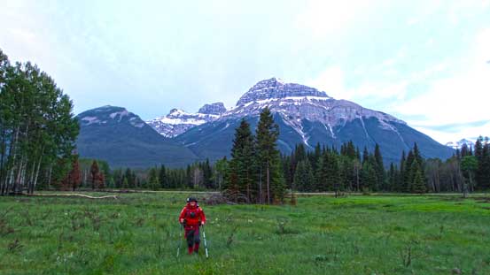
Brandon hiking across Hillside Meadow in the morning
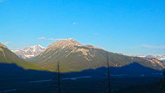
A view of Copper Mountain from the forest
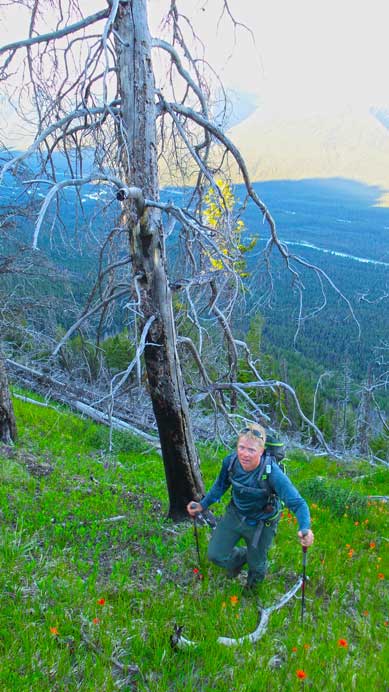
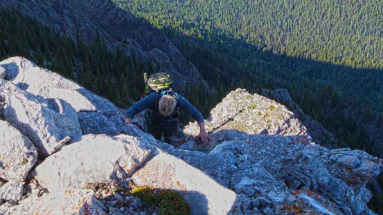
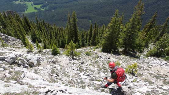
Josh ascending the steep forest
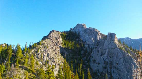
By the time we eventually crested the ridge we’d already done nearly half of the elevation gain. It was at this time we got the first bit of sunlight shone on our faces, and apparently we had a hot day ahead. After a quick break we continued on following a trail/path, overcoming a few bushy section to the base of the “first obvious cliff face”. It’s indeed very obvious as there’s no scramble way through the face if trying to follow the ridgeline. At this point we did the first detour, left side of the ridge proper. For this section we followed exactly what Vern describes on his trip report. After following a trail/path losing some elevation along the rock face, we scrambled up some series of ledges on climber’s right side. This part was moderate scrambling only. Through these ledges we were in a tiny “island” of forest. At this point we aimed straight up, and at the top we had to traverse climber’s left again along a rock face, and eventually scrambled up scree to regain the proper south ridge of Mt. Ishbel.
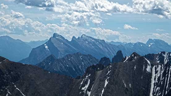
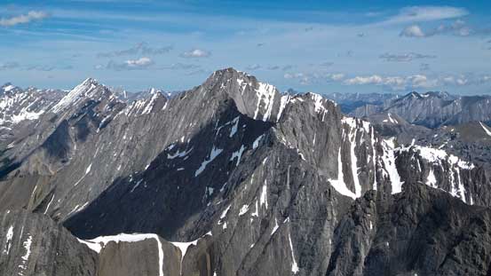
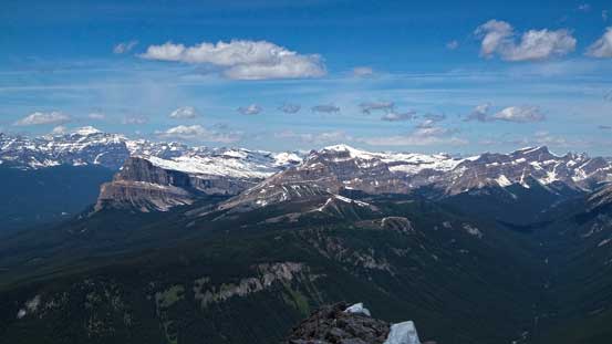
Pilot Mountain is a difficult scramble

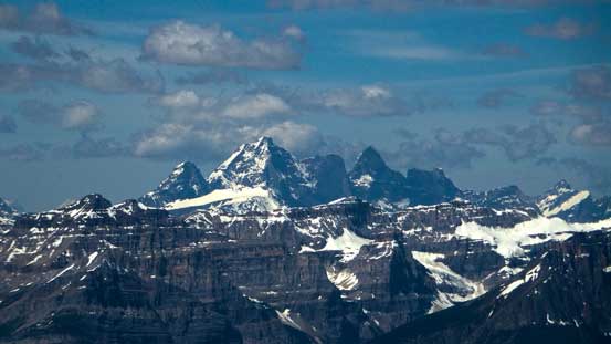
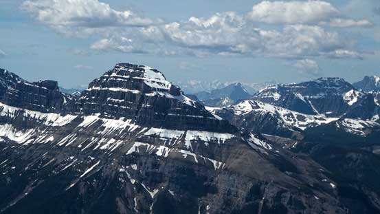
Mt. Ball is a big mountain
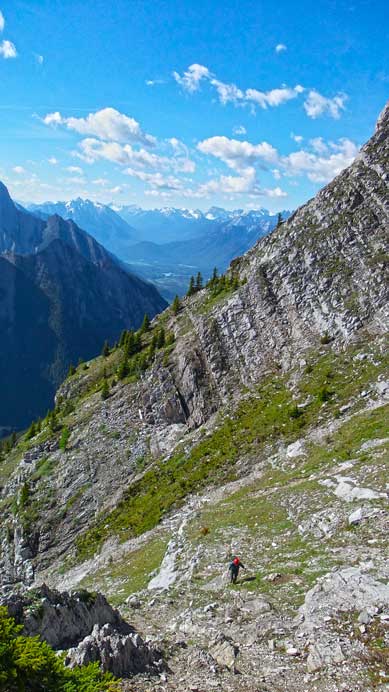
Looking up towards the rockwall where we have to drop to the left
Brandon scrambling up the lower treed ridge
Josh coming up beyond treeline
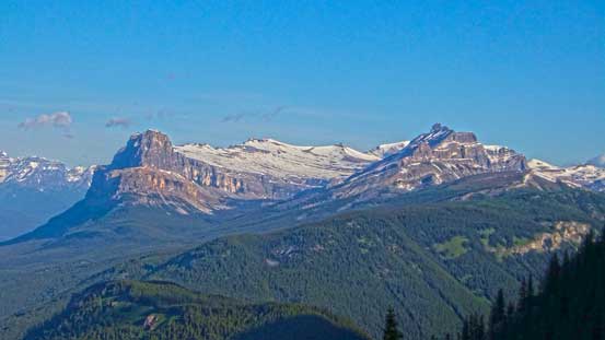
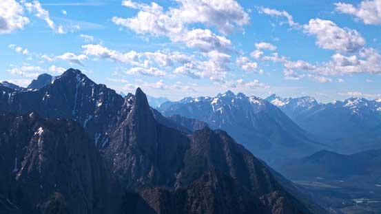
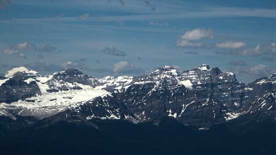
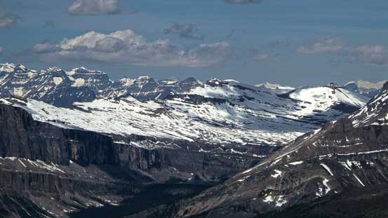
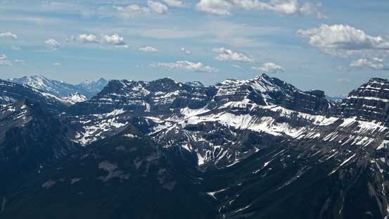
Nice view of Castle Mountain massive
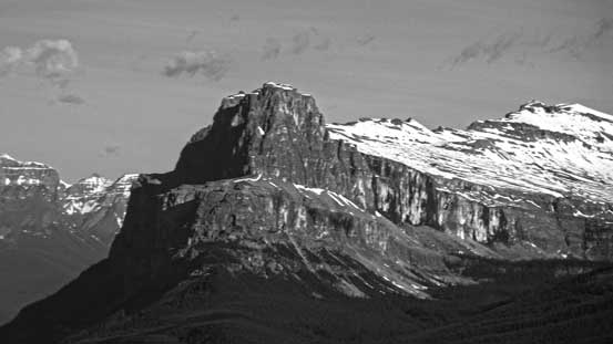
This is a really good viewpoint to study Eisenhower Tower
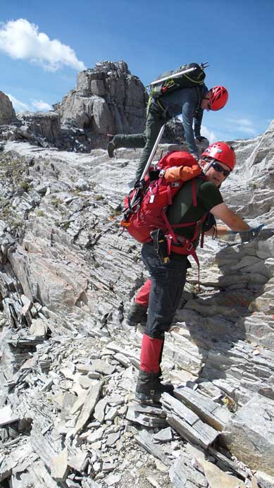
At the first rock face, we’ll go down a bit this way
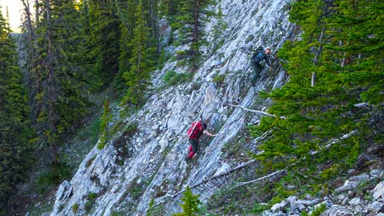
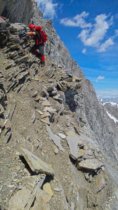
Scrambling up ledges
Josh coming up the ridge proper

Once on the ridge again, looking ahead
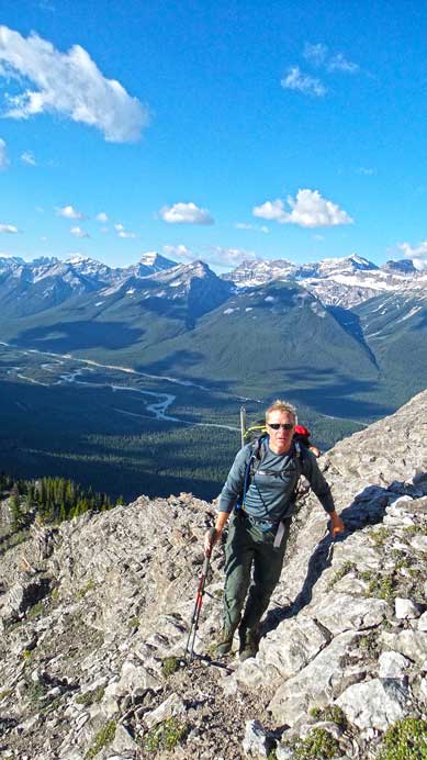
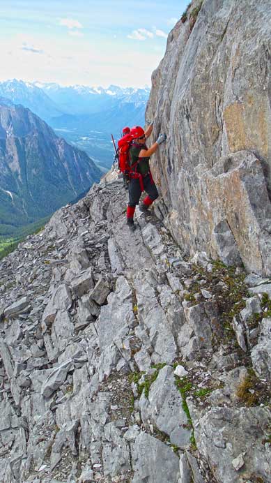
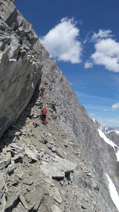
Immediately after regaining the ridge proper, we did the second detour, this time to the right side. The natural trend was following the ridge line up, but that would eventually lead us to a very challenging down-climb. To bypass it we again, followed Vern’s description. This entire section was side-hilling on grass or ledges, aiming diagonally up but staying well below the ridge crest. The down-climb was not in sight until we traversed around a couple corners, so it’s not easy to pick an “optimal line”. There’s some intuition work here, but staying a little higher or lower wouldn’t matter in terms of the big picture. If not staying on the optimal line you might have to do a bit of backtracking with some elevation loss and regain, but nothing too serious. We ourselves had to do a bit of backtracking since we stayed a little too high.

Starting to traverse climber’s right side hoping to bypass the crux down-climb

And yes, we bypassed the down-climb.
Brandon traversing around a corner
Looking back at the down-climb that we bypassed
Coming up to regain the ridge crest again
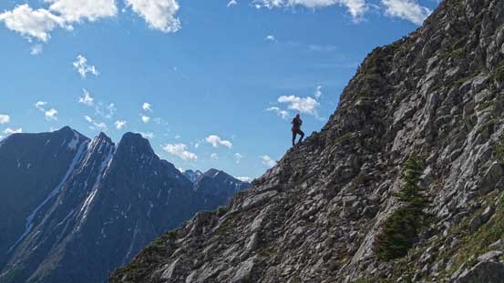
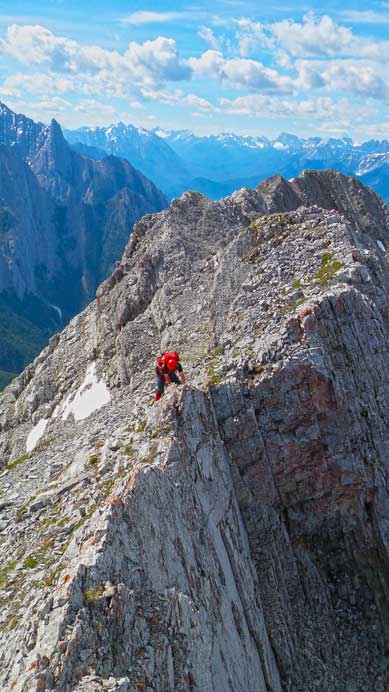
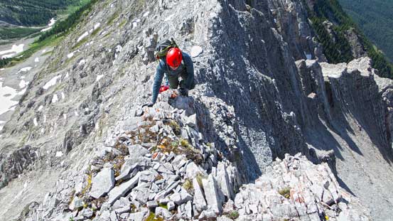
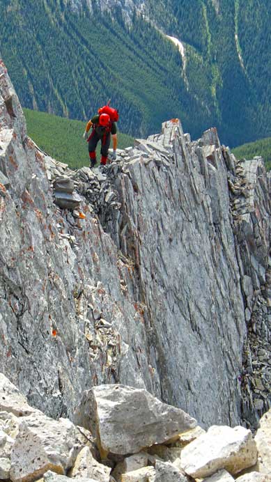
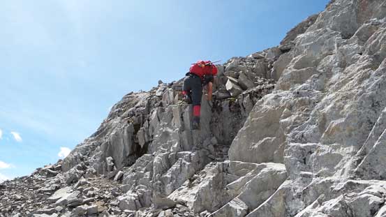
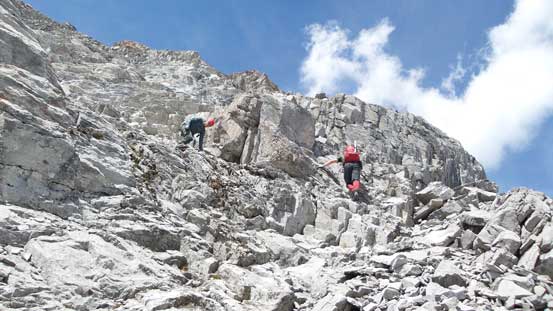
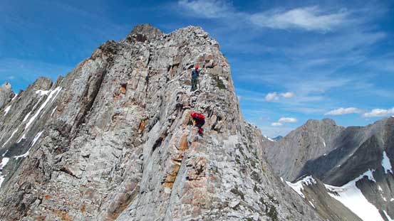
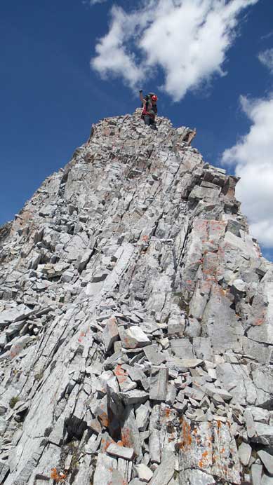
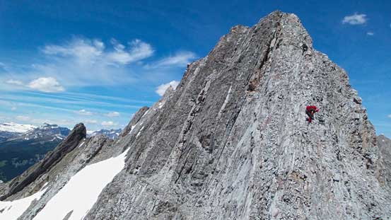
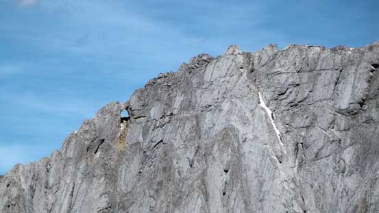
Once regaining the ridge proper for the second time, it was finally the time for the fun part. Initially it was just some exposed ridge walk with smaller moderate to difficult scramble steps here and there, but the higher we went, the harder the ridge got. There was one section we went up a chimney just to the left of the ridge, but the crux came shortly after – a (somewhat) long section of hands-on scrambling up an exposed section of the ridge, followed by detouring slightly left and up a difficult and loose step with severe exposure. Brandon and Josh went straight up the ridge which was just as exposed. In my opinion, this was the only step that might qualify being “climber’s scramble”. After this bit of excitement we had to scramble up another steep roll before leaving the ridge proper for the 3rd time.
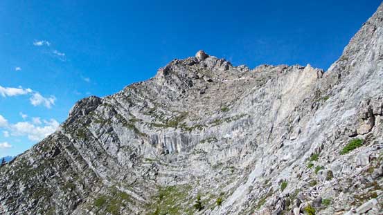
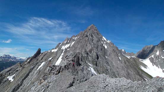
Looking ahead, the ridge is very long

Zooming-in towards the summit
Looking southwards. The Finger is the striking peak just left of center

Here we briefly detoured to avoid an exposed section
Brandon balancing on a narrow part
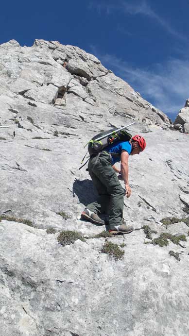
Brandon scrambling up typical terrain
Josh coming up just after the crux move
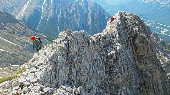
This section just above the crux was exposed
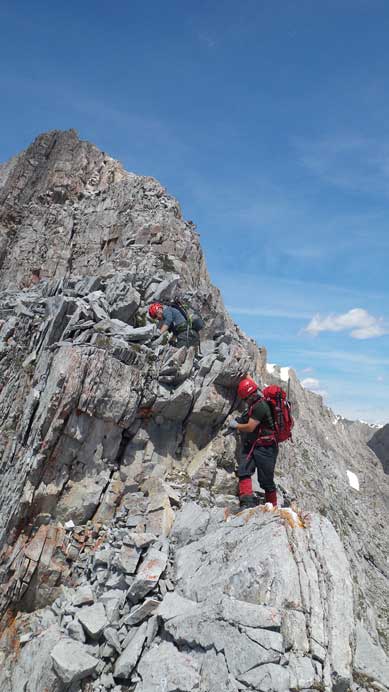
Negotiating another difficult step
A bit of down-climbing

Now what… Ahead looked to be 5th class, so we bailed to the right side
Descending a bit to access the scree ledge
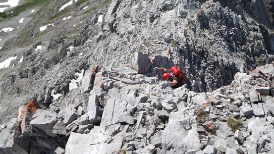
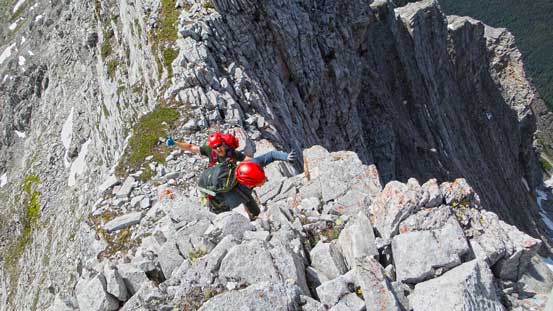
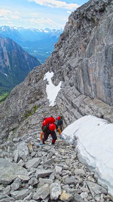
At the point where continuing up the ridge appeared to be no longer scrambling we dropped a bit to the right side and found the proper scree ledge. This is a key ledge on this scramble that will bring one a long ways up to within 50 m from the summit. Before the trip we were worrying about lingering snow patches on this ledge so brought ice axe and crampons up, but apparently those were not required on this day. There were a couple snow patches but we didn’t have to step on them. The scree ledge has two narrow sections, one at the beginning and the other one at roughly midpoint. Rocks on the second section were considerably loose as well and we had to be extra careful as we couldn’t afford any slip to the right side. The final 50 m to the summit was easier than it appeared with the most challenging part at the base. It was still difficult scrambling though.

On the long scree ledge, looking upwards.
Brandon scrambling through the initial narrow bit
There were snow patches but we could easily walk around them

Josh and Brandon scrambling up the summit block.
Brandon near the top
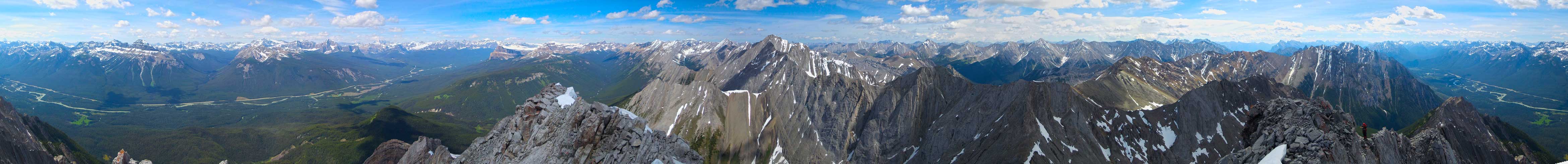
Summit Panorama. Click to view large size.
Mt. Rundle is the one of Banff’s icons. In the foreground you can see Mt. Fifi and Mt. Louis
The intimidating Mt. Goodsir
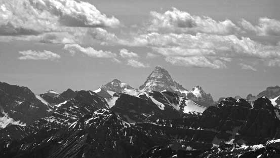
The mighty Mt. Assiniboine
Pilot Mountain

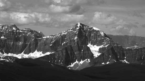
Hungabee Mountain and Mt. Temple
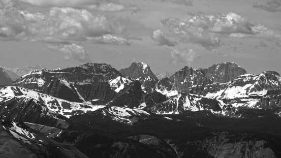
Deltaform Mountain and the “Ten Peaks”
This higher peak just to the north is unnamed

Bonnet Peak in the distance. That’s an area I’d like to visit too.
Pulsatilla Mountain. I’ve been told it’s a worthwhile scramble
Castle Mountain’s plateau. Rockbound Lake is just barely visible
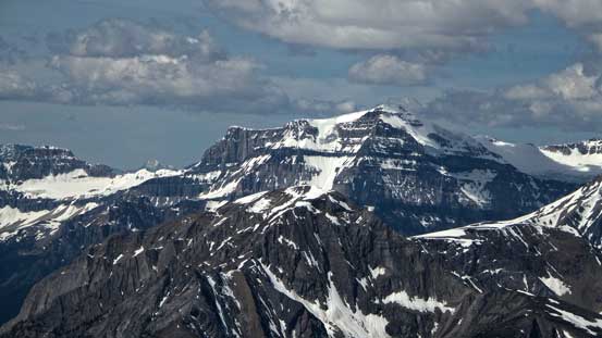
Storm Mountain looks pretty impressive from this side
Mt. Ball
Peaks in Kootenay N. Park including Split Peak
Mt. Brett

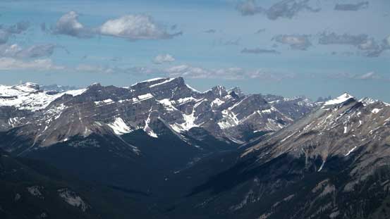
Mt. Cory in the foreground with Old Goat Mountain in the background right of center

Cascade Mountain is another Banff’s icon
The Castle Mountain massive

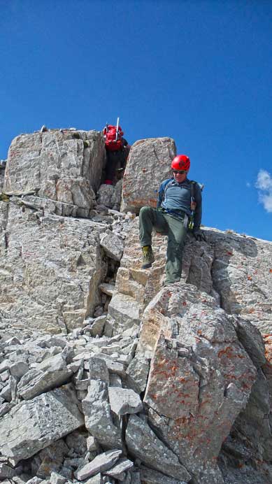
Me on the summit of Mt. Ishbel
We spent a long time on the top soaking in the views and enjoying the sunshine. We knew the descent would be long but it turned out to be even more tedious than we thought. Well it was not particularly difficult but we had to maintain mental concentration for pretty much the entire ridge. And for the entire ridge there’s no spot where we could speed things up (no scree run). The fact I was wearing mountaineering boots didn’t help neither. Adding these factors we had to spend the same amount of time to descend the ridge as to ascend, so it took us considerably longer than expected. And this led to the worst thing, the heat – the afternoon sun was incredibly strong so even with some wind it still felt extremely hot. Apart from the snow patches on the scree ledge there was no water source on this mountain at all, so bringing only 2 L of water up was a big mistake for me. The other two guys brought 3 L but even so it appeared to be insufficient. The side-hill bashing together with the small elevation regain here and there was extremely frustrating and the ridge seemed to drag on forever. Needless to say, it was very tedious and miserable. And eventually we got down the ridge, and still realized there’s more than 600 m to descend on nothing but bushwhacking terrain, and at this time we were pretty much running out of water. Thankfully the mosquitoes were not as bad as in the morning and the ground, though very steep, was grassy and soft so we could go down at a fast pace. Eventually we made back, 12 hours after leaving the truck in the morning, dehydrated and exhausted.
Brandon down-climbing a difficult step from the summit
Descending the summit block to access the scree ledge
The ledge is pretty narrow and loose at places
Brandon and Josh on the ledge

More of the ledge descent

Panorama view from the ledge. Click to view large size.
Starting to descend the ridge
Typical, typical terrain
A steeper pitch
Down-climbing a steep section. Terrain just above Josh was the crux

Descending a chimney
Looking back towards the summit. We still have a long way to go even just for the ridge
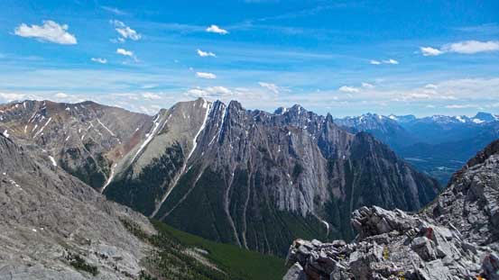
Looking across Ranger Creek towards Cockscomb Mountain
We spotted a rock window on a nearby peak
Further down we got off-route briefly and had to down climb some hard stuffs
Back on track
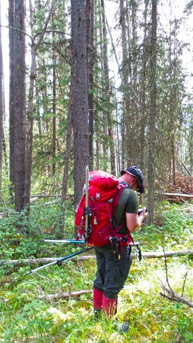
The last bit of the forest. Brandon checking his GPS
Onto Hillside Meadows. Home free now…

Looking back at Ishbel’s ridge

The summit of Ishbel
Overall it was a very satisfying ascent up a beautiful mountain, but quite a “quality suffering”. The ridge is impressive but the route is certainly not the prettiest – there’s considerable amount of side-hill bashing and elevation regain. It would have been a much more enjoyable day if it wasn’t as hot and buggy, and at the mean time if I brought more water up. But oh well, we all successfully bag this summit on the first try, and that’s enough to celebrate. It was also great to make new friends and I’m sure I’ll do more trips with Brandon and Josh in the future.
