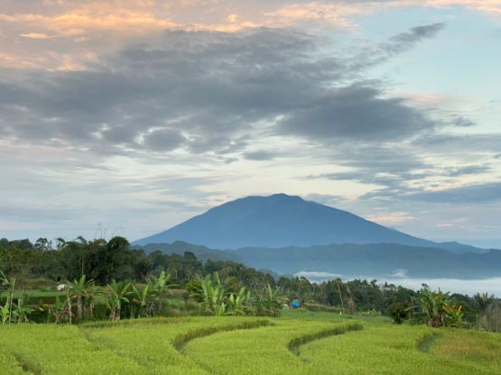
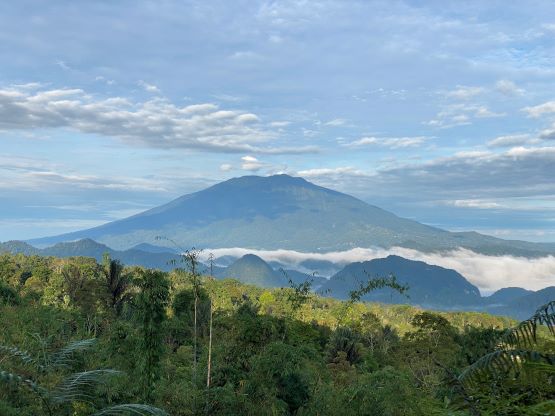
Gunung Sago (Malintang)
August 27, 2023
2261m
Sumatra, Indonesia
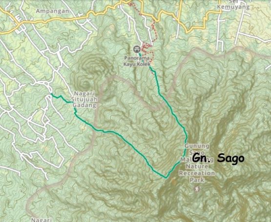
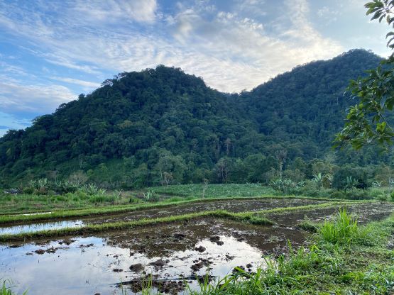
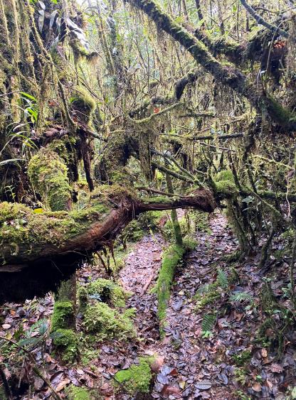
Gunung Sago is the large massif that dominates the south side of Payakumbuh in West Sumatra, boasting over 1300 m prominence. The other name of the highest peak on this massif is “Malintang”, but most locals are only aware of the name “Gunung Sago”. This was the 5th and the final objective in West Sumatra that Adam and I planned to bag. It’s not an “ultra”, but the ascent is not any easier than some of the “ultras” that we had already done. Our only reference was Rob Woodall’s trip report on peakbagger.com and Rob likely followed the “beta” described on Gunung Bagging website. Little did we know that the beta is already outdated. The route is no longer used and already overgrown. There isn’t even a registration post and the “trail-head” is unsigned in the farm lands. Currently most of the ascents are done from Kayu Kolek from the north. The trail from that side is extremely steep with class 3 or even class 4 scrambling on tree roots, but is signed and reasonably wide. I ended up ascending Rob’s route and descending the new trail to Kayu Kolek.
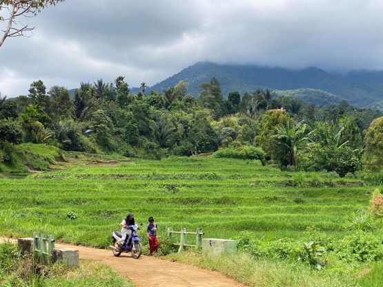
There was some confusion as our driver (with some local knowledge) assumed we’d be taking Kayu Kolek route, that neither Adam nor I had any knowledge about. The driver (Lisa) told us in the previous evening that there’s a registration office and a requirement to hire a local person or a guide. Little did we know that this new information was only referring to the Kayu Kolek route. Rob’s beta for the route from Nagari Situjuah Gadang was still correct, that there’s no registration let alone the mandatory requirement of a guide. We left the hotel at 5:30 am but quickly realized the “mistake” that we weren’t heading anywhere closer to the starting point. I pointed it out to the driver and that’s when we finally realized there are actually multiple (specifically, three) routes on this mountain. It was tempting to take this Kayu Kolek route but we did not have a GPS track and we could not find any English “beta” on the internet, so we insisted to take what we had already known. About 15 minutes later we arrived at the other trail-head. The vehicle was parked at the end of the pavement (850 m) and Adam made the spontaneous decision to bail due to illness.
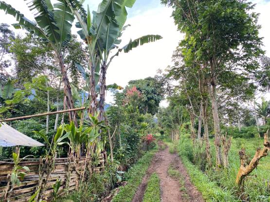
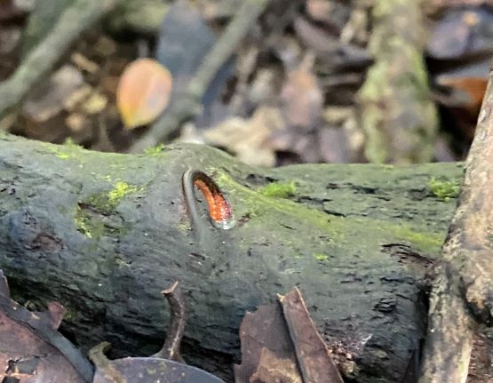
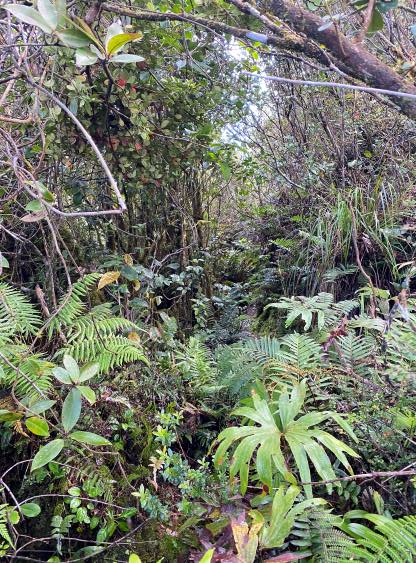
The first 1-2 km was to follow farm roads to the unmarked park’s boundary and the navigation was done mostly by following Rob’s GPX track. There are multiple junctions and the direction was confusing. Upon passing the last few houses I was “greeted” by some barking dogs. At least one of them seemed rather intense, but the owner called it off so I could resume. Right off the bat I was not liking this route. Getting bitten by a dog in this country could mean some serious troubles including a high likelihood of getting rabies, a deadly disease. The lower part of this trail was also overgrown and the grass and the soil was saturated that within a few minutes I was soaked from bottom to the top. The weather was sunny when I ascended the mountain, but it poured for hours in the previous evening. For a fraction of a second I thought about to turn around as I was already tired and unmotivated from the low-quality peaks on this island, but I resisted that temptation and pushed on. Thankfully the trail quality improved once I entered the jungle. There was no sign of recent human traffics but at least the trail was obvious enough to follow, that I was able to cruise for a while. At around 1300 m elevation I noticed some itching on my right foot and sure enough I found a few leeches sticking to various parts of the shoe and the sock. A further inspection saw me finding at least 10 leeches on each of my foot and some of them had already bitten me through the socks. I had been told that the mosquito spray could work, and I indeed had one canister. It indeed repelled the leeches, but could not prevent them from crawling onto the shoes.


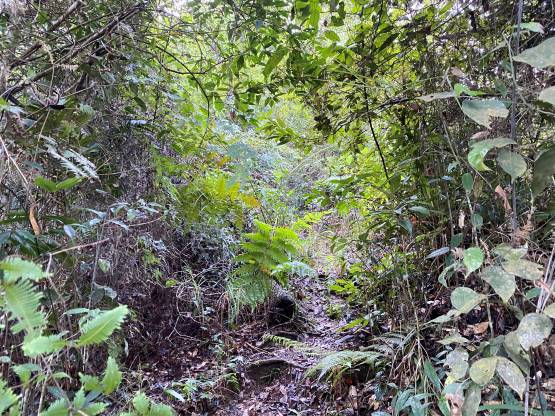


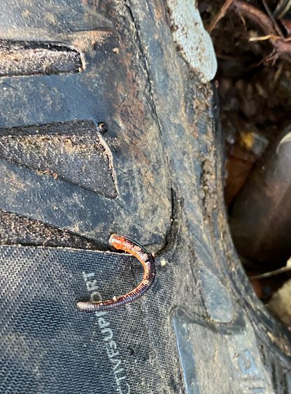
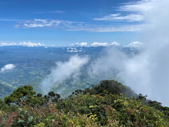
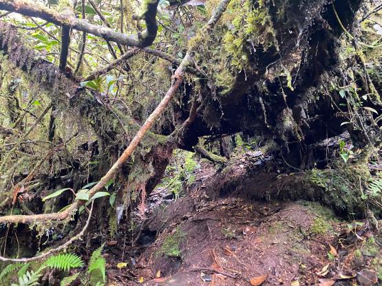
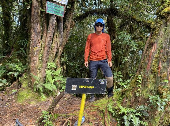
For the next hour or so I had to stop frequently and do “leech inspections”, and averagely I found 1-2 of them crawling onto my shoes for every few minutes. This lasted until 1800 m elevation, and by 1950 m I finally got that 10-minute period that no leech had crawled onto my shoes. I could finally take a much-needed break as I had been both mentally and physically exhausted. I could also apply some sunscreen and put the shirt back on. The lower slope of this mountain was so hot and humid that I opted to wear no shirt despite knowing there were hundreds of leeches around. For the next few hundred meters of elevation to the summit ridge I had to deal with some tree roots scrambling, sometimes up to YDS 3rd class. The most annoying part of this route was actually the traverse across the SW Ridge to the true summit. There were at least 3 or 4 major dips, and the trail was extremely slick with all kinds of obstacles to content with. One particular “dog hole” required me to crawl through on my stomach, that I swore to descend the other route if I could find a trail leading down that side from the summit. I was extremely pissed by this point. There were several small viewpoints along the way, but the true summit was forested with no view whatsoever.


I only spent 10 minutes on the summit and then went down the other route. I could not catch some cell reception but I figured that by one way or another I could let the driver and Adam know to pick me up from the other trail-head. The worst part of this Kayu Kolek route was near the summit, that I must down-climb a serious of 4th class steps on roots. It’s possible that some side branches did lead to easier terrain but there was no obvious “easier bypass”. A few of those down-climbs were quite exposed. I kept going because I could see flagging and some trail markers, and the trail seemed wide enough that it was definitely more travelled than the route I ascended. After 20 minutes of intense scrambling I came to a camping area with some views, and the trail from there downward was mostly easy. I caught up to several groups and I also paid attention to the leeches on the ground. Thankfully I did not pick up any of them on the descent, and were off the mountain in a timely manner. My time to traverse this mountain was just over 5 hours, and I was able to catch some weak reception to inform the driver about the change of itinerary. My plan was to wait at the Kayu Kolek trail-head as I saw at least two vehicles parked there, but all I saw afterwards was ojek traffics only, so I doubted if she could or wanted to drive all the way up here. After about 15 minutes I gave up and walked down to the basecamp (about 2 km on narrow pavement), and I arrived there just in time when the driver/vehicle showed up. The driver was kindly enough to offer me a free shower in her guesthouse before driving us a few hours to Padang.