Mount Elbert
March 28, 2022
4399m
Leadville, CO
Mt. Elbert, the highest peak in the Rocky Mountains, is one of the greater peaks in the western North America that boasts over 2700 m prominence. Unfortunately the difficulty of Mt. Elbert’s ascent does not quite reflect its statistical significance. There’s a trail that goes very much to the summit and the “standard route” can be easily done all year around. I somehow chose to do this peak in “early spring” which is kind of the trickiest time. March/April probably sees the most amount of snow in the Colorado Rockies and the wind is usually fierce. To make it even trickier I somehow lined up my summit window perfectly to the first major warming-up trend in the Rockies that the snowpack condition had gone absolutely shit. There had been recent reports of waist-deep wallowing even with snowshoes on so my success was entirely depended on whether or not the “trench” had been made. My window was a sunny Monday and I hoped at least several parties would have made the attempt over the weekend to pack down the trench.
My previous climbs of the 14ers in U.S. were all done in a single-push fashion from sea level with no acclimatization whatsoever, but I’m no longer as bold as a few years ago. I made an acclimatization hike to the summit of Chief Mountain (3500m) the day before, and drove to the trail-head at 2850 m elevation and slept in the car. In winter/spring one has to park at the South Elbert Trail-head adding a few kilometers’ of plodding each way in addition to about 300 m elevation gain. I drove the Subaru a very short way up the dirt road but immediately turned around and parked upon hitting continuous snow. Tire tracks continued farther but I did not have the best off-roading vehicle especially on snow. To beat the heat I decided to wake up at 3 am to get going by 3:30 am, about 4 hours before sunrise.

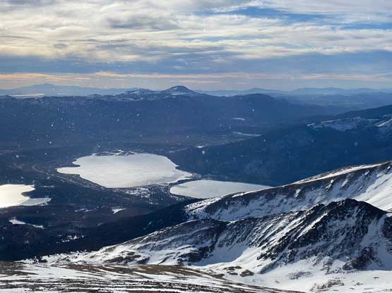
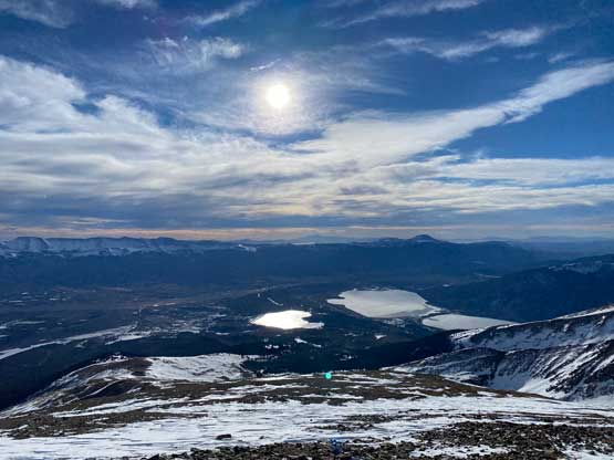
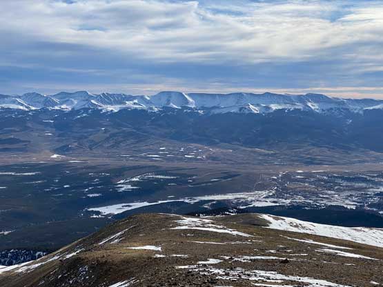
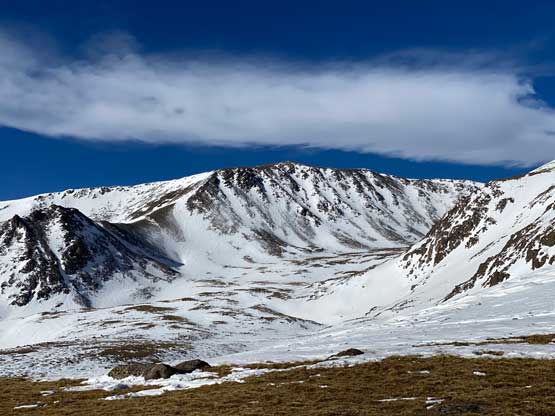
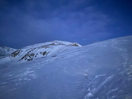
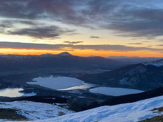
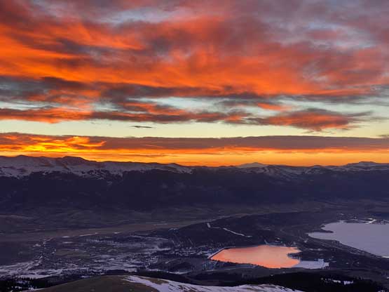
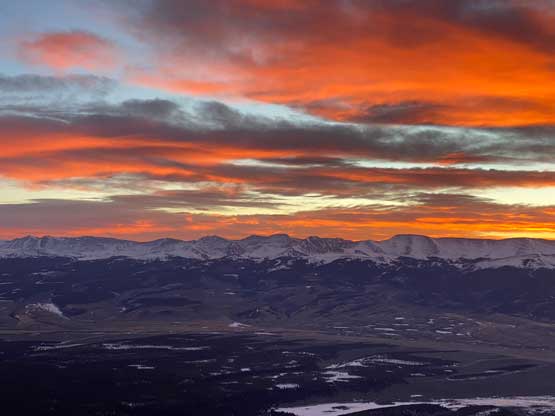
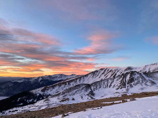
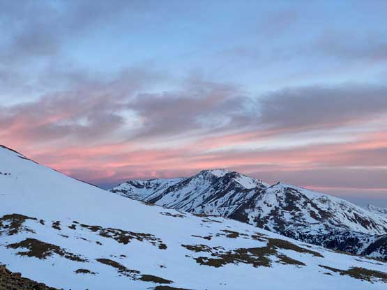
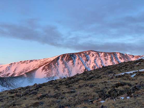
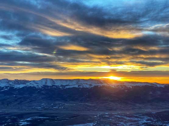
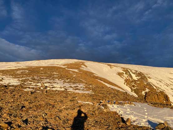
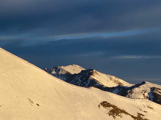
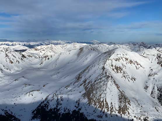
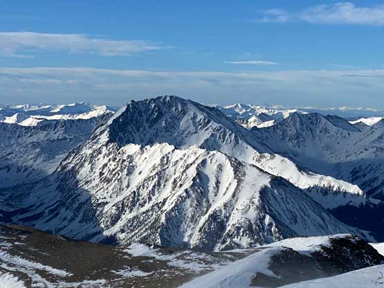
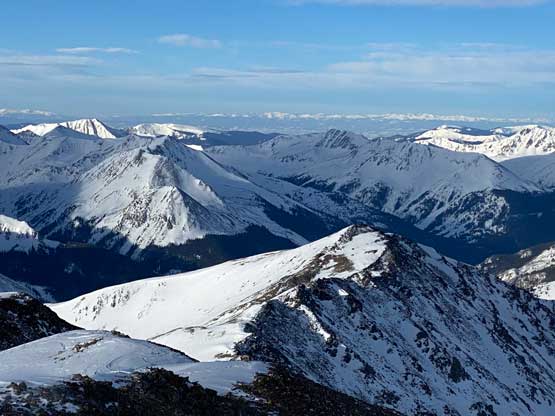
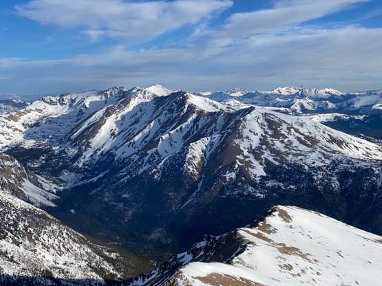
The plod up to the actual summer trail-head was very boring and took a while. The elevation gain was very gradual and there were even stretches with some slight descending. The section immediately past the summer trail-head was a bit confusing with multiple ways. I picked the most obvious path following “Colorado Trail” on my Gaia map. For about 1 km the trail was very flat with some downhills but then I picked up the Mt. Elbert’s main trail. The elevation gain was still quite gradual given the lengthy switchbacks and the snow conditions were better than expected. By staying on the track I did not have to post-hole but a few switchbacks later I had to put the snowshoes on. Some sections of the “trench/track” were braided and I started to post-hole. As soon as I stepped off the trench I would sink in waist deep, even at 5 am in the dark. It did not take me too long to arrive at the treeline zone where I could see the massive post-holes the previous groups had made. I easily plodded onto the east ridge at around 3750 m elevation and strapped the snowshoes back onto my backpack. The ridge was mostly blown bare. I still opted to carry the snowshoes as I did not know what exactly to expect higher up. At around 3900-4000 m elevation zone I watched an incredible sunrise.

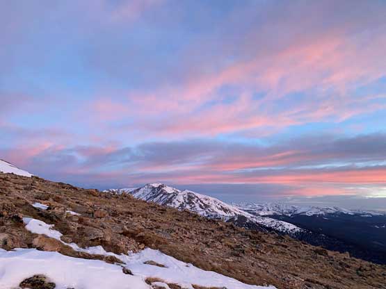


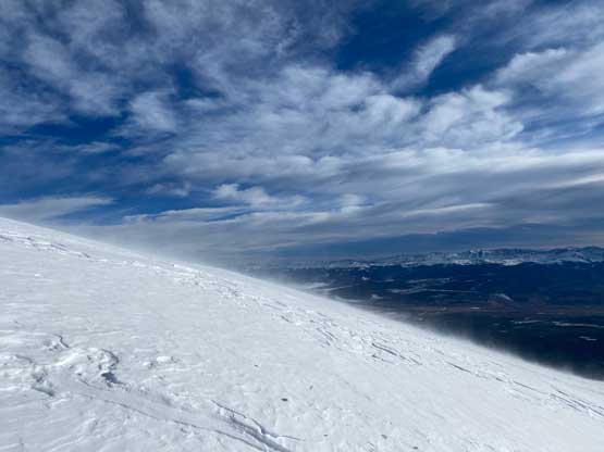
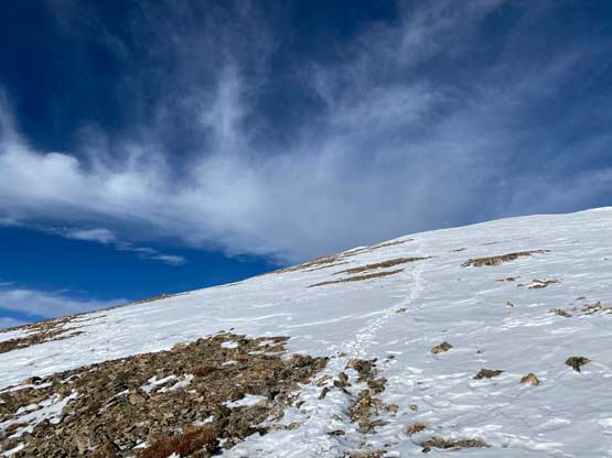
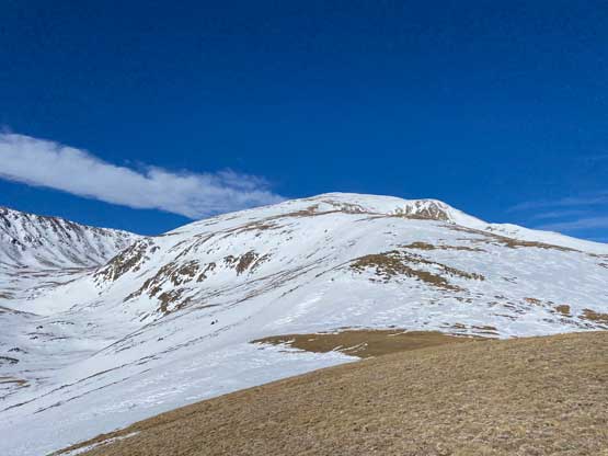
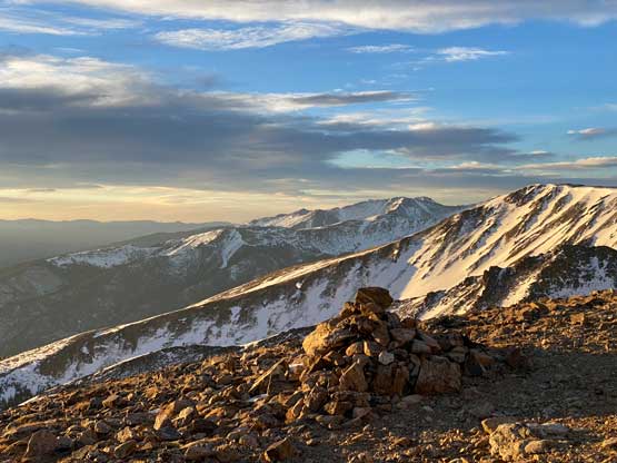
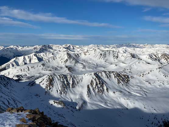
There were patches of firm snow that almost forced me to strap the crampons on, but I was too stubborn for that. I barely managed to edge my mountaineering boots into the surface and avoided using crampons on this day. The wind had picked up and the temperature was not as warm was forecasted. I had to make a mandatory stop to put on the parka and balaclava and while doing that I made a spontaneous decision to ditch the entire backpack. I had about 200 m elevation gain to the summit and the mountain appeared to be extremely straightforward (sans the weather elements). The winds were strong enough on the summit ridge to knock me off balance a few times but I made the summit nonetheless. I only managed to snag a few scenery and selfie shots.


I quickly made my way down paying close attention to follow the foot prints and the GPS tracks as otherwise I could have easily missed the ditched backpack. I picked up the pack and resumed the descent on a furious pace. As soon as the winds died down I had to strip off the layers one after another and eventually at just above treeline I had to take the long joins off inside my hard shell pants. It was getting nuclear warm. Without doing much lingering I bombed down into the forest and had to strap the snowshoes back on. I took off the snowshoes at the very last switchback and dashed back to the car. At this point I had already made a decision to dash for Pikes Peak in the afternoon to climb two of the main objectives in the trip in the same day, so every minute mattered. My round trip time was 7 hours which was a tad faster than expected, mostly thank to the existing trench that eliminated both route-finding and trail-breaking for me.