Traverse Peak
April 12, 2021
2460m
Harrison Lake East, BC
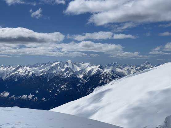
“Traverse Peak” is the unofficial name of the highest summit in the “East Harrison” area about 4 km to the north of the more fabled Mt. Breakenridge. This peak is not as visible as the southern neighbour but boasts 1000m of clean prominence to qualify a “Ribu” status. It’s also a lot harder to access than Mt. Breakenridge. It’s possible that one can directly access “Traverse Peak” from the main logging road in Big Silver Creek via the east slopes, but such would require a whooping 2000 m gain on bushy and exploratory terrain. The most logical access is by traversing the large plateau between Mt. Breakenridge and “Traverse Peak”, which itself is accessed by Mt. Breakenridge’s standard route.
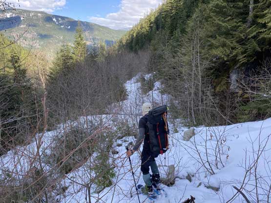
When it comes to “cleaning off an area” I’m very harsh on myself and in this particular case I would only do this approach one time and I must bag both Mt. Breakenridge and “Traverse Peak” in the same trip. I had rejected a few invites to do Mt. Breakenridge as a day-trip over the past several years just because I had this ideology in peak-bagging efficiency. The best season to ascend the standard route of Mt. Breakenridge is spring when a thick snowpack covers the alders on the deactivated English Creek FSR. In the old times (a dozen years ago) the access had been relatively straightforward but nowadays the alders had taken over the roads making a summer ascent a major undertake of bushwhacking. The planning of this trip was done among the six of us – Vlad, myself, Matt, Mel, Ben and Iliya but we would go in as two separate groups. Vlad and I preferred the overnight method because we had time and gears while Matt’s “Midnight Club” would pursue their single-push style as always. A total of close to 40 km distance, 3000 m elevation gain – not that bad as a day-trip if you ask me, but this was an exploratory trip with unknown factors including route, snow conditions and even the logging roads. One day could be doable but two days guaranteed the summit.
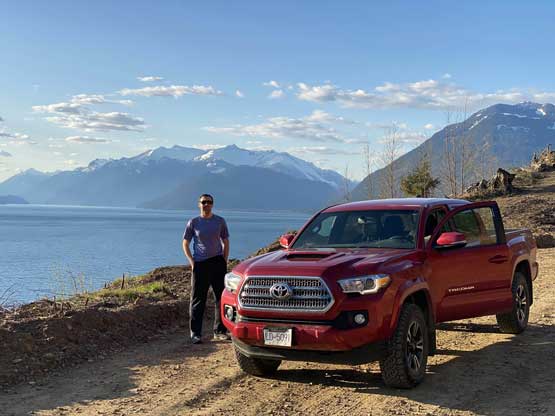
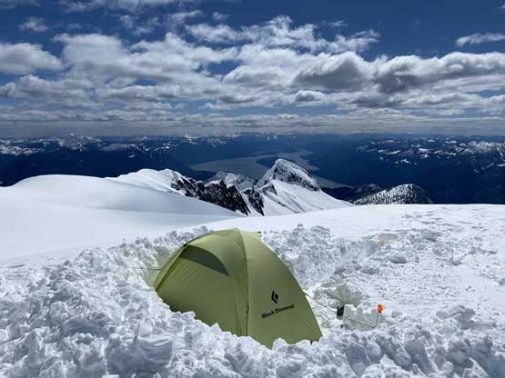
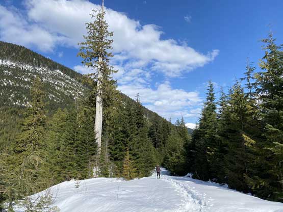
On the first day Vlad and I left home at 4:30 am and made the long drive about 45 km up East Harrison FSR and spent 10 hours wallowing in 30+ cm of fresh and sticky snow to a high camp at 2150 m under the summit of Mt. Breakenridge. We knew there was fresh snow but the trail-breaking effort was much harder than anticipated. On the second day we woke up at dawn and ascended Mt. Breakenridge at sunrise. We then waited at camp for another hour until Matt’s group showed up. I had been communicating with them throughout this trip as the cell services were excellent up there, and the plan was to break trail towards “Traverse Peak” in a combined effort among the six of us.
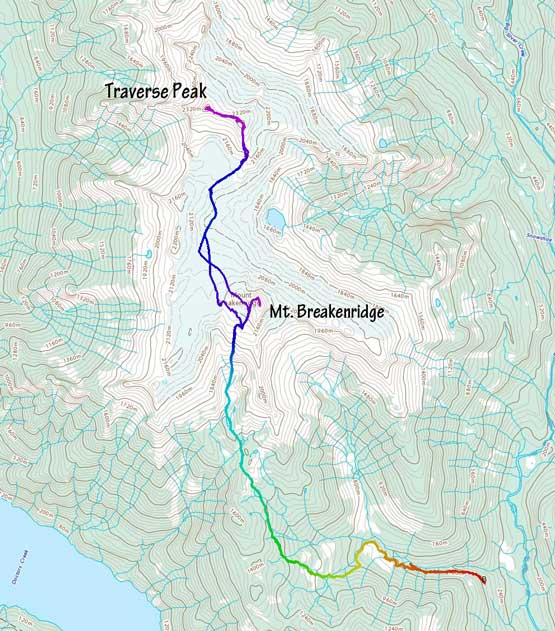
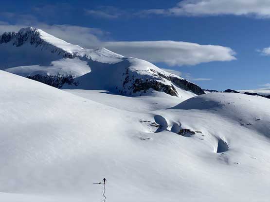
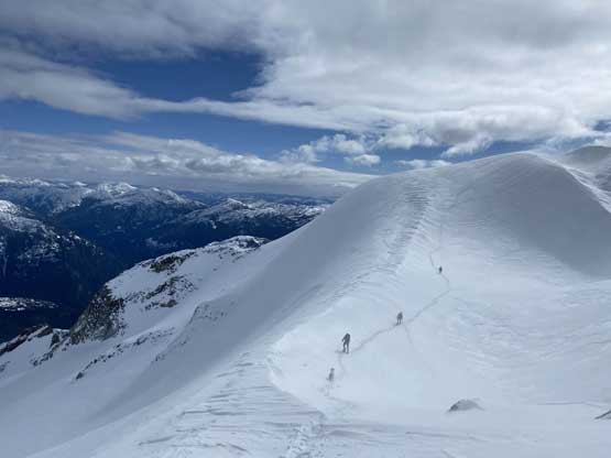
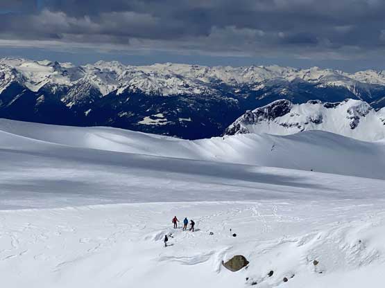
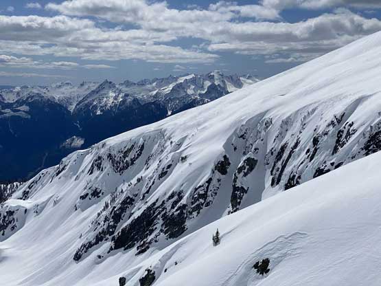
We weren’t quite sure what would be the most efficient line to avoid unnecessary elevation gain and loss from our camp to the large plateau between Breakenridge and Traverse. Matt picked a upper line on the ascent following our Mt. Breakenridge’s tracks 100m up but on the way back we discovered a more efficient lower line. From the shoulder of Mt. Breakenridge we had to lose almost 300 m elevation down the plateau towards the saddle. There were a couple spots that we faced micro-terrain decision making but generally speaking there was no short-cut and the hard earned elevation must be lost. Onward towards “Traverse Peak” we ascended a steep bowl on climber’s right to access the south-eastern flank of the east sub-summit.
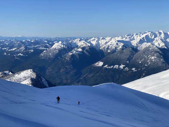

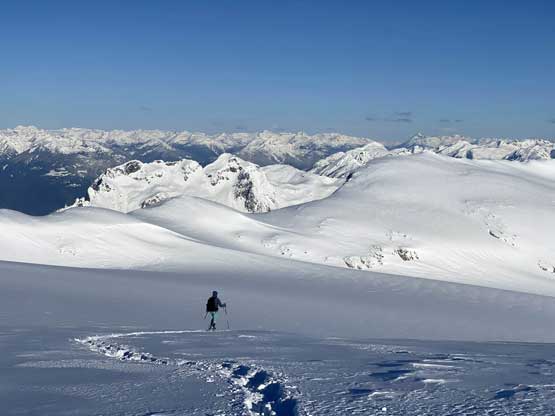


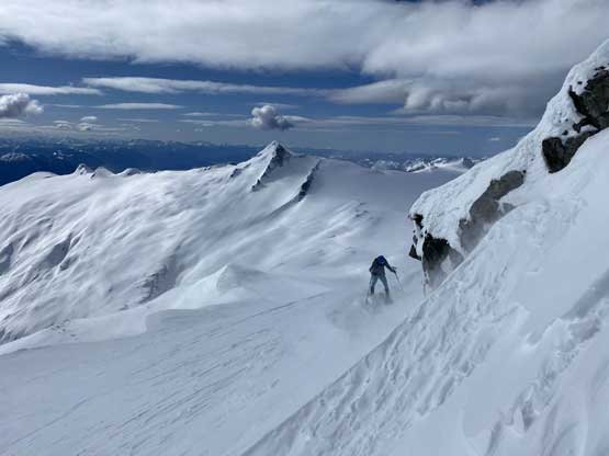
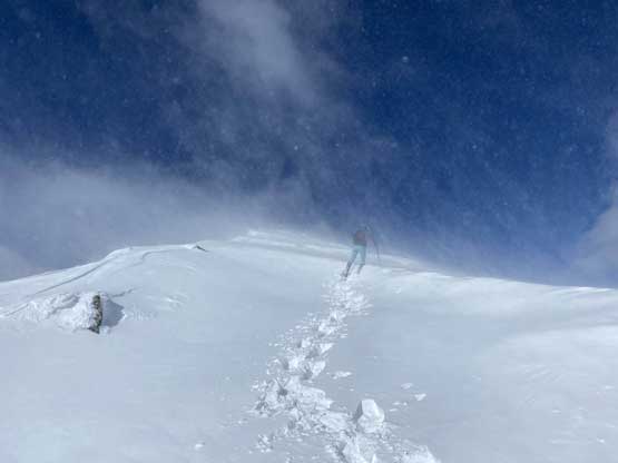
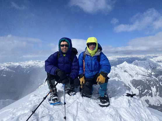
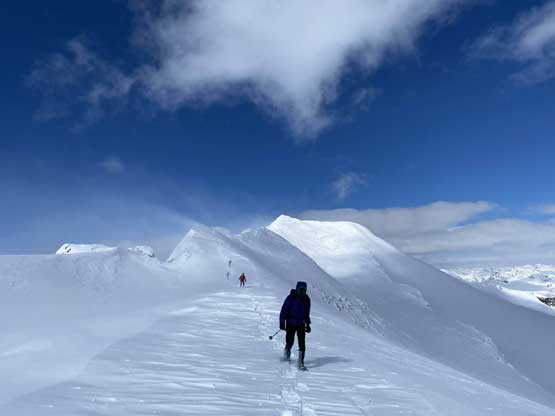
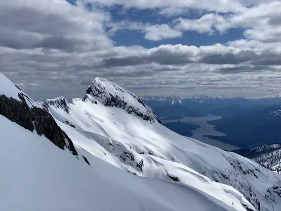
As soon as we got onto the broad S/SE Ridge of the east sub-summit we got hammered by the NE wind gusts. I led a line traversing across the ridge back towards climber’s left which was a little bit sheltered from the wind, but the pleasantness was short-lived. I knew from previous research that we should avoid getting to the very top of this sub-peak and the bypass was by rounding the NE corner about 30 m lower than the top. This stretch was horrendous fighting against the wind. The traverse towards the true summit was harder than I thought with numerous narrow spots and steep slopes but thankfully nothing turned out to be a show-stopper. We all managed to wear snowshoes to the very summit of “Traverse Peak” to conclude another successful exploratory ascent.


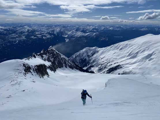

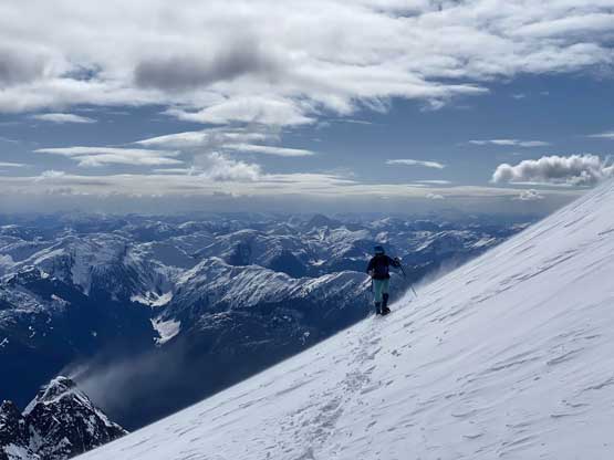


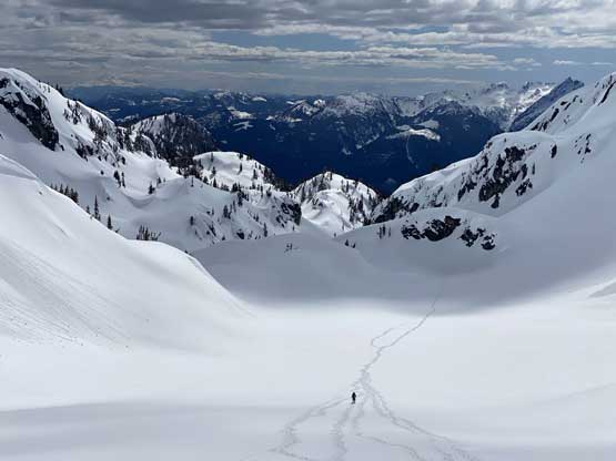
Thank to the winds we couldn’t linger. Reversing the summit ridge traverse was the worst of the day as we had to face into the cold NE wind for about half an hour. Thankfully the rest of the descent back onto the large plateau between Breakenridge and Traverse was not as cold. The wind was still howling and we just still have the jackets on. Matt then led us back via a lower traversing line to short-cut the elevation regain. They had decided to go straight down the lower chute and skip Mt. Breakenridge. Vlad and I had to traverse across a few steep slopes to get back to our camp.


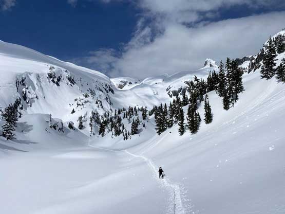
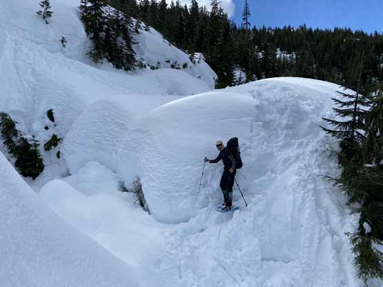
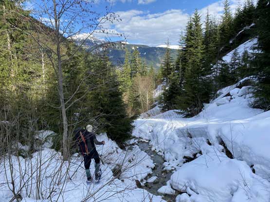
Breaking camp took us 45 minutes exact as I tried hard to be efficient on this. The descent off the main chute off Mt. Breakenridge’s south slopes was pretty easy. I tried to glissade but gave up after 10 meters as I simply couldn’t get moving in this soft and wet snow. We joined the others down tracks at around 1700 m elevation then down into the “lakes district” at treeline zone. The snow conditions weren’t pleasant for either ascending or descending. There’s no more trail-breaking duty but the heavy and wet snow meant we still had to be cautious. We more or less followed the exact same path on the descent and there wasn’t much worth noting other than being patient. There was about 1800 m elevation to lose from camp to the truck so we took our time.


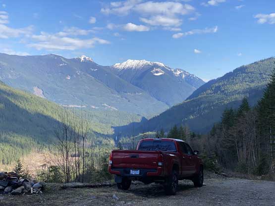
For Vlad and I the round trip time was exactly 20 hours sans camping and for the other guys this was sub 14 hours. There had seen some fresh grading on the main East Harrison FSR so we enjoyed a fast cruise out of the forestry roads. The rest of the drive back home was uneventful but exhausting.