Buckner Mountain
October 1, 2022
2778m
Cascade Pass, WA
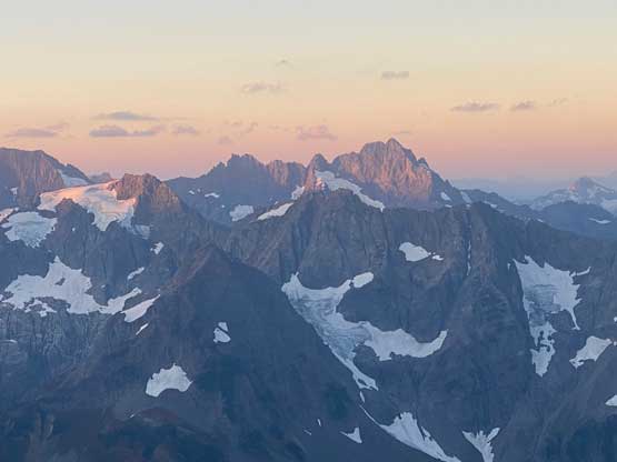
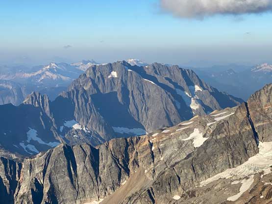
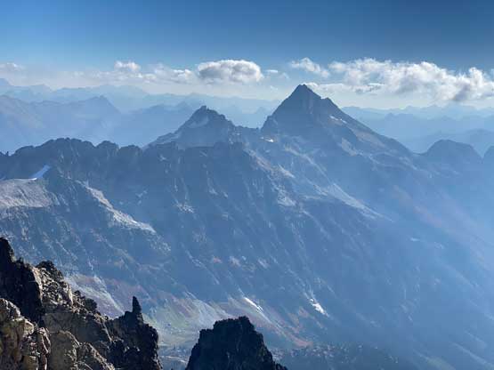
The rugged and glaciated peaks in the immediate vicinity of Cascade Pass accessed by Cascade River Road are very much the “mountaineering central” of Washington and Buckner Mountain is the highest in the area, boasting almost 1000 m prominence. It’s unfortunate that the standard route of this mountain is everything but “fun” requiring a contrived approach and extensive amount of work on loose rocks. Most parties would prefer to do it earlier in the season when the snowpack covers the choss, but I somehow signed up to tackle this bastard in late season without snow.
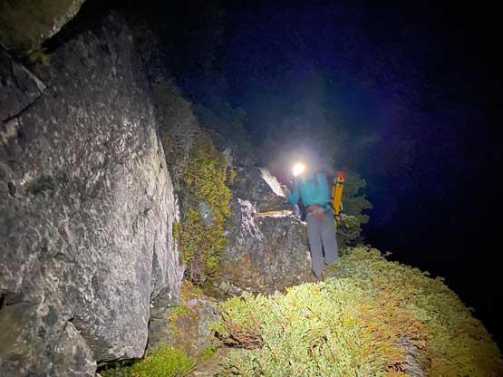
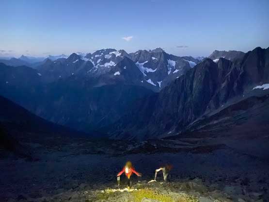
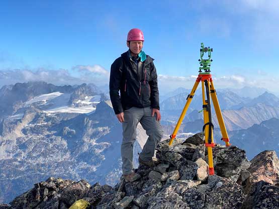
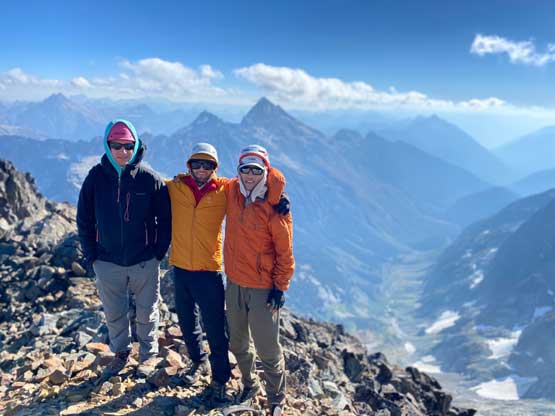
Buckner Mountain boasts two summits (SW and NE) with marginal elevation difference that it’s been a long debate as which of the two is the actual summit. The general consensus had been the SW (easier) summit being the highest point but there hadn’t had enough evidence to support the claim as the two previous surveys made by Greg Slayden and Eric Gilbertson respectively suggested the height difference was very much within the error range of the measuring devices. The SW summit still had a higher probability to be the true one but the confidence wasn’t 100%. Eric was dead set to figure out the truth, borrowed some high-resolution equipment from the university that weighs over 20 lb and was ready to give Buckner Mountain another go, this time with Talon Johnson. The plan of the trip also involved a potential first ascent on the west face of a tower called “Lick of Flame”. I was the last person to sign up for the mission and the ambition got subsequently jacked up to also include Horseshoe Peak as it’s a Bulger that I hadn’t done. Even though the Bulger list isn’t on my agenda at the moment I knew I would regret years later if we skipped that peak in this trip. As typical for Eric as it seems we decided to squeeze everything into one day and to make that happen we decided to start hiking at 1 am, about 6 hours before sunrise. I finished work at 9 pm on Friday night, drove straight down south to the trail-head and got perhaps only 10 minutes of sleep before the alarm went off at 12:40 am.
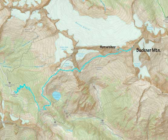
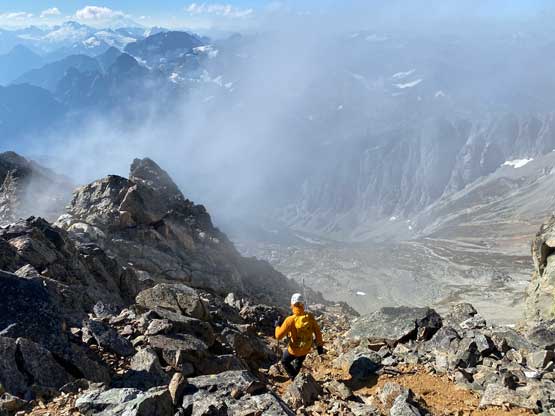
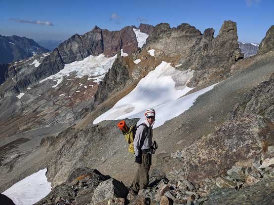
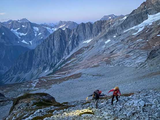
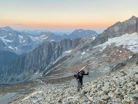
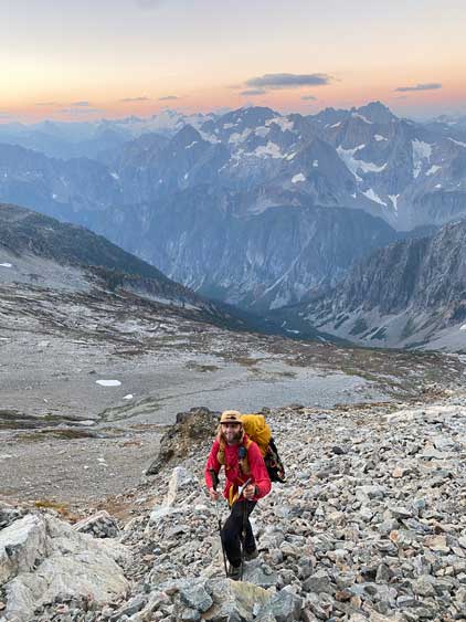
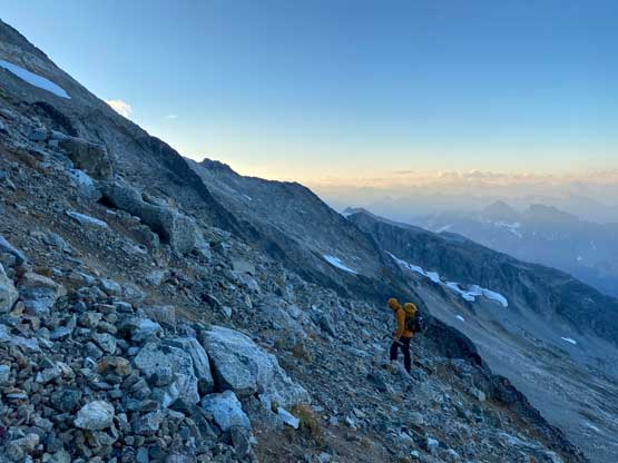
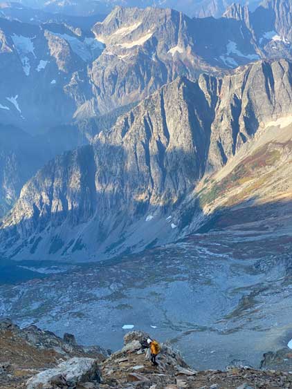
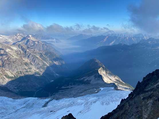
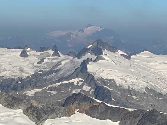
Eric’s pack weighted probably twice as much as mine as he had to carry all of the measuring equipment, whereas Talon and I shared the climbing gears which wasn’t light considering the climbs we would be doing. Talon wanted to put more weight into my pack in addition to the climbing rope but I politely rejected, fearing this trip was already pushing my C2C limit. In retrospect I do think I could have carried a few more items without slowing down the team as the terrain in this trip (choss) was actually in my favour. Eric had done Buckner Mtn. two times so all I needed was to follow behind. It was a boring ass 2 hours plod past Cascade Pass onto Sahale Arm. Our strategy was to keep talking and entertaining each other and Talon was particularly experienced in that. I made one transition to switch footwear from trail runners to mountaineering boots at Sahale Camp. I was hesitating to ditch the runners there considering the popularity of this area, but I trusted that nobody would steal my stinking shoes. We then followed Eric’s lead descending some class 3 terrain adjacent to a snowfield. The bottom of this 300-m descent involved a 4th class step followed by a long and loose gully. The gully was full of loose blocks and compact choss but that’s just a warm-up of what would come an hour or two later. The first half of the traverse across Horseshoe Basin wasn’t bad as we mostly just walked on slabs.
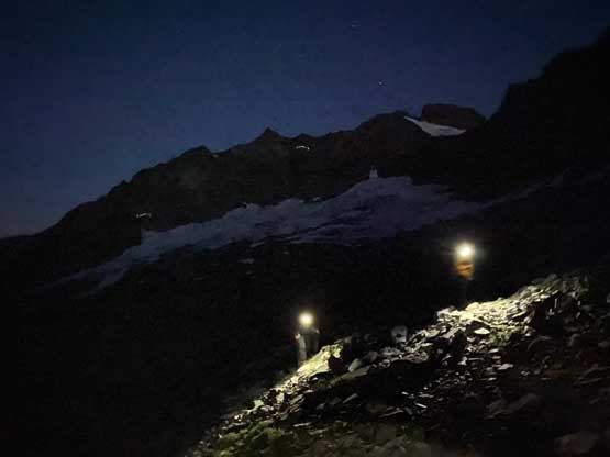
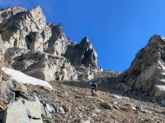
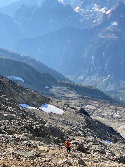
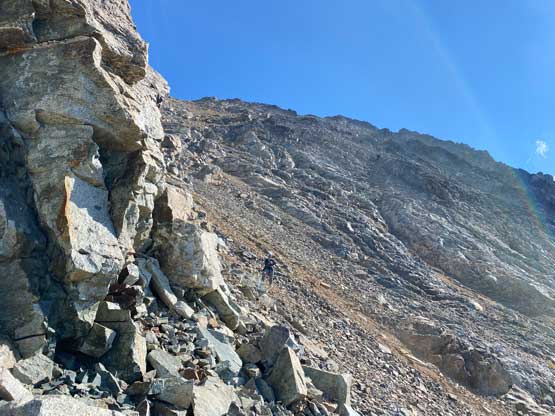
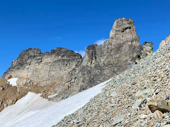
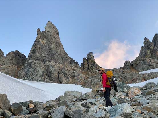
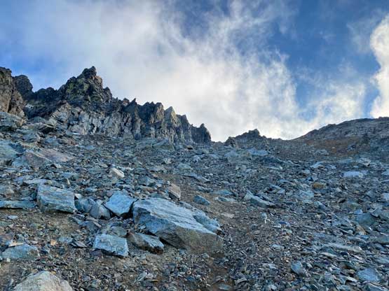
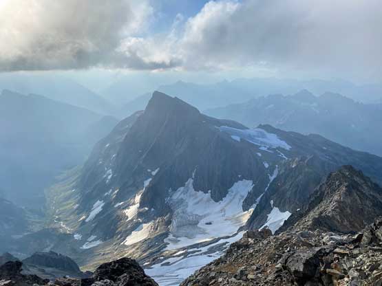
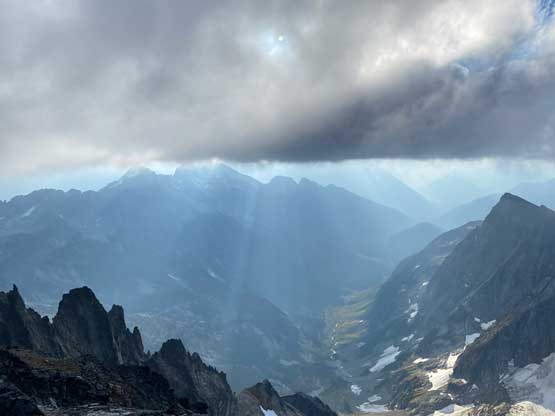
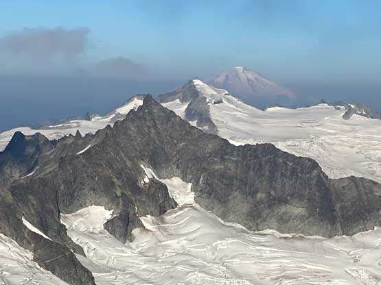
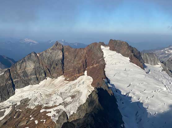
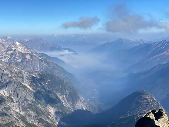
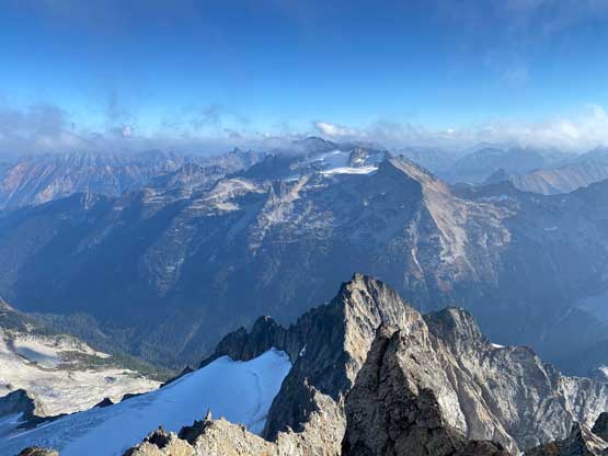
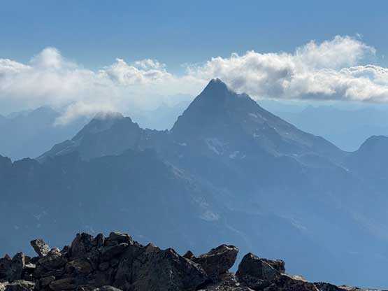
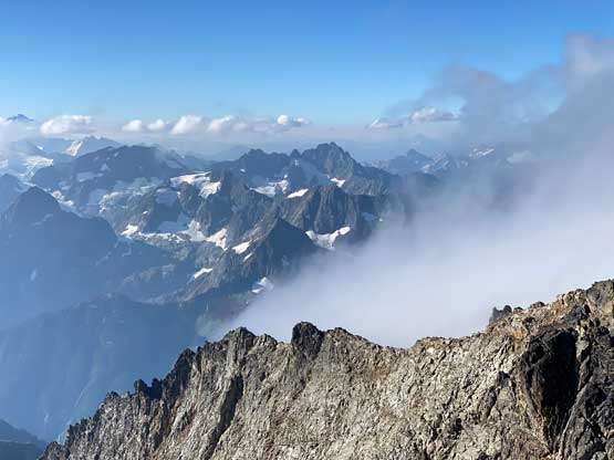
The second part of the Horseshoe Basin traverse was a different game as immediately after the slabs we got ourselves onto some compact hard moraine type of choss. In the darkness it was impossible to navigate the micro-terrain so we basically just followed the GPS track downloaded into my phone and Eric eventually said that line wasn’t nearly as efficient as the one he took weeks ago. The line we took traversed higher up near the rock faces and involved a lot of side-hilling on scree and moraine type of choss. The going was slow and tedious. The worst was to cross a few gullies that greatly reminded me some of the least enjoyable terrain that I had encountered in the Rockies. Nearing the end of this endless rising traverse we could finally turn off the head-lamps and enjoy a beautiful morning alpenglow on the surrounding giants. We plodded into the basin under Horseshoe Peak and “Lick of Flame”. There’s a snow field and a trickle of running stream for us to reload the water bottles. We took a long break there, slogged a little bit higher up to ditch all climbing gears before proceeding upwards onto Buckner Mountain.
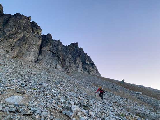
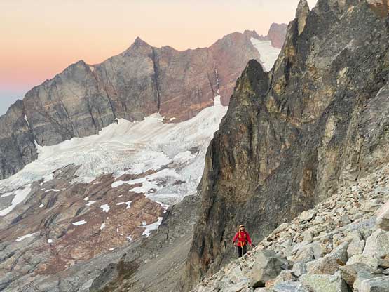

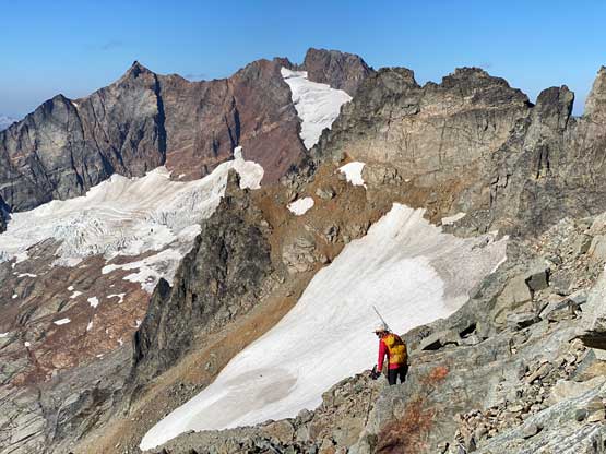
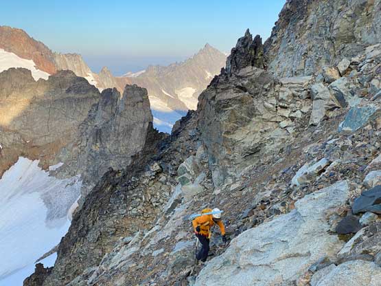
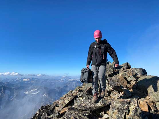
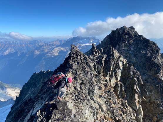
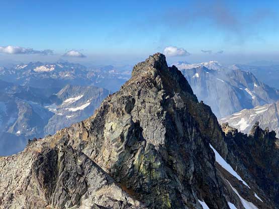
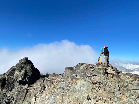
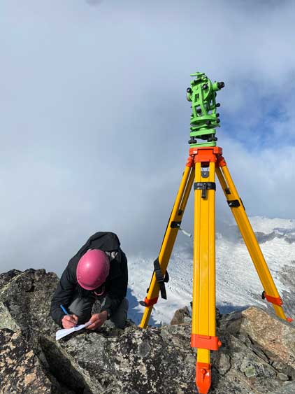
The ascent of the SW Face of Buckner Mountain was basically the same of what we had just done in the past two hours – an ascending traverse on choss. There’s a ledge that we aimed to get into the main gully/face although I think there are multiple ways to get into the zone. We then slogged tediously up the face onto the south ridge of the SW summit. This south ridge brought us to the ridge in between the two summits but much closer to the SW summit, so we tagged that first. Eric and I went up the SW peak with the surveying equipment while Talon traversed to the NE summit solo, carrying the radio and a meter stick. Once everybody’s in position Eric did 5 independent measurements.
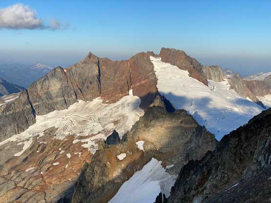
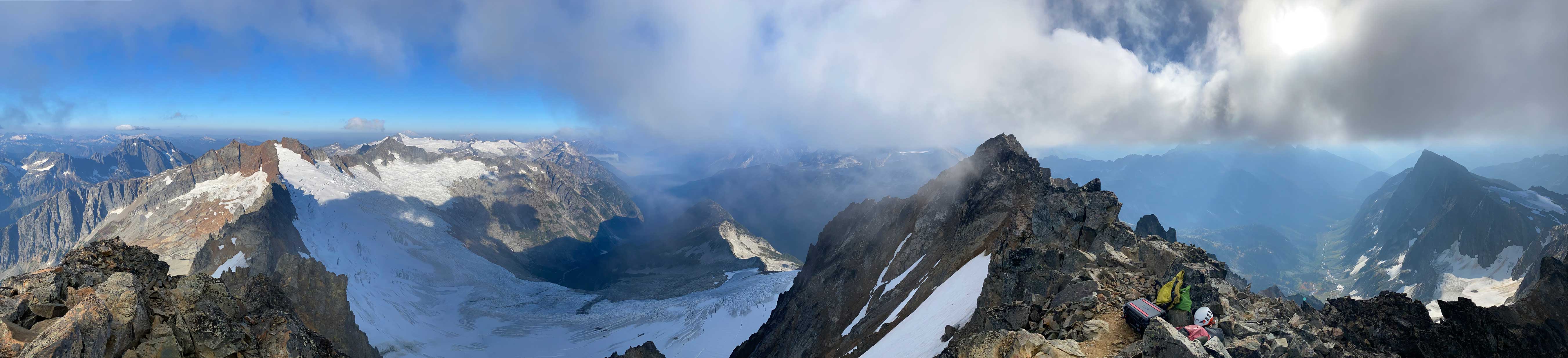
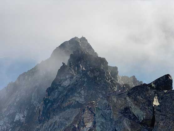
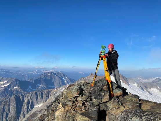
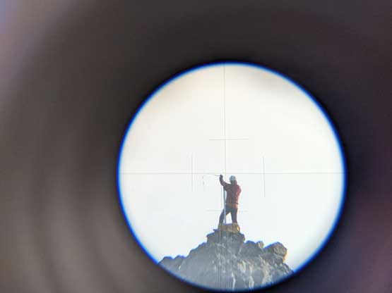
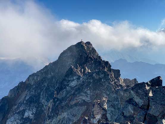
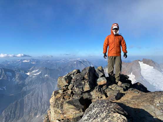
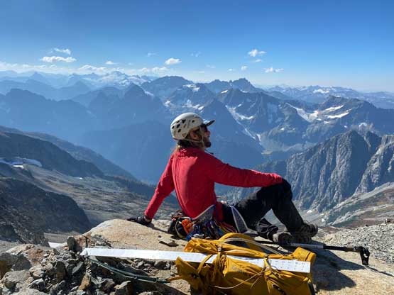
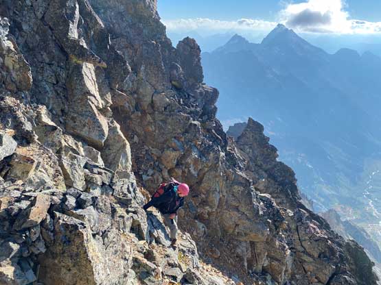
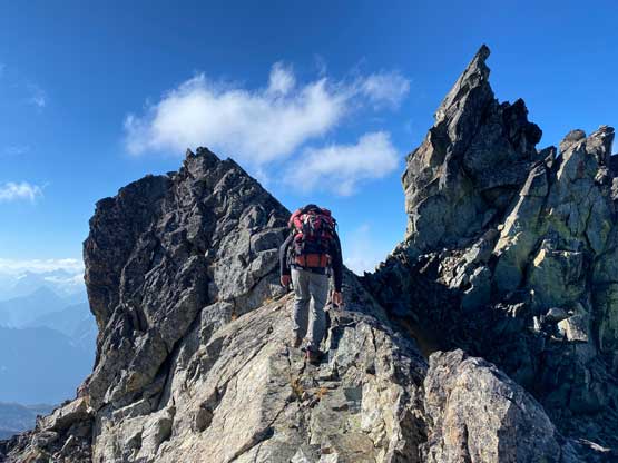
The process took a while but once done, Eric and I would switch position with Talon. To traverse to the NE summit requires 3rd class scrambling with route-finding, but Eric had just done it a few weeks ago so I just followed behind. The route traverses mostly on the south side of the ridge to bypass a few gendarmes and was actually quite straightforward. I had no idea why most scramblers didn’t opt to come up here. Even though this isn’t the true summit the view itself is worth the effort. Eric did another 5 independent measurements and basically announced that the SW summit to be about a foot higher, but some of the angular measurements had to be analysed at home so the result would have to wait for a bit longer. Once the measurements were done we scrambled back up to near the SW summit to regroup with Talon and Eric said we just had the longest ever stay on Buckner Mtn. than everyone else. I agreed as this measuring process took literally forever and I was shivering in the cold winds. (A few days later at home, the conclusion of the measurement by Eric is the SW peak being 18.9 in +/- 3.5 in taller than the NE summit, but more on that in Eric’s trip report.)
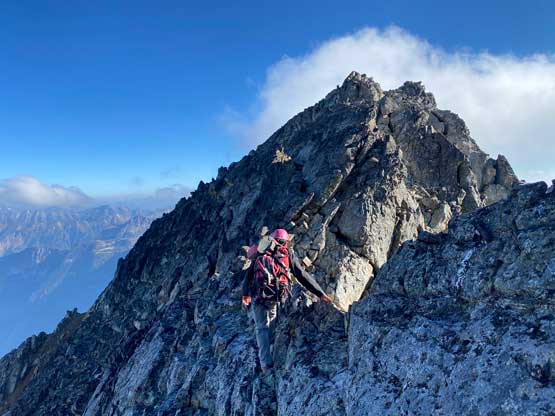
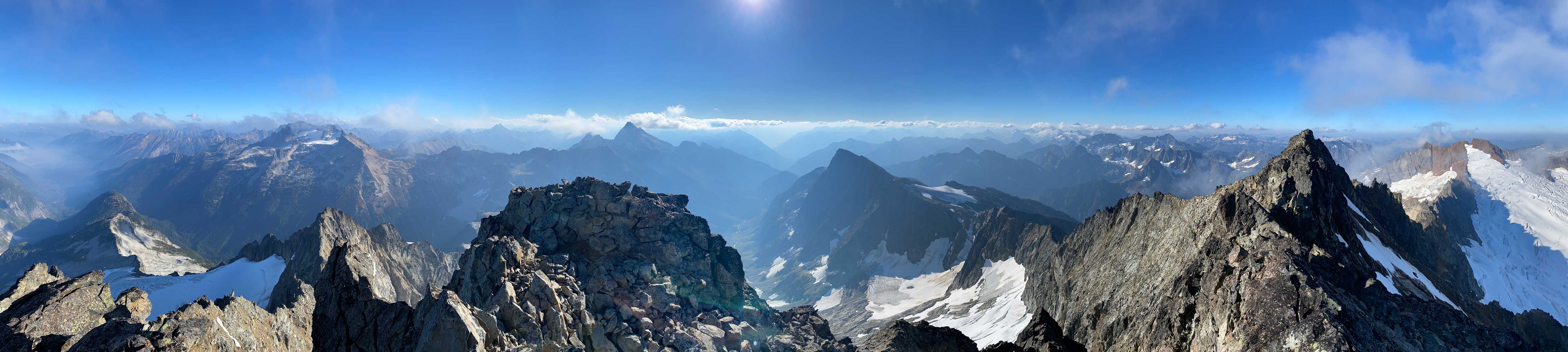
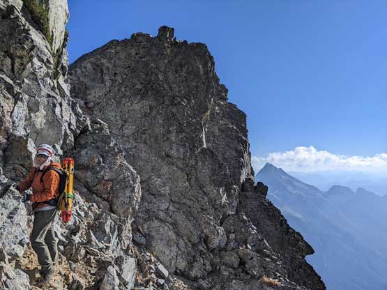
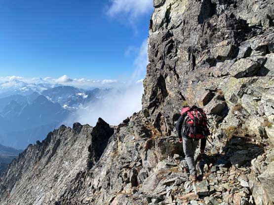
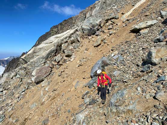
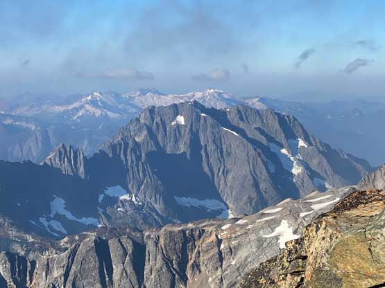
The descent of the SW Face was nowhere pleasant, but far better than plodding it up a few hours earlier. Talon led most of the descent picking some slightly different paths. The biggest challenge was to not dislodge rocks down onto each other. Thankfully the face was wide enough that we didn’t have to be above each other all the time. After descending to the ditched gears we turned our attention to Lick of Flame and Horseshoe Peak.