Mount Armour
August 16, 2015
777m
North Thompson Corridor / Barriere, BC
As you probably know already, I was in the process of moving to Vancouver and that needed more than 1 trip to complete. It’s mostly done now (Sept. 2) and I’m posting this trip report from Vancouver currently. The ascent of Mt. Armour happened as a side-trip from the first drive to Vancouver. As I drove by a small community called Barriere about 1 hour north of Kamloops I noticed this small “peak” just to looker’s left across the highway that appeared relatively prominent. A quick check of the Backroad Mapbook (Thompson Okanagan) I realized that indeed had a name. I was doing good on time so decided to bag it as I was there anyway.
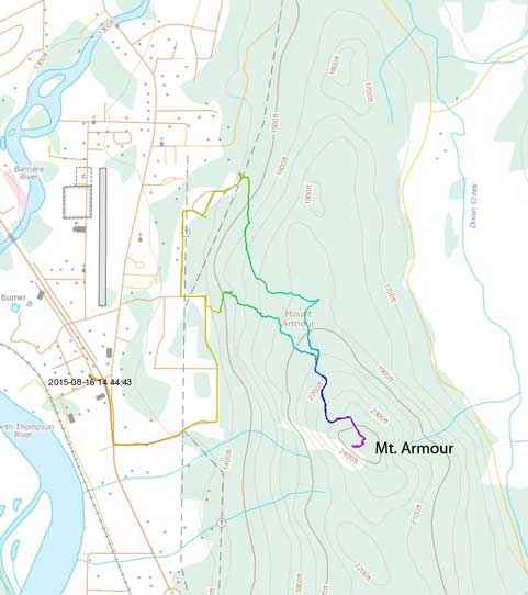
Mt. Armour ascent route. GPX DL
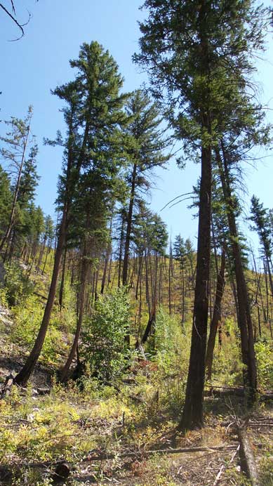
Because the fact this was such a last-minute decision and the information center by Barriere was closed on Sunday I had zero information about this little peak. I basically pulled out the GPS and drove as close to my objective as possible and parked randomly. My GPS showed there’s about 400 meters of height gain so it’s not nearly as short as appeared, but again due to the last-minute decision I did not have hiking shoes, poles nor even a backpack. So off I went following my basic sense. Right-away I realized the desert-like slope that appeared nothing but dirt from afar actually involved quite a bit of bushwhacking through the underbrushes… My progress was painfully slow but thankfully with some determination I eventually came across a set of ATV tracks about halfway up the mountain. This road was going towards the direction I wanted so I followed it up, and indeed it eventually brought me to the summit.
Starting the ascent using my GPS as navigation tool

Cresting the broad N. Ridge
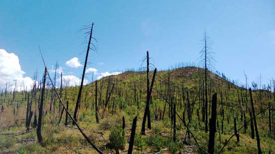
Looking upwards. Despite the appearance I still had a long ways to go

Thankfully I managed to find this ATV road, otherwise the bush could be really bad

Upwards and onwards following the tracks

Partial summit panorama. Click to view large size.

Partial summit panorama. Click to view large size.

Looking into the Monashee Mountains

This treed bump is officially named Barriere Mountain
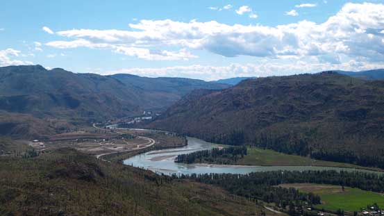
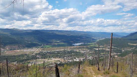
Looking down south along the N. Thompson River

Part of the town of Barriere

Me on the summit of Mt. Armour
The view down towards Barriere and the North Thompson River valley was great but I had no water with me so immediately started the descent. I went down the ATV road for as far as I could but soon I realized it’s dropping down the other side of the ridge so I backtracked a bit and thought I’d have to bushwhacking all the way down from there. Thankfully again I came across another set of ATV tracks lower down (felt weird as I didn’t see it on the way up). This road was indeed going downwards but not quite towards my car neither. I figured a bit of detour at the end was still better than the bush so went down that way.
On the descent I had a better view of Barriere

Looking far North along the North Thompson Corridor

The ATV Road on the descent
Back to the car it was indeed a roughly 1.5-hour trip. Driving towards Kamloops I had another objective in mind. I’d done some research about that one so I knew it’s going to be a lot shorter than the peak I just ascended.
