Mount Harrison (ID)
December 20, 2021
2824m
Twin Falls, ID
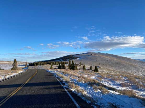
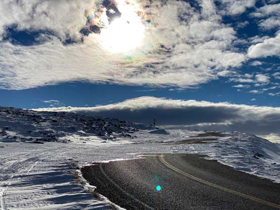
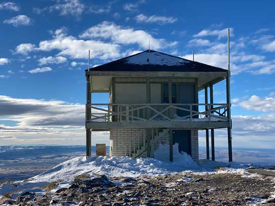
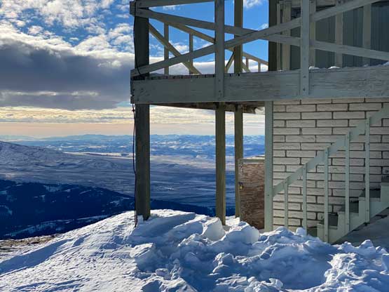
Mt. Harrison locates about an hour’s drive to the south-east of Twin Falls in southern Idaho. This peak is somewhat connected to the much-bigger Cache Peak to the south, but Mt. Harrison itself still boasts over 600 m prominence as well as a recognizable profile. There’s a paved road that goes all the way to the summit and in summer season this peak is a simple drive-up. The road is unmaintained past the ski resort in winter which means about 5-6 km each way of walking. The upper mountain is frequent by snowmobiles so one can use the sled tracks to eliminate trail-breaking.
I did this peak as the first objective in this 22-day foray to the SW desert states. I spotted Mt. Harrison on the map along with the ski resort and the paved road. My initial plan was to spend a full day leisurely driving to Twin Falls and get Mt. Harrison done in the morning of Day 2, but I changed my mind after consulting with the weather forecast. The sunshine in Idaho and Utah was supposed to be short-lived and then a prolonged stretch of bad weather would move in after Day 3. I wanted to do Mt. Harrison and a few other summits in the vicinity of Salt Lake City while the weather was still good, and that required me to squeeze this ascent into Day 1. The drive to Twin Falls would take 11-12 hours and with the short daylight time around winter solstice this was surely not an easy task.
I rushed the packing and managed to leave home at around 5:30 pm the night before but right away I faced an hour-long delay at the border. The border guard apparently didn’t believe in my story of driving all the way to Las Vegas for unknown number of days and issued me a secondary check and a loads of personal questions. They eventually gave me a green light after almost an hour of interviewing. That night I drove over Snoqualmie Pass fluently but encountered a nasty winter storm after Ellensburg in SE Washington. The Google Map directed me off the interstate freeway onto some smaller state road that didn’t even have tire tracks on the fresh snow. The visibility was also terrible. That stretch took me about an hour but conditions did not improve much after rejoining the freeway in northern Oregon. There was enough truck traffic to keep one lane free of snow, but passing these trucks felt very sketchy. If not because of the 4×4 and all terrain tires I probably would have to call it a day here, but I managed to push to Pendleton and then up and over the high pass to Baker City at 2:30 am. By this point the road condition had improved and the snow storm had stopped, but I was too spent to push any further, so pulled over and slept a couple hours in the truck.
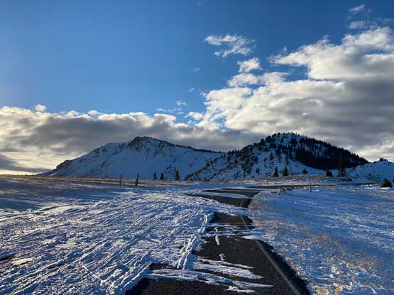
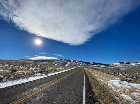
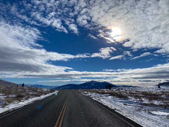
I resumed the driving when it was still dark as I still had a long way to go. I drove through the Boise corridor pretty much during the morning rush hour and the traffic was a bit on the heavy side. The sun finally came out. There was still snow on the ground but the winter-driving finally gave way to some fast cruising. The stretch from Boise to Twin Falls was boring but the speed limit was encouraging, at 80 mph. I then followed the Google’s direction onto the winding road on Mt. Harrison’s eastern flanks. I thought the road would be well maintained to the ski resort but it was apparently not. There was enough snowy stretches that required 4×4 and good tires. I drove another kilometer passed the ski resort to a closed gate where everyone started snowmobiling. This last stretch was not plowed at all but there were enough tire tracks for me to push through, albeit quite sketchily.

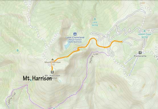
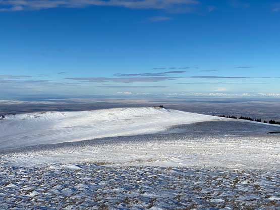
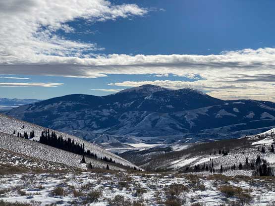
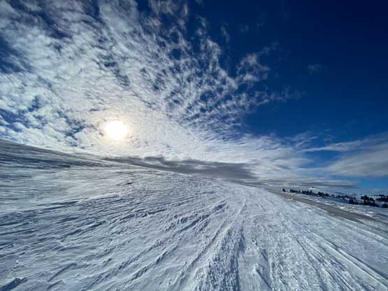
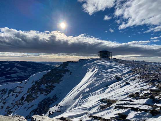
I had about 3 hours of daylight time left so there wasn’t any need to rush anymore. Despite the snowmobile tracks I still carried snowshoes which turned out to be a good call. After about a kilometer I had to strap the snowshoes on but then the road became bare so I had to take them off. The road became snowy again after entering some shady areas but I did not need snowshoes until much higher up near a switchback feature. I decided to just short-cut this switchback through untracked powder, and the trail-breaking was brutal. The snow was bottomless that I sank knee deep to the ground despite the snowshoes. At this point I decided against any major winter ascent in Idaho, Utah or northern Nevada as I did not want to deal with solo trail-breaking. The upper roads were snowy enough that I managed to snowshoe all the way to the summit. The plod felt like a slog in the end but the views were excellent.
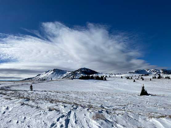
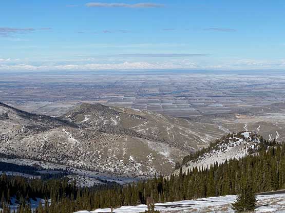

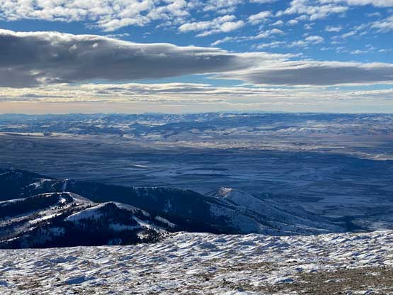
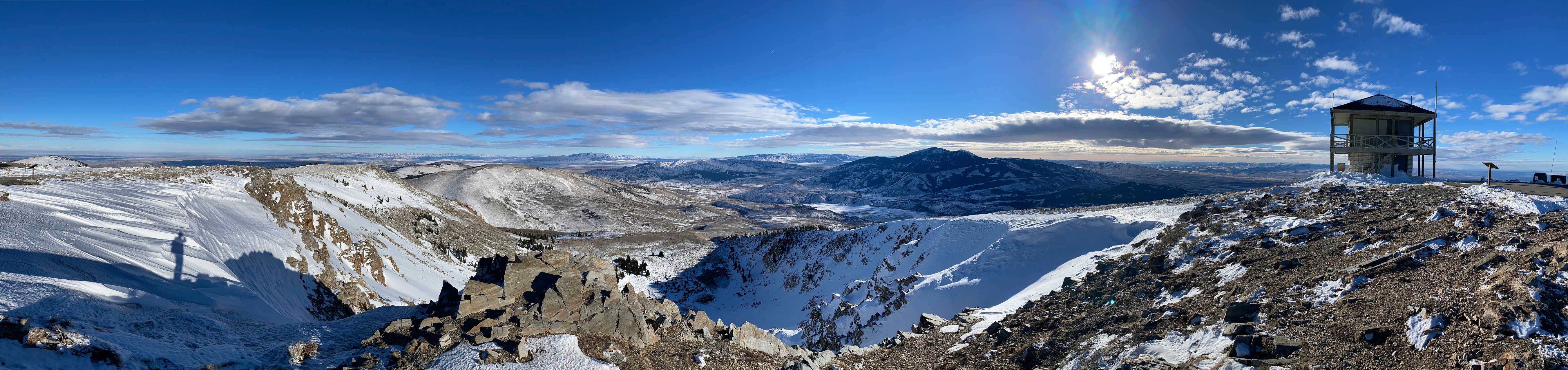


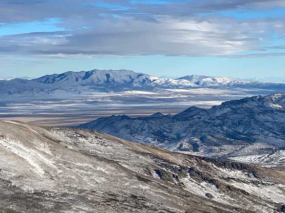
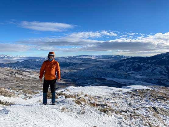
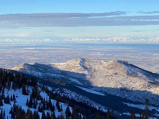
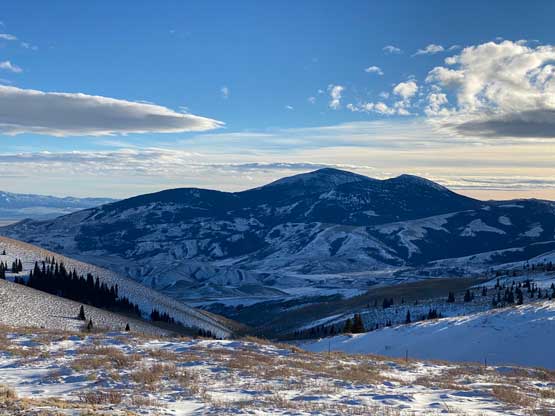
I walked around the summit plateau to every possible corner to fully soak in the views before plodding down. I only needed snowshoes for some short sections including that short-cut I did, but wherever I used snowshoes I definitely needed them. While driving down the windy roads I watched evening alpenglow and another half an hour or so I merged back onto I-84 due SE. I pushed to Tremonton, Utah at 9:30 pm to call it a day. The first thing I did was to find a McDonald for some free wifi as I did not want to turn on the roaming in the US. I spent about two hours to finish watching the two last episode of a recent Chinese drama series that I had been following for quite a while, and then drove to a dark spot and slept in the truck. The night became very cold that I woke up at 3 am even in my -18 degree sleeping bag. I put on more layers and kept sleeping till 8 am.