Boulder Mountain
December 1, 2019
2723m
Gott Creek / Duffey Lake Road, BC
“Boulder Mountain” is not an uncommon name and a quick search on Google reveals at least half a dozen peaks with “Boulder” in its name within a reasonable radius from Vancouver. This one is not to be confused with the others. This name is unofficial, but the peak itself if a rather major summit on the eastern reach of Duffey Lake Road not far from the town of Lillooet. It rises above 2700 m elevation and is one of the taller peaks in the loosely defined region of SW BC. The ascent is without technical difficulties although the route information is sparse online. There are only two routes with documentation – the W/NW Ridge direct, or by the hanging valley paralleling the ridge to the east. The former has a summer trip report on ClubTread while the latter is briefly described in John Baldwin’s Exploring the Coast Mountains on Skis. Both routes are accessed by logging road systems in Gott Creek valley, and at least the first 4.5 km on the main Gott Creek FSR should be drivable by most high clearance 4WD vehicles.
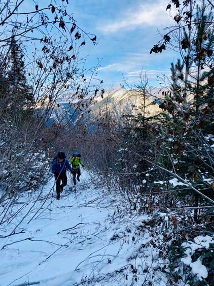
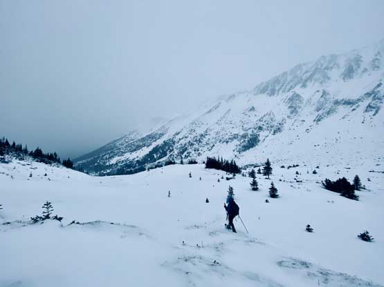
Between the two routes my preferred choice was the ski route because such allows an ascent in winter, or at least winter conditions so that I wouldn’t need to waste a beautiful summer day for a hike-up ascent. To get out of the hanging valley onto the NW Ridge crest does traverse and ascend significant avalanche terrain so stable conditions are an absolute must, and because of that I somehow hadn’t happened to do this trip even though it’s been on my list for more than three years. The decision of this past Sunday among Mel, Gur and myself was very last minute and completely random. The avalanche condition was low/low/low or more precisely, there simply hadn’t have enough snow to slide yet. The temperature was cold. I knew early December could be the worst time of a year to deal with overgrown logging roads and bushwhacking but let’s face it. The alarm went off at 2:50 am and pretty sure I didn’t get any sleep at all. I picked up Gur from Surrey and then Mel from North Vancouver and then drove up the familiar Sea to Sky Corridor. We stopped at Pemberton for some McDonalds and another while later we were at the start of Gott Creek FSR. There’s about one cm of snow but the road wasn’t very steep that my Taco had no problem getting 4.5 km up the main line. The road was narrow and bushy though. I parked at the junction with the spur road and we decided to walk from there.

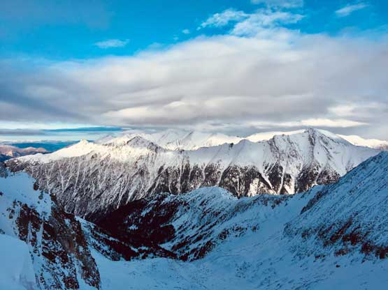
Boulder Mountain from Gott Creek FSR. GPX DL
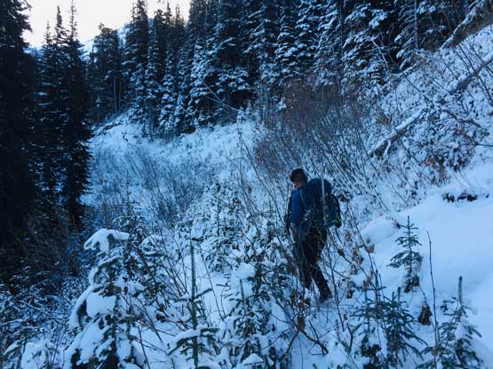
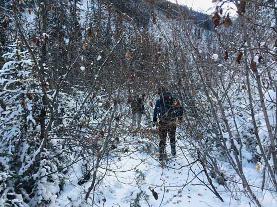
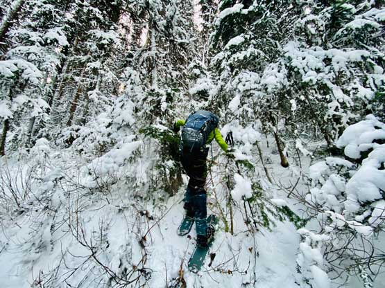
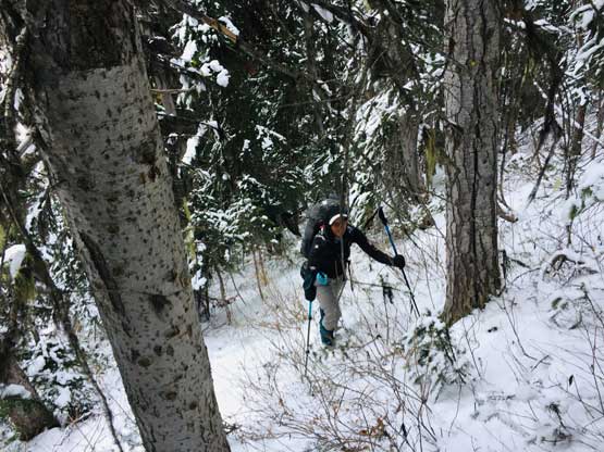
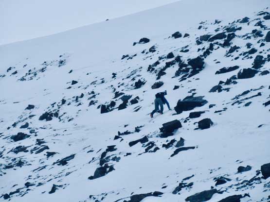
Another truck attempted to drive the spur road but the tire tracks stopped in about 200 m and from there we were on our own. The initial 2-3 km was mostly an open walk with gentle elevation gain, but after a few turns the road started to become overgrown. We had to deal with fair amount of bushwhacking against alders and this was especially not fun in cold temperatures with fresh snow on the tree branches. Partway down the overgrown roads I stopped to don my sunglasses and sunhat just to protect my eyes and face, even though there was absolutely no sun at all at such north-facing aspects. It took us a couple hours to reach the end of the logging roads, where the snow depth was just enough to strap snowshoes on. I opted to don snowshoes while Gur and Mel decided to keep boot-packing. The bushwhack beyond the end of logging roads was even more horrible with lots and lots of young trees, tight timbers, alders and steep traverses with dead-falls, and not to mention the fresh snow that I had to clean off before embracing. The snowshoes actually provided extra traction so the others stopped and strapped the ‘shoes on halfway into the bushwhack. It had taken us longer than expected to finally exit the woods and once upon seeing the steep headwall to get onto the ridge crest we took a long break switching footwear.

Taco parked at the start of the spur road. Already better than I thought.

Mel and Gur walking up the easy portions of the spur road

Geoffrey Peak across the valley to the north

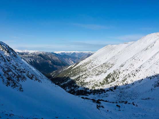
The spur road and some typical Duffey landscape behind
The road’s getting bushier now
Gur and I starting to encounter alders. Photo by Mel O.
Mel and Gur embracing the alders…

Me arriving at the end of road. Photo by Mel O.

Me starting the off-road bush. Photo by Mel O.
It was horrible for a long while. Photo by Mel O.
Mel still trying to smile…

Me encountering another band of alders. Photo by Mel O.
Finally exiting the worst of the bush. Photo by Mel O.
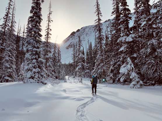
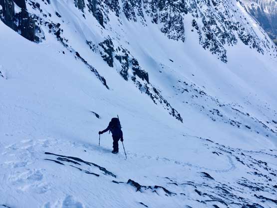
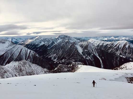
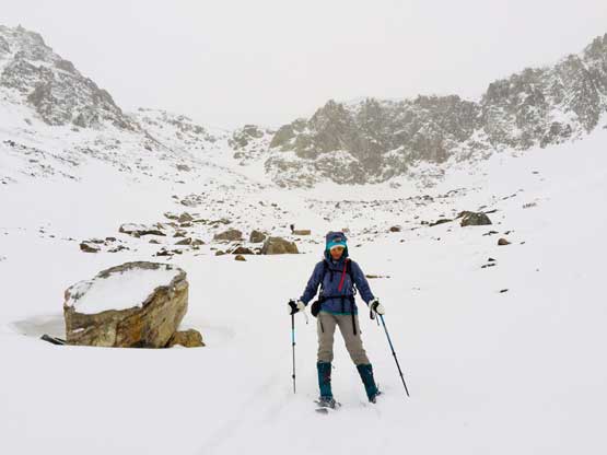
Into the bowl at the head of this hanging valley now.
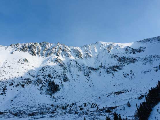
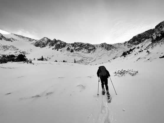
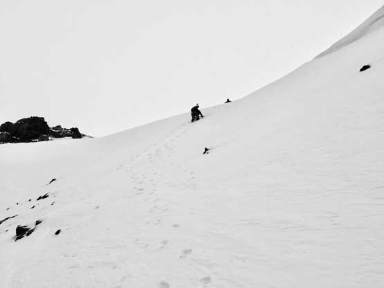
I had hauled mountaineering boots and crampons that far just for that section and the appearance of it confirmed our choice being correct. The headwall was 35-40 degrees and appeared icy. We kept the snowshoes on for as far as we could but then had to do a sketchy transition to don crampons. I didn’t bother to use ice axe though. There had some steep traversing on thin snow underneath cornices followed by a short pitch of 40+ degree climb to the col. Upon seeing the upper 400 m gain we opted to ditch ice axes and snowshoes to save weight. The weather also started to deteriorate at this point but to the east we still had blue skies. The slog to the true summit certainly felt like a long drag and the last section actually reminded me slogging at high altitude. I was very tired, we were post-holing on some very foreshortened slopes, but the wind was cold enough that I didn’t want to stop to take a break. The summit was also very windy and cold but we had to stay there for at least half an hour even just for eating something.
Me leading into the head of the valley. Photo by Mel O.
Gur staring to ascend the steep headwall

As you can see, there were some big terrain around

Mel trying to snowshoe for as far as possible.

Partway up the headwall, looking back at the steep north bowl
Perhaps the bluest weather we got on this day.

Me still trying to keep the snowshoes on. Photo by Mel O.

Me boot-packing now. The snow was very icy at this point. Photo by Mel O.
Me climbing the 40 degree pitch to the ridge. Photo by Mel O.

Looking back down at Mel starting the steepest climb
Another photo of Mel climbing the steep pitch to gain the ridge

The very foreshortened view from the col. Still over 400 m gain to go

Mel ascending above the col now. The bowl behind.
Gur plodding up.

The north face of Wonder Mountain started to show up

Another photo of Gur plodding up

A closer look at Mt. Melvin across the valley in Downton area
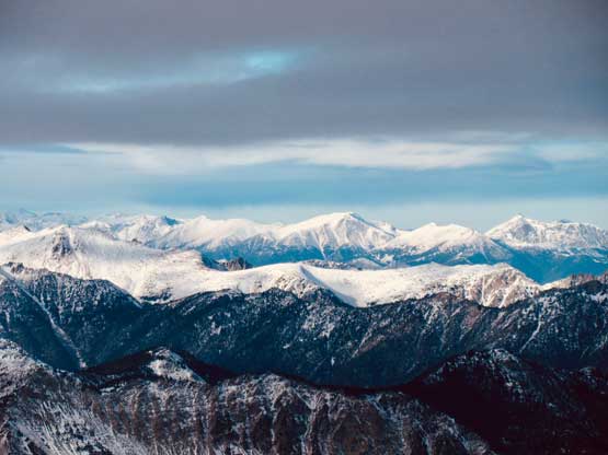
The remote Shulaps Range behind Seton Ridge

Mt. Seton and Saddlebag Peak are two of the tallest peaks around

Interesting lighting on Tigger Peak – another miserable ascent in November
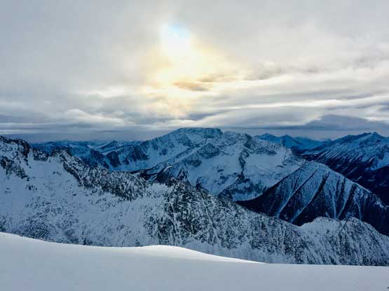
The low-angled sun behind Elusive Peak

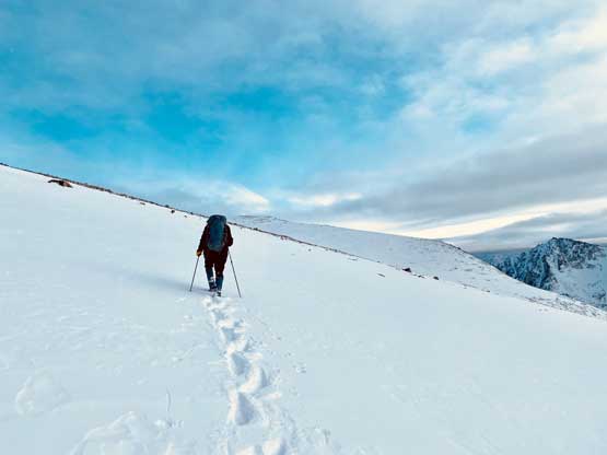
This long stretch had some tedious post-holing. Gur’s still going up
Me post-holing. Photo by Mel O.

Finally at the base of the true summit.
Mt. Brew massif hidden in clouds

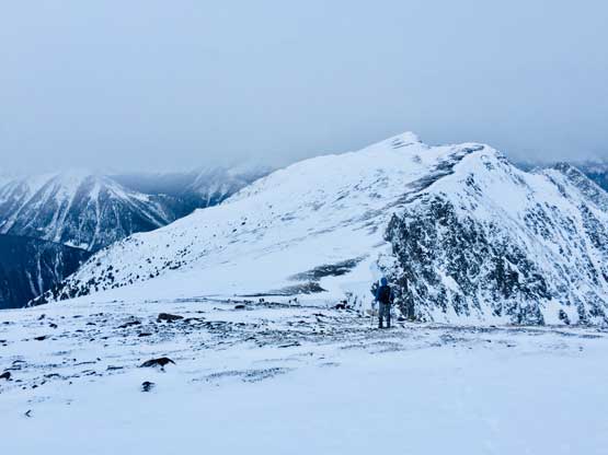
Traversing over a sub-summit

Gur on the final plod

Another look at the north face of Wonder Mountain

Mel on the summit of Boulder Mountain

Looking back at that sub-summit to the NW that we traversed across
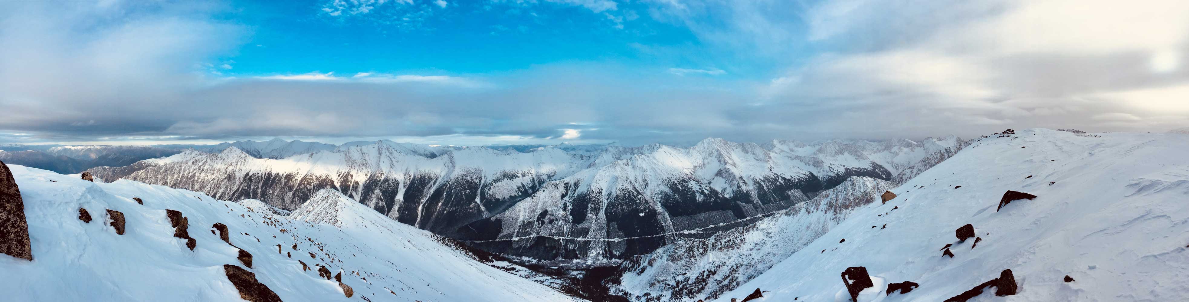
Partial Summit Panorama from Boulder Mountain. Click to view large size.

Partial Summit Panorama from Boulder Mountain. Click to view large size.

Onion Peak across Boulder Creek valley

The Mission Ridge behind the bump of “Northern Peak”

This is a northern view from the summit down Boulder Creek valley

Molybdenite Peak at center
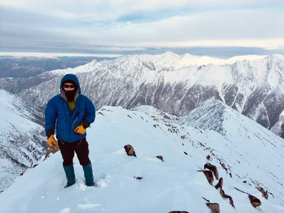
Me on the summit of Boulder Mountain
At this point we only had less than two hours’ daylight time so we had to hurry up. The weather really started to crap out as we descending back towards the col where we ditched snowshoes. The down-climb into the hanging valley was fun and now it started to snow on us. The new goal was to finish the bushwhack before dark but time beat us. We had to make a transition in the woods to take snowshoes off and meanwhile we had to turn the headlamps on. The downhill bushwhacking was easier than expected but still painful. The worst was dealing with those long stretches of alders on the logging roads with some sections of uphill. I wanted to speed the descent but then it was really hard to protect my eyes from being slapped and next time I would for sure bring a pair of lab goggles. Once the brushes ran out the three of us raced the last 2 km back to the truck. The game wasn’t over yet as I still had to careful negotiate the final 4.5 km out of Gott Creek valley. The downhill driving on sketchy snow-covered roads was surprisingly not as bad as I thought, especially considering my trucks only had stock, all-season tires…
Almost back to where we topped out on the ridge.

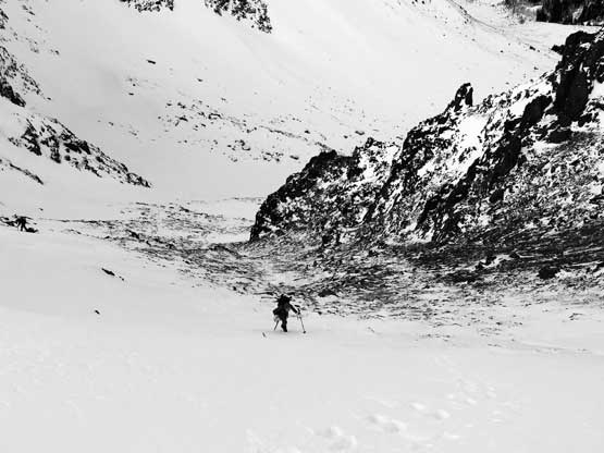
Me down-climbing into the bowl. Photo by Mel O.
Mel starting the down-climb
Me on some steep traverses around thin terrain
Finished the steep part now. It really started to snow
Mel descending into the bowl in deteriorating weather.
There’s already enough dusting of new snow on Duffey Lake Road making the drive back to Pemberton sketchy and exhausting. Again I did not have, and do not want to buy winter tires so with only all-season tires I had to drive very slow on the curvy and downhill stretches. Once back to Pemberton I was already exhausted so we stopped in the McDonalds for a proper dinner. I somehow managed to regain enough energy to drive all the way back to North Vancouver, then Surrey and finally White Rock, arriving at midnight. I didn’t turn in until almost 1 pm, and that concluded another efficient but exhausting peak-bagging mission. More than 36 hours of no sleep…
