Mount Ann
March 29, 2023
1780m
Mt. Baker Highway, WA
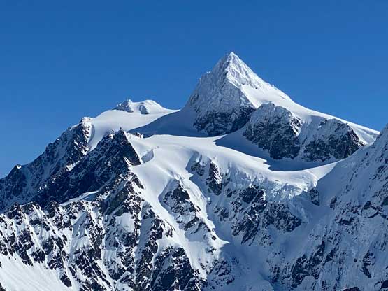
Mt. Ann has finally started to catch attention in the hiking and peak-bagging community as it offers some of the best perspectives of Mt. Shuksan, illustrated by trip reports that popped up on the internet. Prior to the social media era this peak was mostly known in the ski touring groups. The access is straightforward from Mt. Baker ski resort and the ascent is rather “no brainer” but one needs good weather for the views. The approach does involve a grueling 300 m drop from Austin Pass that must be regained at the end of the day, so this isn’t a “short day” for the averaged hikers. The best weather to do Mt. Ann is winter and spring with a thick snowpack to cover the bushes.
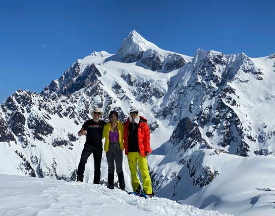
Nikita and I made the spontaneous last-minute decision to hike Mt. Ann along with the unofficially named “Annette” and Raphael managed to join as well. We did not finalize the decision until the night before. I originally had a bigger plan to take advantage of the incredible conditions but I changed my mind because I didn’t want to take any risk of getting injured at this point. In a few days I would be leaving for the Himalayas and I should stick to something easier and well known. The three of us then agreed to meet in White Rock at 6 am and we got to the Heather Meadows trail-head two hours later. I drove us there in my trusty Taco but a small 2WD car could also work in retrospect. There wasn’t any recent precipitation so the roads were bare and clear thank to the frequent maintenance by the U.S. government.
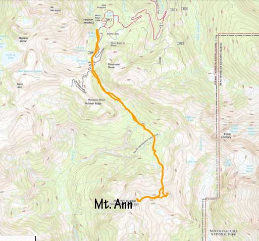
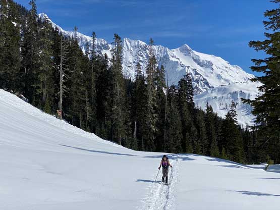
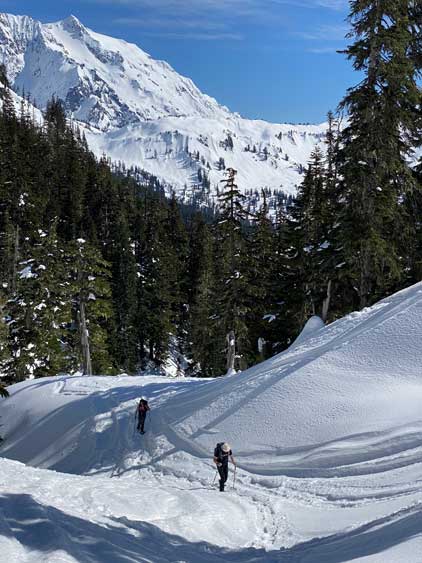
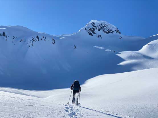
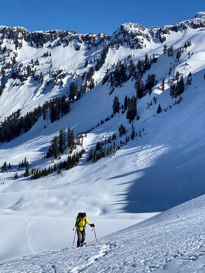
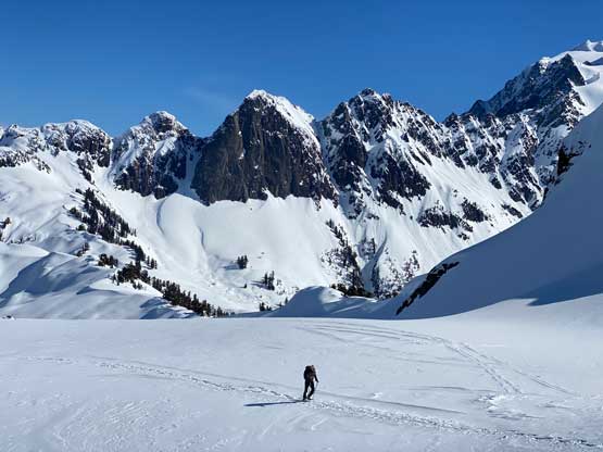
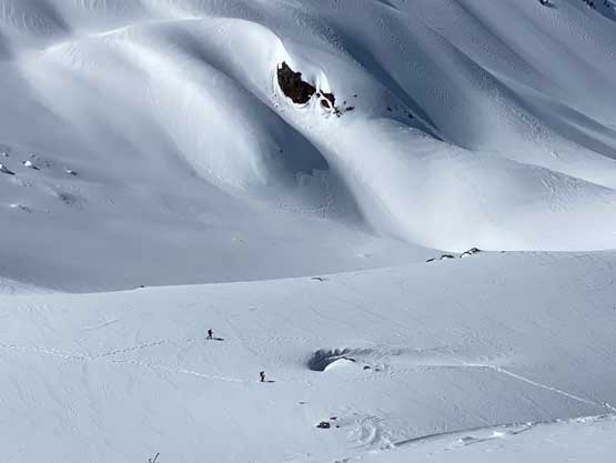
I opted to wear the 30′ Lightning Ascents as I didn’t know how much trail-breaking we would encounter. This turned out to be a good call. The initial stage of plodding to Austin Pass was easy but confusing as there were simply too many tracks to choose from. We eventually opted to just go into the ski resort and snowshoe straight the hell up their ski runs and that proved to be the most efficient way. We also witnessed some other snowshoeers doing the same and no ski patroller came to fuss with us. From Austin Pass we made our own way straight down the middle of the drainage, descending steep (40+ degrees) slopes at times. We later learnt that the skin tracks were mostly skier’s right of us. We joined the skin tracks after descending to a flat zone and mostly followed them side-hilling across the south side of Shuksan Arm to the north slopes of Mt. Ann/”Annette”. The route-finding was confusing due to the micro-terrain so we were glad to have a set of tracks to follow.
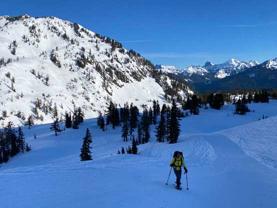

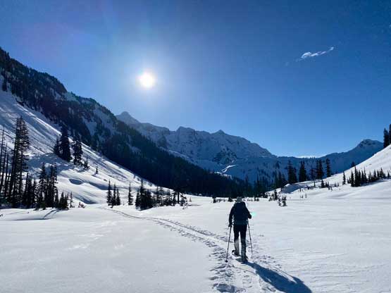


By the time we finally started to regain elevation we had lost 300 precious meters from Austin Pass and we knew the return journey wouldn’t be as enjoyable. The skin tracks on Mt. Ann itself were mostly covered by the recent wind events so we had to break our own trails. My 30′ snowshoes came handy once again. I led us ascending the middle of a depression zone or “gulch” feature aiming towards the col between “Annette” and Mt. Ann and left the gulch near the top when the terrain became increasingly steep (over 35 degrees). We then traversed/ascended a steep slope to get onto a rib feature on climber’s right and followed that to Ann/Annette col.

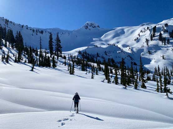

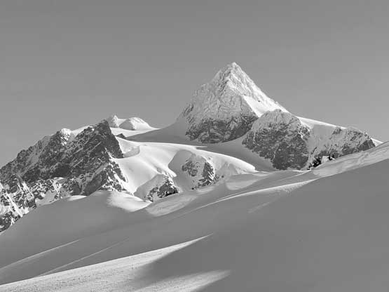


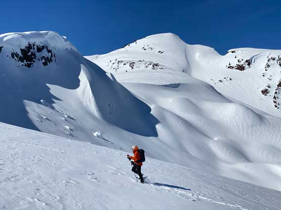
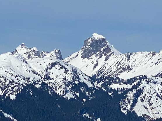
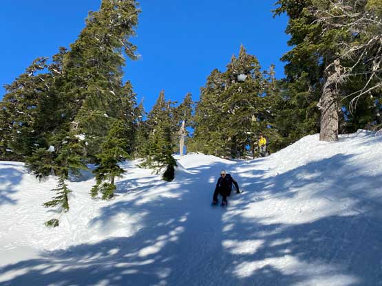
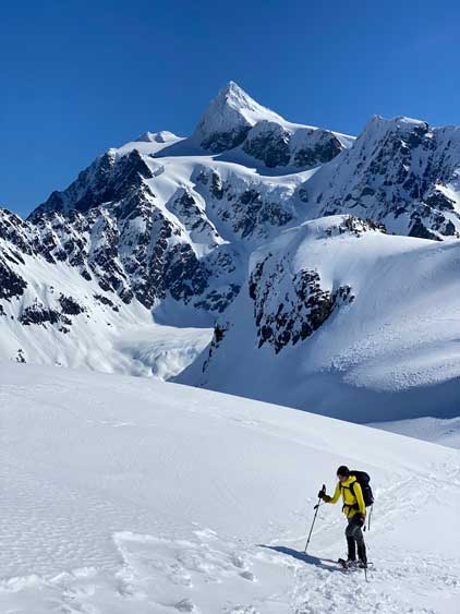
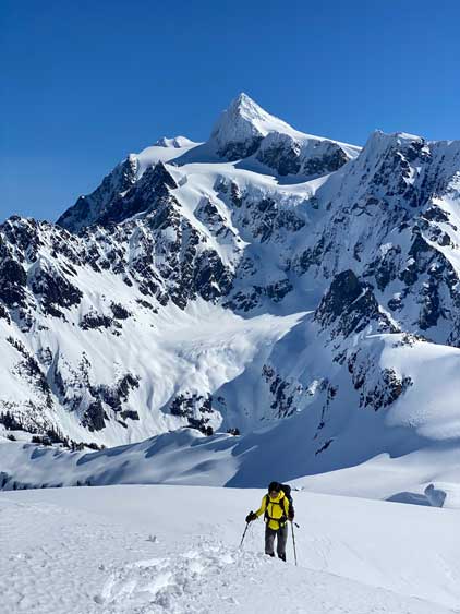
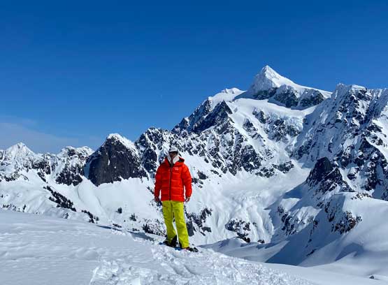
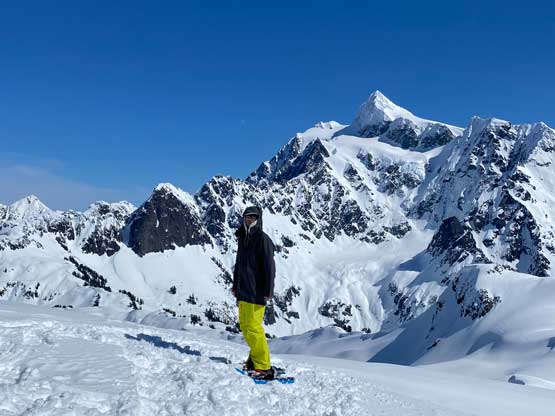
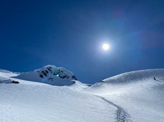
The decision was made to ascend Mt. Ann first so we turned right. To get there we had to plod up and over a subsidiary bump with more micro-terrain to content with. Descending from that bump involved one short stretch of tricky terrain. The final ascent of Mt. Ann via the east slopes was also harder than I thought with slope angle approaching 40 degrees. I determined that the straight-up ascent would be too steep for our snowshoes, so led a line climber’s left (south) of it. The slope was still over 35 degrees. A few bushy steps were then encountered on the uppermost south ridge. The views were magnificent as expected so we lingered on the summit for almost an hour to take pictures.


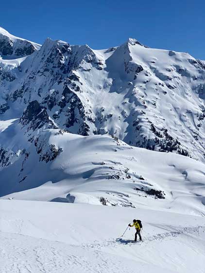


Raphael and Nikita weren’t keen on “Annette” but I had to do it even though I wouldn’t count that as an independent summit. That bump has no official name nor 100 m prominence so it doesn’t count, but I still needed to do it for completion. The other friends who came here earlier in the season all did “Annette” and I didn’t want to be left behind. To get there I needed to ascend one more steep slope (>35 degrees). The views were great, but not much different from what we had already seen, so I thought it wasn’t worthwhile. I then made a short-cut descent and joined the others a few hundred vertical meters lower at treeline where we took the next long break.


Reversing that long and undulating side-hill traverse under Shuksan Arm now in the afternoon heat was not looking promising. The snow had turned mushy. I made Raphael to lead us back through this stage. For the final grunt back towards Austin Pass we opted to follow the well-defined skin tracks to avoid the few steep slopes we encountered earlier in the day. Their route indeed offered a more gradual ascent, but not as direct as ours. We then plunged down the ski resort runs and leisurely snowshoed back to the parking lot. Our round trip time was 7 hours and I eventually got back home in time for dinner.