Okanagan Mountain
March 19, 2019
1576m
Kelowna, BC
The name of Okanagan Mountain is very much self explanatory. This is the namesake summit of Okanagan Mountain Provincial Park on the east side of Okanagan Lake, about half an hour’s drive south of Kelowna in the interior of British Columbia. The park itself is perhaps more popular than the mountain. After finishing the hike I understood why, because most of the better views are actually from the lower elevation zone. The summit has a large communication tower system and is so broad that one can only see a very small fraction of Okanagan Lake. There are two popular routes but only the northern approach is accessible in winter. This is essentially a long plod up a fire road.
I had been planning to spend a few days peak-bagging in the central Okanagan Valley for at least 5 years but the summits of this area are so lowly that I never found enough motivation. The spring break of 2019 saw some unseasonable weather in the western Canada. A strong high pressure ridge kicked in from the south bringing in a full week’s guaranteed sunny conditions but also record-breaking temperatures. The avalanche condition had shot up to High/High/High across every single forecasted region. I could have driven down far south into desert states to escape from snow but it made no sense given the extremely rare weather window we were having in the local areas. On top of that I only had about 4 days to do my own mountain trip and that pretty much meant I should have stayed locally. I had several options in mind but waited until the very last minute to decide spontaneously on the Okanagan Valley. I had been waiting for 5 years and finally found the right window for this trip….
I packed a lot less gear than I used to do on a road trip like this – no ice axe, no technical equipment, no skis and no overnight gears other than a sleeping bag and a stove for car-camping. I drove out of Vancouver after dinner and made to Kelowna 4 hours later. Another half an hour of driving down some windy and narrow (but paved) road saw me parked at the trail-head. It’s already past midnight so sleep came in easily. About 6 hours later I woke up just after it’s bright enough, forced in some breakfast and started this long ass plod soon.
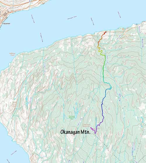
Okanagan Mountain north route. GPX DL
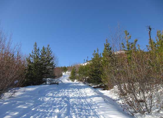
The round trip distance would be well over 20 km and a ton of which would be on snowshoes. This was a hell lot more involved than anticipated and I gradually learnt that during the day. At the beginning I had to carry snowshoes. The temperature was actually quite cold in the morning and the snow had undergone some degree of freeze. There’s also a ton lore more snow than I thought especially on the low elevation zone. The trail had some up-and-downs to deal with and thank to the north-facing aspects much of it was coated by a layer of black ice. I barely managed to get by without having to don microspikes. A couple kilometers later I had to don snowshoes and then another couple kilometers later the trail had joined the main service road. The service road had seen a ton lot more traffic than the trail so at least I was relieved that deep trail-breaking wasn’t needed. By this point I was about 1/3 into the slog.

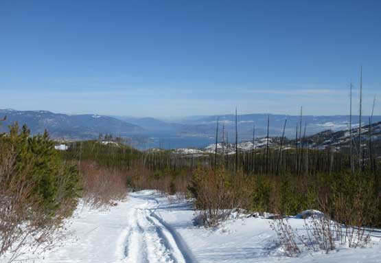
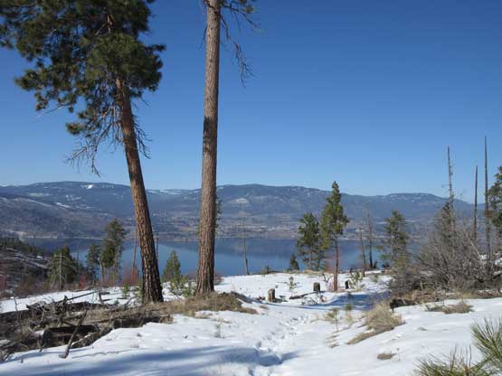
Morning view of Okanagan Lake from just above the parking lot
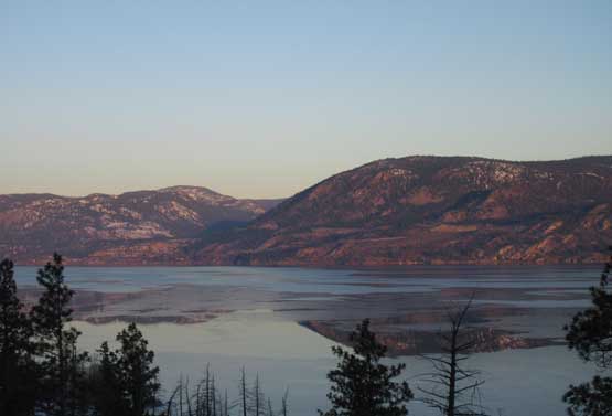
Reflection of Mt. Drought on Okanagan Lake. Note the ice on the lake
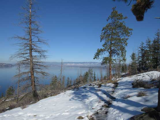
A couple hundred meters up now, looking at Okanagan Lake
As much as the lower elevation views went

I was still on the trail portion here.
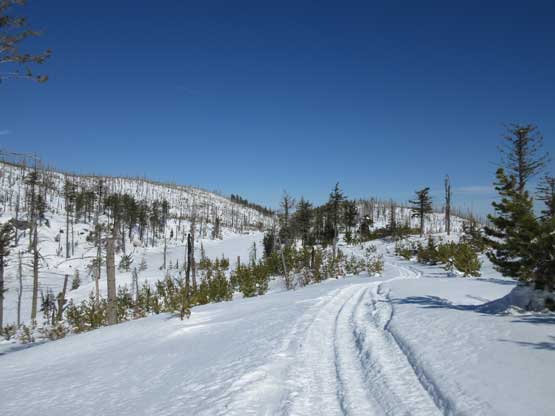
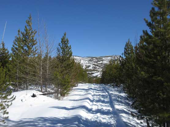
The upper 2/3 of the slog was so much more boring with nothing fancier than putting one’s feet in front of another. The view actually because worse and worse. I have to point out here that the best views in Okanagan Valley are with the presence of Okanagan Lake but unfortunately the lake was not quite visible from the upper mountain. The fire road kept going on forever and I kept checking the GPS to see how far I still had to plod. It never seem to get any closer and the very last 100 vertical meters was very roundabout. There’s a narrow lake called “Divide Lake” that needed to be bypassed on the south end. Any temptation to short-cut was foolish on this particularly day because the snow had gone totally isothermal on anywhere but the snowmobile tracks. As soon as I stepped off the main track I sank to the bottom even with snowshoes on. So? I followed the main road and snowmobile tracks all the way to the summit.

Joining the service road now. The snowmobiles must have started from elsewhere
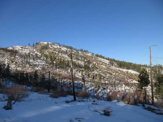
Looking ahead. This isn’t super exciting huh…

Upwards and onward.
Just kept plodding and you’ll get higher. Slowly but steadily…
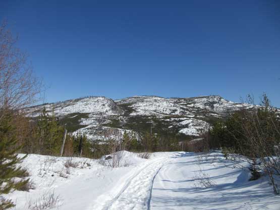
Traversing around Divide Lake
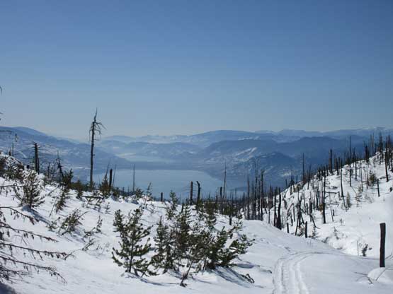
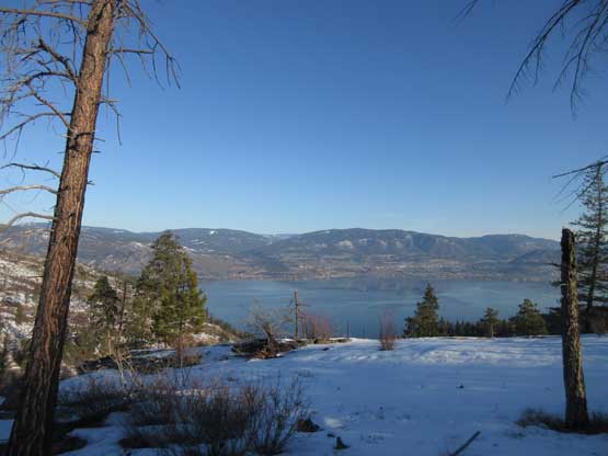
A closer look at the southern end of Okanagan Lake and Skaha Lake

As much as the upper mountain goes

Almost on the summit now, looking back (towards east)
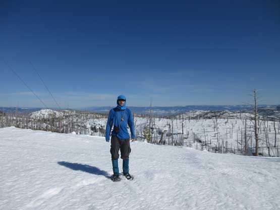
Me on the summit of Okanagan Mountain

Another photo of me on the summit of Okanagan Mountain
I didn’t linger too long up there because the view was actually quite limited. I also resisted the temptation of taking a short-cut near Divide Lake and walked back down the service road like a zombie. It was boring as fuck so I turned the musics on and let it play until I got all the hell of way back to the truck. The best view from the entire descent was actually at the very bottom, at no farther than 50 vertical meters above the parking lot. The Gaia GPS showed about 25 km distance and my round trip time was over 8 hours. I was tired, but not impressed…

A zoomed-in view northwards towards Kelowna
This pic shows the typical view…
Just kept plodding down and you’ll eventually get there…
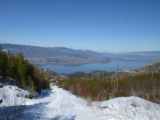
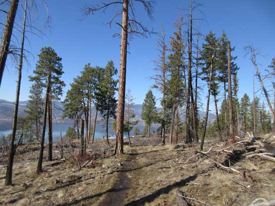
One of the few unobstructed view zone of Okanagan Lake
A lot of hikers stopped here judging by the tracks.
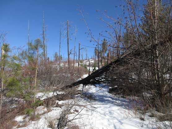
One of the few dead-falls across the trail.
This stretch of the trail was super icy in the morning.
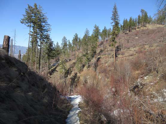
A stretch of no-snow zone…

Almost back to the parking lot. This is Okanagan Lake
One more photo of Okanagan Lake.
It was only in the early afternoon so I could have gone for another summit had I wanted, but given the shitty snow conditions I immediately gave up that idea. I directed the Google Map GPS into the city of Kelowna and had a big meal in a shopping mall. It was still very early so I started playing with the Gaia GPS – more for planning the next few days’ objectives but who knows… I noticed a small peak named Mt. Dilworth not too far from where I parked and spontaneously decided to get up there to watch sunset, for the sake reason of why-not.
