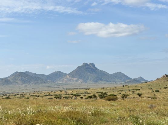
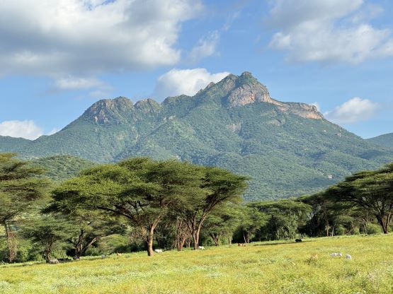
Mount Kulal
December 28, 2023
2285m
Loiyangalani, Kenya
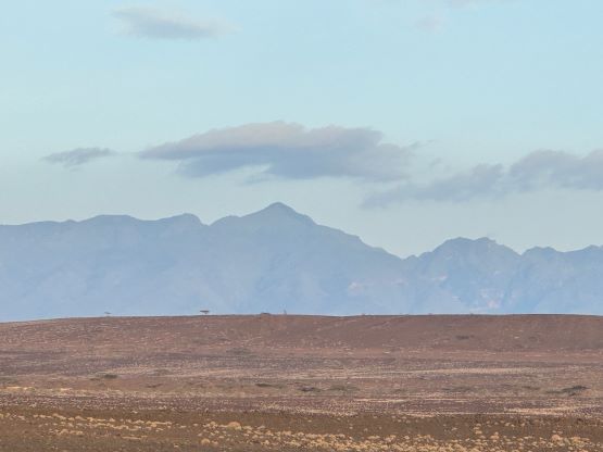
Mt. Kulal is a remote dormant volcano overlooking the small village of Loiyangalani on the east shore of Lake Turkana in northern Kenya. It’s so deep that a full day’s worth of driving on dirt roads is required just to get into the area, and the ascent isn’t a “giver” and would take the majority of a day for most parties. There are several summits on this massif and the true summit is the northern (more difficult) one. Unfortunately Gaia has mislabeled the peak to the lower and easier south summit and that had caused some frustration in the past. Thankfully by now the “beta” is very clear so there’s no confusion for us. This is the only Kenyan “Ultra” (asides Mt. Kenya) that Adam and Petter missed out in their Feb. 2020 trip. The reason was obvious as Adam stated clearly in his trip report that “to get Mt. Kulal would likely require 2 additional driving days” as the roads were incredibly bad. Rob apparently did not believe in that statement as the plan for us was to drive from Lesatima’s basecamp all the way to Loiyangalani in one day. I could not add much as I did not do detailed research until a few days after making the final payment, which was a couple days prior to boarding the flights. Julian Wright, our lead guide for this trip believed in Rob’s planning so I shall not worry.
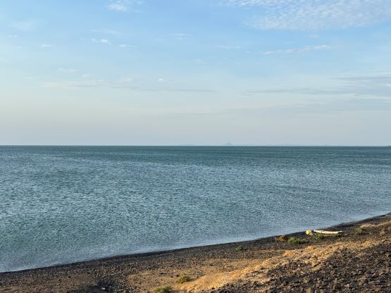
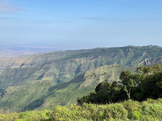
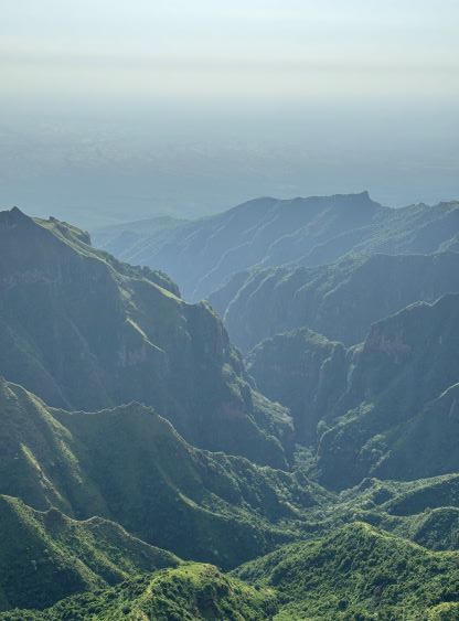
Mt. Kulal turned out to be much more fulfilling than expected, and offered an extremely satisfactory mini-adventure. The drive was long, exhausting and difficult and in fact, this was the longest drive on dirt roads that I’ve done in a single outing, but en route we covered all kinds of climate zones and landscape, losing over 3000 m elevation from Lesatima’s camp to near sea level on the shore of Lake Turkana. The first stage of the drive was from the Aberdares to Nyahururu to meet up with Julian. We then hopped into Julian’s Landcruiser and cruised northwards to Maralal. Up until this point we were mostly driving on paved roads, but there’d have no more pavement for the 230-km ride from Maralal to Loiyangalani. This section ate the majority of the day, that we did not arrive at the Oasis Lodge until dark. Julian later admitted that had he known the current status of this road he would have insisted on taking two travel days here. There were a lot of cool scenery and wildlife sights so we stopped frequently for photos. There were also several security check points and Julian knew what exactly to do. There were more problems coming up on the summit day, that in retrospect I definitely think it’s a great decision to pay the added fees to have Julian. It costed me an additional 1730 USD so I wasn’t so keen when planning this trip. I reluctantly agreed because this was the group decision, but now I would actually highly recommend doing so. These peaks aren’t Kilimanjaro or Mt. Kenya. They are obscured, remote and this is in Africa, the land on which one should always expect the unexpected. Julian was born and raised in Kenya, owns the company of African Ascents, and has successfully guided another group with a similar itinerary (Deividas and co.), so I doubt if there’s anyone else that could do the job better. Sure it’s possible to all these things on your own, but there inevitably will be delays. We ended up summitting Lesatima, Kulal and Ng’iro within 4 days. Can you manage that?


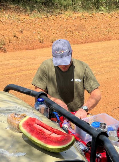


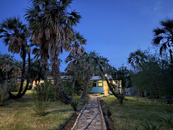
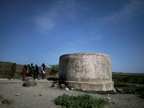
We stayed in Oasis Lodge in Loiyangalani and despite the lack of some infrastructure this was as good as one could expect. The dinner was well served and the hot shower was available. There was unfortunately no WiFi nor air conditioning but this was in Africa. We couldn’t ask for everything. The night was unbearably hot but I was so exhausted that I still managed a couple hours of sleep. The alarm went off at 2:30 am and the plan was to leave the lodge no later than 3:30 am. They were even able to accommodate our ungodly schedule to serve us breakfast. The drive to the trail-head involved more rough roads and took about an hour. We parked right in front of two water towers and to my surprise a few locals showed up after our arrival. I’ve read in Deividas’ account that they hired three gunmen to guard the vehicle but these guys were clearly not up for that. In fact, one of them would be our local guide. I later learnt that Mt. Kulal has some serious private properties issues that even Julian was unable to resolve beforehand. There are two tribes, one owns the lower slopes and one occupies the upper mountain. They both wanted to get paid so there’s some aggressive negotiations during the day. Neither Elijah nor Julian ended up summitting with us as they had to stay back (on different stages) to solve the problems.


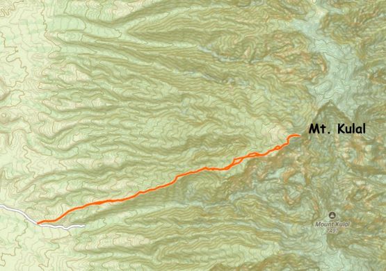
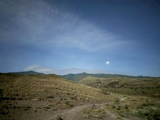
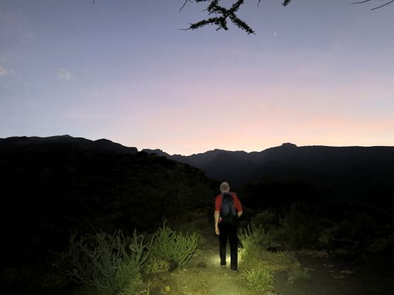
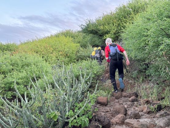
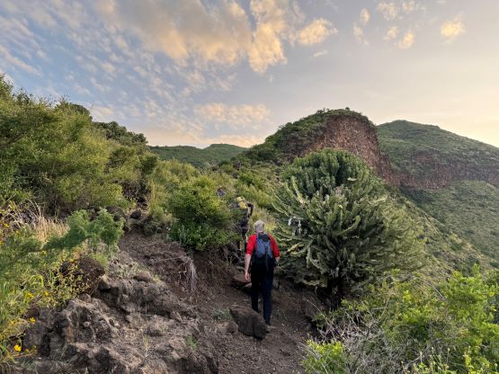
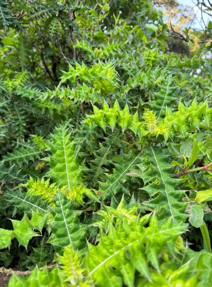
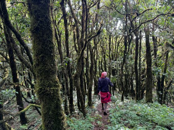
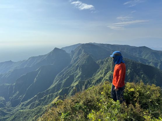
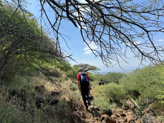
Rob and I, together with Julian and Elijah started the plod following the lead of this local guide. This guy is one of the strongest I’ve ever met and the pace was really fast. Fortunately we had just descended 3000 m elevation in the previous day so that gave us a boost to keep up with this guy. There’s a bright full moon above us, that several of us opted to hike without head-lamp. I, on the other hand, turned the lamp nice and bright as I wanted things to be as easy as possible. There were plenty of cactus and it’s very easy to get caught. About 5 km and a few hundred meters of elevation gain later the horizon had finally gotten bright enough for me to turn off the head-lamp. The route on this mountain is very similar to a typical ascent in Arizona’s desert. The bottom third was sandy and loose; the middle third had lots of cactus and the upper third was actually in some forest. Three locals showed up as we plodded into the upper third. They were very friendly towards us, but Elijah apparently did not have a “fun” time with them as the chief of their tribe suddenly required additional payments.


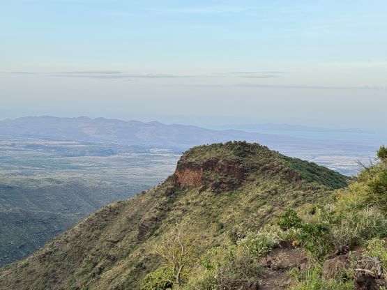


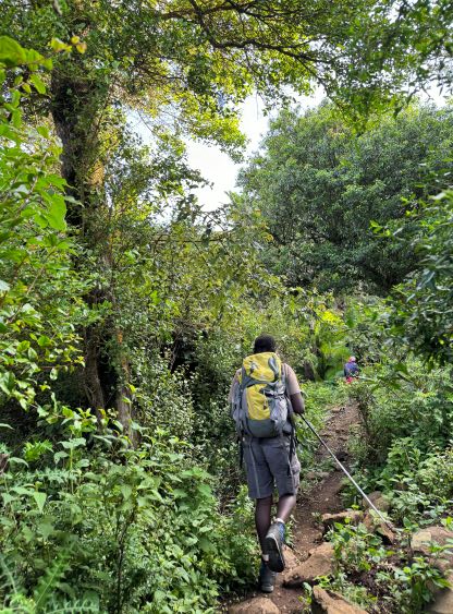


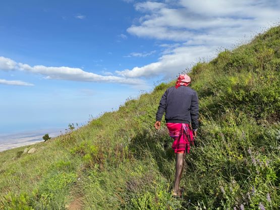
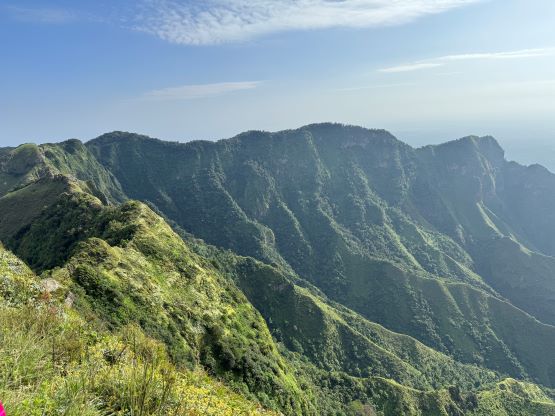
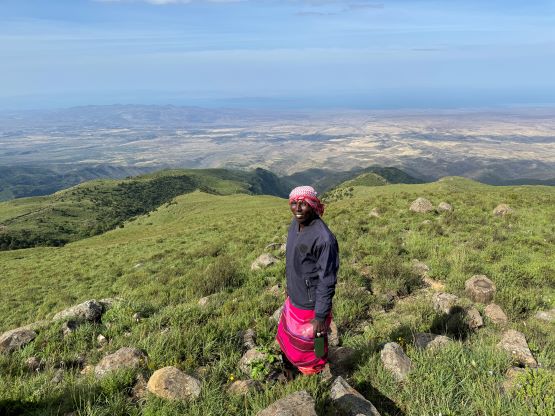
Elijah eventually had to stop to negotiate and it was only the local guide leading me and Rob towards the summit. This local guide was from the lower tribe and the upper people knew him well enough to permit us going. The trail stopped shortly after passing the water source but it was an easy cross-country travel on open grassy slopes. We entered the forest and arrived at the first summit shortly afterwards. The traverse to the second summit involved some up-and-downs and brief bushwhacking and it might not actually be higher, but the views made it a worthy destination. The first peak was basically viewless. The GPS readings were not conclusive to which of the two being the actual high point.


It had taken us about 3 hours 50 minutes to get to this point. We were moving reasonably fast throughout, but the time was still not as short as I was hoping for, suggesting this objective being harder/longer than I thought. We easily descended and regrouped with Elijah and he was not having an easy time with the locals. We then immediately left them and dashed down the trail. We did the descent in probably the fastest possible time given our abilities, the terrain and the hotness. It was unbearably hot but still not as bad as how Deividas made it sound. I also got stabbed a few more times as I was trying hard to keep up with this local guide and was not paying attention to the surroundings. Our round trip time was 7 hours 10 minutes and the distance was 19-20 km. The trail was rocky and loose and not particularly easy for descending.


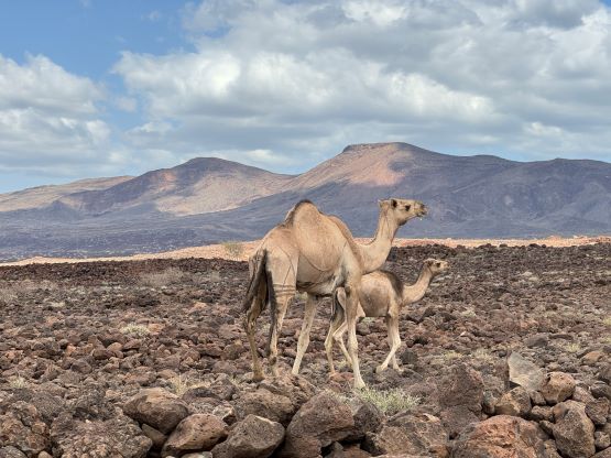
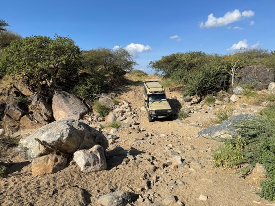
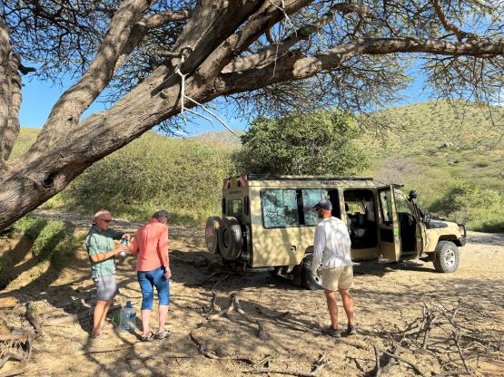
Julian was waiting at the trail-head talking to the lower tribe people while guarding the truck. Without doing much lingering we immediately drove out, back to the lake shore. We found one shaded spot to take a lunch break, then committed to the 5-hour drive towards Tuum. The plan was to bag Mt. Ng’iro on the following day so we must get to that trail-head village. Our first issue was passing 100+ camels that were using the road to travel. It was almost impossible and we had some long conversations with the local kids. Eventually they helped us and we passed the hordes. While watching them running and walking to catch up to the camels reminded me again why the Kenyan guides were so fast. We also decided spontaneously to take that short-cut Tuum-Lojorin Road despite the warnings that it was “seriously washed out”. Julian’s brother lives in Tuum and he knew it was actually passible. We had no tire track to follow after crossing a few wash-outs and this entire drive was a high end 4-wheel-driving adventure into the unknowns. For a few times we had to get out to help spotting. We crossed at least 10 washouts that could easily impose problems to my Tacoma, and it was only the Landcruiser together with Julian’s skills that made it possible. As a result, we got to Tuum before sunset and subsequently settled for the night. We were still on the “best case scenario” schedule.