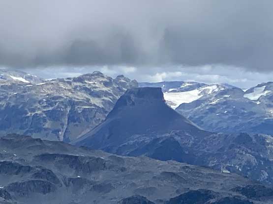
Blanca Peak (BC)
August 24, 2021
2117m
Squamish / Elaho River, BC
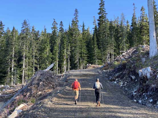
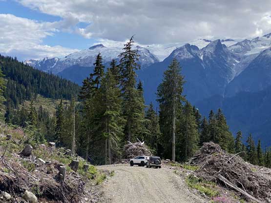
“Blanca Peak” is the unofficial name of the highest summit in the immediate vicinity of Blanca Lake. This area locates not far from the confluence of Elaho River and Squamish River and can also be considered as the very southern extension of Pemberton Icecap. Logging roads had been pushed to 1200 m elevation on the southern slopes and a trail had been built to access Blanca Lake. Because of the easy access and the scenic terrain this area had caught a lot of attention on social media these days, such that even on weekday one can expect to encounter multiple parties. One still needs to drive ~40 km on logging roads just to get here, but such doesn’t seem to be a deterring factor as most who frequent the mountains of SW BC do own a reliable vehicle. To drive the last 2-3 km before the trail-head one does need a 4×4, high clearance vehicle to negotiate the numerous water bars.
I had heard about this peak years ago but my plan had always been to ascend it on snowshoes in spring, but after seeing so many summer photos of the lakes I changed my mind this year. A weather window formed on Tuesday but I was still recovering from the sickness such that my cardio was definitely not 100%. Francis and Andrew happened to have the day available as well so I suggested Blanca Peak as it’s a short, type 1 fun kind of outing. A big thank to Andrew for driving his Jeep here as I didn’t think I had the energy to handle the long drive (both ways) and the hike on the same day. We anticipated some slow show on the roads so agreed to meet up at 5:30 am at the church in West Vancouver. This further meant a wake-up call at 4:30 am for me, which was pretty tiring. The drive to Squamish was without event and the foray into the upper Squamish River valley was as expected, slow due to the endless pot holes. The Elaho Main FSR was not in a better shape neither but in general I think Andrew drives faster on this kind of FSR than I do, so we actually made good time. The spur roads weren’t bad until the last 3 km where high clearance and good traction became a must. Andrew’s Jeep was really struggling and we eventually called it at around 1150 m elevation, a few water bars short of the trail-head. There’s another vehicle parked at the same spot and one truck parked higher up.

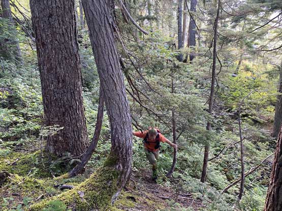
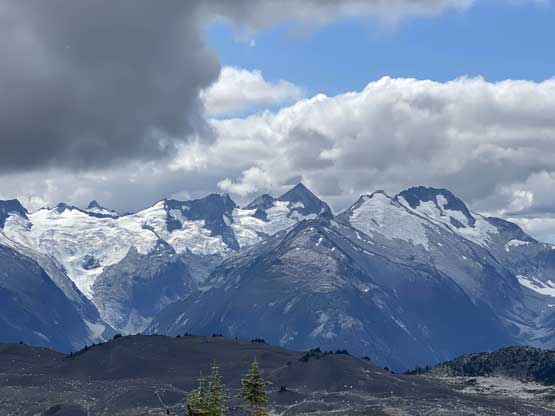
There’s already good view looking back towards Ashlu Mountain but with the hike ahead we didn’t linger long at the trail-head. Right off the bat we went too far and missed the actual trail-head. Thankfully I have a habit to check GPS every few minutes and realized the mistake before it came really costy. We opted to side-hill across the cut-block with some minor bushwhacking to join the trail since none of us wanted elevation loss and regain. I could not comment whether this was a faster option than simply back-tracking but it worked out well. Francis then set up a blistering pace for the next 300 m elevation gain until the trail petered out on a flat bench. I was really struggling to keep up the pace. The trail then did a long and weird traverse due climber’s left aiming at the creek that drains from Blanca Lake. This section was extremely muddy and actually boasted some annoying elevation loss that could definitely become frustrating a few hours later on the return. We rock-hopped across the main creek. The trail then parallels the creek on the left side and very easy to follow all the way to the lake. There were still muddy sections to content with. We made to the lake in about 1.5 hours from the Jeep so this was shaping up to become a short one.

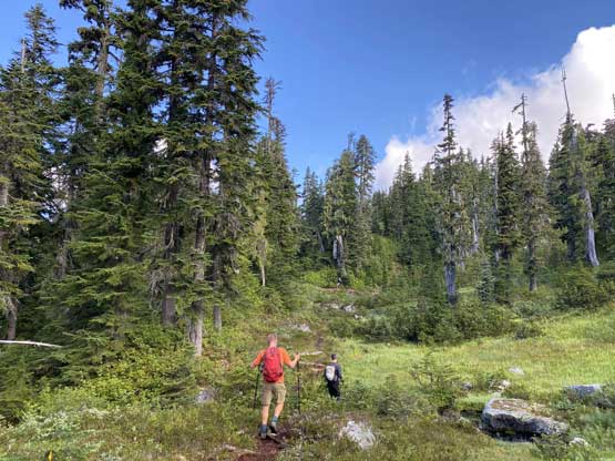


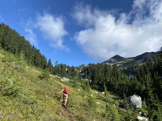

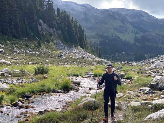
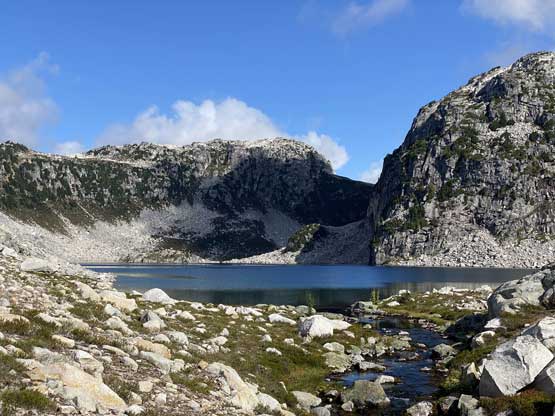
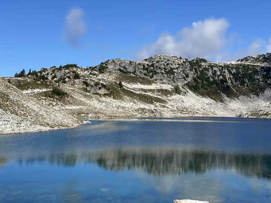

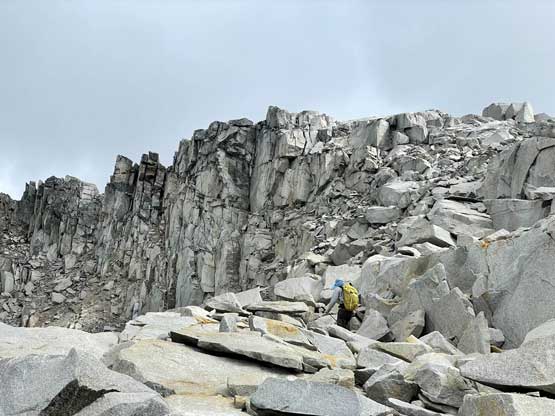
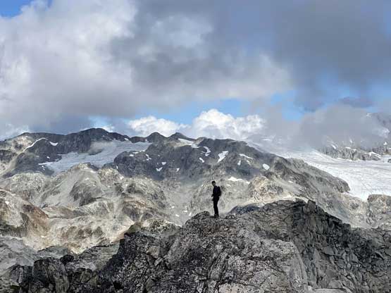
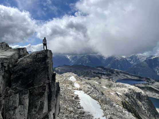
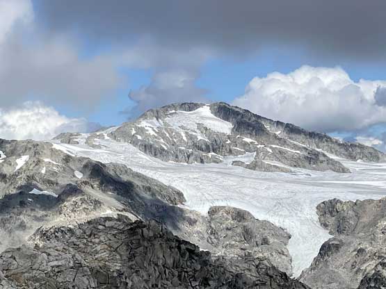
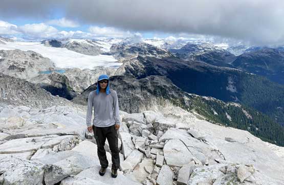
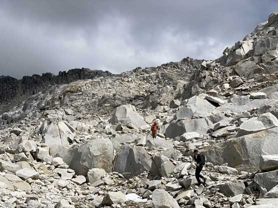
We took our first break of the day at the outflow of Blanca Lake and meanwhile Francis and I did our footwear swap from trail-runners to mountaineering boots. I knew the actual ascent of Blanca Peak had no trail to follow and we must hop across endless boulders, and I needed that extra ankle support of the rigid boots. The boulder-hopping turned out not very sustained but we did have to do substantial amount of them. We easily ascended some grassy terrain for about 100 m out climber’s right before merging onto a long, traversing bench. We traversed across this bench for almost a kilometer due north before making the final push to the summit. That last section to hit the summit ridge had the worst boulders of the day but the scrambling never exceeded “class 2”. The views were great, but honestly not as spectacular as I had seen on social media. I think this peak had gone viral mostly because of the easiness and shortness.


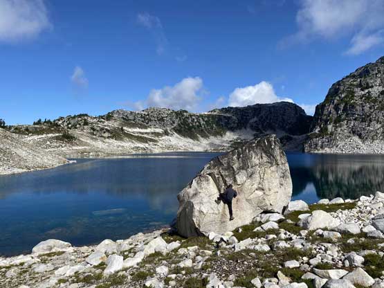
In under an hour we decided to start the descent. I led the group down following the exact same route we took on the ascent. Back to Blanca Lake the lake was disappointedly in shade, so we didn’t bother with any side detours. There were a few smaller lakes to check out for those having extra time, but we simply weren’t in the mood for that. Andrew then set the trail-running pace once we all swapped footwear back to the runners. The softness of the trail combined with the angle of the terrain sure made this a very enjoyable jog. I took over the lead at that steep, 300 m descent to the cut-block and I actually managed to jog most of the way. Our round trip time was under 6 hours and that’s considering the numerous long breaks we took.


Andrew again, did an excellent job negotiating the steep roads down to Elaho Main, and then the hour-long bumpy ride out to Squamish. The traffic back home was horrendous since we got back to West Vancouver at 5:30 pm. It took me an hour and half to drive back to White Rock.
