Luxuria Peak
July 22, 2019
2472m
Pemberton / Upper Lillooet FSR, BC
“Luxuria Peak” is an impressively-looking rock tower immediately south of Mt. Delilah overlooking North Creek in the Pemberton Valley. This peak has steep walls on all sides but the south-east and the only beta on the internet is a 3rd class scramble/bushwhack via SE Ridge. Very few people bother to ascend this peak. An ascent of Luxuria Peak was not part of the plan when Alex, Paul and I ventured into Mt. Sampson area but as we progressed into the trip we jacked up the ambition to make a loop around the headwaters of Delilah Creek while bagging all peaks in one grab. The traverse from Mt. Delilah to Luxuria Peak looked complicated and steep but we all had an exploration mindset and we knew as long as we could traverse onto Luxuria Peak’s SE Ridge we would be home free. Earlier in the trip we had ascended Mt. Sampson, Sessel Mountain and Mt. Delilah, and this was the 3rd day of this trip.
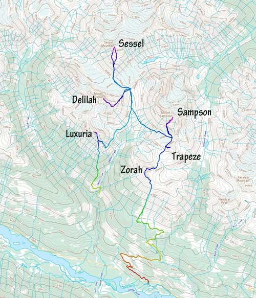
Sampson Group peak-bagging. GPX DL
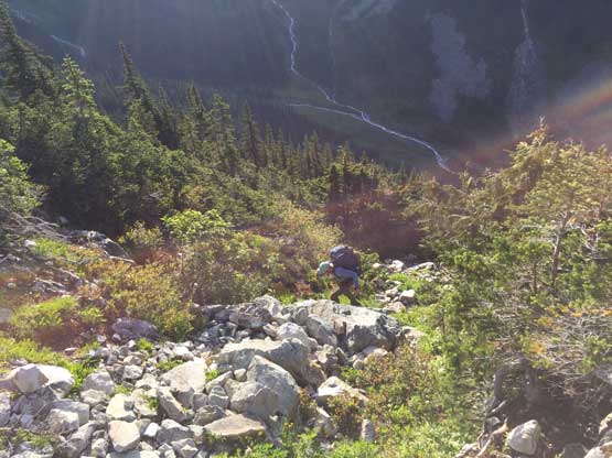
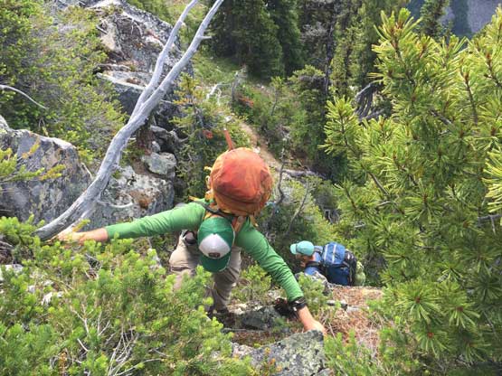
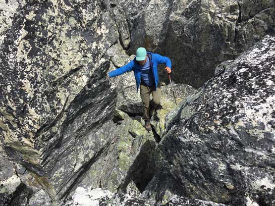
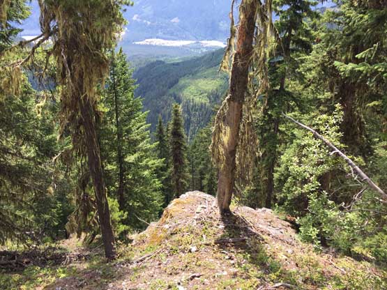
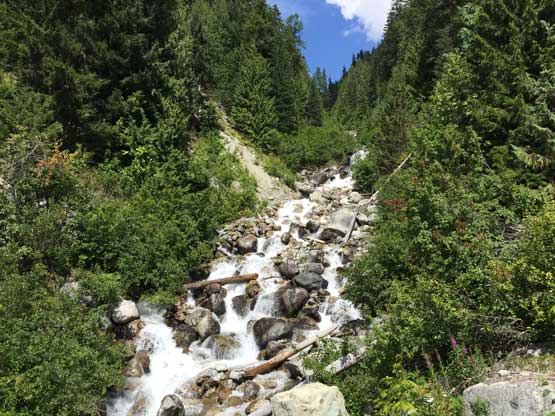
The first section of the traverse was fairly easy on mostly open grass with occasional bush across the west and south-west slopes of Mt. Delilah. We lost a bit of elevation along this stage down into the main drainage between Mt. Delilah and Luxuria Peak. A main glacial-melt creek drains this valley and we hopped across the creek on rocks, then filled up the water bottles. We expected no more water source for the rest of this day so loaded about 3 L each, then carried on into the unknown. We knew nobody had gone up this side but based on the earlier observations we wanted to maintain the elevation without gaining/losing too much. This worked greatly at the start, until we ran into the first of the many deep gullies. Crossing these gullies was no easy fair. We committed to the first one which involved some sketchy 4th class moss and vege-belays. Climbing out of the first gully was exposed 3rd class.
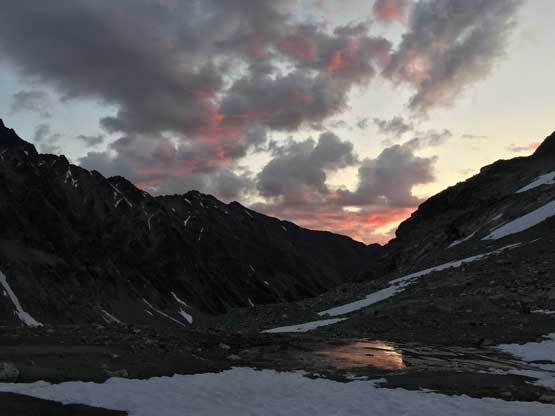
Morning colours at camp.
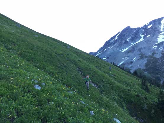
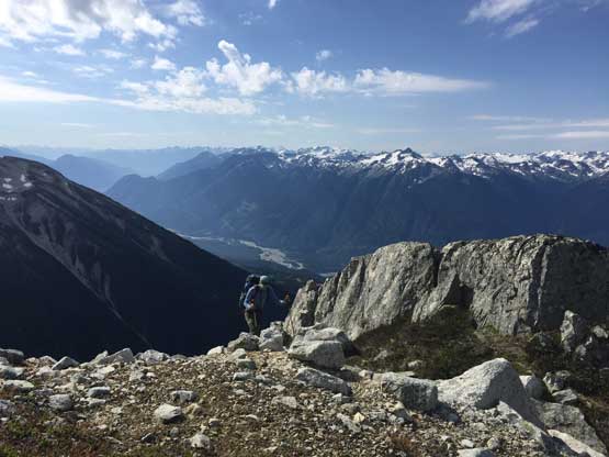
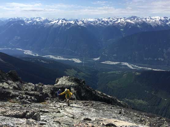
The first section of side-hilling around Mt. Delilah was easy
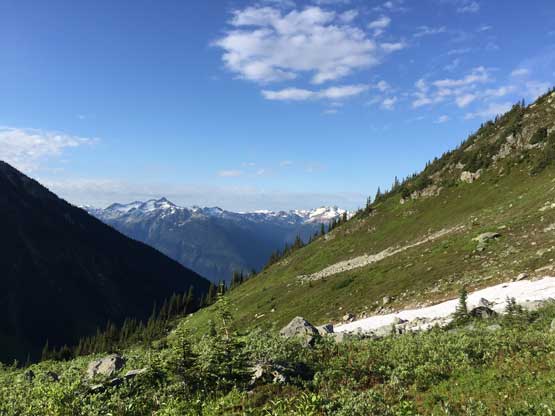
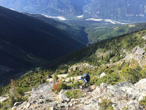
Into the sunshine. Temperature skyrocketed very quickly
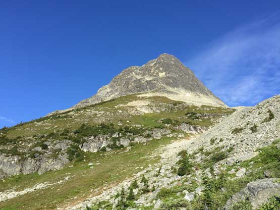
The NE aspect of Luxuria Peak. Not the way up
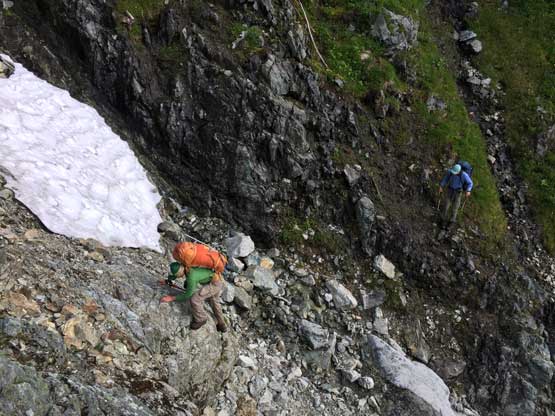
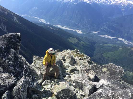
The start of the traverse across Luxuria’s east face wasn’t too bad
This is the first fucked up gully that we had to cross…
Had to vege-belay ourselves down some super slippery moss
Then climb awkwardly out of the gully
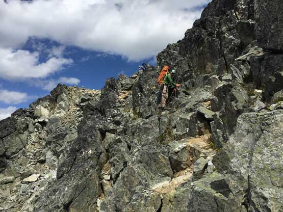
Paul on some very careful moves there…
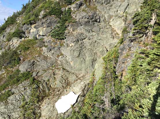
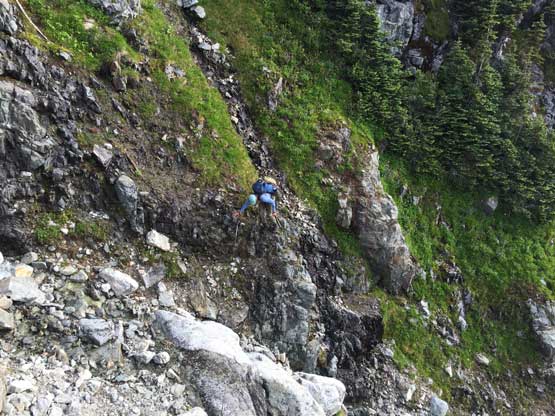
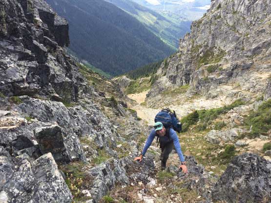
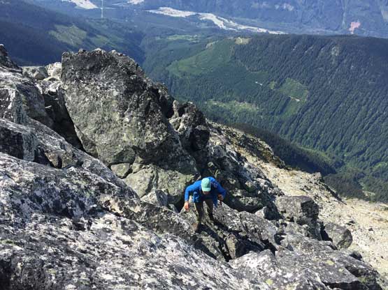
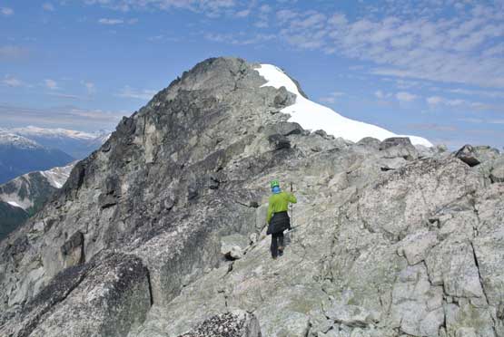
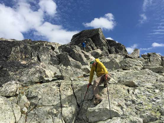
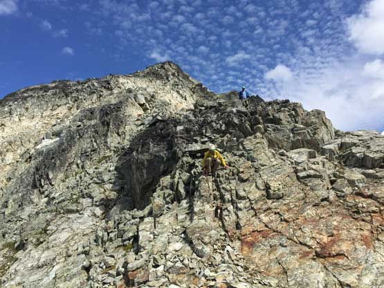
I thought that was the main gully on the east face of Luxuria Peak but apparently not. After a while of steep side-hilling and bushwhacking we hit a couple more gullies and crossed them all, until being stopped by a huge gully running down the entire E/SE Face with no easy way to pass. Our only option at this point was to head up and hope for a route that connected to the SE Ridge much higher up and the gamble was correct. We ascended some easy terrain, then a long stretch of exposed, down-sloping 3rd class and then more easy terrain to intersect the SE Ridge at only 250 m below the summit. We took a break once hitting the ridge, ditched everything and went for the summit. The upper SE Ridge involved more fun 3rd class scrambling with great views.
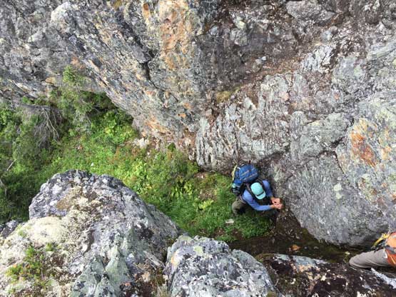
Paul at the bottom of a class 4 moss chimney
Alex pulling himself up the 4th class moss chimney…
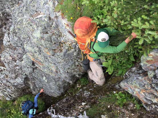
More awful vege climbing…
Onto some open terrain now.
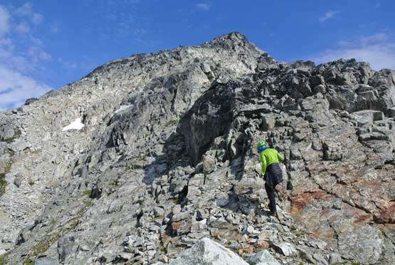
There’s a rock tower that we bypassed on the left side. More 3rd class choss
Terrain eased near the upper SE Ridge
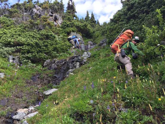
Paul finally climbing onto the SE Ridge. Onto “known” terrain at last
Packs were dropped and up we went
Easy 3rd class boulder scrambling
Me scrambling on the SE Ridge. Photo by Alex R.
Alex hiking up some open rock slabs near the summit
Me on the last few steps to the summit. Photo by Alex R.
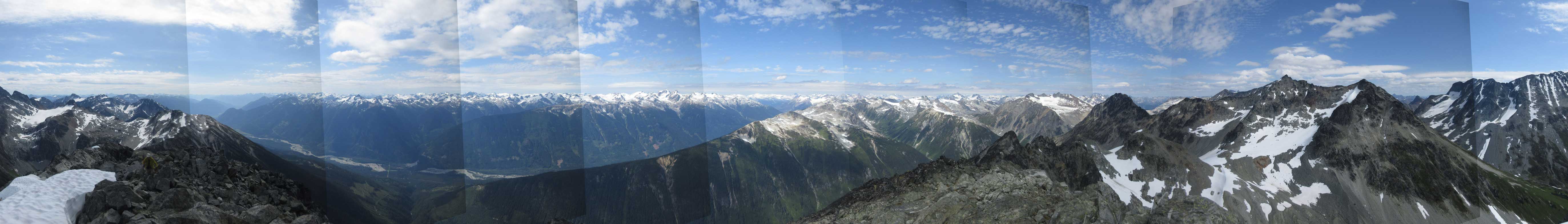
Summit Panorama of Luxuria Peak. Click to view large size.
Overseer Mountain and Spidery Peak
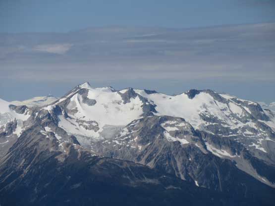
Uriah’s Heap and Pika Peak
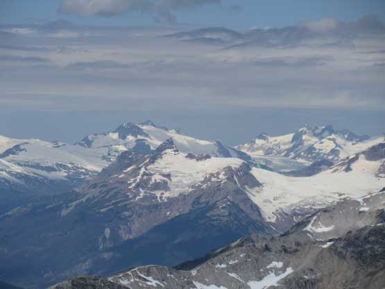
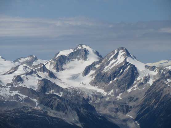
Manatee Peak with Pylon Peak in front
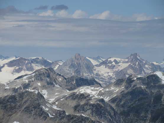
Mt. Meager and Plinth Peak
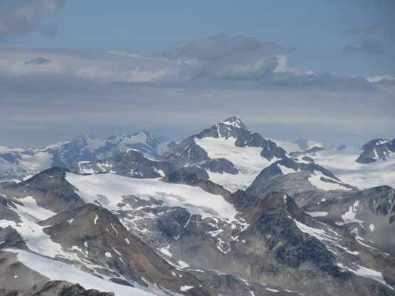
Mt. Athelstan
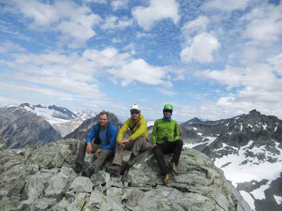
Our group shot on the summit of Luxuria Peak
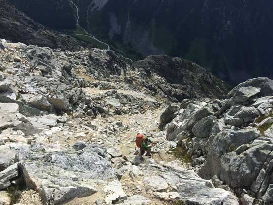
On the descent back to where we ditched backpacks I almost took a tumble on class 2 terrain by stepping on a pile of loose boulders. At least three major boulders broke loose but I reacted fast and stepped out of the momentum. A ride with those boulders would mean a 3-meter fall down a minor cliff with likely injuries so I’m very glad I escaped that. The descent wasn’t that straightforward with a lot of loose, 3rd class terrain with route-finding and now, with heavy packs, but once onto treeline the rest was at least mentally easy. All I needed was checking GPS many times to make sure we stayed on the correct ridge. The bushwhacking was easy but the grade of this ridge was very steep. We took several breaks to rest up the knees. Once down to the deactivated North Creek Road we heard someone talking so yelled and they yelled back. The bridge across Delilah Creek was still there (thank God), and then we caught up with the other guys at North Creek parking lot. One of them (Brian) turned out to be the owner of one of the cabins in this zone that Alex recognized out. We had a lucky day as they offered a ride to bring Paul back to the upper parking lot which saved at least 2 hours of walking/bushwhacking for us. Unfortunately Paul wasn’t so lucky because Brian’s vehicle couldn’t make up the loose corners and he ended up having to walk several kilometers to retrieve his 4Runner.
Alex down-scrambling
More careful down-scrambling
Paul on some boulder garden
Backpacks on, and yet more chossy exposed 3rd class
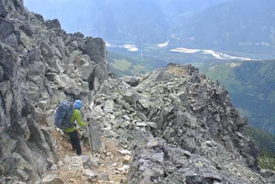
Me traversing a chossy ledge. Photo by Alex R.
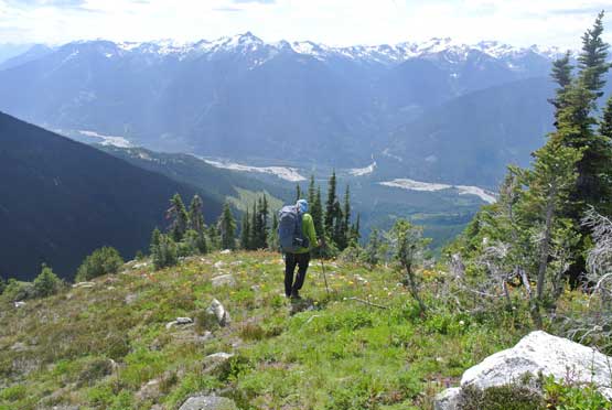
After a long stage of steeps we were down to a grass land. Photo by Alex R.
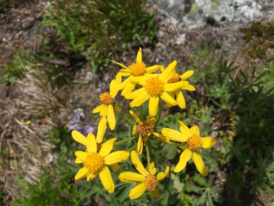
Flowers were nice
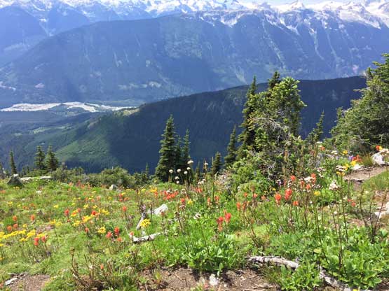
More about the flowers
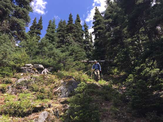
Time to head into the forest. Open travel at first
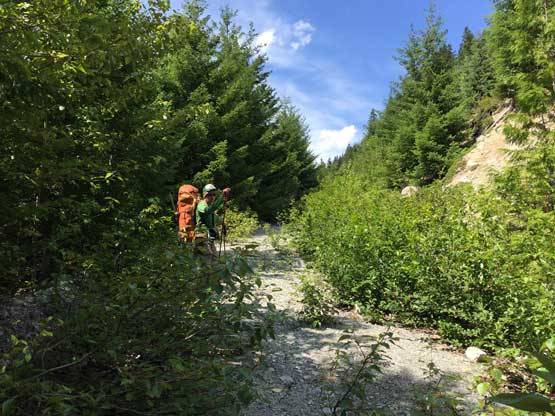
Of course there’d be bushwhacking. It’s BC trip overall…
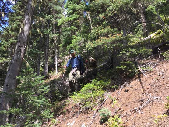
Paul bushwhacking down the typical forest on SE Ridge
For the most parts the ridge was easy going
Alex down to the deactivated section of North Creek FSR
Crossing the raging Delilah Creek on a good old bridge
That’s the end. North Creek parking lot…
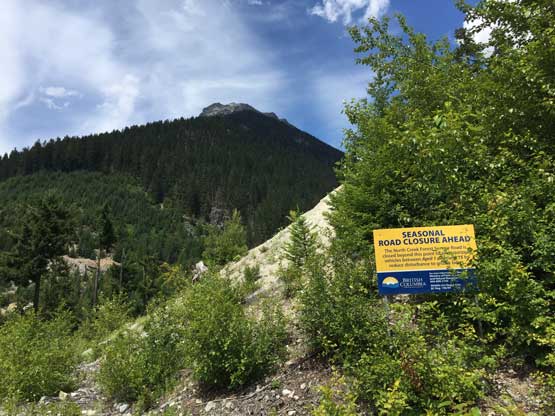
The drive down North Creek FSR was slow going with numerous narrow and rough spots but such wouldn’t impose much of a problem to Paul’s 4Runner. The rest of the way back home was long but uneventful and that concludes another successful adventure in the Pemby area.
