Birkenhead Peak
August 19, 2017
2506m
D’Arcy / Birkenhead Lake Area, BC
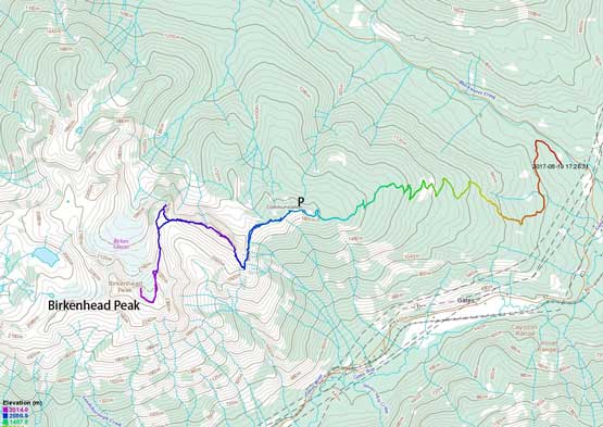
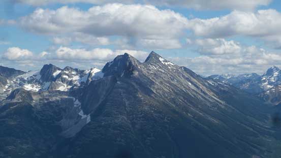
The massif of Birkenhead Peak has three distinct summits and the unique profile is recognizable from various vantage points in areas north of Pemberton. My first time really appreciating the structural beauty of this peak was from Tallifer Group at the headwaters of Phelix Creek. Having the impressive north face/north glacier in sight for pretty much two full days I knew I had to ascend Birkenhead Peak at some point. The standard route is however, not a “sexy” one and certainly not via the north glacier. Thank to a Microwave Road that climbs to almost 2000 m elevation the access is easy for those with a decent 4×4 vehicle. And from the end of the road it’s a fairly straightforward scramble via the east side slopes/ridges and the route is well documented in Matt Gunn’s Scrambles in Southwest British Columbia.
Birkenhead Peak stands out in its own and is surrounded by three deep valleys – Blackwater Creek to the NE, Birkenhead Lake to the NW and Gates River to the south making a pretty impressive number on the prominence (1700+ meters). Any peak that has a clean prominence of 1500+ meters qualities to be an “ultra” and believe or not, Birkenhead Peak is one of the only few “ultras” in SW BC. For the sake of this reason Adam (Gimplator) was super keen on tagging this summit. The concept of “ultras” was completely new to me as I had never heard about something like that, but I agreed because it’s a good-looking objective nonetheless. And believe or not again, my friend Jeff Han and his friends were planning on the same trip at the same time so it made perfect sense to join the forces.
By 6 am all five of us met at the church in West Vancouver and then up the familiar Sea to Sky Corridor we went in two vehicles. Adam and I opted to take the Subaru Crosstrek instead of my trusty Toyota Tacoma thank to a recent condition update. The road was apparently well maintained (very few water bar) but it’s one of the steepest I’ve ever driven. We figured if a RAV4 could make it then the Crosstrek should also be fine. It turned out that we were a little bit too optimistic as the car got overheated about 3/4 of the way up. That costed a bit of a delay but after the engine cooled down we resumed the rest of the drive all the way to the uppermost parking lot. No more problem this time.
Birkenhead Peak standard scramble route. GPX DL
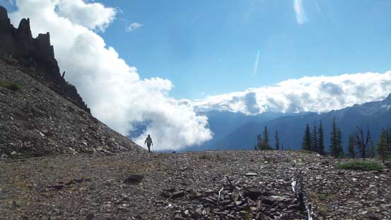
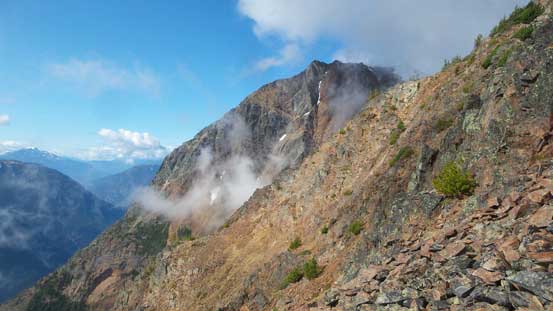
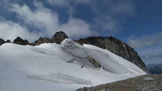
From the parking lot that triangular face straight ahead is known as “Microwave Ridge” and our first business was getting to the base of that ridge. This involves some up-and-downs but the route-finding is easy thank to a trail. The next stage was traversing across a couple steep bowls on the east side of “Microwave Ridge” and depends on who you are this section can well be the crux. There are some game trails but the ground is loose in general and a slip is not an option at some places. To me this was easy peasy. Once the traversing stretch was over we scrambled a loose 3rd class gully (possibly off-route) to gain Microwave Ridge’s south ridge and then took the first break.
The east face of “Microwave Ridge” seen from the start
Jeff coming around a corner. The first stretch was hiking up the old road
Ahead is that steep bowl traverses
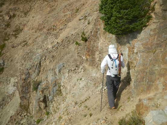
Me going for the most exposed part. Photo by Adam
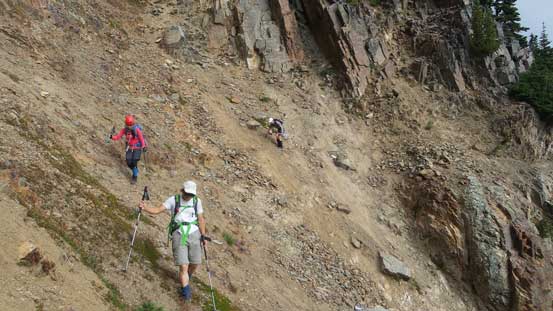
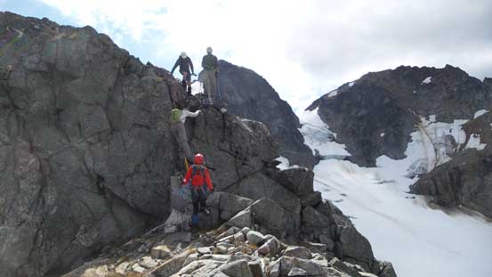
Jeff, Lily and Poco on their way across the nastiest section
And then we scrambled up this loose gully to gain the south ridge
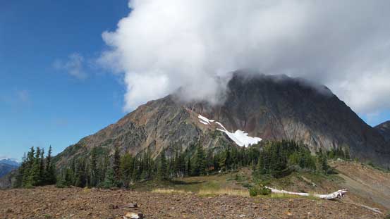
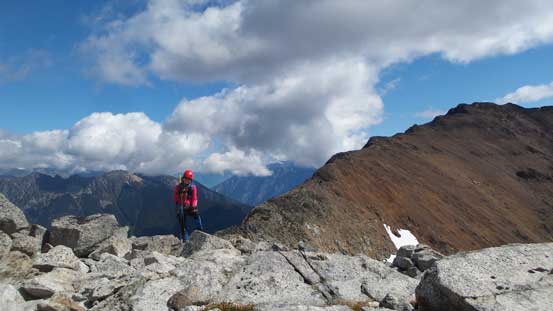
Upwards and onwards along the south ridge the views gradually opened up and at the same time, the clouds were lifting up. Plodding to the high point of “Microwave Ridge” has little worth noting although seeing the amount of elevation loss in the next stage was a bit depressing. Dropping down the north ridge involves about 200 m elevation loss but the terrain is a bit more interesting than the south ridge. We got pretty close to the edge of the vertical east face.
Adam leading up the typical terrain on the south ridge of “Microwave Ridge”
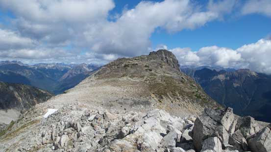
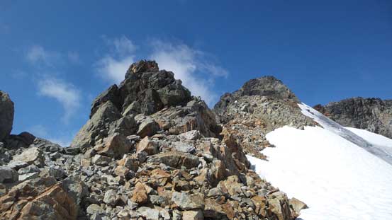
The main block of Birkenhead Peak starts to show up

Upwards and onwards…
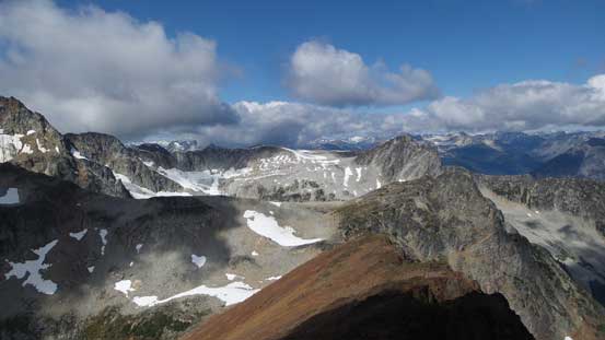
From the highest point on “Microwave Ridge” looking ahead
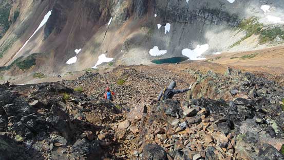
Poco and Lily scrambling down the north ridge. Note the looseness
There’s a lot of elevation loss on this stretch
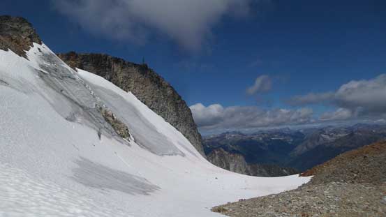
Then upwards again I utilized a patch of snow to take a break from the tedious talus hoping. The others all went around for more talus. Then plodding up the broad north ridge of Birkenhead Peak we stayed mostly on the ridge crest. There were a couple 3rd class steps which we attacked mostly head-on. Near the top of this long north ridge we veered right to bypass the east sub-summit and then went around to the south side of the summit block.
Partway up the broad north rib, looking back at “Birkhorn”
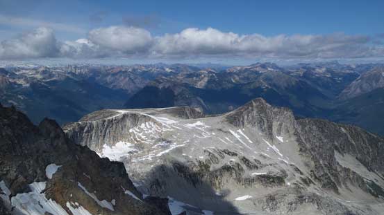
“Algoa Peak” to the north – another sub-summit of Birkenhead massif
Lily having lots of fun
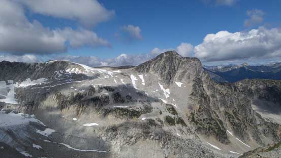
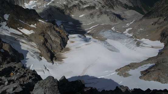
Near the main block we were on the edge of a small glacier
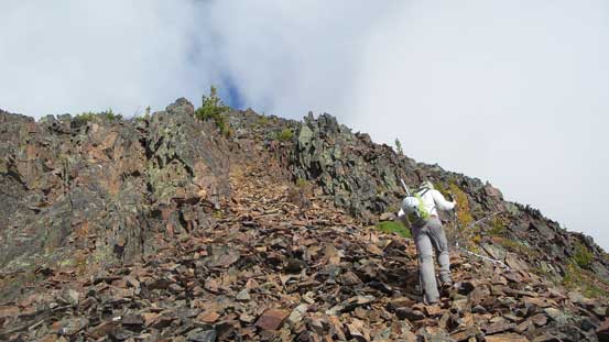
The final attack was via the south ridge. This looked intimidating from afar but actually easy going. The steep step had lots of horizontal ledges and the scrambling never exceeds “low 3rd class”. The summit offers some of the best views in that area and we stayed well close to one full hour before realizing it’s probably the time to head down.
The attack of the summit block was via the south side
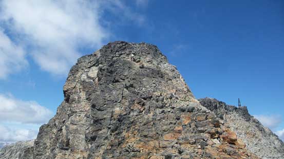
This is the steep step. Easy going despite the appearance
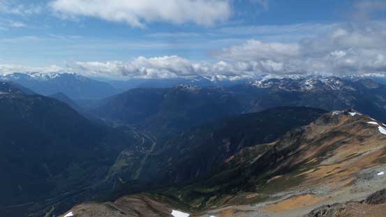
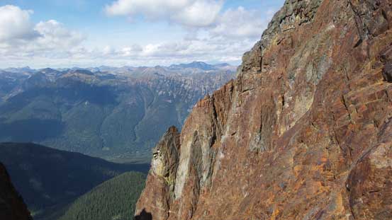
This is looking deeply down into the Gates River valley
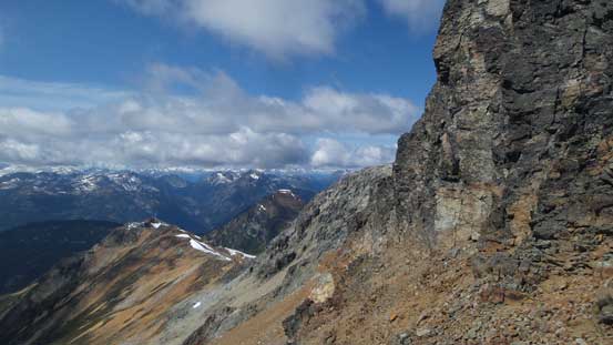
Looking sideways across the steep step into some remote Pemby country
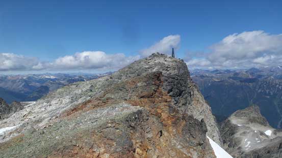
The true summit is within a stone’s throw now
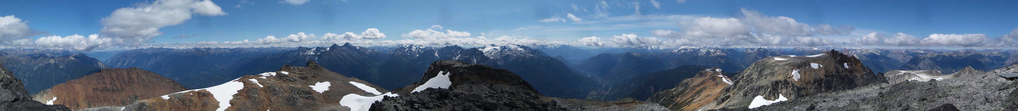
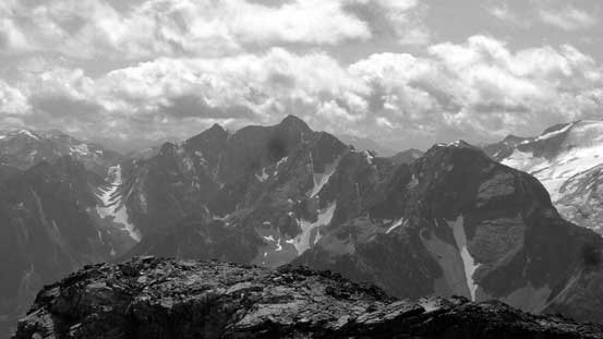
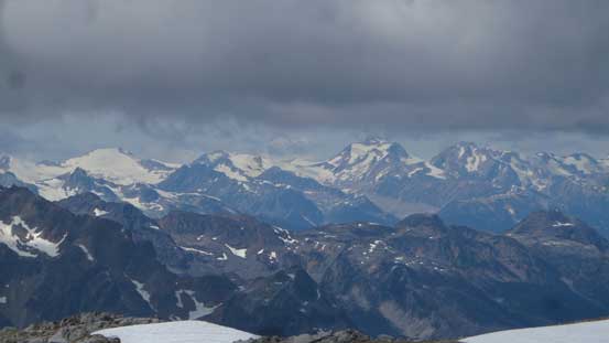
Summit Panorama from Birkenhead Peak. Click to view large size.
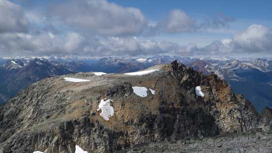
This is the lower west summit of the massif
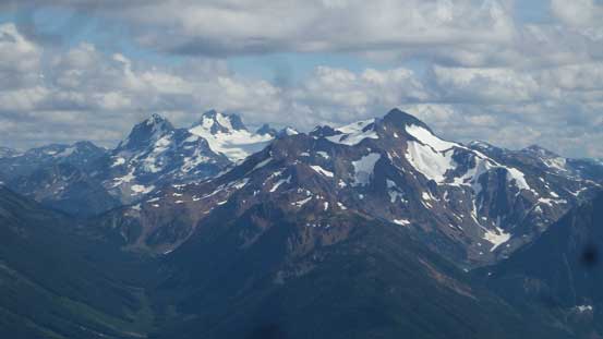
Mt. Oleg and Mt. Olds on the Place Glacier Group
The imposing Cirque Peak on Place Glacier Group
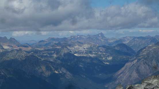
Mt. Truax in the distance
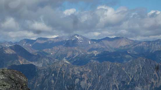
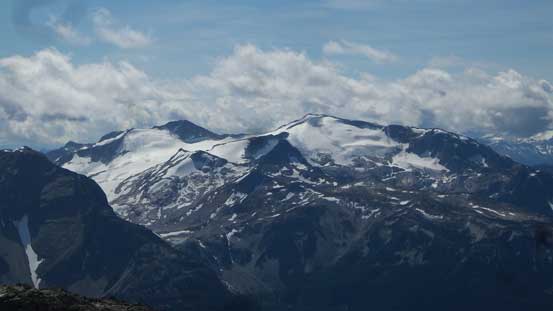
This is the mighty Whitecap Mountain
Overseer Mountain where we’d go in the next trip
Another look down at “Algoa Peak” and the plateau
This is the north glacier
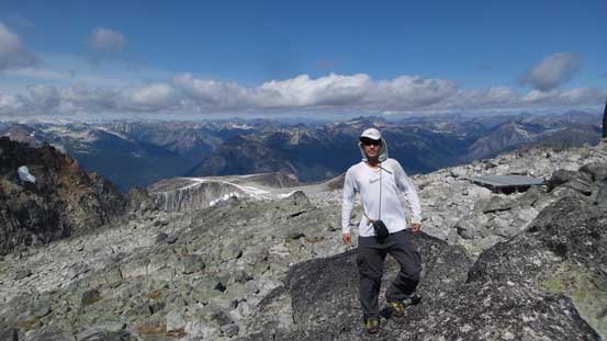
Me on the summit of Birkenhead Peak

Another panorama from the summit of Birkenhead Peak. Click to view large size.
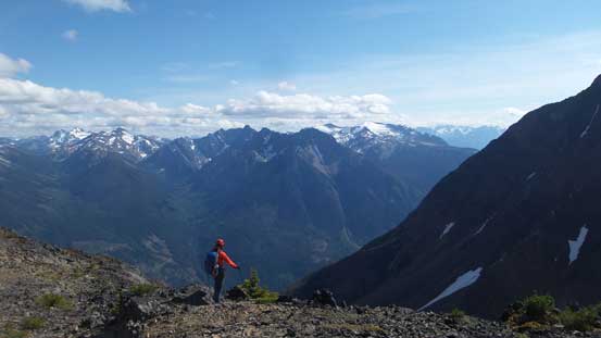
The views are getting even better on the descent thank to the late afternoon lighting. For the couple 3rd class steps we all either carefully down-climbed or found some kind of a bypass on the sides. Once down to the low saddle Adam, Jeff and I decided to check off a minor bump called “Birkhorn”. This is a bivouac.com name so doesn’t have too much of a credit for me but it looked fun nonetheless. The scrambling was a bit disappointing as there’s only one 3rd class move, but the top did offer some neat views towards the north face of Microwave Ridge. On the way down from “Birkhorn” we took a short-cut and then up the north ridge of “Microwave Ridge” we went again. Among five of us Adam was the only one who ditched some gears (to save weight) but the helmet and ice axe all went missing. We spent at least a good half an hour looking for those but they were nowhere to be found. We gave up. The traverse over Microwave Ridge was scenic as expected but at this time of a day it’s already getting a bit sloggy.
Time to head down
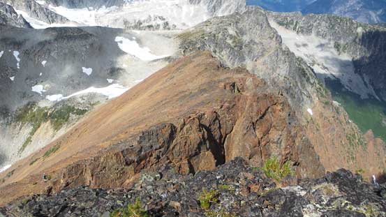
A review shot of the summit block and the south ridge (left skyline)
Down-climbing one of the few 3rd class steps
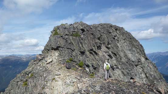
Near the summit of “Birkhorn” for more fun scrambling
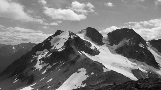
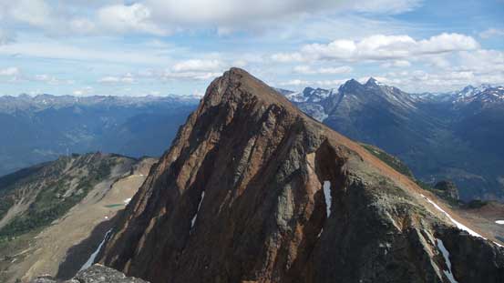
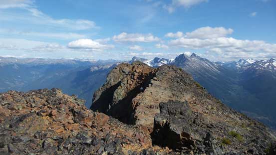
Looking back at the triple summits of Birkenhead Peak
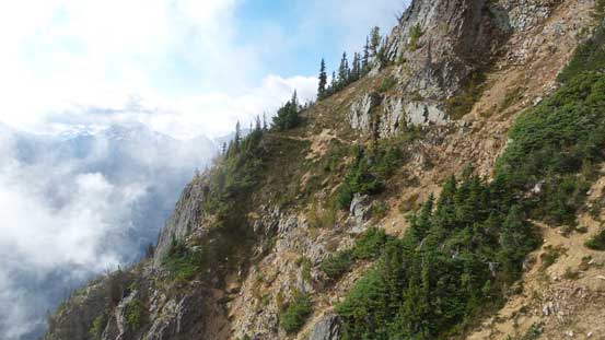
The north face of “Microwave Ridge”
Going back up “Microwave Ridge”
The NE/E Face is almost a straight down…
Very impressive rock formation here
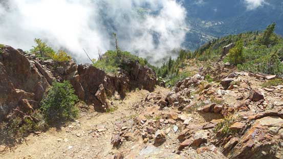
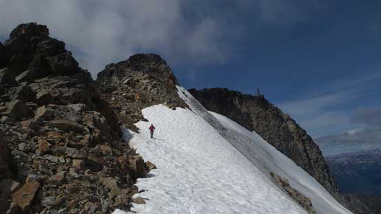
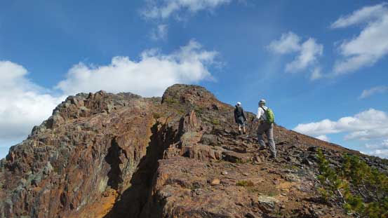
Traversing across the jagged sections on the top of Microwave Ridge
Descending the south ridge of “Microwave Ridge” the most important thing was not missing the turn-off for that steep bowls traverse. This is not really much of a thing to worry about in the modern days thank to the GPS technology. I had been paying close attention in retracing our exact tracks and I surely didn’t miss the turn-off. Back across the bowls went pretty fluently for everybody and the next thing we were all back to the parking lot.
Heading down the south ridge of “Microwave Ridge” now
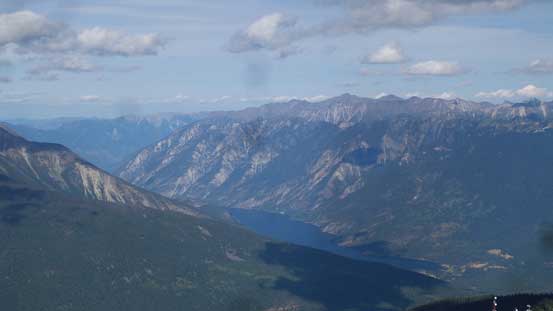
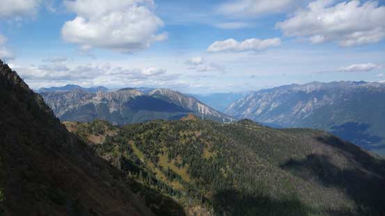
Anderson Lake with Mt. Seton massif behind
Cayoosh Mountain with the Joffre Group behind
Nequatque Mountain and Mt. Marriott
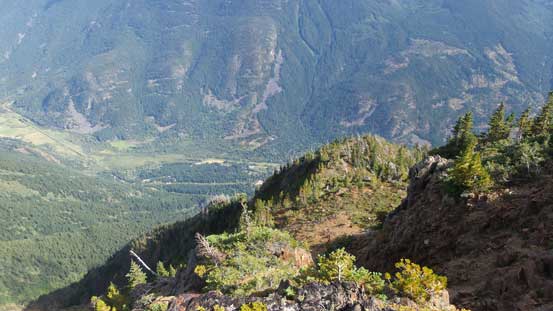
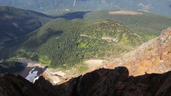
Another look down into Gates River valley where we drove through
This is another look into Anderson Lake valley in the distance
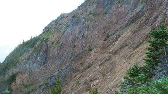
Traversing back across the bowls. Had to be careful here…
The downhill driving could impose some problem to Adam’s Crosstrek. It sure did as we could smell the rubber burning from the constant breaking but we made down nonetheless. The last task was finding a dinner place in the town of Squamish but Jeff had a pretty good idea. I already forgot where we went. The meal was great but all I remember was the troublesome parking and the long lineup. The weekend crowds is definitely not my type of fun.
