Tszil Mountain
March 3, 2019
2377m
Joffre Lakes / Duffey Lake Road, BC
Tszil Mountain is a rather small summit in the heart of Joffre Group immediately attached to the much-bigger Slalok Mountain. Some might argue that it’s nothing more than a bump on the west ridge of Slalok Mountain and in fact, most scramblers do Slalok Mtn. by traversing up and over the summit of Tszil Mountain. The same route (from Taylor/Tszil col) is also doable in winter but the better winter route is via Tszil Glacier and Tszil/Slalok col. There aren’t a ton of information online but from friends’ words I knew Tszil Glacier would be my route of choice. I wouldn’t be going on skis though for the sake of reason I suck at skiing.
The alarm went off at 5:30 am and in no time I was cruising up the Sea-to-Sky Highway into the familiar country. I had a meal in Pemberton’s McDonalds and then went for the infamous Joffre Lakes’ parking lot. I was expecting some form of gong show but I guess the recent cold temperatures had managed to keep the crowds at bay. It’s 9 am on a sunny Sunday morning and my car was only the 4th one parked there. I didn’t start very early because the original plan was only Tszil Mountain and Mt. Taylor, but I upgraded the plan during the day.
Tszil Mtn. and Duffey Peak via Tszil Glacier. GPX DL
The last time I hiked Joffre Lakes trail was in February 2017 en route to Mt. Spetch and Mt. Hartzell. I remembered the whole trail was hardpacked by all types of hordes so without doubting I started by carrying snowshoes on the backpack. This was a vise decision as snowshoes would be useless and cumbersome on the icy trail. I almost had to don crampons on a few steep stretches but managed to tip-toe my way up. There aren’t a lot worth documenting about the plod to upper Joffre Lake. There weren’t much to see neither until the upper lake and even so, the sun was directly behind Matier Glacier making photographing less worthy. It took me 1.5 hours on a steady pace.
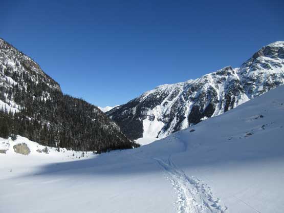
A view from one of the two slide paths on the Joffre Lakes trail
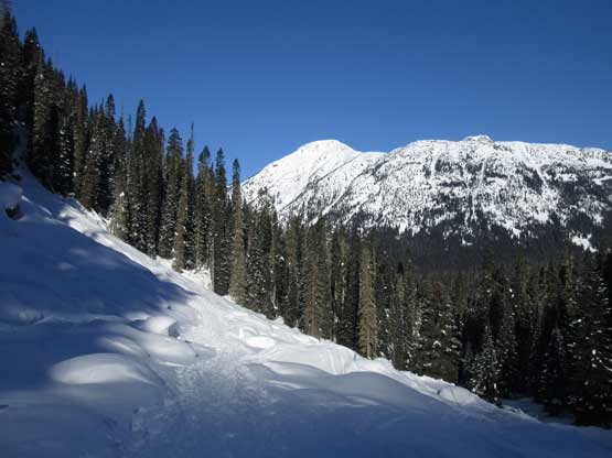
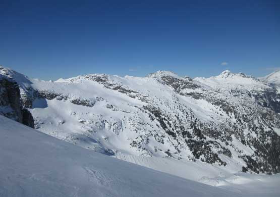
Arriving at the 3rd Joffre Lake, looking up the “Taylor/Tszil valley”

The steep moraine underneath Matier Glacier’s icefall.
The lake was extremely cold so I cruised across skirting around the edge, picking up a set of skin tracks and quickly making my way into the “Taylor/Tszil valley”. Far in the distance would be Taylor/Tszil col but I wouldn’t plod all the way up there, and instead at about 2/3 of the way up this valley I left the skin tracks ascending the rolls of steep slopes on climber’s left side. The section below Tszil Glacier had the steepest slopes of this route (~35 degrees) and the snow condition was a mixed types of crusts. There’s no visible skin track to guide my way from there onward but the route-finding was straightforward. I went diagonally out climber’s left for a long while until I was sure that I had gained Tszil Glacier. Once the slope angle eased I redirected my bearing towards the summit, aiming slightly to the climber’s right. I had to cross a few questionable spots that looked like sagging crevasses (probably just wind drifts) but otherwise it’s hard to notice I was actually on a glacier. It’s as tame as one might expect..

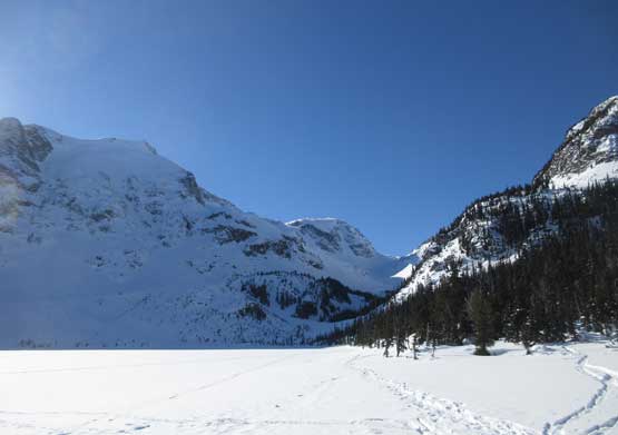
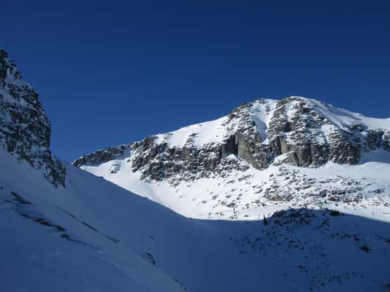
Fast forward, I was already halfway up the valley. Tszil Mountain looms on left
Looking back from halfway up the valley
This is the summit of Mt. Taylor

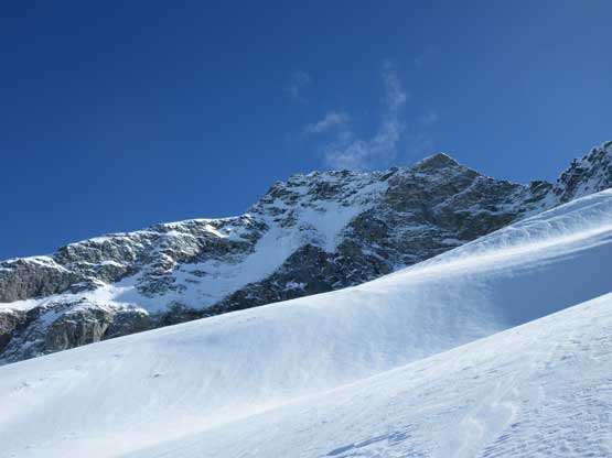
After a while of steep grunt I had gained Tszil Glacier
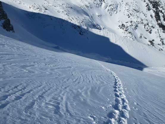
Looking down at my lone snowshoe tracks
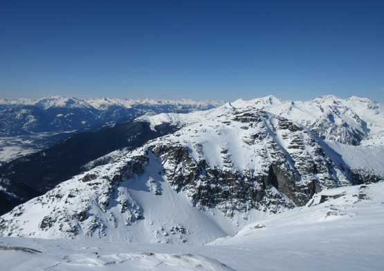
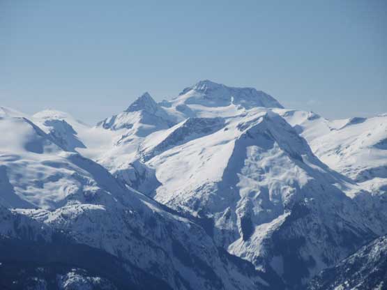
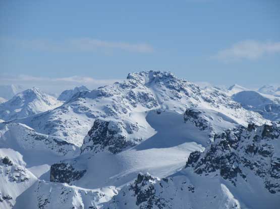
Slalok Mountain and a huge depression zone on the glacier
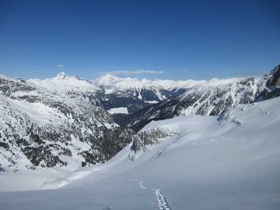
Onto the upper stretch of Tszil Glacier now, looking back
This long ridge is the northern extension of Mt. Taylor
I could have gained the summit via a few different routes and I opted to explore the northernmost (climber’s right) option. This would get me closer to Mt. Taylor to examine what it looked like to directly traverse there. At this point I was still hoping for Tszil-Taylor combo but upon seeing Mt. Taylor I changed my mind. The descent to Taylor/Tszil col appeared steep and complicated and the summit of Mt. Taylor looked rocky and boring. In addition to that I only spent 3 hours to reach the summit of Tszil Mountain so despite the late start I was doing good on time. I went around the summit plateau to check out what it looked like traversing to Duffey Peak. And sure it looked doable, albeit with a ton of elevation loss and regain. The decision was made and what’s supposed to be a relaxing trip had suddenly turned into a race against time. I had to hurry up so down towards Tszil/Slalok col I went.

Looking back at that huge depression zone on Tszil Glacier

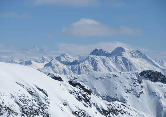
Almost on the summit, looking at Tszil/Slalok col
In the foreground is the summit of Mt. Taylor
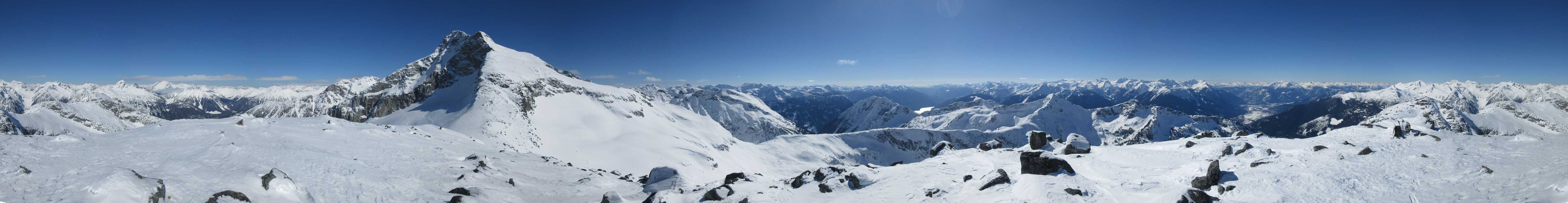
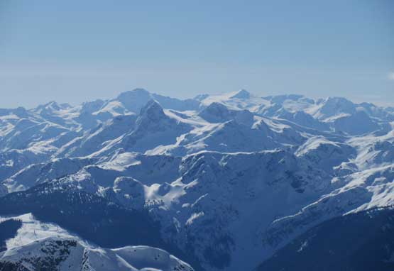
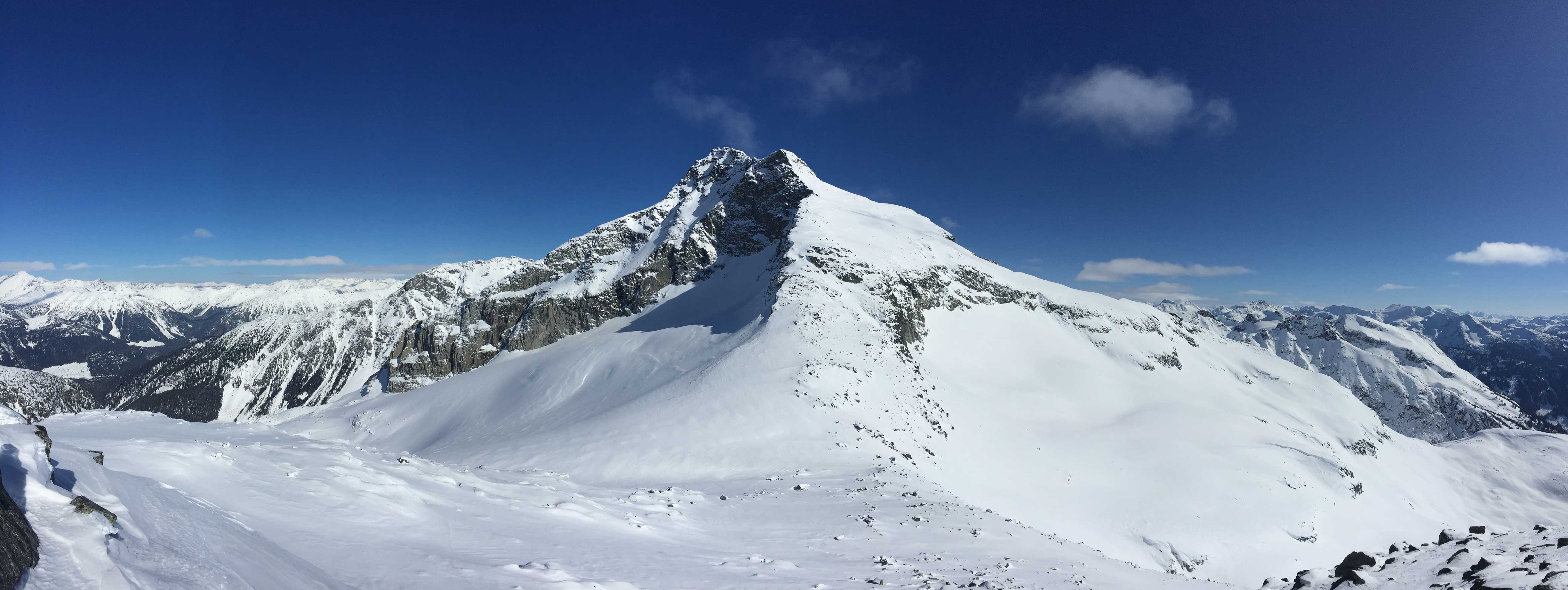
Summit Panorama from Tszil Mountain. Click to view large size.

Twin Goat Mountain in the foreground

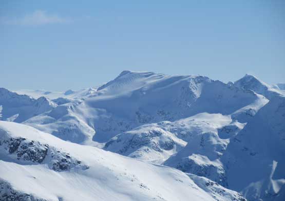
Duffey Peak in the foreground – my next objective

This is looking into Pemberton Valley with Ipsoot Mountain behind

Cassiope Peak and Saxifrage Peak
Mt. Oleg and Mt. Olds on the Place Glacier Group

Cayoosh Mountain is another winter classic along Duffey Lake Road
Mt. Currie looks mighty from almost anywhere
The remote eastern McBride range – Nivalis, Sir Richard et al., behind Gunsight Peak
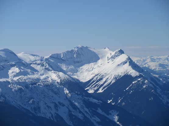
Wedge Mountain with the pointy Lesser Wedge Mtn. to its left
Asherah Peak to the south
Snowspider Mountain has some pretty neat secret terrain on its north slopes
Gideon Peak with the mighty Skihist Mountain poking behind its left shoulder

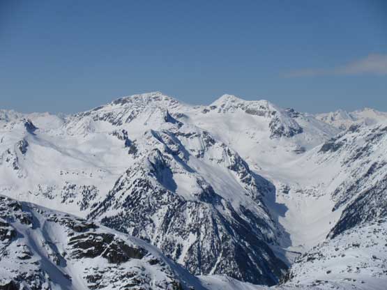
Impressive cliffs on Slalok Mountain

A wider view of Slalok Mountain
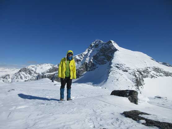
Me on the summit of Tszil Mountain with Slalok Mtn. behind

Another shot of me on the summit of Tszil Mountain
Another panorama from Tszil Mountain. Click to view large size.
I should have retraced my tracks back onto Tszil Glacier but went for a direct descent, and the punishment was a field of boulders on steep and wind-blown terrain. I had to take the snowshoes off and don crampons which certainly ate some time. And the day continued with a rare winter ascent of Duffey Peak.
