Mount Whitney
December 28, 2017
4421m
Lone Pine / The High Sierra, CA
Mt. Whitney is the highest peak in the “Lower 48” of United States and hence needs little introduction. This gigantic massif of granite boasts more than a dozen routes but only three of which are worth a note in this trip report. The easiest option and yet the longest is a 22-mile round trip via Whitney Trail which is essentially a walk-up. In the right conditions nothing’s required beyond a pair of sneakers. For those with a little bit more experience the Mountaineer’s Route offers a more direct finish and this is particularly popular in winter and spring. And finally for those capable doing long, multi-pitch technical climbing the East Buttress is listed as one of the Fifty Classic Climbs of North America.
The three routes above all interest me to some extent but as a peak-bagger I like to keep things as simple as possible. In this particular case I had no previous experience with the Sierras and considering the amount of effort to drive that far down south the simple matter of “tagging this summit” was an absolute must. Everything else would be a bonus and that includes the route selection. This was Jake and I’s third day of this past holiday season desert trip. There was always a talk about ascending Mt. Whitney but the decision wasn’t made until the last minute after actually seeing the peak ourselves. The dry conditions and the stable weather pattern was too hard to pass. The Mountaineer’s Route would be nice but we could not find much of an update. We knew someone had just made the summit via Whitney Trail and we knew besides some traction device no other fancy gear (snowshoes, ice axe, etc.) was required.
In the previous evening we spent at least an hour sorting the gears and in the end we opted to haul mountaineering boots, microspikes and aluminum crampons while hoping to ascend as much as possible in just trail-runners. In retrospect all those gears turned out to be dead weight for exercise. The trail was icy as hell but we both managed to hike up (and down) in just trail runners without having to don microspikes nor crampons… The night was spent camping at the trail-head together with another party who just finished the climb (in 17 hours round trip). The update provided by those guys assured our decisions on gears. The alarm was set as 3:30 am and sleep came fairly easily.
Ascent of Mt. Whitney and Mt. Muir via the trail route.
In the pitch dark the task was simply putting one foot in front of another. The first creek we crossed (North Fork Lone Pine) marks the place where the Mountaineer’s Route branches off from the Whitney Trail. And then after seemingly endless switchbacks through thinning woods we started to encounter more and more snow and ice patches. There’s a tiny bit of descending before Outpost Camp followed by a long stretch of pure ice. That’s roughly where we took the first energy break. We decided to resume on without donning microspikes and then the next “point of interest” was Mirror Lake although we did not get to see anything. For one reason the lake was frozen and for another reason we were still in a pitch dark. The grade seems to mellow out a bit as we slowly ascending into the alpine. The timing for the sunrise and alpenglow was almost perfect and we got to take the second break at Trail Camp.
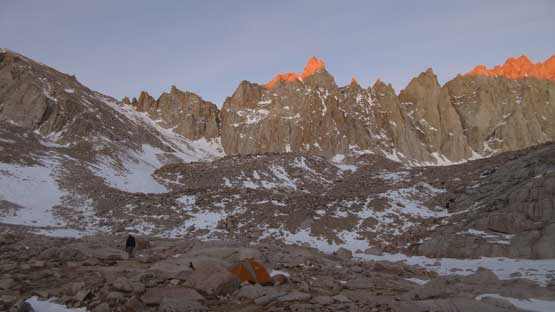
Arriving at Trail Camp just before the full-on alpenglow

Alpenglow on the east face of Mt. Whitney

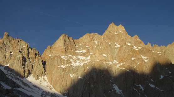
Alpenglow on Mt. Muir and other spires between Muir and Whitney
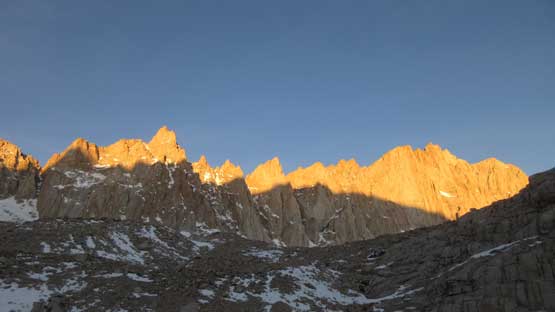
It’s “golden glow” time. Almost time to move on again.
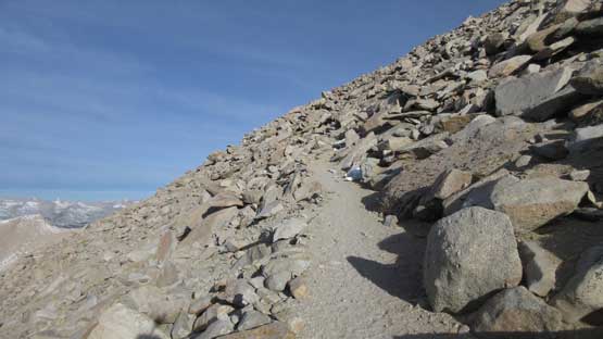
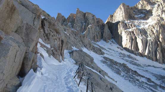
After admiring the granite spires on east faces of Whitney and Muir turning red, orange and then yellow we had to press on. About 2.5 hours into the plod we left Trail Camp, through a short stretch of confusing talus terrain to join the infamous “99 switchbacks”. Believe or not the number of switchbacks seems to be quite accurate but that also reflects how boring the slog is to reach Trail Crest. There’s snow and ice all over the place but not enough to warrant donning any special equipment. At least for Jake and I the trail-runners were more than adequate.
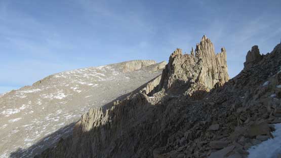
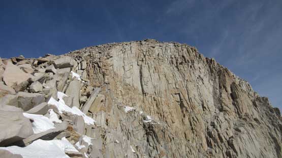
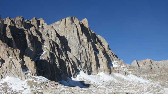
The east face of Mt. Muir is a shear wall
Following the trail up. There were endless switchbacks

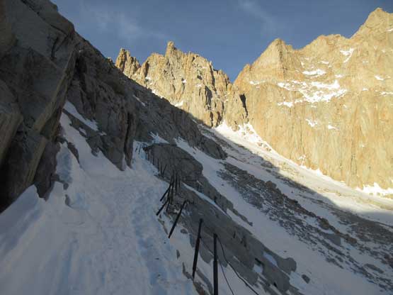
Note the cables on this trail.

This is much higher up on one of the last couple switchbacks.

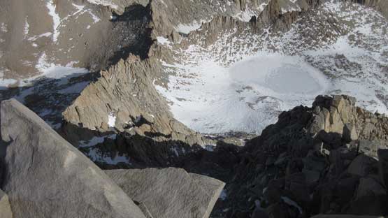
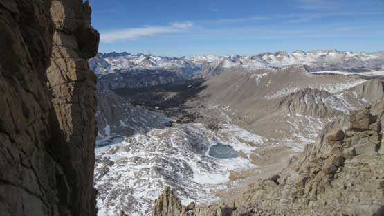
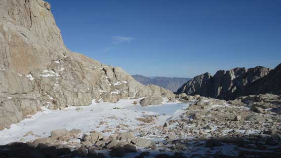
Looking down at the alpine basin by Trail Camp and Wotans Throne
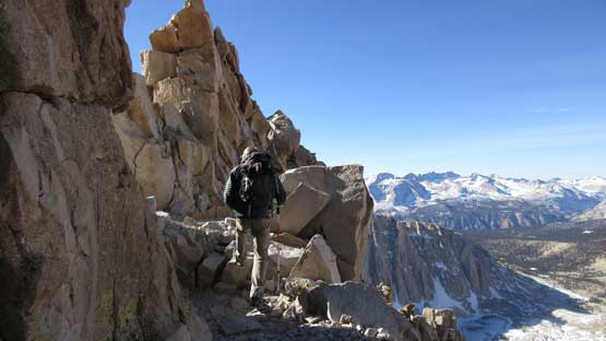
The Trail Crest marks the first time we officially got some sunshine on ourselves although it was short-lived. To skirt around the rugged terrain below Mt. Muir we had to lose about 50 meters of elevation and then traverse. The trail building was surely an amazing project back in the days that it pretty much cuts across the west face of Mt. Muir to make a possible passage. Ironically the summit of Mt. Whitney looks totally uninspiring from the south slopes.

This is looking down at a couple pinnacles with Hitchcock Lakes below
It’s hard to believe how dry it was at this time of a year at 14,000 feet…
The trail skirts around the west side of Mt. Muir and now Mt. Whitney is ahead.
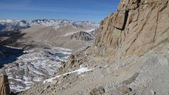
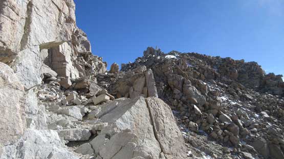
The view was also very foreshortened. The summit appears to be “right there” but actually there’s still fair a bit of elevation and distance to cover. The “fast pace, single push style” had finally caught me at this point that I started to develop some light headache but we weren’t far from the summit overall. The final stretch of the plod after turning onto the broad summit ridge felt like eternity but eventually the hut came in sight and that’s it.
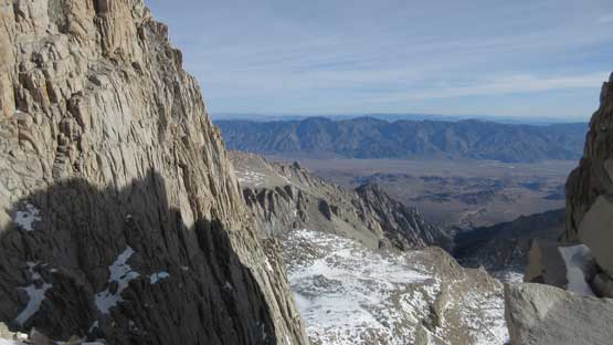
This is looking at the east side from one of the few gaps among pinnacles
The upper east face of Mt. Whitney. There’s still a lot of gain to cover…

The summit hut is finally in sight…

Summit Panorama from Mt. Whitney. Click to view large size.
Looking down at Iceberg Lake where the Mountaineer’s Route comes up from.

This is looking north at Mt. Williamson and Mt. Russell – two CA 14ers
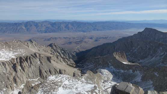
The desert valleys and ridges looking east.

Mt. Langley is another 14er. Looks just as uninspiring as Mt. Whitney itself…

A closer look at the town of Lone Pine in the floor of this deserted valley.

This is a closer look at Mt. Williamson with the Palisades behind on skyline
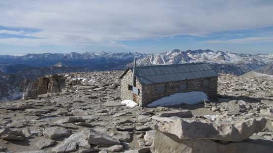
The summit hut on Mt. Whitney is a famous one..

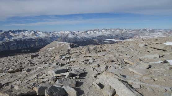
As much as the southern Sierras landscape goes

Kaweah Peaks to the west

A closer look at Mt. Russell – its east ridge is apparently a classic

Me on the summit of Mt. Whitney
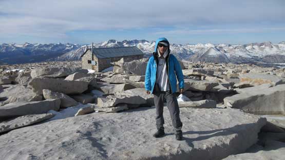
Another picture of me on the summit of Mt. Whitney
About half an hour later we figured it’s about the time to leave the highest point of “Lower 48” behind. Descending the west and south slopes of this summit block did feel much easier although any slight form of elevation regain which traversing underneath Mt. Muir felt like a drag. The summit of Mt. Muir was right there and it counts as a separate CA 14er so we had to tag it as well. The ascent was more fun than Mt. Whitney and is written in a separate trip report as Mt. Muir counts as a separate summit. The 50-meter elevation regain to get back onto Trail Crest was the worst part of this descent. I had to call an additional break at Trail Crest even though we weren’t actually planning on doing a stop there. After about 10 minutes I had gathered enough strength and our next stop would be Trail Camp about 500 meters lower down. The descent on “99 switchbacks” was not as slippery as we thought.
Time to head down. Note how broad and flat the “summit ridge” is….
Keeler Needle and Crooks Peak do not have enough prominence to qualify 14ers
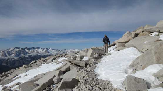
Jake hiking down the upper Whitney Trail

Traversing underneath Mt. Muir on some rugged terrain

This trail cuts across these slopes.
Guitar Lake below and the High Sierra behind

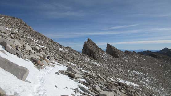
Lots of pinnacles like this on the Whitney-Muir ridge

Another picture of these pinnacles.
After an ascent of Mt. Muir we resumed on

Lots and lots of plodding.

This is where Whitney Trail joins the JMT (John Muir Trail)
There’s considerable amount of elevation regain on the way back…
Ascending back towards Trail Crest
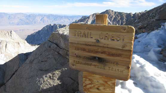
Just had to take a picture of this famous sign of “Trail Crest”…

Partway down from the 99 switchbacks. This is looking at Wotans Throne

The east face of Mt. Muir looks like some Patagonian giant…
Just had to take another shot of this trail (and the handrails)

The east faces of Mt. Muir and Mt. Whitney.
A zoomed-in shot of the east face of Mt. Whitney
Almost back to Trail Camp. That climber’s tarn is also frozen.

Another shot of the east face of Mt. Whitney

This is the only other group we met on the mountain.

Looking back from Trail Camp. Time to leave this pristine area behind.
Downwards the rest of the way back to the parking lot would be a pure slog. There’s a reason why I brought headphones and a iPhone so music on, and down we went. We actually got some pretty decent views from the hike-out because we didn’t get to see anything on the way in. The granite faces of Thor Peak were especially impressive. Towards the end we sped up to beat 11.5 hours round trip time and we did actually beat that.
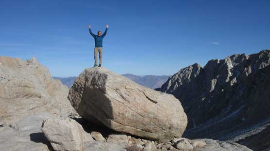
Jake took an opportunity to climb a massive boulder.
Down, down and down…
More downs…

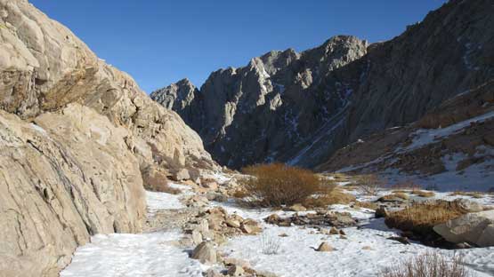
This is that frozen Moon Lake which we didn’t bother to check out.

Finally started to see some trees.

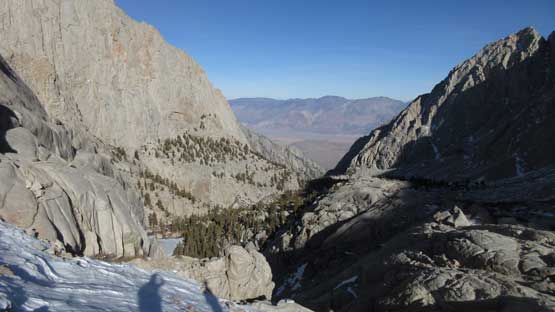
Thor Peak looks really cool from the valley bottom.

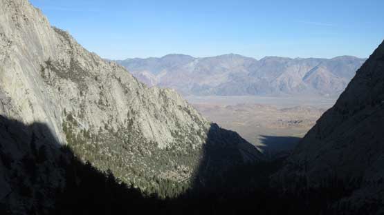
As typical as the scenery goes actually.

Another shot of the SE Face of Thor Peak
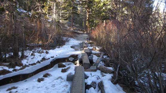
I think everyone takes a shot of these wood platforms so I had to do the same too…
The last stretch of switchbacks descent. No more snow and ice now.
There’s not much point in lingering at the parking lot so engine on, and down we went. The view actually actually pretty good on the drive down to Lone Pine. This is another stretch that we didn’t get to see anything on the way up. At the small town of Lone Pine we did the evening routine again – some food and then a long break to sort some gears out, and then we drove another 2 hours back into Death Valley.
Overall I agree with any other peak-bagger that an ascent of Mt. Whitney is an important one that despite the lack of technical interest, this is peak that stands on top of so many major lists. However I should also comment that the ascent, together with Mt. Muir did not quite impress me even considering the fact we did it in the middle of a winter season. The unseasonably dry condition contributed to the lack of challenge but still, this was nowhere a major feat. But don’t get me wrong, as a 22-mile, 6000+ feet day at altitude is nowhere a “walk in the park” neither..
