Mount Penrose
August 29, 2021
2634m
Gold Bridge, BC
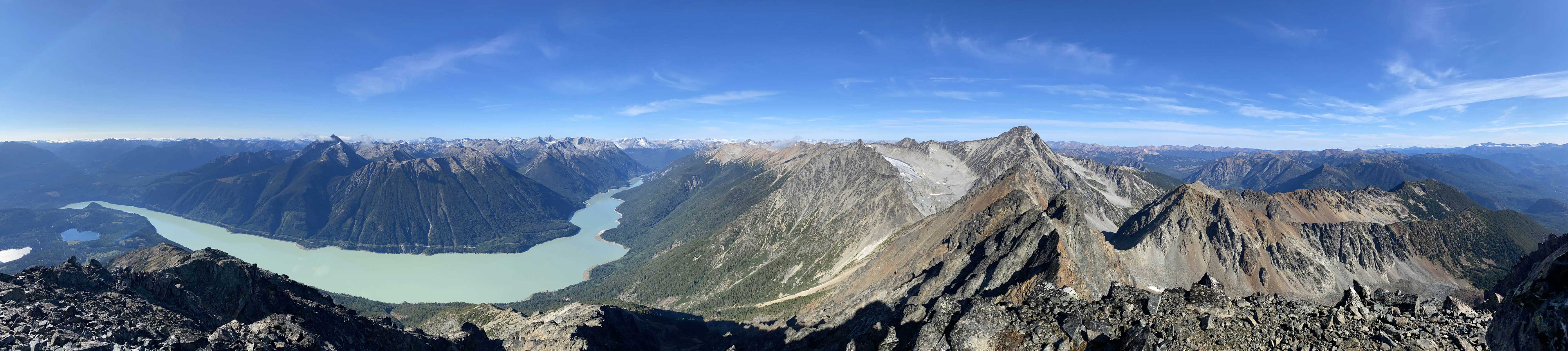
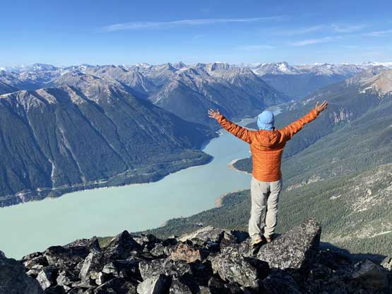
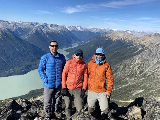
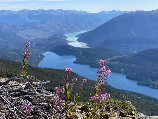
Mt. Penrose is one of those peaks that loom directly above the community of Gold Bridge in Bridge River Valley somewhere deep in the Coast Mountains. This is also one of the easier summits in the area because a trail ascends the southern flanks onto the alpine on the SE Ridge. The scramble along the SE Ridge to the summit was also straightforward with very minimal exposure or hands-on moves. This trail was built by the locals and was kept somewhat secret on the internet in the past, but things had changed in the last few years especially after my friend Adam W. from Washington made an ascent in 2018 with John Stolk and published a GPS track. These days all we needed was to download his GPS track from peakbagger.com and all the mysteries would be resolved. This peak has the potential to become very busy in the near future because it offers some of the finest views of Downton Lake and is relatively easy to ascend. The only drawback is the long drive but let’s face it. Alex, Vlad and I did this same scramble on the second day of our Gold Bridge peak-bagging trip. Earlier in the trip we had ascended Dickson Peak and Mt. Zola and then car-camped not far from Mt. Penrose’s trail-head.

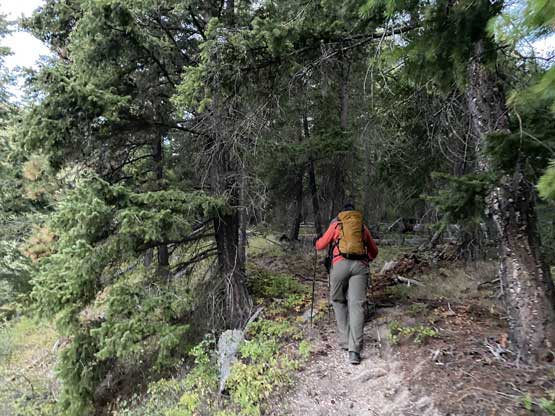
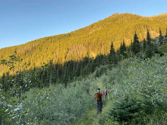
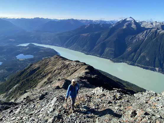
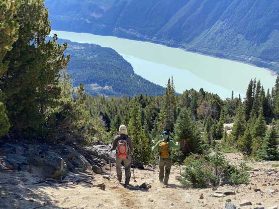
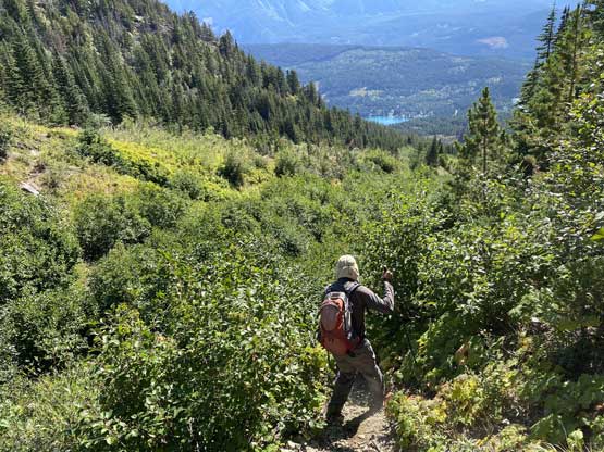
We were concerned about the long drive home after the ascent as both Alex and Vlad had to work on Monday so we shouldn’t get back home too late. We woke up at 5 am in the pitch dark and quickly packed up the tents. The temperature wasn’t as cold as the day before so the tents didn’t get as wet. The drive to the actual trail-head involved about a kilometer of deactivated road with some water bars that required decent clearance. The actual trail-head was just a small pull-out that could only fit a few vehicles. We were the only party on this peak even though it’s a sunny Sunday, so the parking wasn’t a problem. The start of this trail was actually on a deactivated road. The trail paralleled Penrose Creek on the right hand side and we ascended over 500 m elevation before making a hard left-turn to cross the (dry) creek. The trail became increasingly steep and rough after the creek crossing and in no time we had ascended to the treeline zone at near 2000 m. The views were opening up and we took the first break of the day.
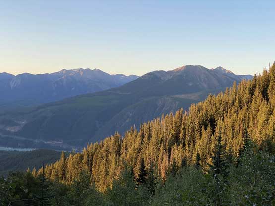
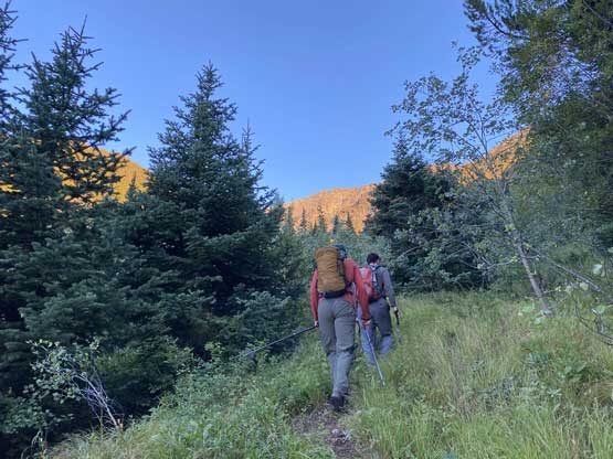

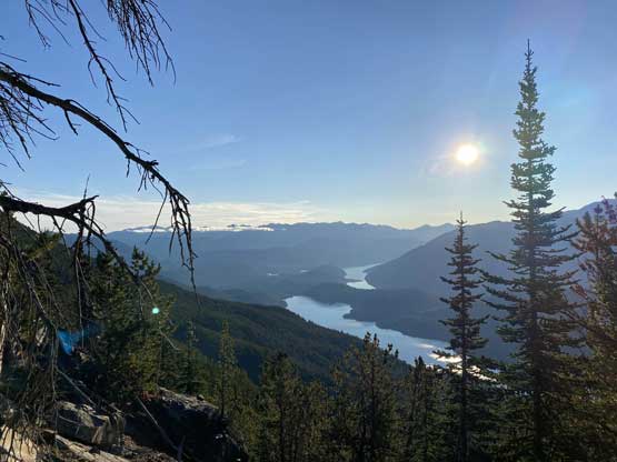
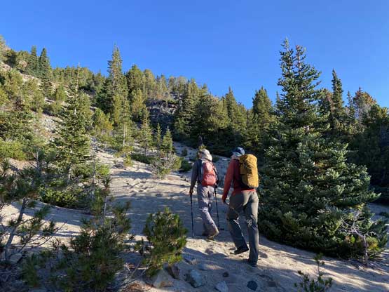
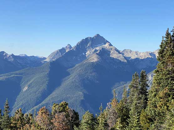
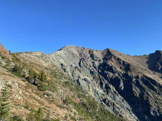
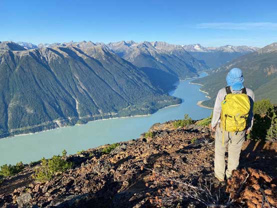
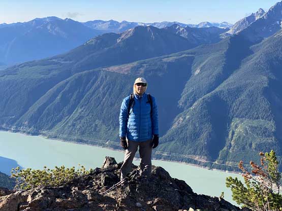
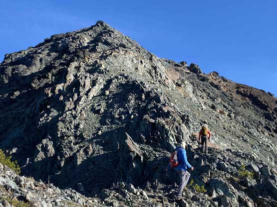
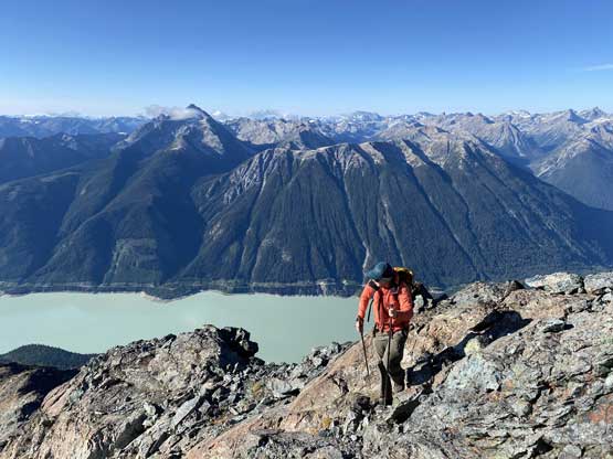
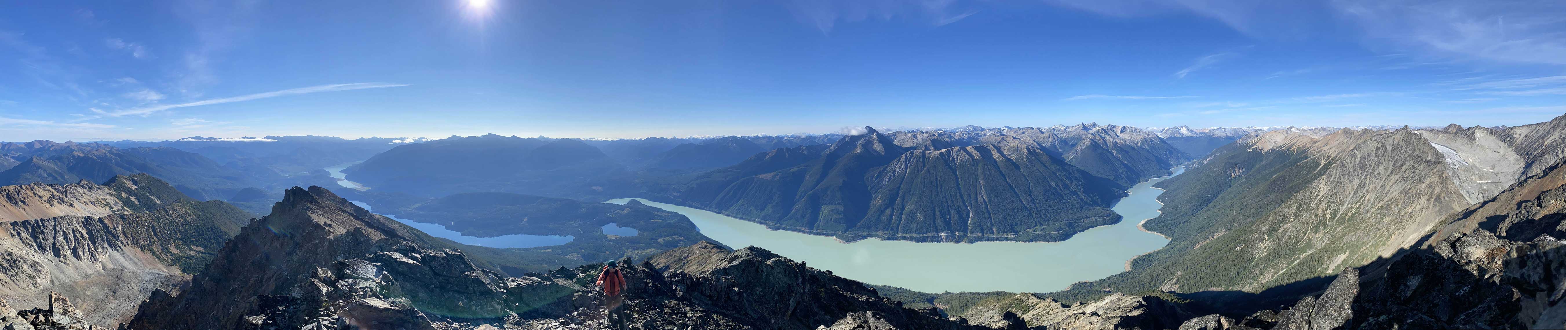
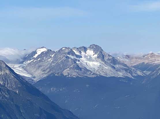
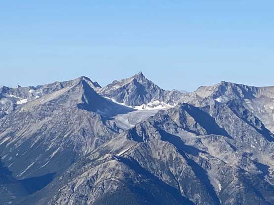
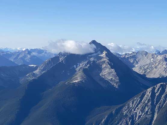
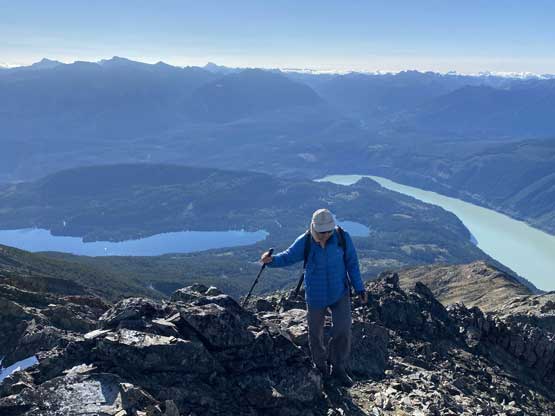
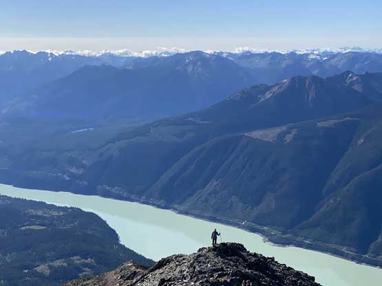
We paid a lot of attention to follow the flagging and the trail took us climber’s left of Adam’s GPS track. At this point it didn’t really matter which way to choose as we were almost onto the ridge anyway. The terrain had a ton of loose sand, painful to ascend but fun to descend a couple hours later. After breaking out of the woods we scrambled onto a subsidiary bump with a weather station (but no cell service). It was here that I ditched the trail runners and swapped footwear for mountaineering boots. For the final 500 m elevation gain we just needed to stay on the crest of the SE Ridge and the scramble was easier than it appeared. The steepest section came about 200 m under the very top where we must deal with a few 3rd class moves on somewhat loose rocks, but as mentioned above there’s no exposure. The entire ascent felt like a slog although the excellent views had diminished the pain factor. I think the view from Mt. Penrose is better than from Dickson Peak because we had unobstructed views of the lakes in Bridge River Valley.


After taking enough photos we started the descent as we still had a long ass way to get home. Descending the upper ridge required some caution but once back to that weather station the rest of the descent was just a pure slog. I wore the mountaineering boots all the way down to the (dry) creek crossing at 1650 m elevation because the trail was really steep above the creek. After swapping footwear back to trail-runners Alex and I enjoyed a fun jog back to the trail-head. Vlad was about 15 minutes behind and we all finished the ascent in under 6 hours round trip.


We were done before noon so we definitely wouldn’t be back home too late, but the earlier finish meant we would be right in time for the Sunday afternoon traffic. I thought we might can beat the worst of the traffic so drove us back up and over the Hurley as fast as I could. We were done the entire Hurley stretch in under an hour and soon we were back in Pemberton. I had to stop for gas and food and that took over half an hour. The drive down to Squamish wasn’t too bad, but then we were stuck in some serious traffic show. The merge at Murrin Park had about 20 minutes delay and then the Second Narrow in North Vancouver had another half an hour’s delay. We followed Google’s direction bypassing a good chuck of Highway 1 by weaving in the neighbourhood of North Vancouver and that surely saved some time. The next stop was Alex’s home in Burnaby and then I also needed to drop off Vlad in Annacis Island before making the final dash down to White Rock. This entire drive-home from Mt. Penrose’s trail-head took over 6.5 hours and was mentally and physically exhausting the whole damn way.
