Reynolds Mountain
August 19, 2015
2781m
Glacier National Park, MT
Reynolds Mountain is one of those that “stand out” when looking around from Logan Pass information center – a place that sees hundreds to thousands of tourists every day.. Taking advantage of the high starting point (more than 2000 m elevation at Logan Pass), and a well used approach trail (Hidden Lake Trail), this peak is doomed to draw significant attention from scramblers and climbers. I had memories from reading trip reports indicating it’s merely a Class 4 scramble so when Mike and I came down south to visit Glacier National Park, MT, I instantly knew I had to give Reynolds Mountain a shot. Having already ascended Mt. Gould and Haystack Butte earlier in the day I was quite bagged already, but I had to resist the urge of getting lazy.. While Mike smartly chose to take a short nap, I continued marching on solo. With only less than 4 hours daylight time left I had to be fast.

Reynolds Mountain scramble route. GPX DL
I didn’t quite know where the Hidden Lake trail started but assumed it’d be obvious. I ended up hiking through the information center and found the trail at its back side. The trail was one of the busiest I’d ever been on to (even busier than Larch Valley trail by Moraine Lake). I passed at least 100 tourists on their way down and they all wondered what the hack I was doing with the “big” pack… It didn’t take me long to arrive at near Hidden Lake Pass where the climber’s trail branches off to the left. It’s not a signed trail but fairly obvious. And perhaps due to the popularity of this mountain the climber’s trail was very well defined even on the few scree sections.

From Hidden Lake Pass trail, looking towards the Garden Wall and Mt. Gould

More of the Garden Wall

Going-to-the-Sun Mountain behind Logan Pass
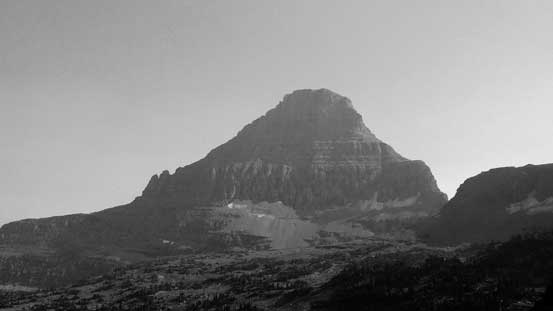
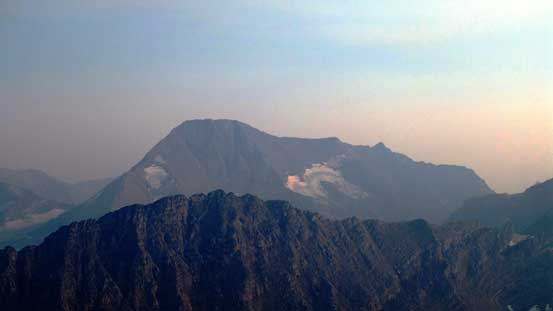
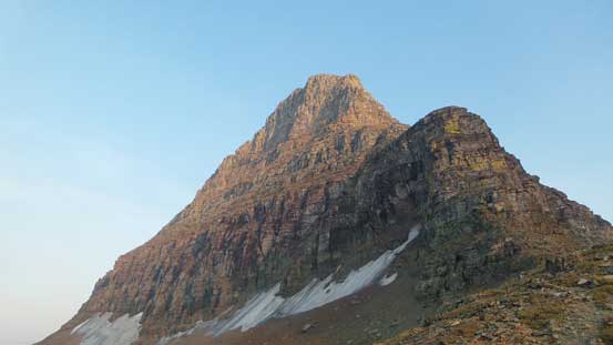
Reynolds Mountain – my objective

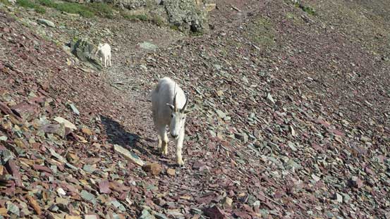
A goat
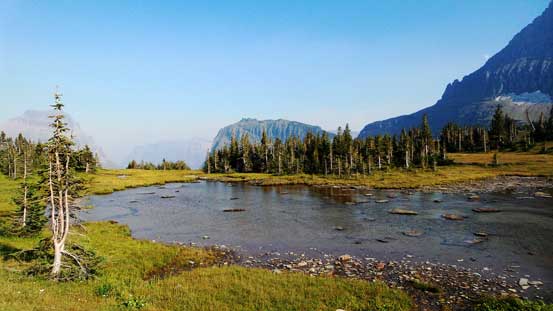
A pond at the trail junction. Behind is the tip of Heavy Runner Mountain

Another picture of Going-to-the-Sun Mountain

Reynolds Mountain
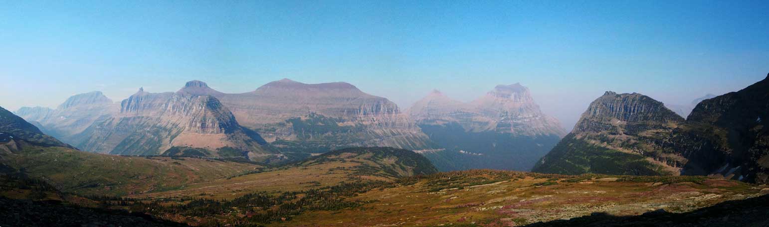
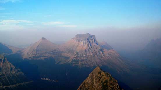
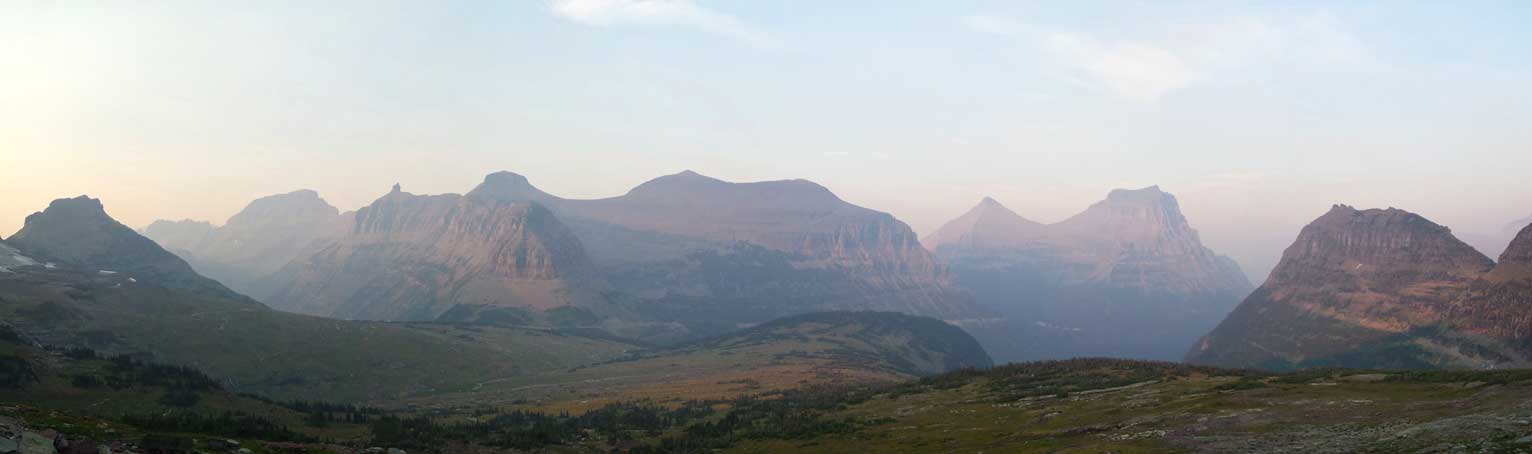
Panorama of the peaks North of Logan Pass. Click to view large size.

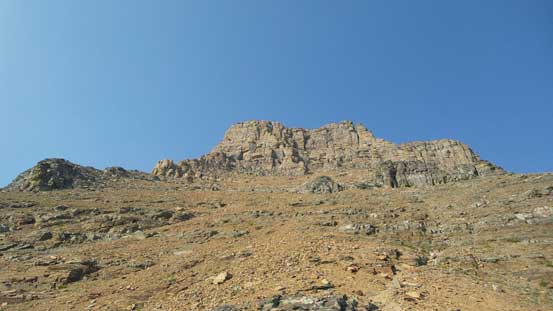
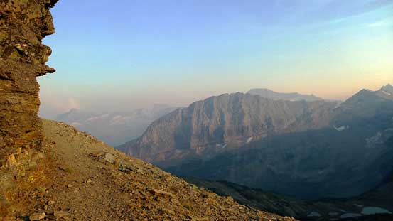
Almost at the base of my objective now.
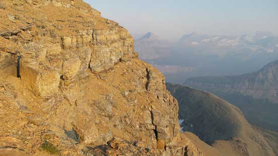
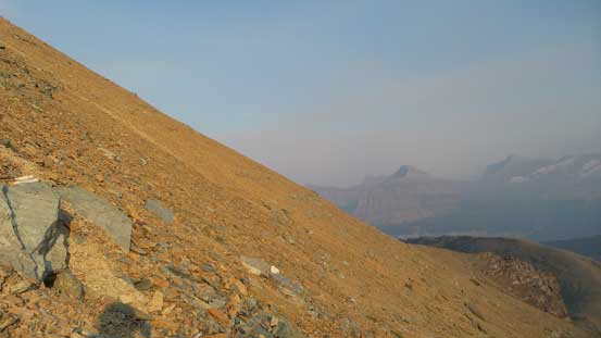
The trail led me to the base of Reynolds Mountain’s NW shoulder and once cresting the col I picked up a goat trail/path that contoured around the W. slopes on a rising traverse line. The wind was pushing me around at the col but once on the W. Face it died down. The scramble route goes up the SW slopes and once around the next corner I spotted a path with some cairns indicating I had to go straight up to break through the lower cliff bands (mostly moderate scrambling). Above the lower cliffs there were again, cairns and paths leading me up the slopes (treadmill scree) on a rising traverse line towards climber’s right. This part was quite foreshortening and checking my GPS I knew there’s still quite a ways to go.

Traversing scree on a goat path around the W. side of Reynolds
Another goat…
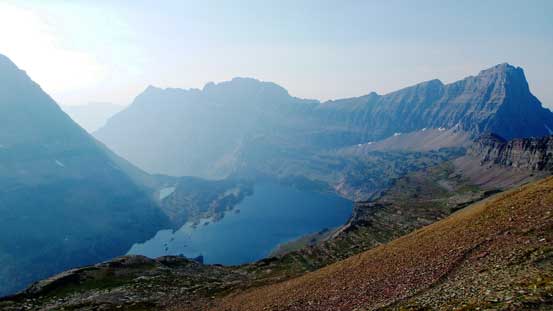
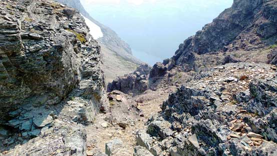
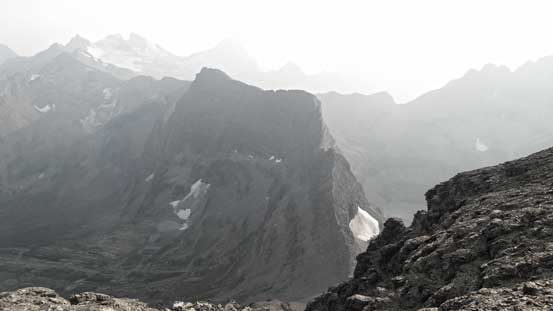
From the SW corner, looking down to Hidden Lake

The SW Face
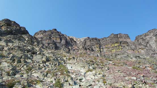
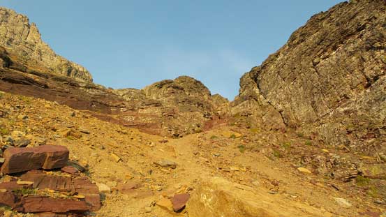
Here I should go straight up the break the lower cliffs
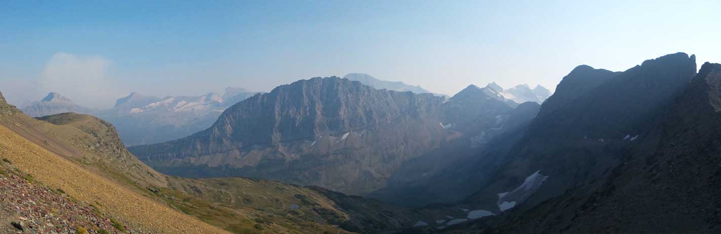
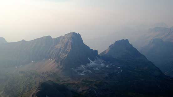
Panorama looking south. Fusillade Mountain at center. Click to view large size.
Looking ahead to the complex upper mountain
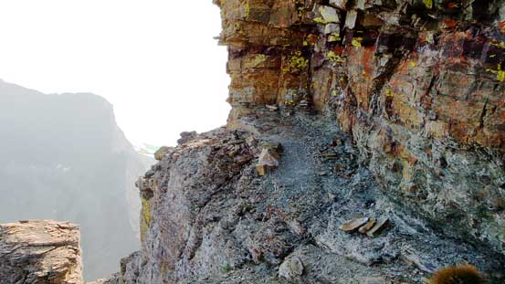
The lower cliffs that I broke through

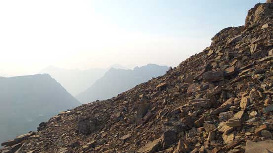
Treadmill scree on the middle section
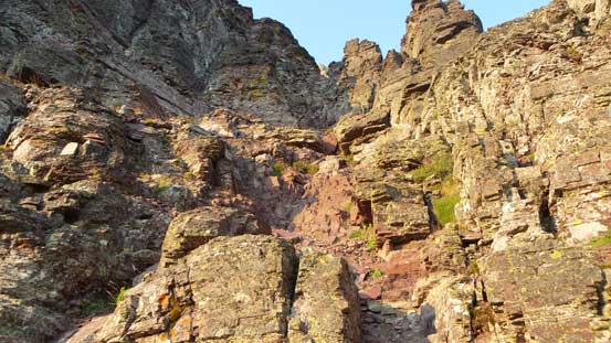
After taking a necessary short break I continued upwards and onwards towards the complex upper cliff bands guarding the summit block. Without a detailed route description and cairns/paths it’d be very difficult to tell where the easiest line went. Thankfully I had abundance (well-placed) cairns to follow so had zero route-finding challenge. There’s a short section at the start that felt like maybe 4th class but everything else was nothing harder than 3rd class. I did have to traverse back-and-forth a few times including a long ledge way to the climber’s left, but again with all the cairns it’s difficult to get lost. I was surprised how fast I made to the top and before I realized I was already on the final summit ridge traverse. One-way ascent time was about 1 hour 50 minutes so I had plenty of time to get down before dark.
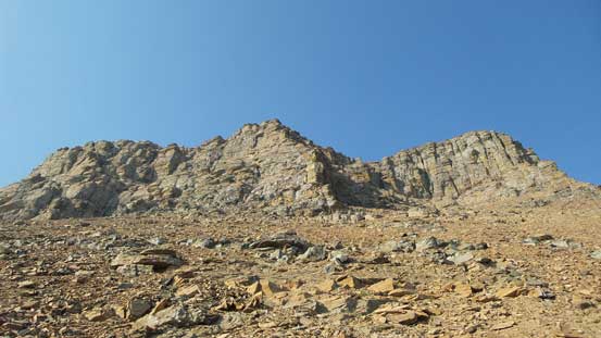
Approaching the upper cliffs
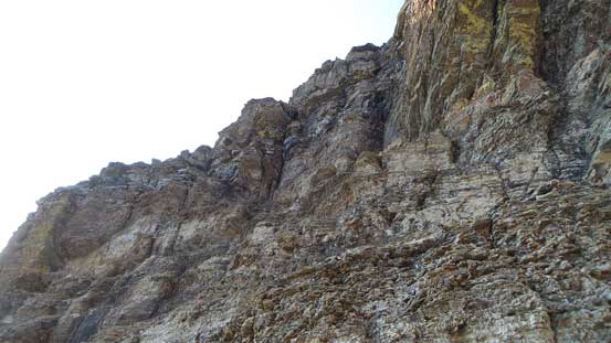
Here’s that Class 3/4 difficult scrambling section
Typical terrain looking across the upper cliffs
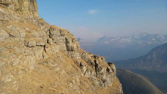
The famous exposed corner that I’ve seen on a few other trip reports
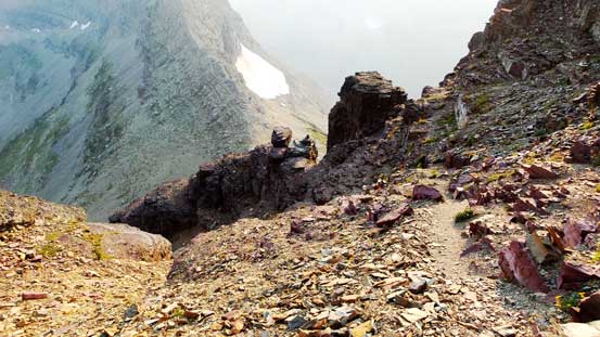
The long ledge traverse that brought me far to the climber’s left
Then the slope angle eased a bit
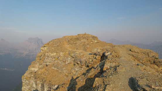
On the final summit ridge traverse now

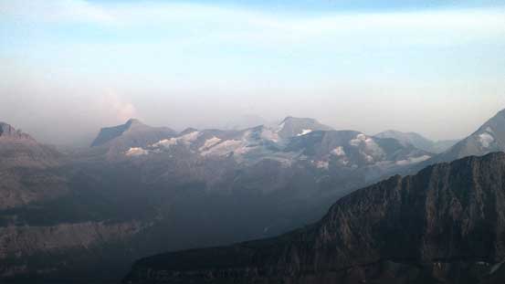
Smoky summit panorama. Click to view large size.
Going-to-the-Sun Mountain with Mataphi Peak to its left

Mt. Siyeh
Mt. Gould, Bishops Cap and part of the Garden Wall
Clements Mountain and Mt. Oberlin
Mt. Logan (L) and Blackfoot Mountain (C)

Peaks by Sperry Glacier – Edwards Mountain and Little Matterhorn
The massive bulk of Mt. Jackson

Me on the summit of Reynolds Mountain
Looking down towards The Dragon’s Tail

And, looking down towards Heavy Runner Mountain
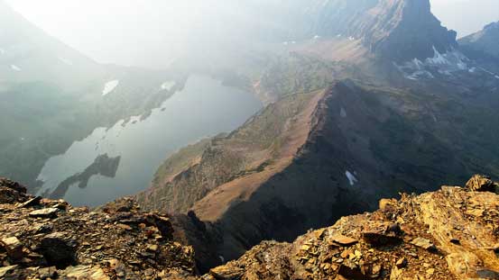
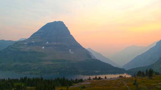
And finally, looking down towards Hidden Lake
The smoke obscured my views so I had little mood to stay long on the summit. Retracing my steps following the cairns/paths was nice and easy and in short time I was off the upper cliffs. The middle mountain was a fast scree skiing and the lower cliff bands were nothing challenge to down-climb neither. The only down-side was that hard ground was generally hard on my knees so I took quite a few short breaks along the way. The rest of the way back was uneventful except for I took a detour to the Hidden Lake Lookout for some extra views since I was doing good on time. My round trip time was roughly 3.5 hours but I was going fast.

Traversing along a key ledge on the descent

Back down through the upper cliffs, looking back
Scree skiing this section was fast
Down through the lower cliffs
Partway down the lower face.
More about the lower cliff bands

Around the SW corner

The smoky sun and Bearhat Mountain
Fusillade Mountain

The Dragon’s Tail
And, Reynolds Mountain
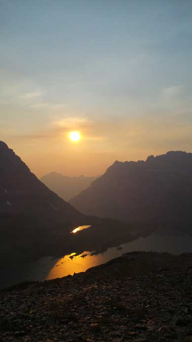
Sun and the reflections in Hidden Lake

Clements Mountain at dusk
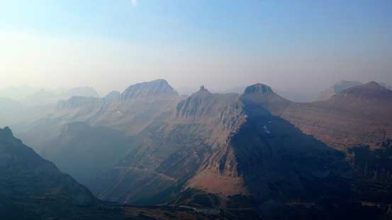
Panorama of the Garden Wall and peaks north of Logan Pass. Click to view large size.

One last picture of Going-to-the-Sun Mountain
Bearhat Mountain at dusk
Overall I’d highly recommend Reynolds Mountain to competent scramblers looking for a classic in GNP, MT. It’s a short and enjoyable “difficult” scramble, and supposed to be super scenic too. Too bad I didn’t get to enjoy those views thank to the smoke. If I ever go back I’ll have to save Clements Mountain for a better day…
