Slollicum Peak
October 24, 2017
1575m
Fraser Valley / Harrison East FSR, BC
There aren’t a lot of easy-to-access peaks in the East Harrison area and even fewer has a trail all the way to the top. Slollicum Peak is one such exception and also offers a complete 360-degree panorama on a clear day. It’s too “good”. For the sake of this reason I was not particularly keen on this objective as I could have easily done it as a day-trip even 30 years later when I’m old, or when introducing someone else into hiking. On the other hand, peaks like this do make memorable winter, or shoulder season outings when the bigger objectives are out of shape. And on top of that I wasn’t super motivated on this particular day so Slollicum Peak and that’s it.
I literally didn’t make up my mind until 7 am in the morning but then there was still enough time to finish the hike before dark, so off I went. The drive down Highway 1 corridor was without event and then I followed the iPhone apps towards Harrison Hot Springs. There were surprisingly quite a few twists and turns but I got there nonetheless and then onto the East Harrison FSR. This road has lots of wash bars and pot-holes such that I was glad to have driven the Tacoma here. In the old days one could have driven a kilometer or so up a spur road but now it’s gated. The companies are doing active logging and the access is shut down so I just parked on the side of the main forestry road.
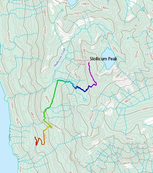
Slollicum Peak hiking route. GPX DL
From the main road I had to walk up the entire stretch of that spur road but it’s a quick fair. At the end of this (first) spur road I picked up the signed and marked “Slollicum Trails” into the woods and then into a boulder field. The trail was very well marked but those boulders were covered by a layer of oil-ish dew or frost making very tricky footwork. I had to often crawl so not to slip and break a leg. After the boulder field this trail rejoins an (older) logging road and then follows it leftwards for a long while. A couple minor creeks were hopped across and then I passed the turn-off to Lookout Peak. Not far after that the “Slollicum Peak trail” starts in between two small wash-outs (creek crossings).
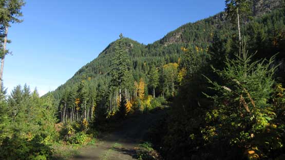
This first spur road would be easily drivable if not because of that gate
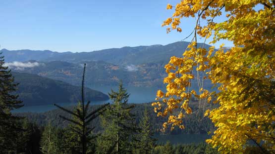
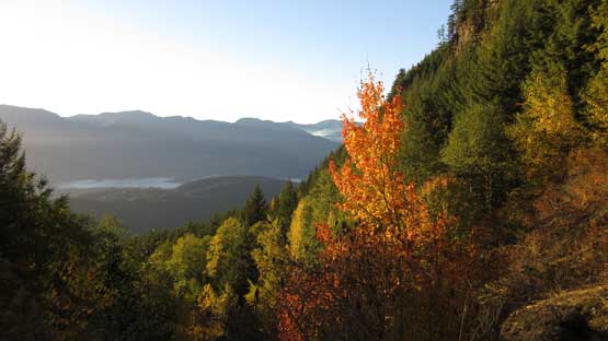
At the end of the first road walk. Already views of Harrison Lake

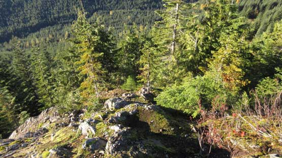
Hiking into this boulder field

The trail travels through somewhere here.

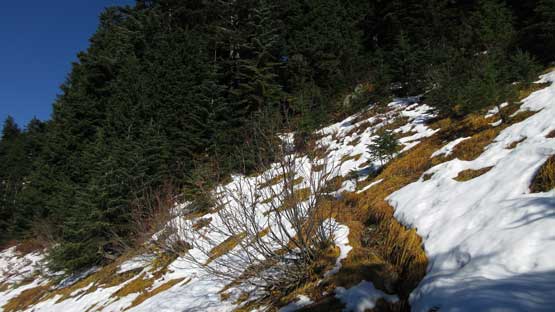
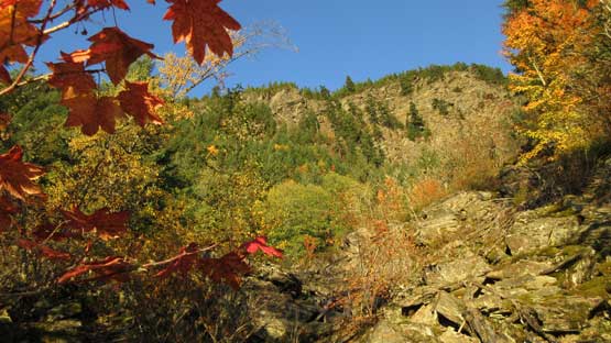
Gorgeous fall colours everywhere.
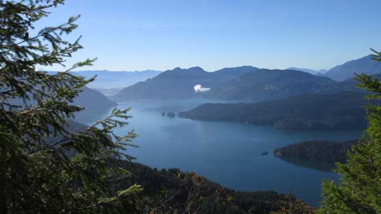
This is looking down at the southern end of Harrison Lake

The second spur road is much more overgrown though.
This trail turns almost directly up into the forest and for the most part it’s well marked. I could tell that without this trail it would have been a hell of bush thrash though so at this point I’m glad I didn’t come here in the middle of a dead winter. The fresh snow did not appear until way up high, like until roughly 200 m below the summit ridge. The snow depth was annoying though as it only served to make the grassy traverses ultra slippery. The snow condition was a complete slush and offered no grip whatsoever. This costed some time but nonetheless I made to the summit ridge.

About halfway up the steep trail, looking at the typical slopes
Started encountering patchy snow.
It’s hard to tell which of the two peaks is the true summit but on the topographic map it’s labelled on the far northern peak so I had to traverse then. This traverse was not very pleasant with some bushwhacking and lots of post-holing on breakable crust (since sections are north-facing and shaded from sun), but speaking the experience and the scenery it’s definitely the highlight. There’s one or two cruxy steps on the second half that required some brief scrambling moves and the actual summit has much better views than the south peak.
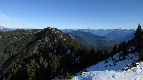
Hitting the summit ridge now, gorgeous view looking east

A wide-open view looking north. The true summit on the far left.
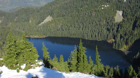
Slollicum Lake
Mt. Urquhart stealing the show
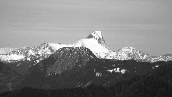
The Old Settler dominates the NE skyline

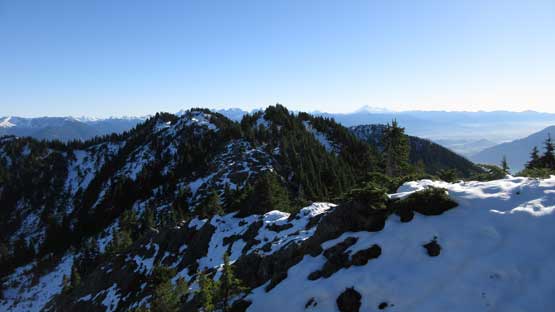
Lots of traverses and up-and-downs on this ridge. And lots of snow
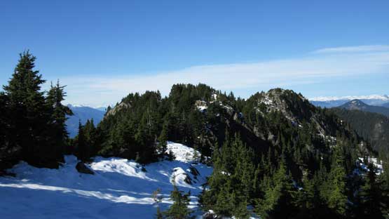
As you can see it’s fair a bit of walk to the true summit

There’s a partially frozen pond.

The true summit looks more impressive now

Summit Panorama from Slollicum Peak. Click to view large size.

A full northern view from the top

Looking way up north with Mt. Breakenridge on the right skyline
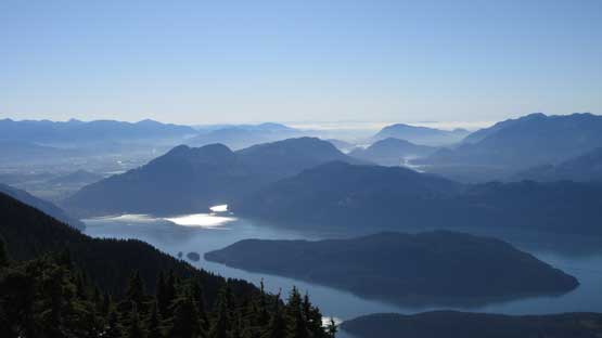
This is looking down into Fraser Valley
The Old Settler
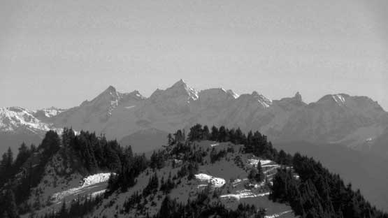
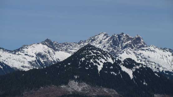
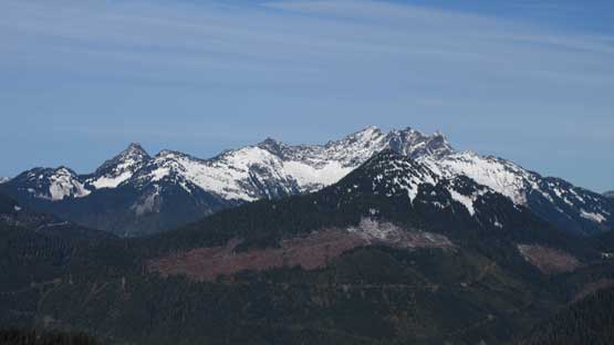
The rugged peaks on Cheam Range

Grainger Peak with Nursery Peak to its left..

The massif of Mt. Charke – Recourse Peak – Viennesse Peak

Mt. Judge Howay and the Stonerabbit Group
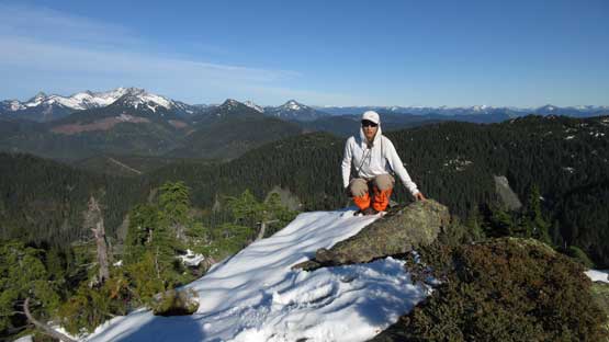
Me on the summit of Slollicum Peak
I lingered for a long while since the views were so nice and I was a bit tired so wanted that extra resting. Reversing the summit ridge traverse felt much easier as I could just follow my own steps without having to worry about the route-finding. And then down into the woods I had to again, pay close attention to not take a slip on those slush-covering-grass traverses. Basically the theme of this entire descent was trying not to slip and fall as the majority of the terrain was very slippery. The only exception being those walking stretches back along the logging roads but those were also the most boring parts. The fall colours were very scenic though so that’s the bonus on this day.

Another look down into Slollicum Lake

Descending from the true summit on blocky terrain
Looking ahead to the rest of the ridge traverse back to south peak

Cannot stop shooting the views.

Mt. Hatfield and Mt. Outram with Hope Mountain in front
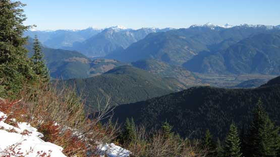
Lots of views into the Fraser Valley looking towards Hope

Into the woods now

There came an opening about halfway down
Keep descending!

Down to the upper logging road now.
Fall colours
More fall colours. This is below the slippery boulder fields now.
My round trip time was a wee bit slower than expected but still I managed to beat the sunset. The snow surely slowed me down in numerous ways but also added to the scenery (and experience). In conclusion I would definitely recommend Slollicum Peak but the only advice, this trail might be a bit rough to take “beginners” up.
