Spuzzum Mountain
April 21, 2017
1913m
Boston Bar / Fraser Canyon, BC
About 40-50 km north of Hope in the Fraser Canyon halfway between Yale and Boston Bar there’s a small community called Spuzzum. This community is so small that if not because of the topographic maps I would never have noticed it. Spuzzum Mountain looms on the west side of the canyon for more than one vertical mile above the Fraser River, but despite its vertical relief this is not an attractive peak. There is no technical challenge as the summit is very broad and flat, but much of the approach is via some overgrown logging roads and steep vegetated slopes. The information is also pretty rare but there are a few useful reports on ClubTread. My reference was Simon’s report but given the April time frame of a year I wouldn’t use the same approach as he did in dry conditions.
There are many more “sexy” objectives I could have bagged in a day like this past Friday, but given the incredible (hence, unusual) amount of low elevation snow I figured I just had to take advantage of that. Those high elevation peaks with easy access could wait but objectives like Spuzzum Mountain would be at their prime time. I had no idea how far I could drive up the access road and assuming I’d have to walk that full 5.5 km length I still made that call to head out on Thursday night after work. I got to the start of Tsileuh Creek Road at around midnight and just like the previous trip in this general area, this road saw some fresh maintenance. Except for some fall rocks there was no major obstacle whatsoever and I had no issue making to Tikwalus Road in my Toyota Tacoma. This spur road was no longer drivable but I was more than happy enough to have knocked 5.5 km off right off the bat.
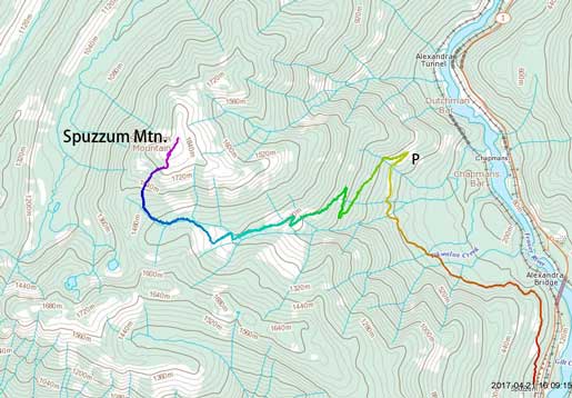
Spuzzum Mountain via Tikwalus Creek. GPX DL
This also shaved off some height gain for me and now with only 1400 m left I no longer had to start early. The next morning I woke up at around 8 am and an hour later I eventually managed to sort everything out and start the plod. The snowline looked to be a couple hundred vertical meters higher so I started with carrying boots/snowshoes while wearing sneakers. About 1 km up the Tikwalus Road I hit snow and it’s time to ditch the sneakers, and another 500 m or so later I had to don snowshoes. Despite not being drivable, this spur road still saw some maintenance from the freshly-cut alder branches and unlike what Simon described in his trip report (which was 6 years ago), I did not have to deal with any bushwhacking. After the first set of switchbacks the snow depth increased dramatically and from there onwards I knew it’d be nothing but a cruise-sailing to the summit.
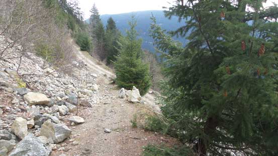
This is the start of Tikwalus FSR
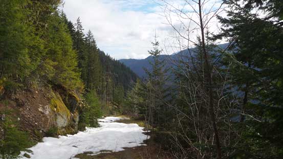
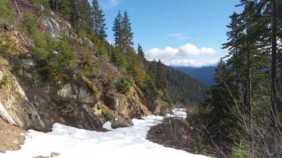
Hitting snow now.

Looking up along the lower Tikawlus FSR.
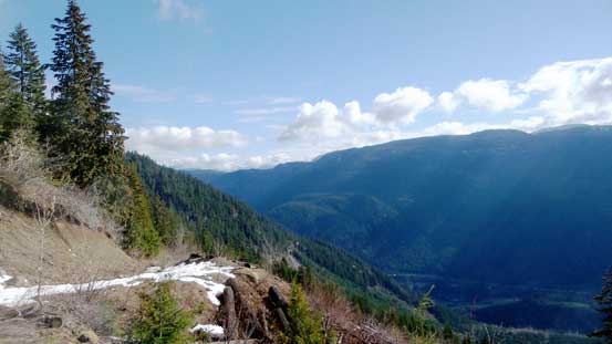
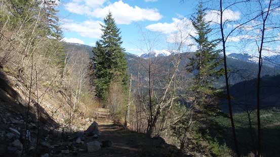
The weather was clearing up revealing the Fraser Canyon view.

This is the first switchback.
The snow had become continuous. Time to don snowshoes..
The road plod soon because monotonous and tiredness, which more likely to be boredom started to creep in and for some reasons I couldn’t let the rhythm flow. I was not at my best physical conditions so once the logging road ended at a large area of clear-cut I made a call to take a break. I don’t like taking a break at such an early stage but it’d be nice to have my energy back, and it turned out to be a good call as I did manage to get my energy back. I followed the remnant road to its end at the clear cut and then did a side-traverse towards north into the upper Tikwalus drainage. The secondary growth forest was tight but with 3 meters of snowpack I could stay away from any real bushwhacking. I could see that this approach would not be very feasible in summer time though.

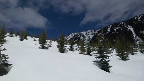
The snow depth increased rapidly.

Upwards and onwards along Tikwalus FSR

Near the end of this road plod.
Ascending this open clear-cut and then cut into the upper drainage.
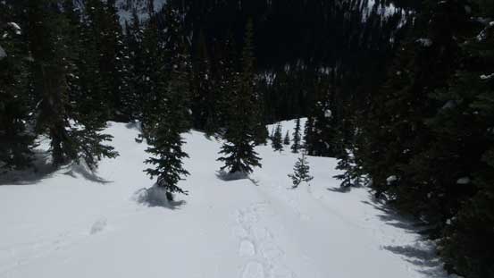
Much of this stage was in the forest so as usual I’d check my GPS screen for every minute or so and once making sense I trended right up the slope. The grade steepened rapidly and soon it became difficult to keep that diagonal traversing mode so after consulting with the GPS unit I abandoned the “SW Ridge” route and instead, went for a “SW/S slopes”. This meant I just had to ascend (steeply) straight up the forested slope and a couple hundred vertical meters later I found myself at treeline. There were a few steeper open slopes to ascend at treeline country and I continued all the way to the final summit ridge before taking the second break of this day.
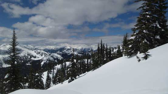
After about 400 m of forest grunt the view opened up again.

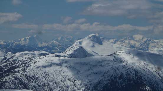
Mt. Urquhart catches one’s eye to the south.
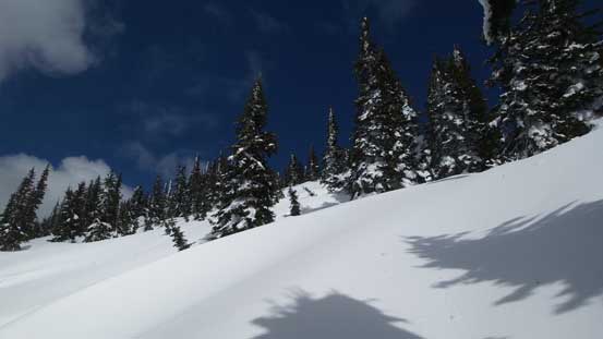
The terrain near treeline was pretty steep.

Still grunting up..
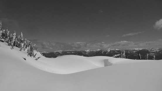
Hitting the final ridge now.
Trending left I overcame two minor rises on snow-covered bluffy terrain and the next thing I was standing on this very broad summit. Ironically there’s not that much to see from the highest point so I continued onwards towards the edges. Firstly I went for at least 200 m further north to check out the views down into Fraser Canyon, and then came back to the south side for a more expansive vista towards the “East Harrison” area. The north face of Mt. Urquhart really stole the show. Eventually I settled at a nice viewpoint, had a break and reconnected on social media.

Plenty of snow at this elevation level.

Winter wonderland!

One of the few rises along the last stage.

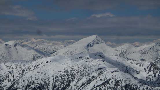
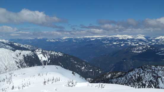
As you can see, Spuzzum Mountain is taller than most of the peaks nearby.
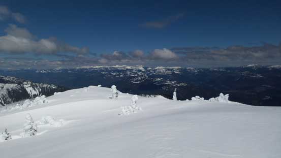
Arriving at the summit.

Partial Summit Panorama from Spuzzum Mountain. Click to view large size.
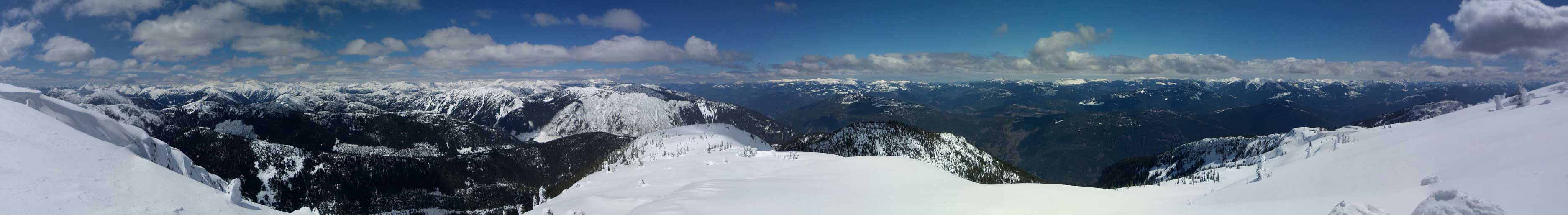
Partial Summit Panorama from Spuzzum Mountain. Click to view large size.

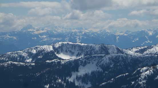
Looking south towards Mt. Urquhart area

Tulameen Mountain looms to the east
Zooming-in looking south towards Hope area. The Fraser Valley peaks on skyline

The Old Settler

Mt. Urquhart
This is the unofficially named “Hornet Peak”
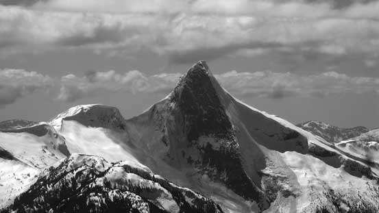
Another shot at the north face of Mt. Urquhart

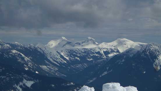
The glaciated massif of Mt. Breakenridge and Traverse Peak

Some very remote peaks north-east of Harrison Lake

Looking north over some unnamed peaks towards The Nipple area on the skyline
Scuzzy Mountain which I bagged last year in September
Guanaco Peak, Vicuna Peak and Alpaca Peak by Coquihalla area

A wider view looking north
A zoomed-in view looking north into Fraser Canyon

Cornices on the summit!

Me on the summit of Spuzzum Mountain
Once I had enough of the views I leisurely started the descent. In no time I was back into the forest and the 400 m elevation loss down into Tikwalus Creek was fast and fun. The snow was getting slushy though and at time I had to deal with some pretty bad post-holing, but it was down-hill so never too bad. The plod down that logging road was also pretty fast as the gentle grade would allow me to comfortably glide for every step forward. Back at where I ditched sneakers I really wan’t in the mood of taking another break but that way I’d be mad at myself for hauling unnecessary weight, so spent a few minutes swapping gears. I also dumped all the water and some food as they all seemed like extra weight now, and soon enough I was back at the truck.

Time to head down.

Can’t get rid of these views!!
Eventually it’s time to enter the forest.

As far as the forested descent went.

At least 3 meters of snowpack at elevation of 1350 m ish.

Following my own tracks.

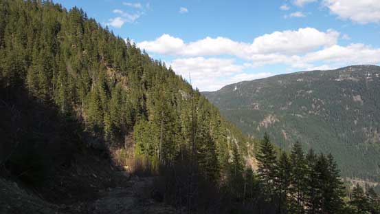
Long descent following this Tikwalus Road

Looking at Anderson River Mountain and its group behind
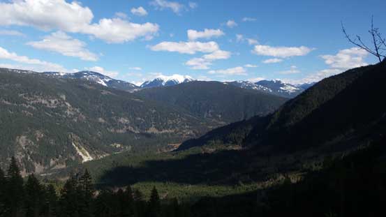
Afternoon lighting was good for picturing the Fraser Canyon
More about this descent. The snowshoes were off now.

Tikwalus FSR.
Down, down, down…

Another photo to show Fraser Canyon
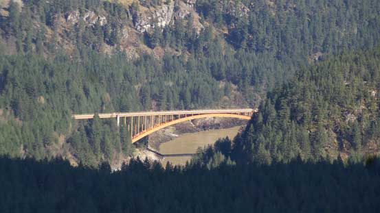
A zoomed-in look at Alexandra Bridge
My round trip time was 7 hours 20 minutes at a normal pace so in the right conditions especially when the Tsileuh FSR is drivable this is quite a short objective. It was still quite early in the day and after briefly considering ascending the nearby Mt. Lincoln I decided against it. The drive southwards down Fraser Canyon towards Hope was very scenic as this was my first time ever seeing those views in daylight time. The rest of the drive was very familiar but the traffic was terrible near Abbotsford thank to a big crash which costed me at least half an hour, but oh well…
