Mount Hewitt Bostock
June 18, 2020
2180m
Boston Bar / Merritt, BC
Mt. Hewitt Bostock is a broad summit in the far northern reach of the Cascades overlooking Boston Bar and the Fraser Canyon. The quickest access is probably via the logging road system in Ainslie Creek to the north-west but the status of that road is largely unknown. For peak-baggers looking to link up several summits in one trip this peak is better accessed from Stoyoma Mountain, which is accessed by driving some complicated logging road system from Merritt and Highway 8. There is some confusion as which is the actual summit of Mt. Hewitt Bostock. The officially-named highpoint isn’t the highest in its close vicinity. The peak about 3 km to the south is significantly higher and is known as “Stoyoma’s Widow” on various guidebooks, while the broad summit about 2 km to the north is also (slightly) higher, and is nicknamed “Cowhead Peak” on bivouac.com. People had been confusing Mt. Hewitt Bostock with either of the two taller summits nearby for understandable reasons. I would have to blame the naming process as why wouldn’t they just name the taller peaks instead. This peak is also not iconic comparing with “Stoyoma’s Widow” or “Cowhead Peak”. All summits in this area are dull and rounded that offer zero mountaineering interest sans some scenic ridge rambling.
For obvious reasons this wasn’t the primary objective. Vlad and I bagged it simply because we happened to be in that area after completing Stoyoma Mountain and “Stoyoma’s Widow“. The traverse to Mt. Hewitt Bostock from “Stoyoma’s Widow” was not particularly inviting with a steep 300 m elevation loss into a bowl, that also must be regained on the way back. But the day was still young so we had to keep going.
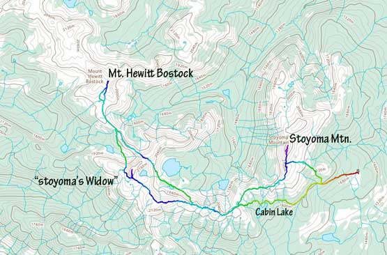
Stoyoma Mtn. and Mt. Hewitt Bostock traverse. GPX DL
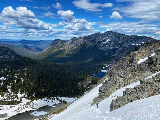
Prior to the trip we knew the crux would be the steep drop on the north side of “Stoyoma’s Widow” and we were correct. The descent looked to involve some steep snow climbing so we took the axes out and strapped crampons on. Getting into the couloir involved a bit of 45-degree down-climbing but the grade soon eased. We then took the crampons off and boot-skied down to the bottom, followed by some frustrating elevation regain to Widow/Bostock col. From there we ditched backpacks and rambled ahead, dealing with more frustrating up-and-downs and some minor route-finding and a lot of post-holing. It’s pointless to describe the exact route we took as all lines go.
Me traversing into the steep down-climb. Photo by Vlad M.
Vlad down-climbing steep snow north of “Stoyoma’s Widow”
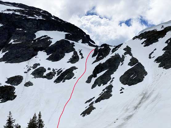
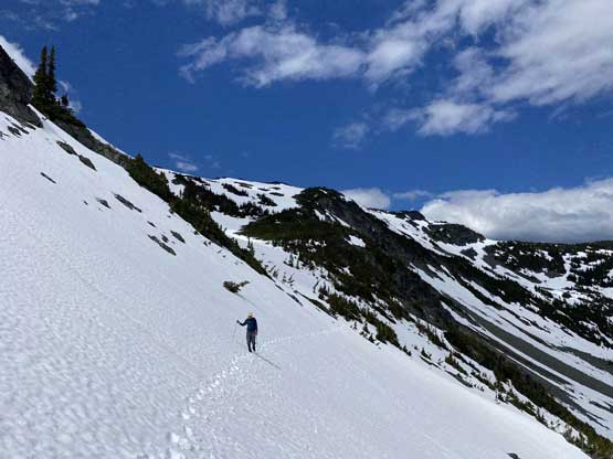
This photo shows our descent from “Stoyoma’s Widow”
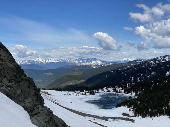
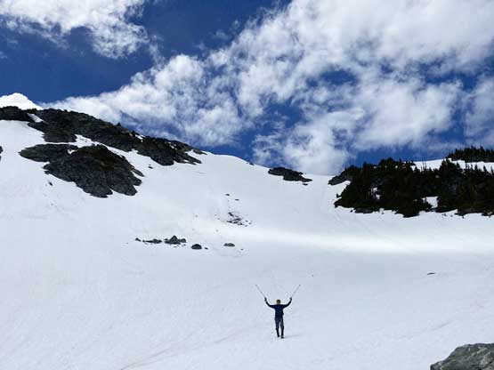
We descended into this bowl after 300 m of elevation loss
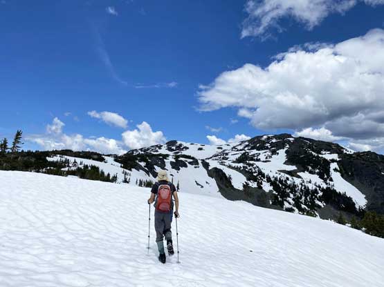
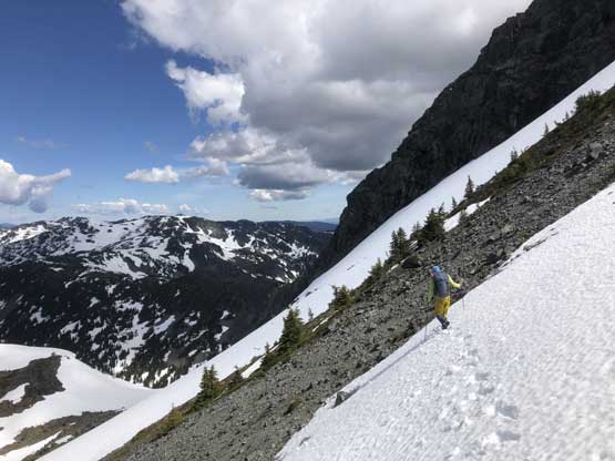
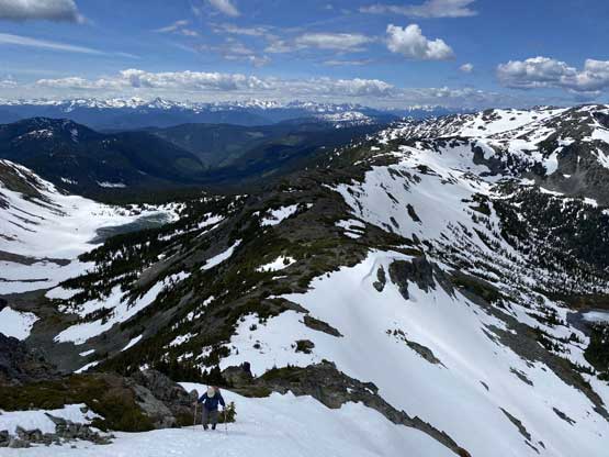
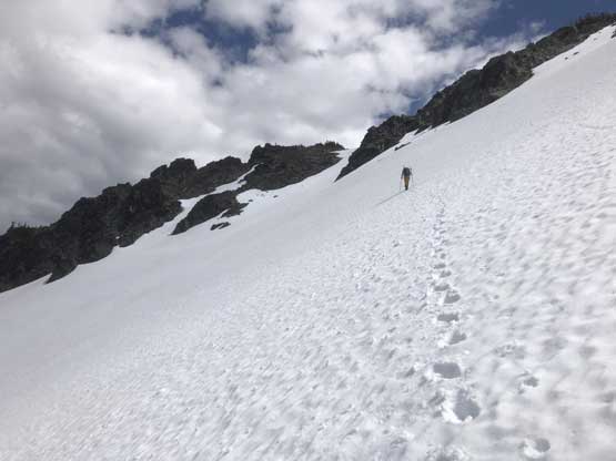
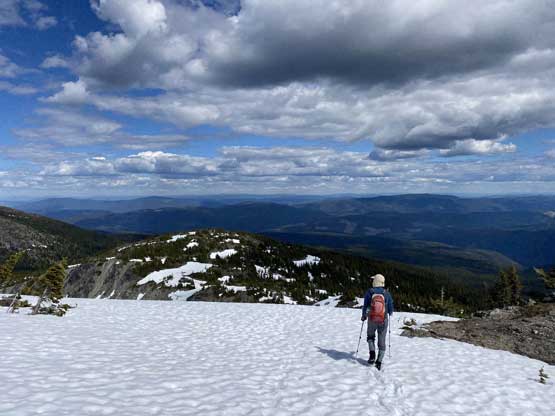
After a while here’s Vlad plodding up the south slopes of Mt. Hewitt Bostock
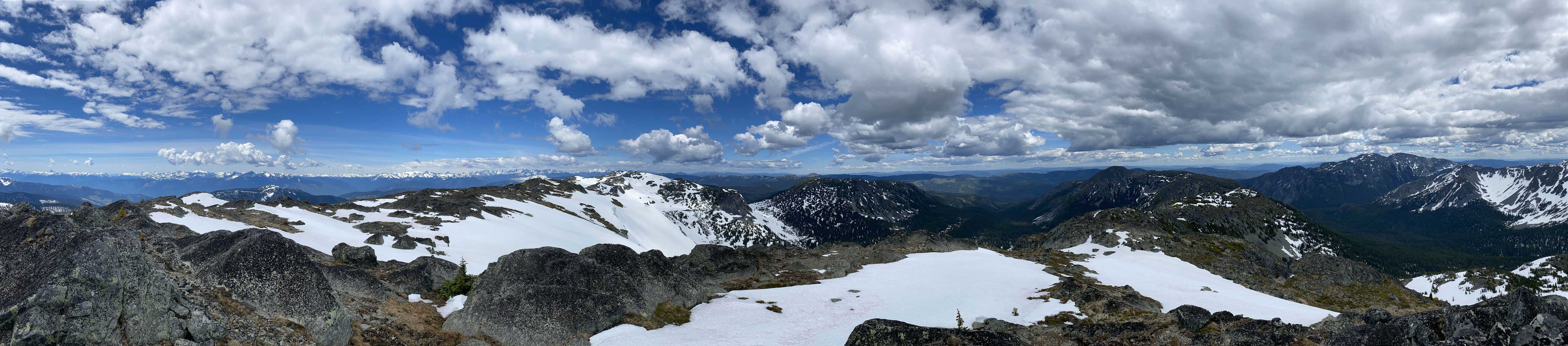
Partial Summit Panorama from Mt. Hewitt Bostock. Click to view large size.
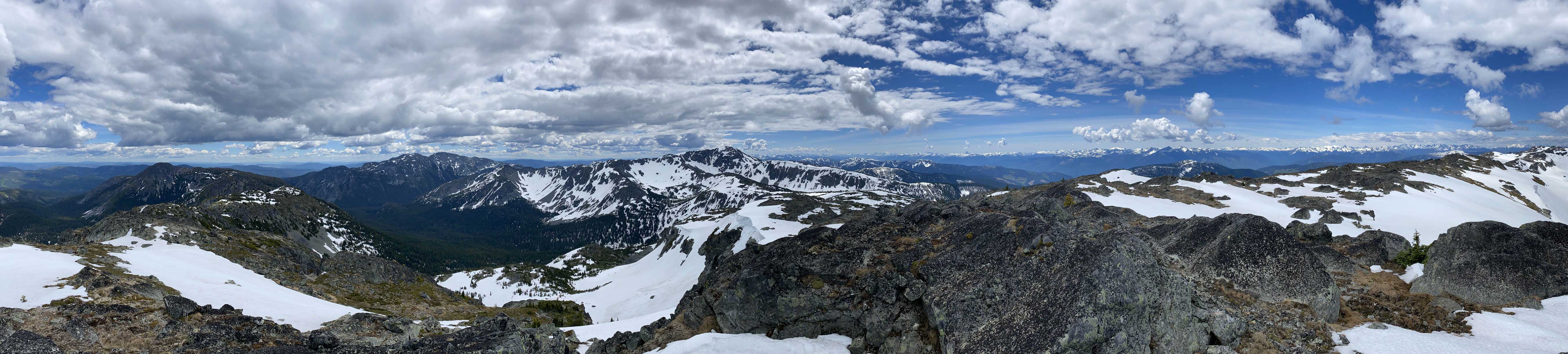
Partial Summit Panorama from Mt. Hewitt Bostock. Click to view large size.
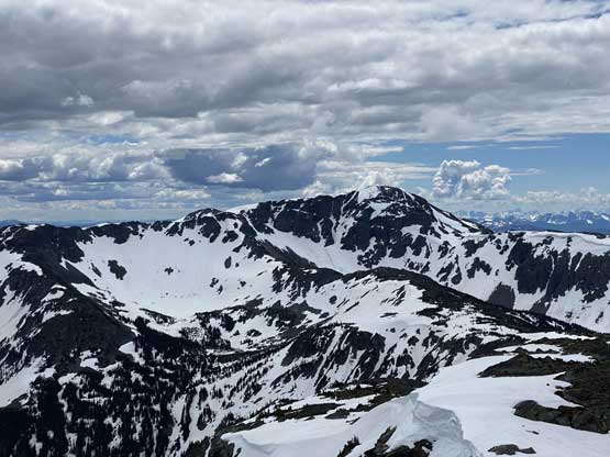
The north face of “Stoyoma’s Widow”
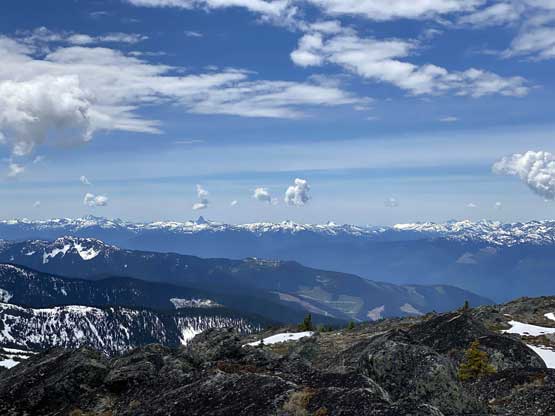
The East Harrison area on the skyline
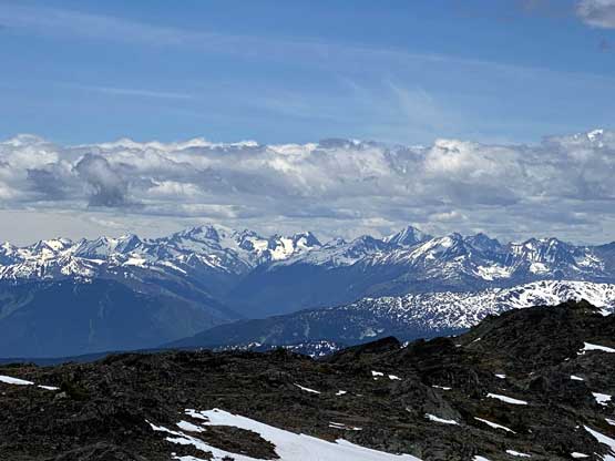
Skihist Mountain and Petlushkwohap Mountain
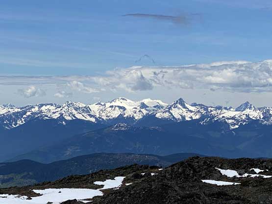
Kumkan Peak, Kwoiek Peak and Kwoiek Needle

The Nipple, Mt. Laughlan and Schist Cap
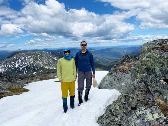
Vlad and I on the summit of Mt. Hewitt Bostock
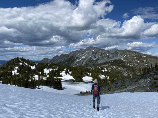
The summit boasts a huge cairn but we couldn’t find a register. Traversing to “Cowhead Peak” would involve at least 2 more hours and we were both tired and low on motivation so decided to head back. On the descent we utilized a nice snow gully on the south-west side to speed things up. And then we opted to stay on the ridge head for the north rib of “Stoyoma’s Widow” and the process was pretty boring and tedious with some up-and-downs and some minor bushwhacking. The ascent of the north rib of the widow was easier than appeared that we didn’t even need to use an ice axe nor crampons. Once topping out on the east shoulder of “Stoyoma’s Widow” we faced another important decision. I voted for descending to near Widow Lake in order to stay on snow for as much as we could. The boot-skiing was super fun and the traverse across the Widow Lake’s basin wasn’t bad, but the 200 m elevation regain at the end was exhausting. The snow was steep to about 40 degrees but soft enough that we didn’t need to use an ice axe.
Vlad ascending the north rib of “Stoyoma’s Widow”
Dropping into the bowl by Widow Lake
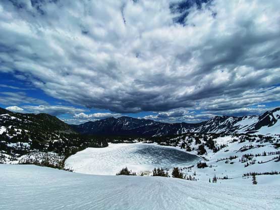
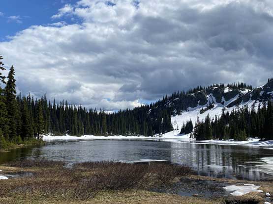
This is the still-frozen Widow Lake
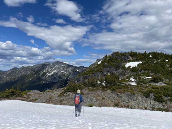
Time to start contouring…
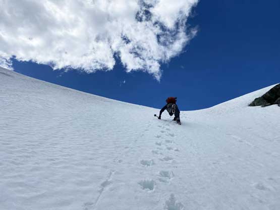
Me leading up the steep snow ascent to get back onto the ridge.
Vlad ascending snow with Stoyoma Mountain behind
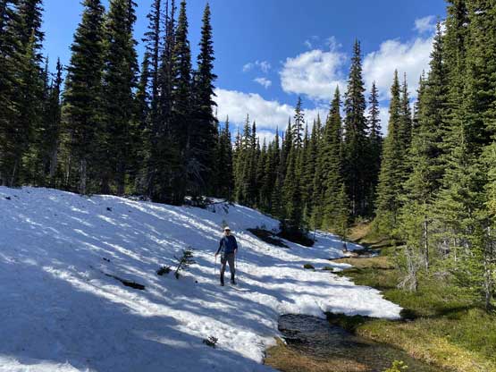
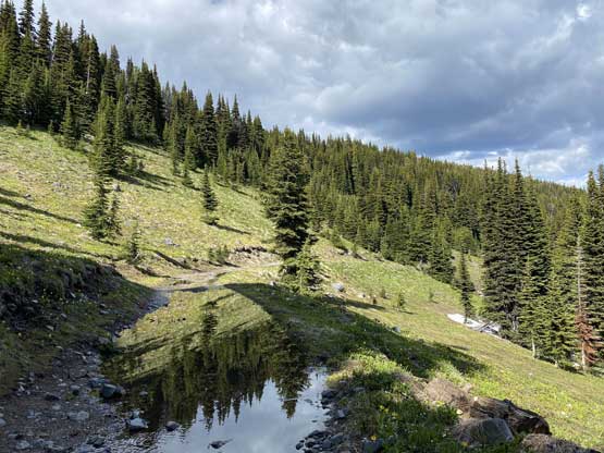
We took a long break after regaining to the ridge but then there came a few more frustrating bumps. At least now we had our own tracks to follow so not much mental work needed. After the last bump we decided to short-cut down to Cabin Lake taking advantage of the snow in the forest. The bushwhack wasn’t bad at all but unfortunately there came a few more major up-and-downs on the final few kilometers of road plod. None of us was expecting much of uphill travel on the road but too bad.
One bump after another. It’s never-ending
Finally went over the last major bump…

The west face of Stoyoma Mountain
Another photo to show Stoyoma Mountain which was our first objective
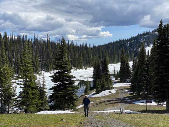
Descending open forest towards Cabin Lake
Down to the shore of Cabin Lake with more elevation regain later…
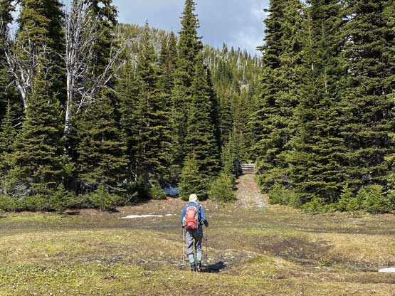
There’s an official recreation site here
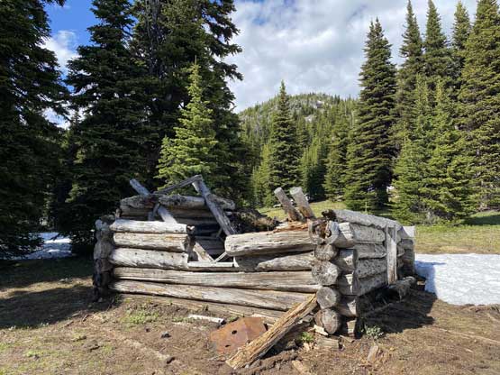
Signs of civilization…
Vlad with Cabin Lake behind
The final few kilometers of road walk…
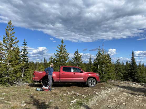
Done. It’s Taco time…
Our round trip time was 11 hours 40 minutes on a steady pace. The total distance was under 28 km with a shit ton of cumulative elevation gain, probably close to 2000 m. There were a lot of mosquitoes at the truck so we didn’t linger any longer than necessary. The driving down to Merritt was exhausting that I had to stop somewhere in Prospect Valley to take an energy nap. Once down to Merritt we stopped in a local Subway for a much-needed dinner and then I had to stop for another nap on Coquihalla Highway. Eventually I made back home at past 11 pm and that concluded another exhausting but satisfying trip…
