Fuya Fuya
December 29, 2022
4279m
Otavalo, Ecuador
Fuya Fuya is the highest summit on the volcanic massif around Lagunas de Mojanda directly to the south of Otavalo. The other notable peak on this massif is Cerro Negro. There are numerous other summits as well, but those are rather small and insignificant. There are two ways to access these peaks and the most commonly-used and the most reliable route is from the north. A road with cobblestone pavement goes up from Otavalo all the way to the “big lake” – Laguna Caricocha at 3750 m elevation. Fuya Fuya can be easily accessed from there whereas Cerro Negro requires a longer walk. Adam and I planned to ascend both Fuya Fuya and Cerro Negro. The Google Maps that Adam used directed us to drive around to the south side of Cerro Negro to the small town of Tabacundo, but detailed research showed that we should come directly up from the north from Otavalo. The roads on the north side weren’t even shown on the Google maps so my Gaia topo map became the navigation tool for once again.
Given the weather pattern in Ecuador we knew that we had to get up as early as possible to have any view on these peaks, so we again informed Marquito to get up at 5 am before dawn. The three of us then checked out the Air B&B. We used Google Maps to direct us to a small hotel in the vicinity of the access road and then used the Gaia map to give Marquito more directions. The access road turned out to be well-signed and the condition was rather excellent. I think even a regular taxi could easily get us to Fuya Fuya’s trail-head, but to drive any farther towards Cerro Negro would definitely need Marquito’s truck, as we learnt a few hours later.

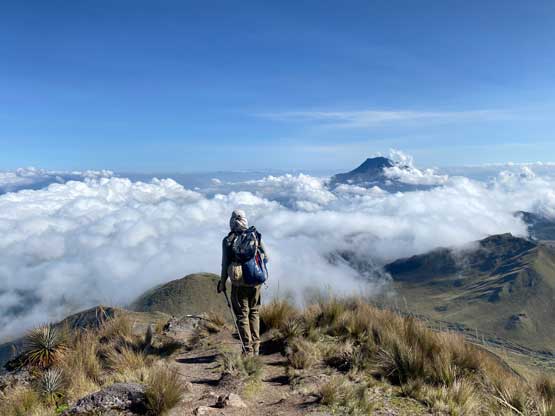
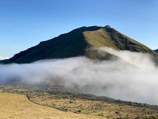
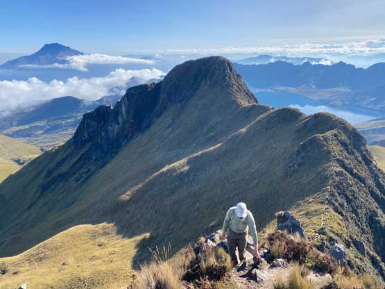
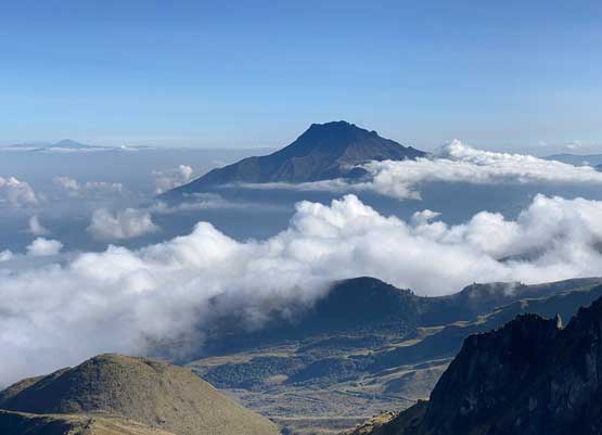
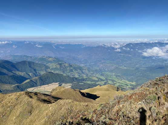
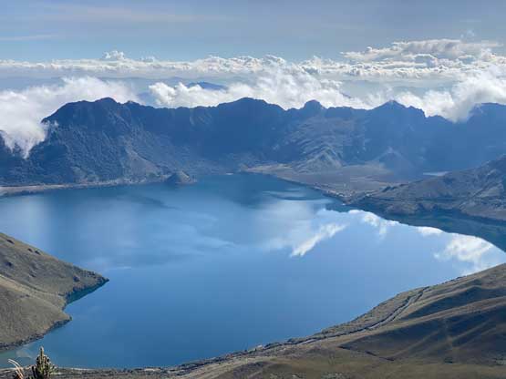
Fuya Fuya has two summits with the harder west summit being the true one, so the plan was to ascend directly to the saddle between the two peaks to be better positioned for the true summit. This was a rather short ascent so we didn’t have to rush. The previous night’s dump of rain had made the grass wet and we got moderately soaked from the first half an hour. Thankfully the trail had become wider higher up. The views from this hike was amazing with the lake stealing the show behind us. This was shaping up to be another beautiful day.
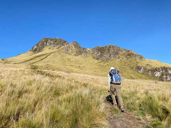


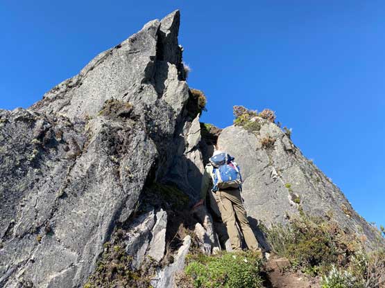
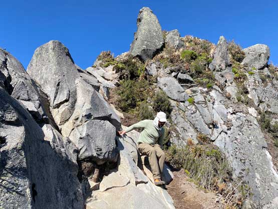
After the steep ascent to the saddle we immediately turned west. The connecting ridge appeared daunting and it sure was. As soon as the terrain became steep we encountered the class 4+ crux that sure put our scrambling skills in test. This route had clearly seen a ton of traffic but none of us believed the tourists were capable to do these moves, so there must be another way around. We would worry about that later on the descent. The terrain immediately above this crux step wasn’t easy neither with some exposed 3rd class sections and basically from there to the summit was a sustained scrambling ascent.


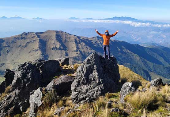
On the descent we down-climbed the 3rd class ridge until just above the crux step and Adam opted to descend a steep chute to the north to hopefully bypass that step. I wanted to have as much hands-on scrambling as possible so ignored those seemingly-easier choices and just down-climbed the crux. A few technical moves were definitely required. We had previously ditched a backpack under the crux so I carried that pack down and we regrouped somewhere above the East/West saddle. We might as well check out the east summit as it involves minimal additional elevation gain. There was again, some scrambling required and the east summit actually offered better views towards the lake.


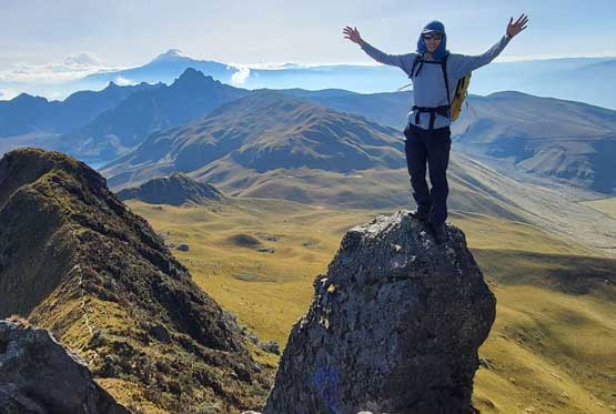


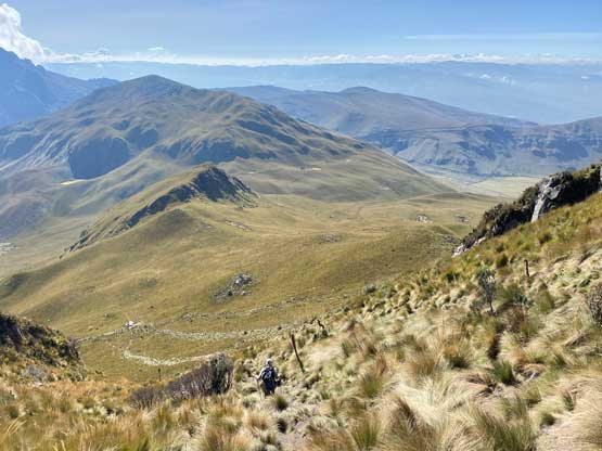
We decided to descend the standard route off the east (tourist) summit to close a loop. The NE side of the east peak was still steep, but had no scrambling step involved so we quickly made our way back down to the main trails and subsequently back to the truck. Our round trip time was just over 2.5 hours. The weather was still holding so we told Marquito to drive as close to Cerro Negro as possible and that’d be our next objective.