Meslilloet Mountain
September 14-15, 2016
1990m
Squamish / Mamquam Main FSR, BC
Meslilloet Mountain is known as the closest glaciated peak to downtown Vancouver. It’s not a tall peak by mean of elevation, but does appear fairly prominent at least when observing from our local North Shore and peaks around Squamish. The ascent is not difficult technically as the south and east ridges all go at 3rd class, but to get there involves a somewhat arduous and complicated approach. Traditionally folks have approached from the Indian River Road via Norton and Joseph Lakes but that side was reported as a hell of bush thrash. Over the past several years other folks, particularly on ClubTread, have discovered a better route from the north side via Mamquam Main FSR.
The north side approach is now considered as the “fastest” way to get to Meslilloet Mountain and a few strong parties, including familiar names such as Simon/Vlad, Jeff/Alastair, Rich So and Matt Dunn, had knocked it off in one long day (~12-15 hours). My plan was to break it down over 2 days given the late season conditions (less snow to take advantage of) and the shortened daylight time, but on top of that I’d also aim to bag the nearby Dunkeld Peak. This bonus peak as well as the neat sunset/sunrise pictures would justify the decision of spending an extra day up there. Looking more into the details I figured it’s probably a better idea to do the two as a mini traverse. The west side of Dunkeld Peak appears like a great place to explore with many lakes and tarns and another advantage was that I’d only need to deal with that steep bushwhacking section on the descent. The downside was more up-and-downs but I was all fine with that, so with a bomber weather forecast for my Wednesday/Thursday time frame I once again, drove up the Mamquam Main by myself. The road was rough but with fresh memories from 10 days ago I had no issue making to the E-100 spur at kilometer 27. Not knowing the status of the road beyond I opted to park and walk from there.
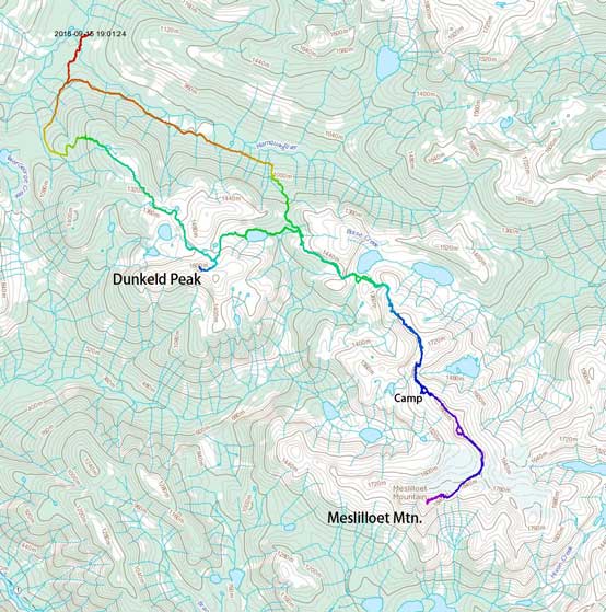
Dunkeld Peak and Meslilloet Mountain ascent route. GPX DL
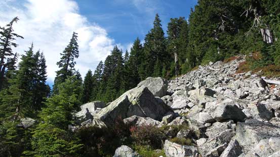
The initial half a kilometer or so was a pleasant walk down to a bridge and then the road ascended steeply up the opposite side. The road bed had become very rough here (lots of rocks) and alders had further closed in. Not far up I passed the S-100 junction (that’s where I’d return a day later) and continued along the main branch. Upon arriving at the next intersection I took the left branch up Dunkeld Spur. This spur road was in a surprisingly good shape and I followed it all the way to its end. During this entire logging road section I actually gained fair amount of height, leaving me only about 300 vertical meters of bushwhacking to gain that “1400 m plateau”.
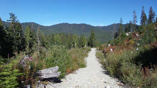
Hiking up Dunkeld Spur

The end of the spur road
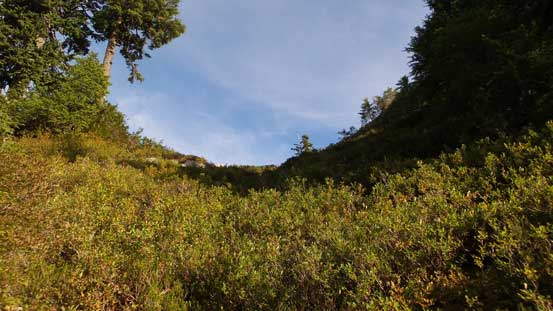
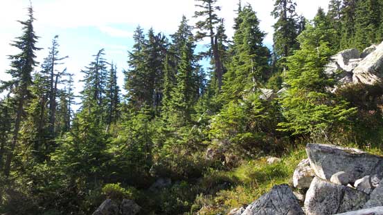
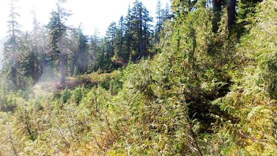
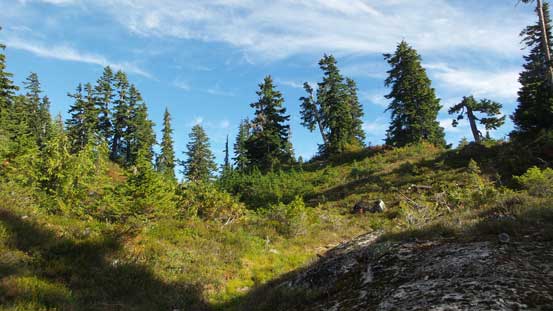
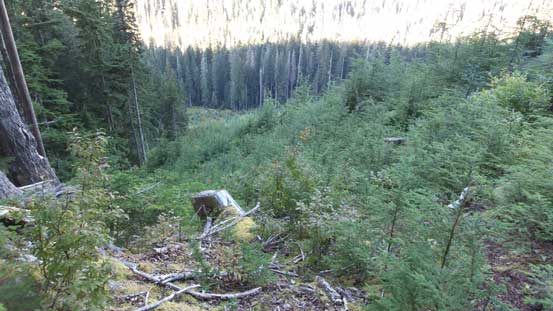
Ascending steeply upwards I followed the middle of the cutblock and that led me to the base of some bluffy terrain which I was not prepared for. After searching around for a while I opted for a break on climber’s right side. The ground was slippery and I had to apply some “bush scrambling” techniques to overcome a few interesting steps but soon enough it was over. The steepness tapered off a bit but more moderate bushwhacking (lots of underbrushes) was involved until the terrain eventually levelled out at the “1400 m plateau”. That’s a pleasant change from steep bushy terrain to some open meadows and I well-deserved break soaking in some sunshine.
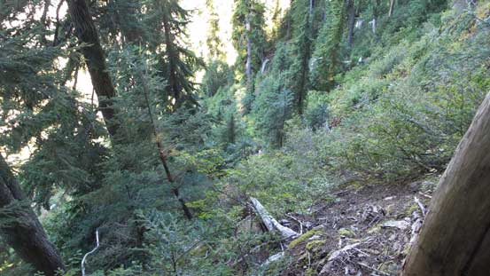
The typical steep and bushy terrain in this general area…

Picking a way up through a bluff

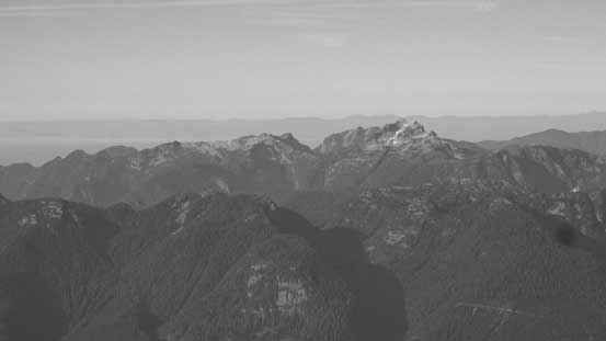
Finishing the initial bushwhacking part, Mt. Garibaldi revealed itself.
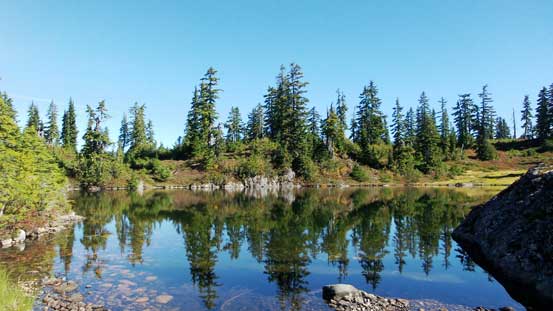
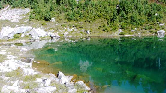
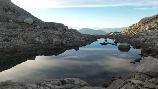
The first of the many tarns/lakes in this trip.
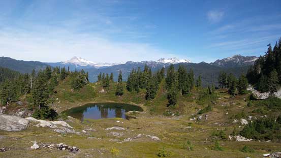
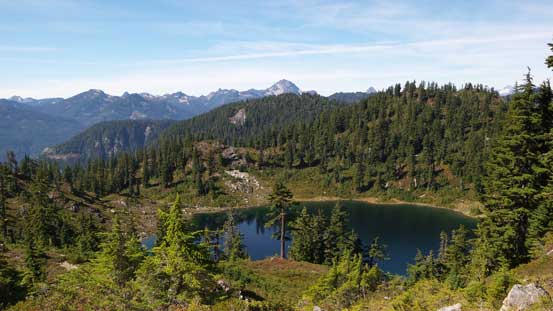
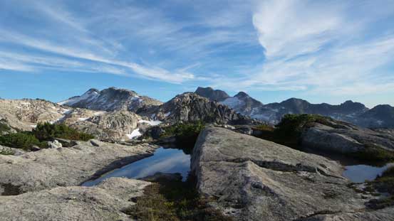
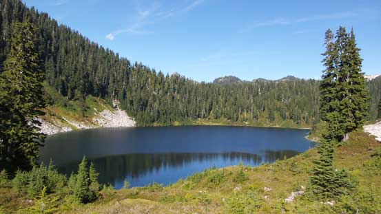
Up and over the “1400 m plateau” the route started to become a bit confusing with some bluffs, bushes, up-and-downs all mixed in the micro-terrain. But guess what I discovered? A flagged and fairly well defined trail presented itself… Initially I thought it was just a game path or so but after following it briefly I had to realize that it’s actually a fairly good trail. That eliminated a ton of route-finding for me. Plodding forward on that path I had no issue overcoming more undulating terrain, bluffs and a few lakes/tarns. As I got closer to Dunkeld Peak the trail started to ascend more towards an unnamed peak on my left side and here I opted to leave it and took a straight beeline towards Dunkeld Peak’s north face. This brought me to another beautiful lake and I circumvented it on the right (south) side before ascending gradually to the broad pass directly below the North Face of Dunkeld Peak.
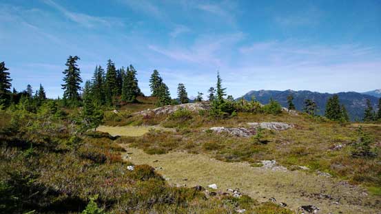
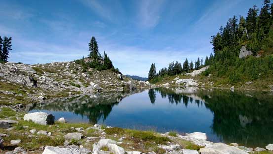
Arriving at the “1400 m plateau”.

I was lucky to pick up this unexpected flagged trail

The second tarn of the day…
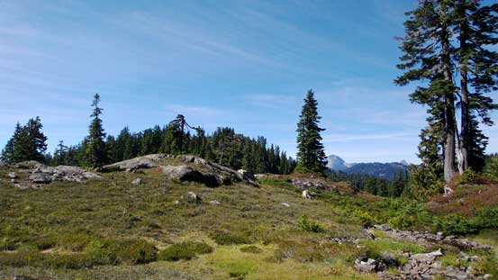
Nice and open meadows, but with fair amount of micro-terrain
Another tarn passed by
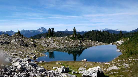
This lake was fairly substantial, but I didn’t have to drop that far down.

I took a straight beeline towards the N. Face of Dunkeld Peak here
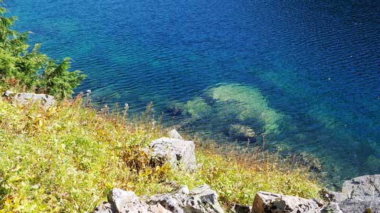
This tarn has some cool colours
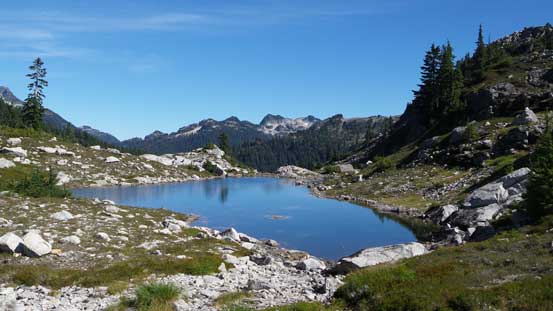
A perfect spot to take a break. Oh by the way, there was plenty of water sources along the route
The same tarn, from the broad bass just below the N. Face of Dunkeld Peak
This is another tarn on the other side of the pass.
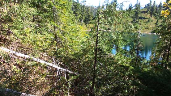
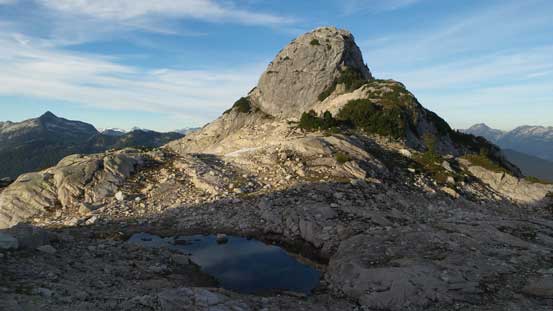
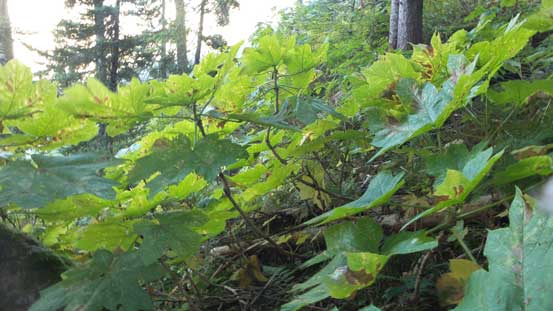
On the opposite side of a boulder field I found a perfect place to dump all the unnecessary gears. There’s no need to haul anything more than just food/water up Dunkeld Peak and the ascent is written in a separate trip report. After coming back from its summit I spent a few minutes repacking and now I had to find my way down the drainage due NE in order to merge onto Meslilloet’s regular approach route. The descent started easily as I just had to follow the creek flow but lower down I entered the bush. Descending down-climber’s right side was overall fairly easily going, until arriving at the lake below. It appeared that circumventing that lake could be “interesting”. The left side looked bushy and the right side appeared cliffy. I tried the right (south) side first but had to give up after a while so into the bush I went. There’s one really bad section to thrash through followed by a long traverse on unstable boulders. And then I had to deal with more bush along the lakeshore before making to the other side.

Descending towards an unnamed lake following this creek

After some moderate bush I made down to this lake

Circumventing the lake on its north side
Very beautiful colours
But thrashing through these wasn’t very pleasant…
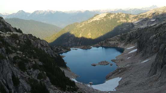
I kept following the terrain down a while but checking my GPS I soon realized I had to go up, not down… I corrected my bearing by ascending a long side-hill traverse (more bush) until my route eventually merged to the reference GPS track. Onto the Meslilloet’s north side approach now I turned right (south) and followed a widely open bench, around a broad corner onto another bench. This bench would eventually lead me bypassing another unnamed bump. The travel was not as easy as I thought with some bush and boulders, and more up-and-downs to deal with. I knew other groups all had snow to take advantage of but I had no luck on that. Towards the end of that bench traverse I dropped a bit, crossed a boulder field and then ascended steeply to another pass. In front of me was another section of major elevation loss (~100 m) down to the unofficially named “Triple Point Lake”.
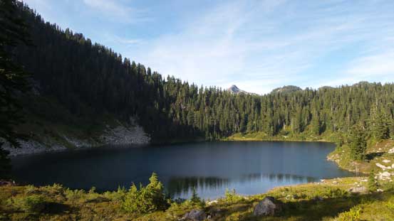
After a long traverse across a heather bench I dropped to Triple Point Lake
Here I initially followed the creek line but soon bailed to down-climber’s right side but no matter what route I took, I had to deal with more moderate bush.. But it was down-hill so didn’t take me long. It also appeared that I didn’t have to drop all the way down to the lakeshore so soon enough I was going up again. This time I was aiming at another broad shoulder directly in front and that’d be the start of the long undulating NE Ridge of Meslilloet Mountain. With a heavy pack this part surely felt like a grunt and higher up I again, had to deal with some bush (slippery ground too). Those “tree hauling techniques” were once again applied.. Onto the shoulder I turned right (south) and then the next half an hour or so was a long plod following the broad ridge to the first highpoint.

Ascending steeply towards a high shoulder
Slippery towards the top
Arriving at the shoulder now

Turning right, it’s a long plod on typical terrain like this.

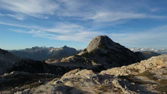
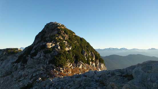
This is the first highpoint
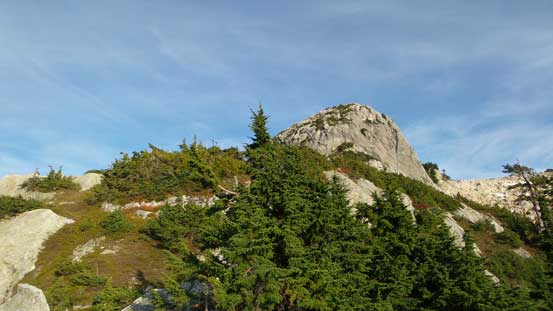
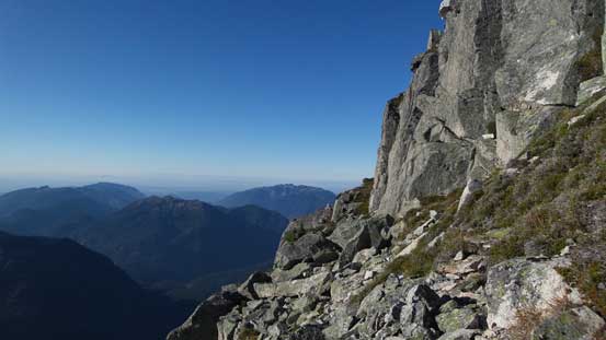
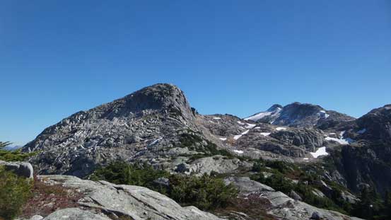
This also marked the final transition from bushy/forested terrain to the alpine ridges and the views were opening up towards all directions. The time was getting on though and I decided to keep marching on to as far as possible until finding a perfect bivy spot. There were a couple neat tarns on or just after the first highpoint but those were not “far enough” for my expectation. Down and up towards the second highpoint that one looked more impressively, but upon close inspection I soon realized I didn’t have to ascend it, and instead a neat path presented itself to cut across the right (west) side. Of course this also involved some elevation loss down to a stream (a short break to drink some water) before ascending steeply up towards the next highpoint. The 3rd highpoint was also bypassed, but on the left (east) side. Again, a neat tarn presented itself but I once again, ignored it and soldiered on.
There’s some perfect bivy spot on this first highpoint, but I still had time so had to press on.

Another micro tarn that I passed
Bypassing the second highpoint on its right side
Looking ahead towards the ridge plod up Meslilloet NE1. Here I also bypassed the 3rd bump
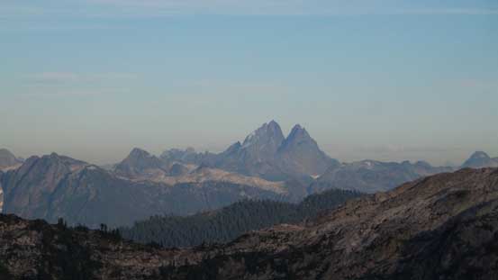
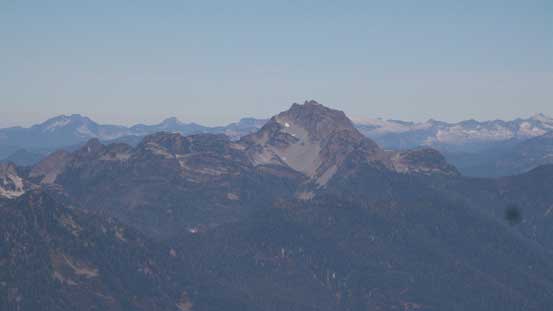
A zoomed-in view of Mt. Judge Howay.
This tarn would also be a perfect bivy spot, but I ignored it and continued on…
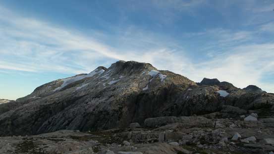
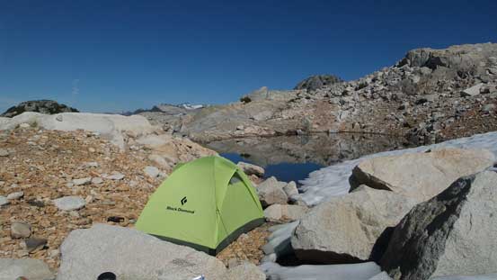
Now looking ahead the next stage appeared like a long grunt up a very foreshortening ridge towards the highest bump along this ridge – Meslilloet NE1. I kept following the terrain for another while and soon enough, another neat tarn appeared in front of me and this one even had a permanent snowfield attached. I could still keep going for at most 1 hour but figured it’s good enough now. A flat spot on the far end of this tarn provided a 5-star bivy spot and I spent some minutes setting up tent and stuffs. Time for a well-deserved dinner and the bonus was some spectacular sunset views. But soon enough the glow was over and knowing there’s still a long day ahead I went to bed early.
Looking back at that tarn as well as the impressively looking 2nd bump
This is a bigger lake on the east side of the divide. I bet it rarely sees visitors…

Now I’ve bypassed the 3rd bump, looking towards my distant objective.
Looking back towards the 2nd bump

Oh yes! Here’s a great bivy spot!!

After setting up camp it’s time to wait for sunset.

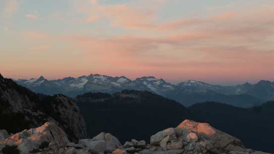
Full-on evening glow over the eastern horizon.

Another look at the 2nd bump
A zoomed-in view of the very remote Old Pierre Mountain

The Katzie Mountain massif by Stave Glacier in the eastern Garibaldi Provincial Park
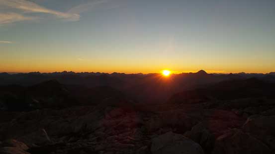
Sunset over the horizon
Dusk over Nimbus/Katzie/Nebula group
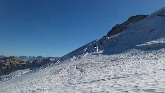
The night was peaceful with some bright moonlight. The next morning my alarm went off at 5:30 am, and in the pitch dark I cooked some breakfast and then started my day just as it’s getting bright enough to now use the head-lamp. With a lighter pack now I could move more efficiently up the ridge. Some scrambling sections here and there but nothing difficult and I made to the highpoint ahead just when it’s time for sunrise. More pictures were taken but looking ahead there appeared to have another few bumps to go up and over before Meslilloet NE1. Towards that sub-peak I opted to bypass it staying just below a snowfield on the left (east) side and that worked greatly, although with some steep side-hilling on loose ground. Down again due south I still had to ascend up and over another bump before hitting the Meslilloet Glacier. This bump involved some not-so-pleasant krummholz to deal with…
Meslilloet Mountain just before alpenglow

It’s sunrise time!
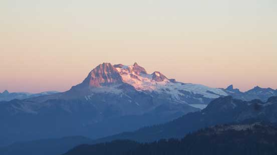
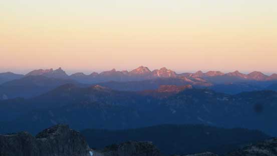
Alpenglow on Mt. Garibaldi massif

Alpenglow on Mt. Tantalus
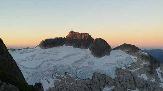
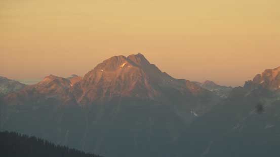
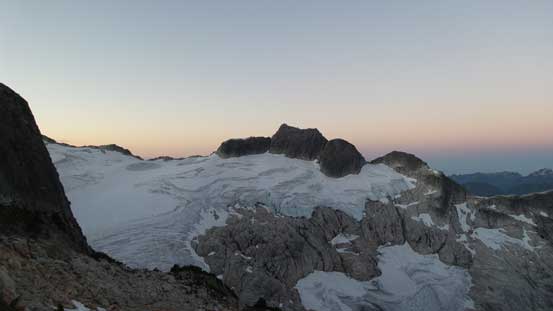
And, alpenglow on my objective – Meslilloet Mountain

Glow on Meslilloet NE1 – I bypassed it on climber’s left side

More morning colours over the western horizon

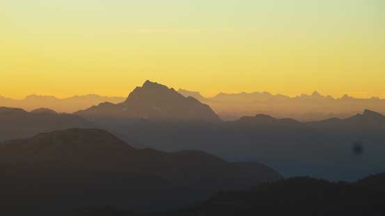
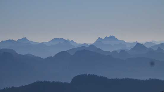
The remote Five Fingers group
Mt. Robie Reid looms impressively, as always
Morning glow on the Lions – Harvey – Brunswick – Hanover by the HSCT
Looking ahead. My route would follow the ridge and then merged onto the glacier
Traversed over another bump..
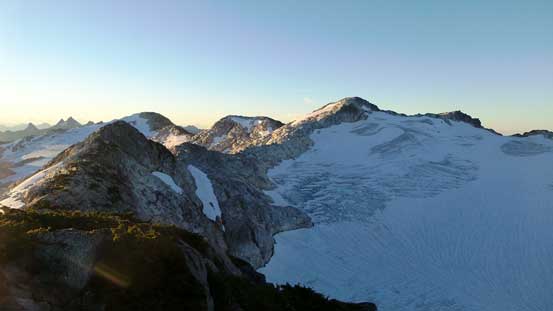
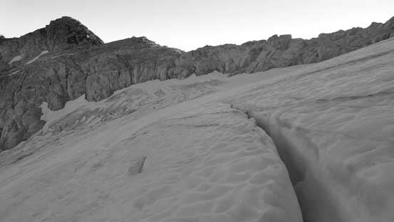
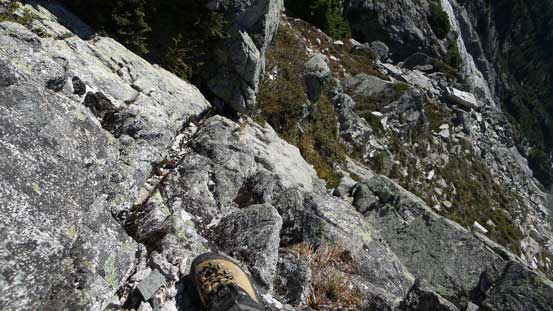
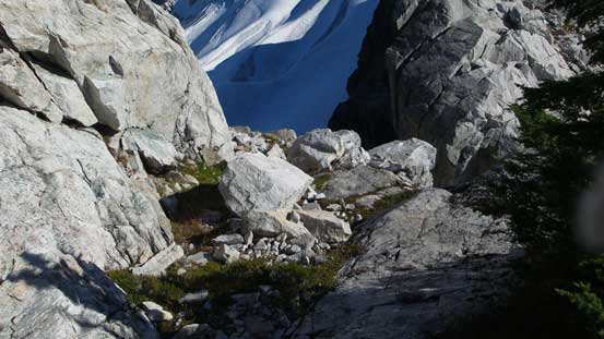
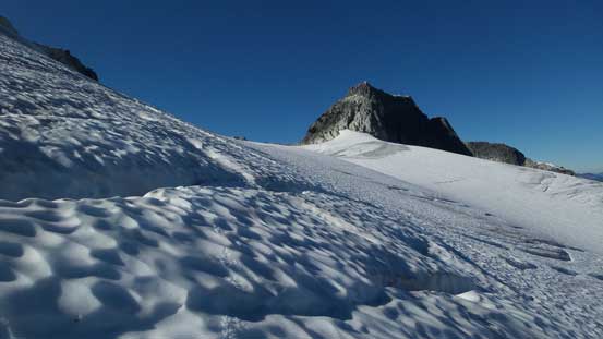
A few interesting big steps were descended as I worked my way down to the glacier. There were more crevasses than I expected but oh well, crampons on and ice axe out I just had to be a bit more careful picking a route. Thankfully the crevassed section was mostly dry with some easy probing and in short time it was over, and then I ascended gradually on continuous snow to the final col before the E. Ridge of Meslilloet Mountain. Ditching the snow gears I made the transition onto rock, and the next step was the “nose” of that ridge. It didn’t look easy to me but it’s reported to be nothing more than 3rd class. Of course I didn’t do much research about the details so went for my own route. I ascended a mini ramp feature from bottom left to top right and then went further towards climber’s right to ascend a slabby gully feature. Some grippy finger holds solved the problem and now I moved back climber’s left, thrashing across a krummholz ledge before pulling up another interesting step.

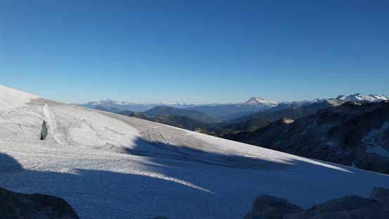
Ready for the glacier plod
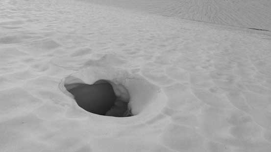
Holes on the glacier…
Looking back from partway across
Done the glacier travel now, time to switch gears again

The “nose” ahead.

I picked my own route up here
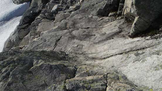
Some finger holds solved this problem.
The terrain levelled out after that and then the “nose” was over. Now staring at the final summit block I picked up my memories from others’ trip reports. The direct line up the E. Ridge would go at 4th class while a vegetated ledge on climber’s left side transitioning to the very upper reach of S. Ridge would offer a 3rd class route. I made some internal debates but eventually opted for the easier option, but after about halfway down the ramp I changed my mind. The rock looked very fun to me and I decided to ascend straight up from midway across the traverse. And of course things like that always turned out harder than expected and I had to overcome a few harder moves near the top with pretty good exposure… A few big blocks pulled loose on me and that didn’t help my confidence, but the problem did get solved and the next thing I was standing on the summit soaking in all the views.
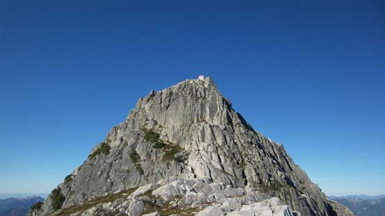
The summit block. I traversed partway across the vegetated ledge before picking a direct line

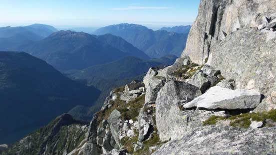
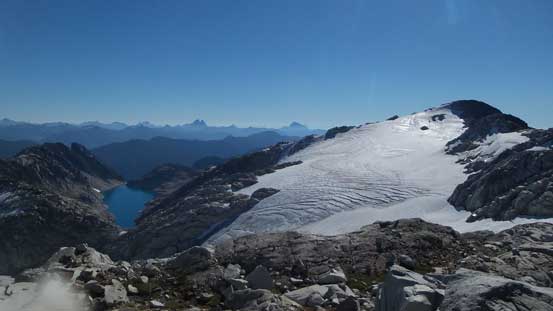
Looking across the south face down towards the glacier below
The easier route keeps traversing along this narrow ledge

I went straight up here.
It’s steep and exposed…

Summit Panorama from Meslilloet Mountain. Click to view large size.

Big crevasses on the glacier below

Mt. Garibaldi massif – happy to have both Atwell and Garibaldi bagged earlier in this year

Mamquam Mountain – bagged in late September last year
The classic Sky Pilot Mountai viewed from an unusual angle – also bagged last year

Mt. Baker on the horizon beyond the haze – bagged in April this year
Mt. Clarke with Grainger Peak to its left. These are some remote peaks

The remote Robertson Peak right of center. Behind to its left is Mt. Breakenridge

Looking into the North Shore Mountains and the typical country around here
Cathedral Mountain is reported to be a hell of a grind there..

The Mt. Seymour group

Me on the summit of Meslilloet Mountain
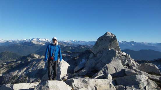
Another picture of me on the summit

Another panorama picture from the summit. Click to view large size.
To my surprise there’s even cell reception and I did some social reconnection on the internet.. The 2-m high true summit boulder was difficult to climb in rigid mountaineering boots. I gave it a half-hearted try and managed to put one leg on a sloping ledge, using a lieback move. I could have pushed up from there but decided against it mainly because there’s no point in risking a potential slip (and injury).. I managed to poke my head higher than the true apex and that’s good enough. Then I spent about 1 hour on the summit resting and enjoying, but now it’s time to get going again. I wasn’t keen on down-climbing the harder route so down the S. Ridge I went. I did manage to find a way down to that vegetated ledge and had no problem following it all the way down the summit block. And then it’s time for the “nose”. I mostly retraced my ascent line and those finger-hold moves were super fun.
On the descent I took the easier route down
Looking down from the vegetated ledge
Picking up my ditched gears it’s time to transition back on to the snow. The snow had become softer than a few hours ago but my tracks still looked fresh. I just simply retraced my footprints across that glacier, and up those big steps I rejoined the NE Ridge. Up and over that krummholz bump and then up Meslilloet NE1. Having extra time to kill I decided to go all the way up that thing. I kind of regretted as there’s really not much “new things” to see up there and that involved about 50 m extra elevation gain/loss. Considering the amount of up-and-downs in this trip I felt dumb. Over another few bumps I made my way down to the camp where I took a long break along with a nap.

Merging onto the glacier now. Meslilloet NE1 ahead
Traversing the glacier
More crevasses than anticipated, but easy route-finding in general

Exiting the glacier I had to climb up a few big steps
More glaciated terrain looking east

Bashing up this bump which involved some bush

From that aformentioned bump, looking ahead towards Meslilloet NE1

Looking back at the glacier and the summit block of Meslilloet Mountain
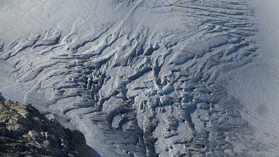
Very fractured glacier…
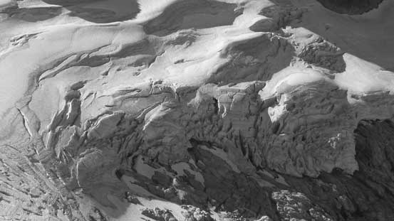
Seracs ….

From Meslilloet NE1, looking ahead to the ridge traverse

Also from Meslilloet NE1, looking down to a set of tarns below the glacier’s drain
Down to the camp now..
It was almost 2 pm and time to get going. I retraced my route bypassing the 3rd and 2nd highpoints and then up and over the 1st highpoint. Not far after that it’s time to say goodbye to the alpine ridges and get ready for the bush… The initial descent down from the col was slippery but manageable with some vege belays, and then it’s a pleasant walk down to Triple Point Lake. Across the lake I went straight for the uphill thrash ahead. It was not very enjoying but not too bad neither and soon enough I was down the other side, traversing across that long vegetated ledge around a sub-summit. Eventually I made my way around that sub-peak and ascended to the last col of the day.

All packed now, time to leave

This is that lake on the east side of the ridge/divide

Back to this beautiful tarn below the second bump now

Back to the first bump now
Looking back from the first bump

Ahead is an unnamed bump that I had to bypass. Below is Triple Point Lake

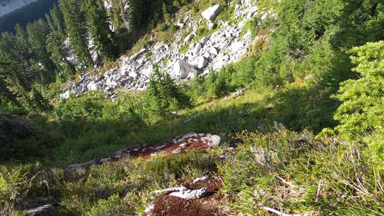
The typical terrain around here. Every step was on the knees..

Steep and bushy to get down
Down to Triple Point Lake now
Uphill thrash to merge onto that bench traverse
Across a boulder field
The bench traverse was bushy at places too
Around a broad corner, the travel was getting easier
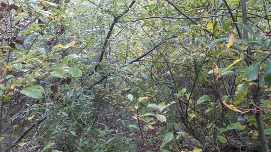
I was not looking forward to this section as I knew this would be the worst bushwhacky part, but I had to face it.. Down the slopes I went I could initially pick up flags here and there and combing with Jeff’s GPS tracks I knew where exactly I had to aim for. A few steep sections were super slippery (wet moss) and I took a few spills. Was it any steeper I would just don crampons… Lower down the grade eased and so no more slippery stuffs, but the bush soon took over. It was getting increasingly thick… Following the terrain I stayed way to the skier’s right of that creek and paid some close attention to some flaggings. The key to avoid a bluff/waterfall lower down was to pick up a hidden treed ramp and with all the careful checking I didn’t miss it. And after that I was down to the cutblock below and then went for its left edge. No further issue to get down to that S-100 spur road below.

Down into the bush I went…

Oh gosh…

Enough…

Steep and bluffy.

Apparently I was losing a lot of height now. Mt. Gillespie in the background
Down to the cutblock now.
What is this?! Oh yeah it’s in the west coast..
It was not over now as the final 4.5 km plod across S-100 spur road wasn’t a cake walk neither. The alders had closed in and I had to push through some sections. Nothing bad although it was not a “smooth sailing” as what I was expecting neither. A ton of bear shits were discovered too but I didn’t see the actual creature.. Finally back to the Mamquam Main what’s left was another kilometer or so’s down-hill plod back to the Jeep.
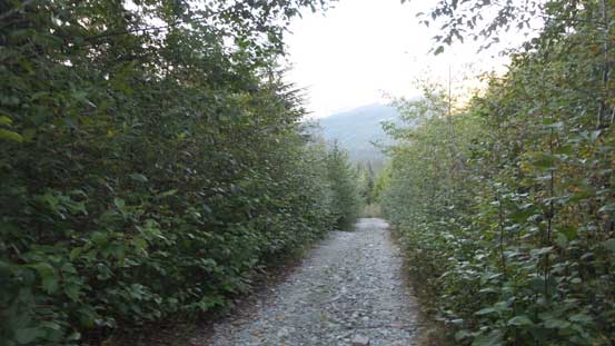
This is the status of the S-100 spur road
Pushing through the alders…
Finally back to Mamquam Main, still had more than 1 km of road plod
Now came the last part of this adventure – the drive out. Some alders, two major wash-outs and lots and lots of pot-holes on that 27-km bumpy ride back to Squamish. It was dark when I got out of the forest, time for a short food break in Squamish before the final 1.5-hour drive back home. Overall this was an awesome trip exploring a neat area and bagging two not-so-often ascended peaks. Meslilloet Mountain is one of those trips that those who enjoy remoteness exploration would enjoy, otherwise you’ll hate that bush thrash and the constant up-and-downs.
