Mount McDonald
June 2, 2026
2281m
Pemberton, BC
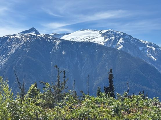
Mt. McDonald is largely overshadowed by the ultra-prominent Birkenhead Peak that it attaches to, but the route is completely different from Birkenhead Peak’s standard or winter routes, and offers some unique experiences and views. It also boasts over 200 m prominence and holds an official name, so I kind of don’t understand the lack of trip reports at least in the peak-bagging community. The drive isn’t even that long and the route involves virtually no bushwhacking as long as the 1800-m plateau hasn’t melted out (usually means mid June or earlier). The trail-head at 940 m does require a reliable 4×4 HC vehicle to access but a Subaru Forester is more than “enough” for a skilled and determined driver. For the worst case one can always park lower as even a Sedan can get to 650 m elevation on Birkenhead River FSR, adding no more than an hour of walking each way.
I was supposed to do Mt. McDonald about a week and half ago but I changed the objective to Mt. Noel after seeing Matt’s recent trip report. Meanwhile Tanja and Ben took the oppourtunity and got Mt. McDonald during that weather window so I again, had a trip report as a recent update. My plan was to hit it on the next weather window, which happened a few days later. This was the 3rd day of an intense peak-bagging itinerary and I’ve already ascended Mt. Callaghan and Hall Peak in the previous two days with some serious back-and-forth driving. Spenny Lee was keen on heading out so I threw out the suggestion at 9 PM the night before, and to my surprise he was actually in. I seriously needed to catch up on some sleep so the plan was leave Vancouver at 6:15 AM. That’s the latest I wanted to leave as I wasn’t keen on dealing with the rush hour traffics. The drive from Surrey to Boundary Road already had some traffics but the situation was tolerable. The drive up to Pemberton was uneventful. I was originally planning to park at the start of the spur road but upon seeing it in person I decided to at least give it a try. In retrospect I should have pushed all the way to the trail-head as there wasn’t a single obstacle that could stop the Forester from going further, but it was consistently steep, loose and rough. I was mostly concerning about encountering an impasse and not having a place to turn around, so upon seeing a flat spot at 800 m I opted to park. That’s fine as we didn’t mind a bit of extra walking.
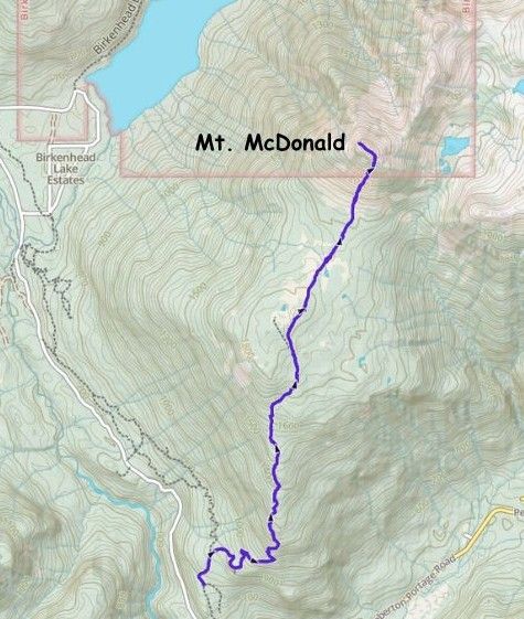
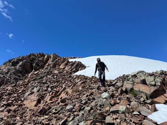
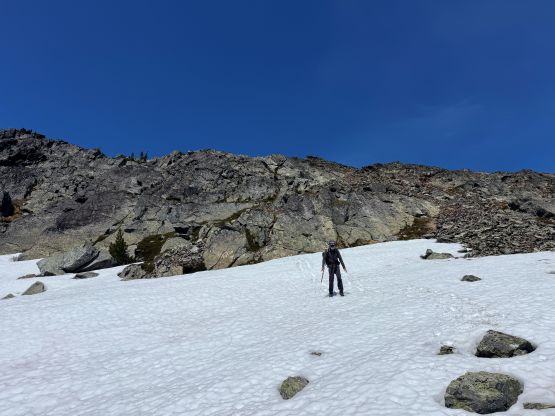
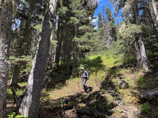
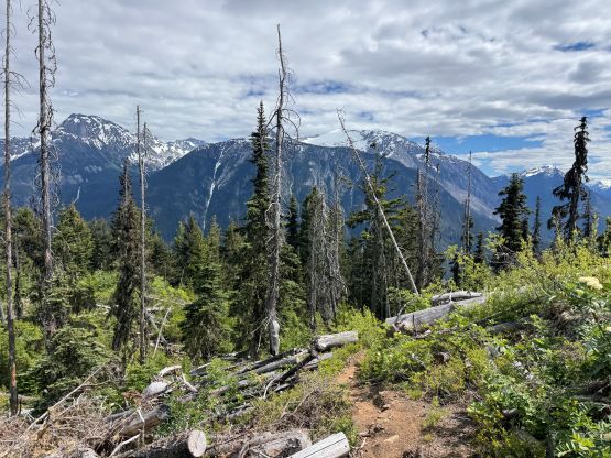
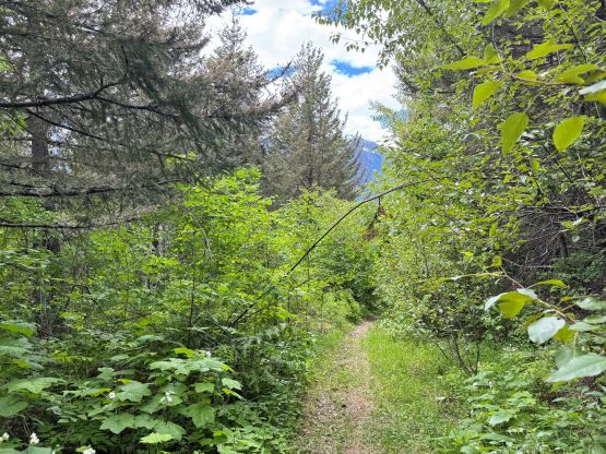
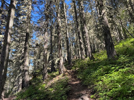
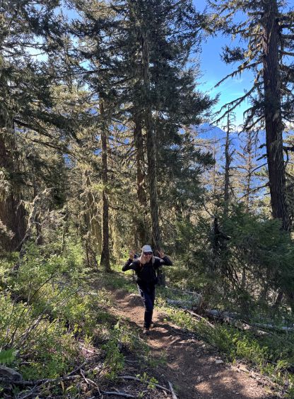
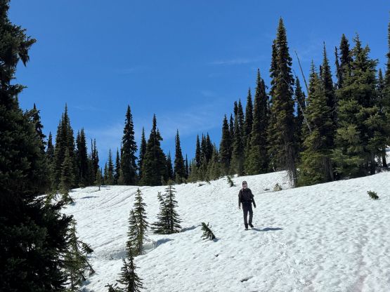
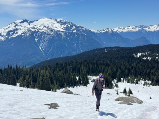
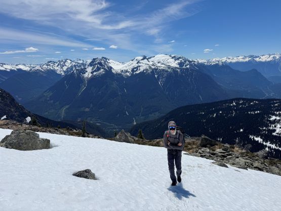
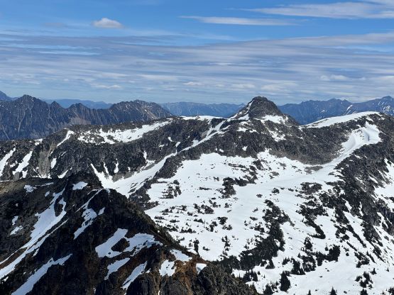
It only took us 12 minutes to plod to Tanja and Ben’s starting point so where exactly one opts to park doesn’t make much of a difference. This spur road access is short, after all. The road continues beyond the trail-head but downed trees and wash-outs prevented any further vehicular access. Both of us were wondering who actually maintained this trail as it was in some excellent conditions. We quickly figured that out as we saw some very fresh dirt biking tracks, but I thought only the skilled and bold riders could drive their bikes up that high. The trail was a steep one even for hiking and I’m not a biker so I couldn’t comment. There was one excellent viewpoint about halfway up and we took the first break there. Continuing upward we did not encounter snow until 1700 m elevation but the snow quickly became continuous. We had brought 3 L of water each as we feared there wouldn’t have any reliable water source, but there were literally a ton of flowing water on various parts of this hike. We also brought the snowshoes but they turned out to be training weight. I did opt to wear trail runners and not bother with carrying the mountaineering boots, and that was the correct call. The snow was never steep enough to warrant the use of the boots and the snow was also soft enough that not bringing an ice axe nor crampons was also the right call. Part of the reason for me to carry the snowshoes was to use them as crampons if needed, so I carried them all the way to the summit just in case.
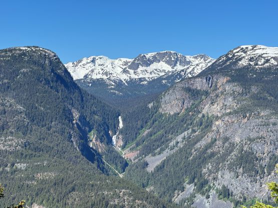
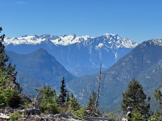
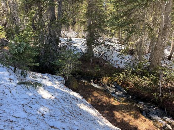
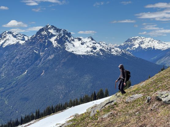
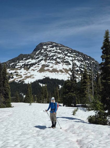
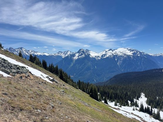
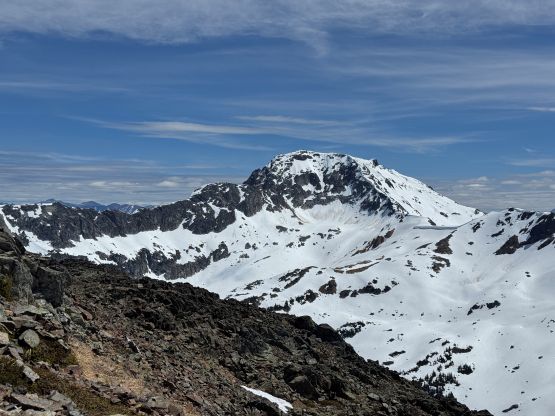
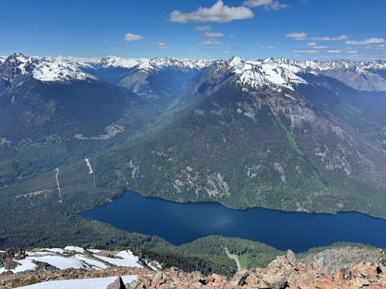
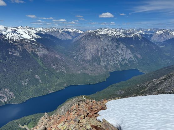
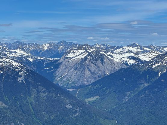
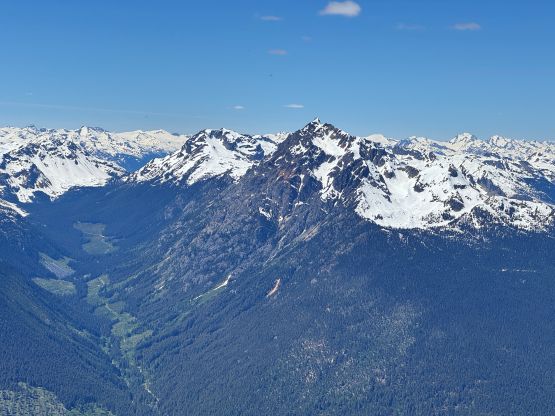
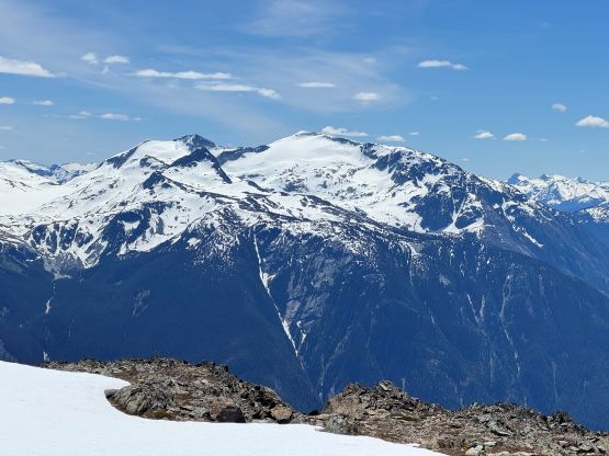
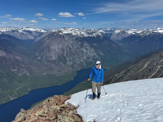
After hopping across a stream we were on our own route-finding across the plateau towards the objective. The trail would have stopped here anyway and I’ve seen reports mentioning bushwhacking in summer conditions. Fortunately this plateau was covered in at least 1-2 m of snow so there was no bushwhacking for us whatsoever. The route-finding was confusing with some micro-terrain so I mostly directed the bearing while holding and staring at the GPS screen, and I think we took more or less a straight and efficient beeline towards the base of Mt. McDonald. There was more than 50 m of unavoidable elevation loss. At the base of the route we encountered another reliable water source. We did have to ascend/cross several steeper patches of snow so as mentioned earlier, we never ditched the snowshoes. The snow was indeed soft as expected, so kicking steps in the trail-runners could make do. Higher up we mostly followed a right trending ramp/gulch system and did some class 2 scrambling before hitting the summit ridge. The best view was down towards Birkenhead Lake and that’s about 100 m beyond the true summit with some notable elevation loss, so make sure you traverse all the way to the NW end of the ridge to get the views. I wouldn’t be doing that if I didn’t see Ben and Tanja’s picture of the lake, so I had to thank them for that.
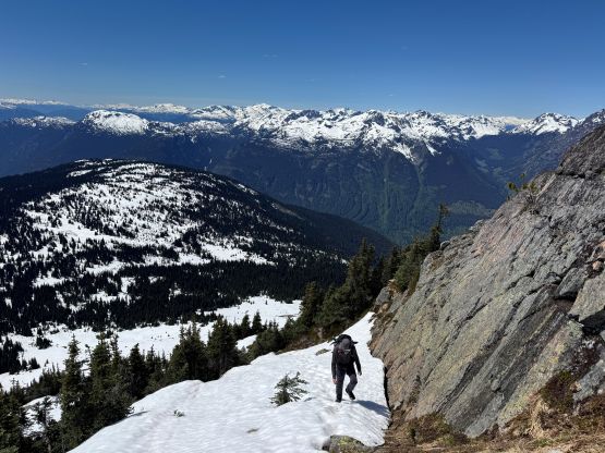
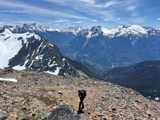
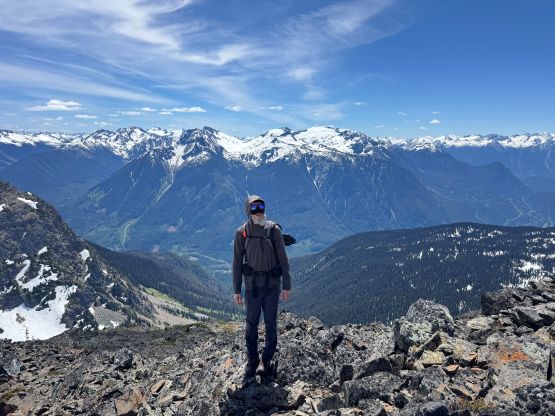
It had taken us 3 hours 10 minutes for the ascent so we took a long break on the summit soaking in the experience. There was also some strong cell reception to reconnect on the socials, but eventually it was the time to head down. Descending the upper mountain required some care as the snow, slippery grass and talus slopes weren’t “designed” particularly for the trail runners but running across the snowy plateau was quite good. Our own tracks had become faint in the heat so we still had to do some navigation. Spenny had his Garmin watch and was able to give me some directions without taking the phone out every time. The rest of the descent was fast and fun, but the trail was quite dusty. Our round trip time was just over 6 hours. I was able to stay awake for the entire drive back to Vancouver and I eventually got home right after dinner time. Fortunately the weather had turned so I could finally get a few days of rest to catch up on work and sleep. Speaking this objective I would highly recommend in the time frame between the second half of May and the first half of June. The 400-m ascent via the SW Face is in serious avalanche terrain but the 1800-m plateau is best done with snow coverages, so the “late spring” is the best time to hit this objective.