Dickson Peak
August 28, 2021
2814m
Gold Bridge, BC
Gold Bridge is a tiny community on the boundary of the area known as the “South Chilcotins” in Bridge River valley. There’s no cell services and the access is only by logging roads system. There are two ways to get in. The more common way for us Vancouverites is to use the Hurley FSR, about 50 km of bumpy road that connects Pemberton Valley to Gold Bridge whereas those living in the interior will drive in from Lillooet along Bridge River and Carpenter Lake. That access is mostly on a paved road, but long and contrived for us living in the Lower Mainland. Either way this is a remote area that requires a long drive to get in. Dickson Peak is one of the more prominent peaks in the immediate vicinity of Gold Bridge and is also documented in Matt Gunn’s Scrambles in SW British Columbia. The standard route ascents the easy south slopes from Roxey Creek drainage. There’s no technical difficulty but this route involves substantial amount of hopping on somewhat unstable granite boulders.
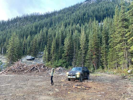
Alex, Vlad and I had been talking to finally give this area a visit and naturally we picked Dickson Peak as the primary objective. We together had two days plus an additional half-day for the drive-in so we picked Mt. Penrose as the secondary objective. Christine opted to join us at the last minute but she had done Mt. Penrose. Christine’s not keen on repeating this secondary objective so she decided to drive separately and do something else on the second day. I left White Rock at 2 pm on Friday afternoon and picked up Alex and Vlad from various parts of Metro Vancouver and didn’t make to Sea to Sky Highway until 4:30 pm. The drive up north to Squamish wasn’t bad, but there’s some paving work going on near Whistler that caused over an hour’s delay. We eventually made to Pemberton at dinner time. After grouping with Christine we drove up the Pemby Valley FSR and then Hurley FSR together. Parts of the Hurley was freshly graded allowing a much faster passage but some parts were still a horror show of washboards such that I had to crawl at 20-30 km/h. Overall this section was better than anticipated but there’s also substantial amount of driving (almost an hour) to get to Dickson Peak from Gold Bridge. At the junction of Roxey FSR with Slim Creek Road we discovered the spur road was surprisingly wide open. There’s a sign saying the “trail was closed” but there’s no gate so we simply ignored it, and drove another 2 km to the end of the new Roxey Road just before the first crossing of the creek. It was already dark so we decided to car-camp at this spot and evaluate the rest of the FSR in the following morning. It looked too narrow for my like, but Christine was keen to push further in her 4Runner.

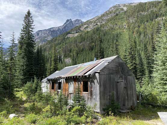
The night was clear and cold such that our tents were fully soaked with dew by the time we woke up at 5:45 am in the dark. We quickly packed up the wet gears, ate some cold breakfast (mine being Save on Food sushi) and piled into Christine’s vehicle. The “road” beyond this new logging cut appeared “fine” so down into the creek crossing we went. The 4Runner made the ford easy. The road was entirely a single track with only one spot to turn-around for the entire stretch between the two crossings of Roxey Creek, which was about 2 km long. We had a lot of slow crawling on rocks but honestly this road was better than expected such that it did not impose any problem to the stock 4Runner. We drove across the upper crossing as well and parked right beside the abandoned cabin.


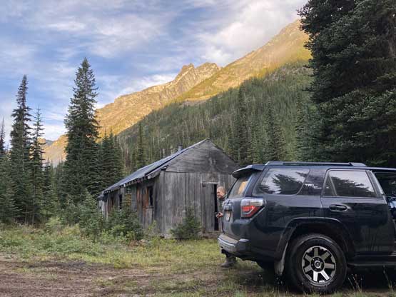
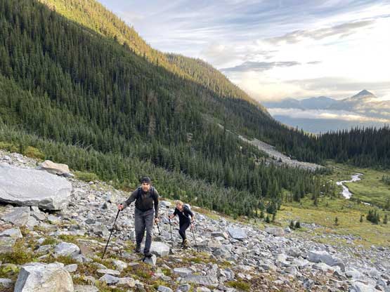
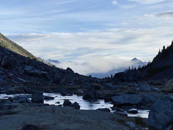
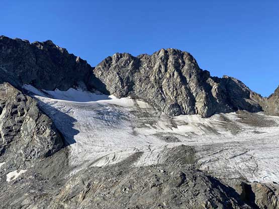
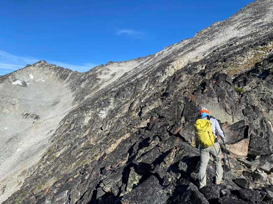
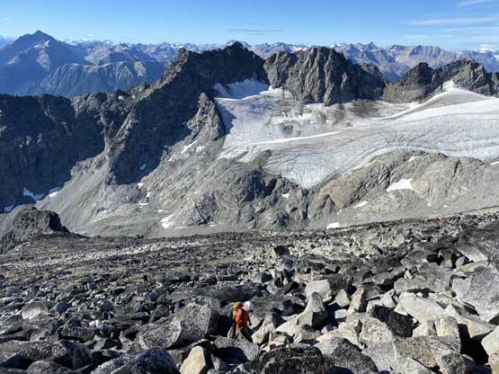
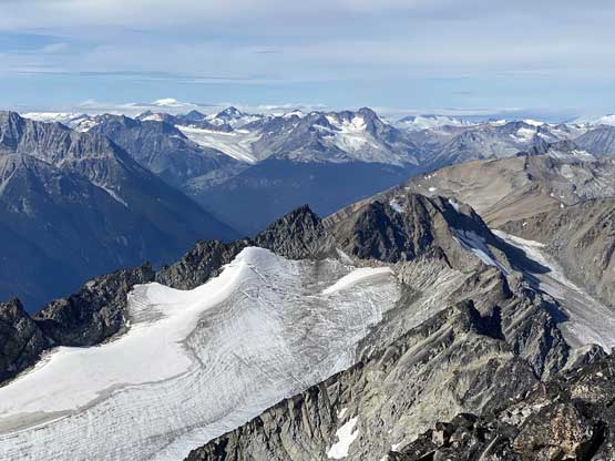
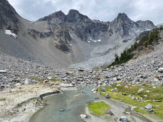
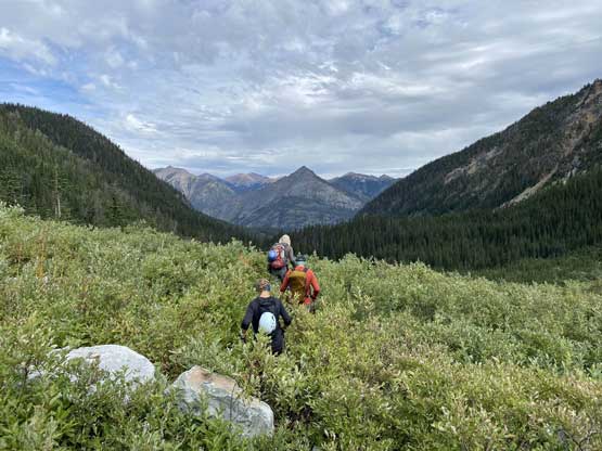
It’s apparent that Adam and John’s GPS track stayed entirely on the north side of the creek so they did not do this upper crossing, but right beside the cabin we saw a path and some flagging. We consulted with Matt Gunn’s description and in the end we opted to take a gamble on this path. We soon realized that it’s an actual trail that went into the alpine. While the others all had just one pair of footwear I decided to wear trail-runners and carry the mountaineering boots even though the approach was only half an hour long. This was because of the morning dew such that I was 100% sure that whatever footwear I used would get soaked right away. The “trail” was not very bushy but we did have to constantly touch the (wet) branches so I thick I made a good call. I wore the trail-runners passed a few boulder fields and ditched them at basically the last vegetation. The dash down the upper Roxey Creek valley was incredibly scenic but then we faced a long stretch of shitty slog on mostly unstable boulders at the head of this valley to access the upper mountain. We followed Adam’s GPS track to stay mostly in the middle of a gulch feature with a creek running underneath. We came here expecting some of the worst boulder-hopping but probably because of the low expectation I actually found this section not as bad. About 1 in 10 boulders we touched would come loose. Towards the end of this section we had to scramble a short stretch of 3rd class (probably off-route) and then the terrain became flat. This upper valley actually had a dry glacier above so we had plenty of water sources to load up the water bottles.


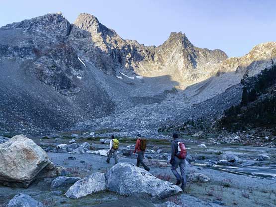

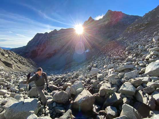


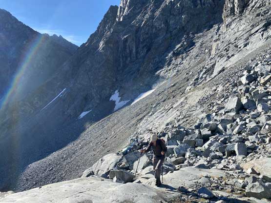
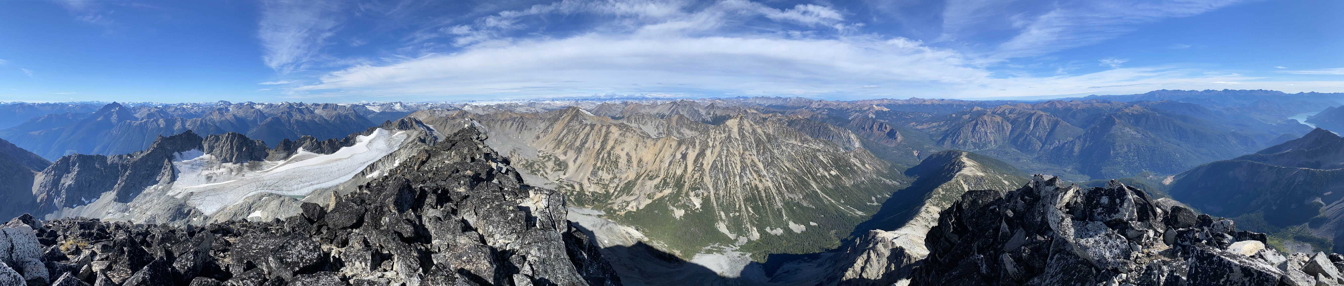
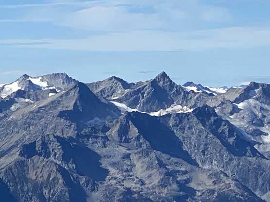
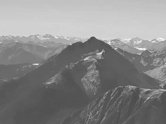
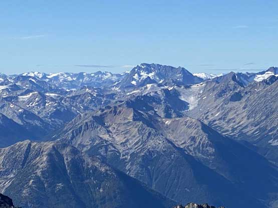
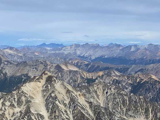
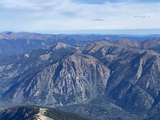
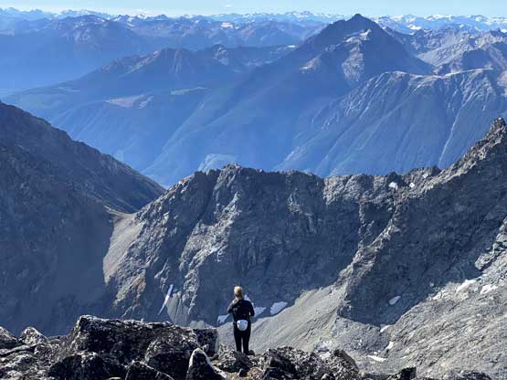
We easily hopped across the glacier’s outflow and scrambled about 200 m of choss to get onto the upper SE Ridge. This stretch might be the steepest of the entire ascent and most of the rocks were loose. The upper SE Ridge/S. Face started off easily with plodding on solid ground but once the terrain angle steepened towards the uppermost 200 m we were back into that game called “boulder hopping”. The upper route was nothing but gigantic boulders, some being car sized, but at least most of them were actually solid. It was quite a slog to reach the summit but the view was as expected, pretty damn awesome. I could recognize most peaks on the southern horizon but the northern peaks into the Chilcotins were all new to me.


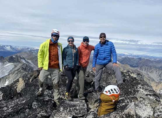
It seemed like a band of high clouds were moving in and it started to become very cold, so we didn’t linger too long on the summit. I led the group retracing our tracks down the upper mountain and then into that shitty gulch of loose boulders. Vlad took a line skier’s right of us staying away from the gulch and proved his route to be the better way. Alex, Christine and I just simply sucked it up. Nothing’s really worth noting as nothing’s difficult, but we did have to pay attention to every single damn step forward. Eventually the boulder-hopping came to an end and we had a leisure descent back to the 4Runner.


Our round trip time was about 6 hours which none of us was expecting. We came here expecting to walk from Slim Creek FSR all the way up. The first surprise was the night before when we discovered the lower parts of Roxey FSR had been fixed and the second surprise was this morning when Christine actually managed to drive us to the cabin. This shaved us almost 5 km each way and 700 m elevation gain. We actually finished the trip by noon and none of us wanted to just kill the rest of the day in camp. Alex and I threw out an idea to hike up Mt. Zola which is the smallest summit in the vicinity. None of us had done any research about it but there’s a trail on Gaia map that goes to the summit.

