Squeah Mountain
April 12, 2020
1798m
Hope / Coquihalla Highway, BC
Sandwiched between Fraser River and Coquihalla Highway there are a few elusive summits immediately to the north of Hope, and Squeah Mountain is one of those. This group of peaks are known to have very few ascents despite their close proximity to civilization. They are guarded by steep, dense and somewhat impenetrable west-coast forest on all sides. There are logging roads running closer to the bases but those are all deactivated long times ago and the status is largely unknown in this modern era. About three years ago I explored the west side approach and bagged Jorgenson Peak and Ogilvie Peak in less effort than expected, but Squeah Mountain kept eluding me. The only access that makes sense is by the long-gone Deneau Creek FSR. The most recent trip report on ClubTread says “increasingly bushy for walking” and that was 7 years ago. The most efficient attack of the peak itself from the head of Deneau Creek valley is via the steep couloir on the east face. This couloir runs a east/southeast orientation, has over 400 vertical meters of run with sustained grade of around 40 degrees so timing is crucial. I had spent at least a few hours over the last several years looking for an alternative attack but couldn’t convince myself if there’s any better option. The wooded SE Ridge might look innocent on the topographic maps, but the access requires crossing the Deneau Creek’s slot canyon. This drainage is in fact, more famous for the out-of-the-beaten-path canyoneering oppourtunity than for climbing.
The biggest uncertainty was the status of Deneau Creek FSR as I couldn’t convince myself that it’s still in walkable shape. Even with a spring snowpack that covers down to 700 m elevation, I still thought the first few kilometers below snowline could be hell of a thrash. On top of that, to safely climb the southeast-facing gully in spring time I would need to wait for a cold snap following a period of stable weather. The better plan would be to camp at the head of Deneau Creek valley but such doesn’t work well with my current work schedule. I had been considering this peak for probably a dozen times, and finally, all stars seemed to align on the Sunday of this Easter long weekend. The avalanche bulletins were shut down unfortunately but Alex and I had been going out every single week and had been monitoring weather every single day so we were confident that the conditions of this weekend was as safe as it could ever get, from a spring mountaineering perspective. Paul S. from Princeton joined our team at the last minute and we agreed to meet at the start of Deneau Creek FSR at 4:30 am. The drive to this unmarked turn-off was a little confusing as we had to make a U-turn at Sowaqua FSR and once there, we continued driving for about 100 m and parked beside some building facilities.

Squeah Mountain via East Face Gully. GPX DL
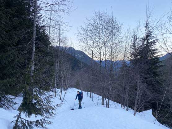
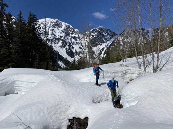
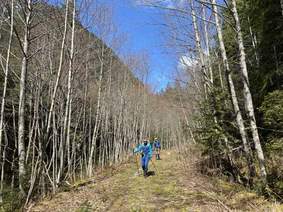
We were confused right off the bat because the road we drove was apparently not the proper Deneau Creek FSR. To access the actual FSR I led a short but steep bushwhack right from the vehicles. This had me further worried about the road conditions but it turned out to be in a much better walkable shape. There were even ATV tracks and generally speaking, we did next-to-none bushwhacking. We did make a critical mistake by taking a left fork (without realizing there’s even a fork), and didn’t realize this mistake until it was too late. Alex suggested we should just go to the end of this left fork road and hoping it somehow would connect to the main branch. Well, this directed us to a dead end and we were forced to bushwhack more than 100 vertical meters to regain the proper road. The bushwhacking here wasn’t too bad, but did cost us time. Once onto the main road the going was a cruise sailing with no bushwhacking thank to the rapidly thickening snowpack. There were dozens of annoying ditches that some even required us to jump across, but such pain was nothing comparing to the alder thrashing I was mentally prepared for. In under 2.5 hours since leaving the vehicles we made to the head of Deneau Creek valley. And I forgot to mention that we did not need to use snowshoes at all and were barely leaving a track on the snow, and this further confirmed that our timing was very correct.
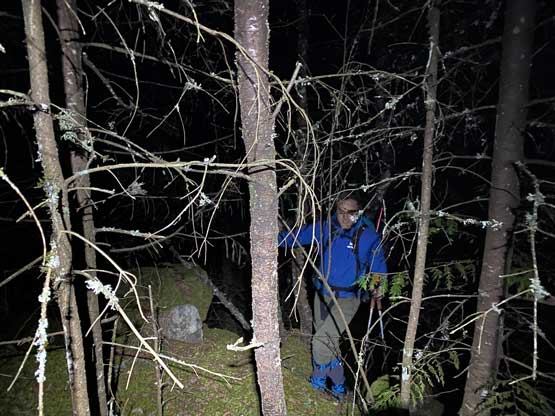
The short bushwhack to short-cut onto Deneau FSR

This is the section of painful off-route bushwhacking
Regaining the main road. This is the typical going

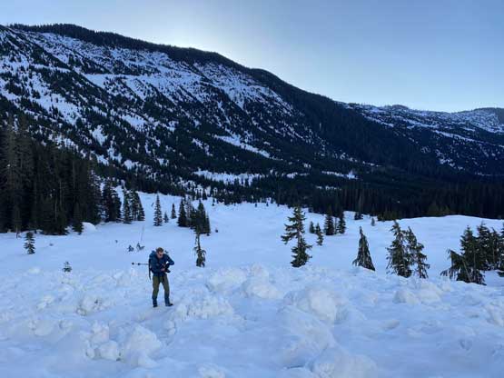
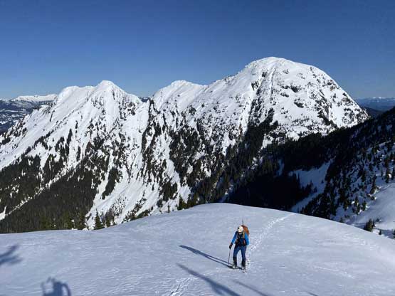
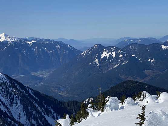
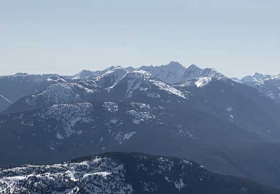
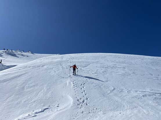
Our first view of Squeah Mountain massif.
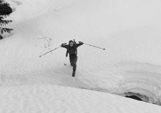
Paul jumping a deep ditch…
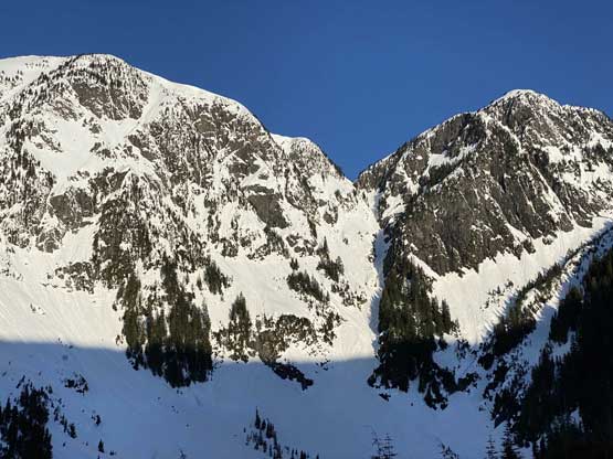
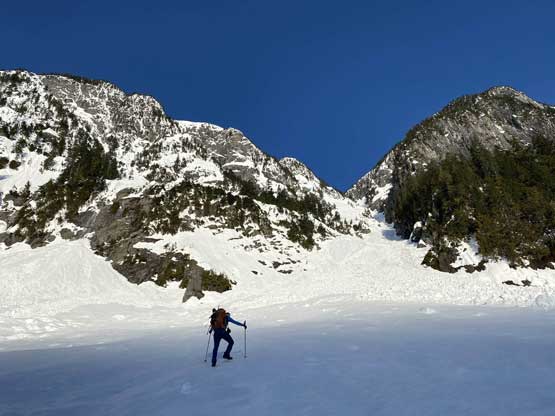
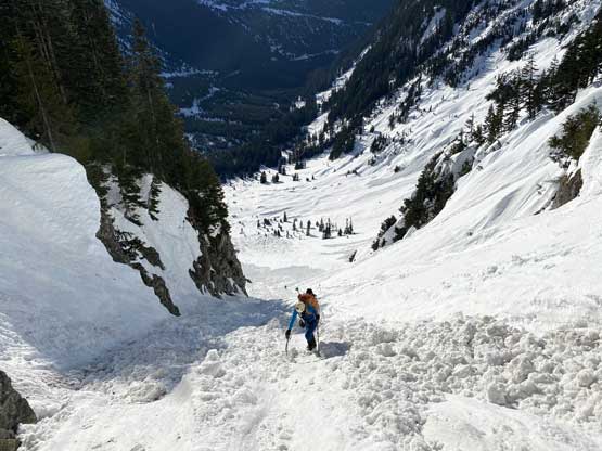
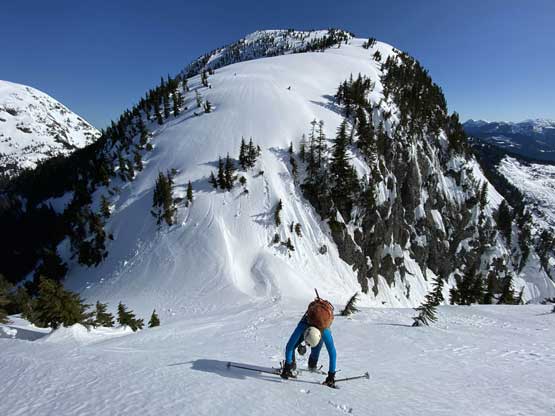
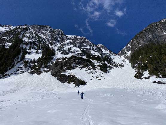
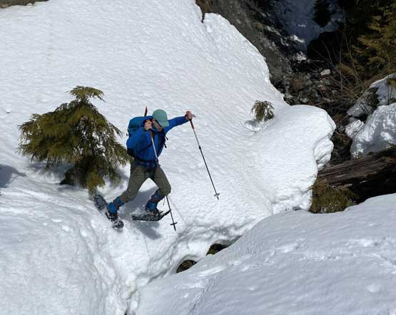
The head-on view of the gully we are going to climb…
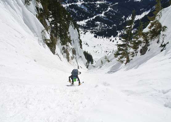
The gully appeared steep and daunting and our concerns now was actually whether one ice axe was sufficient enough for the job or not. It looked like we’d have to climb up some icy runnels. Nonetheless, Alex led us across the flats and walked up some avalanche debris to the gully’s entrance. We took the only break on this ascent here, baked in the sun and donning gears. I was very glad that I at least brought my ice climbing crampons instead of the hybrid ones. Minutes after starting the climb Paul realized one of his crampons broke and were forced to quit and wait for us at the gear transitioning spot by the gear failure. Alex and I continued charging up the increasingly steep gully, from 35 degrees to 40 degrees and probably close to 45 degrees on some short stretches. The condition was very icy at a few spots and having only one (aluminum) ice axe felt certainly undertooled, but at least I had the proper footwear so it wasn’t too bad. The going was slow but steady and the grade of the couloir wasn’t super sustained, nor the icy conditions. Hit some soft stretches for once in a while gave my calves some much-needed relief. The exit of this couloir was actually much mellower (30 degrees) but also held deeper snow. We were forced to don snowshoes about 20 meter below the top as the wallowing were knee-deep on breakable crust.

Alex heading towards the gully
Paul walking up the avalanche debris still far from the gully’s entrance
Alex plodding up towards the entrance

We took a long break here donning gears
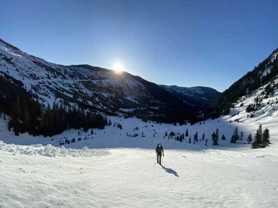
Paul walking up with the sun rising behind

Alex starting the gully climb.
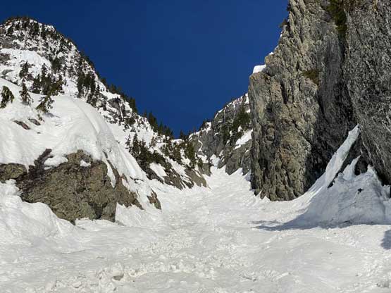
A sideways view looking south from the entrance

Me climbing on. Photo by Alex R.
Alex climbing the lower portion of the gully
This is the upward view

It’s getting steeper and more exposed now.

Alex on a short but icy stretch. Trying to avoid the runnels
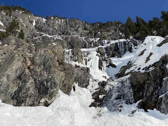
Surprisingly there were still ice on the south-facing side of the wall
Alex climbing the upper portion of the gully now.
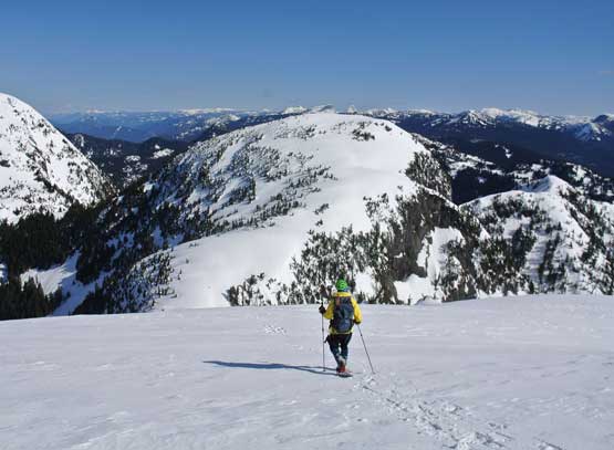
From the top of the gully we turned left onto the broad north ridge of Squeah Mountain. The ascent was not a piece of cake as I expected, and instead we still had to climb over some steep rolls, with one particular roll required me to take a snowshoe off. I was half-snowshoeing, half-bootpacking and believe me or not, such technique worked. There were some more 35+ degree stretches that required extra caution on snowshoes. The last 100 vertical meters to the broad, dome-shaped summit was much mellower though, and we actually had to walk around the flat summit dome to soak in all views. The best views were towards the north face of Jorgenson Peak and the town of Hope.
Alex snowshoeing up a steep roll above and beyond the gully
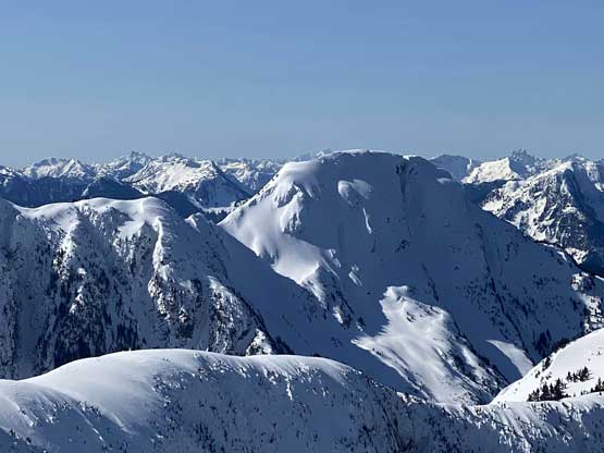
One of the impressive sub-summits behind.

Me plodding up the broad north ridge of Squeah Mtn.
Alex plodding up with that sub-summit behind

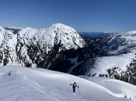
More about the plodding. It’s farther than we thought
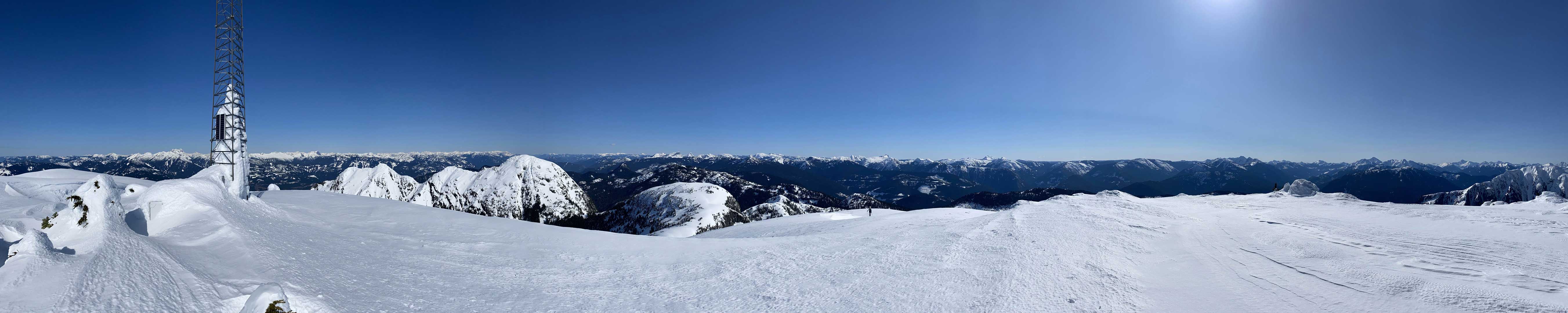
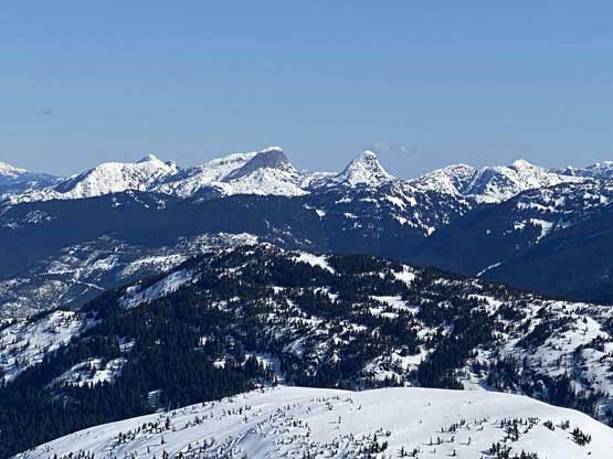
Partial Summit Panorama from Squeah Mountain. Click to view large size.

Partial Summit Panorama from Squeah Mountain. Click to view large size.
Dog Mountain and the town of Hope

A closer look at The Old Settler

Alex approaching the summit with the Coquihalla peaks behind

This is looking up towards the east side peaks of Fraser Canyon

Another sub-summit of Squeah Mountain massif
The spires in Anderson River Group- Steinbok, Ibex etc.

Yak Peak and Needle Peak from an unusual perspective

The west side of Coquihalla Mountain

The north side of Jorgenson Peak massif
Sowaqua Creek valley with Mt. Outram right of center
A closer look at the north face of Jorgenson Peak

Silvertip Mountain, Mt. Payne etc. behind
Tulameen Mountain

The Cheam Range peaks and even Mt. Baker showed up
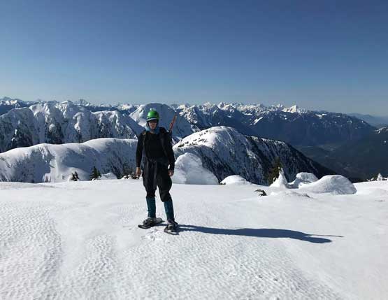
Me on the summit of Squeah Mountain
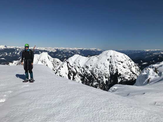
Another photo of me on the summit of Squeah Mountain
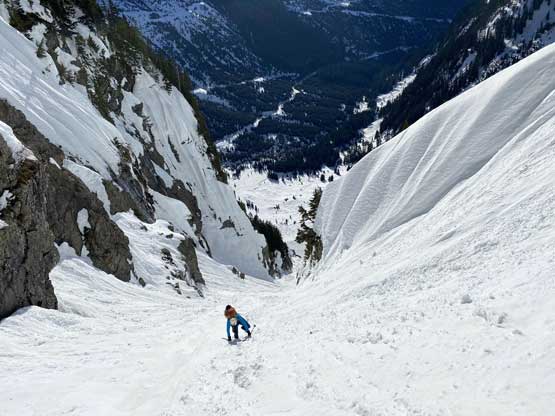
We were worrying about the softening snow conditions on the descent so didn’t linger too long up there. The snowshoeing down to the couloir’s entrance was easy and fun. We continued snowshoeing down the uppermost section of this couloir until things steepened up and became icy. Swapping snowshoes for ice axes and crampons we were then in for a long, monotonous down-climb. For much of this gully we had to down-climb facing into the slope. There were chucks of ice coming down the side of the walls adding to the spice but there’s nothing moving inside the gully, as expected. A long while later the grade eased off and we walked down the avalanche debris like a drunk pair. Paul was actually sleeping on our transition spot. We took another long break swapping gears and then easily snowshoed down to the head of the valley, then onto the FSR. The rest of the descent on Deneau FSR was mind-numbing but uneventful. We did correct our mistake earlier in the morning by sticking to the main road and it was in a decent walkable shape with minimal alder thrashing.
Me snowshoeing down the easy portion of north ridge. Photo by Alex R.

Alex enjoying the views
Alex descending a steeper roll

Entering the gully now. The top portion softened up considerably

Me down-climbing. Photo by Alex R.

Alex down-climbing the upper gully

Alex now down-climbing the middle section
The down-climb never ends. Photo by Alex R.
Alex and Paul snowshoeing now.

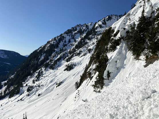
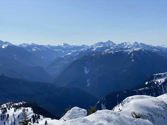
A review shot of the Squeah Mtn. – East Face Gully
Snowshoeing back down Deneau FSR
Paul jumping a trench on snowshoes..

Starting to run low on snow
This is the typical road conditions lower down. Easy peasy..
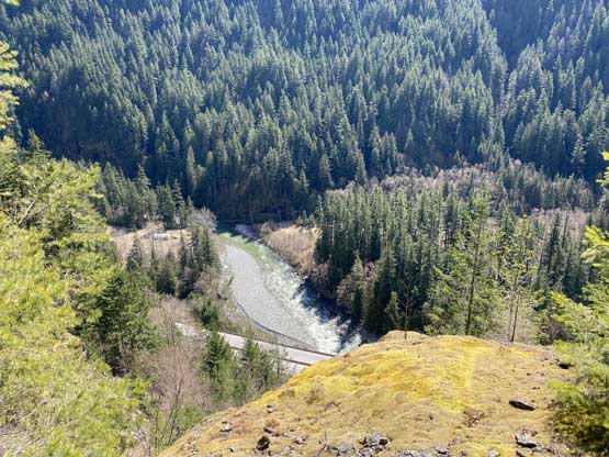
Coquihalla Highway from the lower reach of Deneau FSR

The last 2 km or so of Deneau FSR.
Our round trip time was under 8 hours 20 minutes and that’s considering one major route-finding mistake in the morning. This trip had been much more fluent than I anticipated and with the access mistery resolved I hope more climbers come up this way to enjoy some quality mountaineering. In terms of the length and the terrain I think this couloir is on par with Aussie Couloir on Joffre Peak, but mellower on average and without a steep exit on the top.
